Items Similar to Lyonnais, Beaujolais, Forez, Mâconnais: A 1644 Depiction of France's Provinces

Want more images or videos?
Request additional images or videos from the seller
1 of 7
Lyonnais, Beaujolais, Forez, Mâconnais: A 1644 Depiction of France's Provinces
$460.32
$575.4020% Off
£341.95
£427.4420% Off
€384
€48020% Off
CA$639.21
CA$799.0120% Off
A$697.52
A$871.9020% Off
CHF 365.86
CHF 457.3320% Off
MX$8,471.66
MX$10,589.5720% Off
NOK 4,569.83
NOK 5,712.2920% Off
SEK 4,318.72
SEK 5,398.4020% Off
DKK 2,923.35
DKK 3,654.1920% Off
About the Item
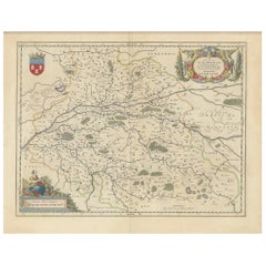
An original antique map from 1644, depicting the French provinces of Lyonnais, Beaujolais, Forez, and Mâconnais. In this map, north is oriented to the right, which is a cartographic convention not commonly used today but seen in historical maps. The map includes various geographical details such as rivers, towns, and regional borders, and is embellished with a decorative cartouche and coat of arms, illustrating the region's heraldry and the mapmaker's artistic flair typical of the period.
The map is made and published by Willem & Joan Blaeu. From: Theatrum Orbis Terrarum.. J. Blaeu, 1644-45.
The Blaeu family, comprising Willem Janszoon, Cornelis, and Joan, were preeminent figures in 17th-century cartography and publishing. Willem Janszoon Blaeu, born in 1571 near Alkmaar, Netherlands, was an accomplished student of mathematics and astronomy under Tycho Brahe. He established himself in Amsterdam in 1596, becoming a noted globe, instrument, and map-maker. His significant contributions to maritime cartography began with a globe in 1599 and expanded to include the pilot guide "Het Licht der Zeevaert" and an appointment as Hydrographer to the V.O.C. by 1633. His establishment of the Blaeu publishing house marked a new era of atlas-making, beginning with the "Atlas Appendix" in 1630.
Competition with neighbor and fellow mapmaker Johannes Janssonius in Amsterdam prompted Willem to adopt his grandfather's nickname 'Blaeu' to distinguish himself. After his death in 1638, his sons Cornelis (whose contributions are lesser-known) and Joan continued the business. Joan, succeeding his father at the V.O.C., became famous for the "Atlas Major" and extensive town-books of the Netherlands and Italy, cementing the Blaeu legacy in cartography.
Tragedy struck in 1672 when a fire destroyed the Blaeu business, and Joan Blaeu died a year later. The remnants of their extensive collection were auctioned off, ending up in the hands of various Amsterdam booksellers and publishers. The Blaeu printing house, once a towering name in cartographic publishing, concluded its operations with a final auction in 1695.
- Dimensions:Height: 20.08 in (51 cm)Width: 23.82 in (60.5 cm)Depth: 0 in (0.02 mm)
- Materials and Techniques:Paper,Engraved
- Period:1640-1649
- Date of Manufacture:circa 1644
- Condition:Condition: Good, given age, general age-related soiling and toning. Folding line as issued. Large damp stains in the outer margin - not touching the image. French text on the reverse. Please study scan carefully.
- Seller Location:Langweer, NL
- Reference Number:Seller: BG-13703-11stDibs: LU3054338140552
About the Seller
5.0
Recognized Seller
These prestigious sellers are industry leaders and represent the highest echelon for item quality and design.
Platinum Seller
Premium sellers with a 4.7+ rating and 24-hour response times
Established in 2009
1stDibs seller since 2017
2,647 sales on 1stDibs
Typical response time: <1 hour
- ShippingRetrieving quote...Shipping from: Langweer, Netherlands
- Return Policy
Authenticity Guarantee
In the unlikely event there’s an issue with an item’s authenticity, contact us within 1 year for a full refund. DetailsMoney-Back Guarantee
If your item is not as described, is damaged in transit, or does not arrive, contact us within 7 days for a full refund. Details24-Hour Cancellation
You have a 24-hour grace period in which to reconsider your purchase, with no questions asked.Vetted Professional Sellers
Our world-class sellers must adhere to strict standards for service and quality, maintaining the integrity of our listings.Price-Match Guarantee
If you find that a seller listed the same item for a lower price elsewhere, we’ll match it.Trusted Global Delivery
Our best-in-class carrier network provides specialized shipping options worldwide, including custom delivery.More From This Seller
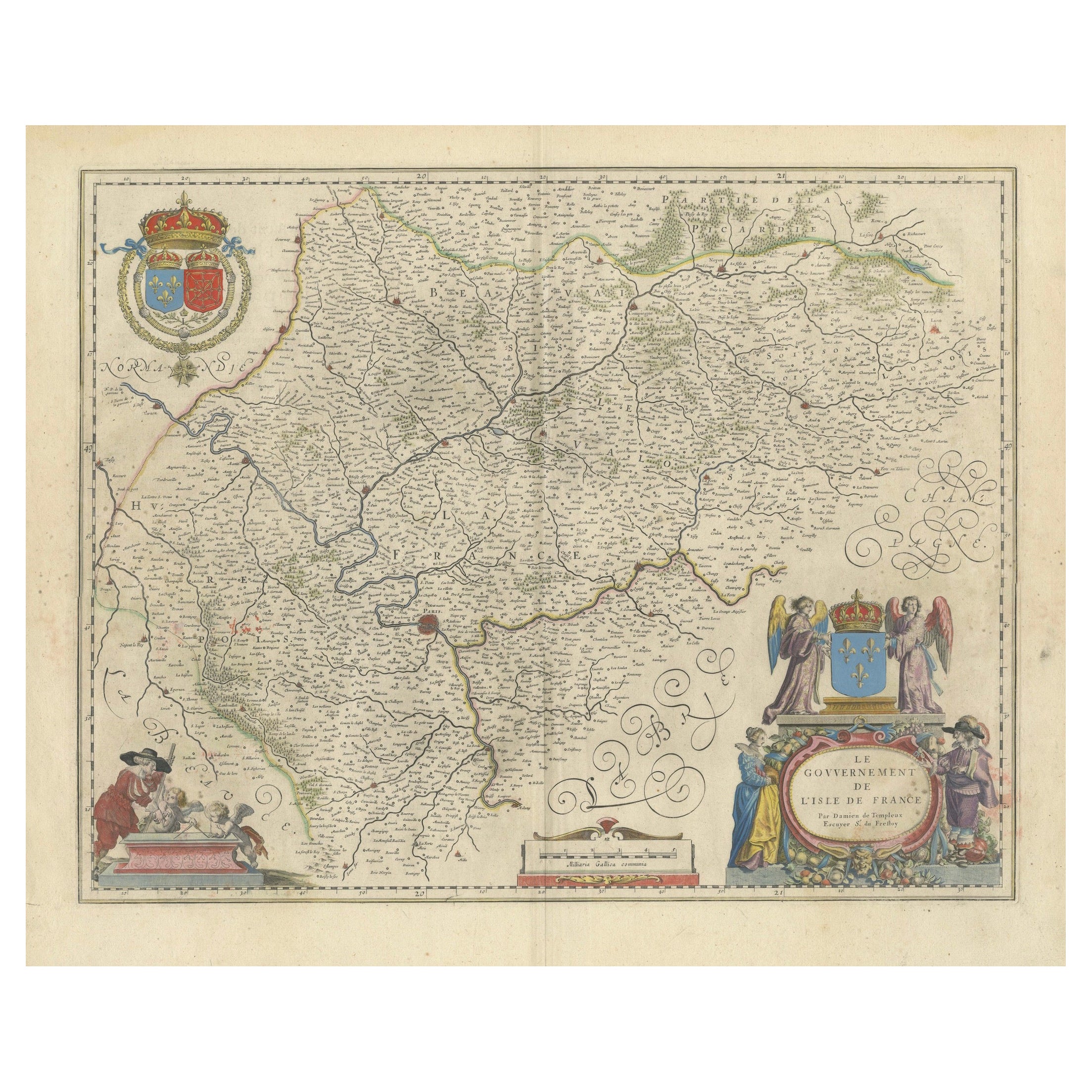
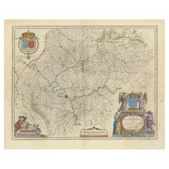
View AllMapping the Heart of France: Willem Blaeu's 17th Century Île-de-France, ca.1650
Located in Langweer, NL
This original antique map titled "Le Gouvernement de l'Isle de France" represents the Île-de-France region, which historically was one of the provinces of France and contained the ci...
Category
Antique 1650s Maps
Materials
Paper
$364 Sale Price
20% Off
Free Shipping
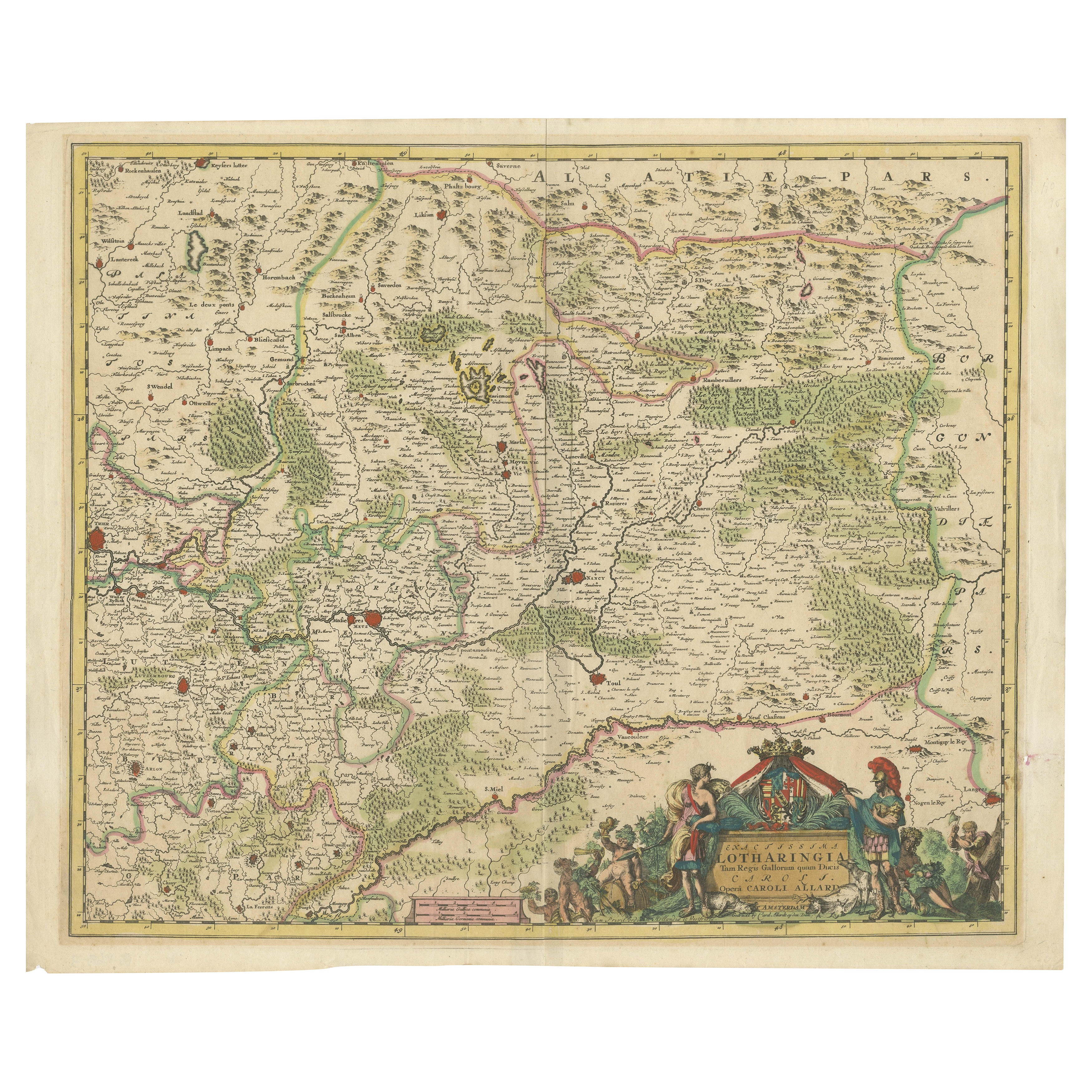
Historic 1690 Map of Lorraine in France by Allard - Cities of Toul, Nancy, Metz
Located in Langweer, NL
Exactissima Lotharingia - A Rare 17th Century Map of Lorraine by Carel Allard
This fascinating map of Lorraine, created by Carel Allard around 1690, is a stunning example of coppe...
Category
Antique 1690s Maps
Materials
Paper
$661 Sale Price
20% Off
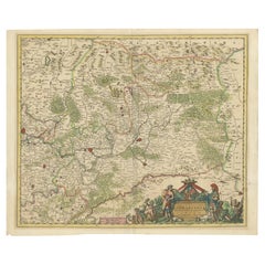
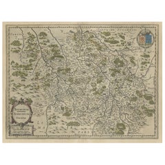
Antique Map of the Region of Lyon by Hondius, circa 1630
Located in Langweer, NL
Antique map titled 'Lionnois, Forest et Beauiolois'. Old map of the former region of Lyon, Vienne, Bresse, Rohan and the Rhône River. This map originates f...
Category
Antique Mid-17th Century Maps
Materials
Paper

$479 Sale Price
20% Off
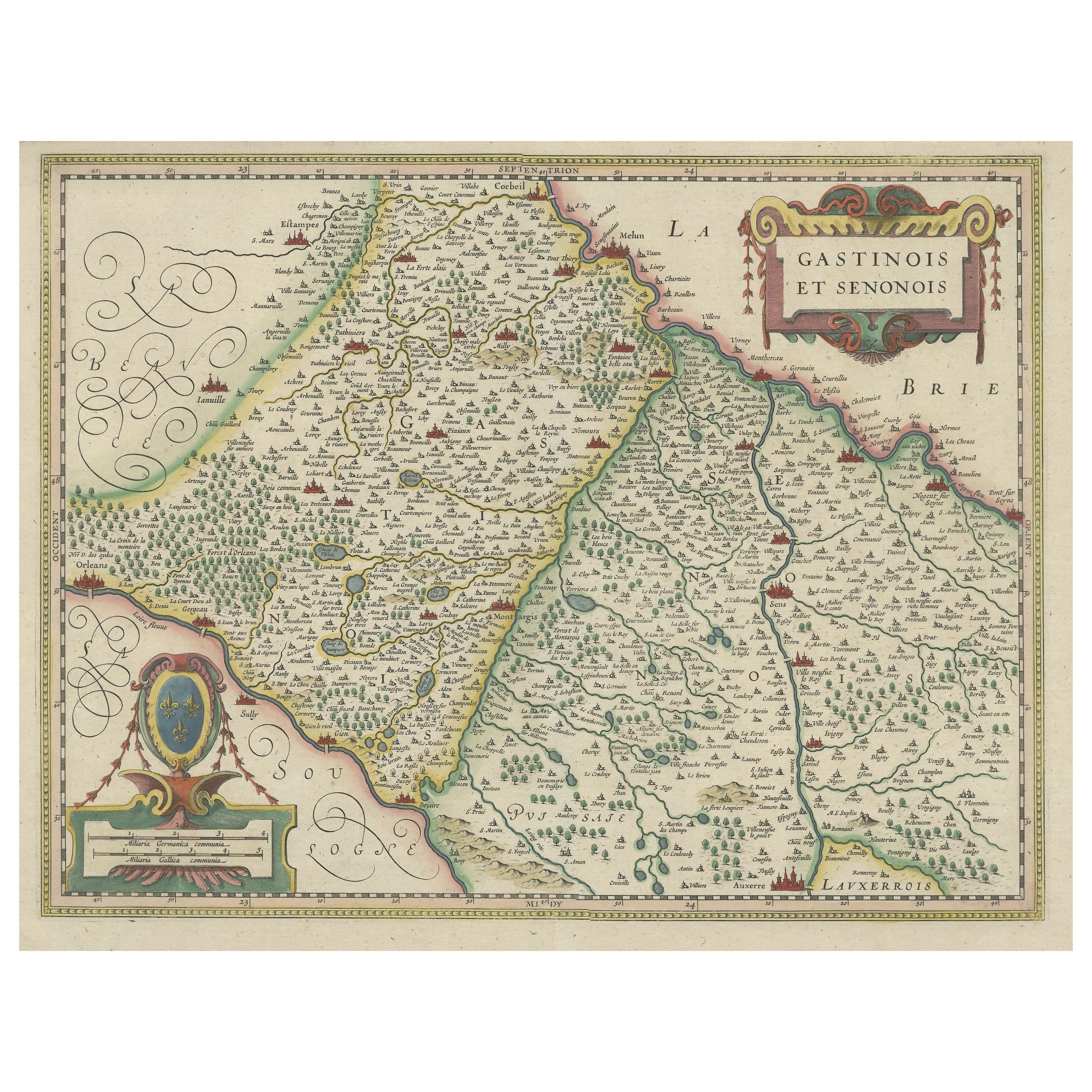
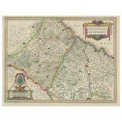
Original Antique Regional Map of France with Orleans, Auxerre and Montargis
By Johannes Janssonius
Located in Langweer, NL
Original antique map titled 'Gastinois et Senonois'. Beautiful regional map of France. With Corbeil in the north, Pont sur Seyne in the east, Auxerre in the south, and Orleans in the...
Category
Antique Mid-17th Century Maps
Materials
Paper
$805 Sale Price
20% Off
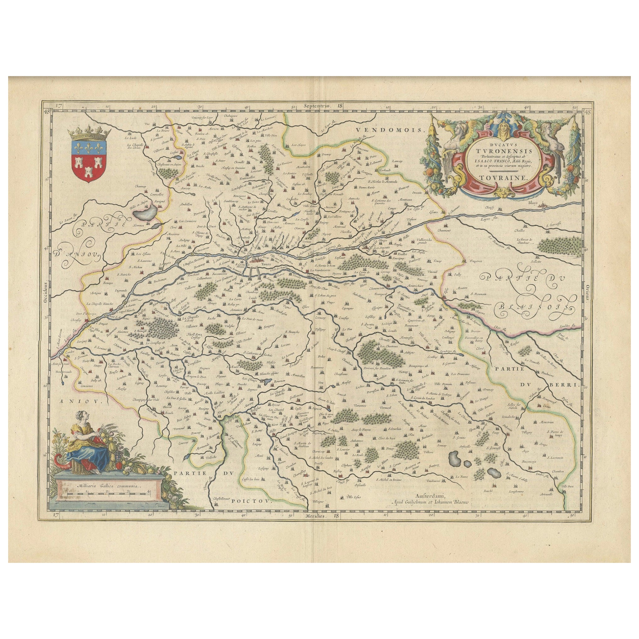
Cartographic Elegance of Touraine: A 17th-Century Map Showing French Heritage
Located in Langweer, NL
"Ducatus Turonensis - Touraine," is a original antique historical map of the Touraine region, which is located in the heart of France, centered...
Category
Antique 1630s Maps
Materials
Paper
$469 Sale Price
20% Off
Free Shipping
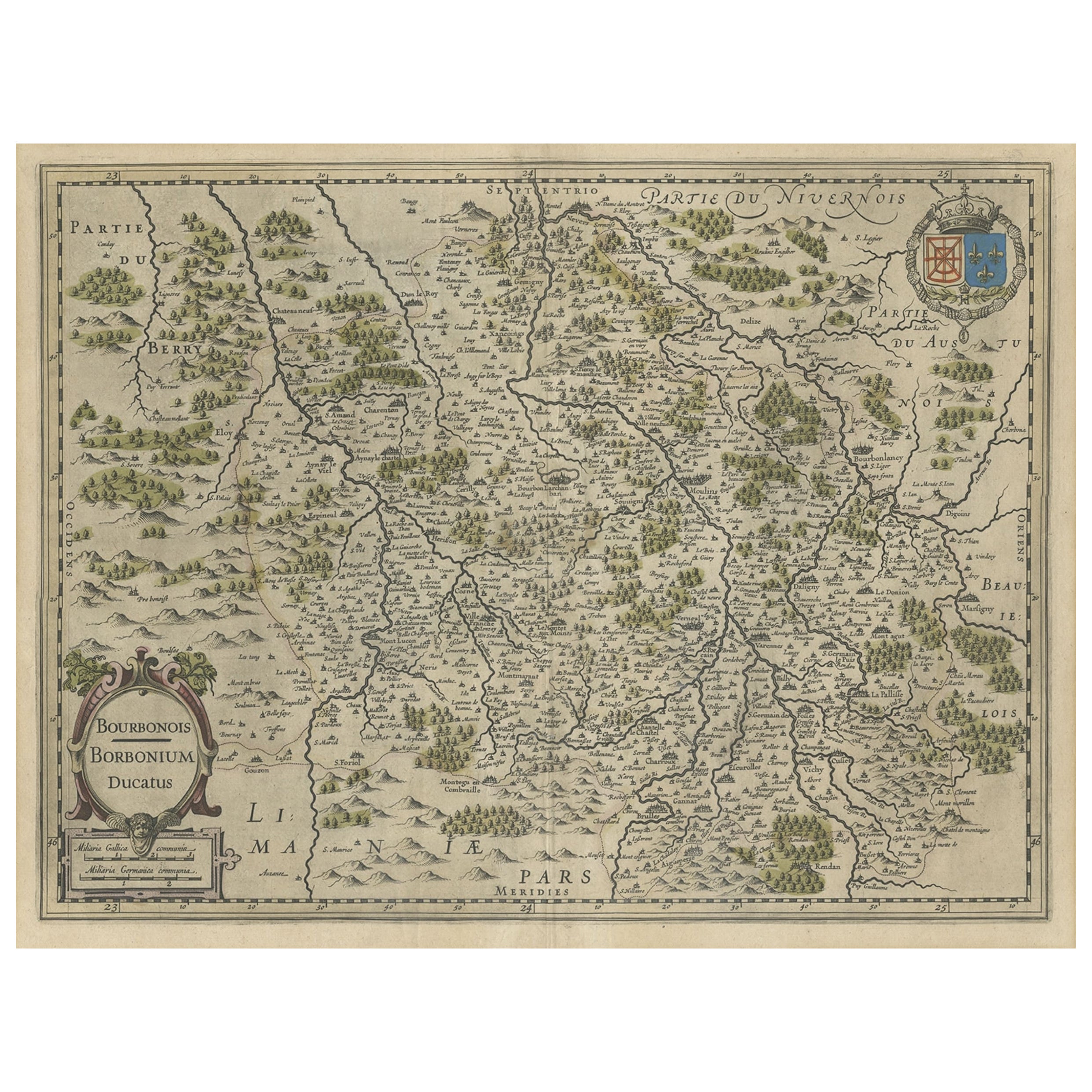
Old Map of the Bourbonnais Region of France, ca.1630
Located in Langweer, NL
Antique map titled 'Bourbonois - Borbonium Ducatus'.
Old map of the Bourbonnais region of France. Bourbonnais was a historic province in the centre of France that corresponds to ...
Category
Antique 1630s Maps
Materials
Paper
$604 Sale Price
20% Off
You May Also Like
1656 Jansson Map Metz Region of France Entitled "Territorium Metense" Ric0014
Located in Norton, MA
1656 Jansson map Metz Region of France entitled "Territorium Metense."
Ric0014
" Authentic" - Map of the historical region surrounding Metz, in Lorraine, France.
Oriented with ...
Category
Antique 17th Century Dutch Maps
Materials
Paper

1640 Joan Bleau Map Entitled"Diocecese de rheims et le pais de rethel, " Eic.a011
Located in Norton, MA
1640 Joan Bleau map entitled
"Diocecese de rheims et le pais de rethel,"
Ric.a011
OAN BLAEU
Diocecese de Rheims, et le pais de Rethel.
Handcolored engraving, c.1640.
...
Category
Antique 17th Century Dutch Maps
Materials
Paper

1630 Pierre Petit map "Description du Gouvernement de la Capelle" Ric0010
Located in Norton, MA
1630 Pierre Petit map entitled
"Description du Gouvernement de la Capelle,"
Ric0010
Pierre Petit was the son of a minor provincial official in Montluçon. The town, in the Auver...
Category
Antique 17th Century Dutch Maps
Materials
Paper

1635 Willem Blaeu Map of Northern France"Comitatvs Bellovacvm" Ric.a08
Located in Norton, MA
1635 Willem Blaeu map of northern France, entitled.
"Comitatvs Bellovacvm Vernacule Beavvais,"
Colored
Ric.a008
“COMITATVS BELLOVACVM…” Amsterdam: W...
Category
Antique 17th Century Unknown Maps
Materials
Paper

1625 Mercator Map of the Provenience of Quercy, "Quercy Cadvrcivm Ric.0013
Located in Norton, MA
1625 Mercator map of the provenience of Quercy, entitled
"Quercy Cadvrcivm,"
Ric.0013
" Authentic" - Map of the provenience of Quercy Cadvrcivm
D...
Category
Antique 17th Century French Maps
Materials
Paper

1594 Maurice Bouguereau Map of the Region Limoges, France, Ric0015
Located in Norton, MA
1594 Maurice Bouguereau map of the region Limoges, France, entitled
"Totivs Lemovici et Confinium Pro Uinciarum Quantum ad Dioecefin Lemo Uicenfen Fpectant,"
Hand Colored
Ric0015
Jean IV Le Clerc...
Category
Antique 16th Century Dutch Maps
Materials
Paper

More Ways To Browse
Antique Plate Germany
Side Table Made In Denmark
England Antique Plates
19th Century Round Dining Table
Antique Thrones
Carved Chinese Tables
Italian Ceramic 1960s
Mid Century Modern Danish Teak Dining Tables
Rosenthal Century
Long Rug Runners
Pair Arm Chairs
Sterling Silver Dinner Sets
United Chair Company
British Antiques
Italian Beech Chairs
Shirvan Rugs
Spain Marble
Vintage Brown Bottles