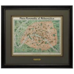
Map of Paris, Published by Robelin, Antique Pictorial Map, circa 1913
View Similar Items


Want more images or videos?
Request additional images or videos from the seller
1 of 5
Map of Paris, Published by Robelin, Antique Pictorial Map, circa 1913
About the Item
- Dimensions:Height: 35 in (88.9 cm)Width: 40 in (101.6 cm)Length: 35 in (88.9 cm)
- Materials and Techniques:
- Place of Origin:
- Period:1910-1919
- Date of Manufacture:1913
- Condition:Wear consistent with age and use. Overall very good condition. Original fold lines visible, but otherwise no notable damage and the paper is healthy. This map is artfully displayed in a custom-built archival frame.
- Seller Location:Colorado Springs, CO
- Reference Number:Seller: M2011stDibs: LU90978887193
About the Seller
4.9
Platinum Seller
These expertly vetted sellers are 1stDibs' most experienced sellers and are rated highest by our customers.
Established in 2010
1stDibs seller since 2011
400 sales on 1stDibs
More From This SellerView All
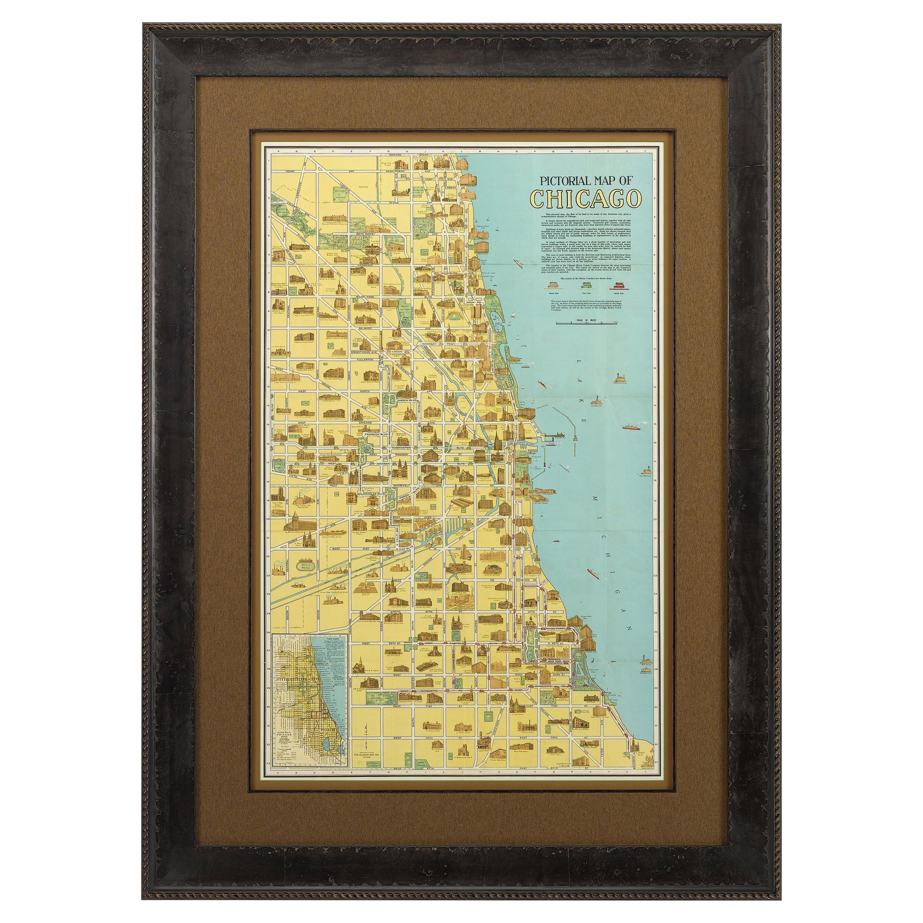
- Pictorial Map of Chicago, circa 1926Located in Colorado Springs, COThis is a colorful folding pocket map of the city of Chicago, published by The Clason Map Co., circa 1926. This highly decorative, double sided map features "Pictorial Map of Chicago...Category
Vintage 1920s American Maps
MaterialsPaper
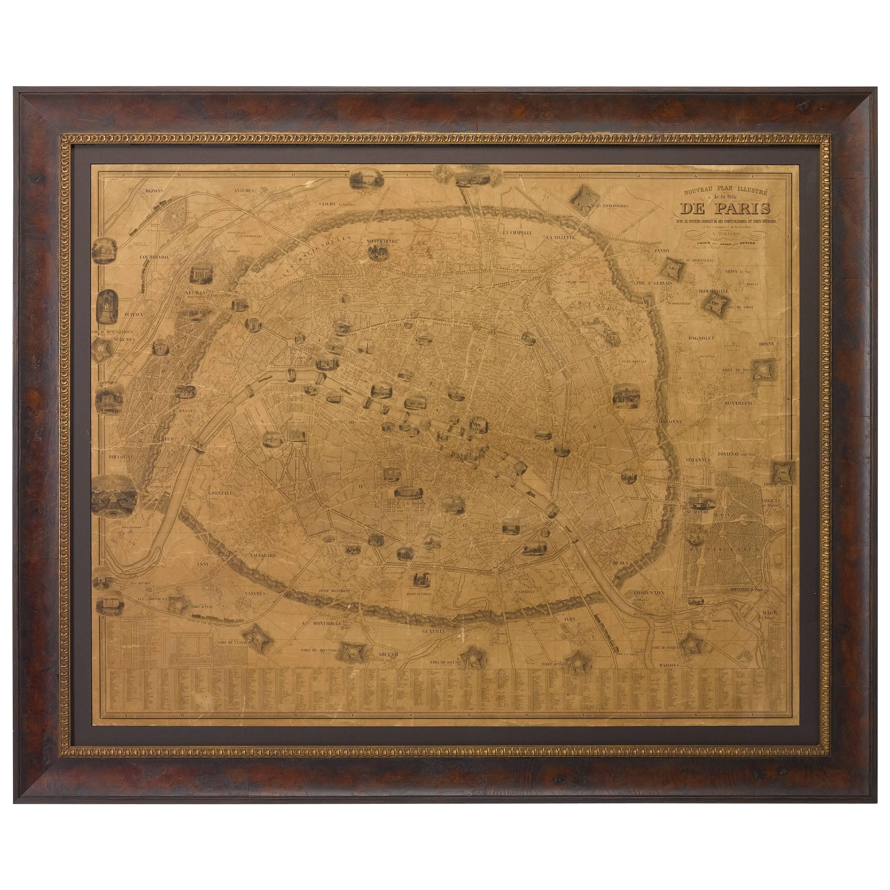
- Plan of Paris, France, by A. Vuillemin, Antique Map, 1845Located in Colorado Springs, COThis large and detailed plan of Paris was published by Alexandre Vuillemin in 1845. The map conveys a wonderful amount of information and is decorated throughout with pictorial vigne...Category
Antique 1840s American Maps
MaterialsPaper
- 1840 Map of the City of Washington Published by William M. MorrisonLocated in Colorado Springs, COThis map, printed in 1840, is a detailed representation of Washington, D.C. in the mid-19th century. The map shows block numbers, wards, and government buildings as well as details o...Category
Antique 1840s American Federal Maps
MaterialsPaper
- Antique Map of Paris, "Carte Routiere des Environs de Paris" 1841Located in Colorado Springs, COThis beautiful hand-colored road map of Paris was published in 1841. The map shows Paris and the surrounding area in a folding pocket map. Organized and detailed for travelers, this ...Category
Antique 1840s French Maps
MaterialsPaper
- 1842 Wall Map of the United States by J. H. Young, Published by S. A. MitchellLocated in Colorado Springs, COPresented is an 1842 hanging “Map of the United States,” engraved by J. H. Young and published by Samuel Augustus Mitchell, Philadelphia. This is a beautiful example of the rare 1842...Category
Antique 1840s American Maps
MaterialsPaper
- 1907 Map of Colorado, Antique Topographical Map, by Louis NellLocated in Colorado Springs, COThis highly detailed pocket map is a topographical map of the state of Colorado by Louis Nell from 1907. The map "has been complied from all availabl...Category
Antique Early 1900s American Maps
MaterialsPaper


You May Also Like
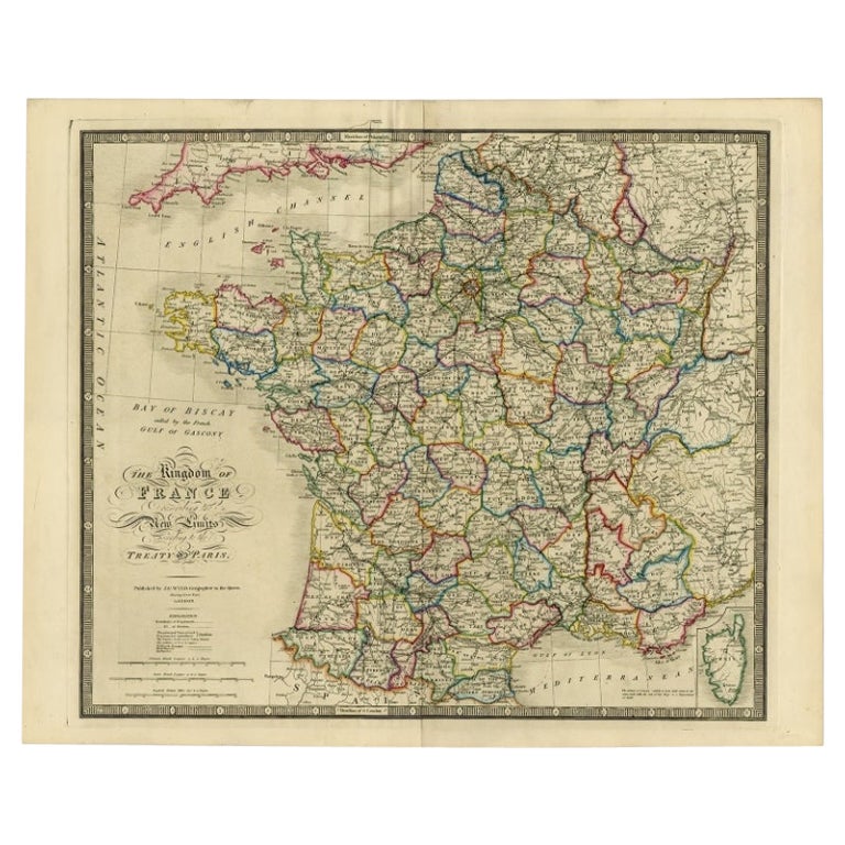
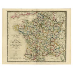
- Antique Map of France according to the Treaty of Paris '1815', Published in 1854Located in Langweer, NLAntique map titled 'The Kingdom of France, describing the new limits according to the treaty of Paris. (1815)'. Large map of France. From James Wyld's 'A New General Atlas of Modern ...Category
Antique 19th Century Maps
MaterialsPaper
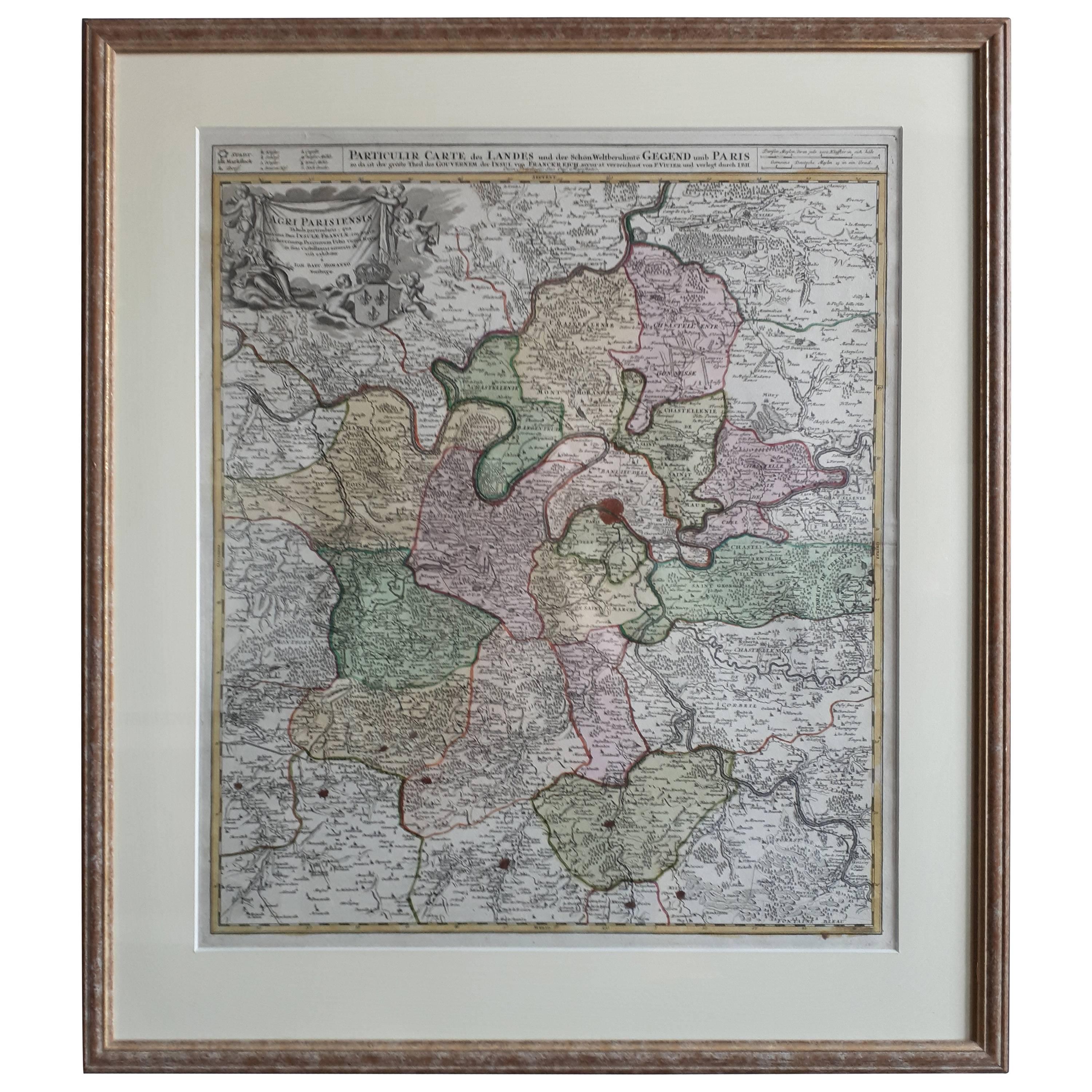
- Antique Map of the Region of Paris ‘France’ by H. Heirs, circa 1720Located in Langweer, NLAntique map titled 'Agri Parisiensis Tabula particularis, qua maxima Pars Insulae Franciae (..)'. Incredibly detailed map showing everything from tiny villages to forests, farmland, ...Category
Antique Early 18th Century Maps
MaterialsPaper
 $929 Sale Price22% Off
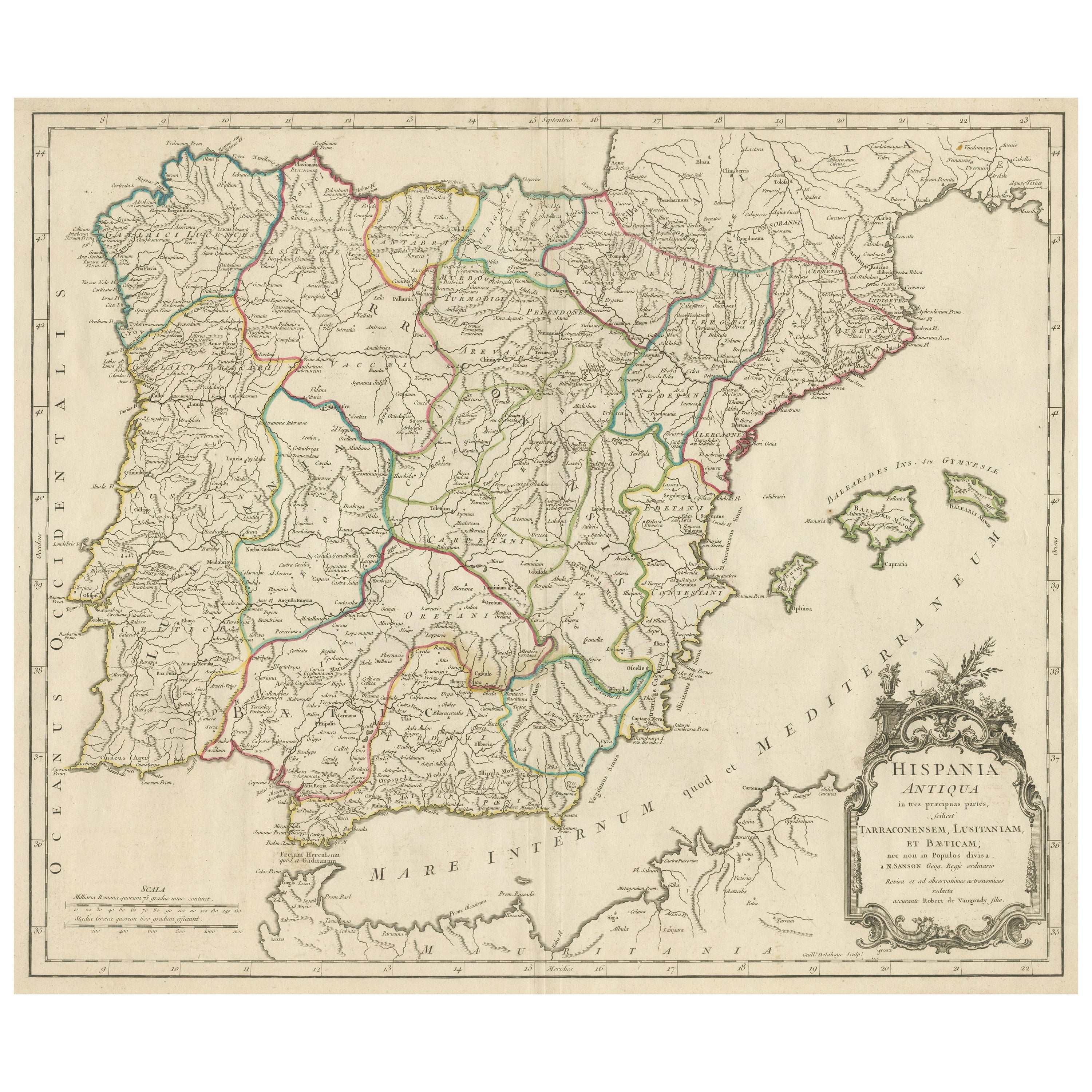
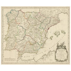
 - Large Antique Map of Ancient Spain and Portugal, Published in circa 1760Located in Langweer, NLAntique map titled 'Hispania Antiqua (..)'. Map of ancient Spain and Portugal. Engraved by G. Delahaye. Published circa 1760, by or after Sanson & Vaugondy.Category
Antique Mid-18th Century Maps
MaterialsPaper
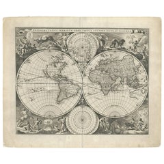
- Gorgeous Antique World Map by the Dutch Mapmaker Visscher, published circa 1679Located in Langweer, NLAntique map titled 'Novissima Totius Terrarum Orbis Tabula, Auctore Nicolao Visscher'. Gorgeous example of Nicholas Visscher's World map, which appeared...Category
Antique Late 17th Century Maps
MaterialsPaper
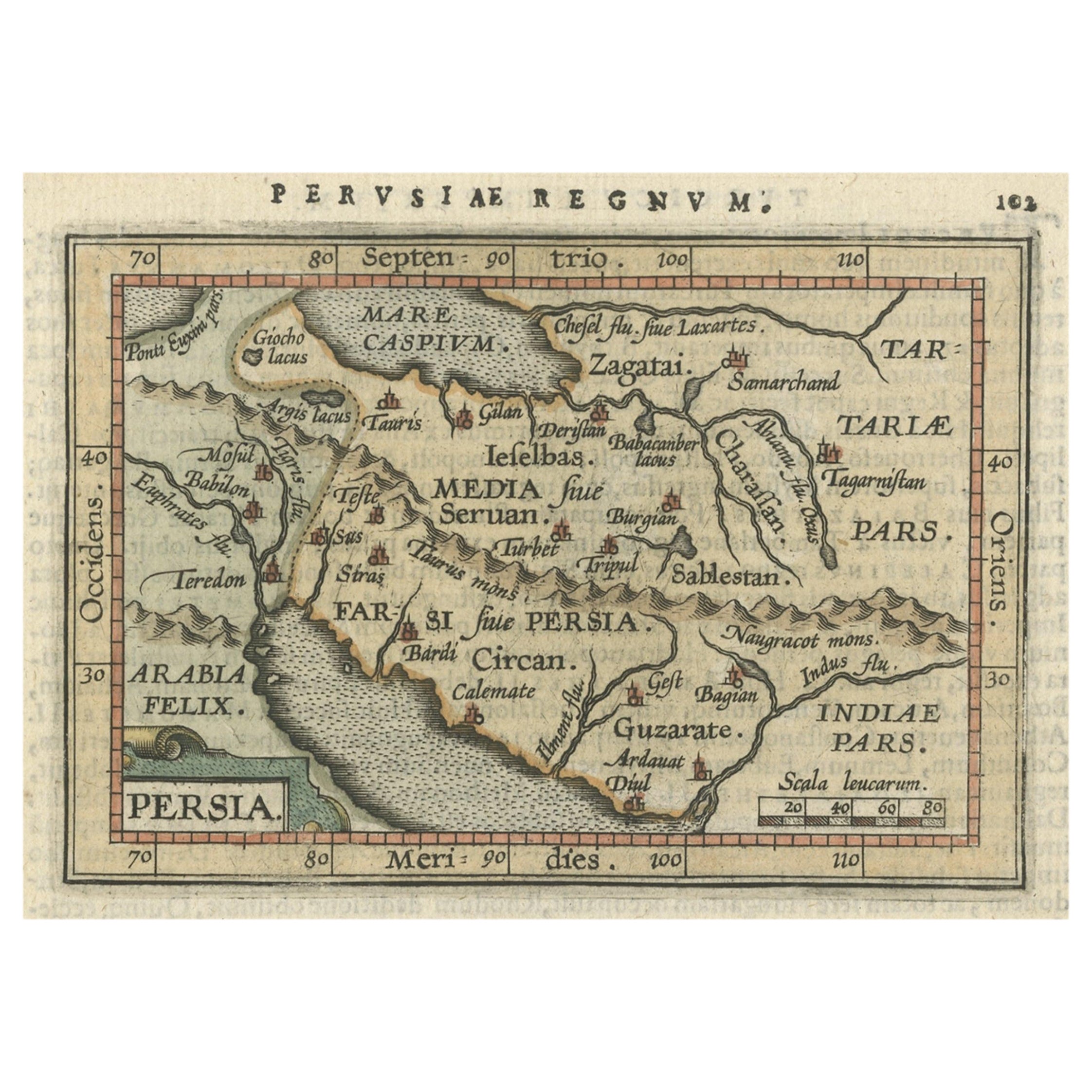
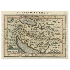
- Original Antique Miniature Map of Persia, Published, ca.1601Located in Langweer, NLAntique miniature map titled 'Persia'. Small map of Persia published in the Epitome, or pocket-edition of the "Theatrum Orbis Terrarum". Artists and e...Category
Antique Early 1600s Maps
MaterialsPaper
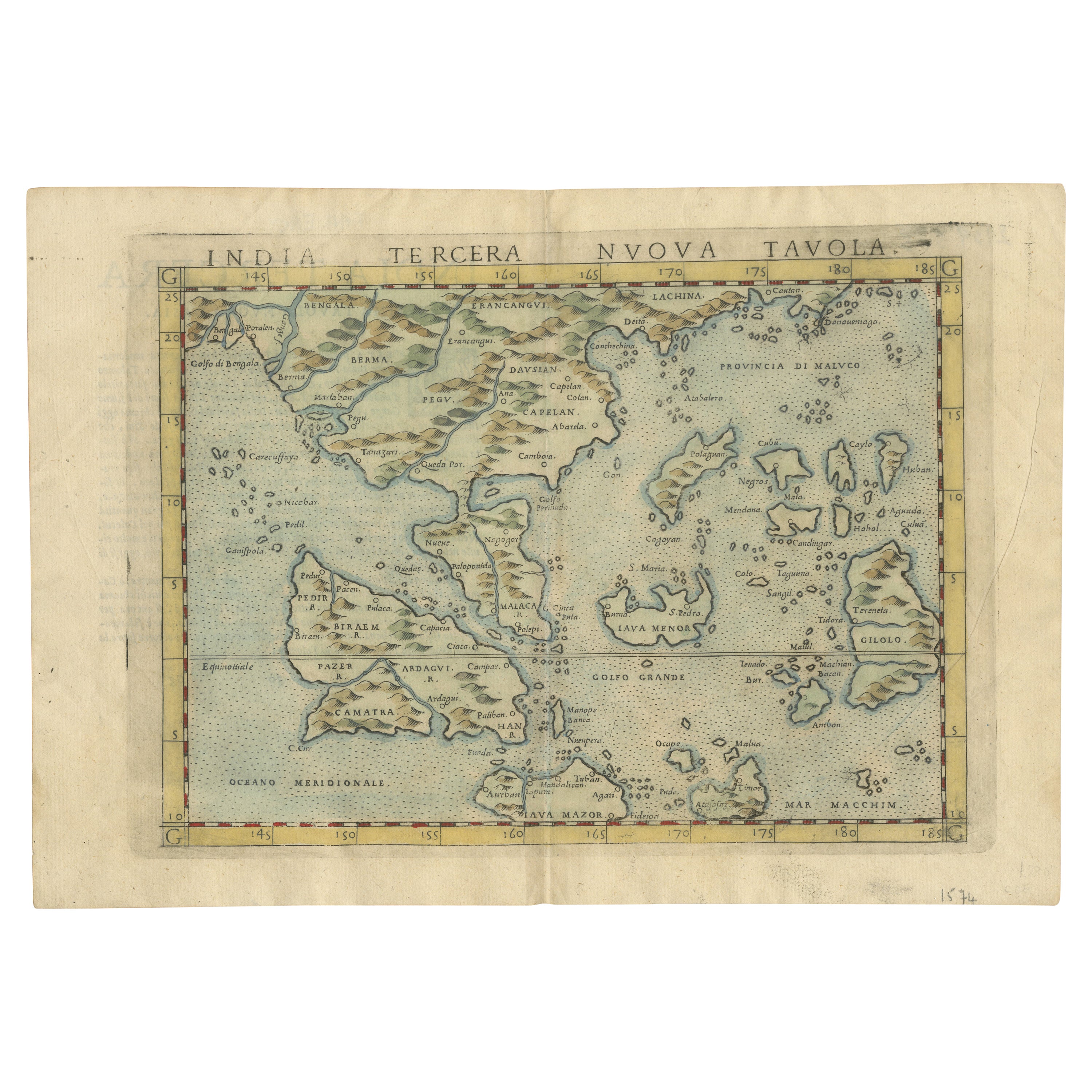
- Original Antique Map of Southern Asia, Published in 1833Located in Langweer, NLAntique map titled 'Carte de l'Inde'. Detailed map extending from India in the west to Vietnam and the Malay Peninsula in the east. This map originates from 'Atlas universel de geogr...Category
Antique Mid-19th Century Maps
MaterialsPaper

Recently Viewed
View AllMore Ways To Browse
Antique Train Station Furniture
Bird Prints French Antique
Large Antique Map Of Paris
Train Map
Arc De Triomphe Antique
Tower Bridge Antique
Birds Eye View Map
Large Maps Of Paris
Antique Arc Light
Antique Navigation Map
Subway Light
Antique Train Station
Green Eiffel Tower
Antique Furniture South East London
Antique Island Caribbean
Teak Sphere
Atlas Stand
Antique Battle Maps