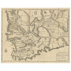
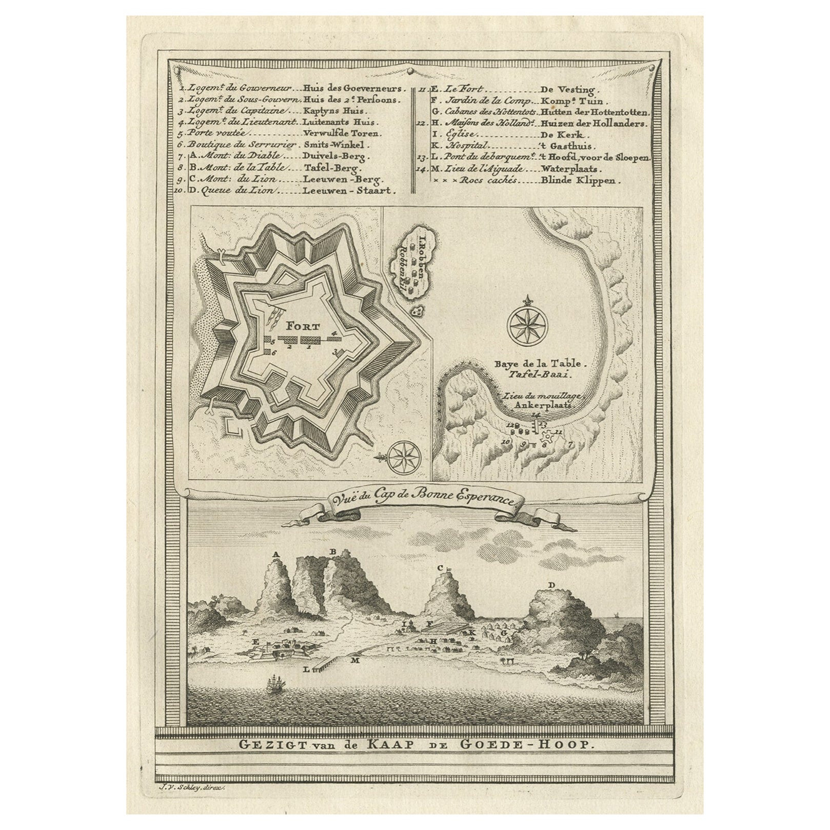
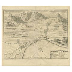
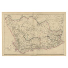
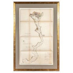
Rare Map of Cape of Good Hope from the Doornbosch River to Algoa Bay, 1726
View Similar Items
Want more images or videos?
Request additional images or videos from the seller
1 of 6
Rare Map of Cape of Good Hope from the Doornbosch River to Algoa Bay, 1726
About the Item
- Dimensions:Height: 18.9 in (48 cm)Width: 22.84 in (58 cm)Depth: 0 in (0.02 mm)
- Materials and Techniques:
- Period:1720-1729
- Date of Manufacture:1726
- Condition:Additions or alterations made to the original: Condition: Good, general age-related toning. Few repairs on folding lines. Please study image carefully. Repaired: Few repairs on folding lines. Wear consistent with age and use. Condition: Good, general age-related toning. Few repairs on folding lines. Please study image carefully.
- Seller Location:Langweer, NL
- Reference Number:Seller: BGRN-249 1stDibs: LU3054326762562
About the Seller
5.0
Platinum Seller
These expertly vetted sellers are 1stDibs' most experienced sellers and are rated highest by our customers.
Established in 2009
1stDibs seller since 2017
1,948 sales on 1stDibs
More From This SellerView All
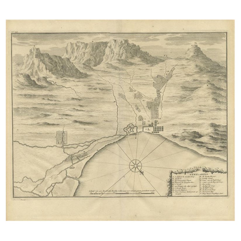
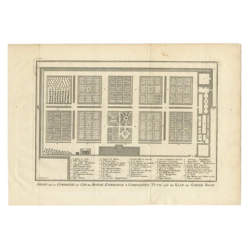
- Antique Print of the Cape of Good Hope in South Africa, 1726Located in Langweer, NLAntique print Africa depicting the Cape of Good Hope. With Dutch legend. This print originates from 'Oud en Nieuw Oost-Indiën' by F. Valentijn. Arti...Category
Antique 18th Century Prints
MaterialsPaper
 $431 Sale Price20% Off
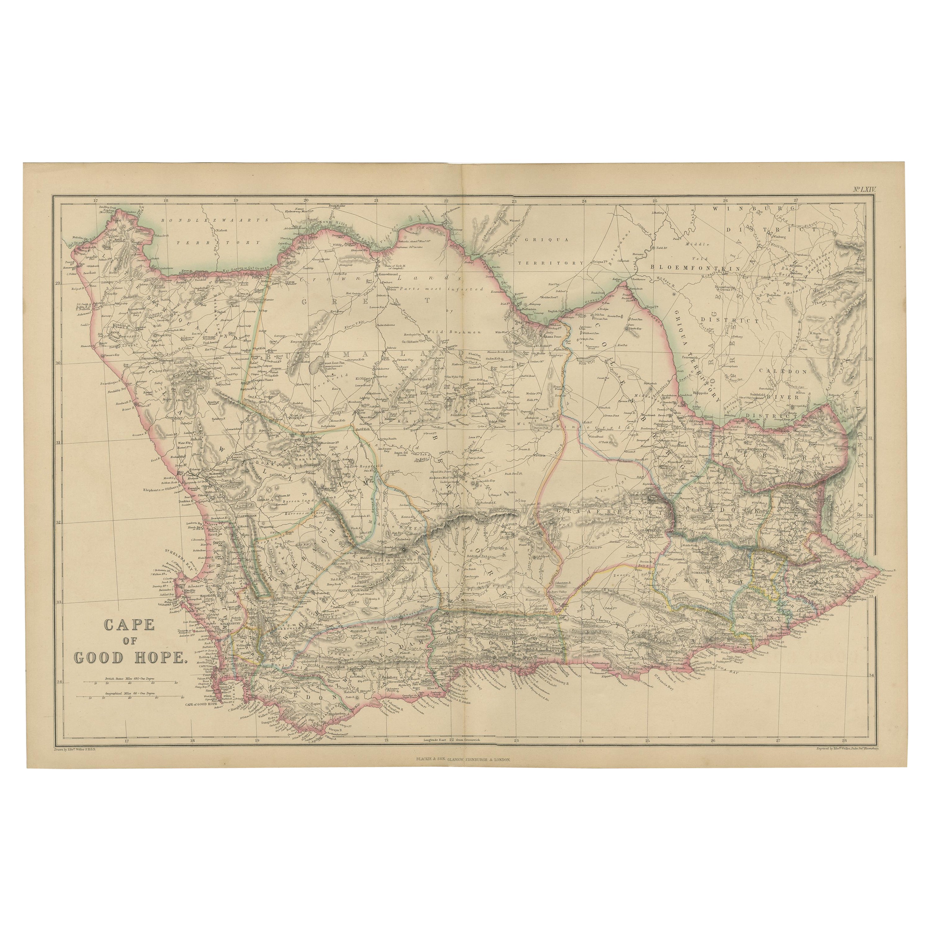
 - Antique Map of the Cape of Good Hope by W. G. Blackie, 1859Located in Langweer, NLAntique map titled 'Cape of Good Hope'. Original antique map of the Cape of Good Hope. This map originates from ‘The Imperial Atlas of Modern Geography’. Published by W. G. Blackie, ...Category
Antique Mid-19th Century Maps
MaterialsPaper
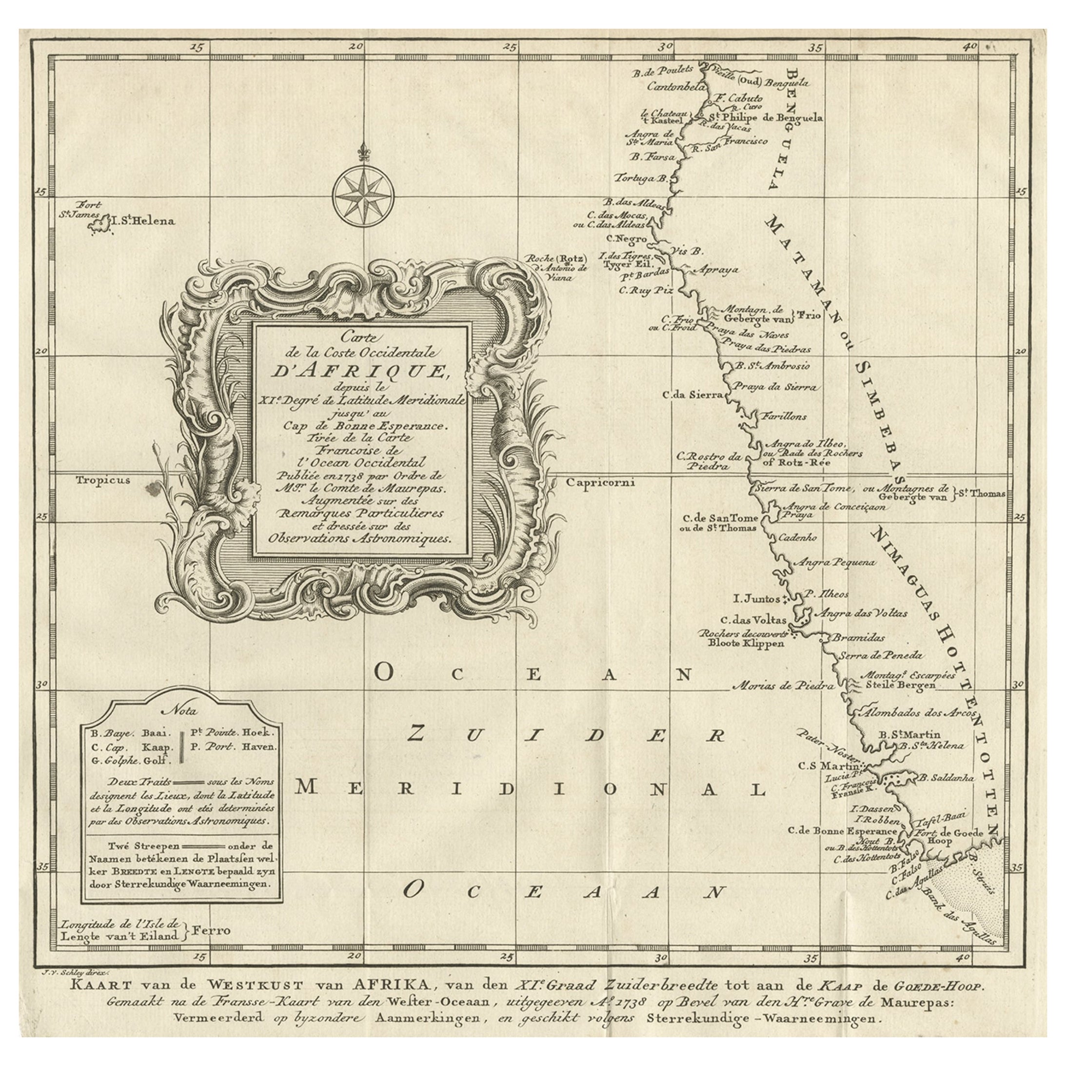
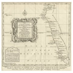
- Dutch Antique Map of the West Coast of Africa, to the Cape of Good Hope, 1747Located in Langweer, NLAntique map of the Coast of Africa titled 'Kaart van de West Kust van Afrika (..)'. Map of the west coast of Africa, from 11 degrees south latitude to the Cape of Good Hope. This...Category
Antique 1740s Maps
MaterialsPaper
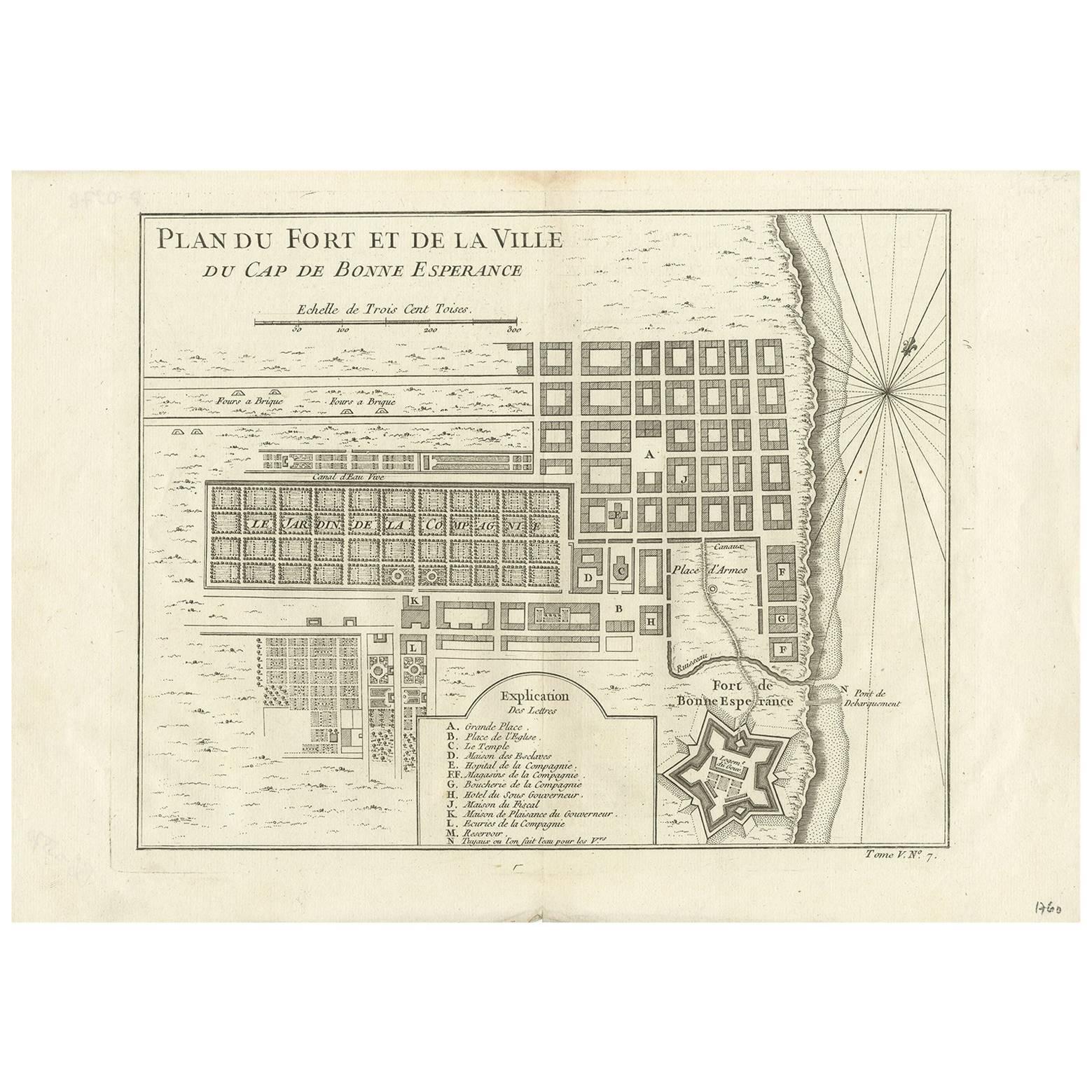
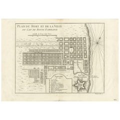
- Antique Map of the Cape of Good Hope by J.N. Bellin, 1748Located in Langweer, NLEarly plan of the Cape of Good Hope, includng a town plan and illustrations of the fortificatons. This map originates from Tome V of Abbe Prevost's Histoire generale du voyages.Category
Antique Mid-18th Century Maps
MaterialsPaper
 $275 Sale Price27% Off
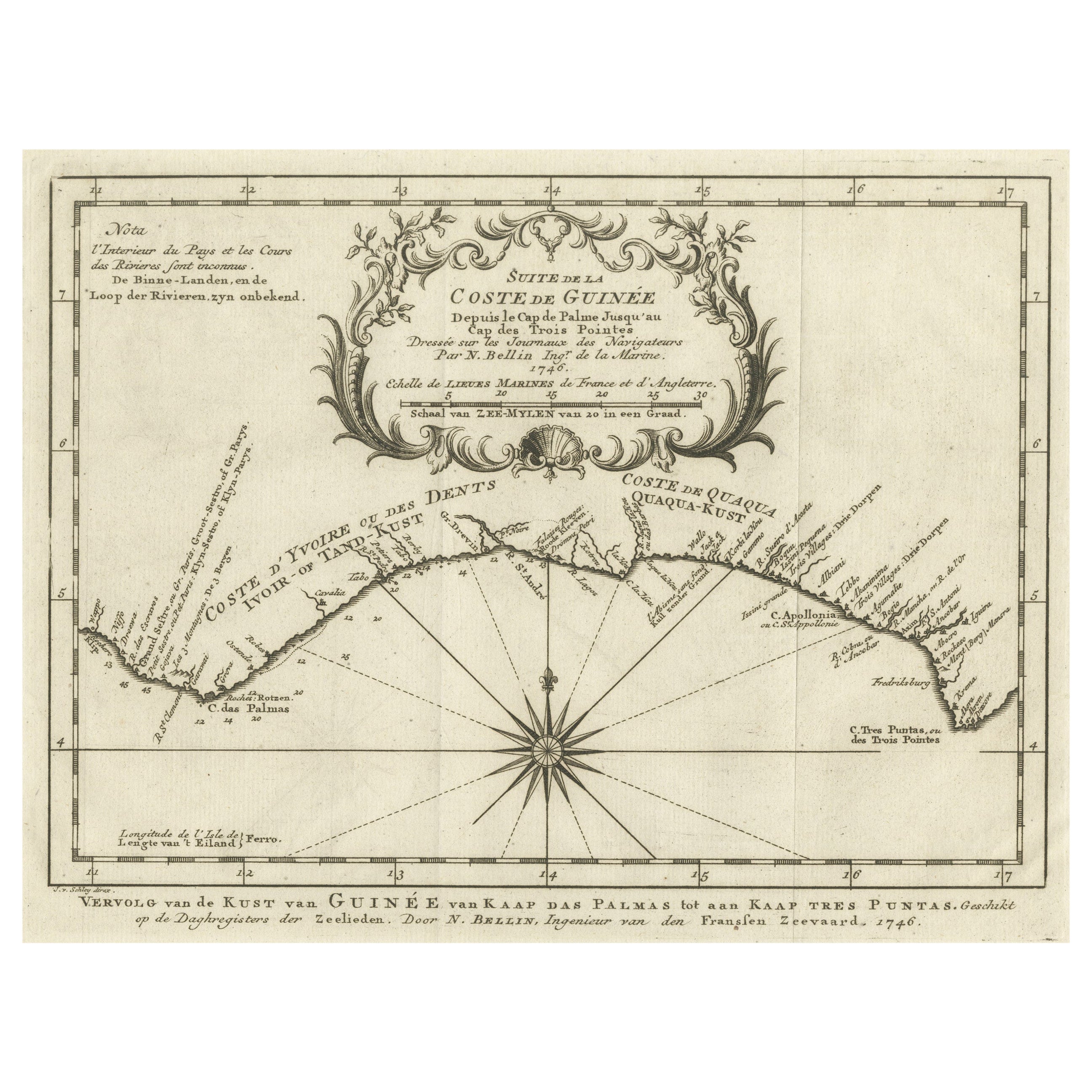
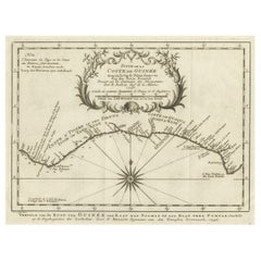
 - Antique Map of the Coast of Guinea from, Cape Apollonia to the Volta RiverLocated in Langweer, NLAntique map titled 'Suite de la Coste de Guinée (..) - Vervolg van de Kust van Guinée (..)'. Decorative map of the coast of Guinea from, Cape Apollonia to the Volta River. Engraved b...Category
Antique Mid-18th Century Maps
MaterialsPaper
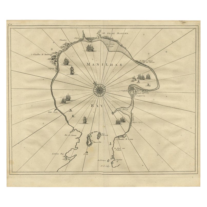
- Antique Engraved Map of Manila, the Earliest Obtainable Map of Manila Bay, 1726Located in Langweer, NLAntique map titled 'Manilhas Bay'. This map is considered the earliest obtainable map of Manila Bay. Depicts Manila Bay, locating the city of Manila, Castle (Cabitta), Cloister of Sa...Category
Antique 18th Century Maps
MaterialsPaper
 $1,104 Sale Price35% Off
You May Also Like
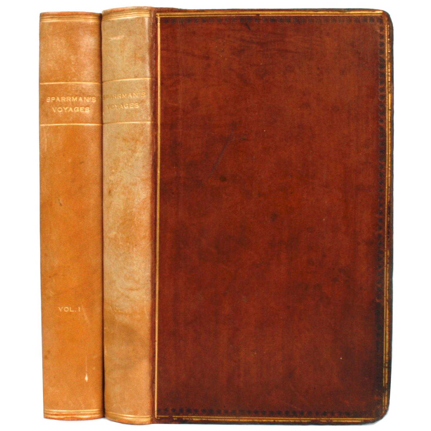
- Voyage to the Cape of Good Hope, First Edition, c1785Located in valatie, NYVoyage to the Cape of Good Hope, towards the Antarctic polar circle, and round the world, but chiefly into the country of the Caffres, from the year ...Category
Antique 18th Century Irish Books
MaterialsLeather, Paper
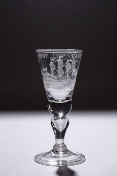
- Engraved 'Cape of Good Hope' Colonial Commemorative Glass, 18th CenturyLocated in Amsterdam, NLA commemorating glass with an engraving of a farmer ploughing, an East Indiaman and a text reading: Het Lan’s Wel Varen An De Caap (the country’s prosperity at the Cape of Good Hope...Category
Antique 18th Century South African Glass
MaterialsGlass
- Antique 1798 James Colnett A Voyage to the South Atlantic & Round Cape Hope BookLocated in Hamilton, OntarioThis antique book titled "A Voyage to the South Atlantic and Round Cape Horn into the Pacific Ocean", and authored by W. Bennett, on the work of James Colnet...Category
Antique Late 18th Century English Georgian Books
MaterialsLeather, Paper
- 1880s Map of The Italian Alps from Milan to Lake GardaLocated in Roma, ITGeographical Map of the Profile and Elevation of the Italian Alps from Milano to Lake Garda. The map features the name of each peak and key cities including Monza, Brescia and Bergam...Category
Antique 1880s Italian Maps
MaterialsParchment Paper
- 1864 U.S. Coast Survey of the Potomac River, from Indian Head to GeorgetownLocated in Bridgeport, CTAn antique nautical map with hand-painted color accents entitled "Potomac River (in four sheets): Sheet no. 4, from Indian Head to Georgetown". Created b...Category
Antique 19th Century American Classical Maps
MaterialsPaper
- 1856 U.S. Coast Survey Map of Chesapeake Bay and Delaware BayLocated in Colorado Springs, COPresented is U.S. Coast Survey nautical chart or maritime map of Chesapeake Bay and Delaware Bay from 1856. The map depicts the region from Susquehanna, Maryland to the northern Outer Banks in North Carolina. It also shows from Richmond and Petersburg, Virginia to the Atlantic Ocean. The map is highly detailed with many cities and towns labeled throughout. Rivers, inlets, and bays are also labeled. Various charts illustrating more specific parts of the region are marked on the map using dotted lines. The lines form boxes, and the corresponding chart number and publication date are given. Extensive triangulation surveys were conducted the length of Chesapeake Bay and are illustrated here. Hampton Roads, Virginia is labeled, along with the James, York, and Rappahannock Rivers, which were all extensively surveyed. The chart was published under the supervision of A. D. Bache, one of the most influential and prolific figures in the early history of the U.S. Coast Survey, for the 1856 Report of the Superintendent of the U.S. Coast Survey. Alexander Dallas Bache (1806-1867) was an American physicist, scientist, and surveyor. Bache served as the Superintendent of the U.S. Coast Survey from 1843 to 1865. Born in Philadelphia, Bache toured Europe and composed an important treatise on European Education. He also served as president of Philadelphia's Central High School and was a professor of natural history and chemistry at the University of Pennsylvania. Upon the death of Ferdinand Rudolph Hassler, Bache was appointed Superintendent of the United States Coast Survey. The Office of the Coast Survey, founded in 1807 by President Thomas Jefferson and Secretary of Commerce Albert Gallatin...Category
Antique 1850s American Maps
MaterialsPaper


Recently Viewed
View AllMore Ways To Browse
Cape Beige
Antique Cape
Antique Capes
Bay Antique Furniture
Antique Bay
Cape Antique Furniture
Antique Quadrant
Antique Map Of Africa
Antique Maps Of Africa
Voc Antique
East Bay Used Furniture
Cape Of Good Hope
East Africa Map
Antique Furniture Cape Town
Antique House Plans
Antique Metal Window
Antique Metal Windows
Antique Furniture Rollers