East Africa Map
3
to
20
75
37
68
39
28
25
22
15
14
13
10
8
7
7
7
7
6
5
5
4
3
3
3
3
3
2
2
2
2
2
2
1
1
1
1
1
1
1
1
1
1
1
1
8
4
3
2
2
Sort By
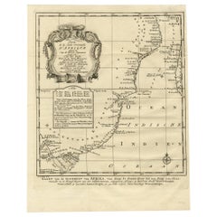
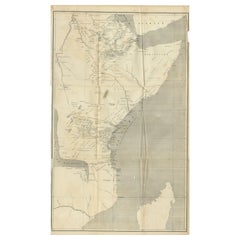
Original Detailed Antique Map of the East Coast of Africa, 1747
Located in Langweer, NL
'.
Original antique map of the east coast of Africa. Reaches from Cape of Good Hope and the land of the
Category
Antique 1740s Maps
Materials
Paper
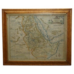
London 1744 Published Watercolour Antique Map of East Africa by Eman Bowen
Located in GB
This is a decorative antique engraved map of East Africa, colored by kingdoms and provinces.
The map
Category
Antique 1740s English George III Maps
Materials
Paper
H 17.52 in W 21.07 in D 0.79 in
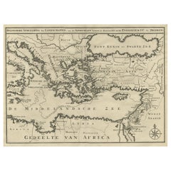
Scarce Map of the Mediterranean and Parts of Europe, Africa & Middle East, 1725
Located in Langweer, NL
, Africa and the Middle East, illustrating the travels of Paul between the Holy Land and Rome, through the
Category
Antique 1720s Maps
Materials
Paper
H 15.75 in W 18.51 in D 0 in
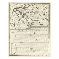
Intriguing Antique Map of Europe, the Middle East and Africa by Scherer, c.1703
Located in Langweer, NL
Antique map depicting part of Africa, Europe and the Middle East. Also showing various cities in
Category
Antique 18th Century Maps
Materials
Paper
H 10.63 in W 8.27 in D 0 in
Antique Map of Eastern Africa, Engraved by a German Missionary, 1858
Located in Langweer, NL
Original antique map of Eastern Africa. This map originates from 'Reisen in Ost-Afrika, ausgeführt
Category
Antique 19th Century Maps
Materials
Paper
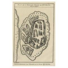
Antique Print of East African Island of Quiloa or Kilwa Kisiwani, Tanzania, 1749
Located in Langweer, NL
Quiloa'.
This bird's-eye view show the East African island of Quiloa, now known as Kilwa Kisiwani in
Category
Antique 1740s Maps
Materials
Paper
H 9.85 in W 7.68 in D 0 in
West Coast of Africa, Guinea & Sierra Leone: An 18th Century Map by Bellin
By Jacques-Nicolas Bellin
Located in Alamo, CA
expansive work that mapped China, the East Indies, Asia, the Americas, early voyages to Australia, New
Category
Antique Mid-18th Century French Maps
Materials
Paper
H 10 in W 14.25 in D 0.07 in
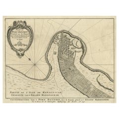
Antique Plan of Fort Dauphin on Madagascar of the East Coast of Africa, 1756
Located in Langweer, NL
Fort Dauphin on the island of Madagascar of the east coast of Africa. This print originates from
Category
Antique 1750s Maps
Materials
Paper
H 9.73 in W 12.21 in D 0 in
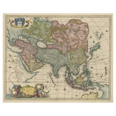
Antique Map of Asia and the East Indies and Korea as a Peninsula, ca.1660
Located in Langweer, NL
Antique map titled 'Asiae nova delineatio'. Decorative map of Asia and the East Indies. The map
Category
Antique 17th Century Maps
Materials
Paper
Free Shipping
H 19.69 in W 24.02 in D 0 in
Antique Map of the Coast of Zanguebar and Madagascar 'Africa' by J. van Schley
Located in Langweer, NL
Decorative map of the area between the east coast of South Africa, the Seychelles, Mauritius and
Category
Antique Mid-18th Century Maps
Materials
Paper
H 10.24 in W 12.8 in D 0.02 in
Antique Map Made After a Roman Papyrus Travel Map, Known as Peutinger Map, 1773
Located in Langweer, NL
Iberian Peninsula and the British Isles), North Africa, and parts of Asia, including the Middle East
Category
Antique 18th Century Maps
Materials
Paper
H 15.56 in W 18.51 in D 0 in
Antique Map of German Colonies by Meyer, 1895
Located in Langweer, NL
Antique map titled 'Deutsche Kolonien.' Lithographed map of the German Colonies. German East-Africa
Category
Antique 19th Century Maps
Materials
Paper
Antique Map of Asia by A. Blondeau, circa 1800
Located in Langweer, NL
Africa and the Mediterranean east to the Bering Sea and south as far as Java and New Guinea. This map is
Category
Antique Early 19th Century Maps
Materials
Paper
Antique Map of the Turkish Empire by Tirion 'c.1760'
Located in Langweer, NL
Antique map titled 'Nieuwe Kaart van het Turksche Ryk gelegen in Europa, Asia en Africa'. Original
Category
Antique Mid-18th Century Maps
Materials
Paper
Road Map, John Ogilby, No 54, London, Yarmouth, Britannia
By John Ogilby
Located in BUNGAY, SUFFOLK
, Shepherds Bush, East Acton and Acton.
All in all, Ogilby's maps represent a fascinating record of the
Category
Antique 1670s English Baroque Maps
Materials
Paper
Antique Map of the Island of Psara by Dapper, 1688
Located in Langweer, NL
Antique map titled 'Sara.' Map of Psara ( Psyra or Ipsera) Island (North East Aegean Islands
Category
Antique 17th Century Maps
Materials
Paper
Antique Map of Edom, an Ancient Kingdom in Transjordan, 1773
Located in Langweer, NL
and east. Originates from the first Dutch editon of an interesting travel account of Northern Africa
Category
Antique 18th Century Maps
Materials
Paper
Mediterranean Tapestry: A 19th Century Map of the Mediterranean Shores, 1882
Located in Langweer, NL
Europe down to the northern coastlines of Africa.
The map is a vivid document of the time, with each
Category
Antique 1880s Maps
Materials
Paper
H 11.03 in W 14.97 in D 0 in
Ancient Realms of Northeast Africa: Arabia, Ethiopia, and Egypt, Published 1880
Located in Langweer, NL
Northeast Africa and the Near East.
The period represented by the map is likely during the classical
Category
Antique 1880s Maps
Materials
Paper
Free Shipping
H 15.56 in W 18.51 in D 0 in
Old Antique Print of Fort Noordwijk, Batavia in the Dutch East Indies, 1739
Located in Langweer, NL
originates from from 'Allerneuester Geographische- und Topographischer Schau-platz, von Africa und Ost-Indien
Category
Antique 1730s Maps
Materials
Paper
H 10.44 in W 13 in D 0 in
Large Antique Map of Asia including All of Southeast Asia, c.1792
Located in Langweer, NL
area from the East African coast to New Guinea and from the Artic to Northern Australia. The island of
Category
Antique 18th Century Maps
Materials
Paper
No Reserve
H 20.67 in W 25.4 in D 0 in
St. Christophe 'St. Kitts' Island: An 18th Century Hand-colored Map by Bellin
By Jacques-Nicolas Bellin
Located in Alamo, CA
Jacques Bellin's copper-plate map of the Caribbean island of Saint Kitts entitled "Carte De De
Category
Antique Mid-18th Century French Maps
Materials
Paper
H 10 in W 14.25 in D 0.07 in
Map Road John Ogilby Britannia No 74 Ipswich to Norwich Cromer Framed
By John Ogilby
Located in BUNGAY, SUFFOLK
of Camden, Shepherds Bush, East Acton and Acton.
All in all, Ogilby's maps represent a
Category
Antique 1670s English Baroque Maps
Materials
Paper
Road Map John Ogilby No 75 Kings Lyn Harwich, Britannia Framed Wallhanging
By John Ogilby
Located in BUNGAY, SUFFOLK
, Shepherds Bush, East Acton and Acton.
All in all, Ogilby's maps represent a fascinating record of the
Category
Antique 1670s European Baroque Maps
Materials
Paper
H 15.75 in W 19.69 in D 0.6 in
Map Road Strip Britannia Sheet 2 John Ogilby London Aberistwith Islip Bramyard
By John Ogilby
Located in BUNGAY, SUFFOLK
of England and Wales.
Strip map Islip to Bramyard, on a scale of approximately one inch to the mile
Category
Antique 17th Century English Baroque Maps
Materials
Paper
H 14.38 in W 19.3 in D 0.79 in
Original Old Composite of Several Maps of the Ancient World on One Sheet, 1880
Located in Langweer, NL
Europe, North Africa, and parts of Asia, reflecting the Roman Empire at its extent.
The map includes
Category
Antique 1880s Maps
Materials
Paper
Free Shipping
H 15.56 in W 18.51 in D 0 in
Road Map No43 London to Kings Lynn, Royston to Downham, John Ogilby, Britannia
By John Ogilby
Located in BUNGAY, SUFFOLK
John Ogilby (British 1600-1676) Cosmographer and Geographick Printer to Charles II.
A road map
Category
Antique Late 17th Century British Charles II Maps
Materials
Paper
H 20.48 in W 24.41 in D 0.4 in
Road Map John Ogilby London St David's Britannia No 15 Abingdon Monmouth Framed
By John Ogilby
Located in BUNGAY, SUFFOLK
passed through the villages of Camden, Shepherds Bush, East Acton and Acton.
All in all, Ogilby's maps
Category
Antique 1670s English Baroque Maps
Materials
Paper
H 20.48 in W 24.41 in D 0.6 in
Road Map Britannia No 32 the Road from London to Barnstable John Ogilby Framed
By John Ogilby
Located in BUNGAY, SUFFOLK
, Shepherds Bush, East Acton and Acton.
All in all, Ogilby's maps represent a fascinating record of the
Category
Antique Late 17th Century English Charles II Maps
Materials
Paper
H 20.48 in W 24.41 in D 0.6 in
Road Map Britannia No 15 London to St Davids John Ogilby Brown Gilt Frame
By John Ogilby
Located in BUNGAY, SUFFOLK
Lechlade, to Fairford, to Barnsley to Gloucester showing Monmouth as the destination. A road map from
Category
Antique Late 17th Century British Charles II Maps
Materials
Paper
H 22.05 in W 26.19 in D 0.6 in
Road Map Britannia No 25 London to the Lands End, John Ogilby Brown Gilded Frame
By John Ogilby
Located in BUNGAY, SUFFOLK
passed through the villages of Camden, Shepherds Bush, East Acton and Acton.
All in all, Ogilby's maps
Category
Antique Late 17th Century British Charles II Maps
Materials
Paper
H 22.05 in W 26.19 in D 0.6 in
Road Map Britannia 1675/6 No 5 Road London to Barwick, London Stilton Grey Frame
By John Ogilby
Located in BUNGAY, SUFFOLK
through the villages of Camden, Shepherds Bush, East Acton and Acton.
All in all, Ogilby's maps represent
Category
Antique Late 17th Century British Charles II Maps
Materials
Paper
H 22.84 in W 25.99 in D 0.4 in
Old Print of Fort James on Kunta Kinteh Island on the Gambia River, Africa, 1746
Located in Langweer, NL
River in 1732, view of Fort James from the north east and a view of Fort James from the NNW. Made by
Category
Antique 1740s Maps
Materials
Paper
H 10.08 in W 7.88 in D 0 in
Ancient Cartography of the Indian Subcontinent, Published in 1880
Located in Langweer, NL
Africa.
5. **Latin Labels**: Following the convention of the time it was created, the map uses Latin for
Category
Antique 1880s Maps
Materials
Paper
Free Shipping
H 15.56 in W 18.51 in D 0 in
The Roman Empire from the Time of Constantine the Great, Published in 1880
Located in Langweer, NL
East and North Africa.
This map serves as a historical document, capturing the grandeur of the Roman
Category
Antique 1880s Maps
Materials
Paper
No Reserve
H 15.56 in W 18.51 in D 0 in
Antique Engraving of the Island Nzwani or Anzuany of the Comoros Islands, 1726
Located in Langweer, NL
Hope to Madagascar, Anjouan and the east coast of Africa to take slaves. These slaves were used as
Category
Antique 1720s Maps
Materials
Paper
H 13.39 in W 8.27 in D 0 in
Large Title Cartouche and a View of Wilhermsdorf, Beieren, Germany, 1744
Located in Langweer, NL
wichtigsten der Holländisch-Ost-Indischen-Compagnie in Africa u: Asia (..)'. Frontispiece of Heydt's
Category
Antique 1740s Maps
Materials
Paper
H 11.82 in W 13.59 in D 0 in
Old Print with a View of the Dutch Church in Batavia 'Jakarta, Indonesia', 1738
Located in Langweer, NL
Topographischer Schau-platz, von Africa und Ost-Indien'.
Artists and engravers: Johann Wolfgang Heydt, a
Category
Antique 1730s Maps
Materials
Paper
H 12.6 in W 14.77 in D 0 in
View of the Island Onrust Near Batavia 'Jakarta', Indonesia, 1739
Located in Langweer, NL
Netherlands were attacked by Germany. In the Dutch East Indies thousands of Germans, Hungarians, Czechs
Category
Antique 1730s Maps
Materials
Paper
Africa. North-East Part. Century Atlas antique vintage map
Located in Melbourne, Victoria
'The Century Atlas. Africa. North-East Part'
Original antique map, 1903.
Inset map of 'Nile Delta
Category
Early 20th Century Victorian More Prints
Materials
Lithograph
Map of the East Indies: An Original 18th Century Hand-colored Map by E. Bowen
Located in Alamo, CA
This is an original 18th century hand-colored map entitled "An Accurate Map of the East Indies
Category
Mid-18th Century Old Masters Landscape Prints
Materials
Engraving
West Coast of Africa; Guinea & Sierra Leone: Bellin 18th Century Map
Located in Alamo, CA
Voyages" was an expansive work that mapped China, the East Indies, Asia, the Americas, early voyages to
Category
1740s Old Masters Landscape Prints
Materials
Engraving
Seminal guide to the East and West Indies, with 42 coloured maps and plates
By Jan Huygen van Linschoten
Located in ZWIJNDRECHT, NL
Seminal guide to the East and West Indies, with 42 double-page and folding plates, including 6 maps
Category
Antique Early 17th Century Dutch Dutch Colonial Books
Materials
Paper
Free Shipping
H 12.6 in W 8.27 in D 1.58 in
Map of the World: An Original 18th Century Hand-colored Map by E. Bowen
Located in Alamo, CA
Hebrides Islands. This map precedes the accurate exploration of the South Pacific and east coast of
Category
Mid-18th Century Old Masters Landscape Prints
Materials
Engraving
Map of the Russian Empire: An Original 18th Century Hand-colored Map by E. Bowen
Located in Alamo, CA
Ocean (Pacific Ocean) in the east. The Arctic Circle is present in the upper map
The map is embellished
Category
Mid-18th Century Old Masters Landscape Prints
Materials
Engraving
St. Christophe (St. Kitts): Bellin 18th Century Hand Colored Map
Located in Alamo, CA
Jacques Bellin's copper-plate map of the Caribbean island of Saint Kitts entitled "Carte De De
Category
1740s Other Art Style Landscape Prints
Materials
Engraving
The Travel Sale: Natural History and Maps. November 2001: Sotheby's London
By Sotheby's
Located in valatie, NY
1-16; New Zealand 17-22; China Trade and Far East Asia 23-51; India 52-74; Africa 75-86; Madeira 86
Category
21st Century and Contemporary English Books
Materials
Paper
H 10.75 in W 8.25 in D 0.5 in
Europe: An Original 18th Century Hand-colored Map by E. Bowen
Located in Alamo, CA
Mediterranean Sea in the south. Iceland is also included in the northwest, Russia in the east and North Africa
Category
Mid-18th Century Old Masters Landscape Prints
Materials
Engraving
Sabena Belgian World Airlines original vintage travel poster to Africa
Located in Spokane, WA
Marci, Brussels. Archival linen-backed so that is ready to frame.
The image is a map of Africa and
Category
1960s Naturalistic Landscape Prints
Materials
Lithograph
Original Vintage Poster KLM Royal Dutch Airline Pilot Caring Hands Route Map
Located in London, GB
Near and Far East, Africa, Tokyo and Sydney. KLM (Koninklijke Luchtvaart Maatschappij / Royal Dutch
Category
Vintage 1950s Dutch Posters
Materials
Paper
H 40.16 in W 25.6 in D 0.04 in
Antique Print of Quiloa 'Africa' by J.N. Bellin, circa 1750
Located in Langweer, NL
This bird's-eye view show the East African island of Quiloa, now known as Kilwa Kisiwani in
Category
Antique Mid-18th Century Prints
Materials
Paper
Siberia as Explored by Behring: Original 18th Century Hand-colored Map by Bowen
Located in Alamo, CA
Kamchatka Peninsula in the east, including what is now known as the Bering Strait. The map depicts the forts
Category
Mid-18th Century Old Masters Landscape Prints
Materials
Engraving
Asia Declineatio: A 17th Century Hand-colored Map of Asia by Justus Danckerts
Located in Alamo, CA
'. This very rare and attractive late 17th century map depicts Asia, India, Indonesia, the Maldives, East
Category
Late 17th Century Old Masters Landscape Prints
Materials
Engraving
Vintage Wall Chart 'Crusades of the Early Middle Ages'
Located in Hemiksem, VAN
Europe, North Africa, and the Middle East. This pull-down map was used in European schools for teaching
Category
Vintage 1960s French Mid-Century Modern Posters
Materials
Wood, Paper
Antique Print of Church Valley on the Island of St. Helena and a Hunting Scene
By Johannes Nieuhof
Located in Langweer, NL
African natives. Published in Churchill's 'A Collection of Voyages and Travels, some now first printed
Category
Antique 18th Century Prints
Materials
Paper
H 13.31 in W 8.08 in D 0 in
A huge pair of 21 inches Cruchley Library Globes
By G.F. Cruchley
Located in ZWIJNDRECHT, NL
authorities. Exhibiting the discoveries in equatorial Africa, north pole. And the new settlements and
Category
Antique 1850s British Victorian Globes
Materials
Other
The World of ISLAM. Faith, People, Culture Book
Located in North Hollywood, CA
rich civilisation.
The central area and period of Islamic greatness - the Middle East and North Africa
Category
Late 20th Century British Islamic Books
Materials
Paper
HMS Newcastle. In Sydney Harbor. December 1956 Melbourne Olympics. Royal Navy.
By Eric Erskine Campbell Tufnell
Located in Sutton Poyntz, Dorset
and he became a boarder at Devonshire House school in East Sussex. At just 14 years old he joined HMS
Category
Mid-20th Century Realist Landscape Drawings and Watercolors
Materials
Paper
H 20.28 in W 24.22 in D 0.99 in
"MIDNIGHT BLUE", sculpture, clay, relief, abstract, contemporary, ceramic
By Harold Wortsman
Located in Toronto, Ontario
attuned to the art of Africa, the Middle East, India and Asia, his forms are organic abstracts with
Category
21st Century and Contemporary Contemporary Abstract Sculptures
Materials
Ceramic, Clay, Pigment, Other Medium, Porcelain, Epoxy Resin
Rare Judaica Jewish Folk Art Sukkot Papercut Jerusalem Mizrach Archie Granot
By Archie Granot
Located in Surfside, FL
North Africa and the Middle East for centuries and has seen a revival in modern times in Israel and
Category
1980s Folk Art Mixed Media
Materials
Mixed Media
- 1
Get Updated with New Arrivals
Save "East Africa Map", and we’ll notify you when there are new listings in this category.
East Africa Map For Sale on 1stDibs
Find many varieties of an authentic east Africa map available at 1stDibs. A east Africa map — often made from paper, wood and animal skin — can elevate any home. You’ve searched high and low for the perfect east Africa map — we have versions that date back to the 18th Century alongside those produced as recently as the 20th Century are available. A east Africa map is a generally popular piece of furniture, but those created in Baroque, Georgian and mid-century modern styles are sought with frequency. You’ll likely find more than one east Africa map that is appealing in its simplicity, but Jacques-Nicolas Bellin, Ottomar Anton and Arent Roggeveen produced versions that are worth a look.
How Much is an East Africa Map?
Prices for a east Africa map start at $25 and top out at $240,832 with the average selling for $900.
More Ways To Browse
Map Of Caribbean
Southeast Asia Map
Caribbean Map
Zodiac Map
Norway Antique Map
Antique Furniture Cape Town
South African Cape Antiques
Dalmation Print
Antique Maps Chicago
Antique Maps Boston
Antique Map Of Chicago
Antique Chicago Maps
Art Rosenbaum
Chicago Antique Maps
Korean Vintage Painting
Antique Map Chicago
St Esprit
School Map Of France
