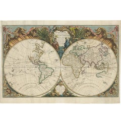
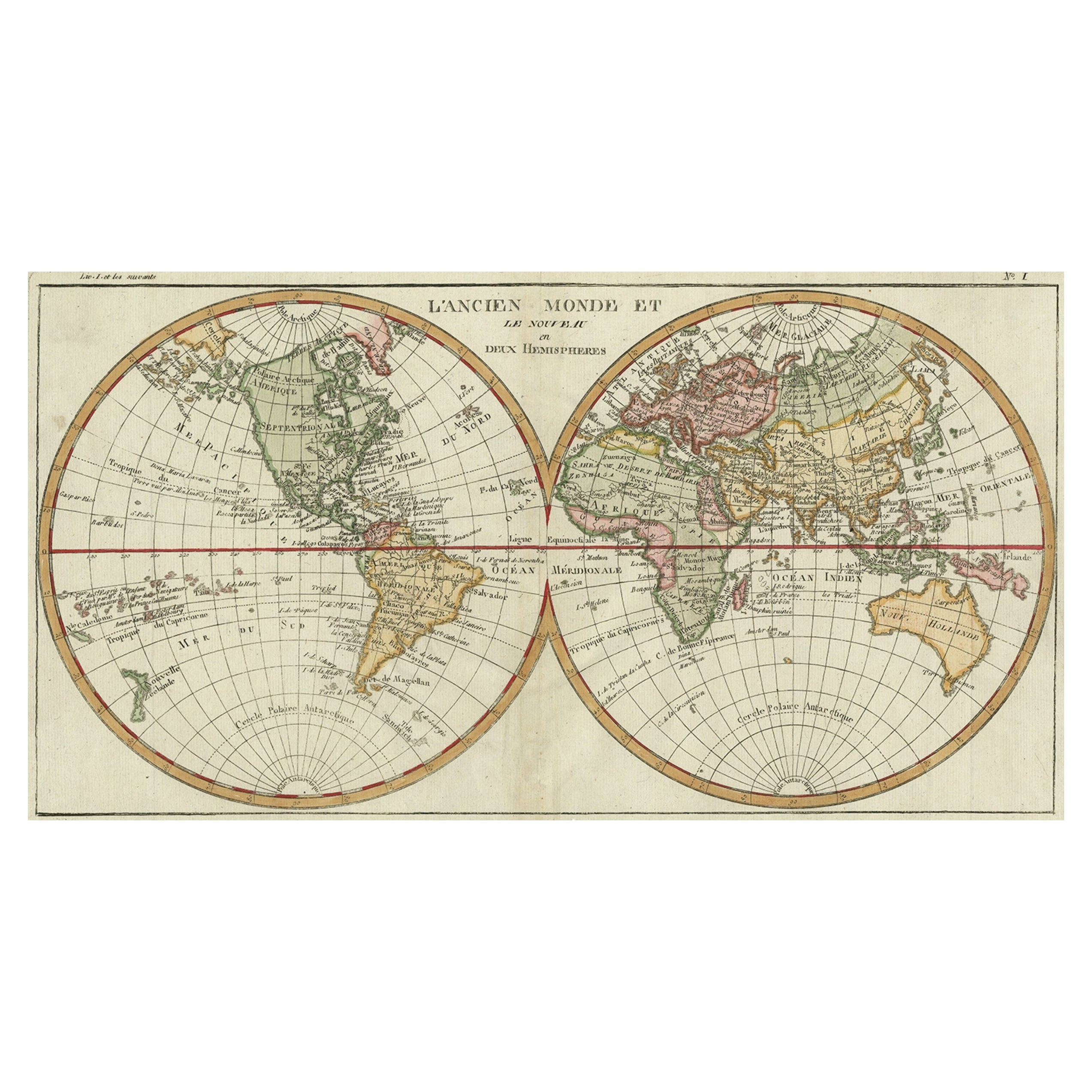
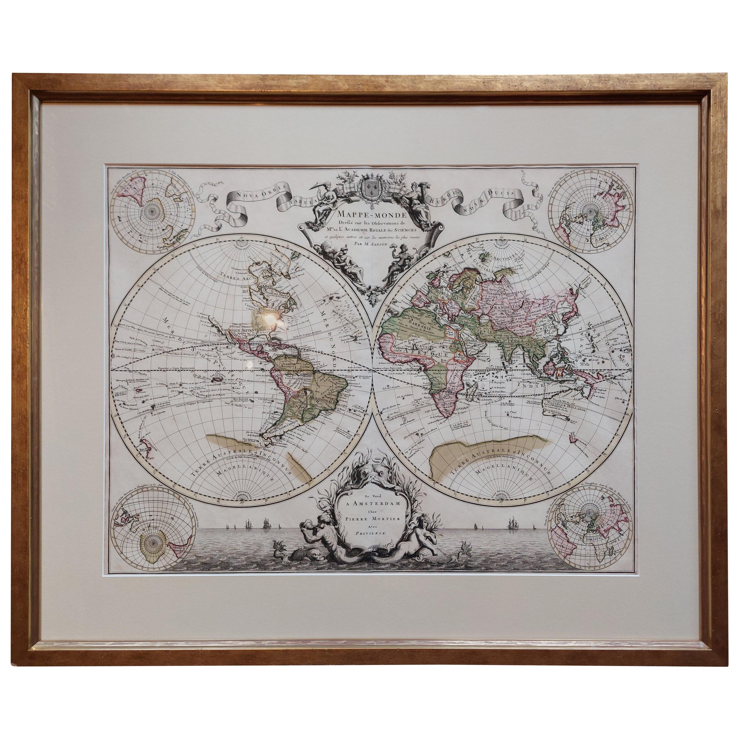
Stunning Original Antique World Map in Decorative Hand-Colouring, 1743
View Similar Items


Want more images or videos?
Request additional images or videos from the seller
1 of 6
Stunning Original Antique World Map in Decorative Hand-Colouring, 1743
About the Item
- Dimensions:Height: 21.38 in (54.3 cm)Width: 30.52 in (77.5 cm)Depth: 0.02 in (0.5 mm)
- Materials and Techniques:
- Period:
- Date of Manufacture:1743
- Condition:Repaired: Small repairs. Partly contemporary colouring. Some small wormholes and repairs. Please study image carefully.
- Seller Location:Langweer, NL
- Reference Number:Seller: BG-099691stDibs: LU3054310423683
About the Seller
5.0
Platinum Seller
These expertly vetted sellers are 1stDibs' most experienced sellers and are rated highest by our customers.
Established in 2009
1stDibs seller since 2017
1,946 sales on 1stDibs
More From This SellerView All
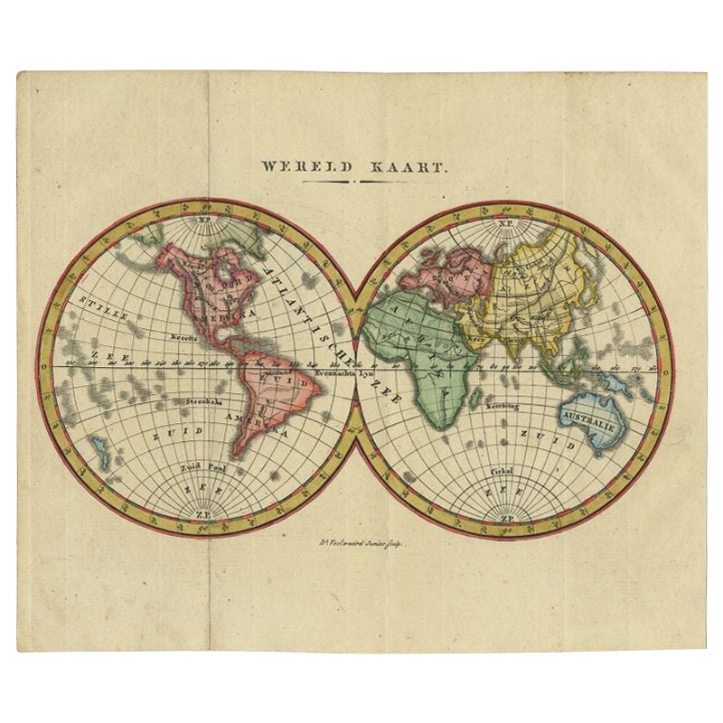
- Small Antique World Map in Decorative Old Hand-Colouring, circa 1840Located in Langweer, NLAntique map titled 'Wereld Kaart'. Small and very decorative double hemisphere world map. Source unknown, to be determined. Published c.1840. Artists and Engravers: Daniel Veelwaa...Category
Antique 19th Century Maps
MaterialsPaper
- Original Antique Map of Friesland in Decorative Hand-Colouring, 1600Located in Langweer, NLAntique map titled 'Frisiae antiquissima trans rhenu provinc et adiacentium regionum nova et exacta descriptio'. Original antique map of the province of Friesland, the Netherlands. T...Category
Antique 17th Century Maps
MaterialsPaper
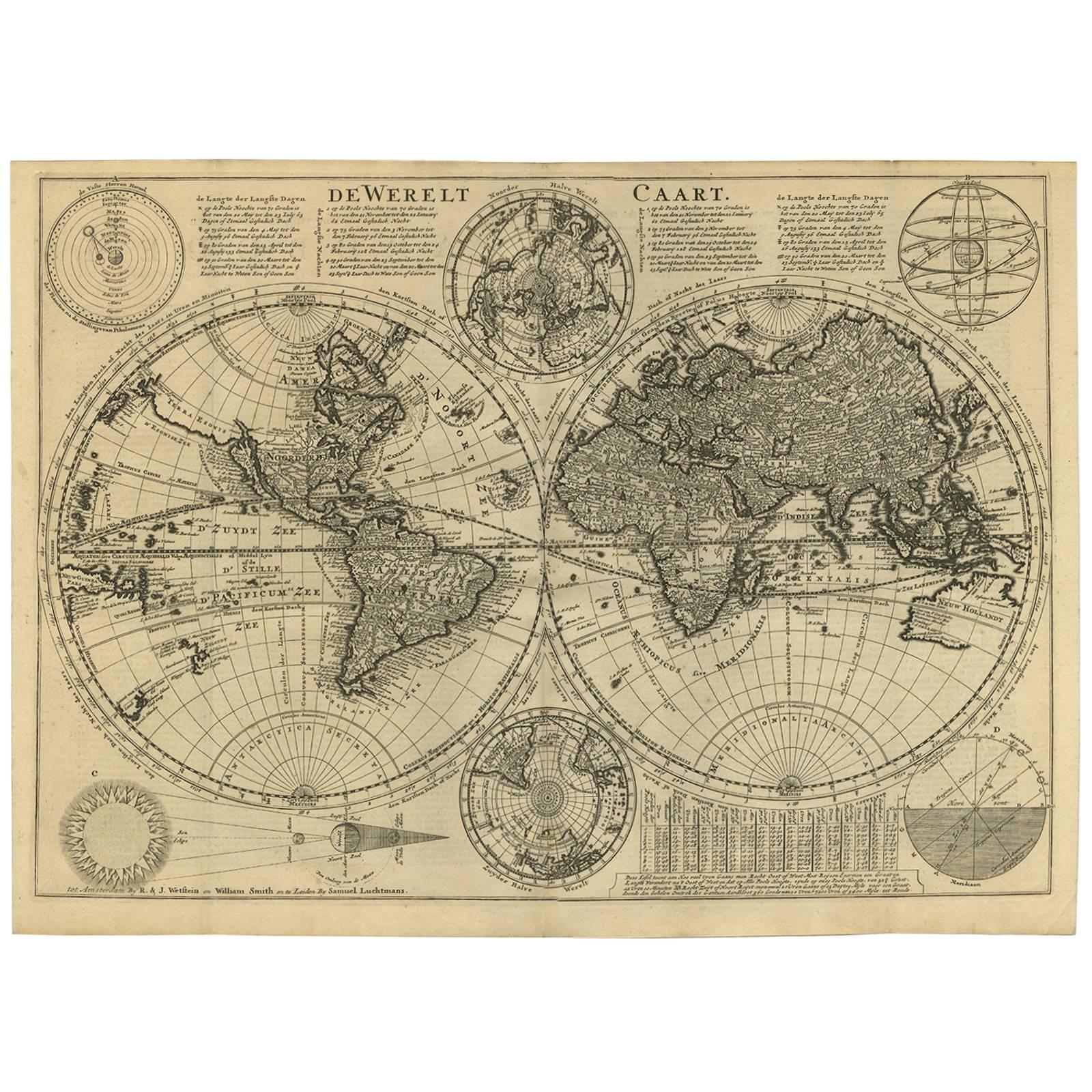
- Antique Bible World Map by R. & J. Wetstein, 1743Located in Langweer, NLAntique world map titled 'De Werelt Caart'. A scarce and richly detailed double hemisphere world map that was probably based on an earlier work by Cornelis Dankerts. This map has t...Category
Antique Mid-18th Century Maps
MaterialsPaper

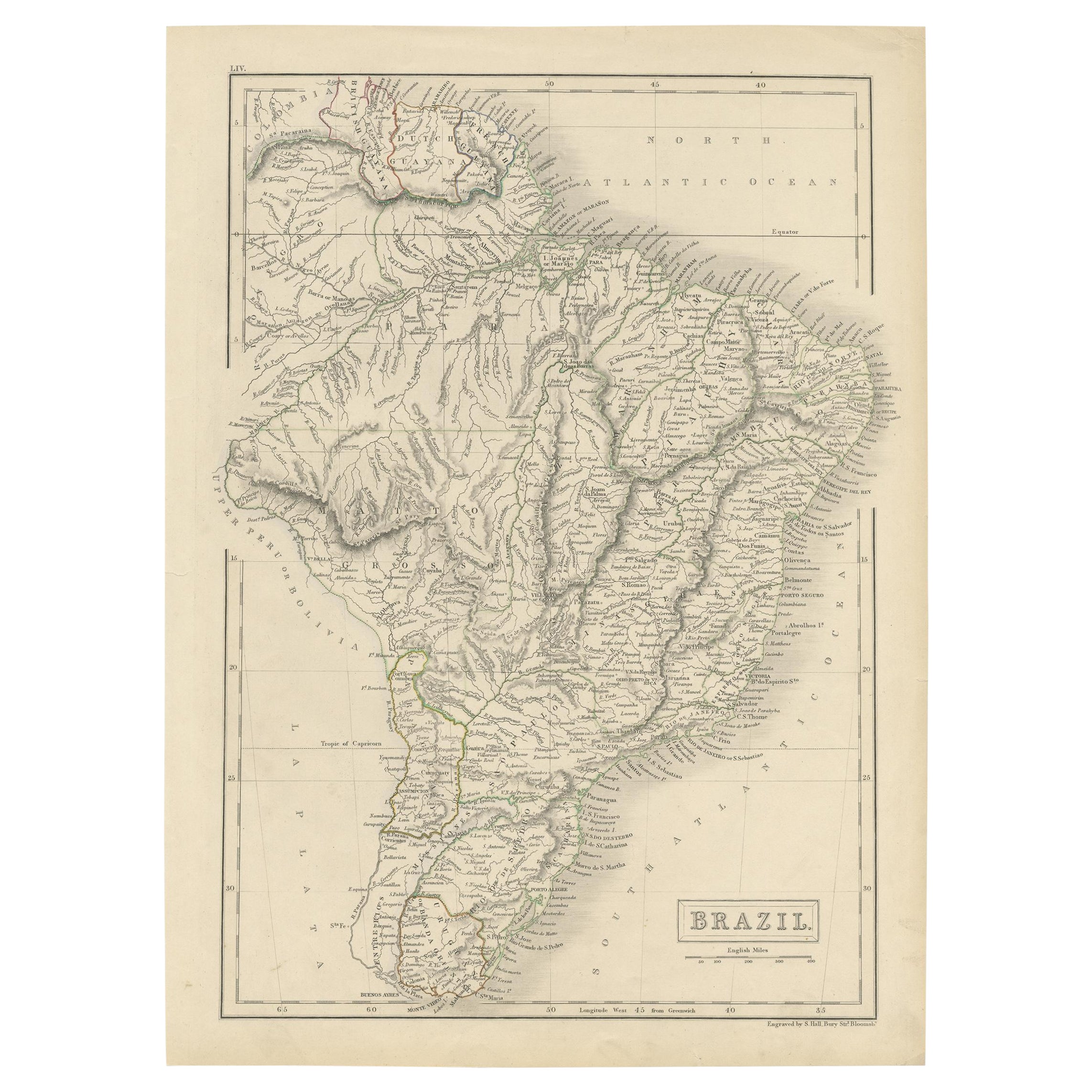
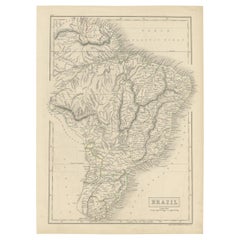
- Antique Map of Brazil with Original Outline Hand-Colouring, c.1844Located in Langweer, NLAntique map titled 'Brazil'. Beautiful map with outline color of Brazil, engraved by S. Hall. Artists and Engravers: Sydney Hall (1788-1831) was one of the most recognised and prolific British map...Category
Antique 19th Century Maps
MaterialsPaper
- Antique Map of Buckinghamshire in England, 1743Located in Langweer, NLAntique map titled 'Buckingham both shyre and shire towne describ'. Map of Buckinghamshire, England. With town plans of Buckingham and Redding. This map originates from Overton's atl...Category
Antique 18th Century Maps
MaterialsPaper

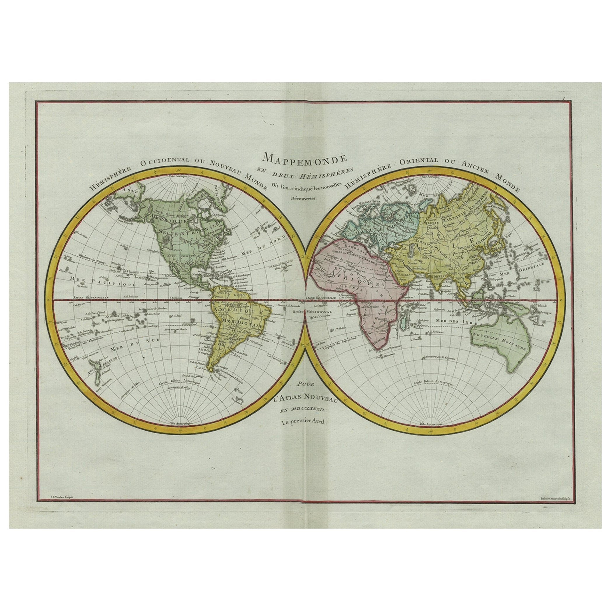
- Very Decorative Original Antique Map of the World, Published in France in c.1780By Rigobert BonneLocated in Langweer, NLAntique map titled 'L'Ancien Monde Et Le Nouveau en Deux Hemispheres' - Double hemisphere map of the World, showing the contemporary geographical...Category
Antique 18th Century Maps
MaterialsPaper
 $677 Sale Price20% Off

You May Also Like
- Large Original Antique Map of The World, Fullarton, C.1870Located in St Annes, LancashireGreat map of the World. Showing both hemispheres From the celebrated Royal Illustrated Atlas Lithograph. Original color. Published by Fullarton, Edinburgh, C.1870 Unframed. Rep...Category
Antique 1870s Scottish Maps
MaterialsPaper
- Original Antique Decorative Map of Japan, Fullarton, C.1870Located in St Annes, LancashireGreat map of Japan Wonderful figural border From the celebrated Royal Illustrated Atlas Lithograph. Original color. Published by Fullarton, Edinburgh, C.1870 Unframed...Category
Antique 1870s Scottish Maps
MaterialsPaper
- 1847 “World at One View” Antique Hand-Colored Wall Map of the WorldLocated in Colorado Springs, COThis is a highly desirable hanging wall map of the "World at One View", published in 1847 by Ensign and Thayer, New York. This pictorial map was printed as a broadside and features...Category
Antique 19th Century American Maps
MaterialsPaper
- Large Original Antique Map of the World, Fullarton, circa 1870Located in St Annes, LancashireGreat map of the World. From the celebrated Royal Illustrated Atlas Lithograph. Original color. Published by Fullarton, Edinburgh, circa 1870. Unframed.Category
Antique 1870s Scottish Maps
MaterialsPaper
- Original Antique Map of The World by Thomas Clerk, 1817Located in St Annes, LancashireGreat map of The Eastern and Western Hemispheres On 2 sheets Copper-plate engraving Drawn and engraved by Thomas Clerk, Edinburgh. Published by Mackenzie And Dent, 1817 ...Category
Antique 1810s English Maps
MaterialsPaper
- World Relief MapLocated in Antwerp, BELarge world relief map. Measures: Width 232 cm. Height 158 cm.Category
Mid-20th Century German Mid-Century Modern Maps
MaterialsAcrylic
 $1,978


Recently Viewed
View AllMore Ways To Browse
Antique And Stunning
Antique And Second Hand Furniture
Second Hand Used Office Furniture
Original World Map
Antique World Map
World Map Antique
World Antique Map
Antique Map World
Antique Maps World
Antique World Map World Maps
Antique World Maps
Antique World Maps World Maps
French Antique Decorative Collectibles
Antique Map Of World
Map Of World Antique
Antique Map Of The World
Antique Maps Of The World
Map Of The World Antique