1750s More Furniture and Collectibles

to
64
76
7
84
3
1
1
1
1
5,196
10,383
31,380
15,147
6,660
13,549
6,613
930
587
1,131
1,384
1,029
2,837
2,868
2,596
1,212
785
76
5
5
4
2
12
4
3
2
2
84
84
84
Period: 1750s
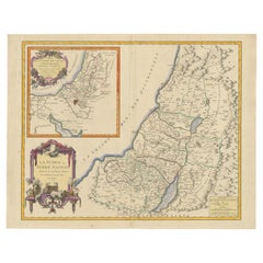
1750 Map of the Holy Land: The Land of Canaan and the Twelve Tribes
Located in Langweer, NL
Carte de la Terre de Canaan ou Terre Promise Cartographer: Le St. Robert Date of Publication: 1750 This exquisite 18th-century map, 'Carte de la Terre de Canaan ou Terre Promise', w...
Category

Antique 1750s More Furniture and Collectibles

Materials

Paper

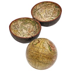
Pocket Globe by Nathaniel Hill, London 1754
Located in Milano, IT
Nathaniel Hill Pocket globe London, 1754 The globe is contained in its original case, which itself is covered in shark skin. There are slight gaps in the original paint on the sphere. The case no longer closes. The sphere measures 2.6 in (6.8 cm) in diameter whereas the case measures 2.9 in (7.4 cm) in diameter. lb 0.24 (kg 0.11) The globe is made up of twelve printed paper gores aligned and glued to the sphere. In the North Pacific Ocean there is a scroll with the inscription: A New terrestrial Globe by Nath. Hill, 1754. The celestial globe is depicted on the inside of the box. On the terrestrial globe much of central and southern Africa is empty. North America bears only the name of some British colonies. It shows California as a peninsula and the northwest coast of America as "unknown parts" (Alaska is not described and is only partially delineated; it would become part of the United States in 1867). The route of Admiral Anson is traced (1740) and the trade winds are indicated by arrows. Australia, still named New Holland (the new name would be introduced in 1829), is part of the west coast. (See Van der Krogt, P., Old Globes in the Netherlands, Utrecht 1984, p. 146 and Van der Krogt, P. - Dekker, E., Globes from the Western World, London 1993, p. 115.) Nathaniel Hill (London, news from 1746 to 1768) had impeccable professional credentials: he had done his apprenticeship with Richard Cushee, who at the time was carrying out surveying work for John Senex's Surrey map...
Category

English George II Antique 1750s More Furniture and Collectibles

Materials

Shagreen, Paper

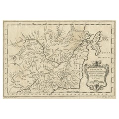
Original Antique Map of Tartary 'Northern China & Far Eastern Russia', 1757
Located in Langweer, NL
Antique map titled 'Carte de la Tartarie Orientale (..)'. Original antique map of what is present day northern China and far eastern Russia. Centere...
Category

Antique 1750s More Furniture and Collectibles

Materials

Paper

1750 Map of the Holy Land: The Land of Canaan and the Twelve Tribes
Located in Langweer, NL
Carte de la Terre de Canaan ou Terre Promise Cartographer: Le St. Robert Date of Publication: 1750 This exquisite 18th-century map, 'Carte de la Terre de Canaan ou Terre Promise', w...
Category

Antique 1750s More Furniture and Collectibles

Materials

Paper

Voltaire's Candide True First Edition & First London Edition
Located in Savannah, GA
A rare example of a first edition Candide, published in Geneva by Cramer, 1759. 299pp. Woodcut ornaments and Voltaire's corrected pages (pp. 31...
Category

Swiss Antique 1750s More Furniture and Collectibles

Materials

Leather, Paper

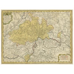
Original Hand-Colored Antique Regional Map of Switzerland, 1753
Located in Langweer, NL
Antique map Switzerland titled 'Territorium Reipublicae liberae Helveticae Scaphusiensis (..)'. Regional map of Switzerland. Artists and En...
Category

Antique 1750s More Furniture and Collectibles

Materials

Paper

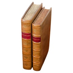
Ireland House of Commons 1753 Vol. III and Statutes at Large 1703-1719 Vol. IV
Located in Morristown, NJ
Two leather bound volumes published in Dublin, Ireland in the mid 1700's. The Journals of the House of Commons of the Kingdom of Ireland from the Eleventh Year of King James the Fir...
Category

Irish Georgian Antique 1750s More Furniture and Collectibles

Materials

Gold Leaf

Pocket Globe by Nathaniel Hill, London 1754
Located in Milano, IT
Nathaniel Hill Pocket globe London, 1754 The globe is contained in its original case, which itself is covered in shark skin. There are slight gaps in the original paint on the sphere. The case no longer closes. The sphere measures 2.6 in (6.8 cm) in diameter whereas the case measures 2.9 in (7.4 cm) in diameter. lb 0.24 (kg 0.11) The globe is made up of twelve printed paper gores aligned and glued to the sphere. In the North Pacific Ocean there is a scroll with the inscription: A New terrestrial Globe by Nath. Hill, 1754. The celestial globe is depicted on the inside of the box. On the terrestrial globe much of central and southern Africa is empty. North America bears only the name of some British colonies. It shows California as a peninsula and the northwest coast of America as "unknown parts" (Alaska is not described and is only partially delineated; it would become part of the United States in 1867). The route of Admiral Anson is traced (1740) and the trade winds are indicated by arrows. Australia, still named New Holland (the new name would be introduced in 1829), is part of the west coast. (See Van der Krogt, P., Old Globes in the Netherlands, Utrecht 1984, p. 146 and Van der Krogt, P. - Dekker, E., Globes from the Western World, London 1993, p. 115.) Nathaniel Hill (London, news from 1746 to 1768) had impeccable professional credentials: he had done his apprenticeship with Richard Cushee, who at the time was carrying out surveying work for John Senex's Surrey map...
Category

English George II Antique 1750s More Furniture and Collectibles

Materials

Shagreen, Paper

Rare 1757 Jesuit Map of California and Baja, Dedicated to the King of Spain
Located in Langweer, NL
Title: Rare 1757 Jesuit Map of California and Baja, Dedicated to the King of Spain This rare and detailed map, titled *Carte de la Californie Levee par la Société des Jésuites*, wa...
Category

Antique 1750s More Furniture and Collectibles

Materials

Paper

Barbados Island at the Height of the Plantation Economy, Circa 1759
Located in Langweer, NL
Carte de l'Isle de la Barbade by Jacques-Nicolas Bellin (1703–1772), Circa 1759 This rare antique map of Barbados, titled Carte de l'Isle de la Barbad...
Category

Antique 1750s More Furniture and Collectibles

Materials

Paper

18th Century Italian Antique Oil on Canvas Painting Saint Francesco Saverio
Located in Casale Monferrato, IT
Beautiful antique Italian oil painting on canvas. Excellent pictorial quality great attention to detail. Italian school of the 18th century. Not signed. A beautiful religious painting Saint Francesco...
Category

Italian Antique 1750s More Furniture and Collectibles

Materials

Canvas

Detailed Antique Map of Hungary and Transylvania by Tirion, 1753
Located in Langweer, NL
Title: Nieuwe Kaart van’t Koninkryk Hongaryen en Zevenbergen by Isaak Tirion, 1753 – Antique Map of Hungary and Transylvania Description: This is an antique 1753 map titled *Nieuwe Kaart van’t Koninkryk Hongaryen en Zevenbergen*, created by the notable Dutch cartographer and publisher Isaak Tirion. The map showcases the Kingdom of Hungary and the region of Transylvania (referred to as "Zevenbergen") as they appeared in the mid-18th century. Tirion’s maps are well-known for their clarity, precision, and attention to geographic detail, making them highly sought after by collectors of antique maps. This map provides a detailed view of Hungary and Transylvania, including borders, towns, cities, rivers, and mountain ranges. It was created using the latest discoveries and updates of the time and reflects the political landscape of the region, which was part of the Habsburg Empire during a period of territorial changes and consolidations. The map’s borders are highlighted with color to distinguish different regions, and significant cities such as Buda, Pest, and Debrecen are clearly labeled. Isaak Tirion was one of the most prominent Dutch publishers of the 18th century, particularly known for his *Nieuwe en Beknopte Hand-Atlas* (New and Concise Hand Atlas) series, which included a wide range of maps of Europe and beyond. His works were appreciated for their cartographic accuracy and artistic quality. This map is a valuable piece for collectors interested in 18th-century European maps, particularly those that highlight Central Europe, Hungary, Transylvania, and the Habsburg Empire. It is a fine example of the craftsmanship of Isaak Tirion and offers insight into the historical geography of the region. Condition: Excellent for its age, with finely preserved hand-coloring and wide margins. Slight edge wear typical of maps from this period. Effective keywords that may help attract collectors or enthusiasts interested in historical maps of Hungary, Transylvania, and Central Europe: - Antique map of Hungary - Historical map of Transylvania - 18th-century map of Central Europe - Habsburg Empire map - Isaak Tirion map - Nieuwe Kaart van’t Koninkryk Hongaryen en Zevenbergen - Kingdom of Hungary map...
Category

Antique 1750s More Furniture and Collectibles

Materials

Paper

Old Engraving Depicting the Buddhist Festival of Souls 'Obon' in Japan, 1758
Located in Langweer, NL
Antique print religion titled 'La Fête des Ames - 't Feest der Zielen'. Old print depicting the Buddhist festival of souls (Obon). This print originates from 'Histoire générale des Voyages' by A. Prévost. Obon (??) or just Bon (?) is a Japanese Buddhist custom to honor the spirits of one's ancestors. This Buddhist–Confucian custom has evolved into a family reunion holiday during which people return to ancestral family places and visit and clean their ancestors' graves when the spirits of ancestors are supposed to revisit the household altars. It has been celebrated in Japan for more than 500 years and traditionally includes a dance, known as Bon Odori. The festival of Obon lasts for three days; however, its starting date varies within different regions of Japan. When the lunar calendar was changed to the Gregorian calendar at the beginning of the Meiji era, the localities in Japan responded differently, which resulted in three different times of Obon. Shichigatsu Bon (Bon in July) is based on the solar calendar and is celebrated around the 15th of July in eastern Japan (Kanto region such as Tokyo, Yokohama and the Tohoku region), coinciding with Chugen. Hachigatsu Bon (Bon in August), based on the lunar calendar, is celebrated around the 15th of August and is the most commonly celebrated time. Kyu Bon (Old Bon) is celebrated on the 15th day of the ninth month of the lunar calendar, and so differs each year, which appears between August 8 and September 7. One exception was in 2008 and 2019, when the solar and lunar calendar matched so Hachigatsu Bon and Kyu Bon were celebrated on the same day. Kyu Bon is celebrated in areas such as the northern part of the Kanto region, Chugoku region, Shikoku, and Okinawa Prefecture. These three festival days are not listed as public holidays, but it is customary for people to be given leave. (Source: Wikipedia) Artists and Engravers: Jan van Schley, Dutch engraver. Condition: Very good, please study image carefully. Date: 1758 Overall size: 20.5 x 27 cm. Image size: 13 x 20 cm. We also offer thousands of antique prints covering fields of interest as diverse as architecture, natural history, religion, ethnology and many more. Antique prints have long been appreciated for both their aesthetic and investment value. They were the product of engraved, etched or lithographed plates. These plates were handmade out of wood or metal, which required an incredible level of skill, patience and craftsmanship. Whether you have a house with Victorian furniture or more contemporary decor an old engraving...
Category

Antique 1750s More Furniture and Collectibles

Materials

Paper

A General View of Jerusalem in the Early Part of the 18th Century" (circa 1752)
Located in Langweer, NL
The print is signed by the artist "S. Mynde sc." in the lower right corner. This suggests that the maker of the print is Samuel Mynde, a known engraver from the 18th century. His wor...
Category

Antique 1750s More Furniture and Collectibles

Materials

Paper

Large Antique Map of the Region of Berry, Nivernois & Bourbonnais, France, 1753
Located in Langweer, NL
Antique map titled 'Gouvernements généraux du Berry, du Nivernois et du Bourbonois'. Large, original antique map of the region of Berry, Nivernois and Bourbonnais, France. Featur...
Category

Antique 1750s More Furniture and Collectibles

Materials

Paper

Copper Engraving with a Panoramic View of Mexico City, 1754
Located in Langweer, NL
Antique print titled 'Nouveau Mexico'. Copper engraving with a panoramic view of Mexico city. This print originates from 'Histoire générale des voyages, ou nouvelle collection de...
Category

Antique 1750s More Furniture and Collectibles

Materials

Paper

18th Century Continental Coffer Trunk Small
Located in Nashville, TN
This is a handsome 18th century Continental trunk. This one is smaller in size. Some repairs are evident. The right side handle is not original. Warm...
Category

European Jacobean Antique 1750s More Furniture and Collectibles

Materials

Oak

Ayres, Philip, Emblems of Love, 1750, in a Fine Full Leather Binding
Located in Hillsborough, NJ
Author: AYRES, Philip. Title: Emblems of Love. In Four Languages. Dedicated to the Ladys. Publisher: London: for John Wren Bookseller & Binder at ye Bible & Crown near Great T...
Category

British Antique 1750s More Furniture and Collectibles

Materials

Leather

Map of the Amazon River's Course and Surrounding Regions (1743-1744)
Located in Langweer, NL
This original antique map, titled "Carte du Cours du Maragnon ou de la Grande Riviere des Amazones," illustrates the course of the Amazon River (referred to here as the Maragnon) fro...
Category

Antique 1750s More Furniture and Collectibles

Materials

Paper

John Kidgell, the Card, 1755, First Ed, the Earliest Known Mention of Baseball
Located in Hillsborough, NJ
AUTHOR: KIDGELL (John) TITLE: The Card. PUBLISHER: London: for the Maker & sold by J. Newberry, 1755. DESCRIPTION: FIRST AND ONLY EDITION. 2 vols., 6-5/8" x 4-1/4", hand col...
Category

British Antique 1750s More Furniture and Collectibles

Materials

Leather

Original Antique Map of Tartary 'Northern China & Far Eastern Russia', 1757
Located in Langweer, NL
Antique map titled 'Carte de la Tartarie Orientale (..)'. Original antique map of what is present day northern China and far eastern Russia. Centere...
Category

Antique 1750s More Furniture and Collectibles

Materials

Paper

Chinoiserie Toile Hangings Curtains French Blue & White Rococo
Located in BUNGAY, SUFFOLK
- Exceptionally rare pair of large, Rococo Chinoiserie blue & white cotton bed curtains. Measures: 4ftwide 7ft9"hig. - Chinoiserie was the height of fashion during the Rococo and these hangings would have been a luxury item, making a exotic statement in the bedroom. They have been used as wall hangings for the last 35 years. - From a private collection, purchased 35 years ago from a set of six removed from a Chateau in France. One was purchased by Nina Campbell...
Category

French Rococo Antique 1750s More Furniture and Collectibles

Materials

Cotton

Italian Neoclassical Walnut Cherub Prie Dieu w/ Sloped Shell on Kneeler, C. 1750
Located in Charleston, SC
Italian Neoclassical carved Walnut Prie Dieu with central robe cherub raising a foliage shell sloped shelf supported by a demi-lune plinth kneeler with a decorative scrolled foliage ...
Category

Italian Neoclassical Antique 1750s More Furniture and Collectibles

Materials

Walnut

French Framed Copper Engraved Hand Colored Map of Carolina & Georgia, Circa 1757
Located in Charleston, SC
French copper engraved hand colored map of Carolina & Georgia matted under glass with a painted frame, mid-18th century
Category

French Louis XV Antique 1750s More Furniture and Collectibles

Materials

Paper, Paint, Wood, Glass

Rare Low Walnut Italian Baroque Period Cellist Lectern
Located in Montreal, QC
Rare Low Walnut Italian Baroque Period Cellist lectern.
Category

Italian Baroque Antique 1750s More Furniture and Collectibles

Materials

Walnut

Map of the Margraviate and Electorate of Brandenburg by de Beaurain - ca.1750
Located in Langweer, NL
Historical Map of the Margraviate and Electorate of Brandenburg by Chevalier de Beaurain - Circa 1750 This impressive historical map, titled "Carte du Marquisat et Electorat de Br...
Category

Antique 1750s More Furniture and Collectibles

Materials

Paper

Original 18th-Century Map of Southern Austria, Carinthia, Carniola, and Styria
Located in Langweer, NL
title: 18th-Century Map of Southern Austria, Carinthia, Carniola, and Styria by Robert de Vaugondy Description: This finely engraved 18th-century map by Gilles Robert de Vaugondy ...
Category

Antique 1750s More Furniture and Collectibles

Materials

Paper

1756 Map of Brazil from Bahia to São Paulo by Bellin – French Colonial Engraving
Located in Langweer, NL
Antique Map of Brazil from Bahia to São Paulo – Bellin for L'Histoire des Voyages This elegant 18th-century French map titled "Suite du Bresil, Depuis la Baie de Tous les Saints jus...
Category

Antique 1750s More Furniture and Collectibles

Materials

Paper

18th-Century Map of Holstein and Surrounding Duchies by Homann Heirs
Located in Langweer, NL
18th-Century Map of Holstein and Surrounding Duchies by Homann Heirs Description: This finely detailed 18th-century map by the Homann Heirs (Homannische Erben) illustrates the Duc...
Category

Antique 1750s More Furniture and Collectibles

Materials

Paper

Map of Northern India and Pakistan 'Mogol', Showing Kabul, Delhi Etc., 1758
Located in Langweer, NL
Antique map titled 'Mogol'. Map of Northern India and Pakistan ('Mogol'), showing Kabul, Delhi and surroundings. This map originates from 'Kort begrip der Oude en Nieuwe Staatkun...
Category

Antique 1750s More Furniture and Collectibles

Materials

Paper

Lignum Vitae Treen Vices Pair of Minature Tree of Life
Located in BUNGAY, SUFFOLK
- Collector's specimens - Lignum vitae is sought after for the beauty of its grain, coloring, patina, density and toughness Translated from Latin, vignum vitae means “wood of lif...
Category

English George II Antique 1750s More Furniture and Collectibles

Materials

Wood

Map of Friesland (La Frise), from a French Atlas - circa 1756
Located in Langweer, NL
Title: Map of Friesland (La Frise), from "Atlas Nouveau Portatif" (1756) This is an 18th-century map of Friesland (Frise), a northern province of the Netherlands, engraved by *Georg...
Category

Antique 1750s More Furniture and Collectibles

Materials

Paper

Attractive Hand-Tinted Antique Map of Japan, Published in 1752
Located in Langweer, NL
Nice decorative hand tinted map of Japan with the title (in French): Carte de L'Empire du Japon Bellin, 1752 This antique map is engraved with very attractive title cartouche. ...
Category

Antique 1750s More Furniture and Collectibles

Materials

Paper

Optical Print or Vue d'optique of a Chinese Temple, ca.1750
Located in Langweer, NL
Antique print titled 'Vue d'un temple Chinois : Le grand Kia-cheu de la Chine, ou Temple des Aïeux, préparé pour le Sacrifice solemnel, que les Chinois célébrent pour leurs Ancêtres'. Vue d'optique of a Chinese temple prepared for annual sacrifice held in honour of deceased ancestors, whose portraits are displayed around the temple. This is an optical print...
Category

Antique 1750s More Furniture and Collectibles

Materials

Paper

Old Map of Region Champagne-Ardenne with Reims, Troyes & Épernay in France, 1759
Located in Langweer, NL
Antique map titled 'Tabula Geographica Campaniae (..).' Detailed map of the Champagne region in France by J. B. Homann, covering the region Champagne-Ardenne with Reims, Troyes a...
Category

Antique 1750s More Furniture and Collectibles

Materials

Paper

Old Map of the Lower Bishopric of Münster (1726-1750) by Sanson & Ottens, c.1750
Located in Langweer, NL
Historical Map of the Lower Bishopric of Münster (1726-1750) by Sanson & Ottens – Hand-Colored Copperplate Engraving The map titled "BASSE PARTIE DE L'EVESCHE DE MUNSTER" is a detai...
Category

Antique 1750s More Furniture and Collectibles

Materials

Paper

Original Antique Map of the Empire of Japan, Centered on the Bay of Osaka, c1752
Located in Langweer, NL
Antique map titled 'Carte de L'Empire de Japon (..).' Map of the Empire of Japan. Centered on the Bay of Osaka, this map covers from Hirado (here identified as I. Firando) and Na...
Category

Antique 1750s More Furniture and Collectibles

Materials

Paper

Antique Map of Spain & Portugal 'Iberian Peninsula', Decorative Cartouche, c1755
Located in Langweer, NL
Antique map titled 'Spain and Portugal'. Small, detailed antique map of Spain and Portugal (Iberian Peninsula). Decorative title cartouche. Artists and Engravers: Thomas Jeff...
Category

Antique 1750s More Furniture and Collectibles

Materials

Paper

Detailed Antique Map of the Southern Part of European Russia and Ukraine, 1752
Located in Langweer, NL
Antique map titled 'Partie meridionale de la Russie Européenne'. Detailed map of the southern part of European Russia by Robert de Vaugondy. It covers from Moscow south to Georgia and from Poland east to the Volga River, including Crimea and Ukraine. Artists and engravers: Gilles Robert de Vaugondy (1688-1766) was the head of a leading family of geographers in eighteenth century France. Gilles got his start when he jointly inherited the shop of Pierre-Moullart Sanson, grandson of the famous geographer Nicholas Sanson. The inheritance included the business, its stock of plates, and a roller press...
Category

Antique 1750s More Furniture and Collectibles

Materials

Paper

Detailed Map of Arabian Peninsula and Canaan, Highlighting Biblical Territories
Located in Langweer, NL
This antique map, titled "Terre de Chanaan ou Terre Promise a Abraham," is a finely detailed copper-engraved map created around 1750 by Delamarche in Paris, based on earlier works by...
Category

Antique 1750s More Furniture and Collectibles

Materials

Paper

Excellent Antique Map of America with Unusual Northwest Coast of America, c.1754
Located in Langweer, NL
Description: Antique map titled 'Nieuwe Kaart Van het Westelykste Deel Der Weereld, dienende tot aanwyzing an de Scheepstogten der Nederlanderne Naar West Indie.' Excellent map of America, featuring an unusual northwest coast of America, which includes Martin d'Aguilar's strait which provides for a Northwest Passage via the Great Lakes. The rest of the NW coast...
Category

Antique 1750s More Furniture and Collectibles

Materials

Paper

Original Engraved Map of Saint Lucia in the West Indies by Bellin, 1758
Located in Langweer, NL
The "Carte de L’Isle de Sainte Lucie" by Jacques Nicolas Bellin, a prominent figure as the Royal Hydrographer and engineer of the French Navy, is a remarkable antique map showcasing ...
Category

Antique 1750s More Furniture and Collectibles

Materials

Paper

Old Engraving of Batavia 'Jakarta, Indonesia' with Map and Harbour View, 1750
Located in Langweer, NL
Antique map titled 'Carte des environs de Batavia '. French map of the Batavia area (Jakarta) in Indonesia. With cartouche, scale and compass rose. Published circa 1750. The map i...
Category

Antique 1750s More Furniture and Collectibles

Materials

Paper

Antique Engraving of Tinian, an Island of the Northern Mariana Islands, 1757
Located in Langweer, NL
Antique print titled 'Vue de la Rde de Tinian Gezigt van de Rheede van Tinian (..)'. Views of the south-west side of the island of Tinian and a view of the anchorage of Tinian, w...
Category

Antique 1750s More Furniture and Collectibles

Materials

Paper

Old Print with a View of the Cape of Good Hope and Table Bay, South Africa, 1750
Located in Langweer, NL
Antique print titled 'Gezigt van de Kaap de Goede-Hoop'. Old print with a view of the Cape of Good Hope and Table Bay. Engraved by J. van Schley for a Du...
Category

Antique 1750s More Furniture and Collectibles

Materials

Paper

1750 Bellin Map of the Red River (Tonkin River) and Hanoi, Vietnam
Located in Langweer, NL
Title: 1750 Bellin Map of the Red River and Hanoi, Vietnam Description: This finely engraved eighteenth-century French map, titled Carte du Cours de la Riviere de Tunquin, was created by the renowned cartographer Jacques-Nicolas Bellin and published in 1750. It depicts the course of the Red River, historically referred to as the Tonkin River, from Hanoi, labeled as Cacho, Ville Capitale du Tunquin, to the Gulf of Tonkin, labeled as Baye de Tunquin. Bellin’s work was based on navigational surveys by an English explorer, as stated in the title, reflecting the growing European interest in Southeast Asia during the early colonial period. The Red River Delta was a crucial region for trade and agriculture, forming the backbone of Vietnam’s economic and cultural history. The river originates in China and flows through northern Vietnam, passing through Hanoi before emptying into the Gulf of Tonkin. This map captures the strategic importance of the river, as it served as a major trade route for goods and a point of interest for European navigators, merchants, and missionaries seeking access to Indochina. The map includes numerous geographical details. Hanoi is prominently labeled as the capital of Tonkin, a historical term used by Europeans to describe northern Vietnam. The surrounding settlements, islands, and tributaries are carefully marked, illustrating the intricate network of waterways that characterized the region. Notable features include Île de la Potterie, referring to a location known for ceramic production, and various sandbanks and fortified locations along the river. A decorative compass rose is placed in the upper left corner, reinforcing the map’s navigational purpose. The scale of measurement is provided in French leagues, labeled as Grandes Lieues...
Category

Antique 1750s More Furniture and Collectibles

Materials

Paper

18th-Century Map of the Swiss Confederation by Robert de Vaugondy
Located in Langweer, NL
Title: 18th-Century Map of the Swiss Confederation by Robert de Vaugondy Description: This detailed 18th-century map by Gilles Robert de Vaugondy presents the Swiss Confederation,...
Category

Antique 1750s More Furniture and Collectibles

Materials

Paper

Detailed Regional Map of the Gulf of Bengal and the Lower Ganges River, ca.1750
Located in Langweer, NL
Title of this original and rare antique map: Nouvelle Carte Du Royaume De Bengale Mapmaker: Jacques-Nicolas Bellin (1703-1772). He was among the most important mapmakers of the eighteenth century. In 1721, at only the age of 18, he was appointed Hydrographer to the French Navy. In August 1741, he became the first Ingénieur de la Marine of the Dépôt des cartes...
Category

Antique 1750s More Furniture and Collectibles

Materials

Paper

Detailed Antique Map of Portugal, Published for the 'Gentleman's Magazine', 1758
Located in Langweer, NL
Antique map Portugal titled 'A Map of the Kingdom of Portugal'. Detailed map of Portugal, published for the 'Gentleman's Magazine'. Artist...
Category

Antique 1750s More Furniture and Collectibles

Materials

Paper

Old Original Antique Map of the Sunda Islands of Indonesia, 1756
Located in Langweer, NL
Title: Isles De La Sonde. Attractive old decorative map of the Isles de la Sonde, Borneo, Sumatra, Java and Malacca ( Malaysia) with the Straits of Malacca. Penang is spelled as P...
Category

Antique 1750s More Furniture and Collectibles

Materials

Paper

Antique Map of Northern China and Far Eastern Russia Around the Amur River, 1754
Located in Langweer, NL
Antique map titled 'Carte De La Tartarie Orientale (..)'. A map for this far eastern portion of what is present day northern China and far eastern Russia...
Category

Antique 1750s More Furniture and Collectibles

Materials

Paper

Original Antique Map of the Region of Torneå 'Tornio' in Northern Finland, 1759
Located in Langweer, NL
Antique map titled 'Carte des Environs de Tornea'. Original antique map of the region of Torneå (or Tornio), in northern Finland. This print originates from volume 19 of 'Histoir...
Category

Antique 1750s More Furniture and Collectibles

Materials

Paper

Detailed Map of Dutch Rivers, with the Rhine, Maas, de Merwe en de Lek, C.1750
Located in Langweer, NL
Antique map titled 'Kaart van den Loop der Rivieren de Rhyn, de Maas, de Waal, de Merwe en de Lek, door de Provincien van Gelderland, Holland en Utrecht'. ...
Category

Antique 1750s More Furniture and Collectibles

Materials

Paper

Detailed Original Antique Map of the Russian Empire in Asia, 1750
Located in Langweer, NL
Antique map titled 'Partie Orientale de l'Empire de Russie en Asie (..)'. Detailed map of the Russian Empire in Asia. Artists and Engravers: Gilles Robert de Vaugondy (1688-1766) was the head of a leading family of geographers in eighteenth century France. Gilles got his start when he jointly inherited the shop of Pierre-Moullart Sanson, grandson of the famous geographer Nicholas Sanson. The inheritance included the business, its stock of plates, and a roller press...
Category

Antique 1750s More Furniture and Collectibles

Materials

Paper

Old Original Antique Map of the Islands of East Indonesia, 1756
Located in Langweer, NL
Title: Isles Moluques. Old and rare, this decorative map of the Maluku Islands in the period it was still controlled by the Dutch colonial power. It also shows the island of Bali, Lombok, part of Borneo (Kalimantan), Celebes (Sulawesi), Timor, The Lesser Sunda Islands, West Papua...
Category

Antique 1750s More Furniture and Collectibles

Materials

Paper

Old Copper Engraving of the Port City Dabhol in India, 1757
Located in Langweer, NL
Antique print titled 'Dabul'. Old print of the port city Dabhol in India. In the 15th and 16th centuries, Dabul was an opulent Muslim trade center. Around 1660 it was annexed to th...
Category

Antique 1750s More Furniture and Collectibles

Materials

Paper

Fine Engraving Depicting an Officer's Mess in the Low Countries, 'Holland', 1754
Located in Langweer, NL
Title on Page (Dutch and French): CORPS DE GARDE van Hollandsche Officiers / Corps de Garde des Officiers Hollandois". Amst., 1754. Fine engraving depicting an officer's mess by J. Punt and P. Tanjé after a painting by C. Troost, with coat of arms engraved in lower margin and dedication to G. Braamcamp ("beminnaar der schilderkonst"). Waiting room with reading, smoking and card playing officers. Right, one of them studies a map of the Netherlands. On the wall a coat of arms with the Dutch lion. At the bottom of the margin the coat of arms and an assignment to Gerrit Braamcamp, who had the original painting in his collection. Cornelis Troost...
Category

Antique 1750s More Furniture and Collectibles

Materials

Paper

Antique View of The N.W. side of Saypan and one of The Ladrones Islands, 1757
Located in Langweer, NL
Antique print titled 'Vue de deux des Iles des Larrons - Gezigt van twee der Eilanden Ladrones (..)'. View of two Ladrones Islands; View of the N.W. side of Saypan, one of the La...
Category

Antique 1750s More Furniture and Collectibles

Materials

Paper

Old Map of the Gulf of Bothnia, the Northernmost Arm of the Baltic Sea, 1759
Located in Langweer, NL
Antique map titled 'Carte du Golphe de Bothnie'. Original antique map of the Gulf of Bothnia, the northernmost arm of the Baltic Sea. It is situated between Finland's west coast ...
Category

Antique 1750s More Furniture and Collectibles

Materials

Paper

The Angel & Jesus with the Sick in Bethesda Near Jerusalem's Sheep Gate, 1754
Located in Langweer, NL
Antique religious print titled 'L'Ange du Seigneur descend dans la piscine des brebis pour la guerison des malades'. The Angel descending into the pool of Bethesda...
Category

Antique 1750s More Furniture and Collectibles

Materials

Paper

Old Print of the Spanish Conquest of Cusco or Cuzco, Capital of the Incas, c1750
Located in Langweer, NL
Antique print titled 'Grundriss von Cuzco bey der Eroberung von den Spaniern'. Old plan of the city of Cusco, Peru, often spelled Cuzco. It shows Cusco during the conquest by the...
Category

Antique 1750s More Furniture and Collectibles

Materials

Paper

Read More

Medal-Worthy Memorabilia from Epic Past Olympic Games

Get into the games! These items celebrate the events, athletes, host countries and sporting spirit.

Ahoy! You’ve Never Seen a Collection of Sailor Art and Kitsch Quite Like This

French trendsetter and serial collector Daniel Rozensztroch tells us about his obsession with objects related to seafaring men.

39 Incredible Swimming Pools

It's hard to resist the allure of a beautiful pool. So, go ahead and daydream about whiling away your summer in paradise.

Pamela Shamshiri Shares the Secrets behind Her First-Ever Book and Its Effortlessly Cool Interiors

The sought-after designer worked with the team at Hoffman Creative to produce a monograph that beautifully showcases some of Studio Shamshiri's most inspiring projects.

Moroccan Artworks and Objects Take Center Stage in an Extraordinary Villa in Tangier

Italian writer and collector Umberto Pasti opens the doors to his remarkable cave of wonders in North Africa.

Montecito Has Drawn Royalty and Celebrities, and These Homes Are Proof of Its Allure

Hollywood A-listers, ex-pat aristocrats and art collectors and style setters of all stripes appreciate the allure of the coastal California hamlet — much on our minds after recent winter floods.

Whaam! Blam! Pow! — a New Book on Pop Art Packs a Punch

Publishing house Assouline and writer Julie Belcove have teamed up to trace the history of the genre, from Roy Lichtenstein, Andy Warhol and Yayoi Kusama to Mickalene Thomas and Jeff Koons.

The Sparkling Legacy of Tiffany & Co. Explained, One Jewel at a Time

A gorgeous new book celebrates — and memorializes — the iconic jeweler’s rich heritage.
Recently Viewed

View All