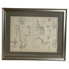
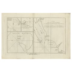
Mariners Chart of Westport Mass and Narraganset Pier by George Eldridge 1901
View Similar Items


Want more images or videos?
Request additional images or videos from the seller
1 of 16
Mariners Chart of Westport Mass and Narraganset Pier by George Eldridge 1901
$299List Price
About the Item
- Dimensions:Height: 23 in (58.42 cm)Width: 28 in (71.12 cm)Depth: 1 in (2.54 cm)
- Materials and Techniques:
- Place of Origin:
- Period:1900-1909
- Date of Manufacture:1901
- Condition:
- Seller Location:Norwell, MA
- Reference Number:Seller: 85761stDibs: LU1741238280122
About the Seller
5.0
Vetted Professional Seller
Every seller passes strict standards for authenticity and reliability
Established in 1967
1stDibs seller since 2015
415 sales on 1stDibs
Typical response time: 1 hour
Authenticity Guarantee
In the unlikely event there’s an issue with an item’s authenticity, contact us within 1 year for a full refund. DetailsMoney-Back Guarantee
If your item is not as described, is damaged in transit, or does not arrive, contact us within 7 days for a full refund. Details24-Hour Cancellation
You have a 24-hour grace period in which to reconsider your purchase, with no questions asked.Vetted Professional Sellers
Our world-class sellers must adhere to strict standards for service and quality, maintaining the integrity of our listings.Price-Match Guarantee
If you find that a seller listed the same item for a lower price elsewhere, we’ll match it.Trusted Global Delivery
Our best-in-class carrier network provides specialized shipping options worldwide, including custom delivery.More From This Seller
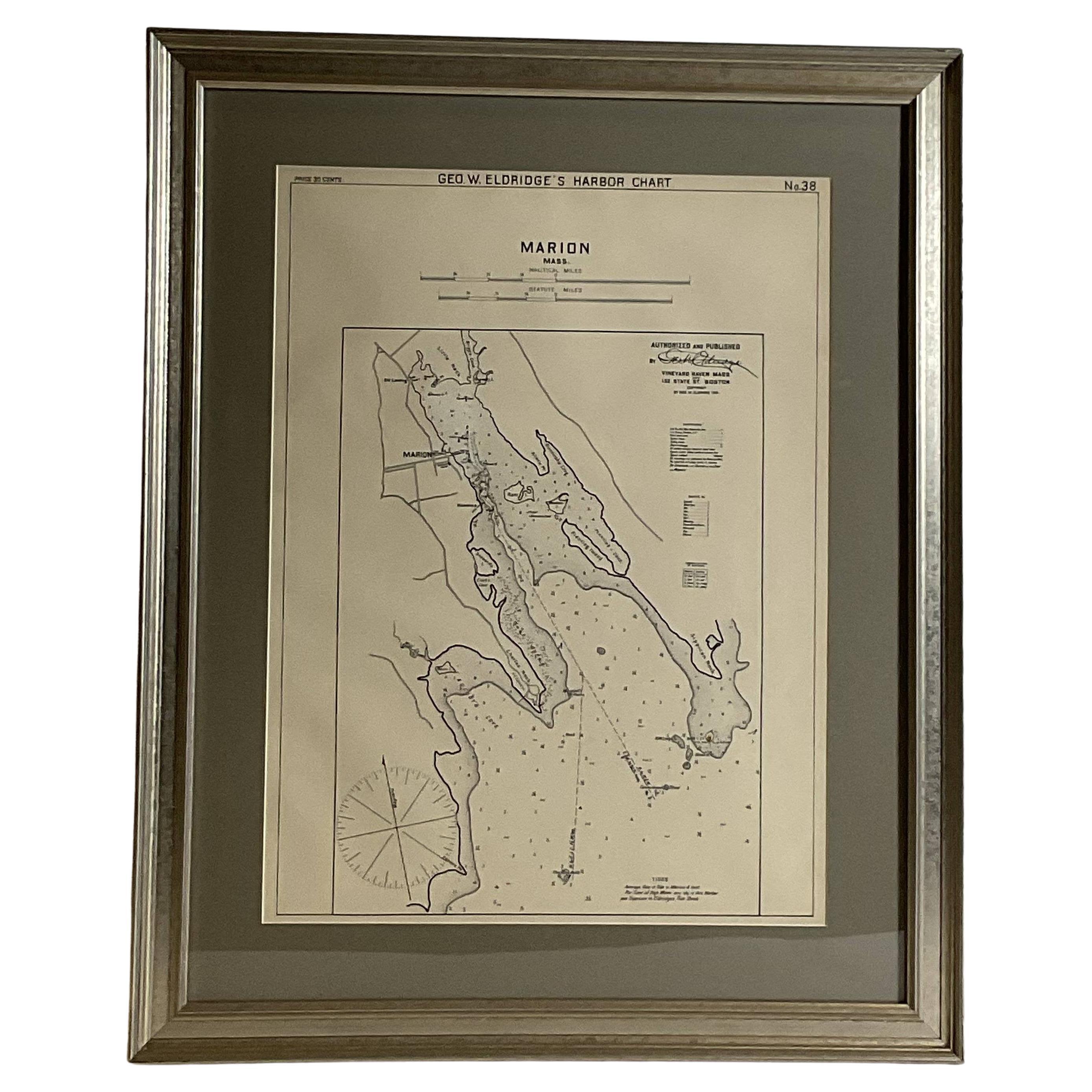
View AllMariners Chart of Marion Massachussets by George Eldridge 1901
Located in Norwell, MA
Nautical chart showing the harbor and local waters of Marion Harbor., The chart displays depth, buoys, lighthouses, etc., Shown are Planting Island, Ram Island, Sippican Neck, Little...
Category
Antique Early 1900s North American Prints
Materials
Paper

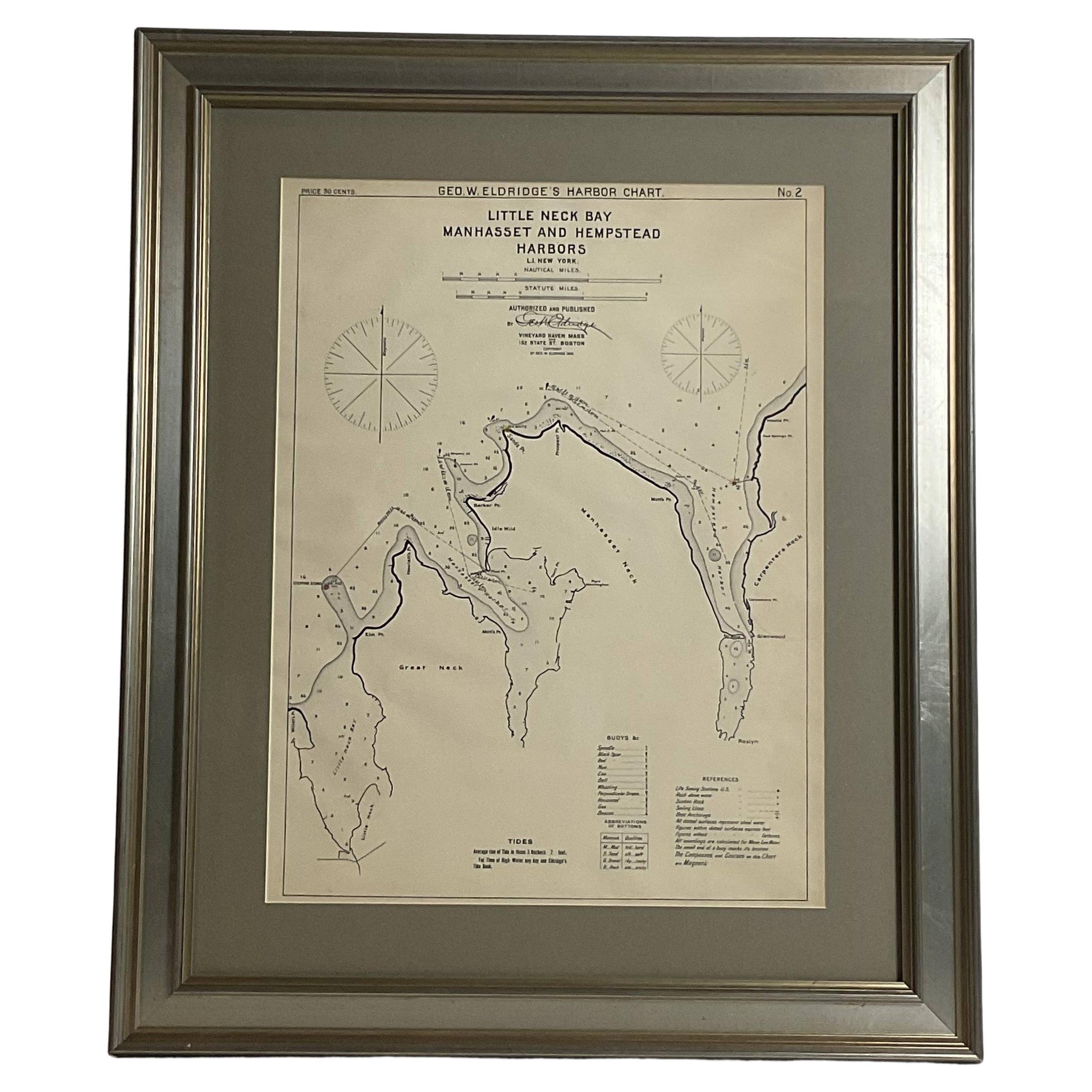
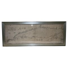
Mariners charts of Massachusett Long Island by George Eldridge 1901
Located in Norwell, MA
Nautical Chart showing the harbor and local waters of the Little Neck Bay, Manhasset and Hempstead Harbors. The chart displays depths, buoys, lighthouses, etc., Shown is Manhasset Ne...
Category
Antique Early 1900s North American Prints
Materials
Paper

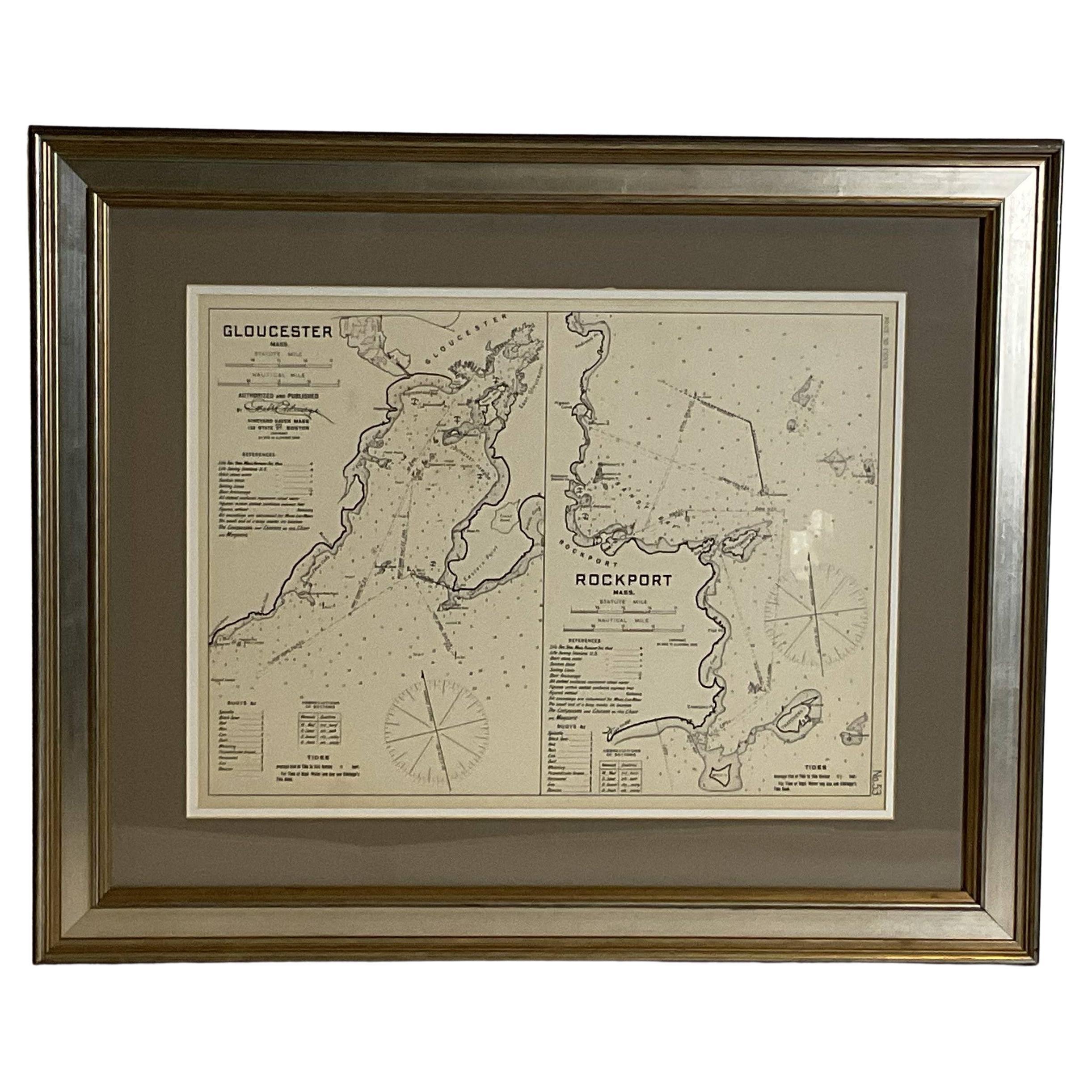
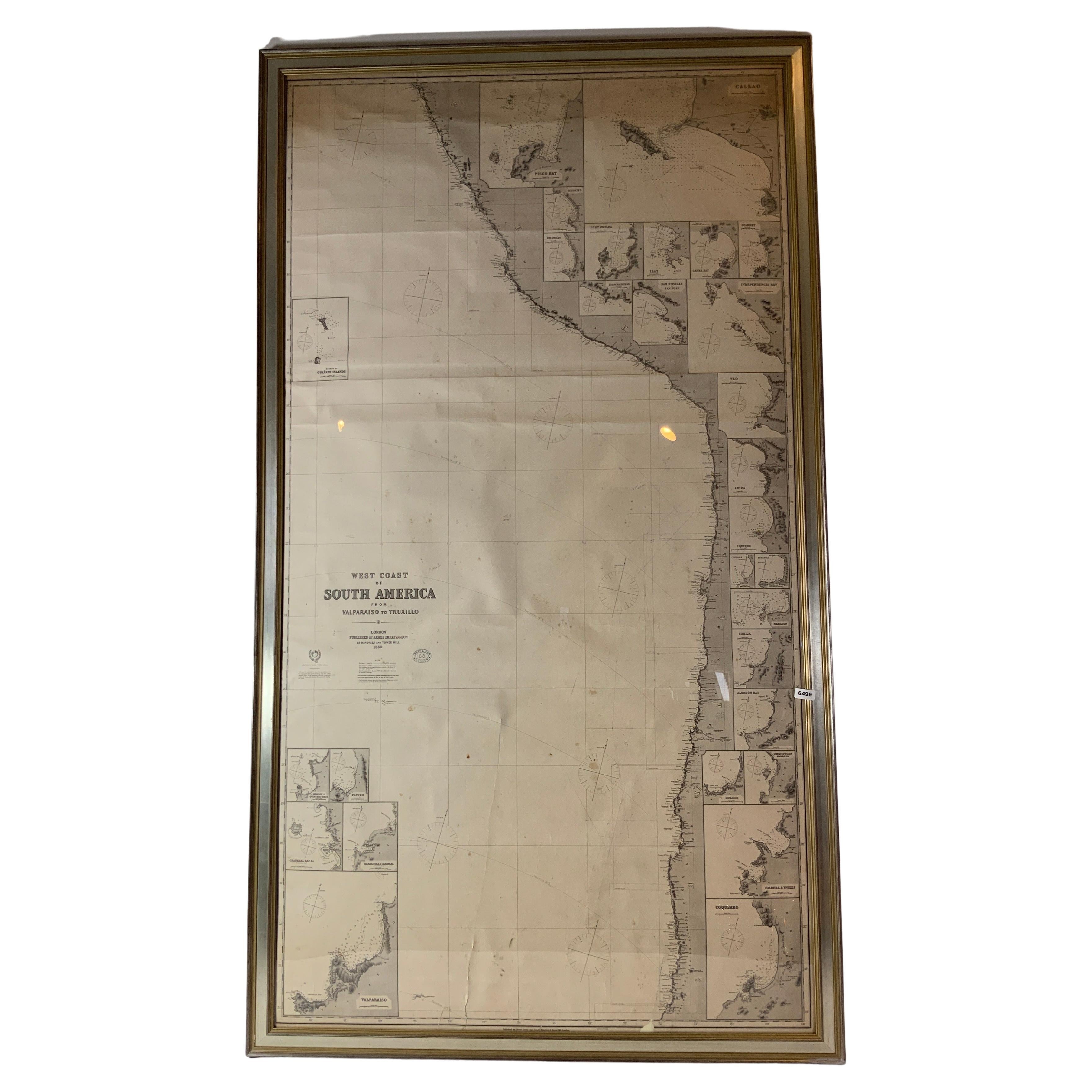
Mariners Chart of Gloucester and Rockport by George Eldridge 1910
Located in Norwell, MA
Nautical chart showing the harbor and local water. The chart display depths buoys, lighthouses, etc., This chart shows Eastern Point, Rocky Neck, Stage head, Thatcher Island, Sandy B...
Category
Vintage 1910s North American Prints
Materials
Paper
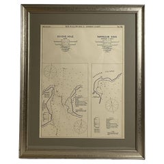
Mariners Chart of Quicks Hole and Tarpaulin Cove by George Eldridge 1901
Located in Norwell, MA
Nautical chart showing the harbor and local waters of Naushon Island Quick Holes. The chart display depths buoys, lightness, etc., The chart shows the cove in Naushon with ships stor...
Category
Antique Early 1900s North American Maps
Materials
Paper
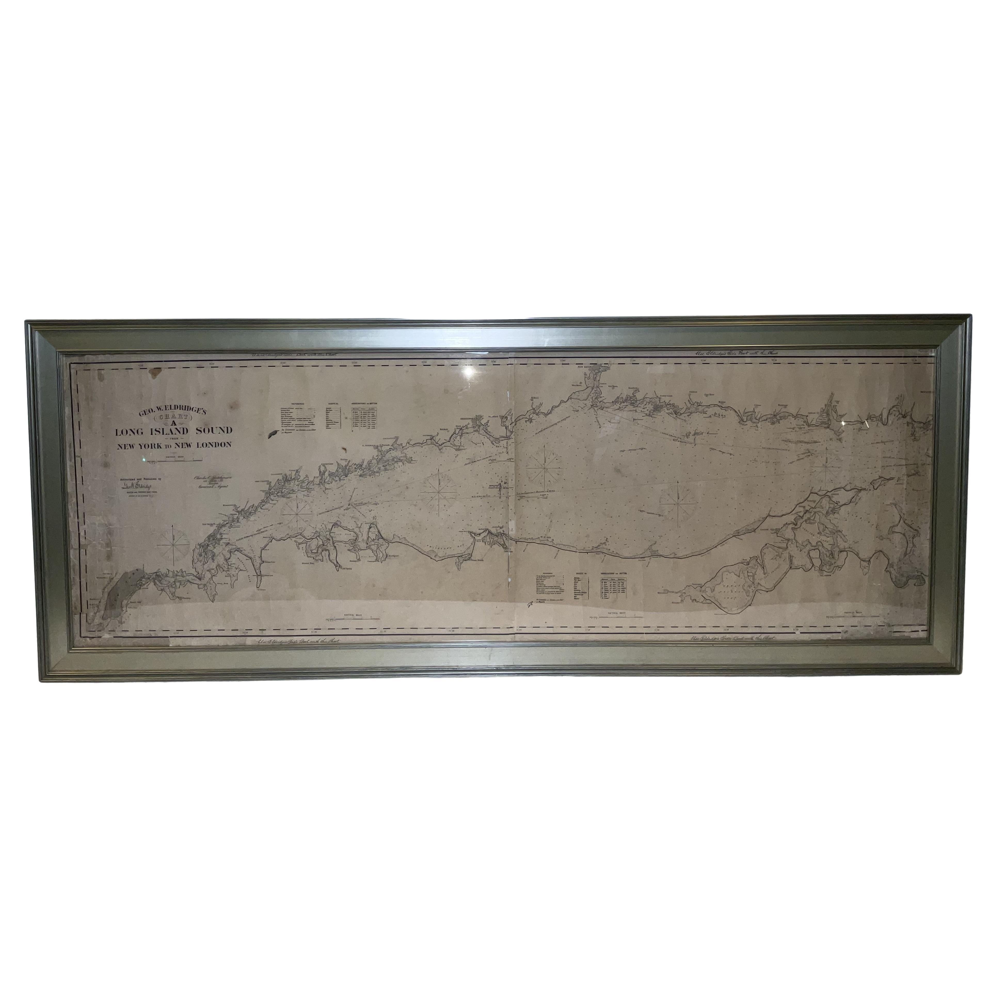
1905 Chart of Long Island Sound by Eldridge
Located in Norwell, MA
Original chart of Long Island Sound by George Eldridge, date-stamped 1905. Also includes the seller's name, Ships Chandler Charles C. Hutchinson, 152 State St., Boston, General Agent...
Category
Antique Early 1900s North American Prints
Materials
Paper
Copy of 1901 Chart of Boston Harbor
Located in Norwell, MA
Later copy after an original Boston Harbor chart by George Eldridge of Vineyard Haven and Boston. Detailed chart of Boston Harbor from the Neponset River in Quincy south down to Kimb...
Category
Vintage 1910s North American Prints
Materials
Paper

You May Also Like
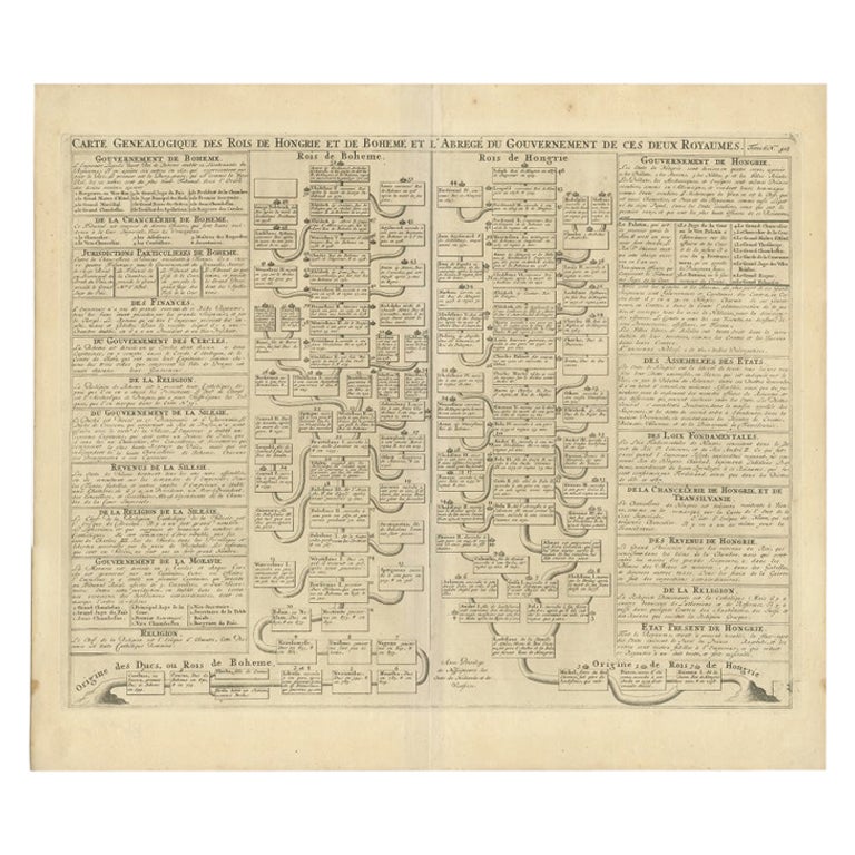
Antique Chart of CAP Providence and Other Charts by Hawkesworth, 1774
Located in Langweer, NL
Antique print titled 'Baye du Cap Upright (..)'. Eight charts on one sheet of Cap Providence, St. David's Cove, the Bay of the Island, Swallow's Haven, Puzzling Bay, Baye du Cape Upr...
Category
Antique 18th Century Prints
Materials
Paper
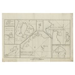
$303 Sale Price
20% Off
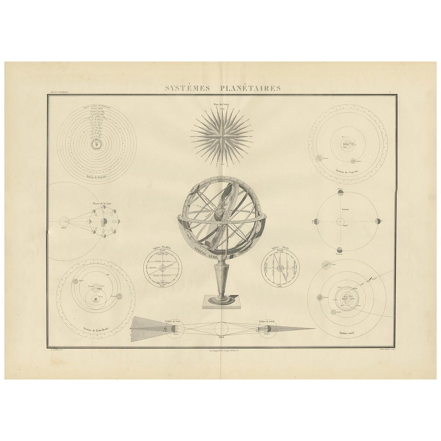
Antique Chart of Celestial and Scientific Models by Lapie, 1842
Located in Langweer, NL
Antique print titled 'Systèmes Planétaires'. Chart of various celestial and scientific models. Includes an armillary sphere and various models of the universe, the season, eclipses, a Copernican, Tycho...
Category
Antique Mid-19th Century French Prints
Materials
Paper
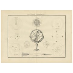
$711 Sale Price
25% Off
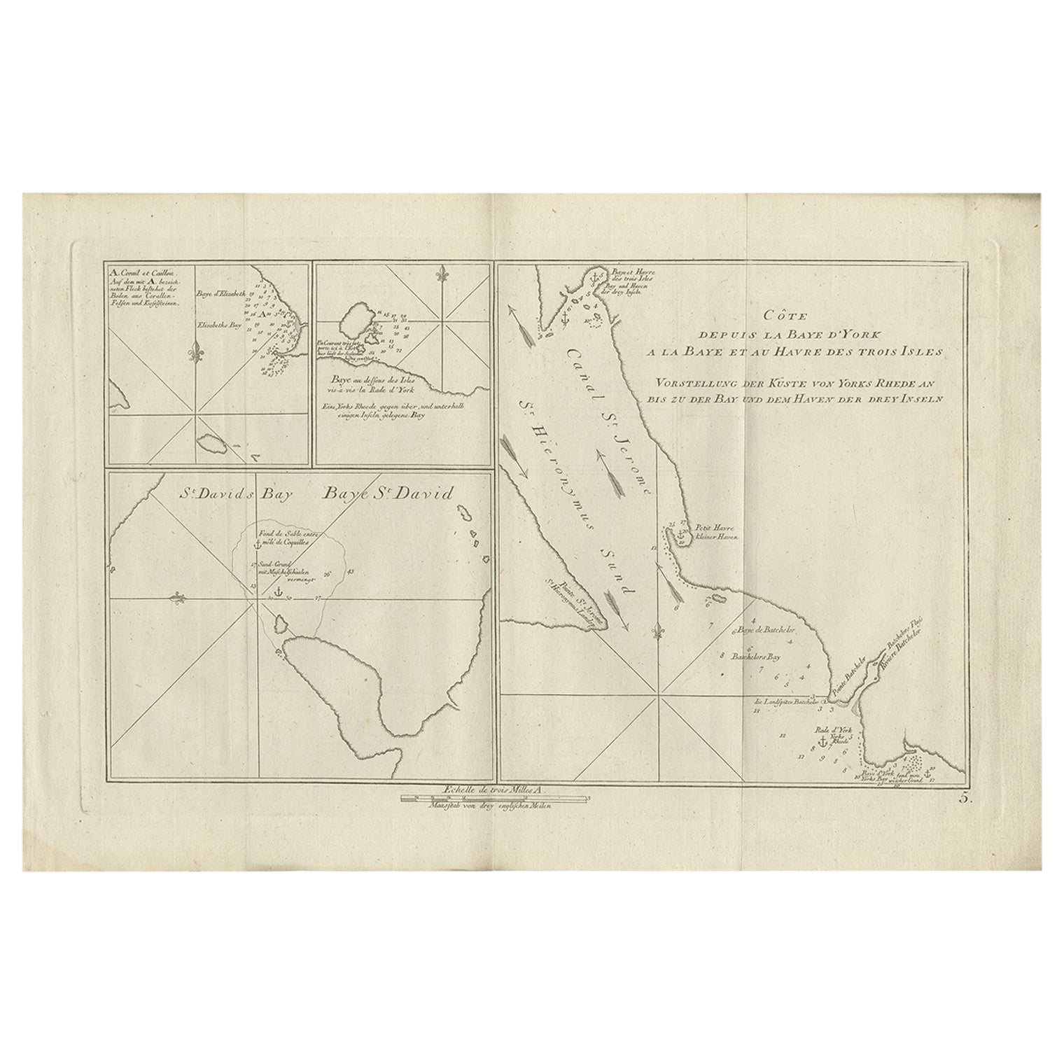
Antique Chart of York's Bay and Surroundings by Hawkesworth, 1774
Located in Langweer, NL
Antique print titled 'Baye St. David (..)'. Charts of York's Bay, Haven of the Three Islands, St. David's Bay, and Elizabeth's Bay. Originates from 'Geschichte der See-Reisen und Ent...
Category
Antique 18th Century Prints
Materials
Paper
$275 Sale Price
20% Off
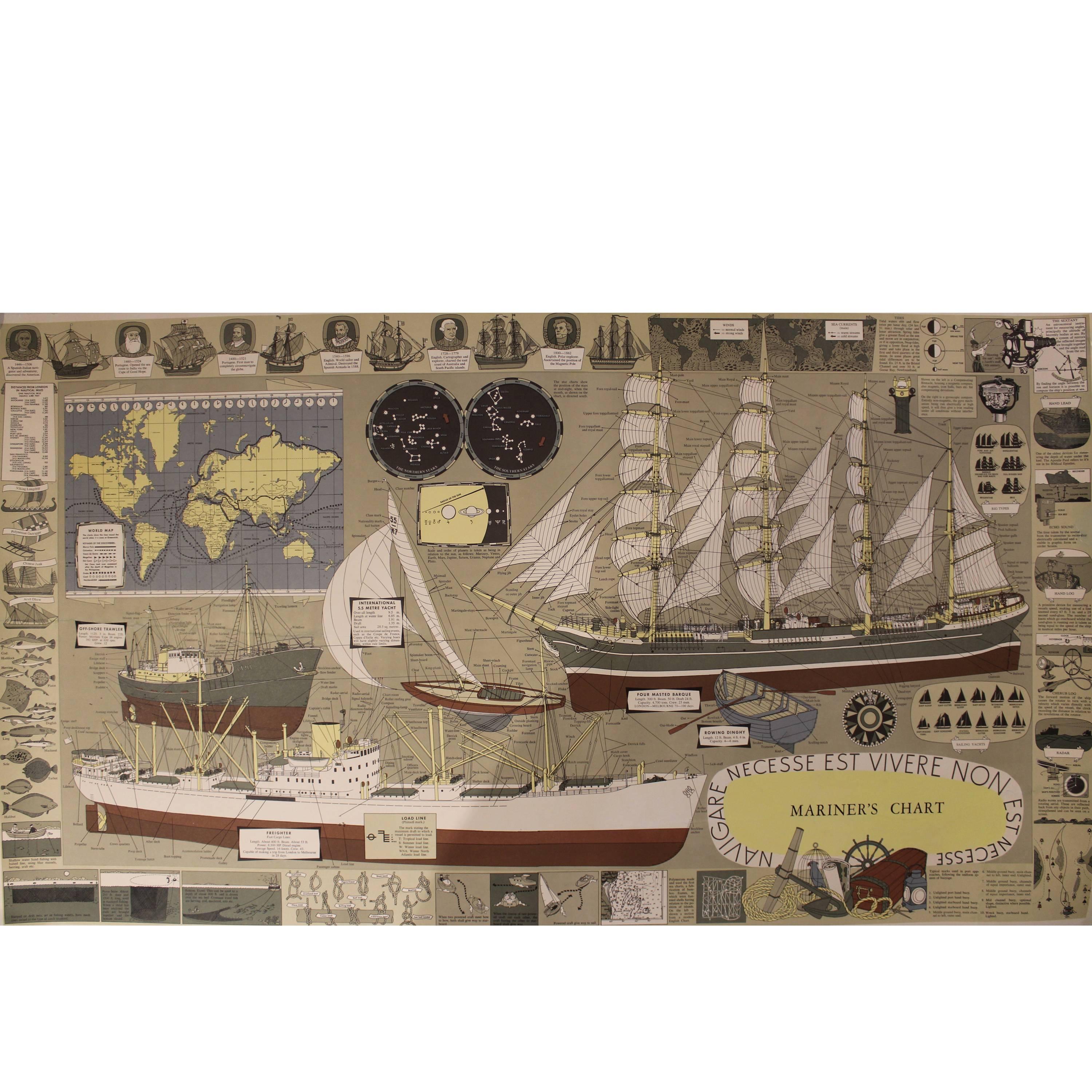
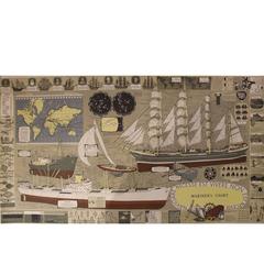
Mariner's Chart Poster
Located in Hamilton, Ontario
Mariner's chart poster (nautical).
Category
20th Century Posters
$1,795 Sale Price
20% Off
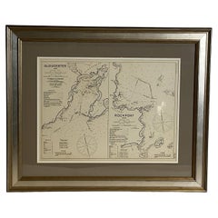
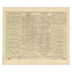
Antique Genealogy Chart of the Kings of Hungary and Bohemia by Chatelain, 1732
Located in Langweer, NL
Antique print titled 'Carte Genealogique des Rois de Hongrie (..)'. Genealogical chart of the kings of Hungary and Bohemia. This print orginates from 'Atlas H...
Category
Antique 18th Century Prints
Materials
Paper
$227 Sale Price
20% Off
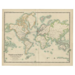
Antique Chart of the World by Johnston '1909'
Located in Langweer, NL
Antique map titled 'Chart of the World on Mercator's Projection Showing the directions of the Oceans Currents with the Routes and Distances Between Principal Ports'. Detailed map of ...
Category
Early 20th Century Maps
Materials
Paper
$284 Sale Price
20% Off
Recently Viewed
View AllMore Ways To Browse
Dutch China Cabinet
Ebony Secretary
Edo Period Cabinet
Enameled Silver Box China
Falling Clock
Flower Vase Pin
Folding Buffet
Four Post King Bed
French Bakery
Georgian Bachelors Chest
Georgian Mahogany Serpentine Chest Of Drawers
German China Cabinet
Gilt Chalice
Glass Flower Frogs
Gold Leaf Carved Box
Gold Leaf Headboard
Hb Henriot Quimper
Music Box Inlaid