Europe
to
89
225
127
344,634
250,259
157,784
140,895
103,812
77,147
50,722
50,098
43,937
35,254
28,310
27,308
22,585
20,011
15,981
15,563
14,742
14,173
11,696
10,732
10,463
7,574
5,842
5,743
4,981
4,403
4,314
3,596
2,816
2,609
2,118
2,114
1,940
1,553
1,473
1,275
1,189
1,137
1,004
954
932
859
717
682
523
500
393
302
281
228
221
198
195
170
165
154
115
109
99
60
45
39
25
4
4
2
2
Period: 1650s
Period: 1630s
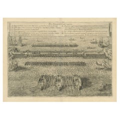
The Duke of Parma's Pontoon Bridge in The Siege of Antwerp, 1632
Located in Langweer, NL
Rare original engraving of the Pontoon Bridge Constructed by the Duke of Parma in 1585, depicting the famous pontoon bridge over the Scheldt River.
This engineering feat was accomp...
Category
1630s Antique Europe
Materials
Paper
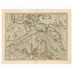
Map of Northwestern Switzerland (Basel and Zurich Region) by Willem & Jan Blaeu
Located in Langweer, NL
Map of Northwestern Switzerland by Willem & Jan Blaeu (Circa 1650)
This is a detailed map of Northwestern Switzerland, specifically depicting the region between Basel and Zurich, cr...
Category
1650s Antique Europe
Materials
Paper
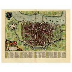
Beautiful Original Antique Map of Antwerp, Belgium by Mapmaker Blaeu, ca.1652
Located in Langweer, NL
Description: Antique map titled 'Antverpia; Gallis Anvers. Vernacule Antwerpen.'
A very nicely coloured plan of Antwerp in Flanders, Belgium. West-oriented, with the river Scheld...
Category
1650s Antique Europe
Materials
Paper
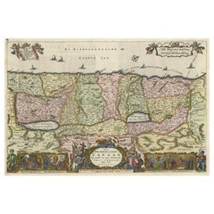
Detailed Map of the Holy Land, Showing the Travels of Christ & Apostles, ca.1650
Located in Langweer, NL
Antique map titled 'Het Beloofde Landt Canaan door wandelt van onsen Salichmaeker Jesu Christo neffens syne Apostelen.'
Detailed map of the Holy Land, showing the travels of Christ and the Apostles, including Paul's travel's at sea and numerous sailing vessels. Below bible scenes such as the nativity and crucifiction of Christ. An excellent example of a Duch Bible map...
Category
1650s Antique Europe
Materials
Paper
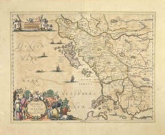
Epirus Albania - Etching by Johannes Janssonius - 1650s
By Johannes Janssonius
Located in Roma, IT
Epirus Albania is an ancient map realized in 1650 by Johannes Janssonius (1588-1664).
Good conditions.
From Atlantis majoris quinta pars, Orbem maritimum [Novus Atlas, volume V: ca...
Category
1650s Modern Europe
Materials
Etching
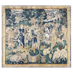
17th Century Tapestry Village Festival - n° 1048
Located in Paris, FR
1048 - 17th century Tapestry village festival.
Thanks to our Restoration-Conservation workshop and also Our know-how,
we are pleased to present to you works of art in fabric such as...
Category
1650s Belgian Louis XIV Antique Europe
Materials
Wool
“Tuomas” Acrylic Pendant Light by Yki Nummi for Stockmann-Orno, Finland, 1950s
By Yki Nummi, Stockmann-Orno
Located in Steenwijk, NL
This nice grey and white acrylic pendant light was designed by Yki Nummi for Stockmann-Orno in the 1950's. The lamp is in a very good condition with some minor signs of age and use.
...
Category
1650s Finnish Mid-Century Modern Antique Europe
Materials
Metal
Cartographic Elegance of Touraine: A 17th-Century Map Showing French Heritage
Located in Langweer, NL
"Ducatus Turonensis - Touraine," is a original antique historical map of the Touraine region, which is located in the heart of France, centered...
Category
1630s Antique Europe
Materials
Paper
Old Original Engraving of Prussia on the Southeast Coast of the Baltic Sea, 1632
Located in Langweer, NL
Description: Antique map titled 'Prussia'.
Original map of Prussia, a historically prominent German state that originated in 1525 with a duchy centered on the region of Prussia o...
Category
1630s Antique Europe
Materials
Paper
Loudun and Mirebeau: A Cartographic Masterpiece of 17th Century France by Blaeu
Located in Langweer, NL
Cartography, 17th century. Willem (1571-1638) and Joan Blaeu (1596-1673), Theatrum Orbis Terrarum sive Atlas Novus..., 1635. Figure: Loudonois. Laudunum (Loudun); Mirebalais (Mirebea...
Category
1650s Antique Europe
Materials
Paper
Map of Scotland - Etching by Johannes Blaeu - 1650s
Located in Roma, IT
Map of Scotland is an geographic map realized by Johannes Blaeu.
Etching, printed in 1660 ca.
Copper engraving, colored (coeval coloring), on paper, with center fold;
Latin text. ...
Category
1650s Modern Europe
Materials
Etching
Antique Engraving Showing Animals of the Guenon & Armadillo Species, 1657
Located in Langweer, NL
Antique print of various animals; Cercopithecus Sagovin Clusy (Guenon species) - Mapach (Racoon) - Cercopithecus Barbatus Clusy (Guenon species) - Iguavu sive Haut clusy - Armadillo ...
Category
1650s Antique Europe
Materials
Paper
Decorative Antique Map of the Berry Region, France, 1657
Located in Langweer, NL
Antique map of France titled 'Bituricum Ducatus - Duche de Berri'.
Decorative map of the Berry region, France. Berry is a region located in the center of France. It was a provinc...
Category
1650s Antique Europe
Materials
Paper
Original Antique Map of the English counties Cornwall, Devon, Dorset, etc, 1633
Located in Langweer, NL
Antique map titled 'Cornubia, Devonia, Somersetus, Dorcestria, Wiltonia, Glocestria, Monumetha, Glamorgan, Caermarden, Penbrok, Cardigan, Radnor, Breknoke et Herfordia'.
Old map of the English counties of Cornwall, Devon, Somerset, Dorset, Wiltshire, Gloucestershire, Herefordshire, Worcestershire etc. Originates from the 1633 German edition of the Mercator-Hondius Atlas Major, published by Henricus Hondius and Jan Jansson under the title: 'Atlas: das ist Abbildung der gantzen Welt, mit allen darin begriffenen Laendern und Provintzen: sonderlich von Teutschland, Franckreich, Niderland, Ost und West Indien: mit Beschreibung der selben.'
Artists and Engravers: Gerard Mercator (1512 - 1594) originally a student of philosophy was one of the most renowned cosmographers and geographers of the 16th century, as well as an accomplished scientific instrument maker. He is most famous for introducing Mercators Projection, a system which allowed navigators to plot the same constant compass bearing on a flat...
Category
1630s Antique Europe
Materials
Paper
Golf of Benngala - Etching by Johannes Janssonius - 1650s
By Johannes Janssonius
Located in Roma, IT
Golfo De Benngala is an antique map realized in 1650 by Johannes Janssonius (1588-1664).
The Map is Hand-colored etching, with coeval watercoloring.
Good conditions with slight fox...
Category
1650s Modern Europe
Materials
Etching
Original Old Map of South East England Incl London, Oxford, Cambridge, Etc, 1633
Located in Langweer, NL
Antique map titled 'Warwicum, Northhamtonia, Huntingdonia, Cantabrigia, Suffolcia, Oxonium, Buckinghamia, Befordia, Harfordia, Essexia, Berceria, Middlesexia, Southhatonia, Surria, Catiu & Southsexia'.
Old map of south east England. Includes London, Salisbury, Oxford, Cambridge, Leicester and Norwich and the Isle of Wight. Originates from the 1633 German edition of the Mercator-Hondius Atlas Major, published by Henricus Hondius and Jan Jansson under the title: 'Atlas: das ist Abbildung der gantzen Welt, mit allen darin begriffenen Laendern und Provintzen: sonderlich von Teutschland, Franckreich, Niderland, Ost und West Indien: mit Beschreibung der selben.'
Artists and engravers: Gerard Mercator (1512 - 1594) originally a student of philosophy was one of the most renowned cosmographers and geographers of the 16th century, as well as an accomplished scientific instrument maker. He is most famous for introducing Mercators Projection, a system which allowed navigators to plot the same constant compass bearing on a flat map.
Category
1630s Antique Europe
Materials
Paper
Original Rare Antique Map of the Ancient German Empire in Northern Europe, c1650
Located in Langweer, NL
Antique map titled 'Germaniae Veteris typus.'
Map of the ancient German Empire in Northern Europe, based upon an earlier map by Ortelius. Extends fr...
Category
1650s Antique Europe
Materials
Paper
Set of 2 Gianfranco Frattini Chairs Modell 830, 1950s, Cassina, Italy
By Cassina, Gianfranco Frattini
Located in Wolfurt, AT
This pair of "Model 830" armchairs was designed by Gianfranco Frattini for the Italian company Cassina in the 1950s. Both pieces are upholstered in dark green fabric and are supporte...
Category
1650s Italian Mid-Century Modern Antique Europe
Materials
Fabric, Wood
Decorative Antique Map of the Region of Cambrai, France, ca.1630
Located in Langweer, NL
Antique map titled 'l'Archevesche de Cambray'. Decorative map of the region of Cambrai, France. Includes the cities of Cambrai, Valencienes, Douai, and Bouchain.
Artists and Engravers: Henricus...
Category
1630s Antique Europe
Materials
Paper
Antique Map by Janssonius of the Dutch Province of Overijsel, ca.1650
Located in Langweer, NL
Very good, given the age. Center fold as issued with wide margins. Sharp print with beautiful old-fashioned colouring, carbon copy on verso. Paper in the margins somewhat browned.
Category
1650s Antique Europe
Materials
Paper
Original Antique Map of Prussia, ca.1630
Located in Langweer, NL
Antique map titled 'Prussia - Preussen'. Original map of Prussia, a historically prominent German state that originated in 1525 with a duchy centered on...
Category
1630s Antique Europe
Materials
Paper
Beautiful Antique Map of the Moluccas or Spice Islands, Indonesia, ca.1650
Located in Langweer, NL
Antique map titled 'Insularum Moluccarum Nova Descriptio.'
Beautiful map of the Moluccas. The famous Spice Islands, the cornerstone of the Dutc...
Category
1650s Antique Europe
Materials
Paper
Rare Old Copper Engraving of a Clove Tree in the East Indies, Asia, 1659
Located in Langweer, NL
Antique print titled 'Clove Tree'.
Copper engraving of a clove tree. This print originates from 'Voyages and Travels to the East-Indies' by J. Nieuhof.
Artists and engravers:...
Category
1650s Antique Europe
Materials
Paper
Original Antique Map of the Dutch Provinces of Overijssel and Drenthe, 1635
Located in Langweer, NL
Antique map titled 'Transiselania Dominium vernacule Over-Yssel.' - Map of the Dutch Provinces of Overijssel and Drenthe. Dedicated to Mr. Bartold Wich...
Category
1630s Antique Europe
Materials
Paper
Murano Glass Fumè Bottle
Located in Vo', Veneto
Smoked glass bottle, VeArt, Murano manufacture (Venice), 1960s.
VeArt
Murano Artistic Glassware
VeArt Vetreria was founded in 1965 by the collaboration of Ludovico Diaz and Bili...
Category
1650s Italian Antique Europe
Materials
Glass, Art Glass
Rare Etching of a Warrior Standing and Leaning on a Long Sword, ca.1658
Located in Langweer, NL
Etching of a warrior standing and leaning on a long sword. Originates from a figurine series 1653-1658, signed with his monogram.
Artists and engravers: Sa...
Category
1650s Antique Europe
Materials
Paper
Map of the Alsace, France Incl the Rhine from Phillipsburg to South Basle, c1650
Located in Langweer, NL
Antique map titled 'Utriusquae Alsatiae Superioris Ac Inferioris Nova Tabula'.
Map of the Alsace region (France) including the Rhine from Phillipsburg to south of Basle. Two deco...
Category
1650s Antique Europe
Materials
Paper
Original Antique Engraving of a Vox, Wolf and Hyenas, 1657
Located in Langweer, NL
Antique print of various animals; Lupus, Wolff (Wolf) - Vulpes, Fuchs (Fox) - Zilio Hyaena (Hyena). This print originates from 'Historiae Naturalis (..)' by John Johnston, published by Matthias Merian in 1657.
Artists and Engravers: John Johnston (or Johnstone, 1603-1675) was a descendant of a Scottish...
Category
1650s Antique Europe
Materials
Paper
Old Map of The Southern Part of Norway, Covering the Region Around Bergen, c1650
Located in Langweer, NL
Antique map titled 'Nova et Accurata Tabula Episcopatuum Stavangriensis et Asloiensis'.
Old map of the southern part of Norway, it covers the region around Bergen. Decorated with...
Category
1650s Antique Europe
Materials
Paper
Decorative Antique Map of the Quercy Region in France, 1657
Located in Langweer, NL
Antique map of France titled 'Quercy olim Cadurcium'.
Decorative map of the Quercy region. Quercy is a former province of France located in the country's southwest, bounded on th...
Category
1650s Antique Europe
Materials
Paper
Detailed Antique Map of Northern Spanish Region of Aragon, c.1650
Located in Langweer, NL
Antique map titled 'Arragonia Regnum'.
Detailed map of northern Spanish region of Aragon. The map is centered on the city of Zaragoza, aka, Saragossa. Shows towns, rivers, castle...
Category
1650s Antique Europe
Materials
Paper
Old Map of the City of Franeker, Friesland by the Famous Mapmaker Blaeu, 1652
Located in Langweer, NL
Antique map titled 'Franekera'. Old map of the city of Franeker, Friesland. Also shows two cartouches, coats of arms and legend. This map originates from a Latin edition of the town ...
Category
1650s Antique Europe
Materials
Paper
Antique Print of Domestic and Wild Cat Species, incl The Civet, 1657
Located in Langweer, NL
Antique print of domestic and wild cat species; Felis domestica, Zahme Katz (Domestic cat) - Felis sylvestris, Wilde Katz (Wild Cat) - Felis Zibetti, Zibet Katz (Civet cat) - Genetta...
Category
1650s Antique Europe
Materials
Paper
Attractive Antique Map of Western Africa with Lots of Details on the Coast, 1655
Located in Langweer, NL
Title: "L'Afrique, ou Lybie ulterieure ou sont le Saara, ou Desert, le pays des negres, la Guinee, et les Pays circonv. Tirée en partie de Sanut, et de l'Arabe de Nubie; en partie de diverses Cartes veües jusques a present".
Handsome map of Western Africa filled with information, much of it spurious, in the Sahara Desert, the Niger River and the coast of Guinea. Of particular interest are several incomplete rivers in the desert regions that appear and then disappear. The map is beautifully engraved with a title cartouche fashioned in the form of an oriental carpet.
The map shows a fantastic level of detail near the coastlines, which extends into legend and Ptolemaic myth in the interior of the continent. Detail is particularly extensive in Guinea and the Gold and Ivory Coasts. The Niger River is traced to its Malian lakes. The Mediterranean is barely visible in the northern part of the map. This map incorporates the discoveries made by Samuel Blommaert, who was director of the Dutch West Indies Company, in addition to traveling extensively to Africa and settling the oldest land deed...
Category
1650s Antique Europe
Materials
Paper
Original Antique Engraving of a Sea Chart of the Western Mediterranean, ca.1650
Located in Langweer, NL
Antique map titled 'Pascaerte van 't westlyckste deel vande Middelandsche-Zee (..)'.
Sea chart of the Western Mediterranean. The map extends from the Straits of Gibralter to Italy ...
Category
1650s Antique Europe
Materials
Paper
Nice Hand-Colored Plan by Blaeu of Bolsward in Friesland, the Netherlands, 1652
Located in Langweer, NL
Antique print, titled: 'Bolswaert' - (Town plan of Bolsward).
Plan of Bolsward in Friesland, the Netherlands. A cartouche and two coats of arms. From the town atlas 'Toneel der S...
Category
1650s Antique Europe
Materials
Paper
Detailed Original Antique Map of the Picardy Region of France, 1657
Located in Langweer, NL
Antique map of France titled 'Picardia vera et inferior'.
Detailed map of the Picardy region of France. This map originates from 'Atlas Novus, Sive Theatrum Orbis Orbis Terrarum:...
Category
1650s Antique Europe
Materials
Paper
Old Map of the Alsace 'Elzas' Region with Lotharingen 'Lorraine', France, c1650
Located in Langweer, NL
Antique map titled 'Alsatia superior cum Suntgoia et Brisgoia'.
Old map of the Alsace (or Elzas) region with Lotharingen (Lorraine), Strassburg, Freiburg, Basel etc. Source unkno...
Category
1650s Antique Europe
Materials
Paper
Map of the Duchy Clivia & Ravestein, Brabant in The Netherlands & Germany, 1635
Located in Langweer, NL
Antique map titled 'Clivia Ducatus et Ravestein Dominium.'
Map of the Duchy Clivia and Ravestein, part of Brabant in The Nethe...
Category
1630s Antique Europe
Materials
Paper
Old Print of a Partridge in Front of The Walled City of Azemmour, Morocco, c1630
Located in Langweer, NL
Antique print, titled: 'Azaamurum.' - Caption in the top reads: 'Foenerari iniustum est'.
A partridge in the foreground, with the walled city (Azemmour...
Category
1630s Antique Europe
Materials
Paper
Antique Map of Frisian Cities Sloten, Ylst, Workum and Hindelopen by Blaeu, 1652
Located in Langweer, NL
Antique print titled 'Slooten - Ylst - Worcum - Hinloopen'. Three plans and a bird's eye view on one sheet. The plans show the Frisian cities Sloten, IJlst, Workum and the view shows...
Category
1650s Antique Europe
Materials
Paper
Antique Copper Engraving of Various Rodent Species, 1657
Located in Langweer, NL
Antique print of various rodent species; Aperea cuniculi species, Veld Ratte (Rodent, Rat species) - Carigueya (Opossum species) - Aguti (Agouti) - Cavia Cobaya - Cuniculi Inda Gesne...
Category
1650s Antique Europe
Materials
Paper
Detailed Original Antique Map of Thuringia, Germany by J. Janssonius, ca.1650
Located in Langweer, NL
Antique map titled 'Thuringiae Nova Descriptio.' Detailed map of Thuringia, Germany by J. Janssonius. With one cartouche, coat-of-arms and a mileage scale. With Erfurt in the centre....
Category
1650s Antique Europe
Materials
Paper
Charming Map of Northeastern Spain with the Areas of Pamplona & Valladolid, 1634
Located in Langweer, NL
Antique map titled 'Biscaia, Guipiscoa, Navarra et Asturias de Santillana'.
Charming map of Northeastern Spain with the areas of Pamplona and Valladolid. This map originates from...
Category
1630s Antique Europe
Materials
Paper
Original Hand-Colored Antique Map of Artois or Artesia, France, ca.1650
Located in Langweer, NL
Antique map titled 'Artesia Comitatus Artois'.
Map of Artois or Artesia, France. Artois is former province located in the northwestern part of France, boarding Belgium (Flanders)...
Category
1650s Antique Europe
Materials
Paper
Antique Map of Dutch & Belgium Provinces Limburg, Namen and Ardennes, ca.1635
Located in Langweer, NL
Antique print, titled: 'Leodiensis Dioecesis.'
Detailed map including the Dutch and Belgium provinces Limburg and the Belgium province of Namen and Ardennes. Exquisitely engraved...
Category
1630s Antique Europe
Materials
Paper
Old Portrait of Peter Canisius, a Renowned Dutch Jesuit Catholic Priest, Ca.1650
Located in Langweer, NL
Antique portrait titled 'R.Petrus Canisius Societatis Iesv'.
Old portrait of Peter Canisius, a renowned Dutch Jesuit Catholic priest. He became kno...
Category
1650s Antique Europe
Materials
Paper
Handsome Old Detailed Map of the Low Countries by Famous Mapmaker Blaeu, ca.1635
Located in Langweer, NL
Antique map titled 'Novus XVII Inferioris Germaniae Provinciarum Typus'.
Handsome - and much sought after- detailed map of the Low Countries by the world most famous map maker Bla...
Category
1630s Antique Europe
Materials
Paper
Antique Print of Buffalos, Bisons Magnus, Jubatus and Locobardus, 1657
Located in Langweer, NL
Description: Antique print of bisons, buffalo; Bisons Magnus - Bison Jubatus - Locobardus Bison.
This print originates from 'Historiae Naturalis De Piscibus Et Cetis Libri V' by ...
Category
1650s Antique Europe
Materials
Paper
Large Panoramic View of Eisenerz, an Old Mining Town in Styria, Austria, c.1650
Located in Langweer, NL
Description: Antique print titled 'Der weyt berümpte Marckt und Bergwerck Eysenärtz im Hertzogtum Steyer'.
Large panoramic view of Eisenerz, an old mining town in the Austrian st...
Category
1650s Antique Europe
Materials
Paper
Mid-Century Modern Crystal Vase Val Saint Lambert - Belgium, 1950
By Val Saint Lambert
Located in Girona, Girona
Large vase of pliers worked crystal.
Design: Antonio Bon for Val Saint Lambert.
Belgium, Liège c. 1950.
Category
1650s Belgian Mid-Century Modern Antique Europe
Materials
Crystal
The Adoration -Painting by Giuseppe Assereto - 1630
By Giuseppe Assereto
Located in Roma, IT
The Adoration is an original modern artwork realized by Giuseppe Assereto (died in Genoa in 1650) in the first half of the 17th Century.
Original Oil Painting on Canvas.
A 19th Century style gilded wood frame is included.
The Autograph of the work was confirmed by Camillo Manzitti.
Very good conditions. The frame is in excellent conditions too.
Reference:
C. Marcenaro, Pittori genovesi a Genova nel '600 e nel '700, Genova 1969, pp. 134 ; 135, n. 55.
Z. Wazbinski, Un Quadro Caravaggesco Di Gioacchino Assereto, in Prospettiva, n. 26, 1981, pp. 60 ; 63.
F. R. Pesenti, La Pittura in Liguria. Artisti del primo Seicento, Genova 1986, p. 397, nota 23.
A. Gesino, Tracce di Matthias Stom nel collezionismo tra la Sicilia e Genova, in Caravaggio e i genovesi, catalogo della Mostra a cura di A. Orlando, Genova 2019, pp. 182 ; 195.
The Adoration is an excellent example of the XVII Century Italian Painting. The style of the work denotes the suggestive influence of Assereto father's mature production, when influenced by Mathias Stom (Amersfoort, about 1600 - Sicily, after 1650) expresses dark sensibilities in a southern Italian style. In his works, however, there is an accentuated naturalism and interesting similarities with the production of Giovanni Benedetto Castiglione. Gioacchino Assereto died in 1650, while, according to Soprani, he was intent on painting a Last Supper for the oratory...
Category
1630s Old Masters Europe
Materials
Oil
17th-Century Original Antique Map of Hunan and Hubei Provinces, China – by Blaeu
Located in Langweer, NL
Title: 17th-Century Antique Map of Hunan and Hubei Provinces, China – "Hvqvang" by Blaeu, Richly Detailed and Illustrated
Description: This beautiful 17th-century map of the regions that now comprise Hunan and Hubei Provinces, historically referred to as "Hvqvang," was created by Johannes Blaeu and published in 1655 as part of the *Novus Atlas Sinensis*. This map, drawn with input from Jesuit missionary Martino Martini, provides a meticulous representation of central China’s geography, capturing its rivers, towns, and mountainous terrain.
The Yangtze River (Changjiang) is prominently featured, emphasizing the region’s importance as a vital waterway for trade and transportation. Wuhan, now a modern metropolis, and Changsha, the capital of Hunan Province, were historically significant cities that appear on the map. The area is also notable for its fertile lands and contributions to China’s agricultural prosperity, particularly in rice and tea production.
The decorative cartouche in the lower-right corner features two figures in traditional Chinese attire standing amid bamboo, symbolizing the cultural and natural richness of the region. Blaeu’s map combines precision and artistry, with vibrant hand-coloring distinguishing boundaries and geographical features. The copperplate engraving ensures fine detail, making this map a remarkable historical artifact.
Condition: Near excellent. Clean impression with vivid hand-coloring. Wide margins with minor age-toning appropriate for its age.
Framing Tips: Use a neutral double mat and a gilt or dark wood frame to enhance the presentation. UV-protective glass is recommended to preserve the vivid hand-coloring and intricate engraving details.
Hunan and Hubei, historically referred to as "Hvqvang," are known for their strategic location along the Yangtze River and their cultural and economic significance in Chinese history. The region’s fertile lands have supported extensive rice cultivation, earning it the title of one of China’s "breadbaskets." Hubei, with Wuhan at its center, has long been a hub of transportation and trade, owing to the convergence of the Yangtze and Han Rivers. Hunan, with Changsha as its capital, is known for its rich cultural heritage and contributions to Chinese literature and art.
Important places in the region include Wuhan, an ancient trade center, and Changsha, known for its historical sites and cultural prominence. The Yangtze River, a key feature on the map, highlights the region’s historical importance as a major waterway for commerce and agriculture. Other notable features include Dongting Lake, a vital ecological and cultural landmark, and the surrounding mountainous areas that have shaped the region’s history and development.
Keywords: antique map of Hunan, Hubei map, Hvqvang map, Yangtze River map, 17th-century Chinese map...
Category
1650s Antique Europe
Materials
Paper
OriginaAntique 17th-Century Map of Guizhou Province, China – (Qveichev) by Blaeu
Located in Langweer, NL
Title: Antique 17th-Century Map of Guizhou Province, China – "Qveichev" by Blaeu, Richly Illustrated and Colored
Description: This remarkable map of Guizhou Province, historically known as "Qveichev," was created by Johannes Blaeu and published in 1655 as part of his *Novus Atlas Sinensis*. This atlas, developed in collaboration with Jesuit missionary Martino Martini, marked the first Western attempt at a comprehensive geographic representation of China. Blaeu’s map offers a detailed depiction of the mountainous terrain, rivers, and towns of Guizhou, a province known for its rugged beauty and cultural diversity.
The map is adorned with two decorative cartouches, each reflecting the artistic and cultural influences of the time. The title cartouche in the lower-right corner features two figures in traditional Chinese attire, symbolizing the blend of European cartographic mastery and Chinese heritage. The upper-left corner includes a secondary cartouche with an explanatory key, adding a touch of elegance to the map’s functionality. Towns, mountains, and rivers are meticulously labeled in Latin, showcasing Blaeu’s dedication to detail and accuracy.
Crafted using the copperplate engraving technique, this map demonstrates exceptional precision. The hand-coloring enhances its visual appeal, highlighting borders and geographic features with vibrant tones. Blaeu’s work is not only a tool for geographic understanding but also a piece of art that embodies the spirit of exploration during the Dutch Golden Age.
Guizhou Province, historically known as "Qveichev," is renowned for its breathtaking natural landscapes, rich ethnic diversity, and historical significance. As one of China's most mountainous regions, Guizhou is characterized by dramatic karst formations, lush green hills, and cascading waterfalls. The province is also home to a variety of ethnic minority groups, including the Miao, Dong, and Bouyei, whose traditions, colorful costumes, and vibrant festivals make the region culturally significant.
Famous features and important places include Huangguoshu Waterfall, one of Asia's largest and most iconic waterfalls, located near the city of Anshun. Zhijin Cave, a vast karst cave system, is celebrated for its stunning stalactites and stalagmites. Kaili is known as the cultural center of Miao traditions, with picturesque villages and celebrated festivals. Zunyi holds historical importance for the Zunyi Conference, a pivotal event in the Chinese Communist Party's history. Fanjing Mountain, a UNESCO World Heritage Site, stands out for its unique biodiversity and sacred Buddhist sites.
Keywords: antique map of China, Guizhou map, Qveichev, 17th-century China map...
Category
1650s Antique Europe
Materials
Paper
HUGE ANTIQUE 1631 DATED HAND CARVED OAK DANISH WEDDING DOWRY LiNEN TRUNK COFFER
Located in West Sussex, Pulborough
Royal House Antiques
Royal House Antiques is delighted to offer for sale this absolutely exquisite Antique hand carved solid Danish Oak trunk or coffer which is dated 1631
Please ...
Category
1630s Dutch Charles II Antique Europe
Materials
Oak
Ancient Map-Poli Arctici (Map of the Poles)-Etching by Johannes Janssonius-1650s
By Johannes Janssonius
Located in Roma, IT
Poli Arctici is an ancient map realized in 1650 by Johannes Janssonius (1588-1664).
The Map is a Hand-colored etching, with coeval watercoloring.
Good conditions with slight foxing...
Category
1650s Modern Europe
Materials
Etching
Modern Times
Located in London, GB
Original US Herald for the 1936 Comedy romance directed and starring Charlie Chaplin. This Herald would have been given out in the cinema in 1936.
This piece is conservation paper b...
Category
1630s American Antique Europe
Materials
Paper
Richard Ginori Giovanni Gariboldi San Cristoforo Dromedary Ceramic, 1936, Italy
By Giovanni Gariboldi
Located in Milano, IT
Richard Ginori Giovanni Gariboldi San Cristoforo Dromedary ceramic, 1936, Italy.
Category
1630s Italian Art Deco Antique Europe
Materials
Ceramic
17th Century Rosewood and Ebony Coat Rack Attributed to Herman Doomer Amsterdam
Located in Amsterdam, NL
Magnificent and ultra rare Baroque period wall coat rack.
Design attributed to Herman Doomer Amsterdam.
Striking Dutch design from the 17th century.
S...
Category
1650s Dutch Baroque Antique Europe
Materials
Ebony, Oak, Rosewood
Nils Thorsson Scandinavian Marselis Ceramic Bowl for Royal Copenaghen, 1950s
By Royal Copenhagen, Nils Thorsson
Located in Reggio Emilia, IT
Scandinavian ceramic “Marselis” ashtray bowl series designed by Danish artist Nils Thorsson for Royal Copenaghen, 1950s.
Please note that the litem is original of the period and t...
Category
1650s Danish Mid-Century Modern Antique Europe
Materials
Ceramic
