Sale
to
1,991
301
128,839
125,177
52,295
51,923
37,040
26,628
17,627
16,334
13,431
10,640
9,890
9,538
8,603
7,313
6,148
5,739
5,393
4,701
4,553
4,212
2,938
2,655
2,361
1,818
1,540
1,431
1,428
1,418
790
662
643
600
555
502
446
446
423
389
330
327
307
299
214
208
168
158
157
154
126
98
91
90
87
85
80
54
54
39
31
26
16
16
56
18
12
7
5
Period: 17th Century
Period: 1690s
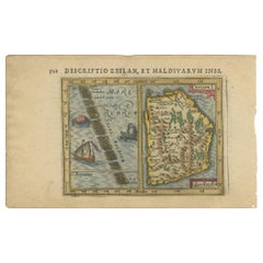
Antique Miniature Map of Ceylon 'Sri Lanka' and the Maldives by Bertius, 1618
Located in Langweer, NL
Antique map titled 'Descriptio Zeilan, et Maldivarum Inss'. Rare, original antique miniature map of Ceylon/Sri Lanka and the Maldives. This map originate...
Category
Antique Early 17th Century Maps
Materials
Paper
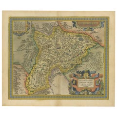
Antique Map of the Region of Salzburg by Ortelius 'circa 1606'
Located in Langweer, NL
Antique map titled 'Salisburgensis Iurisdictionis'. Original antique map of the region of Salzburg, Austria. Published by A. Ortelius, circa 1606.
Category
Antique Early 17th Century Maps
Materials
Paper
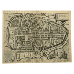
Antique Map of the City of Rotterdam by Guicciardini, C.1600
Located in Langweer, NL
Antique map titled 'Rotterdam'. Bird's eye view plan of Rotterdam in the province of Zuid-Holland, The Netherlands, Holland. This map originates from one of the editions of 'Discritt...
Category
Antique 17th Century Maps
Materials
Paper
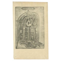
Antique Map of the City of Franeker by Guicciardini, 1613
Located in Langweer, NL
Antique map titled 'Franicher'. Plan of the city of Franeker, Friesland, the Netherlands. This map originates from the 1613 edition of 'Discrittione di tutti i Paesi Bassi', by L. Gu...
Category
Antique 17th Century Maps
Materials
Paper
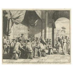
The Iron Duke of Alva of Spain Planning the Atrocities Against the Dutch, c.1680
Located in Langweer, NL
Antique print titled ‘Afbeeldinge van de Spaansche Bloedraad in den Jaare 1567 door den Hartog van Alva aangestelt’.
The Duke of Alva and his entourage seated at a table planning...
Category
Antique 1680s Prints
Materials
Paper
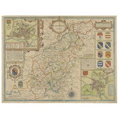
Antique Map of Northamptonshire by Speed, 1676
Located in Langweer, NL
Antique map titled 'Norhamtonshire'. Map of Norhamptonshire, England. Includes inset town plans of Peterborough and Northampton. This map originates from 'Theatre of Great Britaine' ...
Category
Antique 17th Century Maps
Materials
Paper
Antique Flemish Baroque painting, 17th Century Portrait "Medici" Oil on canvas.
By Justus Sustermans
Located in Berlin, DE
Antique Flemish Baroque painting, 17th century, portrait, Medici. Oil on canvas.
The painting is probably attributed to the Flemish painter Justus Sustermns.
Pictured is most likel...
Category
17th Century Baroque Portrait Paintings
Materials
Canvas, Oil
Antique Map of the Maluku Islands by Blaeu, c.1640
Located in Langweer, NL
Antique map titled 'Moluccae Insulae Celeberrimae'. Decorative map of the Maluku Islands, also known as the Moluccas or the Spice Islands. Inset of the island of Bachian (Batjan) in ...
Category
Antique 17th Century Maps
Materials
Paper
Flowers Paint Oil on canvas Old master 17th Century Italy Still-life Art
Located in Riva del Garda, IT
Master of the Grotesque Vase (active in Rome and Naples in the first quarter of the 17th century)
Still life of flowers in a classic vase
oil on canvas
66 x 51 cm, In frame cm. 82 x...
Category
17th Century Old Masters Paintings
Materials
Oil
Antique Map of Friesland by Guicciardini, 1613
Located in Langweer, NL
Antique map titled 'Frisia Occidenta.' (Map of the province of Friesland, the Netherlands.) This original old antique print / plate originates from the scarse French edition of 'Desc...
Category
Antique 17th Century Maps
Materials
Paper
Antique Map of the Region of Valois by Hondius, circa 1630
Located in Langweer, NL
Antique map titled 'Le Pais de Valois'. Old map of the historic region of Valois, France. It corresponds to the southeastern quarter of the modern département of Oise, with an adjace...
Category
Antique Mid-17th Century Maps
Materials
Paper
Rare Animals Lea Capra, Fantasy Creature, Ovis Cretensis, Camelo Pardalis, 1657
Located in Langweer, NL
Antique print of various animals; Lea Capra - Fantasy creature, Ovis Cretensis, Camelo Pardalis. This print originates from 'Historiae Naturalis (..)'...
Category
Antique 17th Century Prints
Materials
Paper
Rare Antique Engraving of a Dromedary, 1657
Located in Langweer, NL
Antique print of a dromedary. This print originates from 'Historiae Naturalis (..)' by John Johnston, published by Matthias Merian in 1657.
Artists and Engravers: John Johnston (o...
Category
Antique 17th Century Prints
Materials
Paper
Detailed Map of Southern Holland, Incl the Hague, Rotterdam, Delft, Gouda, c1680
Located in Langweer, NL
Antique map titled 'Delflandia, Schielandia et circumjacentes Insulae ut Voorna, Overflackea, Goerea, Yselmonda et aliae.'
Detailed map of Southern Holland, which includes the ci...
Category
Antique 1680s Maps
Materials
Paper
Rare Chinese Porcelain Ming Period Ko Akae Floral Dish, ca 1600-1660
Located in Amsterdam, Noord Holland
Dish with iron-red, green, aubergine, yellow, brown and black with an insect in flight above flowering peony issuing from rockwork, the rim with flower sprays reserved on diaper-patt...
Category
Antique 17th Century Chinese Ming Decorative Dishes and Vide-Poche
Materials
Porcelain
Antique Frontispiece of 'L'Histoire Des Pays-Bas D'Emanuel De Meteren', 1618
Located in Langweer, NL
Antique frontispiece titled 'L'histoire des Pays-Bas d'Emanuel de Meteren (..)'. This print originates from 'L'histoire des Pays-Bas d'Emanuel de Meteren. Ou recueil des guerres, et ...
Category
Antique 17th Century Prints
Materials
Paper
Antique Print of the Sang-Won-Hab Mountains in China, 1665
Located in Langweer, NL
Antique print titled 'Gebergte van Sang-Won-Hab'. Old print depicting the Sang-Won-Hab mountains (China) with many ships on the river between the mountains. This print originates fro...
Category
Antique 17th Century Prints
Materials
Paper
Antique Map of the City of Coevorden by Blaeu, 1649
Located in Langweer, NL
Antique map titled 'Coeverden'. Original map of the city of Coevorden, the Netherlands. This map originates from 'Novum Ac Magnum Theatrum Urbium Belgicae Liberae Ac Foederatae' publ...
Category
Antique 17th Century Maps
Materials
Paper
Antique Print of the Town of Duinkerken ‘France’ by L. Guicciardini, 1613
Located in Langweer, NL
Beautiful bird's eye-view plan of the town of Duinkerken. From Ludovico Guicciardini.'s description of the Netherlands 'Beschrijvinghe van alle de Nederlanden anderssins ghenoemt Ned...
Category
Antique Early 17th Century Prints
Materials
Paper
17th Century French Still Life Peonies, Blossom & Tulips, 17th Century MONNOYER
By Jean-Baptiste Monnoyer
Located in Blackwater, GB
Still life with peonies, orange blossom and tulips in a vase on a ledge, 19th Century
ANTOINE MONNOYER (1670-1747) sales to $95,000
Large 17th Century French Still Life of peonies,...
Category
17th Century Still-life Paintings
Materials
Canvas, Oil
Antique Map of the City of Muiden by Merian, 1659
Located in Langweer, NL
Antique map titled 'Muyden'. Original antique map of the city of Muiden, the Netherlands. This map originates from 'Topographia Germania Inferioris' by C. Merian. Published 1659.
...
Category
Antique 17th Century Maps
Materials
Paper
Antique Map of Upper Bavaria, Germany
Located in Langweer, NL
Antique map titled 'Bavariae pars superior cum insertis et adjacentibus regionibus non solum in ejusdem ditiones generales (..). Original antique map of upper Bavaria from Regensburg...
Category
Antique Late 17th Century Maps
Materials
Paper
Antique Japanese Ko-Imari Plate Arita Japan Porcelain, ca 1660-1680
Located in Amsterdam, Noord Holland
A Rare Porcelain Dish, Arita Kilns.
Additional information:
Material: Porcelain & Pottery
Region of Origin: Japan
Period: 17th century, 18th century
Age: Pre-1800
Condition: Overall...
Category
Antique 17th Century Japanese Decorative Dishes and Vide-Poche
Materials
Porcelain
Antique Map of the Province of Gelderland, the Netherlands, c.1690
Located in Langweer, NL
Antique map titled 'Ducatus Geldriae novissima descriptio'. Map of Gelderland, The Netherlands. Shows many cities (like Arnhem, Nijmegen, Eindhoven, Zutphen, Zwolle, etc), roads, riv...
Category
Antique 17th Century Maps
Materials
Paper
Antique Map of Stavoren by Blaeu, 1649
Located in Langweer, NL
Antique map titled 'Staveren'. Original antique map of the city of Stavoren, Friesland, The Netherlands. This map originates from 'Novum Ac Magnum Theatrum Urbium Belgicae Liberae Ac...
Category
Antique 17th Century Maps
Materials
Paper
Antique Map of the Province of Kilan by Olearius '1662'
Located in Langweer, NL
Antique map titled 'A Map of ye Province of Kilan as it lies on ye Caspian Sea'. Rare map of the province of Kilan, near the Caspian Sea. Originates from 'The voyages and travells of the Ambassadors sent by Frederick Duke of Holstein, to the Great Duke of Muscovy, and the King of Persia...
Category
Antique Mid-17th Century Maps
Materials
Paper
Antique Map of Sloten, IJlst, Workum & Hindeloopen by Blaeu, 1652
Located in Langweer, NL
Antique map titled: 'Sloten - Ylst - Worcum - Hinloopen.' - Three plans and a bird's eye view on one sheet. The plans show the Frisian cities Sloten, IJlst, Workum and the view shows...
Category
Antique 17th Century Maps
Materials
Paper
Antique Map of Mar del Sur, Chile, Peru, New Guinea and Tierra del Fuego, 1621
Located in Langweer, NL
Uncommon and rare map of Mar del Sur and the coast of Peru. With inset maps of part of New Guinea and Tierra del Fuego. This map originates from 'Miroir Oost &...
Category
Antique 17th Century Maps
Materials
Paper
Antique Botany Print of a Limonium Flowering Plant, circa 1680
Located in Langweer, NL
Antique botany print titled 'Limonium minus Bellidis (..)'. Original antique print of a limonium flowering plant. This print originates from 'Me´moires pour servir a' l'histoire des ...
Category
Antique Late 17th Century Prints
Materials
Paper
Antique Map of Flanders 'Belgium' by F. de Wit, circa 1680
Located in Langweer, NL
Antique map titled 'Comitatus Flandriae Tabula, in Lucem Edita'. Large map of Flanders, Belgium. Published by F. de Wit, circa 1680.
Category
Antique Late 17th Century Maps
Materials
Paper
Antique Map of the Region of Île-de-France by Hondius, circa 1630
Located in Langweer, NL
Antique map titled Gouvernement de l'Isle de France'. Old map of the region of Île-de-France, France. It is located in the north-central part of the country and often called the régi...
Category
Antique Mid-17th Century Maps
Materials
Paper
Antique Map of the Region of Guyenne by Janssonius, 1657
By Johannes Janssonius
Located in Langweer, NL
Antique map of France titled 'Description du Guienne'. Decorative map of Guyenne region. Guyenne or Guienne was an old French province which corresponded roughly to the Roman provinc...
Category
Antique 17th Century Maps
Materials
Paper
Antique Map of the City of Leeuwarden by Guicciardini, 1613
Located in Langweer, NL
Antique map tited 'Lewardum'. Plan of the city of Leeuwarden, Friesland, the Netherlands. This map originates from the 1613 edition of 'Discrittione di tutti i Paesi Bassi', by L. Gu...
Category
Antique 17th Century Maps
Materials
Paper
Antique Map of Nova Zembla by Janssonius, c.1650
Located in Langweer, NL
Antique map titled 'Nova Zemla, waygats fretum Nassovi cum et terra Samoiedum singula omnium emendatissime descripta'. This map depicts Nova Zembla and the northern continental coast...
Category
Antique 17th Century Maps
Materials
Paper
Antique Map of the Region of Saintonge by Janssonius, 1657
By Johannes Janssonius
Located in Langweer, NL
Antique map 'La Saintonge vers le Midy avecq le Brovageais'. Decorative map of the Saintonge region, a former province of France located on the west central Atlantic coast. This map ...
Category
Antique Mid-17th Century Maps
Materials
Paper
Antique Ming Kosometsuke Chinese Porcelain Dish Literati Hongwu Marked
Located in Amsterdam, Noord Holland
A chinese Tianqi period, 17th century dish, Jingdezhen Kilns.
Diameter: 17 CM
This porcelain dish is depicting motif of Coin 洪武通宝 Hong Wu Tong Bao (coin of Emperor Hongwu) and auspi...
Category
Antique 17th Century Chinese Ming Planters, Cachepots and Jardinières
Materials
Porcelain
Antique Map of Drenthe, a Province of The Netherlands, 1635
Located in Langweer, NL
Antique map titled 'Drentiae'. Original antique map of the province of Drenthe, the Netherlands. This map originates from 'Vyerige Colom verthonende de 17 Nederlandsche Provintien.',...
Category
Antique 17th Century Maps
Materials
Paper
Amazingly Decorative Antique Fireback / Backsplash
Located in Haarlem, Noord-Holland
Superb tal cast iron fireback or backsplash.
This beautifully detailed fireback was originally a piece of a 17th century stove.
These were taken apart and sold separately.
Beaut...
Category
Antique 17th Century Architectural Elements
Materials
Iron
Antique Map of the Adriatic Sea and the Balkan by J. Janssonius, circa 1650
Located in Langweer, NL
Striking large-scale map of the Greater Balkans. Decorated with two large-scale cartouches, one showing two swordsman at odds with one another and the other ...
Category
Antique Mid-17th Century Maps
Materials
Paper
Antique Print of the Poppendam Estate by Smallegange, 1696
Located in Langweer, NL
Antique print titled 'Huys en Hoff te Poppendamm'. Copper engraving of the estate of Poppendam, the Netherlands. This print originates from 'Nieuwe Cronyk van Zeeland' by Mattheus Sm...
Category
Antique 17th Century Prints
Materials
Paper
Pair Sculptures Winged Angels Wood Tuscany 17/18th Century Old master Gold Art
Located in Riva del Garda, IT
Pair of sculptures depicting two winged angels in carved wood
Tuscany, late 17th century
Carved, gilded and polychrome wood
Dimensions: Height 64 cm - ...
Category
17th Century Old Masters Sculptures
Materials
Wood
Antique Map of the Province Groningen in The Netherlands, c.1680
Located in Langweer, NL
Antique map titled 'Groningae et Omlandiae Dominium vulgo de Provincie van Stadt en Lande'.
Old map of the province of Groningen, the Netherlands. This map originates from 'Germani...
Category
Antique 17th Century Maps
Materials
Paper
Antique Map of the Namur Region in France by Coronelli, c.1695
By Vincenzo Coronelli
Located in Langweer, NL
Antique map titled 'Contado di Namur (..)'. Old map of the Namur region in central Belgium. Includes several coats of arms.
Artists and Engravers: The remarkable Vincenzo Coronell...
Category
Antique 17th Century Maps
Materials
Paper
Antique Map of the Rhine-Palatinate by Janssonius, circa 1630
Located in Langweer, NL
Antique map titled 'Nova Descriptio Palatinatus Rheni'. Detailed map of the Rhine-Palatinate, a state of Germany located in the west of the country. The map tracks the course of the ...
Category
Antique Mid-17th Century Maps
Materials
Paper
Antique Map of the City of Alkmaar by Priorato, 1673
Located in Langweer, NL
Antique map titled 'Alcmaer'. Original map of the city of Alkmaar, the Netherlands. This map originates from 'Teatro del Belgio', by G. Gualdo Priorato. Artists and Engravers: Author: Galeazzo Gualdo Priorato (1606-1678) entered military service at a very young age and served in Flanders under the Prince of Orange. After his retirement, he authored several historical accounts including the Teatro del Belgio, which described the Catholic/Protestant wars in Belgium and Netherlands during the seventeenth century. His superb plans do not show the internal layout of the cities, except for showing the locations of the major churches. Instead the emphasis is on the fortification, as well as on the surrounding site, rivers and canals...
Category
Antique 17th Century Maps
Materials
Paper
Antique 17th Century Map of the Islands Near Ceylon or Sri Lanka, 1672
Located in Langweer, NL
Antique map titled 'Eyland Ceylon.' Map of the islands near Ceylon or Sri Lanka. Dutch text on verso. Source unknown, to be determined.
Artists and Engravers: Philip Baldaeus (1632-...
Category
Antique 17th Century Maps
Materials
Paper
Original Antique Map of the City of Stavoren, Friesland, The Netherlands, 1649
Located in Langweer, NL
Antique map titled 'Staveren'. Original antique map of the city of Stavoren, Friesland, The Netherlands. This map originates from 'Toonneel der Steden van de Vereenighde Nederlanden'...
Category
Antique 1640s Maps
Materials
Paper
Antique Map of the City of Gorinchem by Merian, 1659
Located in Langweer, NL
Antique map titled 'Gorckum'. This print depicts the city of Gorinchem (or Gorcum/Gorkum, The Netherlands). This print originates from 'Topographia Germaniae Inferioris (..)' by C. M...
Category
Antique 17th Century Maps
Materials
Paper
Antique Map of the City of Franeker by Blaeu, 1652
Located in Langweer, NL
Antique map titled 'Franekera'. Old map of the city of Franeker, Friesland. Also shows two cartouches, coats of arms and legend. This map originates from a Latin edition of the town ...
Category
Antique 17th Century Maps
Materials
Paper
Antique Map of the Namur Region 'France' by F. de Wit, circa 1680
Located in Langweer, NL
Antique map titled 'Comitatus Namurci Tabula in Lucem Edita'. Large map of the Namur region, France. Published by F. de Wit, circa 1680.
Category
Antique Late 17th Century Maps
Materials
Paper
Antique Pair 17th C Dehua Blanc de Chine Whistles European figures on a horse
Located in Amsterdam, Noord Holland
A pair of Shunzhi or Kangxi Blanc de Chine Porcelain figures on horses.
Blanc de Chine Statues like these were made in the kilns of Dehua in Fujian province.
These are rare example...
Category
Antique 17th Century Chinese Ming Planters, Cachepots and Jardinières
Materials
Porcelain
Antique Map of the Region of Zevenwouden in Friesland, The Netherlands, 1635
Located in Langweer, NL
Antique map titled 'De Zeeven Wolden'. Map of the region of Zevenwouden (or Zevenwolden) in Friesland, the Netherlands. This region include the villages of Langweer, Echtenerbrug, Le...
Category
Antique 17th Century Maps
Materials
Paper
Antique Map of the Region of Kollumerland by Schotanus, 1664
By B. Schotanus
Located in Langweer, NL
Antique map titled 'De Grietenije van Kollumer landt (..).' Map of the Grietenij of Kollumerland, Friesland, The Netherlands. Multiple cartouches, key and coat of arms. "Beschrijving...
Category
Antique 17th Century Maps
Materials
Paper
Antique Map of Southern Germany and Switzerland by Cluver, 1685
Located in Langweer, NL
"Antique map titled 'Vindeliciae et Norici conterminarunque terrarum antiqua descriptio.' Miniature map of south Germany and Switzerland in Celtic times, From the pocket atlas 'Intro...
Category
Antique 17th Century Maps
Materials
Paper
Antique Map of the Region of Beauce in France by Janssonius, c.1650
Located in Langweer, NL
Antique map of France titled 'La Beauce'. Decorative map of the region of Beauce, a natural region in northern France, located between the Seine and Loire ri...
Category
Antique 17th Century Maps
Materials
Paper
Antique Map of the Alsace Region of France by Janssonius, c.1650
Located in Langweer, NL
Antique map titled 'Utriusquae Alsatiae Superioris Ac Inferioris Nova Tabula'. Map of the Alsace region (France) including the Rhine from Phillipsburg to south of Basle. Two decorati...
Category
Antique 17th Century Maps
Materials
Paper
Antique Map of Overijssel by Visscher, c.1652
Located in Langweer, NL
Antique map titled 'Transisalania provincia vulgo Over-yssel'. Original antique map of the province of Overijssel, the Netherlands. Published by N. Visscher after N. ten Have, circa ...
Category
Antique 17th Century Maps
Materials
Paper
Antique Print of the Igel Column and Church, c.1650
Located in Langweer, NL
Untitled print of the Igel Column (Igeler Säule) near Trier. The Igel Column is a multi-storeyed Roman sandstone column in the municipality of Igel, Ge...
Category
Antique 17th Century Prints
Materials
Paper
