Sale
to
1,991
300
127,827
122,904
51,735
50,873
36,471
26,540
17,358
16,150
13,146
10,625
9,481
9,171
8,430
7,302
6,016
5,693
5,383
4,441
4,332
4,100
2,925
2,563
2,360
1,807
1,541
1,407
1,401
1,387
787
661
635
597
550
498
447
447
421
389
327
326
306
299
212
208
168
158
157
154
126
98
91
90
87
86
80
54
54
38
31
26
16
16
56
18
12
7
5
Period: 17th Century
Period: 1650s
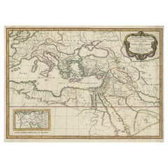
Antique Map of the Holy Land Described in the Old and New Testament, ca.1660
Located in Langweer, NL
Antique map titled 'Geographiae Sacrae ex Veteri et Novo Testamento Desumptae Tabula Prima quae Totius Orbis Partes Continet.'
Map of the lands described in the Old and New Testame...
Category
Antique 1660s Maps
Materials
Paper
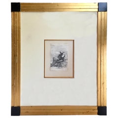
Fine 17th Century Italian Etching by Salvator Rosa, 1615-1673
By Salvator Rosa
Located in Vero Beach, FL
Salvator Rosa, the Italian Baroque painter was also a significant etcher and printmaker. Rosa’s is series of small prints of soldiers was very popular and influential. This etching i...
Category
Antique 17th Century Italian Baroque Prints
Materials
Paper
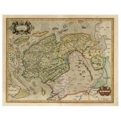
Old Map of the Dutch Provinces of Friesland and Groningen, The Netherlands, 1604
Located in Langweer, NL
Antique print, titled: 'Frisiae Occidentalis.'
Handsome map of the Dutch Provinces of Friesland and Groningen. Embellished with strapwork title-car...
Category
Antique Early 1600s Maps
Materials
Paper
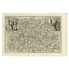
Antique Map of the Franconia Region by Scherer, 1699
Located in Langweer, NL
Antique map titled 'Franconia multa numerat loca deiparae sacra in quibus magna recipit à dei matre beneficia.' Detailed uncommon map of the Franconia region in Germany. Source unkno...
Category
Antique 17th Century Maps
Materials
Paper
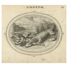
Rare Antique Print of A Cupid being Eaten by A Crocodile, ca. 1608
Located in Langweer, NL
Antique print of Cupid and a crocodile.
This print originates from 'Amorum Emblemata', this work includes engravings of Cupids encountering the various trials of Love. The emblematic illustrations include verses in Latin, Dutch and French. The verse of this print would translate to 'Love is the opposite of a crocodile. They say the crocodile has such a nature, that he cries when he is killing and devouring men. But Amor has an opposite nature, for he laughs when he makes lovers perish'.
Artists and Engravers: Otto van Veen...
Category
Antique Early 1600s Prints
Materials
Paper
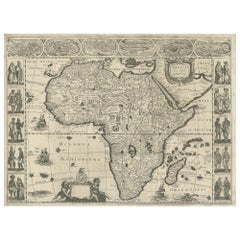
Antique Map of Africa Made after Hondius, circa 1655
Located in Langweer, NL
Antique map titled 'Africa Nova Tabula Auct Jud. Hondio'. Beautiful and rare paneled map of Africa, Based Upon Hondius' map. The first derivative of the map was issued separately by ...
Category
Antique Mid-17th Century Maps
Materials
Paper
Antique Map of Northern Switzerland by Janssonius '1657'
By Johannes Janssonius
Located in Langweer, NL
Antique map 'Zurichgow et Basiliensis provincia'. Detailed map of northern Switzerland, including Zurich and Basel. This map originates from 'Atlas Novus, Sive Theatrum Orbis Orbis T...
Category
Antique Mid-17th Century Maps
Materials
Paper
Original Antique Engraving of a Statue of a Sabine Woman in Rome, Italy
Located in Langweer, NL
Antique print, titled: 'Sabina in Hortis Ludovisianis.' - Statue of a Sabine woman in Rome. The Sabines were an Italic tribe which lived in the central Apennines of ancient Italy.
From the 1660 Dutch edition of 'Icones et Segmenta Nobil. Signorum et Statuarum quae Romae extant' by Francois Perrier. This first Dutch edition was published by Nicolaas Visscher, printed in 1660 (Amsterdam). Although Perrier was French, he fell in love with Rome when he traveled there first in 1628 and then returning in 1635 and remaining for 10 years. While there, he completed this series of 100 views of Roman statuary in the various palaces and gardens, including the Medici and Vatican gardens and the Palazzo Farnese.
Artists and Engravers: Made by 'Cornelis van Dalen...
Category
Antique 1660s Prints
Materials
Paper
Antique Print of the City of Namhun in China by Nieuhof, 1668
Located in Langweer, NL
Antique print China titled 'Namhun'. Old print depicting a view on the Chinese city of Namhun with its ramparts. This print originates from the Latin edition of Nieuhof's work titled...
Category
Antique 17th Century Prints
Materials
Paper
Original Hand-Colored Antique Map of Ancient Germany, circa 1630
Located in Langweer, NL
Antique map titled 'Germaniae Veteris typus'. Very attractive map of ancient Germany. Published by G. Blaeu after A. Ortelius, circa 1630.
Willem Jans...
Category
Antique Mid-17th Century Maps
Materials
Paper
Antique 17th Century Brussels Mythological Boar's Head Tapestry, by Jan Leyniers
By Charles Le Brun, Jan Leyniers
Located in New York, NY
An antique 17th century Brussels mythological tapestry, size 11'6 H x 10'8 W, from the workshop of the renowned weaver, Jan Leyniers, after cartoons by Charles Le Brun...
Category
Antique 17th Century Belgian Tapestries
Materials
Wool, Silk
Antique Map of the City of Zutphen by Guicciardini, 1613
Located in Langweer, NL
Antique map Zutphen titled 'Zutphen'. This map depicts the city of Zutphen, Gelderland, The Netherlands. Originates from 'Discrittione di tutti i Paesi Bassi'.
Artists and Engrav...
Category
Antique 17th Century Maps
Materials
Paper
Antique Map of the Province of Zeeland, The Netherlands by Coronelli, 1692
Located in Langweer, NL
Antique map titled 'Contado di Zelanda'. Beautiful map of the Dutch province of Zeeland. With the islands of Walcheren, Schouwen-Duiveland, Noord-Beveland, Zuid-Beveland, Tholen and ...
Category
Antique 17th Century Maps
Materials
Paper
Antique Map of the Empire of the Great Mogul
Located in Langweer, NL
Antique map titled 'Magni Mogolis Imperium'. This map depicts the Empire of the Great Mogul in northern India including the region from Iran to Burma. The Indus and Ganges Rivers are...
Category
Antique Late 17th Century Maps
Materials
Paper
Antique Map of the Burgundy Region by Merian, 1646
Located in Langweer, NL
Antique map titled 'Utriusque Burgundiae tum Ducatus tum Comitatus descriptio'. Old map of the Burgundy region of France. This map originates from 'Neuwe Archontologia cosmica'. Arti...
Category
Antique 17th Century Maps
Materials
Paper
Antique Print of Brittenburg 'Near Katwijk' in the Netherlands by Blaeu, 1649
Located in Langweer, NL
Antique print titled 'Arx Britannica'. View of De Brittenburg, a Roman ruin on the Dutch coast near Katwijk, The Netherlands. Originates from 'Toneel der Steeden' published by Joan B...
Category
Antique 17th Century Prints
Materials
Paper
Rare Kangxi Chinese Porcelain Famille Noir Dish Birds Flower, ca 1700 Early
Located in Amsterdam, Noord Holland
Kangxi period and amazing quality dish with different kind of flowers, trees and birds in verte palette on a black ground. Base with bamboo sprouts on yellow ground and a shop mark.
Additional information:
Material: Porcelain & Pottery
Region of Origin: China
Period: ca 1700 Qing (1661 - 1912)
Age: Pre...
Category
Antique 17th Century Chinese Qing Decorative Bowls
Materials
Porcelain
Antique Portrait of Johan II, King of Sweden by Janszoon, 1615
Located in Langweer, NL
Antique portrait titled 'Ioannes II (..)'. Portrait of Johan II of Sweden. This print originates from 'Tooneel der keyseren ende coningen van christenryck sedert den onderganck van h...
Category
Antique 17th Century Prints
Materials
Paper
17th Century Flemish Hand-Carved Oakwood Cabinet
Located in Casteren, NL
17th century flemish hand-carved oakwood cabinet.
Originates Belgium, dating approximately 1680.
Category
Antique Late 17th Century Belgian Cabinets
Materials
Oak
Original Antique Engraving of Sakai in the Osaka Prefecture, Japan, 1669
Located in Langweer, NL
Antique print, titled: 'De Stadt Saccai. La Ville de Saccai.' - ('The City Saccai').
This plate shows a view of Sakai in the Osaka Prefecture, Japan. Sakai has been one of the la...
Category
Antique 1660s Maps
Materials
Paper
Antique Map of the Westphalia region of Germany
Located in Langweer, NL
Antique map titled 'Circulus Westphaliae (..)'. Original old map of the Westphalia region, Germany. Published by Justus Danckerts, circa 1696.
Justus Danckerts I (11 November 1635 ...
Category
Antique Late 17th Century Maps
Materials
Paper
Antique Map of the Archdiocese of Cologne, Germany
Located in Langweer, NL
Antique map titled 'Archevesche et Eslectorat de Cologne avec ses Enclaves'. Original old map of the Archdiocese of Cologne with the course of the Rhine from Andernach to Wesel with ...
Category
Antique Late 17th Century Maps
Materials
Paper
Aly Faustina Cum Gladiatore, Van Dalen, Etching on Paper, 1660
Located in Langweer, NL
Antique print, titled: 'Aly Faustina cum Gladiatore (…).' - Statue of Faustina and a gladiator in Rome. From the 1660 Dutch edition of 'Icones et Segmenta Nobil. Signorum et Statuarum quae Romae extant' by Francois Perrier...
Category
Antique 17th Century Prints
Materials
Paper
Antique Print of Deer Hunting, circa 1680
Located in Langweer, NL
Copper engraving depicting a stag hunt. It shows deer hunting. Source unknown, to be determined.
Artists and Engravers: Jean le Pautre (1618-1682) was ...
Category
Antique 17th Century Prints
Materials
Paper
Antique Hand-colored Map of Brandenburg, Germany
Located in Langweer, NL
Antique map titled 'Marchionatus Brandenburgicus'. Original antique map of Brandenburg, with Königsberg and Stettin, Germany. Published by J. Janssonius, circ 1650.
Jan Janssonius ...
Category
Antique Mid-17th Century Maps
Materials
Paper
Antique Map of the German Empire with decorative Title Cartouche
Located in Langweer, NL
Antique map titled 'Germania, Non ea tantum quae Rheno, Vistula, Danubio, mariqz Germanico Veteribus claudebatur; Sed tota illa continens quae hodie communiter Germanica lingua utitu...
Category
Antique Early 17th Century Maps
Materials
Paper
Antique Map of Batavia 'Jakarta', Indonesia by Montanus, circa 1669
Located in Langweer, NL
Antique map Batavia titled 'Ware Affbeeldinge wegens het Casteel ende Stadt Batavia'. Antique print of the castle and city of Batavia on the Island of Java'. Rare edition with Englis...
Category
Antique 17th Century Maps
Materials
Paper
Rare 17th C. Tuscan Baroque Credenza Console Cabinet Italian Sideboard LA CA
Located in West Hollywood, CA
Rare 17th C. Tuscan Baroque Credenza Console Cabinet Italian Sideboard LA CA . A good late 17th century-early 18th century Tuscan baroque polychrome decorated credenza cabinet 2 door...
Category
Antique Late 17th Century Italian Baroque Credenzas
Materials
Iron
The Whale Harvest of St. Mary's Island - Copper Engraving by de Bry, 1601
Located in Langweer, NL
Original Antique engraving by Theodore De Bry from 'Pars Quarta Indiae Orientalis...,' 1601, with descriptive latin text below the image.
This 1601 e...
Category
Antique Early 17th Century Prints
Materials
Paper
The Melancholy Tree of the East: A 1601 de Bry Engraving from 'Indiae Orientalis
Located in Langweer, NL
This engraving from Theodore de Bry's "Indiae Orientalis" showcases a serene yet intriguing scene titled "EFFIGIES ILLIUS ARBORIS, QUAM TRISTEM VOCANT,...
Category
Antique Early 17th Century Prints
Materials
Paper
New World Flora: Aloe, Maguey, and Mexican Plants in De Bry's 1601 Work
Located in Langweer, NL
Title: "New World Flora: Aloe, Maguey, and Mexican Plants in De Bry's 1601 Work"
Description: This engraving by Theodore de Bry from 1601 offers a detai...
Category
Antique Early 17th Century Prints
Materials
Paper
Verdant Wonders: Exotic Trees and Spices of India in De Bry's 1601 Illustration
Located in Langweer, NL
Title: "Verdant Wonders: Exotic Trees and Spices of India in De Bry's 1601 Illustration"
Description: This striking 1601 engraving by Theodore de Bry, titled "IDEA LANTOR, ASSA, PIM...
Category
Antique Early 17th Century Prints
Materials
Paper
Botanical Illustration of Saint Lawrence's (Madagascar) Seeds and Plants, 1601
Located in Langweer, NL
"Botanical Illustration of Saint Lawrence's Seeds and Plants by De Bry, 1601"
Description: This engraving from Theodore de Bry's collection, produced in 1601, features a botanical study of various seeds and plants native to the island of Saint Lawrence, also known as Madagascar. Each plant is meticulously rendered with Latin letters corresponding to a legend that identifies them. This careful study was part of De Bry’s extensive work to document and illustrate the flora and fauna encountered by European explorers during their voyages to exotic lands.
The illustration captures the diverse plant life from the island, from the bulbous shapes of the roots in the foreground to the towering forms of the trees in the background. The detail in the image reflects the European fascination with new and foreign natural history, a subject that was growing in popularity and significance during the Age of Exploration. De Bry's works served not only as scientific records but also as means to captivate and educate his contemporaries about the wonders of the natural world.
Translation of the Latin text:
"There is a certain tree, its summit dividing into the smallest of branches. From this, the Chaonas nuts are collected. B. The House of...
Category
Antique Early 17th Century Prints
Materials
Paper
Original Antique Map of the Holy Land with Decorative Cartouche
Located in Langweer, NL
Antique map titled 'Totius Terrae Sanctae'. Original old map of the Holy Land, with a large decorative cartouche. The term "Holy Land" usually refers to a territory roughly correspon...
Category
Antique Late 17th Century Maps
Materials
Paper
Antique Map of the Limoges Region in France, c.1690
Located in Langweer, NL
Antique map titled 'Le Diocèse de Limoges'. Large map of the Limoges region, France.
The map is dedicated to the bishop of Limoges, Antoine de Charpin.
Artists and Engravers:...
Category
Antique 17th Century Maps
Materials
Paper
Antique Print of the Imperial Palace in Peking by Nieuhof, 1668
By Johan
Located in Langweer, NL
Antique print China titled ‘Interior aulae Imperatoriae facies'. Antique print of the Imperial Palace in Peking, China. This print originates from the Latin edition of Nieuhof's work...
Category
Antique 17th Century Prints
Materials
Paper
Antique Map of the Coast of Africa and the Cape Verde Islands, ca.1680
Located in Langweer, NL
Antique map Africa titled 'Isles du Cap Verd Coste et Pays des Negres'.
Antique map of the coast of Africa and the Cape Verde islands.
Artis...
Category
Antique 1680s Maps
Materials
Paper
Antique Map of the region between Bergen op Zoom, Sandvliet, Hulst and Antwerp
Located in Langweer, NL
Original antique map titled 'Tabula Castelli ad Sandflitam (..)'. Detailed map of the region between Bergen op Zoom, Sandvliet, Hulst and Antwerp. Published by J. Janssonius, circa 1...
Category
Antique Mid-17th Century Maps
Materials
Paper
Original Old Map of South East England Incl London, Oxford, Cambridge, Etc, 1633
Located in Langweer, NL
Antique map titled 'Warwicum, Northhamtonia, Huntingdonia, Cantabrigia, Suffolcia, Oxonium, Buckinghamia, Befordia, Harfordia, Essexia, Berceria, Middlesexia, Southhatonia, Surria, Catiu & Southsexia'.
Old map of south east England. Includes London, Salisbury, Oxford, Cambridge, Leicester and Norwich and the Isle of Wight. Originates from the 1633 German edition of the Mercator-Hondius Atlas Major, published by Henricus Hondius and Jan Jansson under the title: 'Atlas: das ist Abbildung der gantzen Welt, mit allen darin begriffenen Laendern und Provintzen: sonderlich von Teutschland, Franckreich, Niderland, Ost und West Indien: mit Beschreibung der selben.'
Artists and engravers: Gerard Mercator (1512 - 1594) originally a student of philosophy was one of the most renowned cosmographers and geographers of the 16th century, as well as an accomplished scientific instrument maker. He is most famous for introducing Mercators Projection, a system which allowed navigators to plot the same constant compass bearing on a flat map.
Category
Antique 1630s Maps
Materials
Paper
Antique Map of the Region involved in the Conquest of Cyrus the Great
Located in Langweer, NL
Antique map titled 'Tabula Itineris Decies Mille (..)'. This historical map illustrates the region involved in the conquest of Cyrus the Great (558-528 BC), the founder of the Persia...
Category
Antique Mid-17th Century Maps
Materials
Paper
Antique Map of Berkshire, South East England
By Joan (Johannes) Blaeu
Located in Langweer, NL
Antique map titled 'Bercheria vernacule Barkshire'. Original old map of Berkshire, a historic county in South East England. Published circa 1665 by J. Blaeu. Willem Jansz. Blaeu and ...
Category
Antique Mid-17th Century Maps
Materials
Paper
Antique Print of the City of Sloten, Friesland, the Netherlands, circa 1630
Located in Langweer, NL
Antique print titled 'Sloten'. Beautiful view of the Frisian city of Sloten, the Netherlands. This print originates from Meisner's 'Politisches Schatzkastleins'.
Artists and Engra...
Category
Antique 17th Century Prints
Materials
Paper
Antique Map of the Northeast of England by Mercator 'circa 1620'
Located in Langweer, NL
Antique map titled 'Eboracum Lincolnia, Derbia, Staffordia, Notinghamia, Lecestria, Rutlandia, et Norfolcia'. Decorative early map of the northeast of England, comprising the countie...
Category
Antique Early 17th Century Maps
Materials
Paper
Original Antique Map of the East Indies (Indonesia) by Janssonius, c.1644
By Johannes Janssonius
Located in Langweer, NL
Antique map titled 'India quae Orientalis dicitur, et Insulae adiacentes'. Old map of the East Indies and Southeast Asia showing the area between India in the West and parts of Japan...
Category
Antique 17th Century Maps
Materials
Paper
Antique Portrait of Gaspard III de Coligny, c.1643
Located in Langweer, NL
Antique print titled 'Gaspard conte de Colligny de Chastillon'. Portrait of Gaspard III de Coligny, half-length directed to right, looking to front, holding a baton. This print origi...
Category
Antique 17th Century Prints
Materials
Paper
Small Original Antique Map of Upper Saxony, Germany
Located in Langweer, NL
Antique map titled 'Saxonia Superior'. Small original antique map of Upper Saxony, Germany. Upper Saxony (German: Obersachsen) was the name given to the majority of the German lands ...
Category
Antique Early 17th Century Maps
Materials
Paper
Sergio Mazza for Artemide Midcentury Table Mirror Model Narciso, Italy 1960s
By Sergio Mazza, Artemide
Located in Reggio Emilia, IT
Italian Mid-Century Modern design swivel table mirror model Narciso designed by Sergio Mazza for Artemide with white marble base, 1960s.
Please note that the item is original of the...
Category
Antique 1660s Italian Mid-Century Modern Table Mirrors
Materials
Marble, Metal
Scarce Antique Map of the Middle East, Surrounded by Latin Text, 1624
Located in Langweer, NL
Antique map titled 'Lumen Historium per Orientem (..).'
Scarce map of the Middle East, surrounded by Latin text. The two insets show Israel and an oval world map. This map (from the last edition of Ortelius Theatri Orbis Terrarum Parergon, 1624) was engraved by Franciscus Hareio. Later, this map was copied by Hornius for his World Atlas (1653).
Artists and Engravers: Franciscus Haraeus (Latinised form of Franciscus Verhaer; also known as Frans Verhaer), (Utrecht 1555? - Leuven, 11 January 1631), was a Dutch theologian, historian, and cartographer. He is best known for his history (from a Catholic point of view) of the Dutch Revolt...
Category
Antique 1620s Maps
Materials
Paper
Antique Map of the Artois Region 'France' by F. de Wit, circa 1680
Located in Langweer, NL
Antique map titled 'Tabula Comitatus Artesiae emendata'. Large map of the Artois region, France. Published by F. de Wit, circa 1680.
Category
Antique Late 17th Century Maps
Materials
Paper
17th Century Venetian Old Master Floral Still Life Oil Painting Flowers
Located in Bradenton, FL
A beautiful Italian Still Life oil painting on old canvas of an urn holding a bouquet of assorted flowers set on a ledge. 17th century....
Category
Antique 17th Century Italian Baroque Paintings
Materials
Paint
Antique Map of the course of the Rhine from Lahnstein to Rheinkassel, Germany
Located in Langweer, NL
Antique map titled 'Parte meridionale degli Stati dell 'Elet di Colonia'. This map shows the course of the Rhine from Lahnstein to Rheinkassel and the area west to Aachen, Germany. W...
Category
Antique Late 17th Century Maps
Materials
Paper
Antique Map of the region of Lennep, Blankenburg and Dortmund, Germany
Located in Langweer, NL
Antique map titled 'Berge Ducatus Marck Comitatus'. Original antique map of the region of Lennep, Blankenburg and Dortmund, Germany. Published by Hondius, circa 1644.
Category
Antique Mid-17th Century Maps
Materials
Paper
Antique Print of Chinese Monks by Nieuhof, 1665
Located in Langweer, NL
Antique print titled 'Sineesche paapen'. Old print depicting Chinese monks. This print originates from 'Het gezantschap der Nee^rlandtsche Oost-Indische ...
Category
Antique 17th Century Prints
Materials
Paper
Antique Print of a Fleet of Nine Ships Departing to the East Indies '1603'
Located in Langweer, NL
Extremely rare original antique print of a fleet of nine ships departing from Amsterdam for a voyage to the East Indies, 1603. This may be the second voyage to the East Indies for the VOC under Steven van...
Category
Antique Early 17th Century Prints
Materials
Paper
Arrival of the English King Charles II from Delft in The Hague, Holland, 1660
Located in Langweer, NL
Antique engraving with the title Arrival of the English King Charles II from Delft in The Hague, 25 May 1660. Episode during his tour through and departure from the Netherlands. Arrival at the Vijverberg and Het Groene Zoodje, salute shots are fired at the Hofvijver. In the air the fame and putti with the arms of the English king, Holland and The Hague. On the left part of the signs of the zodiac. Marked at the top: Page. 34.
In the top the Arms of the King with the text: Honi soit qui mal y pense. This a maxim in the Anglo-Norman language, a dialect of Old Norman French spoken by the medieval ruling class in England, meaning "shamed be whoever thinks ill of it", usually translated as "shame on anyone who thinks evil of it" It has been used as the motto of the British chivalric Order of the Garter. In current French usage, the phrase may be used ironically to insinuate the presence of a hidden agenda or a conflict of interest.
Makers (mentioned on the engraving): Pieter Philippe after a design of: Jacob...
Category
Antique 1660s Prints
Materials
Paper
Antique Portrait of Fernando Alvarez De Toledo, the Grand Duke of Alba, 1618
Located in Langweer, NL
Antique portrait titled 'Ferdinando Alvares a Toledo (..)'. Old portrait of Fernando Alvarez de Toledo y Pimentel or Ferdinandus Toletanus Dux Albanus (1507 - 1582), known as the Grand Duke of Alba...
Category
Antique 17th Century Prints
Materials
Paper
Finely Detailed Map Covering Northern Italy, Austria, Slovenia & Croatia, c.1690
Located in Langweer, NL
Antique map titled 'Exactissima Tabula, qua tam Danubii Fluvii Pars Superior'.
Very finely detailed map covering the region of northern Italy, Austria, Slovenia and Croatia. The co...
Category
Antique 1690s Maps
Materials
Paper
Original Antique Print of a Procession of Monks in Ceylon 'Sri Lanka', 1672
Located in Langweer, NL
Antique print, untitled. This original antique print shows a procession of monks in Ceylon. A group of dancing monks, beating drums, in front of the abbot, seated on an elephant. Dut...
Category
Antique 1670s Prints
Materials
Paper
