City Map Large Large City Map
to
117
392
385
243
236
182
160
127
123
87
78
47
47
38
38
35
33
31
30
29
22
22
19
17
16
16
15
15
13
12
12
12
11
11
11
11
10
10
9
9
7
6
6
6
6
6
6
6
5
5
4
3
3
3
3
2
2
2
2
2
2
2
1
1
54
21
16
15
12
Sort By
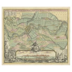
Large Antique Map of the City of Bremen and Surroundings, Germany
Located in Langweer, NL
Original antique map titled 'Prospect und Grundris der Keiserl Freyen Reichs und Ansee Stadt Bremen
Category
Antique Early 18th Century Maps
Materials
Paper
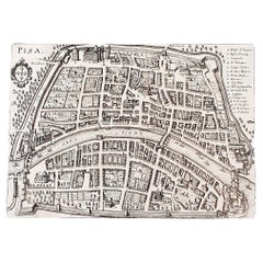
Italian Parchment Map of the City of Pisa Dated, 1640
By Matthäus Merian the Elder
Located in Florence, Tuscany
An antique map of the Tuscan city of Pisa engraved for The 'Itinerarium Italiæ Nov-antiquæ' by
Category
Antique 1640s Italian Maps
Materials
Paper
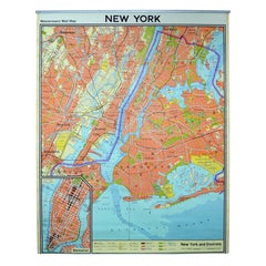
Vintage Wall Chart New York City Urban Map, USA 1950s
Located in Stockholm, SE
A classical wall chart showing a map of the city of New York. published by Westermann and with
Category
Vintage 1950s German Maps
Materials
Metal
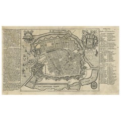
Antique Map of the City of Copenhagen in Denmark c.1720
Located in Langweer, NL
Antique map titled 'Copenhagen'. Original antique map of the city of Copenhagen, Denmark. This map
Category
Antique 18th Century Maps
Materials
Paper
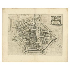
Antique Map of the City of Dokkum by Blaeu, c.1650
Located in Langweer, NL
Antique map titled 'Dockum'. Large map of the city of Dokkum, Friesland, The Netherlands
Category
Antique 17th Century Maps
Materials
Paper
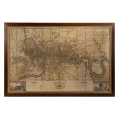
Large Scale Map of the London Metropolis
Located in Dallas, TX
The product is a large scale map of the London Metropolis, specifically focusing on the city in
Category
Mid-20th Century English Maps
Materials
Paper
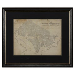
1840 Map of the City of Washington Published by William M. Morrison
Located in Colorado Springs, CO
. The map shows block numbers, wards, and government buildings as well as details of the city that have
Category
Antique 1840s American Federal Maps
Materials
Paper
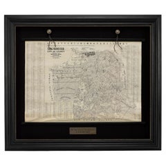
1915 "San Francisco City and County" Hanging Map by W. Bashford Smith
Located in Colorado Springs, CO
and white and is surrounded by a large index of city street names. Based on OCLC records, this map was
Category
Vintage 1910s American Art Deco Maps
Materials
Wood, Paper
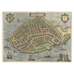
Beautiful Decorative Antique Map of the City of Dordrecht, the Netherlands, 1581
Located in Langweer, NL
Antique map titled 'Dordrecht'.
Map of the city of Dordrecht, the Netherlands. Bird's-eye plan
Category
Antique 16th Century Maps
Materials
Paper
H 15.16 in W 20.08 in D 0 in
Antique Map of the City of Dordrecht by Braun & Hogenberg, c.1581
Located in Langweer, NL
Antique map titled 'Dordrecht'. Map of the city of Dordrecht, the Netherlands. Bird's-eye plan view
Category
Antique 16th Century Maps
Materials
Paper
Antique Map of the City of Bolsward, Friesland in The Netherlands, c.1598
Located in Langweer, NL
Antique map titled ‘Bolzvardia vetus in Frisia Foederis (..)’. Old map of the city of Bolsward
Category
Antique 16th Century Maps
Materials
Paper
H 9.45 in W 10.63 in D 0 in
Historic 1690 Map of Lorraine in France by Allard - Cities of Toul, Nancy, Metz
Located in Langweer, NL
perspective on the area, which includes the cities of Toul, Nancy, Metz, and Trier. The map’s vibrant hand
Category
Antique 1690s Maps
Materials
Paper
H 19.69 in W 24.02 in D 0.01 in
18th Century French Map and City View of Joppe/Jaffa 'Tel Aviv' by Sanson
By Nicolas Sanson
Located in Alamo, CA
of the city of Joppe (in Hebrew Japho), now called Japha or Jaffa, the harbor portion of modern day
Category
Antique Early 18th Century French Maps
Materials
Paper
H 18.88 in W 23 in D 1.13 in
City View of Nuremberg, Germany: An 18th Century Hand-Colored Map by M. Seutter
By Matthew Seutter
Located in Alamo, CA
An 18th century hand-colored city view of Nuremburg, Germany entitled "Geometrischer Grundris der
Category
Antique Mid-18th Century German Maps
Materials
Paper
H 22 in W 24.25 in D 0.13 in
Very Large Vintage Map of Canada, German, Education, Institution, Cartography
Located in Hele, Devon, GB
This is a very large vintage map of Canada. A German, quality printed educational or institution
Category
Mid-20th Century German Maps
Materials
Paper
H 77.56 in W 85.04 in D 1.19 in
Historical Large Map of Kyoto, Japan (1905) - Published by Kobayashi
Located in Langweer, NL
the top, translates to "Map of Kyoto City".
### Interesting Aspects
1. Historical Context:
- This
Category
Early 20th Century Maps
Materials
Paper
Large Antique Map of France by De Wit, c.1680
By Frederick de Wit
Located in Langweer, NL
Antique map titled 'Accuratissima Galliae Tabula vulgo Royaume de France'. Detailed map of France
Category
Antique 17th Century Maps
Materials
Paper
Large 1695 Hand-Colored Engraved Map of Gascony (Gascogna), France
Located in Langweer, NL
This map, created by Giacomo Cantelli da Vignola in 1695, represents the "General Government of
Category
Antique 1690s Maps
Materials
Paper
Large Original Antique City Plan of Baltimore, USA, 1894
By Rand McNally & Co.
Located in St Annes, Lancashire
Fabulous colorful map of Baltimore
Original color
By Rand, McNally & Co.
Published, 1894
Category
Antique 1890s American Maps
Materials
Paper
Large Original Antique City Plan of Detroit, USA, 1894
By Rand McNally & Co.
Located in St Annes, Lancashire
Fabulous colorful map of Detroit
Original color
By Rand, McNally & Co.
Published, 1894
Category
Antique 1890s American Maps
Materials
Paper
1816 Large Southern Hindostan Map by J. Thomson – New General Atlas
Located in Langweer, NL
Title: 1816 Southern Hindostan Map by J. Thomson – New General Atlas
This map, titled "Southern
Category
Antique 1810s Maps
Materials
Paper
1817 Large Northern Hindostan Map by J. Thomson – New General Atlas
Located in Langweer, NL
, which played a crucial role in British colonial operations.
The map marks key cities of the period
Category
Antique 1810s Maps
Materials
Paper
Large Map of Castile's Southern Realms - Granada, Andalusia, and Murcia, 1652
Located in Langweer, NL
This antique map, titled 'Les Etats de la Couronne de Castille', represents the southern regions of
Category
Antique Mid-17th Century Maps
Materials
Paper
H 17.64 in W 23.75 in D 0.02 in
Large Original Antique City Plan of San Francisco, USA, 1894
By Rand McNally & Co.
Located in St Annes, Lancashire
Fabulous colorful map of San Francisco
Original color
By Rand, McNally & Co.
Published
Category
Antique 1890s American Maps
Materials
Paper
Large Original Antique City Plan of Philadelphia, USA, circa 1900
By Rand McNally & Co.
Located in St Annes, Lancashire
Fabulous colorful map of Philadelphia
Original color
By Rand, McNally & Co.
Published
Category
Antique Early 1900s American Maps
Materials
Paper
Large Original Antique City Plan of Montreal, Canada, circa 1900
By Rand McNally & Co.
Located in St Annes, Lancashire
Fabulous colorful map of Montreal
Original color
By Rand, McNally & Co.
Published, circa 1900
Category
Antique Early 1900s American Maps
Materials
Paper
Large Original Antique City Plan of Dublin, Ireland, circa 1880
Located in St Annes, Lancashire
Great city plan of Dublin
Published circa 1880
Unframed
Free shipping.
.
Category
Antique 1880s Scottish Maps
Materials
Paper
Very Large Double Page Detailed Map of Italy and Surrounding Regions, 1794
Located in Langweer, NL
This is a large (two seperate sheets) and detailed map of Italy, including the southern parts of
Category
Antique 1790s Maps
Materials
Paper
H 25.79 in W 36.23 in D 0 in
Large Antique Map of Asia including All of Southeast Asia, c.1792
Located in Langweer, NL
Antique map titled 'L' Asie Divisee en ses Empires, Royaumes, et Etats'. Attractive, large map of
Category
Antique 18th Century Maps
Materials
Paper
1868 "Lloyd's Topographical Railway Map of North America..." Hanging Wall Map
Located in Colorado Springs, CO
1900.” This map was published by J. T. Lloyd, in New York, in 1868. A large, hanging map of the United
Category
Antique 1860s American Late Victorian Maps
Materials
Linen, Paper
H 60 in W 67.5 in D 1 in
Large Original Antique City Plan of Lucknow, India. Edward Weller, 1861
Located in St Annes, Lancashire
Great city plan of Lucknow
Lithograph engraving by Edward Weller
Original colour
Published, 1861
Category
Antique 1860s English Victorian Maps
Materials
Paper
Large Copper Engraved Map of the Coastline of Friesland and Terschelling, c.1670
Located in Langweer, NL
Antique print, titled: 'Dominii Frisiae Tabula, inter Flevum et Lavicum (…)'
This large copper
Category
Antique 1670s Maps
Materials
Paper
H 20.28 in W 23.9 in D 0 in
Map of Samoa or Schiffer-Inseln (Navigator Islands) - 19th Century German Map
Located in Langweer, NL
.
In the lower section of the map, there is a detailed inset of Upolu at a larger scale (1:375,000
Category
Antique 1890s Maps
Materials
Paper
H 5.91 in W 9.26 in D 0.01 in
Large 1750 Map of the Kingdoms of Spain and Portugal by Robert de Vaugondy
Located in Langweer, NL
the western edge of the map).
- **Barcelona** (a key city on the northeastern coast of Spain, an
Category
Antique Mid-18th Century Maps
Materials
Paper
H 20.56 in W 27.84 in D 0.02 in
Old Map of Prussia, Embellished with a Large Cartouche and Compass Rose, ca.1680
Located in Langweer, NL
Blaeu published a collection of Dutch city maps named Tooneel der Steeden (Views of Cities). In 1651 he
Category
Antique 1680s Maps
Materials
Paper
H 17.13 in W 21.86 in D 0 in
Large Original Antique City Plan of Minneapolis and St Paul, USA, circa 1900
By Rand McNally & Co.
Located in St Annes, Lancashire
Fabulous colorful map of Minneapolis and St Paul, Minnesota.
Original color
By Rand, McNally & Co
Category
Antique Early 1900s American Maps
Materials
Paper
H 27.5 in W 20.5 in D 0.07 in
1812 United States Map, by Pierre Tardieu, Antique French Map Depicting the U.S.
By Pierre François Tardieu
Located in Colorado Springs, CO
Map by Tardieu
This attractive map, published in Paris in 1812, is one of the most rare large
Category
Antique 1810s French Maps
Materials
Paper
H 43.5 in W 48 in D 2.25 in
Antique Map of New Zealand, 1895
Located in Langweer, NL
Antique map titled 'Neu-Seeland.' Map of New Zealand. With inset maps of the large cities. This
Category
Antique 19th Century Maps
Materials
Paper
Antique Map of Greece with an Inset Map of the Upper Danube Region, c.1720
Located in Langweer, NL
on map publishing in Germany. Apart from the atlases the firm published a very large number of
Category
Antique 18th Century Maps
Materials
Paper
H 21.07 in W 25.2 in D 0 in
Antique Map of Silesia centered on Glogau
Located in Langweer, NL
Antique map titled 'Ducatus Silesiae Glogani vera delineatio'. This decorative map shows the Odra
Category
Antique Mid-17th Century Maps
Materials
Paper
German Antique Map of Australia, Meyers, 1885
Located in Langweer, NL
Australien.' (Map of Australia. With inset maps of the large cities and Tasmania.) This attractive
Category
Antique 19th Century Maps
Materials
Paper
Antique County Map of Leicestershire, England, 1804
Located in Langweer, NL
Antique county map of Leicestershire first published c.1800. Villages, towns, and cities
Category
Antique Early 1800s Maps
Materials
Paper
1814 Map of "Russian Empire" Ric.r032
Located in Norton, MA
1814 Map of
"Russian Empire"
Ric.r032
Russian Empire. Description: This is an 1814 John
Category
Antique 19th Century Unknown Maps
Materials
Paper
Antique Map of Stavoren by Coronelli, 1706
Located in Langweer, NL
Antique map titled 'Staveren'. Rare antique map of the city of Stavoren, Friesland, the Netherlands
Category
Antique 18th Century Maps
Materials
Paper
Antique Map of the North Sea and Dunkirk
Located in Langweer, NL
Untitled map of the North Sea, top left a large compass rose, bottom right Dunkirk (Duinkerke
Category
Antique Early 18th Century Maps
Materials
Paper
1858 Colton's Map of New York, Ric.B011
Located in Norton, MA
An 1858 Colton's map of New York
Ric.b011
Colton’s New York, 1858 - A large original color
Category
Antique 19th Century Unknown Maps
Materials
Paper
Antique Map of Java 'Indonesia' by Chatelain, 1719
Located in Langweer, NL
Antique map titled 'Carte de l'Ile de Java: Partie Occidentale, Partie Orientale, Dressee tout
Category
Antique Early 18th Century Maps
Materials
Paper
Antique Map of Southeast Asia by Ortelius '1587'
By Abraham Ortelius
Located in Langweer, NL
to the north and south. The map also shows parts of the American northwest, including the cities of
Category
Antique 16th Century Maps
Materials
Paper
Antique Map of the Northwestern Coast of Spain
Located in Langweer, NL
Antique map titled 'Gallaecia Regnum'. Original old map of the northwestern coast of Spain
Category
Antique Mid-17th Century Maps
Materials
Paper
Antique Decorative County Map of Huntingdonshire, England, 1804
Located in Langweer, NL
Antique county map of Huntingdonshire first published c.1800. Cities illustrated include Kimbolton
Category
Antique Early 1800s Maps
Materials
Paper
Antique Decorative County Map of Lincolnshire, England, 1804
Located in Langweer, NL
Antique county map of Lincolnshire first published circa 1800 Cities illustrated include Grantham
Category
Antique Early 1800s Maps
Materials
Paper
Antique Map of French Guiana and Cayenne – Circa 1835
Located in Langweer, NL
city of Cayenne, highlighting its streets and fortifications.
- A larger map of part of the Île de
Category
Antique 1830s Maps
Materials
Paper
1874 Map of the United States with Territorial Boundaries
Located in Langweer, NL
Title: 1874 Map of the United States with Territorial Boundaries
Description: This is an 1874 map
Category
Antique 1870s Maps
Materials
Paper
Antique French Map of Java, Indonesia by Chatelain, '1719'
Located in Langweer, NL
in a large insert in the lower left portion of the map. Above the map are two drapery style title
Category
Antique Early 18th Century Maps
Materials
Paper
Antique Map of the Middle East by Mortier, 1700
Located in Langweer, NL
and the Middle East, centered on the Garden of Eden and including a large Cyprus. Includes the cities
Category
Antique 18th Century Maps
Materials
Paper
Antique Map of Switzerland by Homann Heirs, c.1732
Located in Langweer, NL
coat of arms of the large cities. Second cartouche shows a scene of local cheese making. Artists and
Category
Antique 18th Century Maps
Materials
Paper
Antique Map of the French Coast at Boulogne and Picardy
Located in Langweer, NL
and Picardy. Left a large wind rose. Part of a bundled collection of plans of battles and cities
Category
Antique Early 18th Century Maps
Materials
Paper
Palermo – 1620 Braun & Hogenberg Bird’s-Eye Map of Palermo, Sicily
Located in Langweer, NL
Palermo – 1620 Braun & Hogenberg Bird’s-Eye Map of Palermo, Sicily
This beautifully detailed
Category
Antique 1620s Maps
Materials
Paper
Road Map, John Ogilby, No 54, London, Yarmouth, Britannia
By John Ogilby
Located in BUNGAY, SUFFOLK
English countryside. Fortunately, his maps were printed in relatively large numbers for the period, so
Category
Antique 1670s English Baroque Maps
Materials
Paper
Circa 1659 Johannes Blaeu Map: Ducatus Silesiae Ligniciensis, Legnica Region
Located in Langweer, NL
Circa 1659 Johannes Blaeu Map: Ducatus Silesiae Ligniciensis, Legnica Region
This hand-colored map
Category
Antique 1650s Maps
Materials
Paper
H 16.3 in W 20.9 in D 0.002 in
- 1
- ...
Get Updated with New Arrivals
Save "City Map Large Large City Map", and we’ll notify you when there are new listings in this category.
