Lake Map
to
18
37
17
26
18
14
11
10
9
9
6
6
5
4
3
3
3
3
2
2
2
2
2
2
2
2
1
1
1
1
1
1
1
1
1
1
1
3
1
1
1
1
Sort By
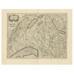
Circa 1659 Willem Blaeu Map: Southwestern Switzerland with Geneva & Lakes
Located in Langweer, NL
Circa 1659 Willem Blaeu Map: Southwestern Switzerland with Geneva & Lakes
This detailed map from
Category
Antique 1650s Maps
Materials
Paper
H 15.1 in W 19.9 in D 0.002 in
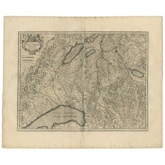
Antique Map of the Region of Lake Geneva by Janssonius '1657'
By Johannes Janssonius
Located in Langweer, NL
Antique map 'Das Wiflispur Gergow'. Detailed map of Switzerland showing Waadt and the Lake of
Category
Antique Mid-17th Century Maps
Materials
Paper
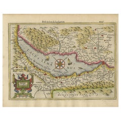
Beautiful Original Copper Engraved Map of Lake Geneva in Switzerland, 1613
Located in Langweer, NL
Description: Antique map titled 'Lacus Lemanus'.
Old map of Lake Geneva with good detail of
Category
Antique 1610s Maps
Materials
Paper
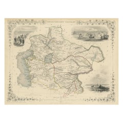
Antique Map of Central Asia between the Caspian Sea and Lake Balkhash
Located in Langweer, NL
Antique map titled 'Independent Tartary'. Original steel engraved map of Central Asia. It covers
Category
Antique Mid-19th Century Maps
Materials
Paper
H 10.56 in W 14.73 in D 0.02 in
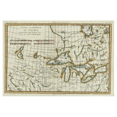
Old Map of the Great Lakes and Upper Mississippi Valley, Northern America, c1780
Located in Langweer, NL
Guilleme Raynal's 1780 map of the Great Lakes and upper Mississippi Valley.
A map of considerable
Category
Antique 1780s Maps
Materials
Paper
H 10.32 in W 14.85 in D 0 in
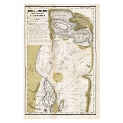
Scarce Antique Map of Lake Toba and Silindoeng on Sumatra, Indonesia, c.1875
Located in Langweer, NL
Antique map titled 'Kaart van het Toba-Meer en het landschap Silindoeng.'
This scarce map shows
Category
Antique 19th Century Maps
Materials
Paper
H 19.69 in W 31.5 in D 0 in
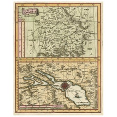
Map of the Electorate of Bavaria, Incl Lake Constance, by Jesuit Scherer, c.1700
Located in Langweer, NL
Scherer. The lower map shows the Lake Constance. Source unknown, to be determined.
Artists and
Category
Antique Early 1700s Maps
Materials
Paper
H 10.63 in W 8.47 in D 0 in
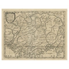
Old Map of the Mughal Empire, Persia in the West to Lake Chimay etc., ca.1685
Located in Langweer, NL
Antique map titled 'L'Empire du Grand Mogol'. Old map of India and Central Asia.
The map
Category
Antique 1680s Maps
Materials
Paper
H 9.85 in W 14.57 in D 0 in
1645 Blaeu Map of Westmorland, Northern England – Hand Colored, Decorative
Located in Langweer, NL
Brigster Park, Colnhead Park, Crosbye, and Wynandermere (now Windermere Lake).
This map would be of
Category
Antique 1640s Maps
Materials
Paper
H 14.89 in W 19.49 in D 0 in
Antique Map of the Arabian Peninsula by Bonne 'c.1780'
Located in Langweer, NL
elevations rendered throughout as well as town names, rivers and lakes. This map originates from 'Atlas de
Category
Antique Late 18th Century Maps
Materials
Paper
Antique Map of the Arabian Peninsula by Bonne 'c.1780'
Located in Langweer, NL
elevations rendered throughout as well as town names, rivers and lakes. This map originates from 'Atlas de
Category
Antique Late 18th Century Maps
Materials
Paper
17th-Century Antique Map of Jiangxi (Kiangsi) Province, China – by Blaeu
Located in Langweer, NL
renowned as the "Porcelain Capital" of the world. Poyang Lake, featured prominently on the map, is vital
Category
Antique 1650s Maps
Materials
Paper
H 18.9 in W 23.04 in D 0.01 in
Antique Map of America with California as an Island by Homann '1710'
Located in Langweer, NL
: The map provides detailed information about the Great Lakes and the course of the Mississippi River
Category
Antique Early 18th Century Maps
Materials
Paper
A 19th-Century Map of West Canada with Niagara Falls and Indigenous Scenes
Located in Langweer, NL
, including Lake Ontario and Lake Erie. The map highlights the regions of Southern Ontario during a period of
Category
Antique 1850s Maps
Materials
Paper
H 10.95 in W 14.26 in D 0.01 in
Antique Map of Canada, The Province of Ontario and Part of Quebec, 1882
Located in Langweer, NL
vital for communication and transportation during that period.
The map features Lake Ontario
Category
Antique 1880s Maps
Materials
Paper
Antique Map of New England and Eastern Canada by Homann Heirs, circa 1755
Located in Langweer, NL
of New England and Eastern Canada made after J.N. Bellin. The map extends from Lake Ontario, the St
Category
Antique Mid-18th Century Maps
Materials
Paper
H 21.07 in W 24.22 in D 0.02 in
Antique Map of New England and Part of Canada by Vaugondy 'circa 1755'
Located in Langweer, NL
large inset map of the Great Lakes. The map covers the Gulf of St. Lawrence, St. Lawrence River, and
Category
Antique Mid-18th Century Maps
Materials
Paper
H 20.08 in W 25.99 in D 0.02 in
Antique French Engraving of Mexico with Lots of Details, c.1780
Located in Langweer, NL
. Shows towns, rivers, mountains, lakes, etc. Detailed map of the region. Source unknown, to be determined
Category
Antique 18th Century Maps
Materials
Paper
Original Vintage Travel Poster Visit Hungary Pictorial Map Budapest Lake Balaton
Located in London, GB
Original vintage travel poster - Visit Hungary! - featuring a pictorial map of the country
Category
Vintage 1960s Hungarian Posters
Materials
Paper
H 26.38 in W 38.59 in D 0.04 in
Original Antique Montreux Oberland Bernois Railway Travel Poster MOB Switzerland
Located in London, GB
trees with a sailing boat on a lake below and a map of the railway route on the other side of the
Category
Antique Early 1900s Swiss Posters
Materials
Paper
H 46.26 in W 29.53 in D 0.04 in
Original Vintage Travel Poster Visit Hungary Pictorial Map Budapest Lake Balaton
Located in London, GB
Original vintage travel poster - Visit Hungary! - featuring a pictorial map of the country
Category
1960s More Prints
Materials
Paper
Map: Russian Empire
By William Home Lizars
Located in Florham Park, NJ
. This highly detailed map shows towns, rivers, mountains, lakes, etc.
Shows towns, rivers, mountains
Category
Antique 19th Century Prints
"Black Lake" - Abstract Encaustic Painting
By Paige Berg Rizvi
Located in New Haven, CT
Paige Berg Rizvi, "Black Lake", 2012, Encaustic, road map, and origami paper on panel, 24
Category
2010s Abstract Mixed Media
Materials
Mixed Media, Encaustic
Original 1900s Montreux Oberland Bernois Railway Poster, Switzerland MOB Railway
Located in London, GB
trees with a sailing boat on a lake below and a map of the railway route on the other side of the
Category
Early 1900s More Prints
Materials
Paper
Framed Map of Lake Winnipesaukee Region, NH
By United States Geological Survey
Located in Essex, MA
A framed, very detailed map of lake Winnipesaukee, NH and surrounding areas (the 'Winnipesaukee
Category
Vintage 1920s American Maps
Materials
Paper, Walnut
1880s Map of The Italian Alps from Milan to Lake Garda
Located in Florence, Tuscany
Geographical Map of the Profile and Elevation of the Italian Alps from Milano to Lake Garda. The
Category
Antique 1880s Italian Maps
Materials
Parchment Paper
Antique Map of North America, Depicting the New World's Lakes and Rivers, 1790
Located in Colorado Springs, CO
A particular map of the American Lakes and Rivers Published in London for John Harrison
This is a
Category
Antique 1790s British Maps
Materials
Paper
H 30.5 in W 49.5 in D 2 in
1899 Lindrooth Map of Lincoln Park, Chicago
Located in Colorado Springs, CO
This is a colorful map of Lincoln Park in Chicago by J. H. Lindrooth. Lindrooth was a civil
Category
Antique 1890s American Maps
1873 Colton's Texas Hand-Colored Antique Map
Located in Colorado Springs, CO
, Galveston and Matagorda Bays, and Sabine Lake. The map shows relative expansion of Texas's counties and
Category
Antique 1870s American Maps
Materials
Paper
Antique Map of Mexico by G. Mercator, 1637
Located in Langweer, NL
two cartouches. Mexico City located on the banks of a lake. Relief shown pictorially.
This map
Category
Antique Mid-17th Century Maps
Materials
Paper
1911 Rand-McNally Pocket Map and Shippers' Guide of Montana
Located in Colorado Springs, CO
railroads, cities, towns, villages, post offices, lakes, rivers, etc”. Additionally, the map boasts it “is
Category
Vintage 1910s Maps
Materials
Paper
1856 Map of the State of Texas by J. H. Colton
Located in Colorado Springs, CO
, “Plan of the Northern Part of Texas," “Plan of Galveston Bay," and “Plan of Sabine Lake.”
The map
Category
Antique 1850s American Maps
Materials
Paper
1885 Denver and Rio Grande System Antique Map by Rand McNally & Co.
Located in Colorado Springs, CO
west to include Grand Junction, Green River, and Salt Lake City. The map is one that was published in
Category
Antique 1880s American Maps
Materials
Paper
1859 "Colton's New Map of the State of Texas..." by Johnson & Browning
Located in Colorado Springs, CO
Texas,” “Plan of Galveston Bay from the U.S. Coast Survey,” and “Plan of Sabine Lake.” The map is
Category
Antique 1850s American Maps
Materials
Paper
H 27.75 in W 38.5 in D 1.38 in
1904 Map of the Denver and Rio Grande & Rio Grande Western System, Rand McNally
Located in Colorado Springs, CO
to 1904. The map extends as far west to include Marysville, Silver City, Salt Lake City and Ogden
Category
Antique Early 1900s American Maps
Materials
Paper
H 10.25 in W 28 in D 1 in
World Map Published in June 1783 by Stackhouse and Engraved by S.J. Neele London
Located in Milan, IT
publishers such as Faden, Laurie, Stackhouse, Thomson and others. He engraved maps for "Lake District Maps
Category
Antique 1780s British Maps
Materials
Glass, Wood, Paper
H 21.26 in W 36.93 in D 0.79 in
1879 "United States of America, Western Part" by O. J. Stuart
Located in Colorado Springs, CO
This colorful original map, titled “United States of America, Western Part,” was issued in Volume
Category
Antique 1870s American Maps
Materials
Paper
Map of Lake George.
By Seneca Ray Stoddard
Located in New York, NY
but retains original hard bound covers.
A scarce and highly decorative map of Lake George. Insets
Category
19th Century American Realist Prints and Multiples
Materials
Lithograph
Antique Map of Lake Geneva by Mercator/Hondius '1610'
Located in Langweer, NL
Antique map titled 'Lacus Lemanus'. Old map of Lake Geneva with good detail of surrounding towns
Category
Antique Early 17th Century Maps
Materials
Paper
Antique Map of Lake Geneva by Hondius 'circa 1630'
Located in Langweer, NL
original antique map of Lake Geneva, Switzerland. Decorative map with numerous sailing ships and stunningly
Category
Antique Mid-17th Century Maps
Materials
Paper
Original Antique Map of Salt Lake City, Utah, 1861
Located in St Annes, Lancashire
Great map of Salt lake City
Drawn and engraved by Edward Weller
Original color
Published
Category
Antique 1860s English Victorian Maps
Materials
Paper
Antique Map of the Region of Lake Geneva by Janssonius, 1657
By Johannes Janssonius
Located in Langweer, NL
Lake Geneva. This map originates from 'Atlas Novus, Sive Theatrum Orbis Orbis Terrarum: In quo Galliae
Category
Antique Mid-17th Century Maps
Materials
Paper
Original Antique Map of the Great Lakes, Canada by T. Ettling, 1861
Located in St Annes, Lancashire
Great map of The Great Lakes
Steel engraving with original color outline
Drawn and engraved
Category
Antique 1860s English Other Maps
Materials
Paper
Antique Map of Lake Superior and the Upper Peninsula of Michigan 'c.1870'
Located in Langweer, NL
Antique map titled 'Colton's Lake Superior and the Upper Peninsula of Michigan'. Detailed large
Category
Antique Mid-19th Century Maps
Materials
Paper
H 17.52 in W 28.35 in D 0.02 in
Old French Map with Details of New England, Lake Erie, Virginia, Maryland, 1780
Located in Langweer, NL
England. Detailed map of the region bounded by New England, Lake Erie, the Allegehenies, Virginia and
Category
Antique 1780s Maps
Materials
Paper
H 10.24 in W 14.97 in D 0 in
Antique Map of Switzerland by G. Blaeu, circa 1634
Located in Langweer, NL
with Basel at the top of the map and the Italian Alps with Lakes Maggiore Como, etc. at the bottom of
Category
Antique Mid-17th Century Maps
Antique Map of the Region of Savoy by Janssonius, 1657
By Johannes Janssonius
Located in Langweer, NL
Savoy, showing Geneva, Lake Geneva, Grenobel, etc. This map originates from 'Atlas Novus, Sive Theatrum
Category
Antique Mid-17th Century Maps
Materials
Paper
Old Print Showing New Zealand, Cuba, Iceland etc. Lakes, Mountains, Rivers, 1851
Located in Langweer, NL
Antique map titled 'A comparative view of the principal Waterfalls, Islands, Lakes, Rivers and
Category
Antique 1850s Maps
Materials
Paper
H 14.57 in W 10.24 in D 0 in
Antique Map of the Province of Canada ‘West’ by A.K. Johnston, 1865
Located in Langweer, NL
Antique map titled 'Province of Canada (Western Sheet)'. Depicting Quebec, Lake Ontario and more
Category
Antique Mid-19th Century Maps
Materials
Paper
Antique Framed Hand Colored Map of the Americas by Frederick De Wit, circa 1675
By Frederick de Wit
Located in Morristown, NJ
(Lake Huron), Lac Erie (Lake Erie), and L. de S. Louis (Lake Ontario)
This hand colored map includes
Category
Antique 1670s Dutch Baroque Maps
Materials
Glass, Wood, Giltwood, Paint, Paper
H 22.5 in W 26 in D 1.75 in
1650 "Virginiae Partis Australis et Floridae Partis Orientalis..., " Jan Jansson
Located in Colorado Springs, CO
handsome map of the southeast colonies, extending from the southern part of Virginia to northern Florida
Category
Antique 1650s Maps
Materials
Paper
H 26.38 in W 30.5 in D 1.5 in
Antique Map of American Northwest, 1752
Located in Houston, TX
Siberia to the Great Lakes region.
Original antique map displayed on a white mat with a gold border
Category
18th Century and Earlier Other Art Style More Prints
Materials
Ink, Paper, Watercolor
Vintage Map of Lake Okeechobee
Located in Chicago, IL
White wood frame
20th century
American
Measures: 49" W x 1.25" D x 36.25" H.
Category
20th Century American Maps
Interesting "Lake Como" Engraved Silver Ashtray
Located in London, GB
Large circular Italian silver ashtray, the body engraved with a map of Lake Como.
Ash
Category
20th Century Italian Ashtrays
Materials
Silver
Get Updated with New Arrivals
Save "Lake Map", and we’ll notify you when there are new listings in this category.
