Map Two Africas
3
to
12
166
62
120
103
71
49
31
24
23
21
18
18
18
17
11
11
9
7
7
6
5
4
4
4
4
3
3
3
2
2
2
2
2
2
2
2
1
1
1
1
1
1
1
1
1
1
1
42
42
4
4
3
Sort By
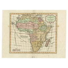
Antique Map of Africa by Delamarche, 1806
Located in Langweer, NL
Antique map titled 'L'Afrique'.
Decorative map of Africa by Robert de Vaugondy, revised and
Category
Antique 19th Century Maps
Materials
Paper
Antique Map of South Africa by Lowry, 1852
Located in Langweer, NL
Antique map titled 'South Africa'. Two individual sheets of South Africa. This map originates from
Category
Antique Mid-19th Century Maps
Materials
Paper
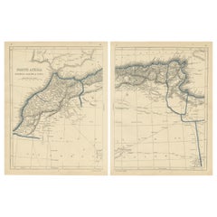
Antique Map of North Africa by Lowry '1852'
Located in Langweer, NL
Antique map titled 'North Africa Marocco Algiers & Tunis'. Two individual sheets of North Africa
Category
Antique Mid-19th Century Maps
Materials
Paper
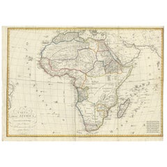
Antique Map of Africa by Bordiga Fratelli 'circa 1818'
Located in Langweer, NL
Antique map titled 'Carta dell Africa'. Large and quite scarce Italian map of Africa, reflecting
Category
Antique Early 19th Century Maps
Materials
Paper
"Africa Vetus": a 17th Century Hand-Colored Map by Sanson
By Nicolas Sanson
Located in Alamo, CA
This original hand-colored copperplate engraved map of Africa entitled "Africa Vetus, Nicolai
Category
Antique Late 17th Century French Maps
Materials
Paper
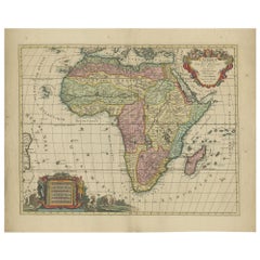
Original Hand-Colored Antique Map of Africa by Elwe '1792'
Located in Langweer, NL
Africa. The cartography is typical for the 17th century with the Nile originating in two large lakes
Category
Antique Late 18th Century Maps
Materials
Paper
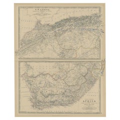
Antique Map of North and South Africa by Johnston, 1882
Located in Langweer, NL
Two antique maps on one sheet titled 'N.W. Africa, Marocco, Algeria & Tunis' and 'Southern Africa
Category
Antique 19th Century Maps
Materials
Paper
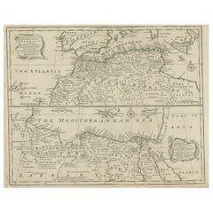
Antique Map of Western and Eastern Barbary in Africa, c.1744
Located in Langweer, NL
of the Eastern Parts of Barbary'. Decorative maps of North Africa and the Southern Mediterranean
Category
Antique 18th Century Maps
Materials
Paper
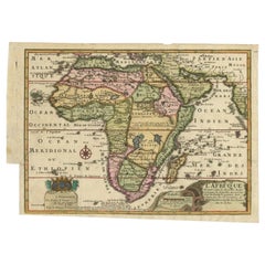
Antique Map of Africa with a Decorative Dedication to the Dauphin, 1717
Located in Langweer, NL
Decouvertes (..).'
This map is a reduced derivative of De Fer's wall map of Africa (1696-98) with its
Category
Antique 18th Century Maps
Materials
Paper
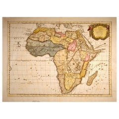
"Africae Accurata", a Hand-Colored 17th Century Map of Africa by Visscher
By Nicolaes Visscher II
Located in Alamo, CA
An 18th century hand-colored map of Africa entitled "Africae Accurata Tabula ex officina" by
Category
Antique Late 17th Century Dutch Maps
Materials
Paper
H 23.75 in W 28.13 in D 0.13 in
Africa: A Large 17th Century Hand-Colored Map by Sanson and Jaillot
By Nicolas Sanson
Located in Alamo, CA
This large original hand-colored copperplate engraved map of Africa entitled "L'Afrique divisee
Category
Antique 1690s French Maps
Materials
Paper
Intriguing Antique Map of Europe, Asia and Africa by Scherer, c.1703
Located in Langweer, NL
Two maps on a single sheet showing Europe, Asia and Africa, each depicting nearly the same area. On
Category
Antique 18th Century Maps
Materials
Paper
London 1744 Published Watercolour Antique Map of East Africa by Eman Bowen
Located in GB
This is a decorative antique engraved map of East Africa, colored by kingdoms and provinces.
The map
Category
Antique 1740s English George III Maps
Materials
Paper
H 17.52 in W 21.07 in D 0.79 in
Antique Map of Fort Mozambique and Mozambique Bay in Africa, c.1759
Located in Langweer, NL
Two antique maps on one sheet. The upper antique map is titled 'Plan du Fort de Mozambique tiré de
Category
Antique 18th Century Maps
Materials
Paper
Antique Map of North-Western and South Africa by A.K. Johnston, 1865
Located in Langweer, NL
Two maps on one sheet titled 'North-Western Africa' and 'Southern Africa'. Depicting Morocco
Category
Antique Mid-19th Century Maps
Materials
Paper
Old Map of Indian Ocean & Sumatra, Java, Borneo, India, Arabia, Africa, c.1783
Located in Langweer, NL
map depicting the Indian Ocean and surroundings including Sumatra, Java, Borneo, India, Arabia, Africa
Category
Antique 1780s Maps
Materials
Paper
H 20.87 in W 25.4 in D 0 in
West Coast of Africa, Guinea & Sierra Leone: An 18th Century Map by Bellin
By Jacques-Nicolas Bellin
Located in Alamo, CA
the map is otherwise in excellent condition.
Two other Bellin maps are available on 1stDibs
Category
Antique Mid-18th Century French Maps
Materials
Paper
H 10 in W 14.25 in D 0.07 in
Antique Map of 'African' Islands in the Mediterranean Sea and The Atlantic, 1747
Located in Langweer, NL
Antique map titled 'Particular draughts of some of the chief African Islands in the Mediterranean
Category
Antique 18th Century Maps
Materials
Paper
H 19.49 in W 15.16 in D 0 in
Antique Map of the City of Algiers and Surroundings in Northern Africa, 1773
Located in Langweer, NL
Antique print titled 'Plan van de Stad Algiers'. Old map of Algiers, also depicting surrounding
Category
Antique 18th Century Maps
Materials
Paper
H 10.44 in W 8.08 in D 0 in
Rare Antique Map of Part of Europe and Africa by Scherer, C.1703
Located in Langweer, NL
Antique map with two figures. The upper figures showing part of Europe and Africa. Below a chart
Category
Antique 18th Century Maps
Materials
Paper
Map & Views of the Cape Verde Islands, in the Atlantic Ocean, West-Africa, 1775
Located in Langweer, NL
Africa. Printed from two copper plates, published for Robert Sayer, London.
Artists and Engravers
Category
Antique 1770s Maps
Materials
Paper
H 21.46 in W 14.57 in D 0 in
Antique Map of St. Jago, St Mayo and Praya Harbour, Mauritania, Africa, c.1750
Located in Langweer, NL
Antique map Africa titled 'Gezigt van 't Eiland St. Jago en de Stad St. Jago of Ribeyro Grande
Category
Antique 18th Century Maps
Materials
Paper
H 7.88 in W 9.85 in D 0 in
Antique Decorative Coloured Map Egypt, Nubia, Abyssinia and more, 1882
Located in Langweer, NL
This image contains two maps, with the left one being labeled "Egypt" and the right one "Nubia
Category
Antique 1880s Maps
Materials
Paper
Free Shipping
H 14.97 in W 22.45 in D 0 in
Road Map, John Ogilby, No 54, London, Yarmouth, Britannia
By John Ogilby
Located in BUNGAY, SUFFOLK
-sixth year, as a publisher of maps and geographical accounts.
Ogilby was born outside Dundee, in
Category
Antique 1670s English Baroque Maps
Materials
Paper
Crossroads of Continents: Spain's North African Enclaves in 1903
Located in Langweer, NL
The image for sale is a historical map of Spanish possessions in North Africa, dated 1903. The map
Category
Antique Early 1900s Maps
Materials
Paper
Free Shipping
H 14.77 in W 20.08 in D 0 in
Antique Sea Chart of the Western Coast of Africa
Located in Langweer, NL
Antique map titled 'Nieuwe Paskaert van de Kust van Genehoa (..)'. This attractive sea chart covers
Category
Antique Late 17th Century Maps
Materials
Paper
Antique Map Showing the Religions Around the World by Johnston '1854'
Located in Langweer, NL
and Pagans. Three side maps show the distribution of missions in India, South Africa and Canada. Two
Category
Antique Mid-19th Century Maps
Materials
Paper
H 21.66 in W 26.38 in D 0.02 in
Rare Antique Map of Yam Suph, Egypt and Red Sea, 1773
Located in Langweer, NL
Antique print with two maps titled 'Uittreksel van de Kaart van Egipten en de Roode Zee' and
Category
Antique 18th Century Maps
Materials
Paper
18th Century Hand Colored Map of Spain and Portugal by Visscher
By Nicolaes Visscher II
Located in Alamo, CA
. The map includes portions of North Africa and the Strait of Gibralter.
This copperplate engraved map
Category
Antique Early 18th Century Dutch Maps
Materials
Paper
Map Silk Embroidered Western Eastern Hemisphere New Old World Asia America Afri
Located in BUNGAY, SUFFOLK
A rare, late-18th century, silk, embroidered, double hemisphere, world map, blackwork, sampler
Category
Antique 18th Century British Georgian Maps
Materials
Silk
H 0.4 in W 0.4 in D 0.4 in
Map Road Strip Britannia Sheet 2 John Ogilby London Aberistwith Islip Bramyard
By John Ogilby
Located in BUNGAY, SUFFOLK
of England and Wales.
Strip map Islip to Bramyard, on a scale of approximately one inch to the mile
Category
Antique 17th Century English Baroque Maps
Materials
Paper
H 14.38 in W 19.3 in D 0.79 in
Road Map John Ogilby No 75 Kings Lyn Harwich, Britannia Framed Wallhanging
By John Ogilby
Located in BUNGAY, SUFFOLK
, as a publisher of maps and geographical accounts.
Ogilby was born outside Dundee, in 1600, the
Category
Antique 1670s European Baroque Maps
Materials
Paper
H 15.75 in W 19.69 in D 0.6 in
Map Road John Ogilby Britannia No 74 Ipswich to Norwich Cromer Framed
By John Ogilby
Located in BUNGAY, SUFFOLK
his sixty-sixth year, as a publisher of maps and geographical accounts.
Ogilby was born outside
Category
Antique 1670s English Baroque Maps
Materials
Paper
St. Christophe 'St. Kitts' Island: An 18th Century Hand-colored Map by Bellin
By Jacques-Nicolas Bellin
Located in Alamo, CA
condition.
Two other Bellin maps are available on 1stDibs, including an unframed map of the southwest
Category
Antique Mid-18th Century French Maps
Materials
Paper
H 10 in W 14.25 in D 0.07 in
Road Map No43 London to Kings Lynn, Royston to Downham, John Ogilby, Britannia
By John Ogilby
Located in BUNGAY, SUFFOLK
John Ogilby (British 1600-1676) Cosmographer and Geographick Printer to Charles II.
A road map
Category
Antique Late 17th Century British Charles II Maps
Materials
Paper
H 20.48 in W 24.41 in D 0.4 in
Road Map John Ogilby London St David's Britannia No 15 Abingdon Monmouth Framed
By John Ogilby
Located in BUNGAY, SUFFOLK
John Ogilby (British 1600-1676) Cosmographer and Geographick Printer to Charles II. A road map from
Category
Antique 1670s English Baroque Maps
Materials
Paper
H 20.48 in W 24.41 in D 0.6 in
Antique Map of Southern Asia with India, the Maldives, Ceylon and Arabia, c.1700
Located in Langweer, NL
Stunning Old Map of Asia.
Description: Two-sheet map of Asia, joined. The left part of this
Category
Antique Early 18th Century Maps
Materials
Paper
H 24.81 in W 37.01 in D 0 in
Rare Map of Six Coast Views and Anchorages of Sierra Leone and Indonesia, 1660
Located in Langweer, NL
and French vessels on their way to Asia. Two views of the coast of Sierra Leone, Africa "Tagrin
Category
Antique 17th Century Maps
Materials
Paper
H 13.98 in W 21.26 in D 0 in
Road Map Britannia No 32 the Road from London to Barnstable John Ogilby Framed
By John Ogilby
Located in BUNGAY, SUFFOLK
A road map from Britannia, by John Ogilby Esq., Cosmographer and Geographick Printer to Charles II
Category
Antique Late 17th Century English Charles II Maps
Materials
Paper
H 20.48 in W 24.41 in D 0.6 in
Road Map Britannia No 15 London to St Davids John Ogilby Brown Gilt Frame
By John Ogilby
Located in BUNGAY, SUFFOLK
Lechlade, to Fairford, to Barnsley to Gloucester showing Monmouth as the destination. A road map from
Category
Antique Late 17th Century British Charles II Maps
Materials
Paper
H 22.05 in W 26.19 in D 0.6 in
Road Map Britannia No 25 London to the Lands End, John Ogilby Brown Gilded Frame
By John Ogilby
Located in BUNGAY, SUFFOLK
Senan in Cornwall. By John Ogilby His Majesties Cosmographer. A road map from Britannia, 1675/6. No 25
Category
Antique Late 17th Century British Charles II Maps
Materials
Paper
H 22.05 in W 26.19 in D 0.6 in
Road Map Britannia 1675/6 No 5 Road London to Barwick, London Stilton Grey Frame
By John Ogilby
Located in BUNGAY, SUFFOLK
John Ogilby (British 1600-1676) cosmographer and geographick printer to Charles II.
A road map from
Category
Antique Late 17th Century British Charles II Maps
Materials
Paper
H 22.84 in W 25.99 in D 0.4 in
Rare Engraving of Dutch and Danish Forts on the West African Gold Coast, 1744
Located in Langweer, NL
the West African Gold Coast, Ghana; a) The Dutch Fort Croevecoeur at Accra, b) The Danish Fort
Category
Antique 1740s Maps
Materials
Paper
H 15.36 in W 13.67 in D 0 in
The Roman Empire from the Time of Constantine the Great, Published in 1880
Located in Langweer, NL
East and North Africa.
This map serves as a historical document, capturing the grandeur of the Roman
Category
Antique 1880s Maps
Materials
Paper
No Reserve
H 15.56 in W 18.51 in D 0 in
Very Large Hand-Drawn View of St Iago Cape Verde, by Frederici, 1783
Located in Amsterdam, NL
The largest recorded early modern panoramic view of Cape Verde, by “the best VOC map maker in South
Category
Antique Late 18th Century Cape Verdean Dutch Colonial Maps
Materials
Paper
Free Shipping
H 11.62 in W 47.45 in D 0.08 in
Colonial Crossroads: Angola and Mozambique in 1903
Located in Langweer, NL
Angola on the left and Mozambique on the right. These two territories on the African continent were major
Category
Antique Early 1900s Maps
Materials
Paper
Miniature Terrestrial Globe Newton & Son London, Post 1833, Ante 1858
By Newton and Son
Located in Milano, IT
with two pins at the meridian circle, which is in turn inserted perpendicular to the horizon circle
Category
Antique 1840s English Early Victorian Maps
Materials
Bronze
Pair of Miniature Globes Lane’s on Tripod Bases, London post 1833, ante 1858
By Lane's
Located in Milano, IT
circle. The two spheres differ in color.
Both globes, the terrestrial and celestial, rest on their
Category
Antique 1840s English Early Victorian Maps
Materials
Paper, Wood
View of the Island Onrust Near Batavia 'Jakarta', Indonesia, 1739
Located in Langweer, NL
island two times a year.
In 1911 Onrust Island was turned into a quarantine station for pilgrims
Category
Antique 1730s Maps
Materials
Paper
"Africa Vetus": A 17th Century Hand-colored Map By Sanson
By Nicholas Sanson d'Abbeville
Located in Alamo, CA
This original hand-colored copperplate engraved map of Africa entitled "Africa Vetus, Nicolai
Category
1690s Landscape Prints
Materials
Engraving
Original Vintage Travel Poster Rhodesia Pictorial Map Southern Africa Zimbabwe
Located in London, GB
Ocean with two antelope on the sides Showing the Relative Position of the Africa Rhodesias (Zimbabwe
Category
Vintage 1930s British Posters
Materials
Paper
H 39.38 in W 24.41 in D 0.04 in
West Coast of Africa; Guinea & Sierra Leone: Bellin 18th Century Map
Located in Alamo, CA
the map is otherwise in excellent condition.
Two other Bellin maps are available on 1stDibs
Category
1740s Old Masters Landscape Prints
Materials
Engraving
Africa: A Large 17th Century Hand-colored Map By Sanson and Jaillot
By Nicholas Sanson d'Abbeville
Located in Alamo, CA
This large original hand-colored copperplate engraved map of Africa entitled "L'Afrique divisee
Category
1690s Landscape Prints
Materials
Engraving
Original Vintage Poster Sabena Belgian Airlines To Europe Asia Africa Travel Map
Located in London, GB
Original vintage pictorial travel map poster advertising Sabena Belgian Airlines flights to Europe
Category
Vintage 1950s Belgian Posters
Materials
Paper
H 39.38 in W 25.6 in D 0.04 in
Map of the World: An Original 18th Century Hand-colored Map by E. Bowen
Located in Alamo, CA
the British Isles, Europe, North America, Africa, and Asia. He also created maps for several important
Category
Mid-18th Century Old Masters Landscape Prints
Materials
Engraving
Map of the Russian Empire: An Original 18th Century Hand-colored Map by E. Bowen
Located in Alamo, CA
margin on the right, as well as two dark spots in the left margin, which may represent paint. The map is
Category
Mid-18th Century Old Masters Landscape Prints
Materials
Engraving
Map of the East Indies: An Original 18th Century Hand-colored Map by E. Bowen
Located in Alamo, CA
the British Isles, Europe, North America, Africa, and Asia. He also created maps for several important
Category
Mid-18th Century Old Masters Landscape Prints
Materials
Engraving
French Nesting Tables in Wood with Maps Tops, 1940s
Located in Barcelona, ES
Map on the top, the medium sized has an America Continent Map and the smallest one has an Africa Map
Category
Mid-20th Century French Mid-Century Modern Nesting Tables and Stacking T...
Materials
Wood
Artemis, colorful African woman feminist bright yellow
By Audrey Anastasi
Located in Brooklyn, NY
maps, providing equal presence to the figures each with their own level of dimensionality. The maps
Category
2010s Contemporary Figurative Drawings and Watercolors
Materials
Charcoal, Archival Paper, Magazine Paper
St. Christophe (St. Kitts): Bellin 18th Century Hand Colored Map
Located in Alamo, CA
condition.
Two other Bellin maps are available on 1stDibs, including an unframed map of the southwest
Category
1740s Other Art Style Landscape Prints
Materials
Engraving
- 1
Get Updated with New Arrivals
Save "Map Two Africas", and we’ll notify you when there are new listings in this category.
More Ways To Browse
Stone Stump
Rolex Air King Ii
Identify Rolex
Rolex Identifier
Extreme Rolex
Rolex Air King Tiffany
Rolex Sea King
Leather Rolex Air King
Rolex Air King Second Hand
Rolex Royal Air King
Rolex 99 Air King
Rolex Air King 99
Rolex Air King Availability
Buy Rolex Air King
Compass Egyptian
Egyptian Compass
Changing Time On A Rolex
Custom Engraved Rolex
