Old Travel Maps
to
12
175
83
137
120
52
38
34
33
31
23
23
18
13
11
10
10
9
8
7
5
4
3
3
3
2
2
2
2
2
2
1
1
1
1
1
1
42
42
19
12
6
Sort By
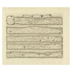
Antique Map Made After a Roman Papyrus Travel Map, Known as Peutinger Map, 1773
Located in Langweer, NL
Old Dutch engraving with title: 'Romeinsche Reis Kaart van K. Peutinger'.
Rare antique map based
Category
Antique 18th Century Maps
Materials
Paper
H 15.56 in W 18.51 in D 0 in
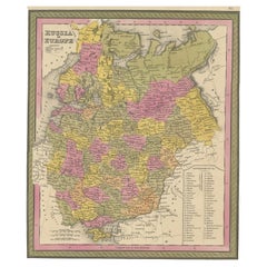
Antique Map of Old European Russia, 1846
Located in Langweer, NL
Antique map titled 'Russia in Europe'. Old map of European Russia. This map originates from 'A New
Category
Antique 19th Century Maps
Materials
Paper
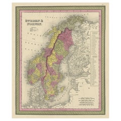
Old Colourful Map of Sweden and Norway, 1846
Located in Langweer, NL
Antique map titled 'Sweden & Norway'. Old map of Sweden and Norway.
This map originates from 'A
Category
Antique 1840s Maps
Materials
Paper
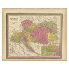
Colourful Old Map of the Austrian Empire, with an Inset Map of Vienna, 1846
Located in Langweer, NL
Antique map titled 'Austrian Empire'.
Old map of the Austrian Empire, with an inset map of
Category
Antique 1840s Maps
Materials
Paper
H 13.78 in W 17.13 in D 0 in
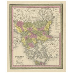
Old Colourful Decorative Map of Turkey in Europe, 1846
Located in Langweer, NL
Antique map titled 'Turkey in Europe'. Old map of Turkey in Europe.
This map originates from 'A
Category
Antique 1840s Maps
Materials
Paper
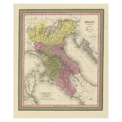
Old Antique Colourful Decorative Map of Northern Italy, 1846
Located in Langweer, NL
Description: Antique map titled 'Italy North Part'.
Old map of Northern Italy. This map
Category
Antique 1840s Maps
Materials
Paper
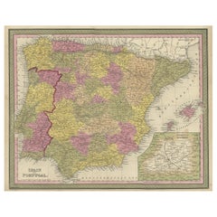
Old Map of Spain and Portugal, with an Inset Map of the Region of Madrid, 1846
Located in Langweer, NL
Antique map titled 'Kingdom of Spain and Portugal'.
Old map of Spain and Portugal, with an
Category
Antique 1840s Maps
Materials
Paper
H 13.78 in W 17.13 in D 0 in
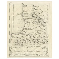
Old Dutch Map of Part of Syria and Phoenicia, 1773
Located in Langweer, NL
Antique print titled 'Gedeelte van Syriën en Phenicië'.
Old map of part of Syria and Phoenicia
Category
Antique 1770s Maps
Materials
Paper
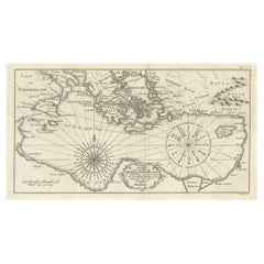
Old Dutch Map of the Region Around the Mediterranean Sea, 1773
Located in Langweer, NL
Antique map titled 'Kaart van een Deel der Middelandsche Zee (..)'.
Old map of the region
Category
Antique 1770s Maps
Materials
Paper
Original Old Map of the Coast of Syria and Phoenicia, 1773
Located in Langweer, NL
Antique map titled 'Kaart van de Zee Kust van Syrië (..)'.
Old map of the coast of Syria and
Category
Antique 1770s Maps
Materials
Paper
Old Dutch Map of the City of Oran 'Warran', Algeria, 1773
Located in Langweer, NL
Antique print titled 'Ligging der Stad en Haven van Warran of Oran'.
Old map of the city of
Category
Antique 1770s Maps
Materials
Paper
Old Map of the Western Region of the Kingdom of Algiers, Algeria, 1773
Located in Langweer, NL
Antique map titled 'Kaart van het Westelyk Gedeelte van het Ryk van Algiers'.
Old map of the
Category
Antique 1770s Maps
Materials
Paper
Old Map of the Eastern Region of the Kingdom of Algiers, Algeria, 1773
Located in Langweer, NL
Antique map titled 'Kaart van het Oostelyke Deel van het Ryk van Algiers'.
Old map of the
Category
Antique 1770s Maps
Materials
Paper
Old Map of Algiers, with Surrounding Cities and the Bay of Algiers, 1773
Located in Langweer, NL
Antique print titled 'Plan van de Stad Algiers'.
Old map of Algiers, also depicting surrounding
Category
Antique 1770s Maps
Materials
Paper
Detailed Original Old Map of the Southern Region of the Kingdom of Algiers 1773
Located in Langweer, NL
Antique map titled 'Kaart van het Zuidelyk Gedeelte van het Ryk Algiers'.
Old map of the
Category
Antique 18th Century Maps
Materials
Paper
H 16.34 in W 10.24 in D 0 in
Old Dutch Map of the City of Carthage and the Bay of Carthage, 1773
Located in Langweer, NL
Antique print titled 'Kaart van de Legging van het Oude Karthago'. Old map of the city of Carthage
Category
Antique 1770s Maps
Materials
Paper
Old Map of the Sinai Peninsula Showing the Mediterranean and the Red Sea, 1773
Located in Langweer, NL
Antique map of the Sinai Peninsula showing the Mediterranean Sea to the north and the Red Sea to
Category
Antique 1770s Maps
Materials
Paper
H 17.05 in W 21.19 in D 0 in
Decorative Antique Map of Germany, 1846
Located in Langweer, NL
Antique map titled 'Germany'. Old map of Germany.
This map originates from 'A New Universal
Category
Antique 1840s Maps
Materials
Paper
Colourful Antique Map of Switzerland, 1846
Located in Langweer, NL
Antique map titled 'Switzerland'. Old map of Switzerland.
This map originates from 'A New
Category
Antique 1840s Maps
Materials
Paper
Antique Map of Spain and Portugal by Mitchell, 1846
Located in Langweer, NL
Antique map titled 'Kingdom of Spain and Portugal'. Old map of Spain and Portugal, with an inset
Category
Antique 19th Century Maps
Materials
Paper
Antique Map of Denmark, Original and Decorative, c.1846
Located in Langweer, NL
Antique map titled 'Denmark'. Old map of Denmark. This map originates from 'A New Universal Atlas
Category
Antique 19th Century Maps
Materials
Paper
Antique Map of Sweden and Norway by Mitchell, 1846
Located in Langweer, NL
Antique map titled 'Sweden & Norway'. Old map of Sweden and Norway. This map originates from 'A New
Category
Antique 19th Century Maps
Materials
Paper
Antique Map of the Kingdom of Tunisia, Africa, 1773
Located in Langweer, NL
Antique map titled 'Kaart van het Koningryk van Tunis'. Old map of the Kingdom of Tunisia
Category
Antique 18th Century Maps
Materials
Paper
Antique Nicely Colored Map of Holland and Belgium, 1846
Located in Langweer, NL
Antique map titled 'Holland and Belgium'. Old map of the Netherlands and Belgium. This map
Category
Antique 19th Century Maps
Materials
Paper
Antique Map of North Africa by Ortelius, c.1600
Located in Langweer, NL
Antique map titled 'Barbariae et Biledulgerid nova descriptio'.
Old map of coastal North Africa
Category
Antique 17th Century Maps
Materials
Paper
Antique Map of Edom, an Ancient Kingdom in Transjordan, 1773
Located in Langweer, NL
Antique print titled 'Idumea, of thet Land der Philistynen'. Old map of Edom, an ancient kingdom in
Category
Antique 18th Century Maps
Materials
Paper
Antique Map of the Banda Islands by Commelin, 1646
Located in Langweer, NL
with a Spanish-Portuguese fleet. This prompted him to retire from exploration and travel. He later
Category
Antique 17th Century Maps
Materials
Paper
Antique Map of Saxon England according to the Anglo-Saxon Chronicle
Located in Langweer, NL
Antique map titled 'Saxon England According to the Saxon Chronicle'. Map of Saxon England based
Category
Antique Early 19th Century Maps
Materials
Paper
Large Map of Castile's Southern Realms - Granada, Andalusia, and Murcia, 1652
Located in Langweer, NL
This antique map, titled 'Les Etats de la Couronne de Castille', represents the southern regions of
Category
Antique Mid-17th Century Maps
Materials
Paper
H 17.64 in W 23.75 in D 0.02 in
An Illustrated Map of Kabul, Punjab, and Baluchistan by Tallis, 1851
Located in Langweer, NL
This map, attributed to John Tallis and featuring the work of Robert Montgomery Martin, is part of
Category
Antique 1850s Maps
Materials
Paper
Antique Map of Germany from an American 19th Century Atlas, 1846
Located in Langweer, NL
Antique map titled 'Germany'. Old map of Germany. This map originates from 'A New Universal Atlas
Category
Antique 19th Century Maps
Materials
Paper
1899 Poole Brothers Antique Railroad Map of the Illinois Central Railroad
Located in Colorado Springs, CO
travel maps.
In 1868, George Amos Poole along with his uncle William H. Rand and Andrew McNally formed
Category
Antique 1890s American Maps
Materials
Paper
Antique Chart of Travelling Distances between European Cities, Ca.1792
Located in Langweer, NL
'. This unusual chart depicts the traveling distances between various European cities.
Artists and
Category
Antique 18th Century Maps
Materials
Paper
Antique Map of Tibet, The Gobi Desert and China by Bellin, circa 1764
Located in Langweer, NL
Antique map titled 'Carte de l'Empire de Hya et Partie de Tangut'. Old map of Tibet, Gobi desert
Category
Antique 18th Century Maps
Materials
Paper
Antique Map of the City of Algiers and Surroundings in Northern Africa, 1773
Located in Langweer, NL
Antique print titled 'Plan van de Stad Algiers'. Old map of Algiers, also depicting surrounding
Category
Antique 18th Century Maps
Materials
Paper
H 10.44 in W 8.08 in D 0 in
Antique Map of the Islands Near Batavia, Capital of the Dutch East Indies, 1682
Located in Langweer, NL
Antique map titled 'Caerte van de Eylanden voor Batavia.'
Map of the islands near Batavia
Category
Antique 17th Century Maps
Materials
Paper
H 11.82 in W 7.49 in D 0 in
Toledo 1902: A Historical Cartographic Study of this Spanish Province
Located in Langweer, NL
roads, suggests the map's practical use for navigation and travel at the time of its creation. The
Category
Antique Early 1900s Maps
Materials
Paper
Free Shipping
H 14.77 in W 20.08 in D 0 in
Charting Eastern Tartary: An 18th-Century Jesuit and English Collaboration, 1757
Located in Langweer, NL
Voyages Tiree des Cartes Levees par les P.P. Jesuites' is an original old map that covers the eastern part
Category
Antique Mid-18th Century Maps
Materials
Paper
Free Shipping
H 9.34 in W 13.12 in D 0.02 in
Antique Print of the City of Ten-Tchoo-Foo, China, 1796
Located in Langweer, NL
Thomas Hickey.
From another source: Macartney was dispatched to Beijing in 1792, traveling via Madeira
Category
Antique 1790s Maps
Materials
Paper
Original Vintage Travel Poster North Wales Map British Railways DW Burley
Located in London, GB
Original vintage British Railways travel map poster - North Wales where mountains and lakes, lovely
Category
Vintage 1960s British Posters
Materials
Paper
H 40.16 in W 50.01 in D 0.04 in
Original Vintage Pictorial Travel Poster Children's Map Of London Fairytales Art
Located in London, GB
Original vintage fold-out pictorial travel map poster - Children's Map of London - featuring the
Category
Vintage 1950s British Posters
Materials
Paper
H 22.45 in W 29.53 in D 0.04 in
Original Vintage Train Travel Map Poster Isle Of Man British Railways UK Manx
Located in London, GB
Original vintage travel map poster for the Isle of Man issued by British Railways in conjunction
Category
Vintage 1950s British Posters
Materials
Paper
H 40.16 in W 24.81 in D 0.04 in
Original Vintage Travel Poster See The Lands Of The Vikings Atlantic Sailing Map
By Benjamin Blessum
Located in London, GB
Original vintage travel poster for the Nordic countries marked on a map - Christiania (Oslo) Norway
Category
Vintage 1930s Swedish Posters
Materials
Paper
H 39.38 in W 24.81 in D 0.04 in
Ireland: A Framed 17th Century Hand-colored Map by Jan Jannson
By Johannes Janssonius
Located in Alamo, CA
This is a 17th century hand-colored map entitled "Hibernia Regnum Vulgo Ireland" by Johannes
Category
Mid-17th Century Old Masters Landscape Prints
Materials
Engraving
H 17.88 in W 22 in D 0.75 in
The Older Couple, Original Painting
By Libby Ramage
Located in San Francisco, CA
piece is a map of New Zealand, selected for its Bay of Plenty which appears on the middle right side
Category
21st Century and Contemporary Outsider Art Mixed Media
Materials
Mixed Media
Antique Paterson's Guide to Britain, English, Maps, Georgian, Published 1811
Located in Hele, Devon, GB
and illustrated maps. Perfect for the collector of travel guides or cartographic interest. Delivered
Category
Antique Early 19th Century British Georgian Books
Materials
Paper
H 7.49 in W 4.73 in D 1.58 in
New France and Labrador - Graphite Drawing, Landscape, On Antiqued Map
By Don Pollack
Located in Chicago, IL
Coeur d’Alenes trail in Northern Idaho. It is a place of rugged and stark beauty barely on the old maps
Category
21st Century and Contemporary Contemporary Landscape Paintings
Materials
Canvas, Oil
Original Vintage Train Travel Poster Bourgogne Burgundy Wine SNCF Railway France
Located in London, GB
Original vintage train travel poster for Bourgogne / Burgundy issued by the National Society of
Category
Vintage 1930s French Posters
Materials
Paper
H 38.98 in W 24.81 in D 0.04 in
Portrait of Lady in Mob Cap - British Old Master 18th century art oil painting
Located in London, GB
This charming British Old Master Regency pastel portrait is attributed to John Russell RA. Painted
Category
18th Century Old Masters Portrait Paintings
Materials
Oil
Original Vintage Travel Advertising Poster BOAC Smaller World By Speedbird 1950s
By Beverley Pick
Located in London, GB
a great mid-century design depicting a modern map of the world on a red globe reflected on an old
Category
Vintage 1950s British Posters
Materials
Paper
H 29.93 in W 20.08 in D 0.04 in
Original Vintage Travel Poster BOAC World Air Routes Western Hemisphere Design
By E.O. Seymour
Located in London, GB
Original vintage travel advertising poster for BOAC World Air Routes Western Hemisphere featuring a
Category
Vintage 1940s British Posters
Materials
Paper
H 30.71 in W 20.48 in D 0.04 in
On the Map: Large scale color monotype, Western mountain landscape with blue sky
By Michele Zalopany
Located in New York, NY
. The imagery of On the Map is taken from an old picture book.
Born in 1955 in Detroit Michigan
Category
1980s Contemporary Landscape Prints
Materials
Monotype
Antique Print of a House in Barbary, North Africa, 1773
Located in Langweer, NL
Antique print titled 'Gedeelte van een Huis in Barbarye (..)'. Old print depicting a view and two
Category
Antique 18th Century Prints
Materials
Paper
Original Antique Engraving of Algiers in Algeria, 1773
Located in Langweer, NL
Antique print titled 'Algiers'. Old print with a view of Algiers, Algeria. With Dutch legend
Category
Antique 18th Century Prints
Materials
Paper
Decorative Interesting Antique Print of an Egyptian Incense Burner, 1773
Located in Langweer, NL
Antique print titled 'Egiptisch Wierookvat (..)'. Old print depicting an Egyptian incense burner
Category
Antique 18th Century Prints
Materials
Paper
Decorative Antique Engraving of Stone Corals, 1773
Located in Langweer, NL
Antique print titled 'Alcyonium candidum (..)'. Old print depicting various (stone) corals
Category
Antique 18th Century Prints
Materials
Paper
Antique Print of a Moorish Song by Shaw, 1773
Located in Langweer, NL
Antique print titled 'De Mizmoune'. Old print depicting a music sheet with the 'Mizmoune' (Moorish
Category
Antique 18th Century Prints
Materials
Paper
Original 'Bundesbahn durch das Gastliches Deutschland' vintage poster
Located in Spokane, WA
your way through Germany.
This original travel map of Germany is linen backed and ready to frame
Category
1950s American Modern Landscape Prints
Materials
Lithograph
H 32.5 in W 23.5 in D 0.05 in
Warm Beach (#108)
By Joyce Kozloff
Located in Austin, TX
with collages incorporating drawings of old maps, imagery from the internet, and Chinese characters and
Category
1970s Post-War Abstract Paintings
Materials
Canvas, Acrylic, Graphite
A Rare ‘Adelie’ Penguin Egg from the Australian 1911-14 Expedition
Located in London, GB
egg, from the ‘Terra Nova’ expedition, see: Sotheby’s, Travel, Atlases, Maps and Natural History
Category
Early 20th Century Antarctican Historical Memorabilia
Materials
Eggshell
- 1
Get Updated with New Arrivals
Save "Old Travel Maps", and we’ll notify you when there are new listings in this category.
Old Travel Maps For Sale on 1stDibs
There is a broad range of old travel maps for sale on 1stDibs. Browse a selection of modern, contemporary or Surrealist versions of these works for sale today — there are 86 modern, 34 contemporary, 17 abstract, 4 Old Masters and 1 Surrealist examples available. There are many variations of these items available, from those made as long ago as the 18th Century to those made as recently as the 21st Century. Old travel maps available on 1stDibs span a range of colors that includes gray, blue, black, brown and more. (after) Henri Matisse, Henri Matisse, Don Pollack, Michael Hoffman and Michael Pajon took a thoughtful approach to this subject that are worth considering. The range of these distinct pieces — often created in lithograph, paint and oil paint — can elevate any room of your home.
How Much are Old Travel Maps?
Prices for pieces in our collection of old travel maps start at $91 and top out at $921,063 with the average selling for $1,620.
More Ways To Browse
Mid20th Century Abstract
Puerto Rico Map
18 Th Century Bird Prints
Antique Maps Of Tennessee
Antique Dispensary
Tunisia Antique Map
John Sartain
Randolph Johnson
Tennessee Map
Cinderella Carriage
John Whaling
Boat Diagram
Chester Williams
Frank Buffalo Hyde
Antique Maps London Uk
Edward L Kennedy
Dawn Patrol
Land Cruiser
