Vintage Maps and Prints
6
to
64
772
556
1,354
867
375
232
180
164
157
154
78
59
59
40
40
39
36
Sort By
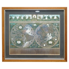
World Map Silver Leaf Print Based on Original Willem Blaeu Wall Map 1571-1638
Located in GB
We are delighted to offer for sale this lovely Antique style pictorial plan map of the globe based
Category
20th Century English Campaign Vintage Maps and Prints
Materials
Silver Leaf
H 22.05 in W 25.6 in D 0.99 in
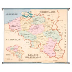
XL Old School Map of Belgium 'Printed by Procure', 1950s
Located in Oostende, BE
XL Old school map of Belgium (Printed by Procure). Presumably from around 1950-1960.
Category
1950s Belgian Mid-Century Modern Vintage Maps and Prints
Materials
Metal
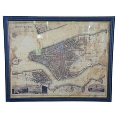
Vintage Oversized New York City Lower Manhattan 1840s Map Print
Located in Dayton, OH
Vintage late 20th century reproduction print of New York City featuring lower Manhattan in 1840.
Category
Late 20th Century Victorian Vintage Maps and Prints
Materials
Paper
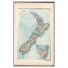
Antique Map of New Zealand and Tasmania, 1904
Located in Langweer, NL
This large antique map is taken from; 'Andrees Allgemeiner Handatlas in 126 Haupt-Und 139
Category
20th Century Vintage Maps and Prints
Materials
Paper
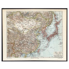
German Antique Map of China And Japan by Meyer, 1902
Located in Langweer, NL
antique print / plate / map originates from the 6th edition of a famous German encyclopedia: 'Meyers
Category
20th Century Vintage Maps and Prints
Materials
Paper
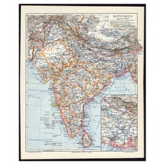
Antique German Map of India and Sri Lanka or Ceylon, 1902
By Meyer
Located in Langweer, NL
original old antique print / plate / map originates from 1885-1907 editions of a famous German encyclopedia
Category
20th Century Vintage Maps and Prints
Materials
Paper
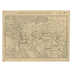
Eason's War Map of Europe, circa 1914
Located in Langweer, NL
Antique map titled 'Eason's War Map of Europe'. Printed in Ireland. Source unknown, to be
Category
20th Century Vintage Maps and Prints
Materials
Paper
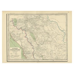
Antique Map of Padang, Sumatra, Indonesia, 1900
Located in Langweer, NL
Antique map titled 'De Padangsche Beneden-en Bovenlanden van de Koninginnedbaai tot Fort de Kock
Category
20th Century Vintage Maps and Prints
Materials
Paper
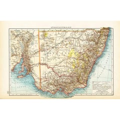
German Antique Map of Southeastern Australia, 1904
Located in Langweer, NL
This large antique map is taken from; 'Andrees Allgemeiner Handatlas in 126 Haupt-Und 139
Category
20th Century Vintage Maps and Prints
Materials
Paper
Antique Map of Southern India by Andree, 1904
Located in Langweer, NL
"Antique map titled 'Vorderindien, sudlicher Teil'. Map of India, southern part. This map
Category
20th Century Vintage Maps and Prints
Materials
Paper
Antique Map of Northwest Africa by Bartholomew, 1922
Located in Langweer, NL
Antique map of Africa titled 'North-West Africa'. Old map of north-west Africa depicting Morocco
Category
20th Century Vintage Maps and Prints
Materials
Paper
Antique Map of Sulawesi by Winkler Prins, c.1900
Located in Langweer, NL
Antique map titled 'Celebes.' (Sulawesi .) This map shows the Indonesian island of Sulawesi, one of
Category
20th Century Vintage Maps and Prints
Materials
Paper
Antique Map of the Batu Islands by Dornseiffen, 1900
Located in Langweer, NL
Antique map of the Batu Islands with the large title 'Soematra, Bangka en de Riouw-Lingga Archipel
Category
20th Century Vintage Maps and Prints
Materials
Paper
Vintage Map of Nantucket Town by Ruth Haviland Sutton, 1946
Located in Nantucket, MA
Vintage Map of Nantucket Town by Ruth Haviland Sutton, 1946, a classic vintage tourist map of
Category
1940s American Other Vintage Maps and Prints
Materials
Paper
Vintage Reproduction 17th Century Map of Europe, American, Cartography, Blaeuw
Located in Hele, Devon, GB
This is a vintage reproduction map of Europe. An American, paper stock cartography print in frame
Category
Late 20th Century Central American Mid-Century Modern Vintage Maps and Prints
Materials
Glass, Wood, Paper
H 30.32 in W 38.39 in D 1.38 in
Large Detailed Map of Australia Wint Inset of Tasmania, 1937
Located in Langweer, NL
Antique map titled 'Australia'. Large folding map of Australia. With inset map of Tasmania. Printed
Category
20th Century Vintage Maps and Prints
Materials
Paper
Very Large Vintage Map of Canada, German, Education, Institution, Cartography
Located in Hele, Devon, GB
This is a very large vintage map of Canada. A German, quality printed educational or institution
Category
Mid-20th Century German Vintage Maps and Prints
Materials
Paper
H 77.56 in W 85.04 in D 1.19 in
Vintage Print of the Lady of Stavoren by Voskuijl, 1946
Located in Langweer, NL
.
Date: 1946
Overall size: 35 x 35 cm.
We sell original antique maps to collectors, historians
Category
20th Century Vintage Maps and Prints
Materials
Paper
Decorative Vintage Print, Dutch Chart of Australia, 1st Edition, 1952
Located in Langweer, NL
educational materials, and printed by J. van Boekhoven in Utrecht, The Netherlands, ensuring its high printing
Category
Mid-20th Century European Vintage Maps and Prints
Materials
Canvas
Double Hemisphere Old World Map Print, Matted & Framed
Located in Plainview, NY
A double hemisphere old world map print. The map is a reproduction of the original of the 1788 Mapa
Category
20th Century Vintage Maps and Prints
Materials
Paper
Map of Paris Photography Fine Art Print Limited Edition
Located in Slovak Republic, SK
Old map of Paris/ 1937, limited edition of 15. Fine Art Print.
Category
1930s Other Art Style Vintage Maps and Prints
Materials
Color, Digital
1960s Canvas Wall School Chart with Sheep by Jung-Koch-Quentell
By Jung Koch Quentell 1
Located in Antwerp, BE
the animal in it's natural environment as well as some anatomical details.
This Pull down map theme
Category
Mid-20th Century German Mid-Century Modern Vintage Maps and Prints
Materials
Wood, Canvas, Paper
Antique Linen Anatomical School Poster from the Cow, 1950s
Located in HEVERLEE, BE
aspect of a cow to the pupils.
Printed on linen.
Cool curio item to decorate a restaurant, butcher
Category
1950s Belgian Vintage Maps and Prints
Materials
Linen
Jacques Liozu's 1951 illustrated map of Australia and Oceania
By Jacques Liozu
Located in PARIS, FR
Jacques Liozu's 1951 illustrated map of Australia and Oceania is a remarkable cartographic work
Category
1950s Vintage Maps and Prints
Materials
Paper, Lithograph
H 16.15 in W 22.05 in
"Rhode Island Map, 1933"
Located in Bristol, CT
Classic c1933 colour (12 fold) red framed map of Rhode Island designed by H.W. Hetherington from
Category
1930s Vintage Maps and Prints
Materials
Lithograph
Jacques Liozu's 1951 illustrated map of North and Central America
By Jacques Liozu
Located in PARIS, FR
Jacques Liozu's 1951 illustrated map of North and Central America is an exceptional work of
Category
1950s Vintage Maps and Prints
Materials
Paper, Lithograph
H 22.05 in W 16.15 in
Jacques Liozu's 1951 illustrated map of Central and Eastern Europe
By Jacques Liozu
Located in PARIS, FR
Jacques Liozu's 1951 illustrated map of Central and Eastern Europe is a cartographic work of great
Category
1950s Vintage Maps and Prints
Materials
Paper, Lithograph
Wine Map of Bordeaux
Located in New York, NY
Original color lithograph for Établissements D. Cordier S.A. Draeger, Imp., circa 1938.
Category
1930s Vintage Maps and Prints
Materials
Paper
Illustrated map from 1934 of the main Italian popular costumes - Old map
Located in PARIS, FR
Very beautiful illustrated map from 1934 of the main Italian popular costumes.
Italy - Tourism
Category
1930s Vintage Maps and Prints
Materials
Paper, Linen, Lithograph
Map of Edgartown, Martha's Vineyard
Located in New York, NY
Original map of Edgartown, Martha's Vineyard with recent hand-coloring, 1938. Light toning to edges
Category
1930s Vintage Maps and Prints
Materials
Paper
Map of Chatham, Cape Cod
Located in New York, NY
Original map of Chatham, Cape Cod, with recent hand-coloring, 1938. Light toning to edges; has
Category
1930s Vintage Maps and Prints
Materials
Paper
Jacques Liozu's 1951 illustrated map of Alsace and Lorraine in France
By Jacques Liozu
Located in PARIS, FR
Jacques Liozu's 1951 illustrated map of Alsace and Lorraine is a remarkable work of cartography
Category
1950s Vintage Maps and Prints
Materials
Paper, Lithograph
Original 'Map of the United States as Californians See It' vintage map poster
Located in Spokane, WA
Original vintage poster: "Map of the United States as Californians See It". 1947, artist: Oren
Category
1940s American Modern Vintage Maps and Prints
Materials
Offset
H 16.5 in W 20.5 in D 0.04 in
Section of Word Map-A Puzzle
By Oyvind Fahlstrom
Located in New York, NY
This lithograph by Oyvind Fahlstrom, produced in an edition of 100, is offered by CLAMP in New York City.
Category
1970s Contemporary Vintage Maps and Prints
Materials
Lithograph
Jacques Liozu's 1951 illustrated map of Asia
By Jacques Liozu
Located in PARIS, FR
Jacques Liozu's 1951 illustrated map of Asia is an exceptional work of cartography that combines
Category
1950s Vintage Maps and Prints
Materials
Paper, Lithograph
Coronation Arrangements Leaflet Map of London 1937 Vintage Transport map poster
Located in London, GB
Anon.
Coronation Arrangements - Map of London
1937
45x60cm (unfolded)
Lithograph
Published for
Category
1930s Modern Vintage Maps and Prints
Materials
Lithograph
Griffin's 1955 Northern Ireland original map - Tourism - Geography
Located in PARIS, FR
geography and features. Printed by James Upton Limited in Birmingham, this map is not just a navigational
Category
1950s Vintage Maps and Prints
Materials
Linen, Lithograph, Paper
Jacques Liozu's 1951 illustrated map of South America
By Jacques Liozu
Located in PARIS, FR
Jacques Liozu's 1951 illustrated map of South America is an exceptional work of cartography that
Category
1950s Vintage Maps and Prints
Materials
Paper, Lithograph
1937 Original planisphere by Lucien boucher - World map
By Lucien Boucher
Located in PARIS, FR
Original poster
Airline Company - Map - Tourism
West - Northern - Orient - Midi
In 1937, Lucien
Category
1930s Vintage Maps and Prints
Materials
Linen, Lithograph, Paper
The Dole Map of the Hawaiian Islands.
Located in New York, NY
Original color lithograph. Honolulu. Hawaiian Pineapple Company, 1950.
Category
1950s Vintage Maps and Prints
Materials
Paper
Vintage German Map Rhineland Rollable Wall Chart Poster Print
Located in Berghuelen, DE
A country core vintage pull-down map illustrating the popular German region of the Rhineland
Category
1960s German Country Vintage Maps and Prints
Materials
Canvas, Wood, Paper
illustrated map of Morocco created in 1950 by Delaye
Located in PARIS, FR
are represented. This illustrated map is printed by Perceval in Rabat.
Map - North Africa
Category
1950s Vintage Maps and Prints
Materials
Lithograph, Paper
Original Las Vegas Fun Map vintage 1960s travel poster
Located in Spokane, WA
Original 1960 Las Vegas Fun Map. Archival linen backed and in very good condition, ready to
Category
1960s American Modern Vintage Maps and Prints
Materials
Offset
Union Pacific West vintage fun map railroad travel poster
Located in Spokane, WA
Original “The Union Pacific West fun map, archivally linen backed in very good condition. Ready to
Category
1960s American Modern Vintage Maps and Prints
Materials
Offset
Original poster made by Monique Cras - Map - New Caledonia
Located in PARIS, FR
Caledonia, and Overseas.
This magnificent map introduces us to New Caledonia as well as to all the great
Category
Mid-20th Century Vintage Maps and Prints
Materials
Paper, Lithograph, Linen
H 16.54 in W 24.41 in
Original Southern California Home Federal Fun Map vintage poster
Located in Spokane, WA
Original California Fun Map vintage poster from 1973. Archival linen backed in fine condition
Category
1970s American Modern Vintage Maps and Prints
Materials
Offset
H 38 in W 24.5 in D 0.05 in
1953 Coronation Map for London Transport
Located in London, GB
."
Coronation Arrangements – Map of London (1953)
Lithograph
45 x 60 cm (unfolded)
Published by London
Category
1950s Vintage Maps and Prints
Materials
Lithograph
1937 Coronation Map for London Transport
Located in London, GB
."
Coronation Arrangements – Map of London (1937)
Lithograph
45 x 60 cm (unfolded)
Published by London
Category
1950s Vintage Maps and Prints
Materials
Lithograph
Original map of Corsica by Carriat-Rolant - Travel poster - Tourism
Located in PARIS, FR
dynamism. Drawn by Gabriel Carriat-Roland, the map presents the urban agglomerations in the form of small
Category
Mid-20th Century Vintage Maps and Prints
Materials
Paper, Lithograph
Pair of Prints Depicting Antique World Maps Framed in Burl Wood
Located in Dallas, TX
A pair of prints depicting antique world maps framed in burl wood. One picture contains a depiction
Category
20th Century American Vintage Maps and Prints
Materials
Paper
London Underground Map of London Christmas poster by Clifford and Rosemary Ellis
By Clifford & Rosemary Ellis
Located in London, GB
message if you cannot find the poster you want.
Clifford and Rosemary Ellis
London Underground Map
Category
1930s Modern Vintage Maps and Prints
Materials
Lithograph
London Underground Map of London Christmas poster by Clifford and Rosemary Ellis
By Clifford & Rosemary Ellis
Located in London, GB
message if you cannot find the poster you want.
Clifford and Rosemary Ellis
London Underground Map
Category
1930s Modern Vintage Maps and Prints
Materials
Lithograph
Illustrated map of Italy by Umberto Zimelli dating from 1933
Located in PARIS, FR
Very nice illustrated map of Italy dating from 1933.
Italy - Tourism
Category
1930s Vintage Maps and Prints
Materials
Paper, Lithograph, Linen
H 26.38 in W 18.51 in
1938 original map titled "Carte du réseau aérien français" Air France
Located in PARIS, FR
the airline and printed by Perceval Paris, this map provides a visual representation of Air France's
Category
1930s Vintage Maps and Prints
Materials
Linen, Paper, Lithograph
Original Los Angeles, California Funny Funny World vintage fun map
Located in Spokane, WA
Original Los Angeles, California vintage fun map, Funny Funny World. Archival linen backed in
Category
1970s American Modern Vintage Maps and Prints
Materials
Offset
Jacques Liozu's 1951 illustrated map of the region of Franche-Comté
By Jacques Liozu
Located in PARIS, FR
Jacques Liozu's 1951 illustrated map of Franche-Comté is a cartographic work of great beauty and
Category
1950s Vintage Maps and Prints
Materials
Paper, Lithograph
Original San Francisco, California vintage fun map poster Henry Hinton
Located in Spokane, WA
Original San Francisco, California fun map vintage poster 1970. Archival linen backed in very
Category
1970s American Impressionist Vintage Maps and Prints
Materials
Offset
H 37 in W 24 in D 0.05 in
Original poster of Thurnher Weiss representing an illustrated map of Vorarlberg
Located in PARIS, FR
Original poster of Thurnher Weiss representing an illustrated map of Vorarlberg which is a region
Category
Mid-20th Century Vintage Maps and Prints
Materials
Paper, Lithograph
Antique Map of The City of Rome by Sebastian Münster, 1549
By Sebastian Münster
Located in Larchmont, NY
Sebastian Münster (German, 1488-1552)
LA SITUATION DE LA VILLE DE ROME
Antique Map of Rome, 1549
Category
1960s Realist Vintage Maps and Prints
Materials
Woodcut
An original poster featuring an illustrated map of Tenerife - La Lucha
Located in PARIS, FR
A beautiful poster featuring an illustrated map of Tenerife or Tenerife, an island in Spain that
Category
1950s Vintage Maps and Prints
Materials
Paper, Lithograph
H 18.51 in W 26.38 in
- 1
- ...
Get Updated with New Arrivals
Save "Vintage Maps And Prints", and we’ll notify you when there are new listings in this category.
Vintage Maps And Prints For Sale on 1stDibs
An assortment of vintage maps and prints is available on 1stDibs. Today, if you’re looking for Art Deco editions of these works and are unable to find the perfect match for your home, our selection also includes contemporary. These items have long been popular, with older editions for sale from the 20th Century and newer versions made as recently as the 20th Century. Vintage maps and prints available on 1stDibs span a range of colors that includes gray, beige, black, blue and more. Uwe Ommer, (after) Henri Matisse, Henri Matisse, Helmut Newton and William Gropper took a thoughtful approach to this subject that are worth considering. Each of these unique pieces was handmade with extraordinary care, with artists most often working in paper, lithograph and pigment print.
How Much are Vintage Maps And Prints?
The average selling price for vintage maps and prints we offer is $1,458, while they’re typically $0 on the low end and $234,000 for the highest priced.
More Ways To Browse
Icecream Vintage
Vignobles De France
Vintage Bedding Sets
Tony Shore
Vintage Algerie
Northumberland Map
Old Israel Map
Vintage Hunting Posters
Giant Frog
Vintage London Tube Map
King Philip Vi
Gately Williams
Large Vintage Treasure Chest
Roussillon Provence
Locomotive Lithograph
Crab Chest
Original Cambridge Railway Poster
Picasso Frog
