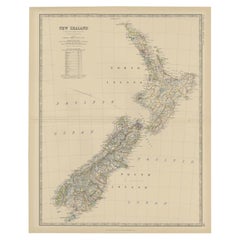
New Zealand Map
12
to
37
123
21
55
45
43
40
24
22
18
15
11
10
10
8
7
7
6
6
5
5
5
4
4
4
4
3
3
3
2
2
2
2
1
1
1
1
1
1
3
3
2
2
2
Sort By
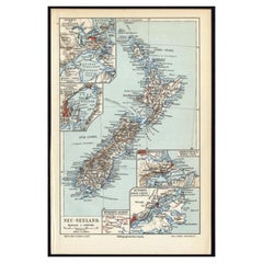
Antique Map of New Zealand, 1895
Located in Langweer, NL
Antique map titled 'Neu-Seeland.' Map of New Zealand. With inset maps of the large cities. This
Category
Antique 19th Century Maps
Materials
Paper
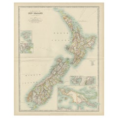
Antique Map of New Zealand by Johnston '1909'
Located in Langweer, NL
Antique map titled 'New Zealand'. Original antique map of New Zealand. With inset maps of Chatham
Category
Early 20th Century Maps
Materials
Paper
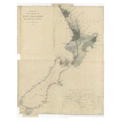
Antique Map of New Zealand by Arrowsmith '1844'
Located in Langweer, NL
Antique map titled 'Map of the colony of New Zealand from official documents'. A scarce map of New
Category
Antique Mid-19th Century Maps
Materials
Paper
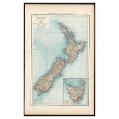
Antique Map of New Zealand and Tasmania, 1904
Located in Langweer, NL
This large antique map is taken from; 'Andrees Allgemeiner Handatlas in 126 Haupt-Und 139
Category
20th Century Maps
Materials
Paper
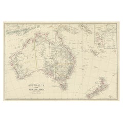
Antique Map of Australia and New Zealand, c.1860
Located in Langweer, NL
Antique map titled 'Australia and New Zealand'. Unusual edition of this map of Australia and New
Category
Antique 19th Century Maps
Materials
Paper
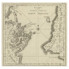
Antique Map of Cook's Strait in New Zealand, 1803
Located in Langweer, NL
Antique map New Zealand titled 'Kaart van Cooks Straat in Nieuw Zeeland'. Antique map of Cook's
Category
Antique 19th Century Maps
Materials
Paper
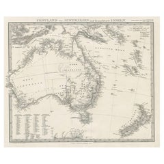
German Antique Map of Australia and New Zealand, 1857
Located in Langweer, NL
Australia and New Zealand, including excellent detail in the settled regions of both. Large list of
Category
Antique 19th Century Maps
Materials
Paper
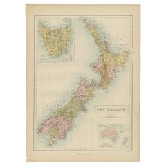
Antique Map of New Zealand by A & C. Black, 1870
Located in Langweer, NL
Antique map titled 'New Zealand'. Original antique map of New Zealand with inset Maps of Australia
Category
Antique Late 19th Century Maps
Materials
Paper
Antique Map of New Zealand by Scottish Geographer Johnston, 1882
Located in Langweer, NL
Antique map titled 'New Zealand'.
Old map of New Zealand. This map originates from 'The Royal
Category
Antique 19th Century Maps
Materials
Paper
Large Original Vintage Map of New Zealand, North Island, circa 1920
Located in St Annes, Lancashire
Great map of North Island, New Zealand
Original color.
Good condition / minor foxing to
Category
Vintage 1920s English Edwardian Maps
Materials
Paper
No Reserve
H 25 in W 19.5 in D 0.07 in
Large Original Vintage Map of New Zealand, South Island, circa 1920
Located in St Annes, Lancashire
Great map of South Island, New Zealand
Original color.
Good condition / repair to a minor
Category
Vintage 1920s English Edwardian Maps
Materials
Paper
No Reserve
H 25 in W 19.5 in D 0.07 in
Antique Map of Australasia, New Zealand, Polynesia & the Pacific Ocean, 1840
Located in Langweer, NL
Antique map titled 'The Pacific Ocean'.
This map depicts Australasia, New Zealand, Polynesia
Category
Antique 1840s Maps
Materials
Abalone, Paper
H 13.39 in W 16.15 in D 0 in
Map of New Zealand Showing Maori Culture and Early Colonial Settlements, 1851
Located in Langweer, NL
being depicted.
The map of New Zealand you've mentioned would have been created when New Zealand was a
Category
Antique 1850s Maps
Materials
Paper
H 14.26 in W 10.71 in D 0 in
Antique Map of Australia and New Zealand by W. G. Blackie, 1859
Located in Langweer, NL
Antique map titled 'Australia and New Zealand'. Original antique map of Australia and New Zealand
Category
Antique Mid-19th Century Maps
Materials
Paper
Old Map of the Oceans Around Australia, Indonesia and New Zealand, 1880
Located in Langweer, NL
Antique map titled 'Océanie'.
Old map of the oceans around Australia, Indonesia and New Zealand
Category
Antique 1880s Maps
Materials
Paper
Map of Australia, New Zealand, Part of China, Japan and Southeast Asia, 1857
Located in Langweer, NL
German Antique map titled 'Australien'. Map of Australia, New Zealand, part of China, Japan and
Category
Antique 19th Century Maps
Materials
Paper
No Reserve
H 23.23 in W 27.96 in D 0 in
Antique Map of Australia, New Zealand and Oceania by F. von Stülpnagel, 1850
Located in Langweer, NL
Antique map titled 'Australien und Polynesien in Mercators Projection'. A map of Australia, New
Category
Antique Mid-19th Century Maps
Materials
Paper
H 15.16 in W 18.31 in D 0.02 in
Antique Map of Oceania and the Pacific Ocean, Australia and New Zealand, 1826
Located in Langweer, NL
Antique map of Australia titled 'Karte von Australien'. Old map of Australia and New Zealand
Category
Antique 19th Century Maps
Materials
Paper
H 8.47 in W 9.85 in D 0 in
Detailed Map of New Zealand Showing the Route of Capt. Cook's First Voyage, 1803
Located in Langweer, NL
Antique map New Zealand titled 'De Rivier de Theems en Mercurius Baai in Nieuw Zeeland'. Detailed
Category
Antique 19th Century Maps
Materials
Paper
H 13.78 in W 20.48 in D 0 in
Antique Map of the Dusky Bay or Dusky Sound of New Zealand by Captain Cook, 1803
Located in Langweer, NL
Antique map New Zealand titled 'Schets van de Donkere Baai in Nieuw Zeeland 1773'.
Antique map
Category
Antique Early 1800s Maps
Materials
Paper
H 11.03 in W 19.3 in D 0 in
Map Silk Embroidered Western Eastern Hemisphere New Old World Asia America Afri
Located in BUNGAY, SUFFOLK
, Metropolitan Museum, 57.122.212. Dimensions: 16 1/4 in. × 27 in. (41.3 × 68.6 cm)
Museum of New Zealand
Category
Antique 18th Century British Georgian Maps
Materials
Silk
H 0.4 in W 0.4 in D 0.4 in
Colored wall map of the WORLD
By Chambon
Located in ZWIJNDRECHT, NL
-known Strait of Juan de Fuca. Australia and New Zealand are depicted in typical post-Tasman form
Category
Antique Mid-18th Century French French Provincial Maps
Materials
Wood, Paper
Antique Map of Oceania by Delamarche, 1836
Located in Langweer, NL
.' Antique map of Oceania comprising Australia and Polynesia, New Zealand and Indonesia. This map originates
Category
Antique 19th Century Maps
Materials
Paper
Antique Map of Oceania by Johnston, 1882
Located in Langweer, NL
New Zealand. This map originates from 'The Royal Atlas of Modern Geography, Exhibiting, in a Series of
Category
Antique 19th Century Maps
Materials
Paper
Antique Map of Oceania by Levasseur, circa 1860
Located in Langweer, NL
Antique map titled 'Carte générale de l'Océanie'. Large map of Oceania including New Zealand
Category
Antique Mid-19th Century Maps
Materials
Paper
Antique Map of Australia by H. Kiepert, 1875
Located in Langweer, NL
Antique map titled 'Australien'. Large and detailed map of Australia and New Zealand. With color
Category
Antique Late 19th Century Maps
Materials
Paper
Antique Map of Polynesia and Australasia by Neele, 1825
Located in Langweer, NL
Antique map titled 'Polynesia and Australasia'. It shows Australia (New Holland), part of Asia, New
Category
Antique Early 19th Century Maps
Materials
Paper
Antique Map of East Asia by Coronelli, circa 1690
Located in Langweer, NL
Antique map of East Asia showing New Holland and parts of Van Diemens Land and New Zealand. This
Category
Antique Late 17th Century Maps
Materials
Paper
Interesting Original Antique Hemisphere Map Showing the Latest Discoveries
Located in Langweer, NL
from Cook. New Zealand is shown. Australia retains it's a mostly conjectural mid-18th Century Coastline
Category
Antique Late 18th Century Maps
Materials
Paper
No Reserve
H 13.39 in W 22.05 in D 0.02 in
Antique Map of the Pacific Ocean by Rienzi, 1836
Located in Langweer, NL
, the Solomon Islands and New Zealand. This print originates from M.G.L. Domeny de Rienzi's 'Oceanie, ou
Category
Antique 19th Century Maps
Materials
Paper
Antique Map of the Low Countries by Cary, 1813
Located in Langweer, NL
Antique map of the Netherlands titled 'A New Map of the United Provinces comprehending Holland
Category
Antique 19th Century Maps
Materials
Paper
Antique Detailed World Map Drawn on Mercator's Projection, 1700
Located in Langweer, NL
Antique world map titled 'Carte generale du monde, ou description du monde terrestre & Aquatique
Category
Antique 17th Century Maps
Materials
Paper
Antique Bible World Map by R. & J. Wetstein, 1743
Located in Langweer, NL
polar hemisphere maps and astronomical diagrams. The information about Australia, Tasmania and New
Category
Antique Mid-18th Century Maps
Materials
Paper
Antique Map of Harvey Island and Surroundings by Cook, 1803
Located in Langweer, NL
largely uncharted areas of the globe. He mapped lands from New Zealand to Hawaii in the Pacific Ocean in
Category
Antique 19th Century Maps
Materials
Paper
Free Shipping
H 13.19 in W 16.34 in D 0 in
Title: Mid-19th Century Map of Australasia by Carl Flemming - 1855
Located in Langweer, NL
representation of Australasia, encompassing Australia, New Zealand, parts of Indonesia and Polynesia, as well as
Category
Antique 1850s Maps
Materials
Paper
No Reserve
H 14.06 in W 17.52 in D 0 in
Antique Map of the World on Mercator Projection by Anson, 1749
Located in Langweer, NL
Hemisphere, Northwest passage, no New Zealand and a host of other cartorgraphic misconceptions. Shows Anson's
Category
Antique 18th Century Maps
Materials
Paper
Antique Map of Australia and surrounding Islands by F. von Stülpnagel, 1850
Located in Langweer, NL
Zealand, Southern New-Guinea and surrounding islands. This map originates from Stieler's Hand-Atlas, 1850.
Category
Antique Mid-19th Century Maps
Materials
Paper
H 15.16 in W 18.31 in D 0.02 in
Very Attractive Antique Map of the World as Planisphere, Shows Cook's Voyages
Located in Langweer, NL
of Cook's Voyages were integrated into the map, showing better detail in New Zealand, Australia, the
Category
Antique Late 18th Century Maps
Materials
Paper
No Reserve
H 16.15 in W 20.08 in D 0.02 in
Antique Miniature Map of the Western Hemisphere, with California as an Island
Located in Langweer, NL
Northwest Coast of America and an incomplete New Zealand. This map originates from 'Description de l
Category
Antique Late 17th Century Maps
Materials
Paper
H 8.27 in W 5.6 in D 0.02 in
Antique Map of the World in Hemispheres by Keizer & de Lat, 1788
Located in Langweer, NL
. Australia and New Zealand are shown with incomplete coastlines. The map contains six smaller astronomical
Category
Antique Late 18th Century Maps
Materials
Paper
Gorgeous Antique World Map by the Dutch Mapmaker Visscher, published circa 1679
Located in Langweer, NL
. There is only one open ended Great Lake. Australia and New Zealand are substantially incomplete
Category
Antique Late 17th Century Maps
Materials
Paper
Free Shipping
H 20.79 in W 25.2 in D 0.02 in
Old Map of the Pacific, Incl Australia, Polynesia, Melanesia and Malaysia, 1872
Located in Langweer, NL
and as far south as New Zealand. Inset in the lower right quadrant depicts the Sandwich or Hawaiian
Category
Antique 1870s Maps
Materials
Paper
No Reserve
H 12.21 in W 15.16 in D 0 in
Captain Cook's Exploration of Tahiti 18th C. Hand-Colored Map by Bellin
By Jacques-Nicolas Bellin
Located in Alamo, CA
European discovery of the Hawaiian Islands, and the first recorded circumnavigation of New Zealand. Each of
Category
Antique Mid-18th Century French Maps
Materials
Paper
H 11.38 in W 17.5 in D 0.13 in
Antique Map of the World with Polar Projections by Keizer & de Lat, 1788
Located in Langweer, NL
polar projections. In North America, there is a large Island of California. Australia and New Zealand
Category
Antique Late 18th Century Maps
Materials
Paper
H 8.08 in W 11.03 in D 0.02 in
Antique Map of the World in 12 Globe Gores by Scherer, 'circa 1702'
Located in Langweer, NL
bit of New Zealand shown, along with a curious oversized Tierra Del Fuego. Published by H. Scherer
Category
Antique Early 18th Century Maps
Materials
Paper
Early Map of Australasia, Marking The Route of Abel Tasman in 1642 'Publ. 1726'
Located in Langweer, NL
1642, on which he discovered Tasmania and New Zealand and proved that Australia was not part of the
Category
Antique 1720s Maps
Materials
Paper
H 12.6 in W 19.69 in D 0 in
Print of Maps of Islands of the South Pacific, Incl. Pitcairn & Dusky Bay, 1788
Located in Langweer, NL
rose and inset of Dusky Bay on New Zealand. This map originates from 'Atlas encyclopedique: contenant
Category
Antique 1780s Maps
Materials
Paper
No Reserve
H 12.21 in W 18.31 in D 0 in
Original Vintage Travel Advertising Poster NAC New Zealand Airways Airline Map
Located in London, GB
plane over a route map of New Zealand marking the stops in the country and international flight links
Category
Vintage 1950s New Zealand Posters
Materials
Paper
H 37.6 in W 28.75 in D 0.04 in
Large Antique Sea Chart of the South-Eastern Coast of Sumatra, Indonesia
Located in Langweer, NL
tribe in the Bay of Islands off the coast of New Zealand. With title upper left corner and small inset
Category
Antique Late 18th Century Maps
Materials
Paper
H 30.2 in W 20.87 in D 0.02 in
Map Mural Rollable Poster Vintage Wall Chart Australia New Zealand Polynesia
Located in Berghuelen, DE
Map Mural Rollable Poster Vintage Wall Chart Australia New Zealand Polynesia
A beautiful vintage
Category
Vintage 1970s German Country Posters
Materials
Canvas, Wood, Paper
H 70.87 in W 64.57 in D 0.79 in
Vintage Mural Map Rollable Wall Chart Poster Australia New Zealand Indonesia
Located in Berghuelen, DE
Vintage Mural Map Rollable Wall Chart Poster Australia New Zealand Indonesia
The vintage pull-down
Category
Vintage 1970s German Country Posters
Materials
Canvas, Wood, Paper
H 39.38 in W 48.04 in D 0.79 in
"Choke II: Cook Strait (North & South Island, New Zealand)" - ceramic - map
By Gregor Turk
Located in Atlanta, GA
This ceramic wall sculpture features a topographic map in black and white.
Gregor is inspired by
Category
2010s Abstract Sculptures
Materials
Ceramic
Original WWII Map of New Zealand - Natural & Industrial Resources in War & Peace
By "Leslie MacDonald ""Max"" Gill"
Located in London, GB
Original vintage World War Two pictorial map for New Zealand her natural and Industrial resources
Category
Vintage 1940s British Posters
Materials
Paper
H 30.52 in W 20.08 in D 0.04 in
'Mount Taranaki, New Zealand' — from the series 'Axis Mundi', Contemporary
Located in Myrtle Beach, SC
Beth Ganz, 'Mount Taranaki, New Zealand', copperplate photogravure etching, edition 10, 2020
Category
21st Century and Contemporary Contemporary Landscape Prints
Materials
Photogravure, Etching
The King-Country; or, Explorations in New-Zealand by Kerry-Nicholls (1884)
Located in Langweer, NL
'The King-Country; or, Explorations in New-Zealand' by J.H. Kerry-Nicholls. Ibid., Sampson Low etc
Category
Antique Late 19th Century Books
Materials
Paper
H 9.06 in W 6.11 in D 1.38 in
Original Vintage Pan Am Travel Poster To Australia And New Zealand Pan American
Located in London, GB
Original vintage Pan Am travel poster - to Australia and New Zealand PAA Pan American World Airways
Category
Vintage 1940s American Posters
Materials
Paper
H 40.16 in W 28.35 in D 0.04 in
Antique Print of a Landscape with Rock Formation in New Zealand by Cook, 1803
By Cook
Located in Langweer, NL
Antique print New Zealand titled 'Gezigt van eene doorboorde Rots in Nieuw-Zeeland'. Antique print
Category
Antique 19th Century Prints
Materials
Paper
H 11.42 in W 9.06 in D 0 in
Antique Print of a New Zealand Village Located on a Rock by Captain Cook, 1803
By Cook
Located in Langweer, NL
Antique print New Zealand titled 'Verschanst Dorp op eene doorboorde Rots in Nieuw-Zeeland
Category
Antique 19th Century Prints
Materials
Paper
H 11.42 in W 9.06 in D 0 in
Shaw Savill Line by A E Agar brochure Ocean Liners c1940s New Zealand via Panama
Located in London, GB
.
24x34cm (approx)
Provenance: the artist's estate
As new, unissued printer's proof. Could be trimmed to
Category
Mid-20th Century Modern More Prints
Materials
Lithograph
H 9.45 in W 13.39 in
Map of the World: An Original 18th Century Hand-colored Map by E. Bowen
Located in Alamo, CA
This is an original 18th century hand-colored map entitled "A New & Correct Chart of All The Known
Category
Mid-18th Century Old Masters Landscape Prints
Materials
Engraving
- 1
Get Updated with New Arrivals
Save "New Zealand Map", and we’ll notify you when there are new listings in this category.
New Zealand Map For Sale on 1stDibs
At 1stDibs, there are many versions of the ideal new zealand map for your home. A new zealand map — often made from paper, canvas and fabric — can elevate any home. You’ve searched high and low for the perfect new zealand map — we have versions that date back to the 19th Century alongside those produced as recently as the 20th Century are available. A new zealand map, designed in the Victorian style, is generally a popular piece of furniture. A well-made new zealand map has long been a part of the offerings for many furniture designers and manufacturers, but those produced by Leslie MacDonald Gill are consistently popular.
How Much is a New Zealand Map?
Prices for a new zealand map start at $71 and top out at $3,189 with the average selling for $296.
More Ways To Browse
Peter Burns
Boat In Storm
Little Boy Blue
French Women Paintings 1900s
Steamship Line
18th Century Canadian Art
Club 57
How To Leave Review
How To Leave A Review
Retro French School Maps
Retro French School Map
Storm Coming
Keep Your Cool
Map Southern Africa
Vintage Great Lakes Posters
George Washington Smith Homes
Elderly Couple
Mens Ring Size 3 Inches
