Items Similar to Large Antique Wall Map of Friesland by Vegelin van Claerbergen, 1739
Want more images or videos?
Request additional images or videos from the seller
1 of 5
Large Antique Wall Map of Friesland by Vegelin van Claerbergen, 1739
About the Item
Antique map titled 'Nieuwe Caert van Frieslant, Vermeerdert en verbetert op order der Ed. Mo. Heeren Gedeputeerde Staeten'.
Rare and large attractive wall map of Friesland, the so-called 'Vegelin-map'. It shows the region of Oostergo, Westergo and Zevenwolden in Friesland, the Netherlands. Decorated with coats of arms of Friesland, Oostergo, Zevenwolden and other regions and cities/villages of Friesland. Artists and Engravers: For this particular map, Bernhardus Schotanus à Sterringa prepared the plates. However, these plates were never published in his 'Schotanus Atlas'. He wanted the plates to be published as a large wall map but the provincial council was not prepared to pay the extra costs. After Schotanus his death, Francois Halma received his plates and in 1712 Halma was asked to reissue the Schotanus atlas. This 'Halma Atlas' was published in 1718 but for unknown reasons, again, the plates of this map were not included. In 1730, Tobias van Dessel, received the plates of Halma. In 1734, Johan Vegelin van Claerbergen asked the provincial council to publish the wall map. After all these years, the wall map was published and created by Tobias van Dessel, Reinier Ottens and Joshua Ottens in 1739.
Artist: For this particular map, Bernhardus Schotanus à Sterringa prepared the plates. However, these plates were never published in his 'Schotanus Atlas'. He wanted the plates to be published as a large wall map but the provincial council was not prepared to pay the extra costs. After Schotanus his death, Francois Halma received his plates and in 1712 Halma was asked to reissue the Schotanus atlas. This 'Halma Atlas' was published in 1718 but for unknown reasons, again, the plates of this map were not included. In 1730, Tobias van Dessel, received the plates of Halma. In 1734, Johan Vegelin van Claerbergen asked the provincial council to publish the wall map. After all these years, the wall map was published and created by Tobias van Dessel, Reinier Ottens and Joshua Ottens in 1739.
Condition: Very good, given age. Original folds, as issued. Three spots in the intersection of fold lines, with slight paper separation as is common with such a large map (backed). Light creasing. Printed from 6 plates attached together. General age-related toning and/or occasional minor defects from handling.
Please study image carefully.
Date: 1739
Overall size: 127 x 117 cm.
Image size: 124.5 x 113.5 cm.
We sell original antique maps to collectors, historians, educators and interior decorators all over the world. Our collection includes a wide range of authentic antique maps from the 16th to the 20th centuries. Buying and collecting antique maps is a tradition that goes back hundreds of years. Antique maps have proved a richly rewarding investment over the past decade, thanks to a growing appreciation of their unique historical appeal. Today the decorative qualities of antique maps are widely recognized by interior designers who appreciate their beauty and design flexibility. Depending on the individual map, presentation, and context, a rare or antique map can be modern, traditional, abstract, figurative, serious or whimsical. We offer a wide range of authentic antique maps for any budget.
- Dimensions:Height: 46.07 in (117 cm)Width: 50.01 in (127 cm)Depth: 0 in (0.01 mm)
- Materials and Techniques:
- Period:
- Date of Manufacture:1739
- Condition:Condition: Very good, given age. Original folds, as issued. Three spots in the intersection of fold lines, with slight paper separation as is common with such a large map (backed). Light creasing. Printed from 6 plates attached together.
- Seller Location:Langweer, NL
- Reference Number:
About the Seller
5.0
Platinum Seller
These expertly vetted sellers are 1stDibs' most experienced sellers and are rated highest by our customers.
Established in 2009
1stDibs seller since 2017
1,933 sales on 1stDibs
Typical response time: <1 hour
- ShippingRetrieving quote...Ships From: Langweer, Netherlands
- Return PolicyA return for this item may be initiated within 14 days of delivery.
More From This SellerView All
- Antique Map of Friesland by Van Krevelt, 1787Located in Langweer, NLAntique map titled 'Nieuwe Kaart van Friesland behoorende tot het Vaderlandsch Woordenboek van Jacobus Kok'. Original antique map of the province of Friesland, the Netherlands. This ...Category
Antique 18th Century Maps
MaterialsPaper
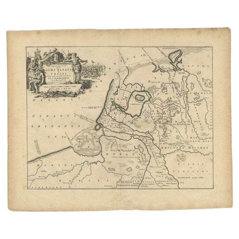
- Antique Map of the Old Land of Batavia and FriesLand, The Netherlands, 1697Located in Langweer, NLAntique map Friesland titled 'Descriptio veteris Agri Batavi et Frisii (..)'. Old map of Friesland, the Netherlands. Depicts the old land of Batavia and Friesland. This map originate...Category
Antique 17th Century Maps
MaterialsPaper
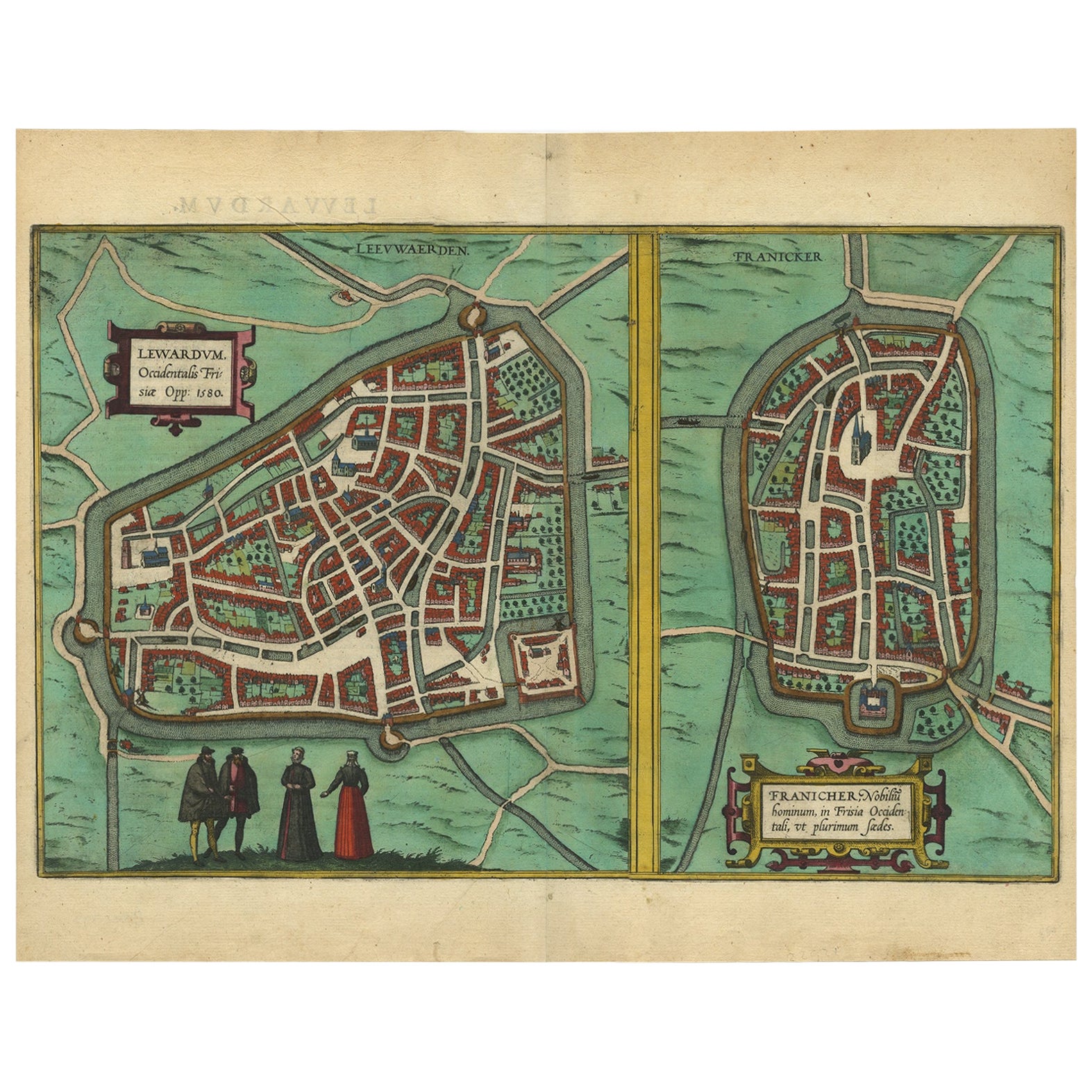
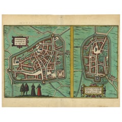
- Antique Map of The Frisian Cities Leeuwarden and Franeker in Friesland, 1580Located in Langweer, NLAntique map titled 'Lewardum Occidentlis Frisiae Opp: 1580, Franicher Nobiliu hominum, in Frisia Occidentali, ut plurimum saedes'. This sheet contains two very detailed bird?s-ey...Category
Antique 16th Century Maps
MaterialsPaper
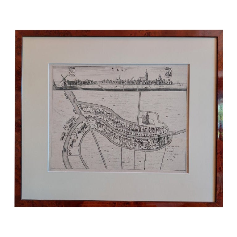
- Antique City View and Map of IJlst, City in Friesland, Holland, Framed, 1664Located in Langweer, NLAntique map titled 'Ylst'. Old map and city view of the city of IJlst, Friesland. This map originates from 'Beschrijvinge van de Heerlyckheydt van Frieslandt' by B. Schotanus à Sterr...Category
Antique 17th Century Maps
MaterialsPaper
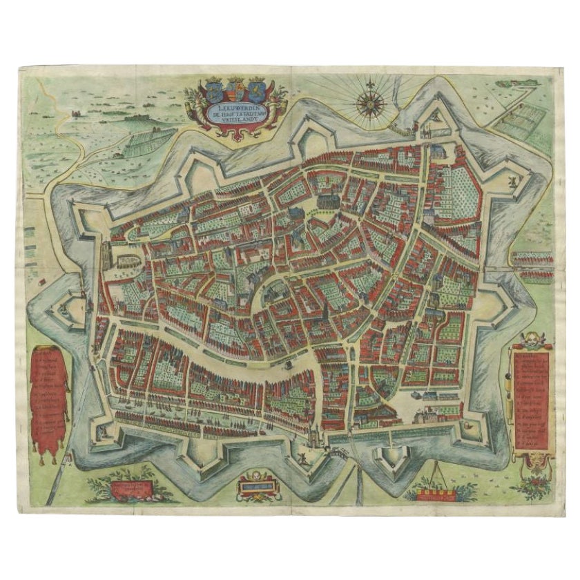
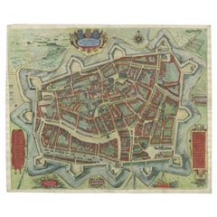
- Handcolored Rare Map of Leeuwarden, Capital of Friesland, The Netherlands, 1622Located in Langweer, NLAntique map titled 'Leeuwerden de Hooftstadt van Vrieslandt'. Rare and old map of the city of Leeuwarden, Friesland. Artists and Engravers: Published by Pieter Feddes van Harlingen...Category
Antique 17th Century Maps
MaterialsPaper
- Antique Map of Friesland by Guicciardini, 1613Located in Langweer, NLAntique map titled 'Frisia Occidenta.' (Map of the province of Friesland, the Netherlands.) This original old antique print / plate originates from the scarse French edition of 'Desc...Category
Antique 17th Century Maps
MaterialsPaper

You May Also Like
- Large Original Antique Map of Poland by Sidney Hall, 1847Located in St Annes, LancashireGreat map of Poland Drawn and engraved by Sidney Hall Steel engraving Original colour outline Published by A & C Black. 1847 Unframed ...Category
Antique 1840s Scottish Maps
MaterialsPaper
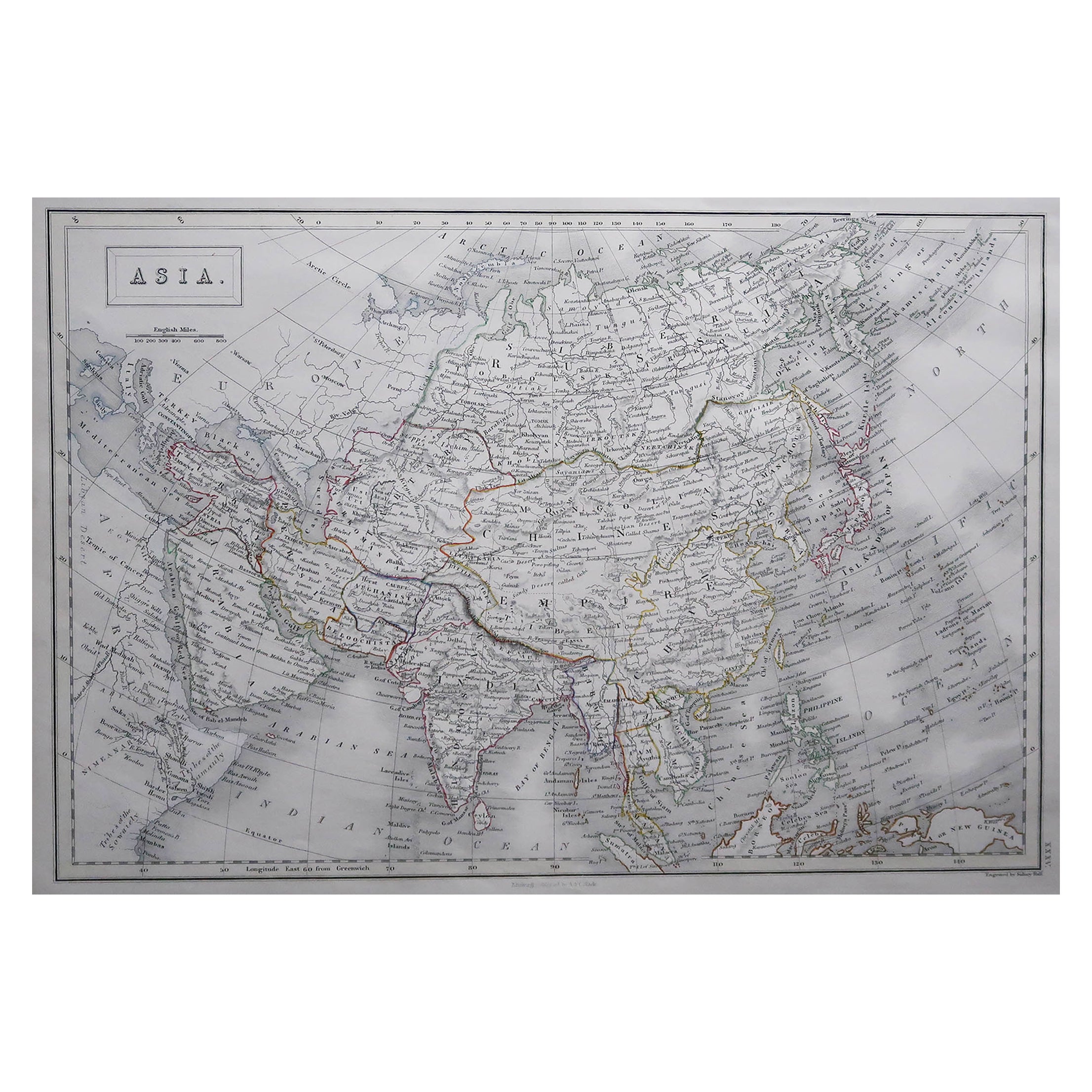
- Large Original Antique Map of Asia by Sidney Hall, 1847Located in St Annes, LancashireGreat map of Asia Drawn and engraved by Sidney Hall Steel engraving Original colour outline Published by A & C Black. 1847 Unframed Free shippingCategory
Antique 1840s Scottish Maps
MaterialsPaper
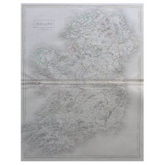
- Large Original Antique Map of Ireland by Sidney Hall, 1847Located in St Annes, LancashireGreat map of Ireland Drawn and engraved by Sidney Hall Steel engraving Original colour outline Published by A & C Black. 1847 Unframed Free shipping.Category
Antique 1840s Scottish Maps
MaterialsPaper
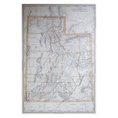
- Large Original Antique Map of Utah, USA, 1894By Rand McNally & Co.Located in St Annes, LancashireFabulous map of Utah Original color By Rand, McNally & Co. Published, 1894 Unframed Free shipping.Category
Antique 1890s American Maps
MaterialsPaper
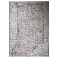
- Large Original Antique Map of Indiana, USA, 1894By Rand McNally & Co.Located in St Annes, LancashireFabulous map of Indiana. Original color. By Rand, McNally & Co. Published, 1894. Unframed. Free shipping.Category
Antique 1890s American Maps
MaterialsPaper
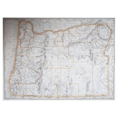
- Large Original Antique Map of Oregon, USA, 1894By Rand McNally & Co.Located in St Annes, LancashireFabulous map of Oregon. Original color. By Rand, McNally & Co. Published, 1894. Unframed. Free shipping.Category
Antique 1890s American Maps
MaterialsPaper


Recently Viewed
View AllMore Ways To Browse
Map Wall
Map Light
Large Coat Of Arms
Antique Wall Map
Antique Wall Maps
Antique World Map Print
Large Map Of The World
World Map Wall
Collectable Wall Plates
Large Maps On Paper
Large Wall Map
Antique Wall World Map
Antique Wall Maps Of The World
Large World Map
Large Wall Maps
Antique Presentation Plates
Large Antique World Maps
Antique Wall Coat Of Arms