Maps
to
1,936
2,521
131
2,657
79
18
9
6
5
4
4
4
3
1
1
2,936
2,181
476
3
289
34
10
127
7
35
9
2
5
4
4
2
2,579
92
35
30
30
329
228
143
126
112
2,657
2,657
2,657
104
29
9
8
7
Maps For Sale
Period: 20th Century
Period: 19th Century
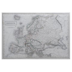
Large Original Antique Map of Europe by Sidney Hall, 1847
Located in St Annes, Lancashire
Great map of Europe
Drawn and engraved by Sidney Hall
Steel engraving
Original colour outline
Published by A & C Black. 1847
Unframed
Free shipping.
Category
1840s Scottish Antique Maps
Materials
Paper
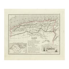
Antique Map of the Region of Algiers, Algeria
Located in Langweer, NL
Antique map titled 'Alger'. This map shows the region of Algiers, Algeria. With a small inset map of the region of Algiers and a decorative vignette with a harbor view. Originates fr...
Category
Mid-19th Century Antique Maps
Materials
Paper
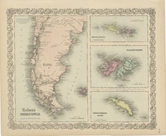
1855 Colton's Map of Patagonia with South Atlantic Islands Insets
Located in Langweer, NL
Title: 1855 Colton's Map of Patagonia with South Atlantic Islands Insets
Description: This is an 1855 map titled "Colton's Patagonia," published by J.H. Colton & Co. in New York. Th...
Category
1850s Antique Maps
Materials
Paper
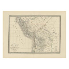
Antique Map of Peru, Ecuador and Bolivia by Lapie, 1842
Located in Langweer, NL
Antique map titled 'Carte du Perou et du Haut Perou'. Map of Peru, Ecuador and Bolivia. This map originates from 'Atlas universel de géographie ancienne et...
Category
19th Century Antique Maps
Materials
Paper
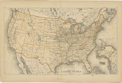
1874 Map of the United States with Territorial Boundaries
Located in Langweer, NL
Title: 1874 Map of the United States with Territorial Boundaries
Description: This is an 1874 map titled "Map of the United States," showcasing the country during a period of rapid ...
Category
1870s Antique Maps
Materials
Paper
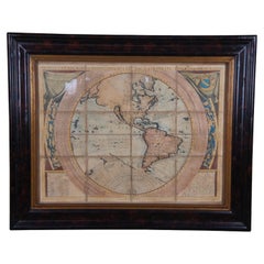
Vincenzo Coronelli's Colored Map of the New World Western Hemisphere Framed 47"
Located in Dayton, OH
A Framed Reproduction of Coronelli's Map of the New World, Attributed to Trevor James Company. The map shows the Western Hemisphere including the discoveries made by Abel Tasman in A...
Category
20th Century Maps
Materials
Paper
Antique Map of the Dusky Bay or Dusky Sound of New Zealand by Captain Cook, 1803
Located in Langweer, NL
Antique map New Zealand titled 'Schets van de Donkere Baai in Nieuw Zeeland 1773'.
Antique map of the Dusky Bay/Dusky Sound of New Zealand....
Category
Early 1800s Antique Maps
Materials
Paper
Antique Map of North Carolina, with inset map of the western part
Located in Langweer, NL
Antique map titled 'North Carolina'. Original antique map of North Carolina, United States. With inset map of the western part of North Carolina....
Category
Late 19th Century Antique Maps
Materials
Paper
Old Map of the Balkans Incl Greece, Turkey, Serbia, Montenegro, Bulgaria, C.1900
Located in Langweer, NL
Antique map titled 'Carte de la presqu-île du Balcan - Karte der Balkan Halbinsel'.
Original antique map of the Balkans including Greece, Turkey, Serbia, Montenegro, Bulgaria and...
Category
Early 1900s Antique Maps
Materials
Paper
Antique Map of Europe by Levasseur, '1875'
Located in Langweer, NL
Antique map titled 'Carte générale de l'Europe'. Large map of Europe. This map originates from 'Atlas de Géographie Moderne Physique et Politique' by A. Levasseur. Published 1875.
Category
Late 19th Century Antique Maps
Materials
Paper
Detailed Map of New Zealand Showing the Route of Capt. Cook's First Voyage, 1803
Located in Langweer, NL
Antique map New Zealand titled 'De Rivier de Theems en Mercurius Baai in Nieuw Zeeland'. Detailed map of New Zealand showing the route of Capta...
Category
19th Century Antique Maps
Materials
Paper
Antique Map of North and West Africa by J.B. Elwe, 1792
Located in Langweer, NL
Beautiful richly engraved map of North and West Africa, based upon the earlier maps of De L'Isle. Richly annotated throughout and with excellent regional detail. Too much detail to d...
Category
Late 19th Century Antique Maps
Materials
Paper
Antique Map of South America by Philip & Son, 1875
Located in Langweer, NL
Antique map titled 'South America'. Old map of South America. Source unknown, to be determined.
Artists and Engravers: George Philip (1800–1882) was a cartographer, map publisher...
Category
19th Century Antique Maps
Materials
Paper
Map of Ancient Gaul & Roman Provinces: Early 19th Century - 1802 Tardieu Atlas
Located in Langweer, NL
### Antique Map Description
**Title:** La Gaule et Ses Grandes Dignités Romaines au Temps des Empereurs
**Publication Details:**
- **Atlas Title:** Nouvel Atlas Universel de Géogra...
Category
Early 1800s Antique Maps
Materials
Paper
Earth table globe attributed to Maitland
Located in Bastia Umbra, IT
Inlaid hardstone and brass terrestrial table globe, attributed to Maitland Smith, 20th century.
This beautiful inlaid hardstone and brass table globe attributed to Maitland Smith i...
Category
20th Century Mid-Century Modern Maps
Materials
Stone, Brass
Large Antique Map of Guadeloupe and Antigua with Adjacent Isles, 19th Century
Located in Langweer, NL
Title: "Antique Map of Guadeloupe and Antigua with Adjacent Isles, 19th Century"
Source: New General Atlas (circa 1817), published in Edinburgh
Description: This detailed antique m...
Category
Early 19th Century Antique Maps
Materials
Paper
Antique County Map, Sussex, English, Framed Lithography, Cartography, Victorian
Located in Hele, Devon, GB
This is an antique lithography map of Sussex. An English, framed atlas engraving of cartographic interest, dating to the mid 19th century and later.
Superb lithography of Sussex an...
Category
Mid-19th Century British Victorian Antique Maps
Materials
Paper
French Guiana and Cayenne: Mid-19th Century Map from France Pittoresque Series
Located in Langweer, NL
This map titled "Guyane" is part of the France Pittoresque series and provides a detailed view of French Guiana along with a plan of the city of Cayenne.
Features:
- The map showcases the broader region of French Guiana, indicating key rivers, settlements, and the coastline along the Atlantic Ocean.
- To the left, there's an inset labeled "Plan de la Ville de Cayenne", which shows the street layout, squares, and main buildings of the capital city, Cayenne. This inset provides a more detailed view of the urban area, highlighting its geometric grid layout near the coast.
- The larger map outlines geographical features such as rivers (e.g., Oyapock and Maroni), forests, and territories in the surrounding area, including the neighboring Brazilian Empire...
Category
1850s Antique Maps
Materials
Paper
Old Map of the Chinese Empire and Japan, 1882
Located in Langweer, NL
An original antique map titled "The Chinese Empire and Japan," dating from an 1882 atlas by Blackie & Son. It is a color map with geographical features such as mountain ranges, river...
Category
1880s Antique Maps
Materials
Paper
Authentique Map by Pilon of The French Colonies in The West Indies, 1876
Located in Langweer, NL
The 1876 map titled "Carte des Colonies Françaises aux Antilles" represents a significant contribution to cartography within the "Grand Atlas Départemental de la France de L'Algérie ...
Category
Late 19th Century Antique Maps
Materials
Paper
Antique Map of the Turkish Empire and Persia, circa 1890
By J. Migeon
Located in Langweer, NL
Antique map Turkish Emprie titled 'Turquie d'Asie et Perse'. Beautiful map depicting the Turkish Empire and Persia. With vignette depicting Damascus. This map originates from 'Nouvel...
Category
19th Century Antique Maps
Materials
Paper
Antique Map of Japan and Korea by Johnston '1909'
Located in Langweer, NL
Antique map titled 'Japan and Korea'. Original antique map of Japan and Korea. With inset maps of the Japanese Empire, Port Arthur, Formosa ,Tokyo and Yoko...
Category
Early 20th Century Maps
Materials
Paper
Antique Map of West Canada by Tallis 'c.1850'
Located in Langweer, NL
Antique map titled 'West Canada'. Original antique map of West Canada, with decorative vignettes titled Kingston and Falls of Niagara. This map originates from 'The History and Topog...
Category
Mid-19th Century Antique Maps
Materials
Paper
Antique Map of the City of Madrid by Balbi '1847'
Located in Langweer, NL
Antique map titled 'Madrid'. Original antique map of the city of Madrid, Spain. This map originates from 'Abrégé de Géographie (..)' by Adrien Balbi. Published 1847.
Category
Mid-19th Century Antique Maps
Materials
Paper
Antique Print of the Interior of Lund Cathedral by Sandberg, c.1864
Located in Langweer, NL
Antique print titled 'Choret I Lunds Domkyrka'. View of the interior of Lund Cathedral (Swedish: Lunds domkyrka), a cathedral of the Lutheran Church of Sweden in Lund, Scania, Sweden...
Category
19th Century Antique Maps
Materials
Paper
Decorative Antique Print of Nice Near Mont Boron in France, c.1865
Located in Langweer, NL
Antique print titled 'Nice, vue prise de l'extremité du Mont Boron'. View of the city of Nice, near Mont Boron, France. This print originates from 'Nice Et Savoie, Sites Pittoreques,...
Category
19th Century Antique Maps
Materials
Paper
Map of Australia, New Zealand, Part of China, Japan and Southeast Asia, 1857
Located in Langweer, NL
German Antique map titled 'Australien'. Map of Australia, New Zealand, part of China, Japan and Southeast Asia. In the upper right is a bit of the California coast by San Francisco. ...
Category
19th Century Antique Maps
Materials
Paper
German Antique Map of Australia and New Zealand, 1857
Located in Langweer, NL
Antique map Australia titled 'Festland von Australien und benachbarte Inseln'. Detailed map of Australia and New Zealand, including excellent det...
Category
19th Century Antique Maps
Materials
Paper
Large Original Vintage Map of Persia / Iran, circa 1920
Located in St Annes, Lancashire
Great maps of Persia.
Unframed.
Original color.
By John Bartholomew and Co. Edinburgh Geographical Institute.
Published, circa 1920.
Free shipping.
Category
1920s British Vintage Maps
Materials
Paper
Antique Map of Switzerland by J. Tallis, circa 1851
Located in Langweer, NL
A decorative and detailed mid-19th century map of Switzerland which was drawn and engraved by J. Rapkin (vignettes by A. H. Wray & J. B. Allen) and published in John Tallis's Illustr...
Category
Mid-19th Century Antique Maps
Materials
Paper
Antique Chart of the US Predominating Sex, 1874
Located in Langweer, NL
Antique chart titled 'Map of predominating sex showing the local excess of males or of females in the distribution of population over the territory of th...
Category
Late 19th Century Antique Maps
Materials
Paper
Newfoundland and St. Pierre & Miquelon: Uncoloured French Map of circa 1820
Located in Langweer, NL
The map is titled "Île et Banc de Terre-Neuve avec les Îles St. Pierre et Miquelon", depicting Newfoundland and the French islands of St. Pierre and Miquelon. It is from the Petit Atlas National series.
Features:
- The map is divided into two sections:
1. The left side shows Newfoundland (Terre-Neuve) and its surrounding waters, including important locations such as the Île du Cap Breton and Grand Bank fishing areas.
2. The right side focuses on St. Pierre and Miquelon, a French overseas territory near Newfoundland.
- Administrative divisions and key geographic features, such as capes, bays, and towns, are labeled on the map.
Historical Context:
- This map is part of a collection meant to showcase France's overseas colonies and territories, including the small but significant St. Pierre and Miquelon, which has been under French control for centuries and was a critical fishing and trading hub.
- The Petit Atlas National series was typically published in the early 19th century, and this map likely dates from the same period, around 1815–1820.
Here the text transalated:
Here is the translation of the text from French to English:
---
**NOTICE.**
The islands of St. Pierre and Miquelon, the only remaining French possession in this part of America since the loss of Canada, are located a few miles from the southern coast of Newfoundland, which belongs to the English. Their relatively fertile soil is broken up by hills that give rise to small streams.
**Grande Miquelon**, the northernmost of the two islands, has a circumference of about 9 to 10 leagues. It offers a convenient port for fishing boats.
**Petite Miquelon**, to the south of Grande Miquelon, has a circumference of about 6 leagues. It is well-watered and well-wooded.
**Saint Pierre**, to the south-southwest of the two other islands, presents a somewhat similar appearance but is devoid of trees. Although it is the smallest of the three islands, it is the most important due to the size of its harbor, which can accommodate 30 to 40 ships of various sizes, and because of its favorable coastline for the preparation, preservation, and export of cod. On its eastern coast, at the bottom of a beautiful bay, lies the town of Saint Pierre, the only notable settlement on the three islands. It is the residence of a naval officer who, under the title of Commander, governs the colony.
The permanent population is about 2,000 souls, of which 800 reside in Saint Pierre. However, sailors come to the islands from the coasts of Brittany and Normandy during the cod fishing season on the Grand Banks of Newfoundland and the Gulf of St. Lawrence. In 1833, it was estimated that about 14,000 sailors were employed in this fishery, and the purchase of supplies required by the colony was valued at over one million francs.
---
This translation reflects the original notice describing the French islands of St. Pierre and Miquelon, with details about their geography, population, and economic activities related to the fishing industry.
People searching for maps or information about Newfoundland and the French islands of St. Pierre and Miquelon use the following keywords:
1. Newfoundland map...
Category
1820s Antique Maps
Materials
Paper
Large Original Vintage Map of The World, circa 1920
Located in St Annes, Lancashire
Great map of The World
Original color.
Good condition / minor foxing
Published by Alexander Gross
Unframed.
Category
1920s English Vintage Maps
Materials
Paper
Newfoundland and St. Pierre & Miquelon: Early 19th Century French Map
Located in Langweer, NL
The map is titled "Île et Banc de Terre-Neuve avec les Îles St. Pierre et Miquelon", depicting Newfoundland and the French islands of St. Pierre and Miquelon. It is from the Petit Atlas National series.
Features:
- The map is divided into two sections:
1. The left side shows Newfoundland (Terre-Neuve) and its surrounding waters, including important locations such as the Île du Cap Breton and Grand Bank fishing areas.
2. The right side focuses on St. Pierre and Miquelon, a French overseas territory near Newfoundland.
- Hand-colored outlines mark the territories, with color distinctions for the different islands.
- Administrative divisions and key geographic features, such as capes, bays, and towns, are labeled on the map.
Here the text translated:
Here is the translation of the text from French to English:
**NOTICE.**
The islands of St. Pierre and Miquelon, the only remaining French possession in this part of America since the loss of Canada, are located a few miles from the southern coast of Newfoundland, which belongs to the English. Their relatively fertile soil is broken up by hills that give rise to small streams.
**Grande Miquelon**, the northernmost of the two islands, has a circumference of about 9 to 10 leagues. It offers a convenient port for fishing boats.
**Petite Miquelon**, to the south of Grande Miquelon, has a circumference of about 6 leagues. It is well-watered and well-wooded.
**Saint Pierre**, to the south-southwest of the two other islands, presents a somewhat similar appearance but is devoid of trees. Although it is the smallest of the three islands, it is the most important due to the size of its harbor, which can accommodate 30 to 40 ships of various sizes, and because of its favorable coastline for the preparation, preservation, and export of cod. On its eastern coast, at the bottom of a beautiful bay, lies the town of Saint Pierre, the only notable settlement on the three islands. It is the residence of a naval officer who, under the title of Commander, governs the colony.
The permanent population is about 2,000 souls, of which 800 reside in Saint Pierre. However, sailors come to the islands from the coasts of Brittany and Normandy during the cod fishing season on the Grand Banks of Newfoundland and the Gulf of St. Lawrence. In 1833, it was estimated that about 14,000 sailors were employed in this fishery, and the purchase of supplies required by the colony was valued at over one million francs.
---
This translation reflects the original notice describing the French islands of St. Pierre and Miquelon, with details about their geography, population, and economic activities related to the fishing industry.
Historical Context:
- This map is part of a collection meant to showcase France's overseas colonies and territories, including the small but significant St. Pierre and Miquelon, which has been under French control for centuries and was a critical fishing and trading hub.
- The Petit Atlas National series was typically published in the early 19th century, and this map likely dates from the same period, around 1815–1820.
People searching for maps or information about Newfoundland and the French islands of St. Pierre and Miquelon use the following keywords:
1. Newfoundland map...
Category
1820s Antique Maps
Materials
Paper
Antique Map of Scandinavia: Norway, Sweden and Denmark
Located in Langweer, NL
Antique map titled 'Suède, Norwège & Danemark'. Attractive map of Scandinavia, with Sweden, Norway and Denmark. With an inset map of Iceland and th...
Category
Mid-19th Century Antique Maps
Materials
Paper
Guadeloupe and Dependencies: 19th Century French Map and Inset of Pointe-à-Pitre
Located in Langweer, NL
This map titled "La Guadeloupe et ses Dépendances" (Guadeloupe and its Dependencies) is from a Petit Atlas National series, focusing on the French Caribbean islands of Guadeloupe, Ma...
Category
1820s Antique Maps
Materials
Paper
Large Antique County Map of the East Riding of Yorkshire, England
Located in Langweer, NL
Antique map titled 'A Map of the East Riding of Yorkshire from the best Authorities'. Original old county map of the East Riding of Yorkshire, England. Engraved by John Cary. Origina...
Category
Early 19th Century Antique Maps
Materials
Paper
The World in the Assyrian Empire's Era: A Historical Map, Published in 1880
Located in Langweer, NL
This map from the "Spruner-Menke Atlas Antiquus" is titled "ORBIS TERRARVM regni Assyrii tempore," which translates to "The World at the Time of the Assyrian Kingdom." It depicts the...
Category
1880s Antique Maps
Materials
Paper
Antique Map of Syria by Wyld '1845'
Located in Langweer, NL
Antique map titled 'Map of Syria'. Original antique map of Syria. This map originates from 'An Atlas of the World, Comprehending Separate Maps of its
Var...
Category
Mid-19th Century Antique Maps
Materials
Paper
Antique Map of the United States of America, also showing the Caribbean
Located in Langweer, NL
Antique map titled 'Verein-Staaten von Nord-America, Mexico, Yucatan u.a.'. Very detailed map of the United States of America showing the ...
Category
Mid-19th Century Antique Maps
Materials
Paper
Oriental Realms: A Detailed Map of Persia, Afghanistan, and Beloochistan, 1882
Located in Langweer, NL
This historical map from the 1882 atlas published by Blackie & Son is a comprehensive depiction of Persia (modern-day Iran), Afghanistan, and Baluchistan (the region that includes pa...
Category
1880s Antique Maps
Materials
Paper
Map of Philadelphia with a Historical Tribute to its Volunteer Fire Companies
Located in Langweer, NL
This elaborate map of Philadelphia in Pennsylvania served as a historical tribute to the city's first volunteer fire departments. It was drawn by J...
Category
1930s Vintage Maps
Materials
Paper
1814 Map of "Russian Empire" Ric.r032
Located in Norton, MA
1814 Map of
"Russian Empire"
Ric.r032
Russian Empire. Description: This is an 1814 John Thomson map of the Russian Empire. The map depicts the region from the Baltic Sea, Prussia, and Sweden to the Aleutian Islands and from the Arctic Ocean to the Yellow River. Highly detailed, myriad cities, towns, and villages are labeled throughout, including St. Petersburg, Moscow, Minsk, Kiev, and Kharkov. Rivers and mountain ranges are also identified, as are islands and numerous locations along the coastlines. It is important to note that the long-disputed sea between Korea and Japan is identified as the 'Sea of Japan.
Historical Context:
In 1815, Tsarist Russia emerged from the Napoleonic Wars economically insolvent and politically fearful of the Revolutionary fervor that had just swept through Europe. In order to shore up Russia's economic position, the Tsars began an aggressive series of expansions into the Caucuses and Central Asia that would vastly increase the landmass of the Russian Empire.
Publication History
Thomson maps are known for their stunning color, awe inspiring size, and magnificent detail. Thomson's work, including this map, represents some of the finest cartographic art...
Category
19th Century Unknown Antique Maps
Materials
Paper
Map of Polynesia Highlighting Cultural Landscapes and Maritime Activities, 1851
Located in Langweer, NL
John Tallis & Company was a London-based map publisher that flourished during the 19th century. Their maps, characterized by elaborate borders and decorative vignettes, are some of t...
Category
1850s Antique Maps
Materials
Paper
Mediterranean Encounters: From the Punic Wars to the Hannibalic War, 1880
Located in Langweer, NL
The map, with the title "MARE INTERNUM cum populis adiacentibus a bello Hannibalico usque ad Vespasiani M. princip," depicts the Mediterranean Sea and its surrounding territories, ex...
Category
1880s Antique Maps
Materials
Paper
Antique Print of Reims Cathedral by Knight, 1835
Located in Langweer, NL
Antique print titled 'West Front of the Cathedral at Rheims'. Old print of Reims Cathedral, a Roman Catholic cathedral in the French city of the same n...
Category
19th Century Antique Maps
Materials
Paper
Gipuzkoa 1902: A Cartographic Snapshot of the Basque Coastline and Highlands
Located in Langweer, NL
The map showcases the province of Gipuzkoa (also known as Guipúzcoa in Spanish), which is part of the autonomous community of the Basque Country in northern Spain, as of the year 190...
Category
Early 1900s Antique Maps
Materials
Paper
Asia Minor and Provinces: A Roman Empire Map from Spruner-Menke Atlas, 1880
Located in Langweer, NL
This authentic map of the 19th century, titled "PONTUS ET BITHYNIA, ASIA, LYCIA ET PAMPHYLIA, GALATIA, CAPPADOCIA, SYRIA, CRET, CYPRVS," details the regions of Asia Minor and surrounding territories during the Roman Empire.
The map is interesting for a number of reasons:
1. **Comprehensive Detail**: It covers a wide range of regions that played significant roles in ancient history, from the cultural crossroads of Asia Minor to the strategic island of Cyprus.
2. **Geographical Information**: It includes detailed topographical features such as mountain ranges, river systems, and coastlines, illustrating the complex geography that influenced ancient political and military strategies.
3. **Historical Context**: The map reflects the Roman administrative organization of these provinces, which were critical for trade, military campaigns, and cultural exchange within the empire.
4. **Inset Maps**: The presence of inset maps for Lycia, Ionia, and Asia Minor provides focused details on regions that had substantial historical significance due to their cultural heritage and geopolitical importance.
5. **Latin Labels**: The use of Latin in the map’s labels and descriptions adds to the historical authenticity and would have served as a scholarly reference for 19th-century academics.
6. **Ancient Civilizations**: This area was the cradle of numerous ancient civilizations and the map likely includes cities of ancient Greek...
Category
1880s Antique Maps
Materials
Paper
Map of French Guiana, Suriname and Cayenne: Plan from Petit Atlas National, 1820
Located in Langweer, NL
This map, titled "Guyane" (French Guiana), is part of the Petit Atlas National series, focusing on French colonies. Here are the key elements of the map and its context:
Features:
-...
Category
1820s Antique Maps
Materials
Paper
Persia Unveiled: Antique Map of Iran, Afghanistan, and Beyond, 1852
Located in Langweer, NL
The antique map titled 'Royaumes de Perse Herat & Kaboul' is an attractive map of Persia. Here are the key details and features of the map:
1. **Geographic Coverage**:
- The map ...
Category
Mid-19th Century Antique Maps
Materials
Paper
Political Map of Europe: Early 19th Century, from the 1802 Tardieu Atlas
Located in Langweer, NL
Antique Map Description
Title: Carte Générale et Politique de l'Europe
Publication Details:
- **Atlas Title:** Nouvel Atlas Universel de Géographie Ancienne et Moderne
- **Purpose...
Category
Early 1800s Antique Maps
Materials
Paper
1882 Detailed Map of South America showing Political and Geographical Features
Located in Langweer, NL
This 1882 map of South America, published by Blackie and Son as part of the 'Comprehensive Atlas and Geography of the World,' showcases the continent in remarkable detail. It provide...
Category
1880s Antique Maps
Materials
Paper
1923 "Washington, The Beautiful Capital of the Nation" Baltimore and Ohio RR Map
Located in Colorado Springs, CO
This is a fabulous 1923 bird's eye map of Washington, DC that shows the city in amazing detail. Every building is individually drawn and all major roads in the city are shown. The vi...
Category
1920s American Art Deco Vintage Maps
Materials
Paper
Large and Extremely Rare Terrestrial Globe by Newton
By Newton Globes - Planer & Newton
Located in Lymington, Hampshire
A large and extremely rare 24-inch terrestrial globe by Newton
Our most magnificent and rare globes were a pair of 24-inch Newton globes.
These too were updated in 1852 (terre...
Category
Mid-19th Century English Antique Maps
Materials
Mahogany
Southwestern U.S. Immigration Map for Texas, Arkansas, and Louisiana, 1881
Located in Langweer, NL
Southwestern U.S. Immigration Map - Published by The Southwestern Immigration Company, Austin, Texas. Detailed Railroad Routes and Regional Statistics for Texas, Arkansas, and Louisi...
Category
1880s Antique Maps
Materials
Paper
Antique County Map, Oxfordshire, English, Framed Cartography Interest, Victorian
Located in Hele, Devon, GB
This is an antique lithography map of Oxfordshire. An English, framed atlas engraving of cartographic interest, dating to the mid 19th century and later.
Superb lithography of Oxfo...
Category
Mid-19th Century British Mid-Century Modern Antique Maps
Materials
Wood
Antique Map of the Region of Georgia with Inset Maps of Florida and Texas
Located in Langweer, NL
Antique map of part of the United States showing Alabama, Georgia, North Carolina, South Carolina, Tennessee, Kentucky, Virginia and part of Florida. With inset maps of the southern ...
Category
Late 19th Century Antique Maps
Materials
Paper
Antique Print of the Rialto Bridge in Venice in Italy, 1835
Located in Langweer, NL
Antique print titled 'The Rialto at Venice'. Old print of the Rialto Bridge (or Ponte di Rialto) in Venice, Italy. This print originates from 'One Hundred and Fifty Wood Cuts selecte...
Category
19th Century Antique Maps
Materials
Paper
