Maps
to
2,410
2,859
113
2,975
26
12
2
1
1
2,926
2,181
476
3
289
34
10
127
7
35
9
2
5
3
4
2
2,961
32
22
3
3
200
72
64
35
31
2,975
2,975
2,975
63
24
16
13
13
Maps For Sale
Period: 18th Century and Earlier
Period: 1830s
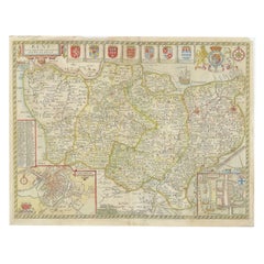
Antique Map of Kent with Inset Plans of Rochester & Canterbury, England, 1676
Located in Langweer, NL
Antique map titled 'Kent with her Cities and Earles described and observed'.
Map of Kent, England. Includes inset town plans of Rochester and Canterbury....
Category
17th Century Antique Maps
Materials
Paper
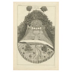
Pl. 21 Antique Print of a Garden Fountain by Le Rouge, c.1785
Located in Langweer, NL
Antique print titled 'Fontaine Rouge No. 3 du Plan Général'. Copper engraving of a garden fountain. This print originates from 'Jardins Anglo-Chinois à la Mode' by Georg Louis le Rou...
Category
18th Century Antique Maps
Materials
Paper
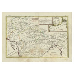
Antique Map of Northern India by Bonne, 1780
Located in Langweer, NL
Antique map titled 'Carte de la partie Supérieure de l'Inde (..)'. A fine example of Rigobert Bonne and Guilleme Raynal?s 1780 map of northern India. Covers the northern part of Indi...
Category
18th Century Antique Maps
Materials
Paper
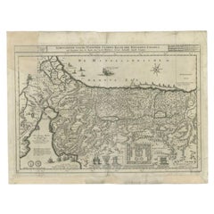
Antique Map of the Holy Land by Danckerts, c.1710
Located in Langweer, NL
Antique map titled 'Afbeeldinge van de Veertich-Iaarige Reyse der Kinderen Israëls uyt Egypten door de Roode Zee en de Woestyne tot in 't Beloofde Landt Canaan'. Map of the Holy Land...
Category
18th Century Antique Maps
Materials
Paper
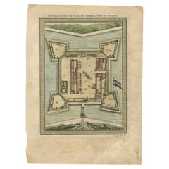
Fort Hollandois De Paliacate Nommé Le Fort De Gueldre, Bellin, 1751
Located in Langweer, NL
Antique print, titled: ?Fort Hollandois de Paliacate nommé le Fort de Gueldre?. Published for Antonine de Prevost d' Exile's Histoire generale des voyages. Artists and Engravers: Jac...
Category
18th Century Antique Maps
Materials
Paper
Antique Print of a Castle or Château de Baudour, Hainaut, Belgium, c.1785
Located in Langweer, NL
Antique print titled 'Vue du Chateau de Boudour (..)'. Copper engraving of a castle and garden. Includes a French legend. This print originates from 'Jardins Anglo-Chinois à la Mode'...
Category
18th Century Antique Maps
Materials
Paper
Map of the Alsace, France Incl the Rhine from Phillipsburg to South Basle, c1650
Located in Langweer, NL
Antique map titled 'Utriusquae Alsatiae Superioris Ac Inferioris Nova Tabula'.
Map of the Alsace region (France) including the Rhine from Phillipsburg to south of Basle. Two deco...
Category
1650s Antique Maps
Materials
Paper
Original Antique Map of the Region of Picardy, France, ca.1602
Located in Langweer, NL
Antique map titled 'Picardiae Belgicae regionis descriptio'.
Original antique map of the region of Picardy, France. Superb example of the decorative style of Ortelius and filled ...
Category
Early 1600s Antique Maps
Materials
Paper
Old Map of the Kingdom of Tonga, Also Known as the Friendly Islands, ca.1780
Located in Langweer, NL
Antique print, titled: 'Carte des Isles des Amis.'
Map of the Kingdom of Tonga, also known as the Friendly Islands, and one of the last hereditary monarchies. Cook named this gro...
Category
1780s Antique Maps
Materials
Paper
Original Antique Map of the Southern Coast of France by Janssonius, 1657
Located in Langweer, NL
Antique map of France titled 'Comté et Gouvernement de Provence'. Decorative map of the southern coast of France. This map originates from 'Atlas Novus,...
Category
17th Century Antique Maps
Materials
Paper
Print of Leopold I, Holy Roman Emperor, King of Hungary, Croatia & Bohemia, 1695
Located in Langweer, NL
Antique print, titled: 'Leopoldus Romanorum Imperator Semper Augustus.'
This original antique plate shows a portrait of Leopold I (9 June 1640 – 5 May 1705), he was Holy Roman Emperor...
Category
1690s Antique Maps
Materials
Paper
Antique Map of the City of Leeuwarden, The Netherlands, by Guicciardini, 1612
Located in Langweer, NL
Antique map titled 'Lewardum Occidentalis Frisia Opp'. Plan of the city of Leeuwarden, in the province of Friesland, the Netherlands. This map originates from 'Beschryvinghe van alle...
Category
17th Century Antique Maps
Materials
Paper
Original Antique Map of the Rhine, South and North of Strasbourg, Germany, 1608
Located in Langweer, NL
Antique map titled 'Argentoratensis agri descriptio'.
Original antique map of the Rhine, both south and north of Strasbourg, based on Daniel Specklin's three-sheet map of the Elz...
Category
Early 1600s Antique Maps
Materials
Paper
Antique Map of the Baltic Region by Homann Heirs, c.1730
Located in Langweer, NL
Antique map titled 'Regnum Borussiae gloriosis auspicijs Seerenissimi et Potentissimi Princip Friderici III (..).' Detailed map of the Baltic region from Memel to Pomerania, extendin...
Category
18th Century Antique Maps
Materials
Paper
Original Detailed Antique Map of Southern India and Most of Ceylon, 1744
Located in Langweer, NL
Antique map titled 'A Map of India on the west Side of the Ganges, comprehending the coasts of Malabar, Coromandel and the Island Ceylon'.
Map of Southern India and most of Ceylo...
Category
1740s Antique Maps
Materials
Paper
Antique Map of the Region of Beauvais by Hondius, circa 1630
Located in Langweer, NL
Antique map titled 'Beauvaisis - Comitatus Belovacium'. Old map of the region of Beauvais, France. This map originates from a composite atlas and is signed by J. Hondius.
Category
Mid-17th Century Antique Maps
Materials
Paper
Antique Map of France under the Reign of Henry IV by Zannoni, 1765
Located in Langweer, NL
Antique map France titled 'Carte de la réunion de la Basse Navarre (..)'. Beautiful old map of France. This map originates from 'Atlas Historique de la France Ancienne et Moderne' by...
Category
18th Century Antique Maps
Materials
Paper
Pl. 6 Antique Print of Château De Neuilly by Le Rouge, C.1785
Located in Langweer, NL
Antique print titled 'Grande Facade de Neuilly'. Copper engraving showing part of Château de Neuilly. This print originates from 'Jardins Anglo-Chinois à la Mode' by Georg Louis le R...
Category
18th Century Antique Maps
Materials
Paper
Antique Map of the City of Hindeloopen by Braun & Hogenberg, c.1598
Located in Langweer, NL
Antique map titled 'Hindelopia'. Original antique map of the city of Hindeloopen, Friesland, the Netherlands. Originally published on one sheet together with other Frisian cities, trimmed. This print originates from the town atlas by Braun and Hogenberg...
Category
16th Century Antique Maps
Materials
Paper
Antique Print of the Monuments of Herculaneum by Bayardi, 1762
Located in Langweer, NL
Antique print originating from 'Le Antichita di Ercolano Esposte'. A vast survey of the bronzes, statues, wall-paintings, and monuments of Herculaneum. This monumental work was the f...
Category
18th Century Antique Maps
Materials
Paper
Antique Genealogy Chart of the Landgraviate Hessen-Kassel, Germany, 1732
Located in Langweer, NL
Antique print titled 'Genealogie de la Maison de Hesse Cassel'. Chart of the genealogy of the Landgraviate Hessen-Kassel / Hesse-Cassel. This includes the coats of arms of both Hesse-Cassel and Hesse-Darmstadt. This print orginates from 'Atlas Historique'.
The Landgraviate of Hesse-Kassel (German: Landgrafschaft Hessen-Kassel), spelled Hesse-Cassel during its entire existence, was a state in the Holy Roman Empire that was directly subject to the Emperor. The state was created in 1567 when the Landgraviate of Hesse was divided upon the death of Philip I, Landgrave of Hesse. His eldest son William IV inherited the northern half of the Landgraviate and the capital of Kassel. The other sons received the Landgraviate of Hesse-Marburg, the Landgraviate of Hesse-Rheinfels and the Landgraviate of Hesse-Darmstadt.
During the Napoleonic reorganisation of the Empire in 1803, the Landgrave of Hesse-Kassel was elevated to an Electorate and Landgrave William IX became an Imperial Elector. Many members of the Hesse-Kassel House served in the Danish military gaining high ranks and power in the Oldenburg realm due to the fact that many Landgraves were married to Danish princesses...
Category
18th Century Antique Maps
Materials
Paper
Original Old Bird's-Eye View Plan of Sint-Winoksbergen or Bergen in France, 1649
Located in Langweer, NL
Antique map titled 'Berga Sti Winoci.' - Bird's-eye view plan of Sint-Winoksbergen in France, with key to locations and coats of arms. Text in Dutch on verso. This plan originates from the famous city Atlas: 'Toneel der Steeden' published by Joan Blaeu...
Category
1640s Antique Maps
Materials
Paper
Antique Map of the Northwestern Netherlands, incl Texel and Vlieland, ca.1741
Located in Langweer, NL
Antique print, titled: 'Tabula Comitatus Hollandiae in Praefecturas sua distributa; cui adjuncta est Provinc. Ultraiectina et maxima pars Geldriae summo studio delin. Et aeri incidit...
Category
1740s Antique Maps
Materials
Paper
Antique Map of Drenthe, the Netherlands, with Original Hand Coloring
Located in Langweer, NL
Original antique map titled 'Illustribus ac Potentibus Comitatus Drentiae (..)'. Old map of the province of Drenthe, the Netherlands. Published by H. Hondius circa 1639.
Hendrik ...
Category
Mid-17th Century Antique Maps
Materials
Paper
Antique Map of France by Homann Heirs, c.1745
Located in Langweer, NL
Antique map titled 'Gallia Postarum geographice designata in qua Cursus Postarum Secundum Statum (..)'. Unusual postal map of France, with coat of arms. Very detailed map showing all...
Category
18th Century Antique Maps
Materials
Paper
VOC Ships, Native People & Coastal Views of Islands near Papua New Guinea, 1726
Located in Langweer, NL
Antique print titled 'Het Eylandt Takel, als gy daar langhs seylt (..)'.
Five engravings on one sheet showing the native boats and peoples and coastal views of islands near New Gui...
Category
1720s Antique Maps
Materials
Paper
Antique Map of the Region of Zutphen in Overijssel, The Netherlands, 1683
Located in Langweer, NL
Antique map titled 'Ducatus Gelriae pars prima Quae est Neomagensis'. Antique map of the region of Zutphen, Gelderland, the Netherlands. This map originates from 'The English Atlas' ...
Category
17th Century Antique Maps
Materials
Paper
Copper Engraving with a Panoramic View of Mexico City, 1754
Located in Langweer, NL
Antique print titled 'Nouveau Mexico'.
Copper engraving with a panoramic view of Mexico city. This print originates from 'Histoire générale des voyages, ou nouvelle collection de...
Category
1750s Antique Maps
Materials
Paper
Old Copper Engraving of the Port City Dabhol in India, 1757
Located in Langweer, NL
Antique print titled 'Dabul'.
Old print of the port city Dabhol in India. In the 15th and 16th centuries, Dabul was an opulent Muslim trade center. Around 1660 it was annexed to th...
Category
1750s Antique Maps
Materials
Paper
Antique Map of Martinique with Title Cartouche Garnished with Sugar Cane, c.1760
Located in Langweer, NL
Antique map titled 'Het Westindisch Eiland Martenique'. Decorative map of Martinique filled with good detail of roads, topography, soundings, villages, windmills, and plantations. Th...
Category
18th Century Antique Maps
Materials
Paper
Old Map of the Empire of the Assyriens & the Tigres and Euphrates Rivers, 1683
Located in Langweer, NL
Antique map titled 'Empire des Assyriens' and 'Assyrie Chaldee et Mesopotamie selon les Anciens'.
Two maps on one sheet, the upper sheet showing the Empire of the Assyriens and the second showing the region of the Tigres and Euphrates Rivers. This map originates from Alain Manesson Mallet's 'Description de l 'Univers'.
Artists and engravers: Alain Manesson Mallet (1630–1706) was a French cartographer and engineer. He started his career as a soldier in the army of Louis XIV, became a Sergeant-Major in the artillery and an Inspector of Fortifications. He also served under the King of Portugal, before returning to France, and his appointment to the court of Louis XIV. His military engineering and mathematical background led to his position teaching mathematics at court. His major publications were Description de L'Univers (1683) in 5 volumes, and Les Travaux de Mars ou l'Art de la Guerre (1684) in 3 volumes.
His Description de L'Universe contains a wide variety of information, including star maps...
Category
1680s Antique Maps
Materials
Paper
Antique Map Plan of Town and Mole of CAP D'agde & Fort De Brescou, France, 1759
Located in Langweer, NL
Antique Plan titled 'Plan of the Town and Mole of Agde with the Fort de Brescou'. Antique town plan of Agde, engraved for the Geographical Dictionary, by Rol...
Category
Mid-18th Century Antique Maps
Materials
Paper
Decorative Original Antique Print Depicting the Cavalry Marching in China, 1665
Located in Langweer, NL
Antique print titled ‘Kryghs-Ordre in het Marseren. L’Ordre de la Cavallerie en Marchant’.
Decorative print depicting the cavalry. This print originates from ‘Joan Nieuhof, Het G...
Category
1660s Antique Maps
Materials
Paper
Old Map by Blaeu of the City of Franeker, Friesland, The Netherlands, 1649
Located in Langweer, NL
Antique map titled 'Franekera'.
Old map of the city of Franeker, Friesland. Also shows two cartouches, coats of arms and legend. This map originates from a Latin edition of the t...
Category
1640s Antique Maps
Materials
Paper
Framed View of the Brouwersgracht in Amsterdam, the Netherlands, 1708
Located in Langweer, NL
Antique print titled 'Societatis Indiae Occident (..) - West Indisch Huys op Raapenburg (..)'.
Despite the title suggesting this print is a view of the West-Indisch House in Amst...
Category
Early 1700s Antique Maps
Materials
Paper
Old Original Antique Map of the Islands of East Indonesia, 1756
Located in Langweer, NL
Title: Isles Moluques.
Old and rare, this decorative map of the Maluku Islands in the period it was still controlled by the Dutch colonial power. It also shows the island of Bali, Lombok, part of Borneo (Kalimantan), Celebes (Sulawesi), Timor, The Lesser Sunda Islands, West Papua...
Category
1750s Antique Maps
Materials
Paper
Antique Plan of the Harbour of Taloo by Cook, c.1781
Located in Langweer, NL
Antique map titled 'Sketch of the Harbours on the North Side of Eimeo (..)'. Plan of the harbour of Taloo in the Island of Moorea, one of the Society Islands, French Polynesia. Origi...
Category
18th Century Antique Maps
Materials
Paper
Fine Engraving Depicting an Officer's Mess in the Low Countries, 'Holland', 1754
Located in Langweer, NL
Title on Page (Dutch and French): CORPS DE GARDE van Hollandsche Officiers / Corps de Garde des Officiers Hollandois". Amst., 1754.
Fine engraving depicting an officer's mess by J. Punt and P. Tanjé after a painting by C. Troost, with coat of arms engraved in lower margin and dedication to G. Braamcamp ("beminnaar der schilderkonst").
Waiting room with reading, smoking and card playing officers. Right, one of them studies a map of the Netherlands. On the wall a coat of arms with the Dutch lion. At the bottom of the margin the coat of arms and an assignment to Gerrit Braamcamp, who had the original painting in his collection.
Cornelis Troost...
Category
1750s Antique Maps
Materials
Paper
Framed View of St. Martin's Cathedral or Domkerk, Utrecht, The Netherlands, 1770
Located in Langweer, NL
Antique print titled 'L'Eglise Metropolitaine de Saint Martin a' Utrecht'.
View of St. Martin's Cathedral in Utrecht, also known as 'Domkerk'.
Artists and Engravers: Publishe...
Category
1770s Antique Maps
Materials
Paper
Antique Engraving with a Description of the Monkey Temple in Japan, 1669
Located in Langweer, NL
Antique print, titled: 'Beschryving van de Japansche Apen-tempel.' - ('Description of the Japanese Monkey Temple').
Interior of a temple filled wit...
Category
1660s Antique Maps
Materials
Paper
Rare Engravings of Council of War in Bantam and Javanese Local Traders, 1614
Located in Langweer, NL
One leaf with an engraving on each site and text in old Dutch. One side shows the War Council of the locals in Bantam and the other side show some vegetables traders of Bantam.
B...
Category
Early 17th Century Antique Maps
Materials
Paper
Old Map of The Southern Part of Norway, Covering the Region Around Bergen, c1650
Located in Langweer, NL
Antique map titled 'Nova et Accurata Tabula Episcopatuum Stavangriensis et Asloiensis'.
Old map of the southern part of Norway, it covers the region around Bergen. Decorated with...
Category
1650s Antique Maps
Materials
Paper
Antique Map of the City of Haarlem by Tirion, 1742
By Isaak Tirion
Located in Langweer, NL
Antique map titled 'Grondtekening van Haarlem (..)'. Original antique map of the city of Haarlem, the Netherlands. Published by I. Tirion, 1742.
Artists and Engravers: Isaak Tirio...
Category
18th Century Antique Maps
Materials
Paper
Antique Print of Sandon Hall by White, c.1770
Located in Langweer, NL
Antique print titled 'Principal Front of Sandon'. Architectural elevation of Sandon Hall, Staffordshire. This print originates from 'Vitruvius...
Category
18th Century Antique Maps
Materials
Paper
Large Antique Detailed Map of a Part of the Spice Islands, Indonesia, 1726
Located in Langweer, NL
Antique matitled 'De Landvoogdy der Moluccos met de aangrenzende Eylanden'.
Large detailed map of a part of the Spice Islands. It includes Baru (Boero), Ambon, Seram and part of Ma...
Category
1720s Antique Maps
Materials
Paper
Antique Map of the Island of Borneo by Janssonius, circa 1650
Located in Langweer, NL
Antique map titled 'Insula Borneo et Occidentalis pars Celebis cum adjacentibus Insulis'. Rare sea chart of the island of Borneo. Published by J. Janssonius, circa 1650.
Category
Mid-17th Century Antique Maps
Materials
Paper
Decorative Bird's-Eye View Plan of Ieper or Ypres in Belgium, 1649
Located in Langweer, NL
Antique print, titled: 'Ypra.'
Bird's-eye view plan of Ieper / Ypres in Belgium. With key to locations and coats of arms. Text in Latin on verso. This plan originates from the famous city Atlas: 'Toneel der Steeden' published by Joan Blaeu...
Category
1640s Antique Maps
Materials
Paper
Extremely Scarce Antique Map of The Island of Borneo, Indonesia, c. 1725
Located in Langweer, NL
Antique map titled 'L'Ile de Borneo Suivant les memoires des plus Celebres Navigateurs.'
A detailed map of the island Borneo, with a small part of Celebes visible. This plate origi...
Category
18th Century Antique Maps
Materials
Paper
Panoramic Engraved View of the Town of Longvek 'or Lavek' in Cambodia, ca.1726
Located in Langweer, NL
Description: Antique print titled 'Eauweck, Hooft Stad van Cambodia'. Decorative panoramic view of the town of Longvek (or Lavek) in Cambodia. It was the second capital city during t...
Category
1720s Antique Maps
Materials
Paper
Print of Pleasure Gardens of the Governor-General of Batavia, Indonesia, ca.1744
Located in Langweer, NL
Antique print titled 'Ein Prospect aus Sr. Hoch-Edelheit des Herrn General-Gouverneurs Lust oder Spiel-Haus nach der Werff, dem Vier Kand und der Baum Wachters Häusgen in Batavia gez...
Category
1740s Antique Maps
Materials
Paper
Antique Engraving of Dutch and German North Sea Coast of Friesland, ca.1680
Located in Langweer, NL
Antique map titled 'Tabula Nova In qua accuratè demonstratur tota Navigatio ab Amstelodami Statione per Vada vulgo de Watten Hamburgum usq.' -
Two maps with the Dutch and German North Sea coast of Friesland, with West Frisian Islands and below East Frisian Islands with inset map of the Elbe around Hamburg. With title and a scale cartouche. Map by Henricus Hondius...
Category
1680s Antique Maps
Materials
Paper
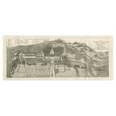
Antique Engraving of Edo 'or Jeddo, Yedo, Now Tokyo', 1669
Located in Langweer, NL
Antique print, titled: 'Iedo'
A bird's eye view of Edo (or Jeddo, Yedo, now Tokyo) as seen from a nearby hill. 62 places are identified in a list (both in French and Dutch). Arno...
Category
1660s Antique Maps
Materials
Paper
Antique View of The N.W. side of Saypan and one of The Ladrones Islands, 1757
Located in Langweer, NL
Antique print titled 'Vue de deux des Iles des Larrons - Gezigt van twee der Eilanden Ladrones (..)'.
View of two Ladrones Islands; View of the N.W. side of Saypan, one of the La...
Category
1750s Antique Maps
Materials
Paper
Antique Map of the Ancient British Isles by Janssonius 'circa 1640'
Located in Langweer, NL
Antique map titled 'Insularum Britannicarum Acurata Delineatio'. Original antique map of the ancient British Isles. England and Wales are labelled as B...
Category
Mid-17th Century Antique Maps
Materials
Paper
Decorative Antique Map of the Dutch Province of Noord-Brabant, ca.1640
Located in Langweer, NL
Antique map titled 'Quarta pars Brabantiae cujus Sylvaducis Willebordus vanderBurgt desrib'.
Highly detailed original antique map of the province of Noord-Brabant, the Netherlands. It shows the cities of 's-Hertogenbosch, Eindhoven and surroundings. Includes a decorative cartouche, 6 coats of arms, topped by winged cherubs and two larger coats of arms...
Category
1640s Antique Maps
Materials
Paper
Antique Map of Thracia ‘Greece’ by J. Janssonius, circa 1650
Located in Langweer, NL
This antique map of Thracia is engraved and published by J. Janssonius after the cartographical sources by Abraham Ortelius. Ornated in the upper left corner with a title cartouche a...
Category
Mid-17th Century Antique Maps
Materials
Paper
Original Old Copper Engravings of Seals of Lubeck, Stavoren, Amsterdam etc. 1767
Located in Langweer, NL
Antique print titled ‚Zegel der stad Lubek (..)’.
Seals of the city of Lubeck and others: Stavoren, Amsterdam (8x), van Amstel, Persijn (..). This print originates from ‘Amsterda...
Category
1760s Antique Maps
Materials
Paper
Colourful Antique Map Centered on Nuremberg and Bamberg in Germany, ca.1703
Located in Langweer, NL
Antique map titled 'Circuli Franconiae pars Occidentalis, exhibes simul integrum fere Electoratum Moguntinum (..)'.
Antique map centered on Nuremberg and Bamberg. Extends from th...
Category
Early 1700s Antique Maps
Materials
Paper
