Maps
to
264
462
61
525
16
6
4
4
3
2
2
2,936
2,181
476
3
289
34
10
127
7
35
9
2
5
4
4
2
485
29
21
18
12
109
86
70
45
35
525
525
525
5
2
2
1
1
Maps For Sale
Period: 20th Century
Period: 1830s
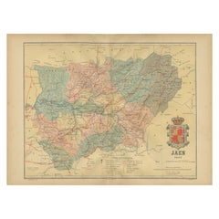
Jaén 1902: A Cartographic Depiction of Andalusia's Olive Heartland
Located in Langweer, NL
This original antique map displays the province of Jaén, located in the autonomous community of Andalusia in southern Spain, as of the year 1902. It contains various geographic and i...
Category
Early 1900s Antique Maps
Materials
Paper
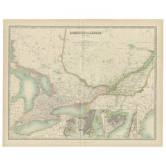
Antique Map of Canada by Johnston '1909'
Located in Langweer, NL
Antique map titled 'Dominion of Canada'. Original antique map of Canada. With inset maps of Niagara, Montreal, Quebec. This map originates from t...
Category
Early 20th Century Maps
Materials
Paper
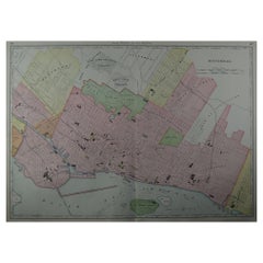
Large Original Antique City Plan of Montreal, Canada, circa 1900
Located in St Annes, Lancashire
Fabulous colorful map of Montreal
Original color
By Rand, McNally & Co.
Published, circa 1900
Unframed
Minor edge tears
Free shipping.
Category
Early 1900s American Antique Maps
Materials
Paper
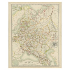
Antique Map of Russia in Europe by Johnston (1909)
Located in Langweer, NL
Antique map titled 'European Russia'. Original antique map of Russia in Europe. With inset maps of St Petersburg and Moscow. This map originates from the ‘Royal Atlas of Modern Geogr...
Category
Early 20th Century Maps
Materials
Paper
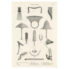
Old Print Depicting Various Utensils of Tongatabu, Site of Tonga's Capital, 1836
Located in Langweer, NL
Antique print titled 'Tonga-Tabu'.
Tongatapu is the main island of the Kingdom of Tonga and site of Tonga’s capital, Nuku?alofa. It is located in Tonga's southern island group, t...
Category
1830s Antique Maps
Materials
Paper
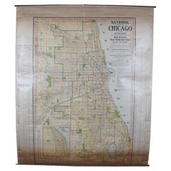
Antique Chicago Illinois National Map Commercial Rollup Classroom Census Map 47"
Located in Dayton, OH
Antique early to mid 20th century double sided hanging map titled the New Commercial and Census Map of Illinois, Edition 1073. Verso shows the National Map of Chicago and Suburbs - O...
Category
Early 20th Century North American Maps
Materials
Paper
Antique Map of the Malay Archipelago by Walker, 1911
Located in Langweer, NL
Antique map titled 'Malay Archipelago'. Old map of the Malay Archipelago including Borneo, Celebes, New Guinea, Java, Timor and others. This map ...
Category
Early 20th Century Maps
Materials
Paper
Antique Map of Alaska '1904'
Located in Langweer, NL
An antique map titled 'Map of Alaska Compiled Under the Direction of R.U. Goode, Geographer,' which relies on data from both the U.S. Geological Survey a...
Category
Early 20th Century Maps
Materials
Paper
Framed Belmont Park Racetrack Barn Area Guide Map
Located in New York, NY
This piece was acquired from the Belmont Park racetrack in Elmont, New York. It displays an itemized map of the barn area at Belmont Park. It is made of acrylic with a black wood fra...
Category
20th Century American Maps
Materials
Acrylic, Wood
German Antique Map of Southeastern Australia, 1904
Located in Langweer, NL
This large antique map is taken from; 'Andrees Allgemeiner Handatlas in 126 Haupt-Und 139 Nebenkarten', Bielefeld; Leipzig: Velhagen & Klasing 1899. Andrees Allgemeiner Handatlas was...
Category
20th Century Maps
Materials
Paper
Vintage Globe on Regency Pedestal Stand
Located in Pasadena, TX
This is a nice vintage globe. It sits on a pedestal tripod base. The base is constructed in a regency style. This globe comes from the office of Roger Rolke of Shell Oil Co.
A nice ...
Category
20th Century American Maps
Materials
Wood
Antique Map of Canada by Johnston '1909'
Located in Langweer, NL
Antique map titled 'Dominion of Canada'. Original antique map of Canada. This map originates from the ‘Royal Atlas of Modern Geography’. Publishe...
Category
Early 20th Century Maps
Materials
Paper
Two Men in Civilian & Military Outfit from Cochinchine or Southern Vietnam, 1830
Located in Langweer, NL
Antique print titled 'Cochinchine'. Two portaits of Vietnamese men one showing in military attire and the second in civilian dress.
Cochinchina or Cochin-China is a historical ex...
Category
1830s Antique Maps
Materials
Paper
Large Original Vintage Map of Mexico, circa 1920
Located in St Annes, Lancashire
Great map of Mexico
Original color.
Good condition
Published by Alexander Gross
Unframed.
Category
1920s English Edwardian Vintage Maps
Materials
Paper
Antique Map of Peru and Bolivia, 1836
Located in Langweer, NL
Antique map titled 'Pérou et Bolivia'.
Decorative map of Peru and Bolivia with outline coloring. Originates from 'Atlas Complet Du Precis De La Geograp...
Category
1830s Antique Maps
Materials
Paper
Large Original Vintage Map of The Pacific Islands Including Hawaii
Located in St Annes, Lancashire
Great map of The Pacific Islands
Unframed
Original color
By John Bartholomew and Co. Edinburgh Geographical Institute
Published, circa 1...
Category
1920s British Vintage Maps
Materials
Paper
Antique Map of Alentejo: Land of Tradition and Tranquility, 1903
Located in Langweer, NL
The image is a historical original antique map of the Alentejo region in Portugal. This map includes the topographical layout of the region, with its complex network of roads and wat...
Category
Early 1900s Antique Maps
Materials
Paper
Antique Map of Africa by Johnston (1909)
Located in Langweer, NL
Antique map titled 'Africa'. Original antique map of Africa. This map originates from the ‘Royal Atlas of Modern Geography’. Published by W. & A....
Category
Early 20th Century Maps
Materials
Paper
Antique Map of American Cities, Vignette of New York City, circa 1920
Located in St Annes, Lancashire
Great maps of American Cities
Unframed
Original color
By John Bartholomew and Co. Edinburgh Geographical Institute
Published, circa 1920
Category
1920s British Vintage Maps
Materials
Paper
Large Original Vintage Map of Sweden and Norway circa 1920
Located in St Annes, Lancashire
Great map of Sweden and Norway
Original color. Good condition
Published by Alexander Gross
Unframed.
Category
1920s English Victorian Vintage Maps
Materials
Paper
Pl. VI Habitations Ouvrières a Laeken, Chabat, c.1900
Located in Langweer, NL
Antique print titled 'Habitations Ouvrières a Laeken pour les ouvriers de l'usine a gaz de la Ville de Bruxelles, Mr. V. Jamaer, Architecte'. This print depicts the design of a buidl...
Category
20th Century Maps
Materials
Paper
Antique Map of Batavia, Semarang and Surabaya by Wolters 'circa 1910'
Located in Langweer, NL
Antique map titled 'Plattegronden van Steden op Java'. Old map with plans of Batavia (Jakarta), Semarang and Surabaya (Soerabaja)'. Published by J.B. Wolters.
Category
20th Century Maps
Materials
Paper
Antique Map of N.W. Africa & Central Africa by Johnston (1909)
Located in Langweer, NL
Antique map titled 'N.W. Africa & Central Africa'. Original antique map of N.W. Africa & Central Africa. This map originates from the ‘Royal Atlas of Modern Geography’. Published by ...
Category
Early 20th Century Maps
Materials
Paper
Antique Map of the Asiatic Archipelago by E. Stanford, circa 1910
Located in Langweer, NL
Antique folding map titled 'London Atlas Map of the Asiatic Archipelago'. Centered on the Philippines and Borneo, the map shows a number of different seasonal passages through the region to Hong Kong and Macao. With inset maps of Singapore...
Category
20th Century Maps
Materials
Paper
Antique Map of New South Wales by Johnston, '1909'
Located in Langweer, NL
Antique map titled 'South Australia, New South Wales, Victoria and Queensland'. Original antique map of New South Wales. With inset map of Cape York Pe...
Category
Early 20th Century Maps
Materials
Paper
Rare Print of the 'Corps Des Guides' of the Belgium Army Regiment, 1833
Located in Langweer, NL
One nicely hand coloured print of an original serie of 23 plates, showing officers and soldiers resting near a village. published in 1833. Rare.
From a serie of beautiful lithographed plates with Belgian military...
Category
1830s Antique Maps
Materials
Paper
Antique Map of the Region of Lampung, Sumatra, Indonesia, 1900
Located in Langweer, NL
Antique map of the region of Lampung, Sumatra. Also depicting part of Palembang and Java. This map originates from 'Atlas van Nederlandsch Oost- en West-Indië' by I. Dornseiffen.
A...
Category
20th Century Maps
Materials
Paper
Antique Map of the Region of Bengkulu in Indonesia, 1900
Located in Langweer, NL
Antique map of the region of Benkulu, Sumatra. Also depicting Enggano Island. This map originates from 'Atlas van Nederlandsch Oost- en West-Indië' by I. Dornseiffen.
Artists and E...
Category
20th Century Maps
Materials
Paper
Douro: The River of Tradition and Wine in Portugal, 1903
Located in Langweer, NL
The uploaded image is a historical map of the Beira Baixa region in Portugal. The map details the topography, including mountain ranges and river systems, as well as the transportati...
Category
Early 1900s Antique Maps
Materials
Paper
Colonial Crossroads: Angola and Mozambique in 1903
Located in Langweer, NL
The image for sale is an original historical map from 1903 that shows the Portuguese colonies of Angola on the left and Mozambique on the right. These two territories on the African ...
Category
Early 1900s Antique Maps
Materials
Paper
Barcelona 1901: A Cartographic Portrait of Catalonia's Capital Province
Located in Langweer, NL
This orignal antique map is a historical depiction of the province of Barcelona from 1901.
It showcases the varied terrain of the province, with the Serra de Collserola ridge near the city of Barcelona and the Pyrenees to the north. The map includes the coastline along the Mediterranean Sea, indicating Barcelona's position as a coastal province. Blue lines indicate rivers, such as the Llobregat and Besòs, which are significant features in the province's geography. Dotted lines may signify the borders of the province within Catalonia.
The coat of arms of Barcelona, highlighted with gold, is prominently displayed, featuring the Cross of Saint George (Cruz de Sant Jordi), the patron saint of Catalonia, and the red and yellow bars which are a symbol of the Aragonese and Catalan heritage.
About the province of Barcelona:
The province of Barcelona is part of the autonomous community of Catalonia in northeastern Spain. It is the most economically significant region of Catalonia, playing a crucial role in the country's economy due to its port, manufacturing, and service industries. The city of Barcelona is the capital and the second most populous city in Spain, known for its rich cultural heritage, architecture by Antoni Gaudí, such as the Sagrada Família, and its influential art scene. The province enjoys a Mediterranean climate and features diverse landscapes from the beaches along the coast to the mountains in the interior. Barcelona is also known for its vibrant festivals, cuisine, fashion, and sports, particularly football, being home to FC Barcelona...
Category
Early 1900s Antique Maps
Materials
Paper
Antique Political Map of the Japanese Empire, 1922
Located in Langweer, NL
Antique map of Japan titled 'Japanese Empire - Political Map'. Old map of Japan depicting Japan, Korea and surroundings. This map originates from 'The Ti...
Category
20th Century Maps
Materials
Paper
The History of the Royal Canadian Mounted Police, Published in 1966
Located in Langweer, NL
This rare pictorial map by Peter R. Furse celebrates the history of the Royal Canadian Mounted Police. It was produced with the cooperation of the RCMP, as acknowledged in an elegant...
Category
1960s Vintage Maps
Materials
Paper
The Astronomer Unique Historical Folk Art Painting Signed 1918
Located in South Burlington, VT
Unique Historical Work of Art Dated 1918 "L' Astronome (The Astronomer) by Fedinant Roybet.
This is an original and one-of-a-kind artistic presentation- a superb pyrography incis...
Category
Early 20th Century French Maps
Materials
Wood
Large Original Antique Map of Arkansas by Rand McNally, circa 1900
Located in St Annes, Lancashire
Fabulous monochrome map with red outline color
Original color
By Rand, McNally & Co.
Published, circa 1900
Unframed
Minor edge tears.
Category
Early 1900s American Edwardian Antique Maps
Materials
Paper
Antique Map of the Basin of the Mediterranean by Johnston '1909'
Located in Langweer, NL
Antique map titled 'Basin of the Mediterranean'. Original antique map of the basin of the Mediterranean. With inset maps of the Strait of Gibraltar, Morocco, Maltese Islands, Valetta...
Category
Early 20th Century Maps
Materials
Paper
Decorative Print of the Belgium Army with Ambulance Troops in the Field, 1833
Located in Langweer, NL
One nicely hand coloured print of an original serie of 23 plates, published in 1833. Rare.
From a serie of beautiful lithographed plates with Belgian military...
Category
1830s Antique Maps
Materials
Paper
Antique Map of the Southern Part of the Orange River Colony by Stanford, 1901
Located in Langweer, NL
Antique map titled 'Orange River Colony, southernpart'. Lithograph of the southern part of the Orange River Colony, Africa. The Orange River Colony was the British colony created aft...
Category
Early 20th Century Maps
Materials
Paper
Two Impressive Huge Midcentury World Map Wall Globes, 95" Diameter, 1950s
Located in Vienna, AT
We proudly offer this outstanding pair of very large wall-mounted modernist globes / world maps with an incredible diameter of 95 inches each. Unique one-of-a-kind sculptures depicti...
Category
Mid-20th Century Austrian Mid-Century Modern Maps
Materials
Aluminum, Iron
Vintage Barrister's Map of London, English, Framed, Inner, Middle Temple, C.1970
Located in Hele, Devon, GB
Our Stock # 24730
This is a vintage barrister's map of London. An English, annotated Inner and Middle Temple lithograph framed behind glass, dating to the late 20th century, circa 1...
Category
Late 20th Century British Mid-Century Modern Maps
Materials
Glass, Wood, Paper
Large Original Vintage Map of The North Pole, circa 1920
Located in St Annes, Lancashire
Great maps of The North Pole.
Unframed.
Original color.
By John Bartholomew and Co. Edinburgh Geographical Institute.
Published, circa 1920.
Free shipp...
Category
1920s British Vintage Maps
Materials
Paper
Cortesi's Masterpiece: A Comprehensive and Authoritative Map of Uruguay, 1903
Located in Langweer, NL
Antique map titled 'Mapa de la Republica Oriental del Uruguay'. Large and detailed folding map of Uruguay. This monumental map depicts all of Uruguay with unprecedented accuracy and detail. Impressively, it serves the multiple roles of being an advanced topographic, economic and political map, as well as being a meticulous sea chart of the Rio de la Plata and the adjacent waters of the Atlantic. The republic's 20 departments are defined in various colors, while a legend, 'Referencias' identifies symbols representing the locations of departmental capitals, town, roads, railways, public schools and lighthouses, amongst other details. Every single river and stream is delineated and named and the ridges of hills are delicately expressed. The map features four insets, including a large map of the capital, Montevideo, as well as maps of Colonia, Maldonado and Punta del Este and the Island of Flores. The hydrographical information provided is truly profound, and renders the map fit for use in maritime commerce.
In 1901, the Uruguayan House of Representatives commissioned the geographer Saturnino Cortesi to employ the most progressive geographical sources, both military and civilian, to devise an authoritative national map of the republic. Cortesi clearly had access to a vast archive of topographical surveys...
Category
Early 20th Century Maps
Materials
Paper
Large Original Vintage Map of South Africa, circa 1920
Located in St Annes, Lancashire
Great map of South Africa
Original color.
Good condition / repair to a minor edge tear middle bottom
Published by Alexander Gross
Unframed.
...
Category
1920s English Edwardian Vintage Maps
Materials
Paper
1908 John Bartholomew Miniature Map of Penang, Malacca, and Negri Sembilan
Located in Langweer, NL
1908 John Bartholomew Map of Penang, Malacca, and Negri Sembilan from Handy Atlas of Church and Empire
Description:
This finely detailed early twentieth-century map features two...
Category
Early 1900s Antique Maps
Materials
Paper
Large Original Vintage Map of British Island Possessions, circa 1920
Located in St Annes, Lancashire
Great map of British Island Possessions
Original color. Good condition
Published by Alexander Gross
Unframed.
Category
1920s English Vintage Maps
Materials
Paper
Eason's War Map of Europe, circa 1914
Located in Langweer, NL
Antique map titled 'Eason's War Map of Europe'. Printed in Ireland. Source unknown, to be determined.
Artists and Engravers: Anonymous.
Condition: Good, ...
Category
20th Century Maps
Materials
Paper
Antique Map of the Region of Bussum, c.1910
Located in Langweer, NL
Antique map titled 'Bussum'. Map of the region of Bussum, the Netherlands. Published by the 'ANWB', circa 1910.
Artists and Engravers: Anonymous.
Condition: Fair/good, general...
Category
20th Century Maps
Materials
Paper
Antique Map of West Asia, circa 1900
Located in Langweer, NL
Antique map titled 'Persia, Afghanistan and Beloochistan'. Folding map on linen.
Published circa 1900. Stamp below title.
Category
Early 20th Century Maps
Materials
Paper
Vintage Map of the Frisian City of Harlingen, 1930
Located in Langweer, NL
Vintage map titled 'Harlingen'. Original map of the city of Harlingen, Friesland, the Netherlands. Published circa 1930.
Condition: Good, passe-partout/matting included. General a...
Category
20th Century Maps
Materials
Paper
Antique Print of the Villa Salamandre in France, Chabat, c.1900
Located in Langweer, NL
Antique print titled 'Villa Salamandre Houlgate (Calvados) Mr. Baumier Architecte'. This print depicts the design of a building in France. Originates from 'La Brique et La Terre Cuit...
Category
20th Century Maps
Materials
Paper
Very Large Vintage Map of Canada, German, Education, Institution, Cartography
Located in Hele, Devon, GB
This is a very large vintage map of Canada. A German, quality printed educational or institution map, dating to the mid 20th century, circa 1965....
Category
Mid-20th Century German Maps
Materials
Paper
Old Map of Australia Showing The Routes of the Main Explorers, ca.1900
Located in Langweer, NL
Antique print, untitled. This map shows Australia with the routes of explorers in the continent and marking the furthest point reached.. Source unknown, to be determined.
Artists ...
Category
Early 1900s Antique Maps
Materials
Paper
Antique Map of the Region of the Nile River by Bartholomew, 1922
Located in Langweer, NL
Antique map of Africa titled 'Egypt and the Nile'. Old map of Africa depicting Egypt, the Nile river and surroundings. This map originates from 'The Times' ...
Category
20th Century Maps
Materials
Paper
Original Antique Map of the American State of California ( Northern Part ), 1903
Located in St Annes, Lancashire
Antique map of California ( Northern part )
Published By A & C Black. 1903
Original colour
Good condition
Unframed.
Free shipping
Category
Early 1900s English Antique Maps
Materials
Paper
Original Antique Map of the American State of Oregon, 1903
Located in St Annes, Lancashire
Antique map of Oregon
Published By A & C Black. 1903
Original colour
Good condition
Unframed.
Free shipping
Category
Early 1900s English Antique Maps
Materials
Paper
Original Antique Map of the American State of Missouri ( Southern part ), 1903
Located in St Annes, Lancashire
Antique map of Missouri ( Southern Part )
Published By A & C Black. 1903
Original colour
Good condition
Unframed.
Free shipping
Category
Early 1900s English Antique Maps
Materials
Paper
Original Antique Map of the American State of Nebraska, 1903
Located in St Annes, Lancashire
Antique map of Nebraska
Published By A & C Black. 1903
Original colour
Good condition
Unframed.
Free shipping
Category
Early 1900s English Antique Maps
Materials
Paper
Original Antique Map of the American State of South Dakota, 1903
Located in St Annes, Lancashire
Antique map of South Dakota
Published By A & C Black. 1903
Original colour
Good condition
Unframed.
Free shipping
Category
Early 1900s English Antique Maps
Materials
Paper
