Maps
to
1,489
2,811
108
2,922
26
11
1
1
1
2,919
2,162
423
3
236
34
10
124
7
35
9
2
5
3
4
2
2,907
29
19
3
3
192
69
63
34
27
2,922
2,922
2,922
63
23
16
13
13
Maps For Sale
Period: 1960s
Period: 18th Century and Earlier
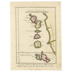
Old Map of the Spice Islands, Moluccas by Bellin, Published in 1771
Located in Langweer, NL
Title: 1771 Jacques-Nicolas Bellin Map of the Moluccas, the Spice Islands of Indonesia
Description: This finely engraved eighteenth-century map, titled Carte Particulière des Is...
Category
1770s Antique Maps
Materials
Paper
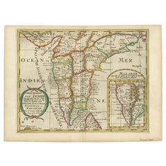
1705 Sanson Map of Southern India and Malabar with an Inset Map
Located in Langweer, NL
Title: 1705 Sanson Map of Southern India and Malabar with an Inset Map
Description: This finely engraved and beautifully hand-colored antique map, published in 1705, depicts south...
Category
Early 1700s Antique Maps
Materials
Paper
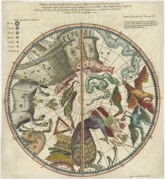
1711 Star Chart of Southern Sky with Mythical Constellations and Exotic Animals
Located in Langweer, NL
1711 Star Chart of the Southern Sky - "Mappa Stellarum Australium quae in Altitudine Poli Borei Graduum"
This beautiful star chart, engraved by Arnold van Westerhout in 1711, shows ...
Category
1710s Antique Maps
Materials
Paper
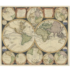
Antique World Map by P. Schenk '1706'
By Peter Schenk
Located in Langweer, NL
Antique map titled 'Diversa Orbis Terrae. Visu Incedente per Coluros Tropicorum, Ambos Ejus Polos, et Parciularis Sphaerae Zenith, in Planum Orthographica Projectio (..) Plat Ontwerp van verscheyde Aert-klooten (..)'. One of the earliest Dutch World Maps to focus on a more modern cartographic style, based on Carel Allard's map of 1696. This map represented a noteworthy shift from the traditional decorative Dutch 17th century maps where the margins would be full of classical mythological...
Category
Early 18th Century Antique Maps
Materials
Paper
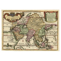
Rare Unusual Antique Map of Asia with a Landbridge from Korea to America, 1717
Located in Langweer, NL
Antique map titled 'L'Asie Suivant les Nouvelles Decouvertes (..).' Interesting and very unusual map of the Asian continent.
The map is based primarily on Dutch sources, particular...
Category
18th Century Antique Maps
Materials
Paper
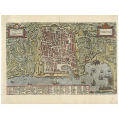
Palermo – 1620 Braun & Hogenberg Bird’s-Eye Map of Palermo, Sicily
Located in Langweer, NL
Palermo – 1620 Braun & Hogenberg Bird’s-Eye Map of Palermo, Sicily
This beautifully detailed bird’s-eye view of Palermo, Sicily, was created by Georg Braun and Frans Hogenberg aro...
Category
1620s Antique Maps
Materials
Paper
Gorgeous Antique World Map by the Dutch Mapmaker Visscher, published circa 1679
Located in Langweer, NL
Antique map titled 'Novissima Totius Terrarum Orbis Tabula, Auctore Nicolao Visscher'. Gorgeous example of Nicholas Visscher's World map, which appeared...
Category
Late 17th Century Antique Maps
Materials
Paper
Antique Bird's-Eye View of Hangzhou (China) by Matthäus Merian, 1638
Located in Langweer, NL
This is an exquisite antique bird's-eye view map of Hangzhou, historically referred to as "Xuntien or Quinzay," from the first edition of Matthäus Merian's publication in 1638. This ...
Category
1630s Antique Maps
Materials
Paper
Antique Map of China and Korea incl Formosa and Hainan, by Janssonius, ca.1650
Located in Langweer, NL
Antique map titled 'Imperii Sinarum Nova Descriptio'. Beautiful map of China and Korea, much detail troughout the map. Including the Islands of Formosa (Taiwan) and Hainan. The Great...
Category
17th Century Antique Maps
Materials
Paper
Orginal Antique Handcolored Map of the Turkish Empire, 1748
Located in Langweer, NL
Antique map titled 'L'Empire des Turcs'. Old map of the Turkish Empire with an inset of the North African regions. Originates from 'Atlas Nouveau Portatif' by G.L. le Rouge.
Artis...
Category
18th Century Antique Maps
Materials
Paper
Antique Map of the Middle East with a Large Arabia, 1799
Located in Langweer, NL
Antique map titled 'Perse, Turquie Asiatique et Arabie (..)'. Map of the Middle East with a large Arabia, extending from the Black Sea to the In...
Category
Late 18th Century Antique Maps
Materials
Paper
1601 Miniature Map of Southeast Asia & Nova Guinea by Ortelius, Vrients Edition
Located in Langweer, NL
This miniature map of the East Indies and Nova Guinea was created by Abraham Ortelius and published in 1601 as part of the "Epitome" by Giovanni Battista Vrients. It is a finely hand...
Category
Early 1600s Antique Maps
Materials
Paper
Antique Street Map of the City of Edo 'Modern Tokyo' in Japan
Located in Langweer, NL
Antique map titled 'Plan de Jedo - Platte Grond van Jedo'. A detailed street map of the city of Edo (modern Tokyo) in Japan, originally engraved by Bellin and Schley and reissued for...
Category
Mid-18th Century Antique Maps
Materials
Paper
Detailed Antique Map of Italy and surrounding Islands
Located in Langweer, NL
Antique map titled 'Italie volgens de allernieuwste Uitgave van den Heere d'Anville'. Very detailed antique map, based on D'Anville's important map of It...
Category
Mid-18th Century Antique Maps
Materials
Paper
1573 Ortelius Map: First to Name California, Spanning Tartary to North America
Located in Langweer, NL
"1573 Abraham Ortelius Map of Tartary, Japan, and Western North America"
Description of the Map:
This is an outstanding example of Abraham Ortelius' map titled "Tartariae Sive Magn...
Category
16th Century Antique Maps
Materials
Paper
Antique Print of the City of Rome, Italy by Münster, C.1580
Located in Langweer, NL
Antique print titled 'Abbildung der Statt Rom/wie sie under Keyser Vespasiano und zu Plinii zeiten gewesen'. Woodcut of ancient Rome. This print originates from Munster's Cosmographi...
Category
16th Century Antique Maps
Materials
Paper
Original Antique Map of Fez and Morocco
Located in Langweer, NL
Antique map titled 'Karte von Fes und Marócos (..)'. Original old map of Fez (or Fes) and Morocco. Also shows the Strait of Gibraltar. By Friedrich Gottlieb Canzler, published 1799.
Category
Late 18th Century Antique Maps
Materials
Paper
Original Antique Map of Normandy, France
Located in Langweer, NL
Antique map titled 'Carte de Normandie (..)'. Attractive map of Normandy, France. it depicts the former French Duchy of Normandy, covers the region fro...
Category
Mid-18th Century Antique Maps
Materials
Paper
Original Antique Map of Ancient Greece- Boeotia, Thebes, 1787
Located in St Annes, Lancashire
Great map of Ancient Greece. Showing the region of Boeotia, including Thebes
Drawn by J.D. Barbie Du Bocage
Copper plate engraving by P.F T...
Category
1780s French Other Antique Maps
Materials
Paper
Antique Map of Southeast Asia from Persia to the Timor Island, 1712
Located in Langweer, NL
Antique map titled 'A New Map of the East Indies'.
Old map covering all of Southeast Asia from Persia to the Timor Island, inclusive of the modern day nations of India, Ceylon, T...
Category
1710s Antique Maps
Materials
Paper
Original Engraving of the West Indies, Gulf of Mexico, Antilles, Caribbean, 1780
Located in Langweer, NL
Rigobert Bonne and G. Raynal's 1780 map of the West Indies, Gulf of Mexico, Antilles, and the Caribbean stands as a remarkable cartographic piece, offering a detailed and expansive v...
Category
Late 18th Century Antique Maps
Materials
Paper
Antique Miniature Map of the Roman Province of Illyricum 'Dalmatia'
Located in Langweer, NL
Antique miniature map titled 'Illyricum'. Original small map of Illyricum. The Roman province of Illyricum stretched from the Drilon River (the Drin, in...
Category
Early 17th Century Antique Maps
Materials
Paper
Old 18th Century Composite Map of Key Caribbean Islands with Descriptive Texts
Located in Langweer, NL
Antique map titled 'Dominia Anglorum in praecipuis Insulis Americae ut sunt Insula S. Christophori, Antegoa, Iamaica, Barbados nec non Insulae Bermudes vel Sommers dictae. Die Englis...
Category
1740s Antique Maps
Materials
Paper
Set of Four Original Antique Maps of Asia by Bolton & Seale, circa 1770
Located in Langweer, NL
Set of four antique maps of Asia:
1) Asia plate 6, Part of China, Tibet and Tartary
2) Asia plate 2, Japan, Corea, the Monguls and part of China
3) As...
Category
Late 18th Century Antique Maps
Materials
Paper
Biblical Map and Family Trees of the Holy Land by Chatelain, ca. 1720
Located in Langweer, NL
Title: 1720 Chatelain Map of the Holy Land with Biblical Family Trees and Chronology
Description:
This fascinating 18th-century folio map by Henry Abraham Chatelain combines geo...
Category
1710s Antique Maps
Materials
Paper
Italian Parchment Map of the City of Pisa Dated, 1640
By Matthäus Merian the Elder
Located in Florence, Tuscany
An antique map of the Tuscan city of Pisa engraved for The 'Itinerarium Italiæ Nov-antiquæ' by Matthäus Merian the Elder and printed in 1640....
Category
1640s Italian Antique Maps
Materials
Paper
Original Antique Hand-colored World Map with or without Frame, '1696'
Located in Langweer, NL
Antique world map titled 'Mappe-Monde dressee sur les Observations de Mrs. de l'Academie Royale des Sciences (..)'. Beautiful original antique world map...
Category
Late 17th Century Antique Maps
Materials
Paper
Antique Map of Arabia including Nubia and Abyssinia, also shows the Red Sea
Located in Langweer, NL
Antique map titled 'Nubie et Abissinie'. Original antique map of Nubia, a region along the Nile river, and Abyssinia or the Ethiopian Empire. This map o...
Category
Late 18th Century Antique Maps
Materials
Paper
Antique Map of Greece from Ortelius's Theatrum Orbis Terrarum, 1595
Located in Langweer, NL
Original antique map titled "Graecia Sophiani." This is a very detailed and decorative engraved map, with two decorative cartouches and a hand-colored initial on the verso, from Abra...
Category
16th Century Antique Maps
Materials
Paper
Antique Map of Venezuela by Montanus, 1671
Located in Langweer, NL
Antique map titled 'Venezuela cum parte Australi Novae Andalusiae'. The map extends from Coquibocoa to the Orinoque River, centered on Bariquicemento and Cape de Curiacao. Large cart...
Category
Mid-17th Century English Antique Maps
Materials
Paper
Renaissance Mapping of Sumatra: Featuring Singapore in Münster’s Woodcut, c.1590
Located in Langweer, NL
Description: Antique map titled 'Sumatra ein grosse Insel / so von den alten Geographen Taprobana genennt worden'. Beautiful map of Sumatra and the southern part of Malaysia, with Si...
Category
16th Century Antique Maps
Materials
Paper
1742 Antique Map of the Persian Empire with Detailed Borders and Cartouche
Located in Langweer, NL
Title: 1742 Covens & Mortier Map of the Persian Empire by Guillaume De L'Isle
This remarkable 1742 map, "Carte de Perse," was originally designed by Guillaume De L'Isle, a preemin...
Category
1740s Antique Maps
Materials
Paper
Large 1693 Maritime Map of Irish Sea, West Coasts of Ireland, England, Scotland
Located in Langweer, NL
This is a historical sea chart titled "Carte Generale des Costes d'Irlande, et des Costes Occidentales d'Angleterre avec une Partie de celles d'Ecosse," which translates to "General Map of the Coasts of Ireland and the Western Coasts of England with a Part of Scotland."
The map was first published in 1693 in the atlas "La Neptune Francois," created by Jaillot and published by Pieter Mortier in Amsterdam. This initiative was started by the French minister Colbert to improve maritime navigation.
Details of the Map:
1. **Geographical Coverage:**
- The map primarily focuses on the Irish coast.
- It also includes the west coast of England and Wales.
- Parts of the west coast of Scotland are also depicted.
2. **Inset Map:**
- There is a detailed inset map showing the area around Chester and the course of the River Dee.
3. **Features:**
- **Depth Soundings:** The Irish Sea is detailed with depth soundings to assist in navigation.
- **Coastal Towns and Islands:** Numerous coastal towns, islands, and geographical features are indicated.
- **Rhumb Lines:** The map includes extensive rhumb lines, which are lines used by navigators to plot a straight-line course.
- **Key:** There is a key describing the quality of the terrain along the coast, important for navigators to understand the nature of the coastal landscape.
4. **Labels and Annotations:**
- **Coastal Settlements:** Ports, forts, and villages along the coast are labeled.
- **Geographical Features:** Islands and other significant features are marked.
5. **Artistic and Practical Elements:**
- The map is printed on thick paper and is hand-colored, reflecting contemporary coloring techniques.
- Detailed lines and soundings are included to help ships navigate around the numerous small islands and narrow inlets safely.
6. **Historical Context:**
- The map was part of a significant French maritime project aimed at improving navigation and charting European waters more accurately.
- It reflects the high level of cartographic skill and knowledge of the late 17th century.
This map would have been a valuable tool for mariners of the time, providing them with crucial information about the coastal features, depth soundings, and safe passage routes around the complex coastlines of Ireland, England, and Scotland.
About the Makers and the Atlas
**1. Alexis-Hubert Jaillot (1632-1712):**
- **Background:** Jaillot was a prominent French cartographer and publisher in the 17th century. He was known for his detailed and accurate maps and atlases.
- **Work:** He collaborated with other notable cartographers of his time and played a key role in improving and publishing detailed maps. Jaillot's work was characterized by its precision and artistic quality.
- **Contribution:** He was instrumental in the creation of "La Neptune Francois," a maritime atlas aimed at improving French naval navigation.
**2. Pieter Mortier (1661-1711):**
- **Background:** Mortier was a Dutch engraver, publisher, and mapmaker based in Amsterdam. He was well-known for his high-quality prints and maps.
- **Work:** Mortier published several important atlases and maps, often collaborating with other cartographers and engravers. His work was recognized for its detailed craftsmanship and accuracy.
- **Contribution:** Mortier published "La Neptune Francois" in Amsterdam, making significant contributions to maritime navigation by providing highly detailed sea charts.
About the Atlas "La Neptune Francois":
**1. Purpose:**
- The atlas was created as part of an initiative led by Jean-Baptiste Colbert, the French minister of finance under King Louis XIV. The goal was to enhance the accuracy and availability of maritime charts for French naval and commercial vessels.
- "La Neptune Francois" was designed to be a comprehensive and detailed reference for navigators, covering various European waters with a focus on the French coast and adjacent regions.
**2. Content:**
- The atlas includes a series of sea charts, each providing detailed information on coastal regions, depth soundings, rhumb lines, and other navigational aids.
- The maps were printed on high-quality paper and hand-colored, reflecting the artistic standards of the time.
**3. Historical Significance:**
- "La Neptune Francois" was a landmark in the history of cartography, representing a significant advancement in the accuracy and detail of maritime maps...
Category
1690s Antique Maps
Materials
Paper
Spectacular 1770 Bird's-Eye View of Dunkirk Harbor by Basset, with 66 Landmarks
Located in Langweer, NL
This engraving, titled *Vue de Dunkerque du coté de la Mer*, is a spectacular bird's-eye view of Dunkirk from the sea, published by Basset around 1770.
It provides a detailed panor...
Category
1770s Antique Maps
Materials
Paper
18th-Century Map of the Eastern Roman Empire by Henri Chatelain, c. 1719
Located in Langweer, NL
Title: 18th-Century Map of the Eastern Roman Empire by Henri Chatelain, c. 1719
Description: This intricately detailed map, titled *Nouvelle Carte pour Servir à l'Histoire de l'Empi...
Category
1710s Antique Maps
Materials
Paper
Saint-Domingue (French Section): 18th Century Map from France Militaire Series
Located in Langweer, NL
This map is titled "St. Domingue (Partie Française)" and is part of the France Militaire series. It focuses on the French portion of Saint-Domingue, which corresponds to modern-day H...
Category
1790s Antique Maps
Materials
Paper
Antique Map of Israel Filled with Biblical Scenes, Published in 1748
Located in Langweer, NL
Antique map Holy Land titled 'Het beloofde landt Canaan doorwandelt van onsen Saligmaker Jesu Christo neffens zyne Apostelen'.
Antique map of Israel ...
Category
1740s Antique Maps
Materials
Paper
Map of The East Indies with the Route of Capt. William Dampier's Voyage, 1698
Located in Langweer, NL
Antique map titled 'Kaart van Oost Indie'.
Old map of the East Indies. It shows the routes of Captain William Dampier's voyage throughout the regio...
Category
1690s Antique Maps
Materials
Paper
1684 Mallet Map of Amazon River & Kingdom of Amazons – Hand Colored, Miniature
Located in Langweer, NL
This map, titled 'Royaume des Amazones', was created by Alain Manesson Mallet and published in 1684 in a German edition of *Beschreibung des Gantzen Welt-Kreisses*, a renowned work d...
Category
1680s Antique Maps
Materials
Paper
Antique Print with Coastal Views of Kamchatka in The Russian Far East, c.1784
Located in Langweer, NL
Antique print titled 'Views of the Coast of Kamtschatka (..)'. Print with coastal views of Kamchatka including volcanoes. Originates from an edition of Cook's Voyages.
Artists and ...
Category
18th Century Antique Maps
Materials
Paper
Antique French Map of Hungary with Decorative Title Cartouche, c.1730
Located in Langweer, NL
Antique map titled 'La Hongrie suivant les Nouvelles Observations (..)'. Antique map of Hungary with decorative title cartouche. Artists and Engravers: ...
Category
18th Century Antique Maps
Materials
Paper
17th Century Nautical Chart of Skagerrak and Øresund by Johannes van Keulen
Located in Langweer, NL
This map titled *Pascaret van Schager-Rack de Bælt en de Sondt* was created by the prominent Dutch cartographer Johannes van Keulen and published in Amsterd...
Category
Late 17th Century Antique Maps
Materials
Paper
Original 17th-Century Antique Map of Nanjing Province, China – by Blaeu
Located in Langweer, NL
Title: 17th-Century Antique Map of Nanjing Province, China – "Nanking sive Kiangnan" by Blaeu, with Decorative Details
Description: This captivating 17th-century map of Nanjing Pr...
Category
1650s Antique Maps
Materials
Paper
Dutch Conquest of Rio Grande, Brazil (1633) Under Prince Frederick Hendrick
Located in Langweer, NL
The image is an engraving titled “VEROVERINGE VAN RIO GRANDE IN BRASIL ANNO 1633.” This historical print depicts the Dutch conquest of Rio Grande in Brazil, known today as Natal, dur...
Category
1690s Antique Maps
Materials
Paper
Antique Map of Persia with Dedication Cartouche
Located in Langweer, NL
Antique map titled 'Persia sive Sophorum Regnum'. Original old map of Persia. The map extends from the Eastern Mediteranian to Tacalistan and the Indus River and the Dalanguer Mounta...
Category
Mid-17th Century Antique Maps
Materials
Paper
Map Holy Land La Terre Sainte Engraved van Loon Published N de Fer 1703 French
Located in BUNGAY, SUFFOLK
La Terre Sainte, The Holy Land, Tiree Des Memoires De M.De.La Rue. Par N. de Fer. Geographe de Sa Majeste Catoliq et de Monseigneur le Dauphin. Avec Privil du Roi 1703
Detailed map of the Holy Land from Nicholas de Fer's L'Atlas Curieux ou le Monde. East is oriented at the top.
MAKER Nicolas de Fer 1646-1720
The French cartographer and engraver, Nicolas de Fer, was a master at creating maps that were works of art. The maps that he published were printed during the Baroque period when the decorative arts were characterized by ornate detail. De Fer’s detailed maps and atlases were valued more for their decorative content than their geographical accuracy.
Nicolas de Fer was born in 1646. His father, Antoine de Fer, owned a mapmaking firm. At the age of twelve, Nicolas was apprenticed to a Parisian engraver named Louis Spirinx. The family business was starting to decline when his father died in 1673. Nicolas de Fer’s mother, Genevieve, took over the business after the death of her husband. In 1687 the business was passed on to Nicolas and the profits increased after he took over the firm. Nicolas de Fer was a prolific cartographer who produced atlases and hundreds of single maps. He eventually became the official geographer to King Louis XIV of France and King Philip V...
Category
Early 1700s French Louis XIV Antique Maps
Materials
Paper
Antique Map of Greece by Allard (c.1698)
Located in Langweer, NL
Antique map titled 'Hellas seu Graecia Universa' Detailed map of Greece, with Crete, the Aegean Islands, and part of Turkey. With two cartouches, compass rose and scale. Carolus Alla...
Category
Late 17th Century Antique Maps
Materials
Paper
Antique plan of Ayutthaya, the capital of Siam, Thailand
Located in Langweer, NL
Antique map titled 'Judia, De Hoofd-Stad van Siam'. Antique plan of Ayutthaya, the capital of Siam (Thailand). This print originates from 'Oud en Nieuw Oost-...
Category
Mid-18th Century Antique Maps
Materials
Paper
1640 Map of North Africa Nova Barbariae Descriptio or The Barbarian Coast
Located in Langweer, NL
1640 Antique Map of North Africa 'Nova Barbariae Descriptio' by Johannes Janssonius
This antique map titled Nova Barbariae Descriptio*, published by Johannes Janssonius around 1640,...
Category
1640s Antique Maps
Materials
Paper
16th-Century Panoramic View of Worms: A Woodcut from Sebastian Münster's
Located in Langweer, NL
This is a woodcut city view of Worms, published in Sebastian Münster's *Cosmographia* around 1578. The image depicts a bird's-eye view of the city of Worms, located in Rheinland-Pfal...
Category
16th Century Antique Maps
Materials
Paper
Bird's-Eye View of Blâmont in Lorraine by Braun and Hogenberg, 1597
Located in Langweer, NL
Title: Bird's-Eye View of Blâmont in Lorraine by Braun and Hogenberg, 1597
This copperplate engraving, published in 1597 by Braun and Hogenberg, depicts a bird's-eye view of the t...
Category
16th Century Antique Maps
Materials
Paper
Dutch City Plan of Sloten in Friesland by N. Van Geelkercken, hand-colored 1616
Located in Langweer, NL
Bird’s-Eye View of Sloten in Friesland by Nicolaes van Geelkercken, ca. 1616
This captivating hand-colored engraving presents an early 17th-century bird’s-eye view of the fortified ...
Category
1610s Dutch Antique Maps
Materials
Paper
Dutch City Plan of Workum in Friesland by N. Van Geelkercken, hand-colored 1616
Located in Langweer, NL
Workum in Friesland by Nicolaes van Geelkercken, hand-colored map ca. 1616
This beautifully hand-colored engraving titled 'Worcum' presents an early 17th-century bird’s-eye view of ...
Category
1610s Dutch Antique Maps
Materials
Paper
Antique Map of North Africa by Ortelius, c.1600
Located in Langweer, NL
Antique map titled 'Barbariae et Biledulgerid nova descriptio'.
Old map of coastal North Africa and the Mediterranean. The map extends from Morocco and the Sahara to Libya and sh...
Category
17th Century Antique Maps
Materials
Paper
Map of Baja California and Mexico - Jesuit Observations and Native Tribes, 1777
Located in Langweer, NL
1777 A. Krevelt Map of Baja California and Northwestern Mexico - Jesuit Observations and Native Tribes
A. Krevelt - Carte de la Californie d'Après les observations les plus exactes ...
Category
1770s Antique Maps
Materials
Paper
Antique Map of Celtic Europe by Cluver, 1678
Located in Langweer, NL
Antique map Europe titled 'Europam sive Celticam Veterem'. Rare map of Celtic Europe. Made after A. Ortelius, originates from 'Introductionis in uni...
Category
17th Century Antique Maps
Materials
Paper
Antique Print of a Ruin of the Kew Gardens in London, England, c.1785
Located in Langweer, NL
Antique print titled 'Ruin de Kew vuë par le Nord'.
Copper engraving of a ruin of the Kew gardens. This print originates from 'Jardins Anglo-Chinois à la Mode' by Georg Louis le Rouge. Artists and Engravers: The work of Le Rouge is considered the most important engraved work concerning the history of European gardens during the 18th century.
Kew Gardens is a botanic garden in southwest London that houses the "largest and most diverse botanical and mycological collections in the world". Founded in 1840, from the exotic garden at Kew Park, its living collections includes some of the 27,000 taxa curated by Royal Botanic Gardens, Kew, while the herbarium, one of the largest in the world, has over 8.5 million preserved plant...
Category
18th Century Antique Maps
Materials
Paper
Map of the Persian Empire by Nicolas Sanson, Hand-colored, circa 1683
Located in Langweer, NL
Map of the Persian Empire by Nicolas Sanson, hand-colored, circa 1683
This finely detailed and delicately hand-colored map titled *L'Empire du Sophy des Perses* presents a late 17th...
Category
1680s Antique Maps
Materials
Paper
