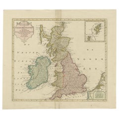
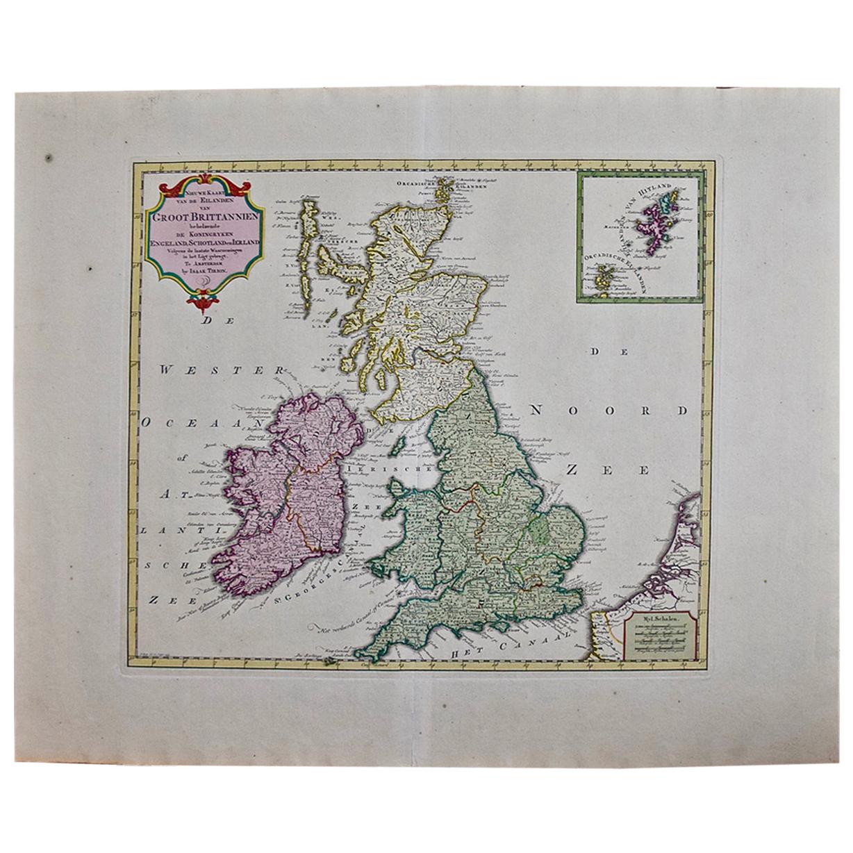
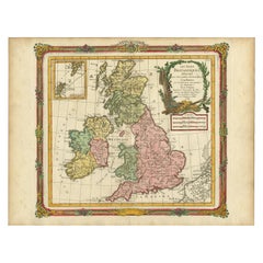
Antique Map of Great Britain and Ireland by Tirion, circa 1750
View Similar Items


Want more images or videos?
Request additional images or videos from the seller
1 of 5
Antique Map of Great Britain and Ireland by Tirion, circa 1750
About the Item
- Creator:Isaak Tirion (Artist)
- Dimensions:Height: 15.36 in (39 cm)Width: 17.33 in (44 cm)Depth: 0.02 in (0.5 mm)
- Materials and Techniques:
- Place of Origin:
- Period:
- Date of Manufacture:circa 1750
- Condition:Original coloring. Repair on folding line and near 'wester-oceaan'. Please study image carefully.
- Seller Location:Langweer, NL
- Reference Number:Seller: BG-115381stDibs: LU3054313306092
About the Seller
5.0
Platinum Seller
These expertly vetted sellers are 1stDibs' most experienced sellers and are rated highest by our customers.
Established in 2009
1stDibs seller since 2017
1,940 sales on 1stDibs
More From This SellerView All
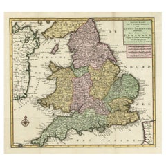
- Antique Map of the South Part of Great Britain by Tirion, c.1750By Isaak TirionLocated in Langweer, NLAntique map titled 'Nieuwe Kaart van 'T Zuider Gedeelte van Groot Britannie behelzende Het Koningryk Engeland (..).' Attractive map showing the south part of Great Britain; the K...Category
Antique 18th Century Maps
MaterialsPaper
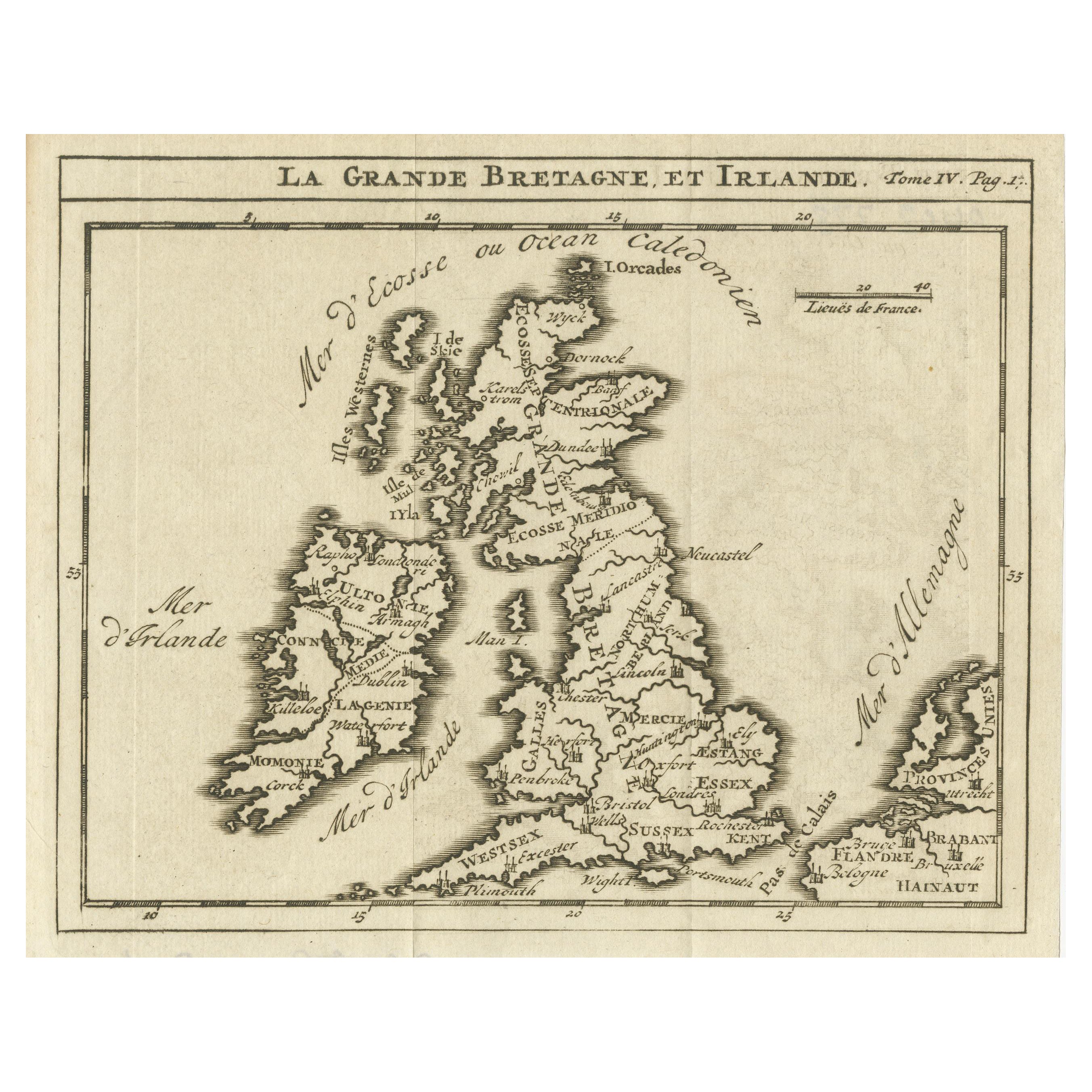
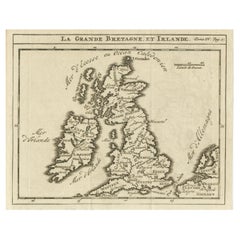
- Rare Small Antique Map of Great Britain and IrelandLocated in Langweer, NLAntique map titled 'La Grande Bretagne et Irlande'. Small antique map of Great Britain and Ireland. Source unknown, to be determined. Publ...Category
Antique Mid-18th Century Maps
MaterialsPaper
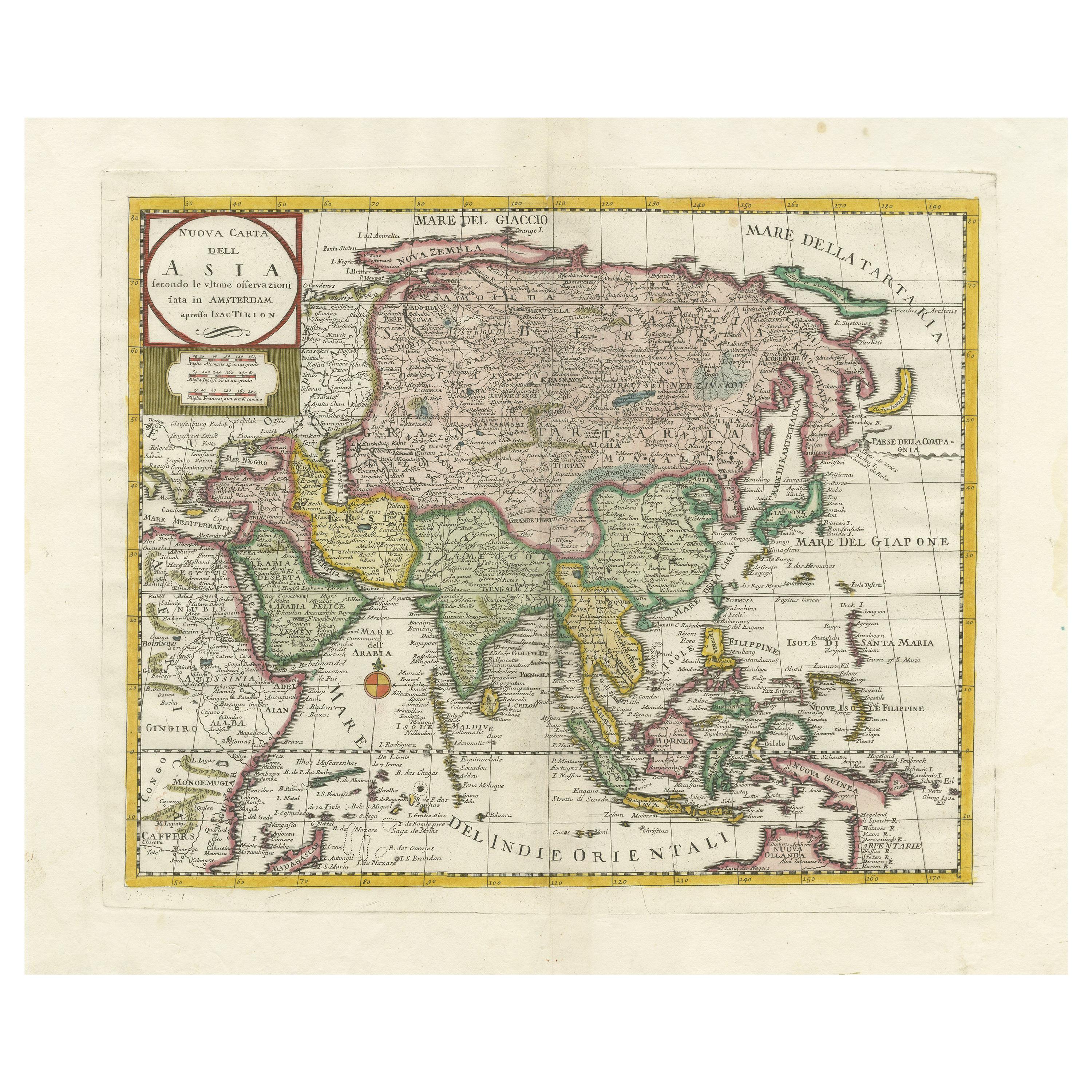
- Antique Map of the Eastern Part of the World by Tirion, 1755By Isaak TirionLocated in Langweer, NLAntique map titled 'Nieuwe Kaart van het Oostelykste Deel der Weereld, dienende tot Aanwyzing van de Scheepstogten der Nederlanderen naar Oostindië'. Australia (Nieuw Holland) shown ...Category
Antique Mid-18th Century Dutch Maps
MaterialsPaper
- Antique Map of Great Britain and Ireland by Brion de la Tour, 1766Located in Langweer, NLAntique map titled 'Les Isles Britanniques (..).' Attractive map of Great Britain surrounded by an engraved border printed from a separate coppe...Category
Antique 18th Century Maps
MaterialsPaper
 $482 Sale Price20% Off
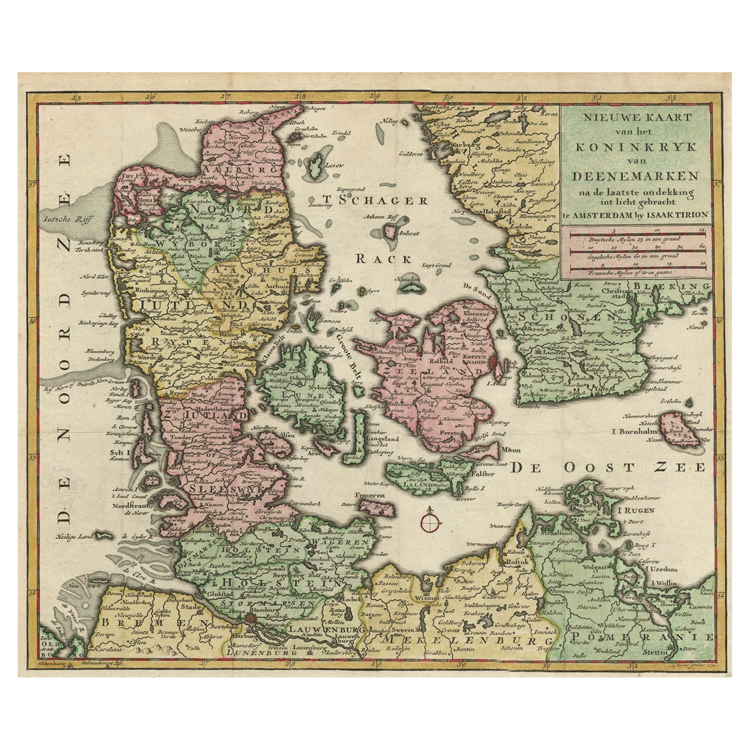
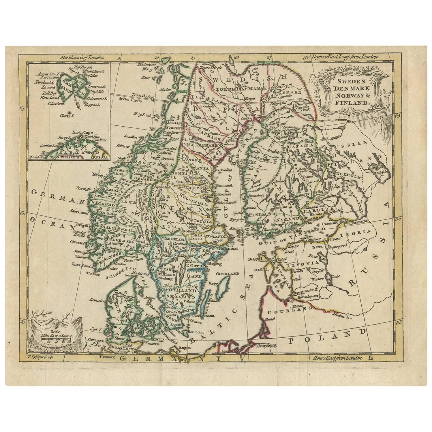
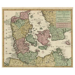
 - Attractive Antique Map showing Denmark and part of Sweden and Germany c.1750By Isaak TirionLocated in Langweer, NLAntique map titled 'Nieuwe Kaart van het Koninkryk van Deenemarken (..).' Attractive detailed map showing Denmark and a part of Sweden and Germany. Title in block-style cartouche wit...Category
Antique 18th Century Maps
MaterialsPaper
- Antique Map of South America by Tirion 'circa 1765'Located in Langweer, NLAntique map titled 'Kaart van het Onderkoningschap van Peru, zig uitstrekkende over Chili, Paraguay en andere Spaansche Landen: als ook van Brazil en verdere Bezittingen van Portugal...Category
Antique Mid-18th Century Maps
MaterialsPaper

You May Also Like
- England, Scotland & Ireland: A Hand Colored Map of Great Britain by TirionBy Isaak TirionLocated in Alamo, CAThis is a hand-colored double page copperplate map of Great Britain entitled "Nieuwe Kaart van de Eilanden van Groot Brittannien Behelzende de Kon...Category
Antique Mid-18th Century Dutch Maps
MaterialsPaper
- Original Antique Map of Ireland- Tipperary and Waterford. C.1840Located in St Annes, LancashireGreat map of Tipperary and Waterford Steel engraving Drawn under the direction of A.Adlard Published by How and Parsons, C.1840 Unframed.Category
Antique 1840s English Maps
MaterialsPaper
- Original Antique Map of Ireland- Kerry. C.1840Located in St Annes, LancashireGreat map of Kerry Steel engraving Drawn under the direction of A.Adlard Published by How and Parsons, C.1840 Unframed.Category
Antique 1840s English Maps
MaterialsPaper

- Original Antique Map of Spain and Portugal, circa 1790Located in St Annes, LancashireSuper map of Spain and Portugal Copper plate engraving by A. Bell Published, circa 1790. Unframed.Category
Antique 1790s English Other Maps
MaterialsPaper
- Original Antique Map of Belgium by Tallis, Circa 1850Located in St Annes, LancashireGreat map of Belgium Steel engraving Many lovely vignettes Published by London Printing & Publishing Co. ( Formerly Tallis ), C.1850 Origin...Category
Antique 1850s English Maps
MaterialsPaper
- Original Antique Map of South America, circa 1830Located in St Annes, LancashireGreat map of South America Copper plate engraving Published by Butterworth, Livesey & Co., circa 1830 Unframed.Category
Antique Early 1800s English Other Maps
MaterialsPaper


Recently Viewed
View AllMore Ways To Browse
Maps Of Ireland 18th Century
Shetland Map
Isaak Tirion On Sale
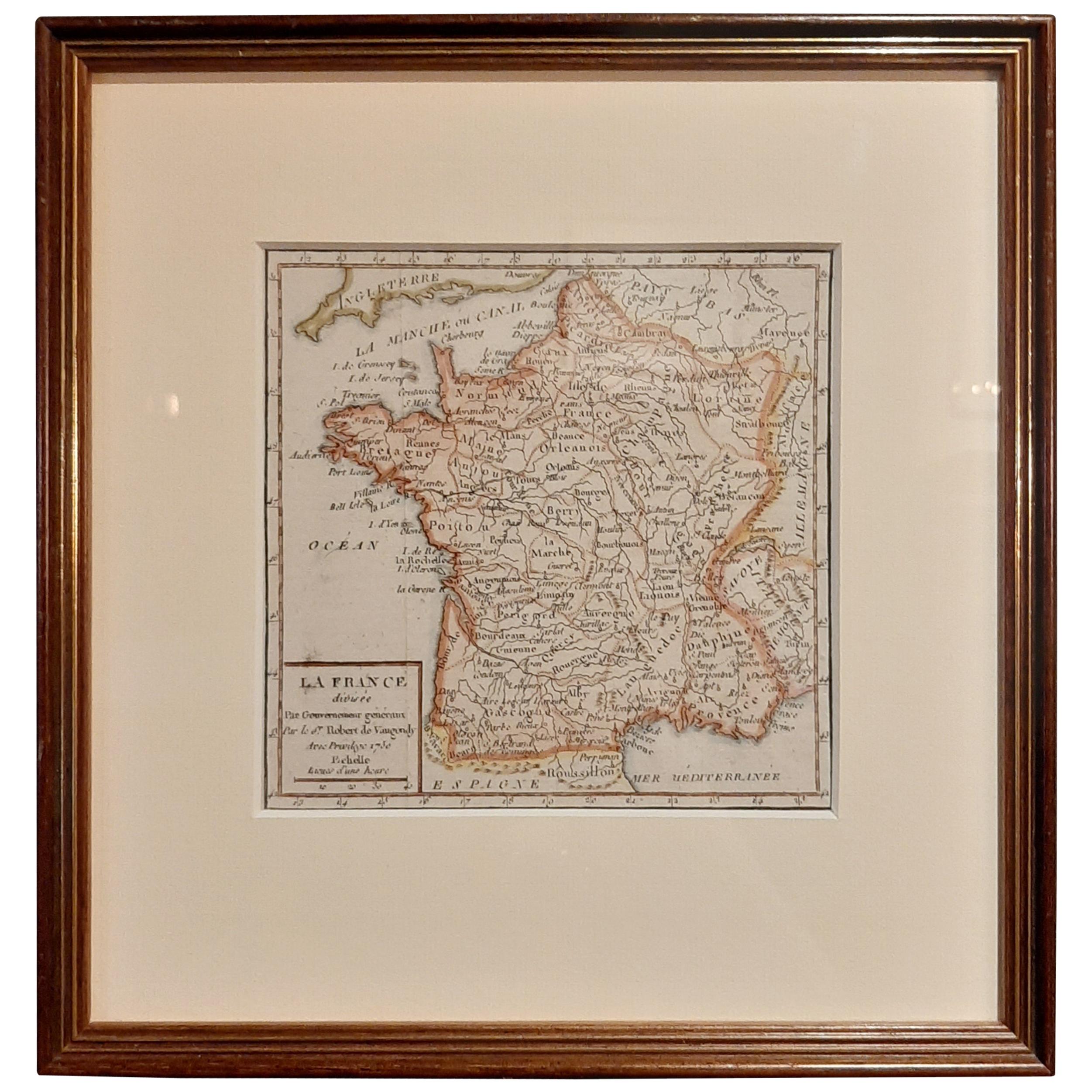
Map Of France
Large Map
Large Maps
Antique German Collectibles
Original World Map
World Atlas
Map Of Itsly
Antique Map World
Antique Maps World
Antique World Map World Maps
Antique World Maps
Antique World Maps World Maps
World Map Antique
World Antique Map
Antique World Map