Items Similar to 1859 Antique Arctic Vista: Greenland, Iceland and Faroe Islands, Blackie's Atlas
Want more images or videos?
Request additional images or videos from the seller
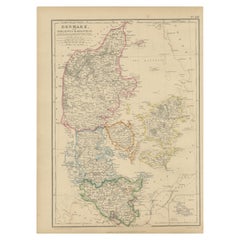
1859 Antique Arctic Vista: Greenland, Iceland and Faroe Islands, Blackie's Atlas
About the Item
The "1859 Antique Arctic Vista: Greenland, Iceland, and Faroe Islands" is an original antique map from 'The Imperial Atlas of Modern Geography', published by W. G. Blackie in 1859. This map provides a detailed and comprehensive representation of Greenland along with the Danish colonies, Iceland, and the Faroe Islands, as they were understood in the mid-19th century.
**Key Features of the Map:**
1. **Geographical Detail**: The map covers the expansive and rugged landscapes of Greenland, the volcanic terrain of Iceland, and the archipelago of the Faroe Islands. It likely showcases the topographical features such as Greenland's ice cap, Iceland's geysers and volcanoes, and the steep cliffs of the Faroe Islands.
2. **Political Boundaries**: Reflecting the political realities of the time, the map delineates the territories of Greenland, Iceland, and the Faroe Islands, which were under Danish colonial rule. This provides insight into the historical territorial divisions and governance structures of these regions.
3. **Settlements and Colonies**: The map marks key settlements, particularly in Iceland and the Faroe Islands, and the Danish colonies in Greenland. It highlights the locations of towns, villages, and possibly trading posts or mission stations.
4. **Maritime Features**: Given the significant maritime nature of these regions, the map likely details coastal features, sea routes, and possibly ocean currents, reflecting the importance of the sea in the life and economy of these areas.
5. **Artistic and Aesthetic Elements**: Consistent with the Victorian era's cartographic style, the map may feature decorative borders, an elegant title script, and other artistic flourishes that add to its visual appeal.
6. **Historical Annotations**: The map may include notes or legends providing historical and cultural context, particularly regarding the exploration and colonization of these areas.
7. **Educational and Historical Value**: As a part of 'The Imperial Atlas of Modern Geography', this map serves as an important educational tool, offering a glimpse into the geographical understanding and perceptions of Greenland, Iceland, and the Faroe Islands in the mid-19th century.
This map is not only a valuable item for collectors of antique maps but also a significant resource for historians, geographers, and anyone interested in the history and geography of the Arctic and North Atlantic regions.
- Dimensions:Height: 14.57 in (37 cm)Width: 10.63 in (27 cm)Depth: 0.02 in (0.5 mm)
- Materials and Techniques:
- Period:
- Date of Manufacture:1859
- Condition:Wear consistent with age and use. General age-related toning. some foxing, Please study image carefully.
- Seller Location:Langweer, NL
- Reference Number:
About the Seller
5.0
Platinum Seller
These expertly vetted sellers are 1stDibs' most experienced sellers and are rated highest by our customers.
Established in 2009
1stDibs seller since 2017
1,949 sales on 1stDibs
Typical response time: <1 hour
- ShippingRetrieving quote...Ships From: Langweer, Netherlands
- Return PolicyA return for this item may be initiated within 14 days of delivery.
More From This SellerView All
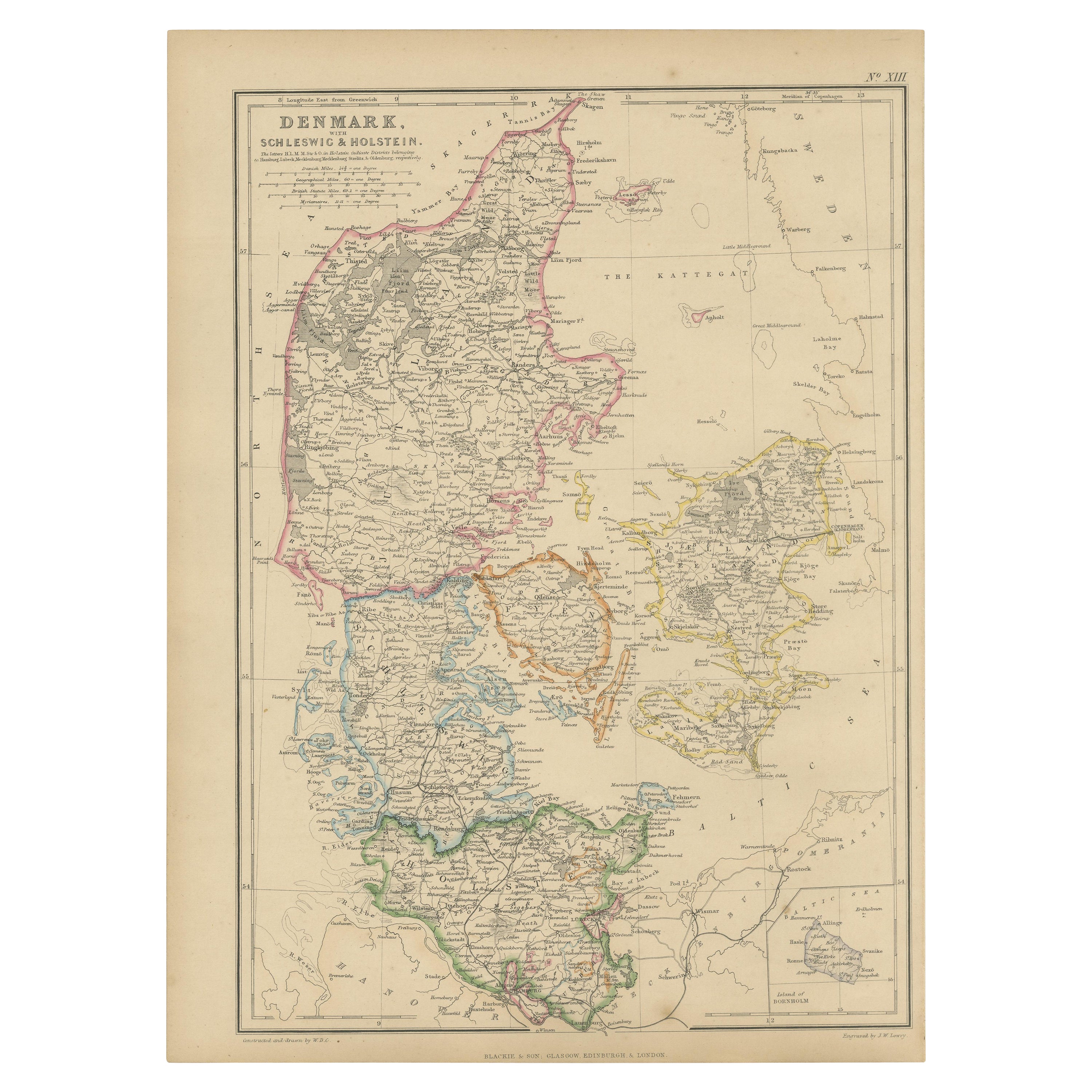
- 1859 Denmark and Schleswig-Holstein Map: A Historical View from Blackie's AtlasLocated in Langweer, NLThe "Antique Map of Denmark with Schleswig & Holstein" from 'The Imperial Atlas of Modern Geography', published by W. G. Blackie in 1859, is a valuable historical document that provi...Category
Antique Mid-19th Century Maps
MaterialsPaper
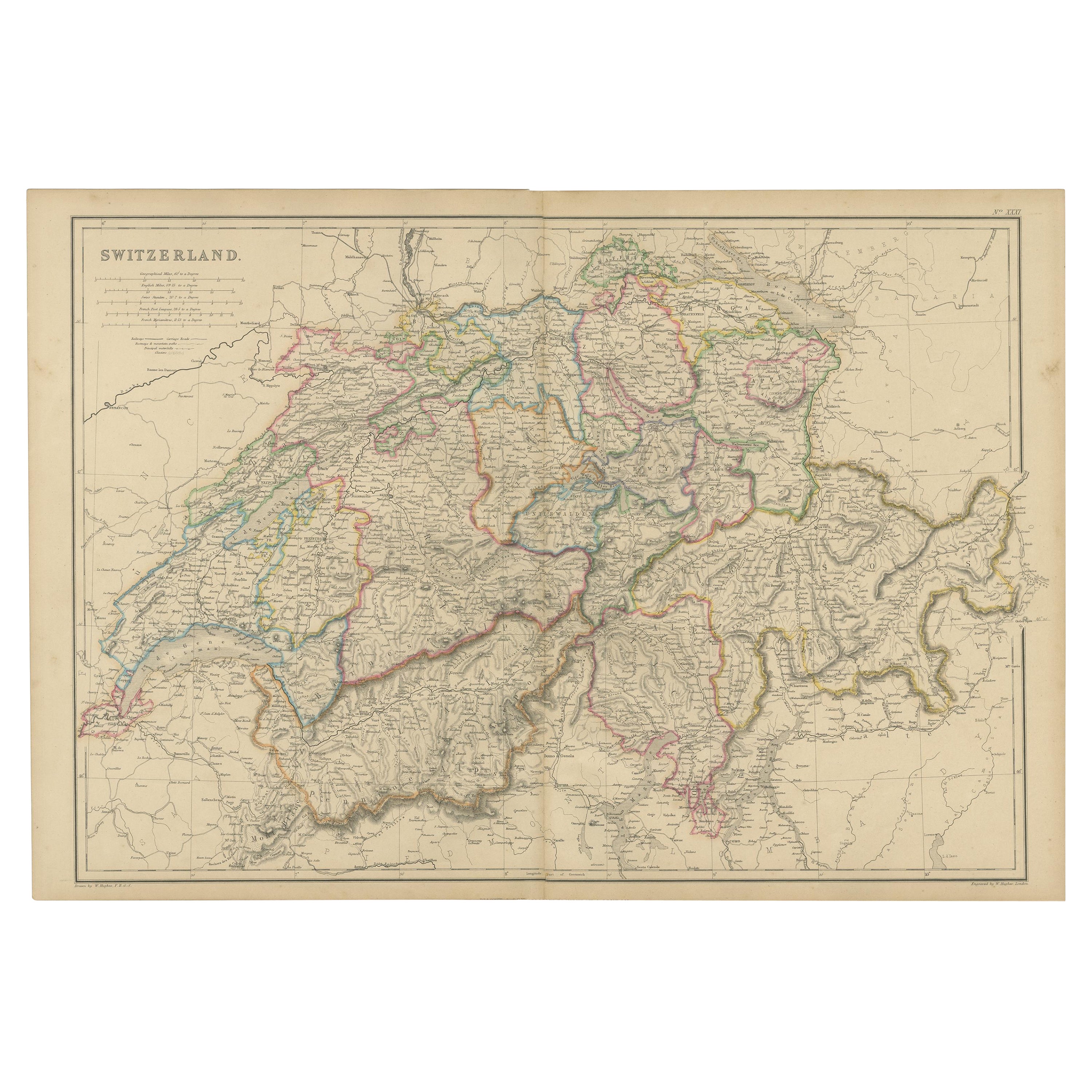
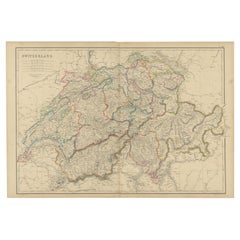
- 1859 Antique Swiss Panorama: Blackie's Detailed Map of SwitzerlandLocated in Langweer, NLThe "Antique Map of Switzerland" is a distinguished piece from 'The Imperial Atlas of Modern Geography', published in 1859 by the renowned cartographer W. G. Blackie. This map presen...Category
Antique Mid-19th Century Maps
MaterialsPaper
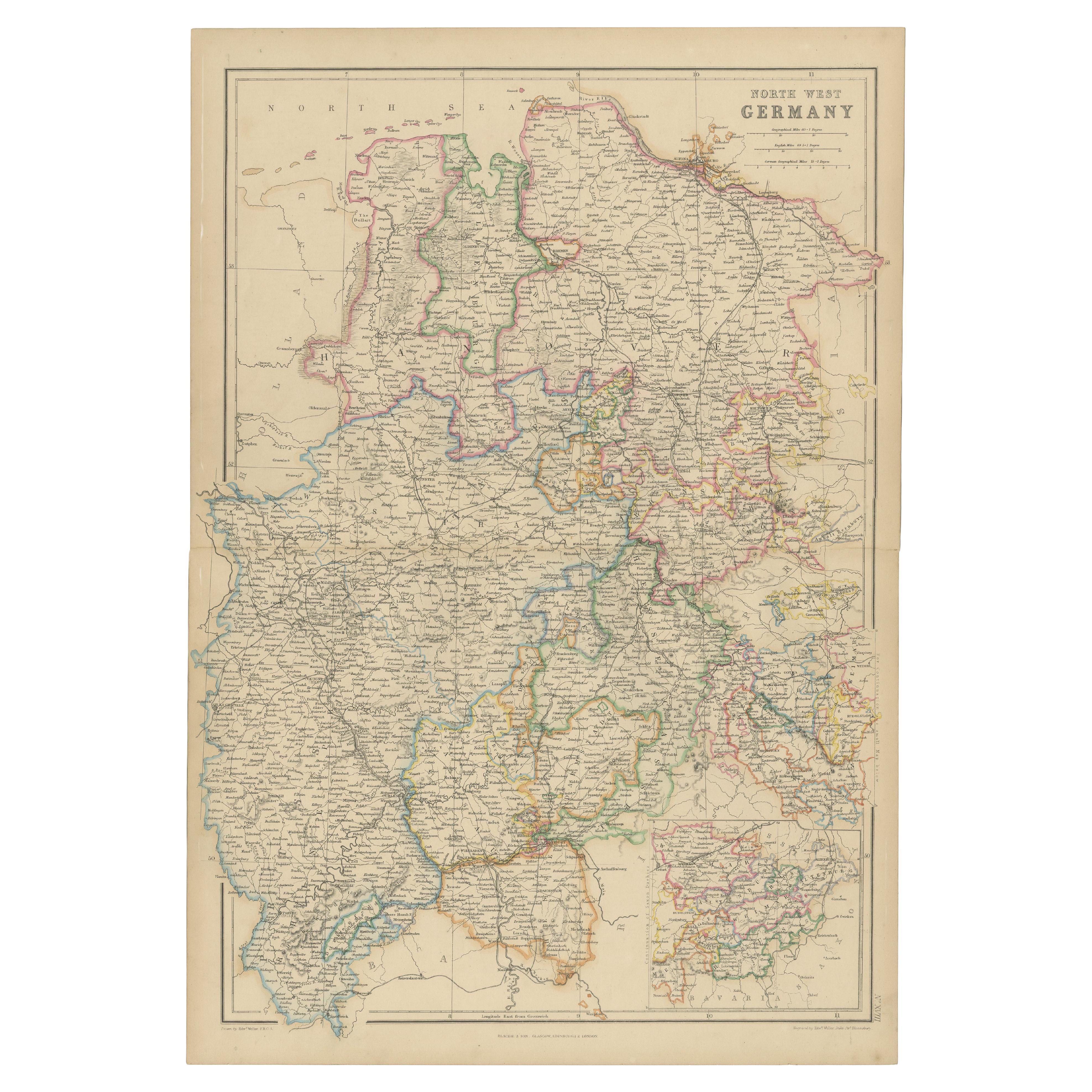
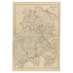
- 1859 Detailed Map of North West Germany with Bavaria Inset - Blackie's AtlasLocated in Langweer, NLThe "Antique Map of North West Germany" with an inset map of Bavaria is a distinguished piece from 'The Imperial Atlas of Modern Geography', published i...Category
Antique Mid-19th Century Maps
MaterialsPaper
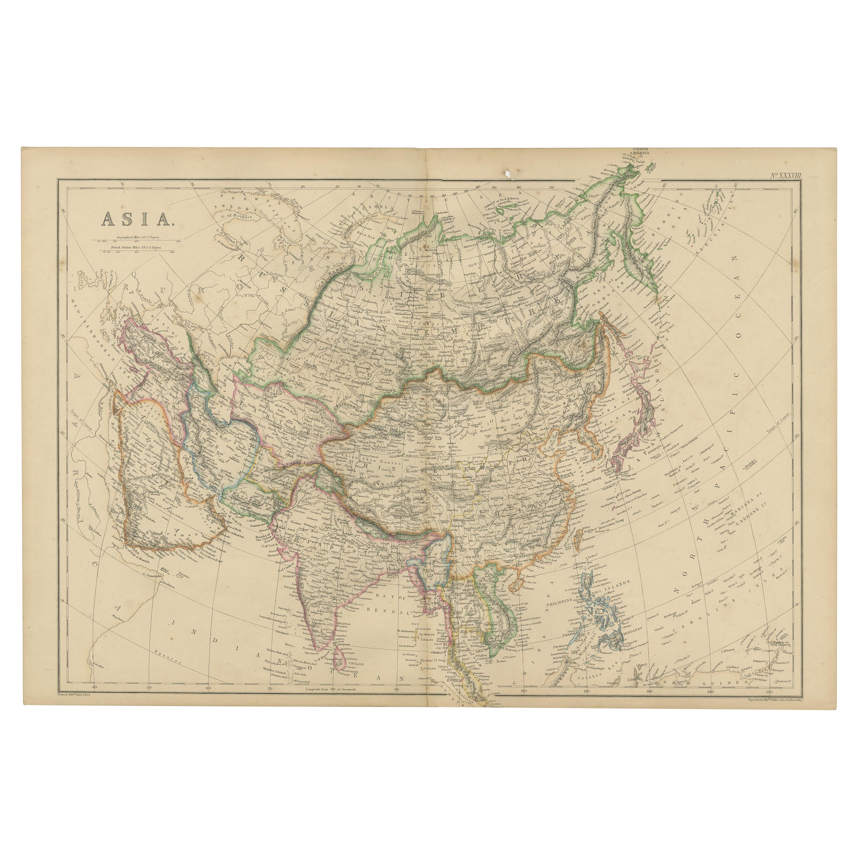
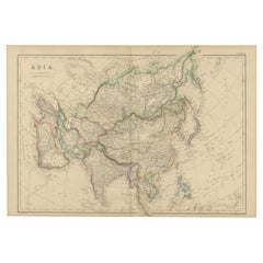
- Original 1859 Map of Asia from W.G. Blackie's Imperial Atlas of Modern GeographyLocated in Langweer, NLAntique map titled 'Asia'. Original antique map of Asia. This map originates from ‘The Imperial Atlas of Modern Geography’. Published by W. G. Blackie, 1859. The "Classic Cartograph...Category
Antique Mid-19th Century Maps
MaterialsPaper
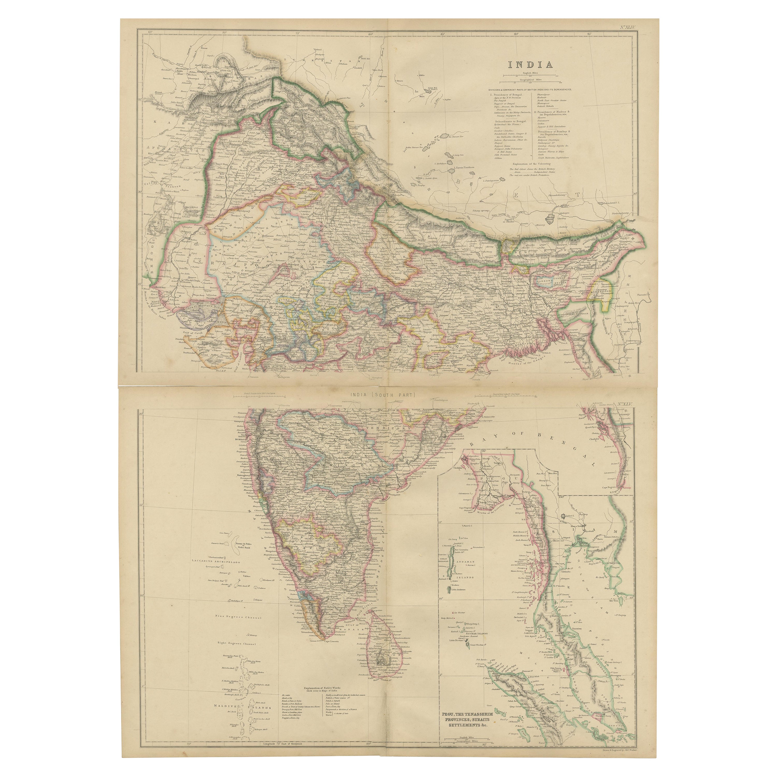
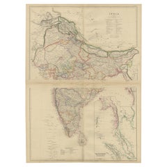
- Vintage Cartographic Collection Set of India Explored - W. G. Blackie's 1859Located in Langweer, NLAntique map titled 'India'. Original antique map of India with inset maps of Pegu, the Tenasserim Provinces, straits settlements. This map originate...Category
Antique Mid-19th Century Maps
MaterialsPaper
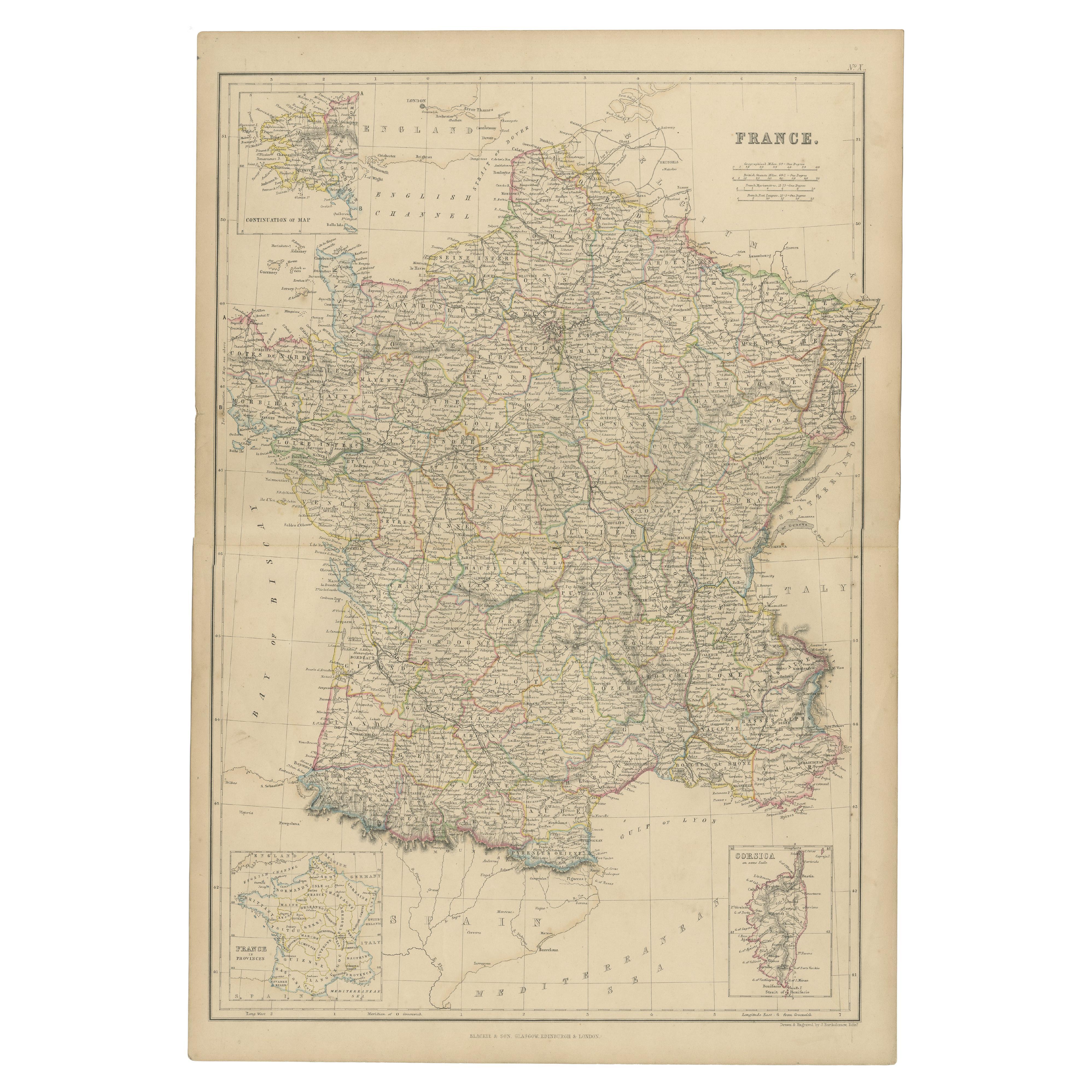
- 1859 Classic Map of France: Blackie's Imperial Geographic MasterpieceLocated in Langweer, NLThe "Antique Map of France" from 'The Imperial Atlas of Modern Geography', published in 1859 by W. G. Blackie, is a historically valuable cartographic work that offers a comprehensiv...Category
Antique Mid-19th Century Maps
MaterialsPaper

You May Also Like
- Large Antique 1859 Map of North AmericaLocated in Sag Harbor, NYThis Map was made by Augustus Mitchell in 1859 It is in amazing condition for being 163 years old. This price is for the rolled up easy to ship version of this piece. I will be Frami...Category
Antique Mid-19th Century American Maps
MaterialsCanvas, Paper

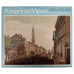
- American Views Prospects and Vistas by Gloria-Gilda Deak, 1st EdLocated in valatie, NYAmerican Views: Prospects and Vistas by Gloria-Gilda Deak. A Studio Book, Viking Press, New York, 1978. 1st Ed hardcover with dust jacket. The color plates artwork and engravings are...Category
Vintage 1970s American Books
MaterialsPaper
- Hand-Colored 18th Century Homann Map of Denmark and Islands in the Baltic SeaBy Johann Baptist HomannLocated in Alamo, CAAn 18th century copper plate hand-colored map entitled "Insulae Danicae in Mari Balthico Sitae utpote Zeelandia, Fionia, Langelandia, Lalandia, Falstria, Fembria Mona" created by Joh...Category
Antique Early 18th Century German Maps
MaterialsPaper
- Lithographic print on paper, depicting the atlas of the hand, France 1850 ca.Located in Milan, ITAn anatomical lithographic print on paper, depicting the anatomical atlas of the hand. Black lacquered fir wood frame with golden ramin wood batting. N. H. Ja...Category
Antique Mid-19th Century French Prints
MaterialsGlass, Wood, Paper
- St. Christophe 'St. Kitts' Island: An 18th Century Hand-colored Map by BellinBy Jacques-Nicolas BellinLocated in Alamo, CAJacques Bellin's copper-plate map of the Caribbean island of Saint Kitts entitled "Carte De De l'Isle St. Christophe Pour servir á l'Histoire Genle. des V...Category
Antique Mid-18th Century French Maps
MaterialsPaper
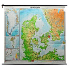
- Denmark Greenland Faroe Islands the North Atlantic Vintage Mural Map Wall ChartLocated in Berghuelen, DEThe vintage pull-down mural map illustrates Denmark with Greenland, the Faroe Islands and the North Atlantic. Published by Westermann. Colorful print on paper reinforced with canvas....Category
Vintage 1970s German Country Posters
MaterialsCanvas, Wood, Paper