Items Similar to Antique Map of the Northern Part of the Netherlands by Jaeger, 1784

Want more images or videos?
Request additional images or videos from the seller
1 of 5
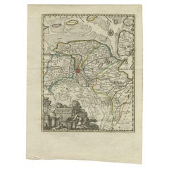
Antique Map of the Northern Part of the Netherlands by Jaeger, 1784
$191.30
$239.1220% Off
£141.62
£177.0220% Off
€160
€20020% Off
CA$264.71
CA$330.8920% Off
A$291.84
A$364.7920% Off
CHF 152.68
CHF 190.8520% Off
MX$3,580.29
MX$4,475.3620% Off
NOK 1,921.93
NOK 2,402.4120% Off
SEK 1,797.31
SEK 2,246.6320% Off
DKK 1,218.78
DKK 1,523.4820% Off
About the Item
Antique print, titled: 'Carte topographique d'Allemagne contenant une partie des Provinces Unies, savoir la province de Friesland occidentale : une partie d'Overyssel, de Gueldre, d'Hollande septentrionale, de differentes isles de la meer d'Allemagne, et du Zuider See.' Large and detailed map of the northern part of The Netherlands with the provinces of Noord Holland, Friesland and Overijssel. Also shows the 'Zuiderzee'. Source unknown, to be determined.
Artists and Engravers: Made by 'I. W. A. Jaeger' after an anonymous artist.
Condition: Good, given age. Vertical crease next to middle fold. Small crease bottom left to middle fold. Original middle fold as issued. General age-related toning and/or occasional minor defects from handling. Please study image carefully.
Date: 1784
Overall size: 68.5 x 52.7 cm.
Image size: 58.7 x 51.5 cm.
We sell original antique maps to collectors, historians, educators and interior decorators all over the world. Our collection includes a wide range of authentic antique maps from the 16th to the 20th centuries. Buying and collecting antique maps is a tradition that goes back hundreds of years. Antique maps have proved a richly rewarding investment over the past decade, thanks to a growing appreciation of their unique historical appeal. Today the decorative qualities of antique maps are widely recognized by interior designers who appreciate their beauty and design flexibility. Depending on the individual map, presentation, and context, a rare or antique map can be modern, traditional, abstract, figurative, serious or whimsical. We offer a wide range of authentic antique maps for any budget.
- Dimensions:Height: 20.75 in (52.7 cm)Width: 26.97 in (68.5 cm)Depth: 0 in (0.01 mm)
- Materials and Techniques:
- Period:
- Date of Manufacture:1784
- Condition:
- Seller Location:Langweer, NL
- Reference Number:Seller: PCT-580281stDibs: LU3054327871362
About the Seller
5.0
Recognized Seller
These prestigious sellers are industry leaders and represent the highest echelon for item quality and design.
Platinum Seller
Premium sellers with a 4.7+ rating and 24-hour response times
Established in 2009
1stDibs seller since 2017
2,609 sales on 1stDibs
Typical response time: <1 hour
- ShippingRetrieving quote...Shipping from: Langweer, Netherlands
- Return Policy
Authenticity Guarantee
In the unlikely event there’s an issue with an item’s authenticity, contact us within 1 year for a full refund. DetailsMoney-Back Guarantee
If your item is not as described, is damaged in transit, or does not arrive, contact us within 7 days for a full refund. Details24-Hour Cancellation
You have a 24-hour grace period in which to reconsider your purchase, with no questions asked.Vetted Professional Sellers
Our world-class sellers must adhere to strict standards for service and quality, maintaining the integrity of our listings.Price-Match Guarantee
If you find that a seller listed the same item for a lower price elsewhere, we’ll match it.Trusted Global Delivery
Our best-in-class carrier network provides specialized shipping options worldwide, including custom delivery.More From This Seller
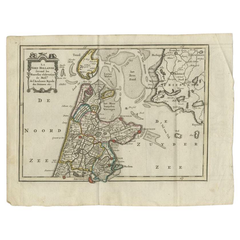
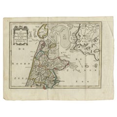
View AllAntique Map of the Province of Noord-Holland by Keizer & De Lat, 1788
Located in Langweer, NL
Antique map titled 'La Nord Hollande (..)'. Uncommon antique map of the province of Noord-Holland, the Netherlands. This map originates from 'Nieuwe Natuur- Ge...
Category
Antique 18th Century Maps
Materials
Paper
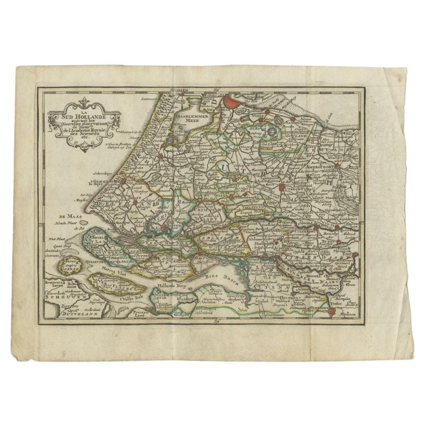
Antique Map of the Province of Zuid-Holland by Keizer & De Lat, 1788
Located in Langweer, NL
Antique map titled 'La Sud Hollande (..)'. Uncommon antique map of the province of Zuid-Holland, the Netherlands. This map originates from 'Nieuwe Natuur- Geschied- en Handelkundige ...
Category
Antique 18th Century Maps
Materials
Paper

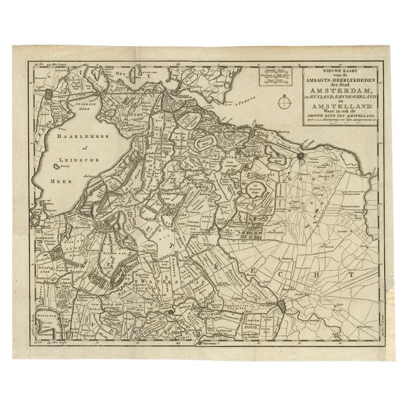
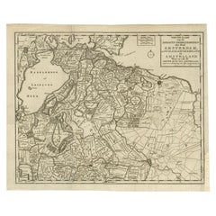
Antique Map of the Region of Amsterdam by Wagenaar, c.1760
Located in Langweer, NL
Antique map titled 'Nieuwe Kaart van de Ambagts - Heerlykheden der Stad Amsterdam, in Rynland, Kennemerland en Amstelland (..).' Detailed map of the administrative territories in the...
Category
Antique 18th Century Maps
Materials
Paper
$280 Sale Price
20% Off
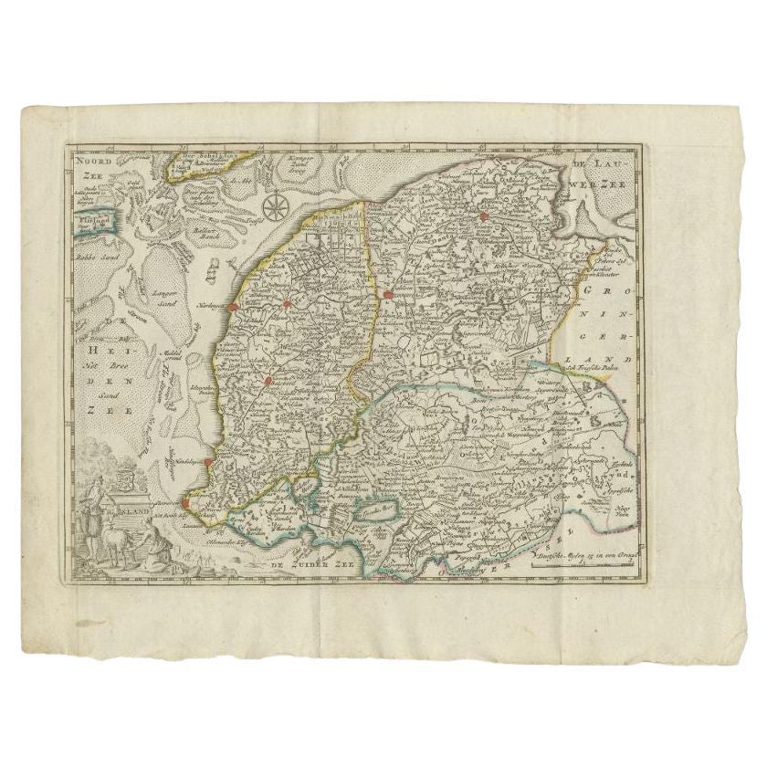
Antique Map of the Province of Friesland by Keizer & De Lat, 1788
Located in Langweer, NL
Antique map titled 'Friesland'. Uncommon antique map of the province of Friesland, the Netherlands. This map originates from 'Nieuwe Natuur- Geschied- en Handelkundige Zak- en Reisat...
Category
Antique 18th Century Maps
Materials
Paper
$210 Sale Price
20% Off
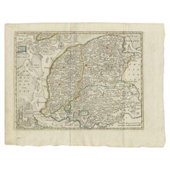
Antique Map of Overijssel by Van Jagen, 1771
Located in Langweer, NL
Antique map titled 'L'Over-Issel'. This map depicts the Dutch province Overijssel. This map originates from 'Nouvel Atlas, très exact et fort commode pour toutes sortes de personnes,...
Category
Antique 18th Century Maps
Materials
Paper

$181 Sale Price
20% Off
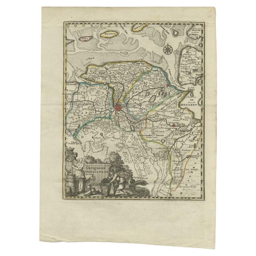
Antique Map of the Province of Groningen by Keizer & De Lat, 1788
Located in Langweer, NL
Antique map titled 'Groningen en Ommelanden'. Uncommon antique map of the province of Groningen, the Netherlands. This map originates from 'Nieuwe Natuur- Geschied- en Handelkundige ...
Category
Antique 18th Century Maps
Materials
Paper
You May Also Like
1752 Vaugoundy Map of Flanders : Belgium, France, and the Netherlands, Ric.a002
Located in Norton, MA
Large Vaugoundy Map of Flanders:
Belgium, France, and the Netherlands
Colored -1752
Ric.a002
Description: This is a 1752 Didier Robert de Vaugondy map of Flanders. The map de...
Category
Antique 17th Century Unknown Maps
Materials
Paper

1643 Willem&Joan Blaeu Map NW Flanders "Flandriae Teutonicae Pars Prientalior
Located in Norton, MA
1643 Willem and Joan Blaeu map of northwest Flanders, entitled
"Flandriae Teutonicae Pars Prientalior,"
Ric0012
" Authentic" - Map of the northwest Fl...
Category
Antique 17th Century Dutch Maps
Materials
Paper

1635 Willem Blaeu Map of Northern France"Comitatvs Bellovacvm" Ric.a08
Located in Norton, MA
1635 Willem Blaeu map of northern France, entitled.
"Comitatvs Bellovacvm Vernacule Beavvais,"
Colored
Ric.a008
“COMITATVS BELLOVACVM…” Amsterdam: W...
Category
Antique 17th Century Unknown Maps
Materials
Paper

1839 Map of Karte Des "Russischen Reiches in Europa Und Asien" Ric.R0013
Located in Norton, MA
1839 map of Karte Des
"Russischen Reiches in Europa and Asien"
Ric.r013
Map of the European and Asian parts of Russian Empire. Karte der Russischen Reiches in Europa und Asien...
Category
Antique 19th Century Unknown Maps
Materials
Paper

1771 Bonne Map of Poitou, Touraine and Anjou, France, Ric.a015
Located in Norton, MA
1771 Bonne Map of Poitou,
Touraine and Anjou, France
Ric.a015
1771 Bonne map of Potiou, Touraine and Anjou entitled "Carte des Gouvernements D'Anjou et du Saumurois, de la Touraine, du Poitou,du Pays d'aunis, Saintonge?Angoumois,"
Carte des gouvernements d'Anjou et du Saumurois, de la Touraine, du Poitou, du Pays d'Aunis, Saintonge-Angoumois. Projettee et assujettie au ciel par M. Bonne, Hyd. du Roi. A Paris, Chez Lattre, rue St. Jacques a la Ville de Bord(ea)ux. Avec priv. du Roi. 1771. Arrivet inv. & sculp., Atlas moderne ou collection de cartes sur toutes...
Category
Antique 17th Century Unknown Maps
Materials
Paper

North Holland, Netherlands: A Large 17th C. Hand-colored Map by Sanson & Jaillot
By Nicholas Sanson d'Abbeville
Located in Alamo, CA
This large hand-colored map entitled "Le Comte De Hollande Dressee sur les Memoires les plus Nouveaux" was originally created by Nicholas Sanson d'Abbeville. This version was publish...
Category
1690s Landscape Prints
Materials
Engraving

More Ways To Browse
Map Of Barbados
Antique Map Of Cuba
Antique Map Vietnam
Antique Maps Colorado
Antique Maps Of Kansas
Antique Marine Maps
Antique World Globe Map
Garde Corps
Antique Furniture South Carolina
Antique Map Of Boston
Antique Map Of Venice
Antique Maps Of Maryland
Charlotte Reine
Cleveland Antique Furniture
Gambia Antique Map
Johann Baptist Homann On Sale
Oman Map
Serbia Antique Map