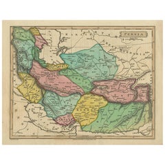
Antique Map of Persia by I. Russel, 1814
View Similar Items


Want more images or videos?
Request additional images or videos from the seller
1 of 5
Antique Map of Persia by I. Russel, 1814
About the Item
- Dimensions:Height: 7.76 in (19.7 cm)Width: 9.93 in (25.2 cm)Depth: 0.02 in (0.5 mm)
- Materials and Techniques:
- Period:
- Date of Manufacture:1814
- Condition:Minor fading. Please study image carefully.
- Seller Location:Langweer, NL
- Reference Number:Seller: BG-094451stDibs: LU3054310068791
About the Seller
5.0
Recognized Seller
These prestigious sellers are industry leaders and represent the highest echelon for item quality and design.
Gold Seller
Premium sellers maintaining a 4.3+ rating and 24-hour response times
Established in 2009
1stDibs seller since 2017
2,446 sales on 1stDibs
Typical response time: 1 hour
Authenticity Guarantee
In the unlikely event there’s an issue with an item’s authenticity, contact us within 1 year for a full refund. DetailsMoney-Back Guarantee
If your item is not as described, is damaged in transit, or does not arrive, contact us within 7 days for a full refund. Details24-Hour Cancellation
You have a 24-hour grace period in which to reconsider your purchase, with no questions asked.Vetted Professional Sellers
Our world-class sellers must adhere to strict standards for service and quality, maintaining the integrity of our listings.Price-Match Guarantee
If you find that a seller listed the same item for a lower price elsewhere, we’ll match it.Trusted Global Delivery
Our best-in-class carrier network provides specialized shipping options worldwide, including custom delivery.More From This Seller
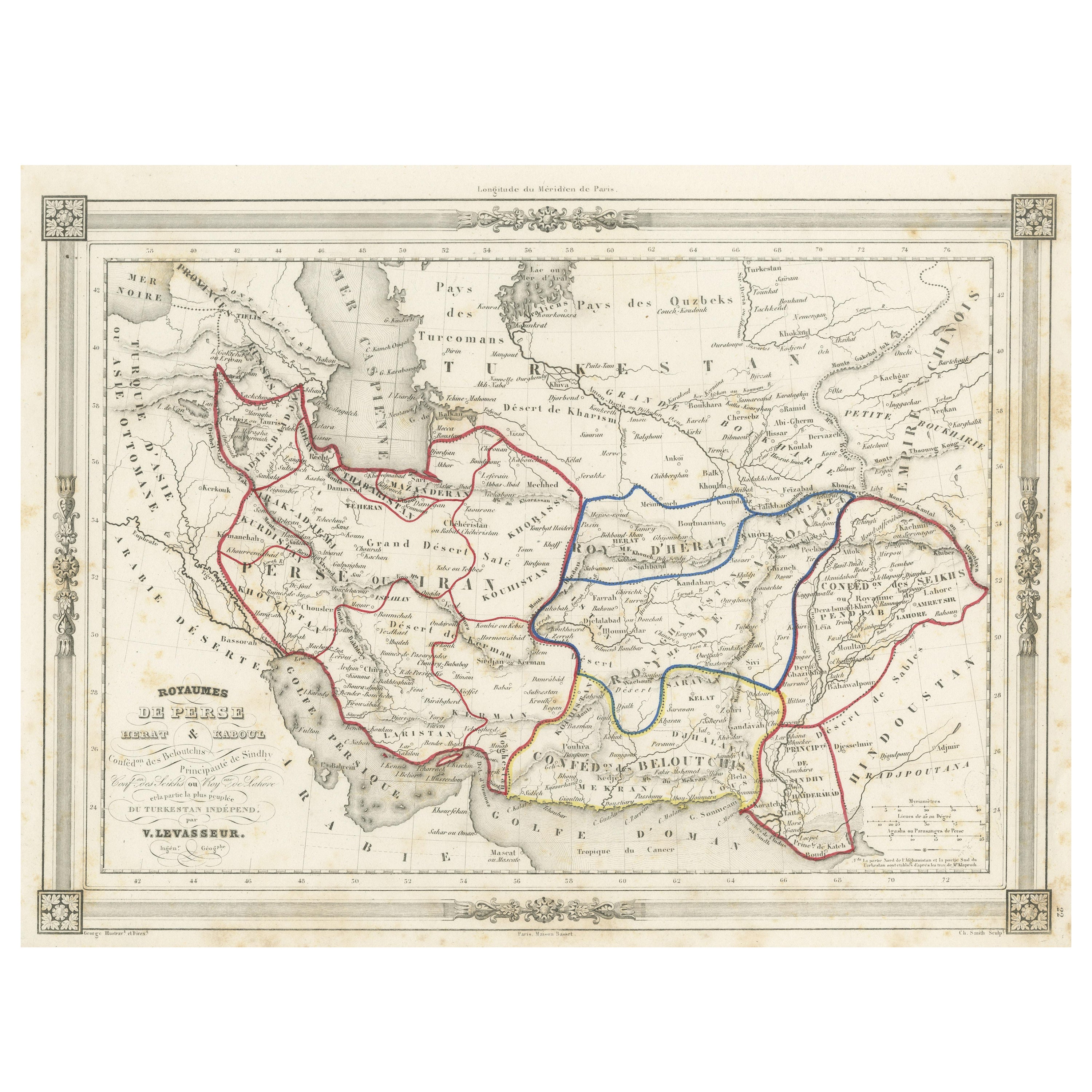
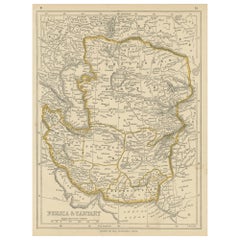
View AllAntique Map of Eastern Persia, 1852
Located in Langweer, NL
Antique map titled 'Eastern Persia'. Original map of Eastern Persia. This map originates from 'Lowry's Table Atlas constructed and engraved from the most recent Authorities' by J.W. ...
Category
Antique Mid-19th Century Maps
Materials
Paper

$93 Sale Price
20% Off
Antique Map of Persia by A. Zatta, circa 1785
Located in Langweer, NL
Antique map titled 'L'Impero della Persia diviso ne suoi Stati'. The Empire of Persia divided into its states. Originates from 'Atlante Novissimo, illustrato ed accresciuto sulle oss...
Category
Antique Late 18th Century Maps
Materials
Paper

$324 Sale Price
20% Off
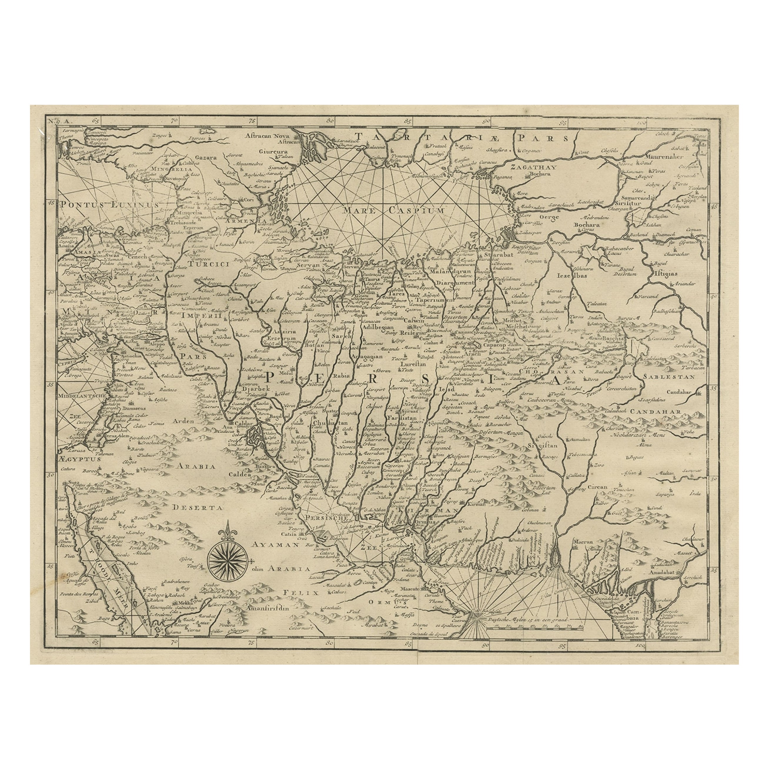
Antique Map of Persia and Tartary by Lowry, '1852'
Located in Langweer, NL
Antique map titled 'Persia and Tartary'. Original map of Persia and Tartary. This map originates from 'Lowry's Table Atlas constructed and engraved from the most recent Authorities' ...
Category
Antique Mid-19th Century Maps
Materials
Paper
$93 Sale Price
20% Off
Antique Map of Persia and Afghanistan by Johnston '1909'
Located in Langweer, NL
Antique map titled 'Persia and Afghanistan'. Original antique map of Persia and Afghanistan. This map originates from the ‘Royal Atlas o...
Category
Early 20th Century Maps
Materials
Paper

$231 Sale Price
20% Off
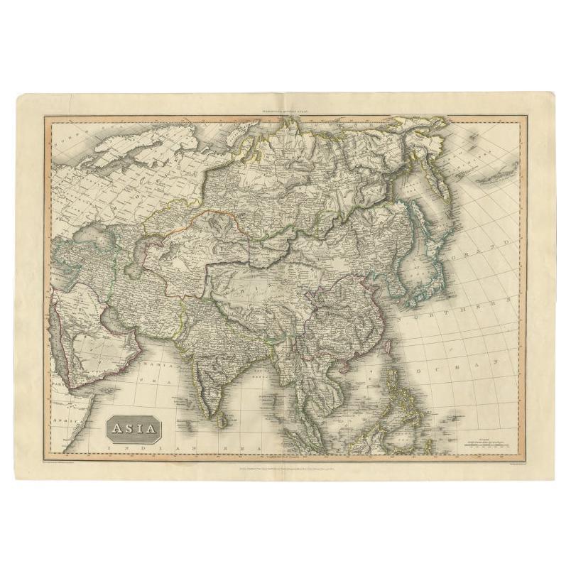
Large Antique Map of the Asian Continent, 1814
Located in Langweer, NL
Antique map titled 'Asia'. Large antique map of the Asian continent. Drawn under the direction of Mr. Pinkerton by L. Hebert.
Artists and Engraver...
Category
Antique 19th Century Maps
Materials
Paper
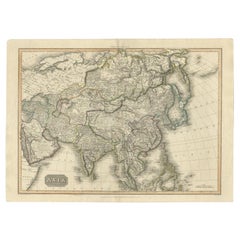
$419 Sale Price
20% Off
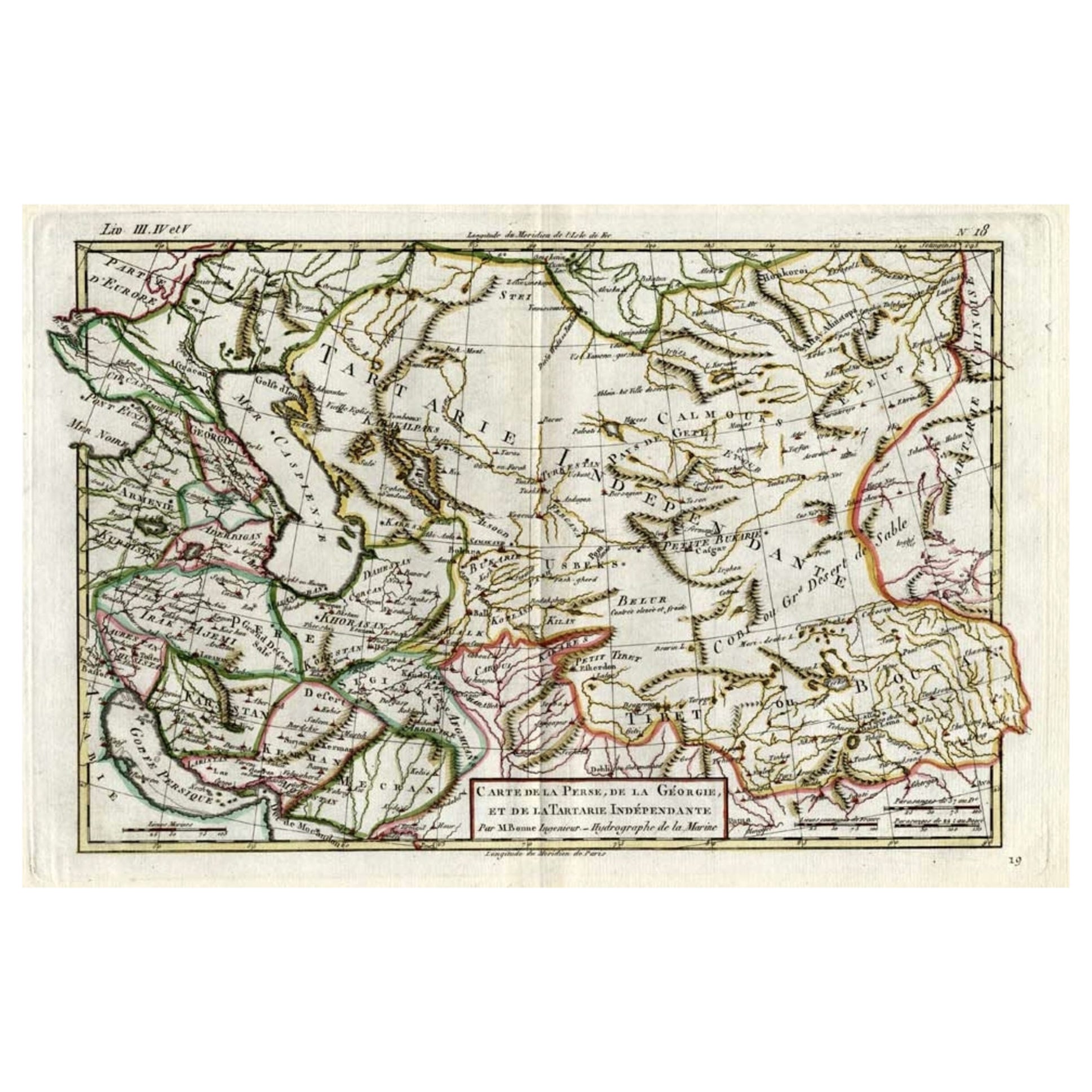
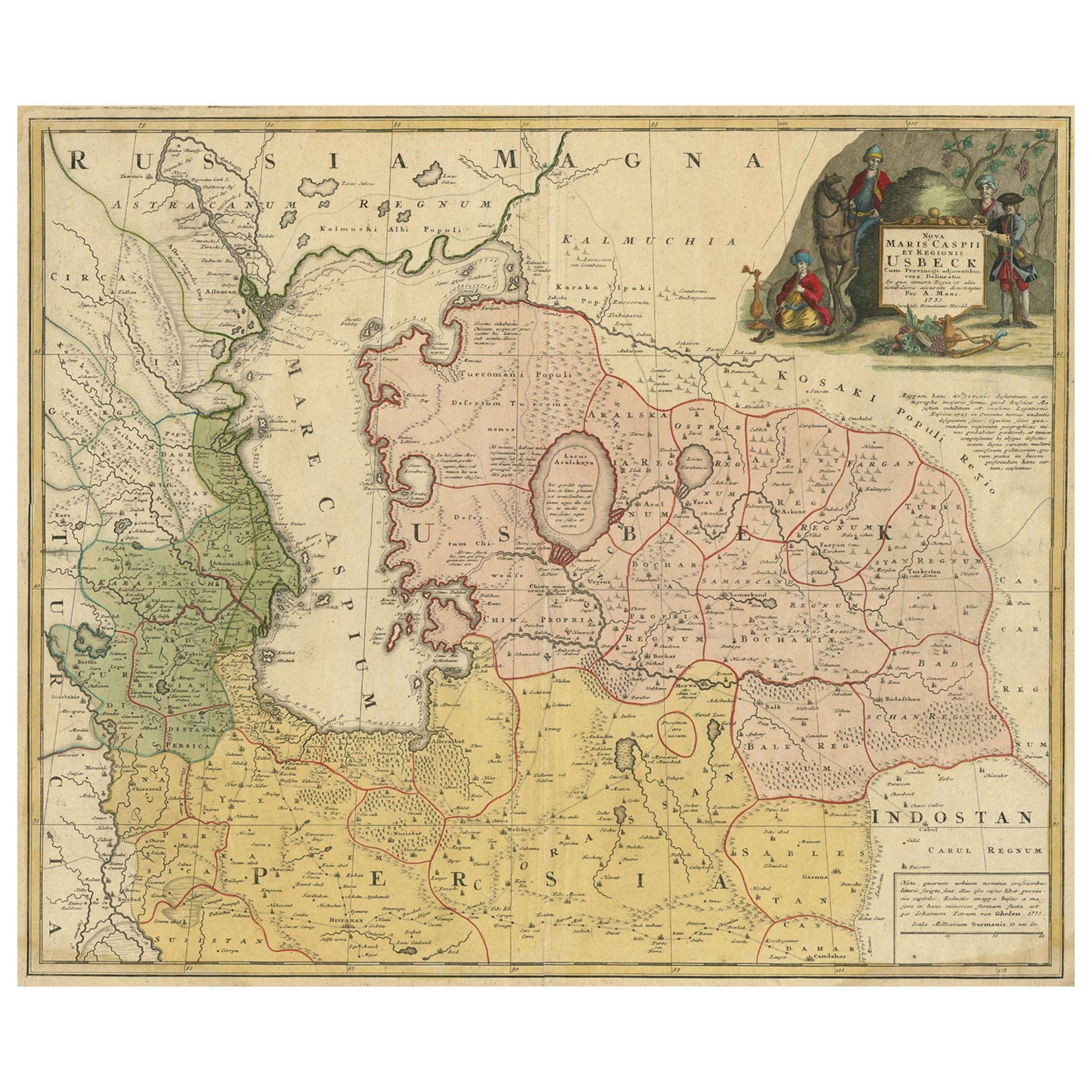
Antique Map of Persia, Georgia and Kazakhstan, ca.1780
Located in Langweer, NL
Antique map titled 'Carte de la Perse, de la Georgie, et de la Tartarie Independante'.
Map of Persia, Georgia and Kazakhstan. This map shows current days Georgia, Iran, Irak, Kaz...
Category
Antique 1780s Maps
Materials
Paper
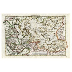
$482 Sale Price
20% Off
You May Also Like
Antique Map of Italy by Andriveau-Goujon, 1843
By Andriveau-Goujon
Located in New York, NY
Antique Map of Italy by Andriveau-Goujon, 1843. Map of Italy in two parts by Andriveau-Goujon for the Library of Prince Carini at Palazzo Carini i...
Category
Antique 1840s French Maps
Materials
Linen, Paper

$3,350 / set
Antique Map of Principality of Monaco
By Antonio Vallardi Editore
Located in Alessandria, Piemonte
ST/619 - "Old Geographical Atlas of Italy - Topographic map of ex-Principality of Monaco" -
ediz Vallardi - Milano -
A somewhat special edition ---
Category
Antique Late 19th Century Italian Other Prints
Materials
Paper

Original Antique Map of Sweden, Engraved by Barlow, 1806
Located in St Annes, Lancashire
Great map of Sweden
Copper-plate engraving by Barlow
Published by Brightly & Kinnersly, Bungay, Suffolk. 1806
Unframed.
Category
Antique Early 1800s English Maps
Materials
Paper

Original Antique Map of Switzerland, Engraved By Barlow, Dated 1807
Located in St Annes, Lancashire
Great map of Switzerland
Copper-plate engraving by Barlow
Published by Brightly & Kinnersly, Bungay, Suffolk.
Dated 1807
Unframed.
Category
Antique Early 1800s English Maps
Materials
Paper

Original Antique Map of The World by Thomas Clerk, 1817
Located in St Annes, Lancashire
Great map of The Eastern and Western Hemispheres
On 2 sheets
Copper-plate engraving
Drawn and engraved by Thomas Clerk, Edinburgh.
Published by Mackenzie And Dent, 1817
...
Category
Antique 1810s English Maps
Materials
Paper

Original Antique Map of Ireland- Kerry. C.1840
Located in St Annes, Lancashire
Great map of Kerry
Steel engraving
Drawn under the direction of A.Adlard
Published by How and Parsons, C.1840
Unframed.
Category
Antique 1840s English Maps
Materials
Paper

Recently Viewed
View AllMore Ways To Browse
Antique Maps Persia
Liverpool Map
Antique Map Of Liverpool
Antique Marine Maps
Antique Mediterranean Map
Map Of Egypt
Antique Maps Of Greece
Framed World Map
Portuguese 16th
Antique Map Of The South Of France
Copper Map Plate
Antique Indian Maps
Antique Wine Maps
Hemispheres Map
Map New Holland
Antique Maps Of Wales
Antique World Globe Map
Ships Log