Items Similar to Antique Map of the Region of Gaasterland, Friesland, The Netherlands, 1791


Want more images or videos?
Request additional images or videos from the seller
1 of 5
Antique Map of the Region of Gaasterland, Friesland, The Netherlands, 1791
$286.95
£212.43
€240
CA$397.06
A$437.75
CHF 229.02
MX$5,370.43
NOK 2,882.89
SEK 2,695.96
DKK 1,828.17
About the Item
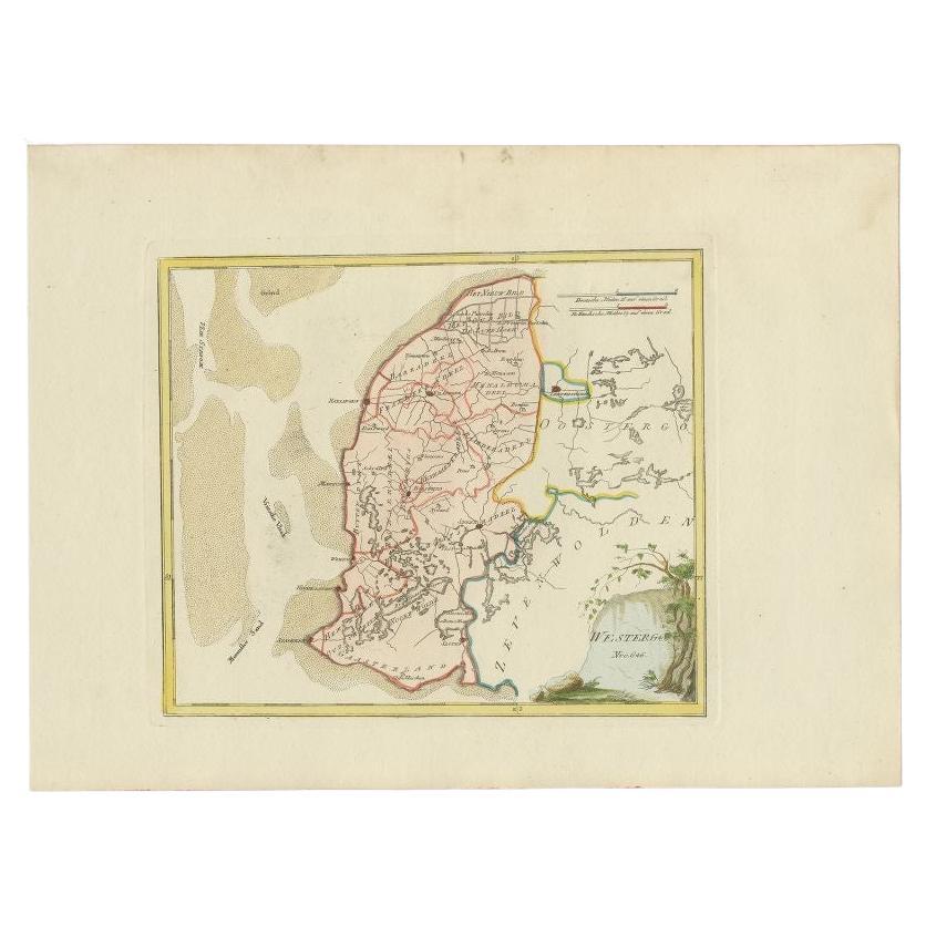
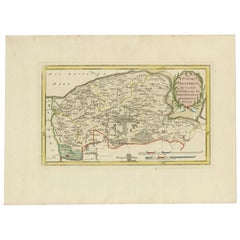
Antique map titled 'Der Provinz Westergo zwey südliche Grietenyen mit dem Gaasterland und der Stadt Staveren, Sloten, Workum, Ylst und Hindelopen'. Map of the region of Gaasterland, Friesland, the Netherlands. This map orginates from 'Schauplatz der fünf Theile der Welt'.
Artists and Engravers: Franz Joseph Johann von Reilly (1766-1820) was a Vienna based art dealer. He is also known as the author of two atlases. The maps were engraved by Ignaz Alberti (also Ignaz Albrecht, 1760-1794). Ignaz was an Austrian illustrator, publisher and engraver.
Condition: Very good, general age-related toning. Minor wear, blank verso. Please study image carefully.
Date: 1791
Overall size: 31.5 x 29 cm.
Image size: 24 x 20 cm.
We sell original antique maps to collectors, historians, educators and interior decorators all over the world. Our collection includes a wide range of authentic antique maps from the 16th to the 20th centuries. Buying and collecting antique maps is a tradition that goes back hundreds of years. Antique maps have proved a richly rewarding investment over the past decade, thanks to a growing appreciation of their unique historical appeal. Today the decorative qualities of antique maps are widely recognized by interior designers who appreciate their beauty and design flexibility. Depending on the individual map, presentation, and context, a rare or antique map can be modern, traditional, abstract, figurative, serious or whimsical. We offer a wide range of authentic antique maps for any budget.
- Dimensions:Height: 11.42 in (29 cm)Width: 12.41 in (31.5 cm)Depth: 0 in (0.01 mm)
- Materials and Techniques:
- Period:
- Date of Manufacture:1791
- Condition:
- Seller Location:Langweer, NL
- Reference Number:Seller: BG-002391stDibs: LU3054327873502
About the Seller
5.0
Recognized Seller
These prestigious sellers are industry leaders and represent the highest echelon for item quality and design.
Platinum Seller
Premium sellers with a 4.7+ rating and 24-hour response times
Established in 2009
1stDibs seller since 2017
2,609 sales on 1stDibs
Typical response time: <1 hour
- ShippingRetrieving quote...Shipping from: Langweer, Netherlands
- Return Policy
Authenticity Guarantee
In the unlikely event there’s an issue with an item’s authenticity, contact us within 1 year for a full refund. DetailsMoney-Back Guarantee
If your item is not as described, is damaged in transit, or does not arrive, contact us within 7 days for a full refund. Details24-Hour Cancellation
You have a 24-hour grace period in which to reconsider your purchase, with no questions asked.Vetted Professional Sellers
Our world-class sellers must adhere to strict standards for service and quality, maintaining the integrity of our listings.Price-Match Guarantee
If you find that a seller listed the same item for a lower price elsewhere, we’ll match it.Trusted Global Delivery
Our best-in-class carrier network provides specialized shipping options worldwide, including custom delivery.More From This Seller
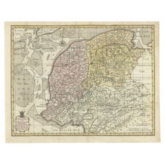
View AllAntique Map of Friesland by Von Reilly, 1791
Located in Langweer, NL
Antique map titled 'Friesland'. Map of the province of Friesland, the Netherlands. This map orginates from 'Schauplatz der fünf Theile der Welt'. Artists and Engravers: Franz Joseph ...
Category
Antique 18th Century Maps
Materials
Paper

$186 Sale Price
20% Off
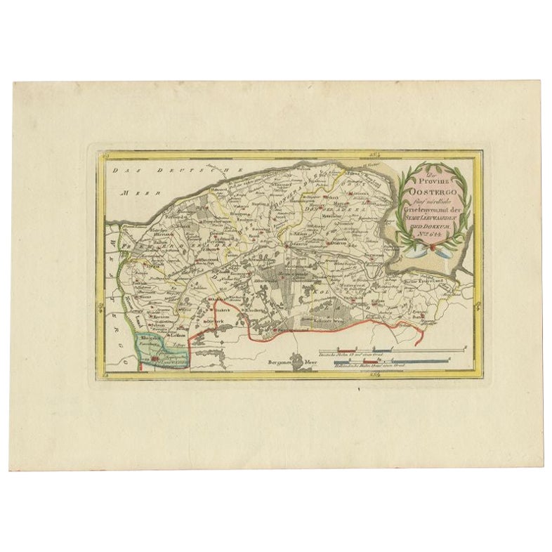
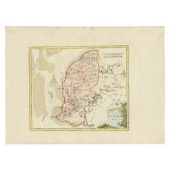
Antique Map of the Region of Leeuwarden and Dokkum in The Netherlands, 1791
Located in Langweer, NL
Antique map titled 'Der Provinz Oostergo fünf nördliche Grietenyen mit der Stadt Leeuwaarden und Dokkum'. Map of the region of Leeuwarden and Dokkum, Friesland, the Netherlands. This...
Category
Antique 18th Century Maps
Materials
Paper
$150 Sale Price
20% Off
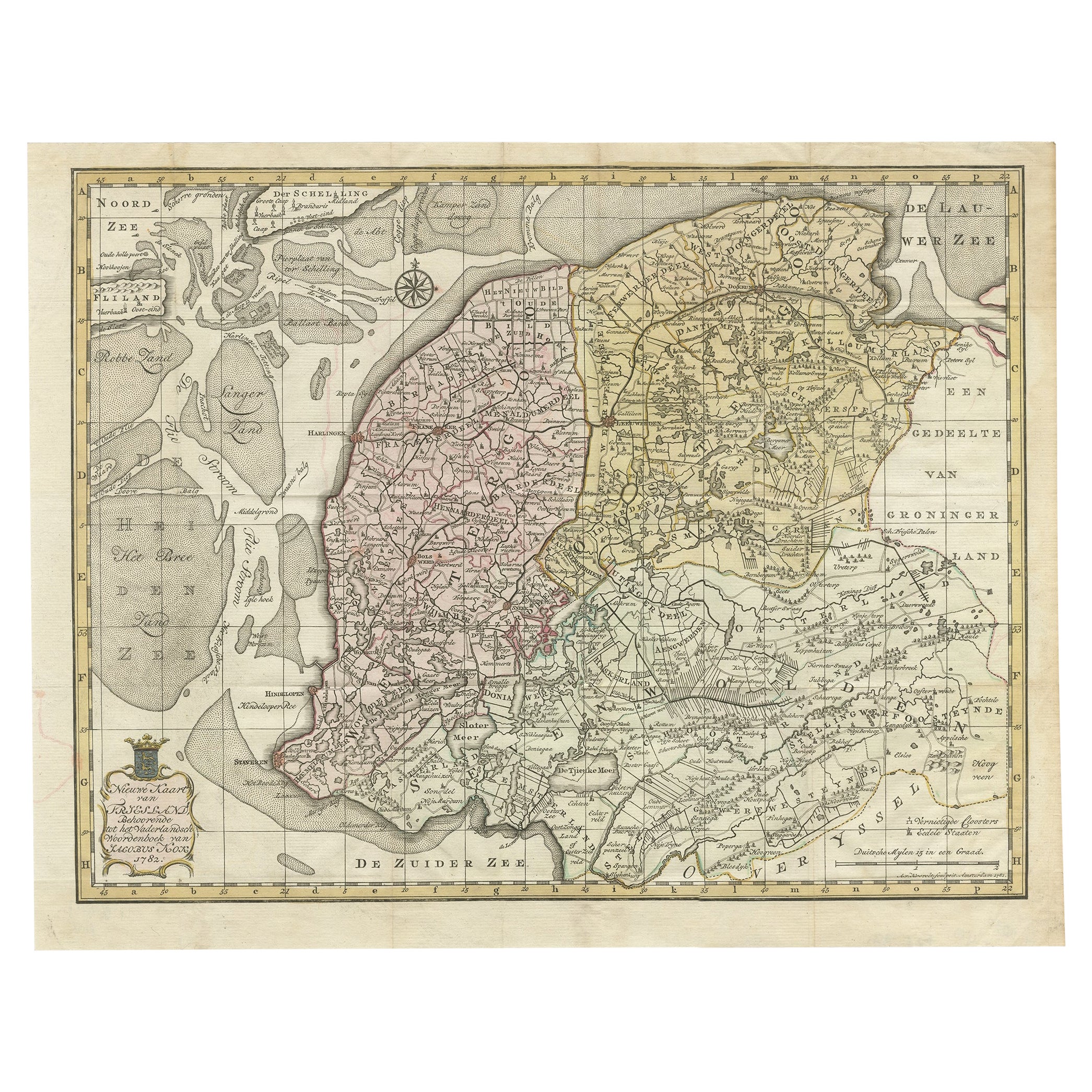
Antique Map of Province Friesland, The Netherlands, 1787
Located in Langweer, NL
Antique map titled 'Nieuwe Kaart van Friesland behoorende tot het Vaderlandsch Woordenboek van Jacobus Kok'. Original antique map of the province of Friesland, the Netherlands. This ...
Category
Antique 18th Century Maps
Materials
Paper
$409 Sale Price
20% Off
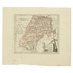
Antique Map of Westergo in Friesland, 1791
Located in Langweer, NL
Antique map titled 'Westergo'. Map of the Westergo region, Friesland, the Netherlands. This map orginates from 'Schauplatz der fünf Theile der Welt'.
Artists and Engravers: Franz...
Category
Antique 18th Century Maps
Materials
Paper
Antique Map of Friesland in the Netherlands, 1770
Located in Langweer, NL
Antique map titled 'De Synode van Friesland, in VI Klassen verdeeld door W.A. Bachiene?. Map of the province of Friesland, the Netherlands. This map originates from 'Nieuwe kerkelyke...
Category
Antique 18th Century Maps
Materials
Paper

$143 Sale Price
20% Off
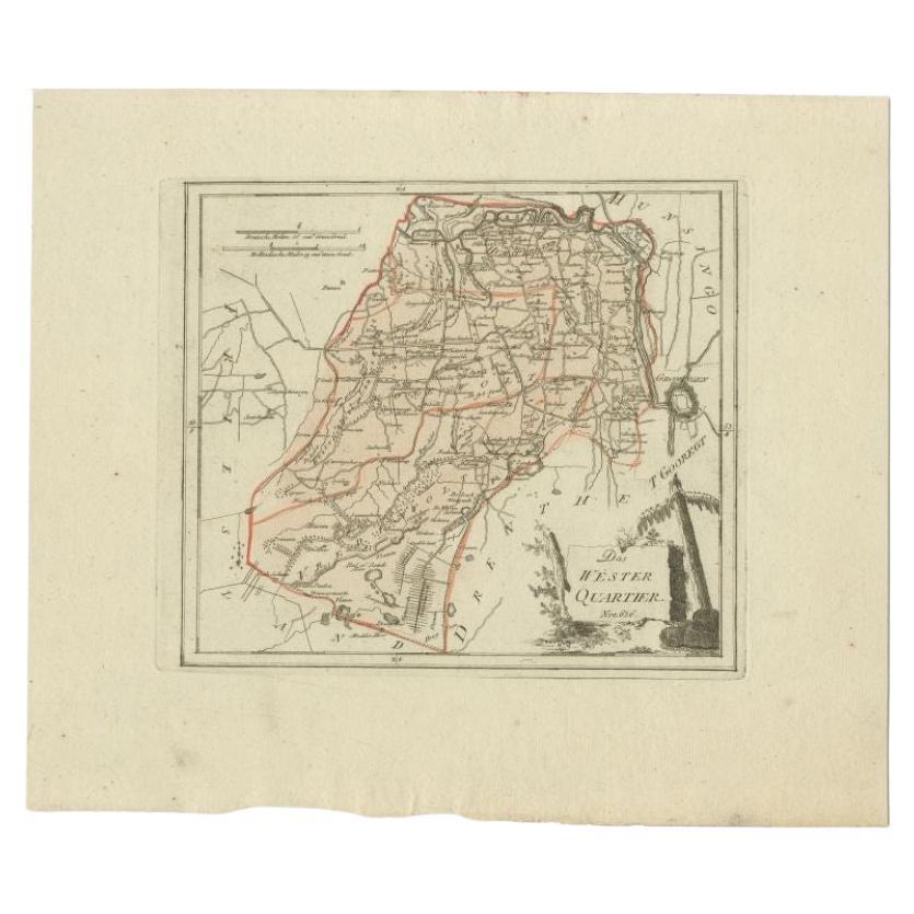
Antique Map of the Westerkwartier Region, a Region in Groningen, 1791
Located in Langweer, NL
Antique map titled 'Das Wester Quartier'. Original antique map of Westerkwartier, a region in the province of Groningen, the Netherlands. This map orginates from 'Schauplatz der fünf...
Category
Antique 18th Century Maps
Materials
Paper
You May Also Like
1752 Vaugoundy Map of Flanders : Belgium, France, and the Netherlands, Ric.a002
Located in Norton, MA
Large Vaugoundy Map of Flanders:
Belgium, France, and the Netherlands
Colored -1752
Ric.a002
Description: This is a 1752 Didier Robert de Vaugondy map of Flanders. The map de...
Category
Antique 17th Century Unknown Maps
Materials
Paper

1635 Willem Blaeu Map of Northern France"Comitatvs Bellovacvm" Ric.a08
Located in Norton, MA
1635 Willem Blaeu map of northern France, entitled.
"Comitatvs Bellovacvm Vernacule Beavvais,"
Colored
Ric.a008
“COMITATVS BELLOVACVM…” Amsterdam: W...
Category
Antique 17th Century Unknown Maps
Materials
Paper

1643 Willem&Joan Blaeu Map NW Flanders "Flandriae Teutonicae Pars Prientalior
Located in Norton, MA
1643 Willem and Joan Blaeu map of northwest Flanders, entitled
"Flandriae Teutonicae Pars Prientalior,"
Ric0012
" Authentic" - Map of the northwest Fl...
Category
Antique 17th Century Dutch Maps
Materials
Paper

Original Antique Map of Switzerland, Engraved By Barlow, Dated 1807
Located in St Annes, Lancashire
Great map of Switzerland
Copper-plate engraving by Barlow
Published by Brightly & Kinnersly, Bungay, Suffolk.
Dated 1807
Unframed.
Category
Antique Early 1800s English Maps
Materials
Paper

1839 Map of Karte Des "Russischen Reiches in Europa Und Asien" Ric.R0013
Located in Norton, MA
1839 map of Karte Des
"Russischen Reiches in Europa and Asien"
Ric.r013
Map of the European and Asian parts of Russian Empire. Karte der Russischen Reiches in Europa und Asien...
Category
Antique 19th Century Unknown Maps
Materials
Paper

1790 Thomas Stackhouse Map, Entitled "Russia in Europe, " , Ric.a004
Located in Norton, MA
1790 Thomas Stackhouse map, entitled
"Russia in Europe"
Ric.a004
Stackhouse, Thomas
Russia in Europe [map]
London: T. Stackhouse, 1783. Map. Matted hand-colored copper engraving. Image size: 14.5 x 15.25 inches. Mat size: 22.75 x 23.75 inches. A beautiful example of this map of Eastern Europe...
Category
Antique 17th Century Unknown Maps
Materials
Paper

More Ways To Browse
Franz Joseph
Antique Map Vietnam
Antique Maps Colorado
Antique Maps Of Kansas
Antique Marine Maps
Antique World Globe Map
Garde Corps
Antique Furniture South Carolina
Antique Map Of Boston
Antique Map Of Venice
Antique Maps Of Maryland
Charlotte Reine
Cleveland Antique Furniture
Gambia Antique Map
Johann Baptist Homann On Sale
Oman Map
Serbia Antique Map
Stanford Antique Furniture