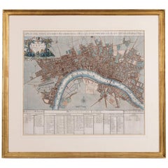
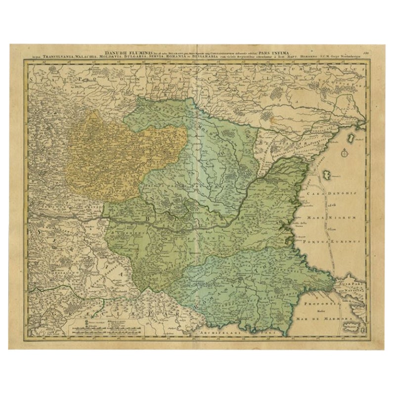
John Senex Map of London in 1720
View Similar Items


Want more images or videos?
Request additional images or videos from the seller
1 of 12
John Senex Map of London in 1720
About the Item
- Creator:John Senex (Illustrator)
- Dimensions:Height: 28.35 in (72 cm)Width: 31.11 in (79 cm)Depth: 1.19 in (3 cm)
- Style:George II (Of the Period)
- Place of Origin:
- Period:1720-1729
- Date of Manufacture:circa 1720
- Condition:Wear consistent with age and use. Later mounted and framed, ,the map with slight age related creases but overall in good original condition.
- Seller Location:London, GB
- Reference Number:Seller: p008711stDibs: LU984310232901
About the Seller
4.9
Vetted Professional Seller
Every seller passes strict standards for authenticity and reliability
Established in 1979
1stDibs seller since 2013
180 sales on 1stDibs
Typical response time: 9 hours
Associations
LAPADA - The Association of Arts & Antiques Dealers
Authenticity Guarantee
In the unlikely event there’s an issue with an item’s authenticity, contact us within 1 year for a full refund. DetailsMoney-Back Guarantee
If your item is not as described, is damaged in transit, or does not arrive, contact us within 7 days for a full refund. Details24-Hour Cancellation
You have a 24-hour grace period in which to reconsider your purchase, with no questions asked.Vetted Professional Sellers
Our world-class sellers must adhere to strict standards for service and quality, maintaining the integrity of our listings.Price-Match Guarantee
If you find that a seller listed the same item for a lower price elsewhere, we’ll match it.Trusted Global Delivery
Our best-in-class carrier network provides specialized shipping options worldwide, including custom delivery.More From This Seller
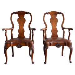
View AllPair of Early Georgian Style Walnut Armchairs
Located in London, GB
A pair of early eighteenth century style walnut and leather upholstered armchairs, Edwardian, the central splat crossbanded, with carving to the seat rail and cabriole legs. In excel...
Category
Early 20th Century British George II Chairs
Materials
Walnut
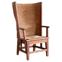
Scottish Arts & Crafts 'Stronza' Orkney Chair, for Liberty's of London
Located in London, GB
Liberty’s Arts and Crafts ‘Stronza’ Orkney Chair, in the manner of those made in the workshop of David Munro Kirkness,pine, s eagrass and rush, Scottish c.1900, previously owned by f...
Category
Early 20th Century Scottish Arts and Crafts Chairs
Materials
Pine
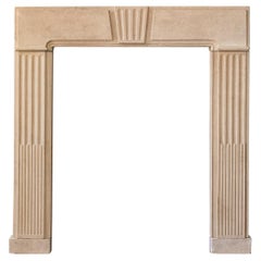
George II Clipsham Stone Fire Surround
Located in London, GB
A George II Clipsham stone fire surround, of architectural form, the paneled header centred by fluted Keystone on stop-fluted jambs, on block feet....
Category
Antique Mid-18th Century European George II Fireplaces and Mantels
Materials
Limestone
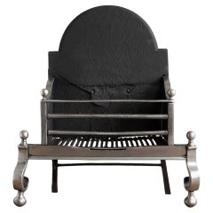
George II Steel and Iron Fire Grate
Located in London, GB
A George II fire grate, circa 1750, steel and iron, with restorations.
A remarkable survivor which has endured centuries of use - whilst with obvious repairs and wear it is now rest...
Category
Antique Mid-18th Century British George II Fireplaces and Mantels
Materials
Steel, Iron
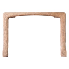
Carved Oak Fire Surround by John Makepeace
By John Makepeace
Located in London, GB
1970s Carved oak fire surround by John Makepeace OBE (b.1939), of naturalistic form.
Opening width 117 cm x 91 cm high.
Category
Vintage 1970s British Fireplaces and Mantels
Materials
Oak
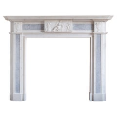
Neo-Classical Statuary Marble Fireplace in the Georgian Style
Located in London, GB
A Neo-Classical Statuary marble fireplace in the Georgian style, mid-twentieth century, the tablet depicting Apollo with his lyre and bow, the corner blocks with campana urns, these ...
Category
Mid-20th Century British George III Fireplaces and Mantels
Materials
Marble
You May Also Like
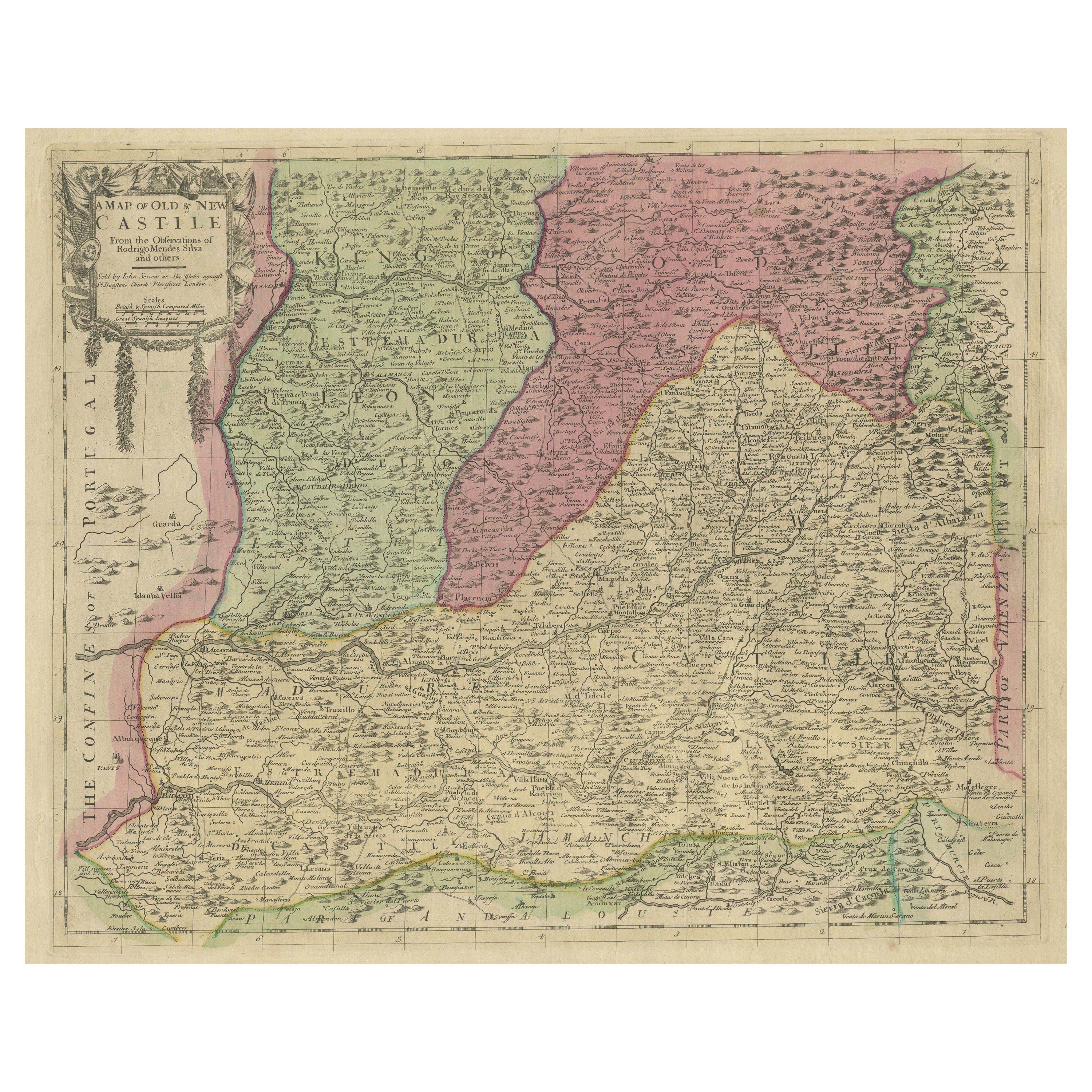
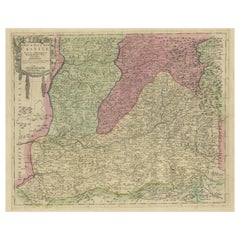
Senex Map of Castile, Leon & La Mancha in The Spanish Heartland, 1714
Located in Langweer, NL
This antique map, titled "A Map of Old & New Castile from the Observations of Rodrigo Mendes Silva and others," depicts the regions of Old Castile and New Castile in Spain, along with the Kingdom of Leon, Estremadura, La Mancha, among others. The map dates back to the early 18th century, a period marked by significant political shifts and territorial changes in Europe, particularly illustrated by the War of the Spanish Succession (1701–1714) that reshaped Spain’s governance and regional boundaries.
The map itself was published in 1714 by John Senex, a prominent English mapmaker, surveyor, globemaker, and geographer of the early eighteenth century. He was apprenticed as a young man to bookseller Robert Clavell and collaborated with notable mapmakers such as Jeremiah Seller and Charles Price. In 1728, Senex's contributions to geography and mapping were recognized when he was elected a Fellow of the Royal Society, an exceptional honor for a mapmaker, underlining his significant role as the Society's engraver and a publisher of maps by Edmund Halley and other notable figures.
John Senex is renowned for his English Atlas, first published in the same year as this map, 1714, and continued to be printed until the 1760s. Following his death in 1740, his widow Mary Senex managed the business until 1755. Afterward, the stock passed to William Herbert and Robert Sayer for maps, and to James Ferguson for globes.
The map serves not just as a geographical record but also as a historical document, reflecting the territorial divisions significant to Spain's political and economic structure at the time. The focus on Old and New Castile underscores their importance during a transformative era in Spanish history.
Here are some potentially significant places and features of this map:
1. **Old Castile (Castilla la Vieja)**: Historically significant as part of the former Kingdom of Castile, this region includes major cities such as Burgos and Valladolid. These cities could be popular search...
Category
Antique Early 18th Century Maps
Materials
Paper
$453 Sale Price
20% Off
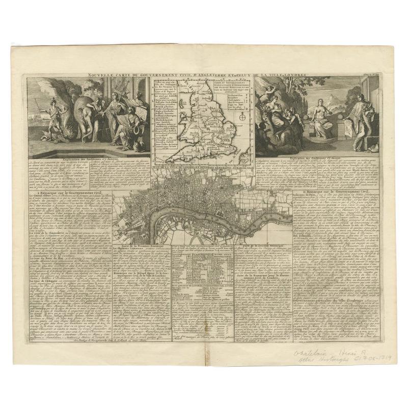
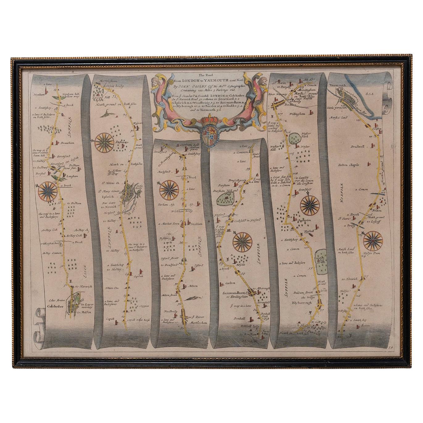
Antique Map of England and London with Two Large Allegorical Views, c.1720
Located in Langweer, NL
Antique map titled 'Nouvelle Carte du gouvernement civil d'Angleterre (..)'. Old plan of London, with map of England and two large allegorical views. This map originates from Chatela...
Category
Antique 18th Century Maps
Materials
Paper

$574 Sale Price
20% Off
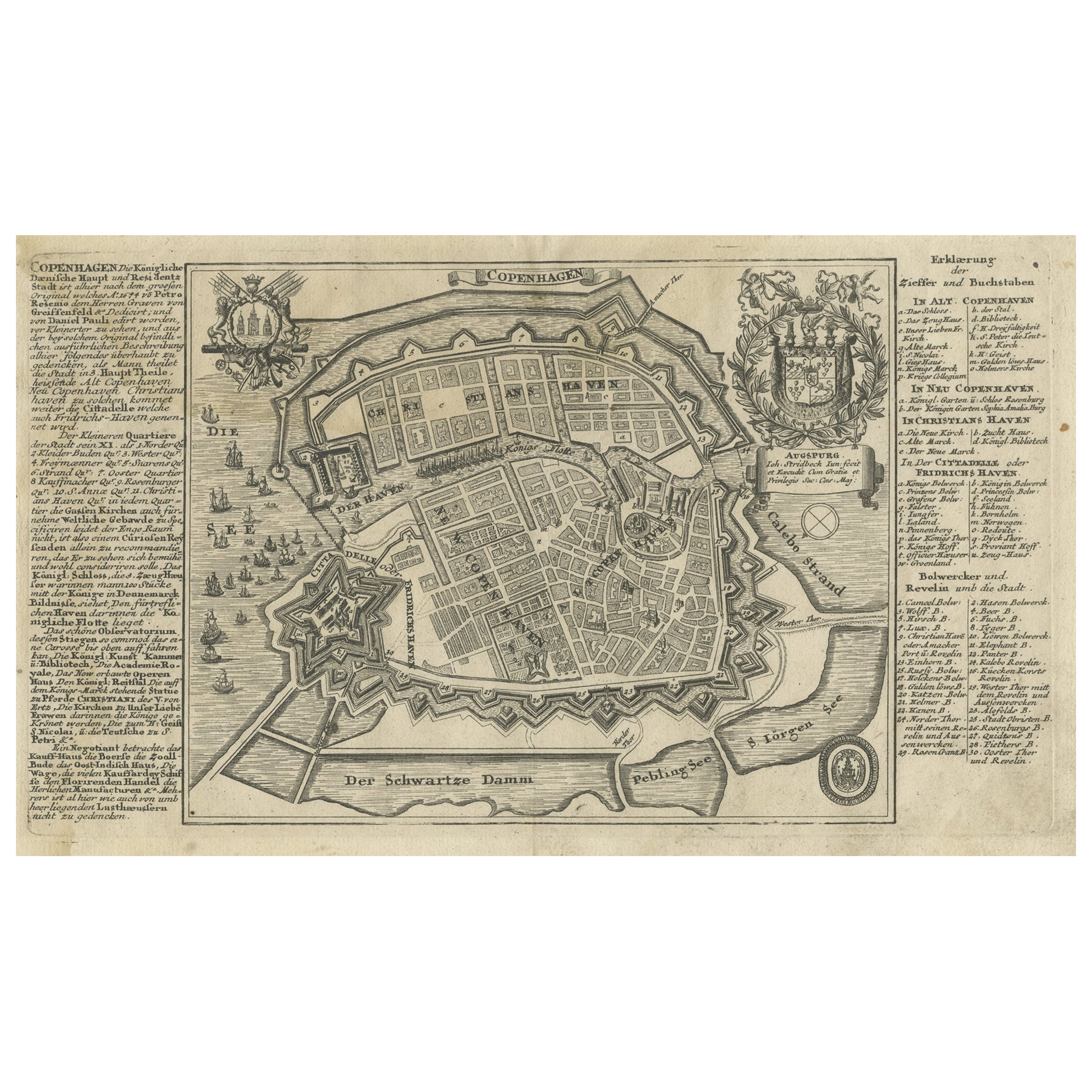
Antique Map of the City of Copenhagen in Denmark c.1720
Located in Langweer, NL
Antique map titled 'Copenhagen'. Original antique map of the city of Copenhagen, Denmark. This map originates from 'Unterschiedliche dieser Zeit Beruffene Laender, Gegenden, Staedte ...
Category
Antique 18th Century Maps
Materials
Paper
$240 Sale Price
20% Off
Antique Map of the Bay of Bantam, c.1720
Located in Langweer, NL
Rare, untitled miniature map of the Bay of Bantam with various Islands including Pulo Dua and Pulo Batto. This map originates from a small travelogue and may originate from an editio...
Category
Antique 18th Century Maps
Materials
Paper

$55 Sale Price
20% Off
Antique Map of Southern India by Chatelain, c.1720
Located in Langweer, NL
"Antique map titled 'Carte Nouvelle des Terres de Cucan, de Canara, de Malabar, de Madura, et de Coromandel'. Map of the southern portion of India, originating from Chatelain's 'Atla...
Category
Antique 18th Century Maps
Materials
Paper
$287 Sale Price
20% Off
Antique Map of Mecklenburg-Vorpommern in Germany by J.B. Homann, c.1720
Located in Langweer, NL
Antique Map of Mecklenburg-Vorpommern by J.B. Homann, c.1720
Old colored antique map of Mecklenburg-Vorpommern by Johann Baptist Homann. This stunning map, titled "Ducatus Meklenbur...
Category
Antique 1720s Maps
Materials
Paper
$500 Sale Price
20% Off
Recently Viewed
View AllMore Ways To Browse
Dragon Sword
Portrait King Of United Kingdom
Antique Marine Maps
Antique Mediterranean Map
Map Of Egypt
Antique Maps Of Greece
Framed World Map
Portuguese 16th
Antique Map Of The South Of France
Copper Map Plate
Antique Indian Maps
Antique Wine Maps
Hemispheres Map
Map New Holland
Antique Maps Of Wales
Antique World Globe Map
Ships Log
17th And 18th Century American Furniture