Wood Maps
to
7
75
45
122
35
11
8
4
4
3
3
2
1
1
1
30
65
27
9
6
3
3
4
1
1
1
5,494
122
55
33
33
99
69
19
15
15
122
122
122
1
1
1
1
1
Material: Wood
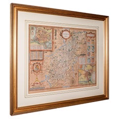
Large Antique Lithography Map, Northamptonshire, Framed Cartography, John Speed
Located in Hele, Devon, GB
This is a large antique lithography map of Northamptonshire. An English, framed atlas engraving of cartographic interest by John Speed, dating to the early 17th century and later.
Superb lithography reproduction of Northamtonshire - place names are written in 17th century English
Displays a desirable aged patina and in very good order
Fascinating Jacobean period cartography, set within a quality, later frame
Reproduced here from its appearance in the 'Theatre of Great Britain' of 1627 published by George Humble
Marked for John Speed as cartographer and George Humbell (sic) as seller
Exceptional detail, as expected from a John Speed map...
Category
Mid-17th Century British Other Antique Wood Maps
Materials
Glass, Wood, Paper
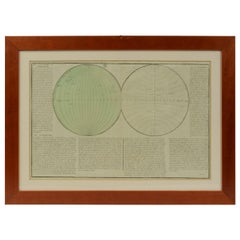
1850 Old French Map Depicting the Entire Earth's Surface Divided into Two Parts
Located in Milan, IT
Geographical map depicting the entire earth’s surface divided into two parts that correspond to the two hemispheres or globes, the map deals with the latitudes and longitudes, the me...
Category
Mid-19th Century French Antique Wood Maps
Materials
Glass, Wood, Paper
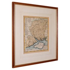
Antique County Map, Hampshire, English, Framed Cartography, Robert Morden, 1700
Located in Hele, Devon, GB
This is an antique county map of Hampshire. An English, framed atlas engraving of cartographic interest By Robert Morden, dating to the late 17th century and later.
Superb lithogra...
Category
Late 17th Century British Other Antique Wood Maps
Materials
Glass, Wood, Paper
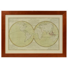
1850 Old French Map Depicting the Entire Earth's Surface Divided into Two Parts
Located in Milan, IT
Geographical map depicting the entire earth's surface divided into two parts that correspond to the two hemispheres where the emerged lands are depicted which have been classified wi...
Category
Mid-19th Century French Antique Wood Maps
Materials
Glass, Wood, Paper
Antique Lithography Map, Cumberland, English, Framed, Cartography, Victorian
Located in Hele, Devon, GB
This is an antique lithography map of Cumberland. An English, framed atlas engraving of cartographic interest, dating to the mid 19th century and la...
Category
Mid-19th Century British Victorian Antique Wood Maps
Materials
Wood
Antique Lithography Map, Buckinghamshire, English, Framed Cartography, Victorian
Located in Hele, Devon, GB
This is an antique lithography map of Buckinghamshire. An English, framed atlas engraving of cartographic interest, dating to the mid 19th century and later.
Superb lithography of B...
Category
Mid-19th Century British Victorian Antique Wood Maps
Materials
Wood, Paper
Antique Coaching Road Map Cranborne to Dorchester, Framed Cartography, Victorian
Located in Hele, Devon, GB
This is an antique coaching road map of Cranborne to Dorchester. An English, framed lithograph engraving of regional interest with second map to reverse, dating to the mid 18th cent...
Category
Mid-18th Century British Other Antique Wood Maps
Materials
Glass, Wood, Paper
Antique Road Map, Bristol to Weymouth, English, Framed Cartography, Georgian
Located in Hele, Devon, GB
This is an antique coaching road map of Bristol to Weymouth. An English, framed lithograph engraving of regional interest with second map to reverse, dating to the mid 18th century ...
Category
Mid-18th Century British George II Antique Wood Maps
Materials
Glass, Wood, Paper
Antique County Map, Cambridgeshire, English, Framed Cartography, Robert Morden
Located in Hele, Devon, GB
This is an antique county map of Cambridgeshire. An English, framed atlas engraving of cartographic interest By Robert Morden, dating to the late 17th century and later.
Superb lit...
Category
Early 18th Century British Other Antique Wood Maps
Materials
Glass, Wood, Paper
Antique Lithography Map, Westmoreland, English, Framed, Cartography, Victorian
Located in Hele, Devon, GB
This is an antique lithography map of Westmoreland. An English, framed atlas engraving of cartographic interest, dating to the mid 19th century and later.
Superb lithography of the ...
Category
Mid-19th Century British Victorian Antique Wood Maps
Materials
Wood
Antique County Map, Essex, English, Framed, Cartographic Interest, Victorian
Located in Hele, Devon, GB
This is an antique lithography map of Essex. An English, framed atlas engraving of cartographic interest, dating to the mid 19th century and later.
Superb lithography of Essex and ...
Category
Mid-19th Century British Victorian Antique Wood Maps
Materials
Wood
Antique County Map, Rutlandshire, English, Framed, Cartography, Victorian, 1860
Located in Hele, Devon, GB
This is an antique lithography map of Rutlandshire. An English, framed atlas engraving of cartographic interest, dating to the mid 19th century and later.
Superb lithography of Rutl...
Category
Mid-19th Century British Victorian Antique Wood Maps
Materials
Wood
Antique Lithography Map, Western Russia, English, Framed, Cartography, Victorian
Located in Hele, Devon, GB
This is an antique lithography map of Western Russia. An English, framed atlas engraving of cartographic interest by John Rapkin, dating to the early Victorian period and later, circ...
Category
Mid-19th Century British Early Victorian Antique Wood Maps
Materials
Wood
1850 Old French Map Depicting the Entire Earth's Surface Divided into Two Parts
Located in Milan, IT
Map depicting the entire earth's surface divided into two parts corresponding to the two hemispheres and showing the Arctic to Antarctic polar circle, the tropics of Cancer and Capri...
Category
Mid-19th Century French Antique Wood Maps
Materials
Glass, Wood, Paper
Antique Lithography Map, Environs of Southampton, English, Framed, Victorian
Located in Hele, Devon, GB
This is an antique lithography map 'The Environs of Southampton'. An English, framed town engraving of cartographic interest by John James Dower, dating to the Victorian period and ...
Category
Late 19th Century British Victorian Antique Wood Maps
Materials
Wood
Early 19th Century Original Framed Land Indenture, England, 1810
Located in Lambertville, NJ
A large hand written land indenture document England, 1810, framed. The beautifully hand written document mounted on board with a red velvet border and ...
Category
1810s English Regency Antique Wood Maps
Materials
Glass, Giltwood, Parchment Paper
German Globe by C. Abel-Klinger, Nuremberg, circa 1860
Located in Milano, IT
Terrestrial globe
Artistic company C. Abel - Klinger
Nuremberg, circa 1860
H cm 31 x 22 cm (12.20 x 8.66 in); sphere 14 cm (5.51 in) in diameter
lb 2.30 (kg 1.04)
State of conservation: good. On the sphere there are slight visible signs of accidental bumping at the poles, as well as on New Guinea and England (vertical and more visible); some ink stains, especially at the South Pole and on the meridian that crosses North America.
The globe is composed of twelve whole gores of printed paper, juxtaposed and glued on a sphere made with a chalky base mixture.
The circle of the meridian, made of brass...
Category
1860s German Other Antique Wood Maps
Materials
Wood, Paper
Antique Lithography Map, Northumberland, English, Framed, Engraving, Cartography
Located in Hele, Devon, GB
This is an antique lithography map of Northumberland. An English, framed atlas engraving of cartographic interest, dating to the mid 19th century a...
Category
Mid-19th Century British Victorian Antique Wood Maps
Materials
Wood
Antique Map of Eastern Hemisphere from the collection of Thierry Despont
Located in New York, NY
Designed by Enrico Bonetti (E. Bonatti) and published by Francesco Vallardi Editore. Based on an earlier map by Evangelista Azzi (Ev. Azzi). Labeled as such at bottom edge of map.
T...
Category
Late 19th Century Italian Antique Wood Maps
Materials
Canvas, Wood
Antique Lithography Map, Durham, English, Framed, Cartography, Early Georgian
Located in Hele, Devon, GB
This is an antique lithography map of Durham. An English, framed engraving of cartographic interest, dating to the early 18th century and later, circa 1720.
Superb lithography of Du...
Category
Early 18th Century British Georgian Antique Wood Maps
Materials
Wood
Antique Nottinghamshire Map, English, Framed, Cartographic Interest, Victorian
Located in Hele, Devon, GB
This is an antique lithography map of Nottinghamshire. An English, framed atlas engraving of cartographic interest, dating to the mid 19th century and later.
Superb lithography of ...
Category
Mid-19th Century British Victorian Antique Wood Maps
Materials
Wood
Antique Lithography Map, Hertfordshire, English, Framed Engraving, Cartography
Located in Hele, Devon, GB
This is an antique lithography map of Hertfordshire. An English, framed atlas engraving of cartographic interest, dating to the mid 19th century an...
Category
Mid-19th Century British Victorian Antique Wood Maps
Materials
Wood
Antique Lithography Map, Gloucestershire, English, Framed Engraving, Cartography
Located in Hele, Devon, GB
This is an antique lithography map of Gloucestershire. An English, framed atlas engraving of cartographic interest, dating to the mid 19th century ...
Category
Mid-19th Century British Victorian Antique Wood Maps
Materials
Wood
Antique Lithography Map, Worcestershire, English, Framed Engraving, Cartography
Located in Hele, Devon, GB
This is an antique lithography map of Worcestershire. An English, framed atlas engraving of cartographic interest, dating to the early 19th centur...
Category
Early 19th Century British Regency Antique Wood Maps
Materials
Wood
Antique Coaching Road Map, Devon, English, Regional Cartography, Georgian, 1720
Located in Hele, Devon, GB
This is an antique coaching road map of Devon. An English, framed lithograph engraving of regional interest, dating to the early 18th century and later.
Fascinating 18th century hig...
Category
Early 18th Century British Georgian Antique Wood Maps
Materials
Wood
1863 "Lloyd's New Map of the United States, the Canadas, and New Brunswick"
Located in Colorado Springs, CO
Presented is “Lloyd's New Map of the United States, the Canadas and New Brunswick, From the latest Surveys, Showing Every Railroad & Station Finished to June 1863, and the Atlantic and Gulf Coasts.” A large, Civil War-era hanging map of the United States and adjacent territories, this map covers the area from the Atlantic Ocean and extends as far west as the 103 meridian, to “Dacotah,” Nebraska, Kansas, "Indian Territory," and Texas. The southern continuation of Florida is shown in an inset map along the right margin. This map was published by J. T. Lloyd, in New York, in 1863. According to the publisher’s marking at lower right, this map was originally issued in two states: "in Sheets, Colored" for 50 cents, and "Varnished nicely, with Rollers" for $1.
Throughout the map, the counties are colored and the towns and cities well labeled. A reference key in the bottom margin provides symbols for railroads, turnpikes and wagon roads, state capitals, cities and towns, and village post offices. As emphasized in the map’s title, this map is especially notable for the countless railway lines and stations depicted, with distances noted between points, listing “every railroad and finished station to June 1863.” Additionally, two shipping agents and their routes are drawn out of New York City. The map includes details of the steamship routes into New York and Philadelphia from Liverpool and on to California and Oregon via an overland Nicaraguan trek, presumably to assist gold rush emigrants.
This expansive and impressive map depicts the eastern half of the United States in the third year of the Civil War. In order not to recognize the legitimacy of the Confederate States of America, each state is shown in the same manner as the Union states. The only indication that the American Civil War was in progress when this map was published is a printed notice that Gideon Wells, Secretary of the Navy, wishes to acquire a quote on 100 copies of Lloyd’s Mississippi River map...
Category
1860s American Antique Wood Maps
Materials
Linen, Wood, Paper
Antique Lithography Map, County Durham, English, Framed Cartography, Victorian
Located in Hele, Devon, GB
This is an antique lithography map of County Durham. An English, framed atlas engraving of cartographic interest, dating to the mid 19th century and later.
Superb lithography of Cou...
Category
Mid-19th Century British Mid-Century Modern Antique Wood Maps
Materials
Wood
Miniature Terrestrial Globe Newton & Son London, Post 1833, Ante 1858
Located in Milano, IT
Miniature Terrestrial Globe
Newton & Son
London, post 1833, ante 1858
Paper, papier-mâché, bronze and wood
It measures: sphere diameter 2.95 in (7.6 cm); diameter of the wooden base 6.02 in (15.3 cm); height 8.36 in (21.24 cm).
Weight: 2,067 lb.
State of conservation: the globe still bears its original paint, but has various small gaps, abrasions and stains on the surface.
The globe is hinged with two pins at the meridian circle, which is in turn inserted perpendicular to the horizon circle; this is supported by four semi-arches connected at the bottom by a small goblet-shaped foot, resting on a wooden bell-shaped base.
Apart from the wooden base, the entire support structure is made of bronze; on the foot there are the scale reproductions of a compass, a telescope and an open book.
The sphere is made of papier-mâché and is covered with twelve printed paper gores.
In the North Pacific Ocean the globe bears a cartouche with the inscription (about 30% of the writing is illegible, but the missing parts can be easily integrated based on the rest):
NEWTON’S
New & Improved
TERRESTRIAL
Globe
Published by Newton & Son
66 Chancery Lane
LONDON
On the globe, much of central Africa is empty and the great lakes Tanganyika and Victoria are not marked (Europeans would begin to explore the area after 1858). Canada is called "British Territory" and Alaska "Russian Territory" (it would become part of the United States in 1867). Australia already bears its modern name (until 1829 it had been called New Holland) and its coasts are completely designed; Tasmania is listed as an island (Matthew Flinders circumnavigated it in 1798). The routes of Cook's various voyages are plotted; both the route followed by Biscoe in 1831 and the "Land of Enderby" which he discovered on the coast of Antarctica, south of Africa, are marked.
Bibliography
P. Van der Krogt, Old Globes...
Category
1840s English Early Victorian Antique Wood Maps
Materials
Bronze
Antique Lithography Map, Isle of Thanet, Kent, English, Cartography, Victorian
Located in Hele, Devon, GB
This is an antique lithography map of The Isle of Thanet in Kent. An English, framed atlas engraving of cartographic interest, dating to the mid 19th century and later.
Superb litho...
Category
Mid-19th Century British Victorian Antique Wood Maps
Materials
Wood
Antique Lithography Map, Black Sea, English, Framed, Cartography, Victorian
Located in Hele, Devon, GB
This is an antique lithography map of the Black Sea region. An English, framed atlas engraving of cartographic interest by John Rapkin, dating to the early Victorian period and later...
Category
Mid-19th Century British Early Victorian Antique Wood Maps
Materials
Wood
Antique Coaching Road Map, South Devon, English, Framed, Cartography, Georgian
Located in Hele, Devon, GB
This is an antique coach road map of South Devon. An English, framed lithograph engraving of regional interest, dating to the early 18th century and later.
Delightful early 18th cen...
Category
Early 18th Century British Georgian Antique Wood Maps
Materials
Wood
1852 Geometrical Constructions Chart by C. W. Knudsen
Located in Garnerville, NY
Twenty two (22) meticulously rendered hand written and drawn geometrical constructions by C. W. Knudsen, circa 1952. The piece is inscribed in red lower left, C. W. Knudsen, August 1...
Category
1850s American Schoolhouse Antique Wood Maps
Materials
Glass, Wood, Paper, Parchment Paper
Early 20th Century American Library Globe
Located in Norwell, MA
Fine library globe with makers logo from Atlas School Supply Co., Chicago. Hardwood base with rich finish and nice detail. Celestial globe with equ...
Category
1920s North American Vintage Wood Maps
Materials
Wood
Vintage Framed United States Map
Located in Queens, NY
Vintage aged paper map of the United States mounted on particle board and framed in a simple wooden frame.
Category
20th Century American Mid-Century Modern Wood Maps
Materials
Wood, Paper
1918 American Frohse Anatomical Chart, A. J. Nystrom, Max Brodel Illustrator
By Max Brödel, A.J. Nystrom & Co
Located in Buffalo, NY
Antique American Frohse Anatomical pull down chart, by A. J. Nystrom, ,revised and augmented by Max Brodel illustrator... Amazing color, patina, age appropriate wear. dated 1918..
Max (Paul Heinrich) Brödel
1870-1941
Brödel, an illustrator and the first director of the Art as Applied to Medicine program at Johns Hopkins...
Category
1910s American Steampunk Vintage Wood Maps
Materials
Wood, Paper
1950's Glass Globe Lamp, Denmark
Located in New York, NY
Danish Glass Globe Lamp, c. 1950's.
Can be lit with inner bulb.
Category
1950s Danish Mid-Century Modern Vintage Wood Maps
Materials
Glass, Wood
Massive Vintage Wall Map of the Soviet Union 'Sowjetunion' by Karl Wenschow
Located in San Diego, CA
A massive vintage wall map of the Soviet Union (Sowjetunion) published by Karl Wenschow in Munich, Germany, circa 1950s. The map was distributed by De...
Category
Mid-20th Century American Wood Maps
Materials
Paper, Wood
Maitland Smith Globe on Stand
Located in Norwell, MA
World globe with brass horizon band. Intricately carved pedestal base with ball and claw feet. Quite detailed. By the famous Maitland Smith, globe itself is from Replogle. 62" H x 26...
Category
1970s North American Vintage Wood Maps
Materials
Wood
George Philip's Large Relief Map of the World 150x110cm
Located in Linkebeek, BE
George Philip's Large Relief Map of the World 150x110cm
PHILIP, George Relief Map of the World. George Philip and Son Limited, c. 1950. Large 3D relief map of the world. Shaded relie...
Category
20th Century British Wood Maps
Materials
Plastic, Wood
Rare and Early Plaster Relief Map of Adirondack Mountains by F J H Merrill
By P.F. Howells, E. W. Merrill
Located in Buffalo, NY
Rare and Early Monumental Plaster Relief Map of Adirondack Mountains by The University of the State of New York, New York State Museum..F J H Merrill director,,,modeled by Howell's ...
Category
1910s American Industrial Vintage Wood Maps
Materials
Plaster, Wood
Antique Environs of Bath & Bristol Map, English, Framed Cartography, Victorian
Located in Hele, Devon, GB
This is an antique region map of Bath and Bristol. An English, framed atlas engraving of cartographic interest, dating to the mid 19th century and later.
Superb lithography of Bath...
Category
Mid-19th Century British Victorian Antique Wood Maps
Materials
Glass, Wood, Paper
Antique County Map, Staffordshire, English, Framed Litho, Cartography, Victorian
Located in Hele, Devon, GB
This is an antique lithography map of Staffordshire. An English, framed atlas engraving of cartographic interest, dating to the mid 19th century and later.
Superb lithography of St...
Category
Mid-19th Century British Victorian Antique Wood Maps
Materials
Glass, Wood, Paper
Vintage Swedish Topographic School Map of European Alps, Made in Sweden 1922
Located in Los Angeles, CA
Vintage Swedish Topographic School map of European Alps, Made in Sweden 1922
This vintage Swedish school map is so unique and a great example of why t...
Category
1920s Swedish Vintage Wood Maps
Materials
Linen, Wood, Paper
1915 "San Francisco City and County" Hanging Map by W. Bashford Smith
Located in Colorado Springs, CO
Presented is a rare wall map of San Francisco by W. Bashford Smith. Published in San Francisco in 1915, this map indicates streets and city districts, and, most notably, shows the si...
Category
1910s American Art Deco Vintage Wood Maps
Materials
Wood, Paper
Antique County Map of Cheshire, Dutch, Framed, Cartography, Janssonius, C.1660
Located in Hele, Devon, GB
This is an antique county map of Cheshire. A Dutch, framed atlas engraving by Johannes Janssonius, dating to the 17th century and later.
A treat for the collector or county native,...
Category
Mid-17th Century Dutch Charles II Antique Wood Maps
Materials
Glass, Wood, Paper
Pair of Miniature Globes Lane’s on Tripod Bases, London post 1833, ante 1858
By Lane's
Located in Milano, IT
Pair of miniature globes
Lane’s, London, post 1833, ante 1858
Papier-mâché, wood and paper
They measure:
Height 9.44 in (24 cm);
Sphere diameter 2.75 in (7 cm);
Diameter of t...
Category
1840s English Early Victorian Antique Wood Maps
Materials
Paper, Wood
Antique Lithography Map, Northamptonshire, English, Framed Cartography, C.1860
Located in Hele, Devon, GB
This is an antique lithography map of Northamptonshire. An English, framed atlas engraving of cartographic interest, dating to the mid 19th century...
Category
Mid-19th Century British Victorian Antique Wood Maps
Materials
Wood
Antique Coach Road Map, East Devon, English, Framed, Cartography, Georgian, 1720
Located in Hele, Devon, GB
This is an antique coach road map of East Devon. An English, framed lithograph engraving of regional interest, dating to the early 18th century and later.
Fascinating 18th century h...
Category
Early 18th Century British Georgian Antique Wood Maps
Materials
Wood
Antique Lithography Map, Cumbria, English, Framed Cartography Interest, Georgian
Located in Hele, Devon, GB
This is an antique lithography map of Cumbria. An English, framed engraving of cartographic interest, dating to the early 18th century and later.
...
Category
Early 18th Century British Georgian Antique Wood Maps
Materials
Wood
Antique Lithography Map, West Africa, English, Framed, Cartography, Victorian
Located in Hele, Devon, GB
This is an antique lithography map of Western Africa. An English, framed atlas engraving of cartographic interest by John Rapkin, dating to the early Victorian period and later, circ...
Category
Mid-19th Century British Early Victorian Antique Wood Maps
Materials
Wood
Antique Weber Costello 30" Floor Globe 1914-1924
By Costello
Located in Los Angeles, CA
Lucky to find a 30" globe in this condition. The best that Weber Constello ever put out.
Category
20th Century American American Craftsman Wood Maps
Materials
Brass
Framed 17th Century Map of Cumberland, England by John Speed, 1610
By John Speed
Located in Middleburg, VA
A fascinating and richly detailed antique map of Cumberland County in northwest England, drawn and published by the celebrated English cartographer John Spe...
Category
Early 17th Century English British Colonial Antique Wood Maps
Materials
Copper, Gold Leaf
Matthaus Seutter, Framed 1730 Color Engraving Map of "Belgium Fonderatum"
Located in Bridgeport, CT
Label on verso. From Grosser Atlas. The name Belgium comes from the ancient designation "Gallis Belgica". Figural decoration upper left. M. Seutter was a famed German mapmaker in the...
Category
18th Century European Renaissance Antique Wood Maps
Materials
Brass
Framed 1731 Color Engraving, Map of Rotterdam by Matthaus Seutter, "Roterodami"
Located in Bridgeport, CT
"Roterodami". Seutter (1678-1757) was an important German 18th century map maker. Bird's eye view of the city above with full details, neoclassi...
Category
18th Century European Renaissance Antique Wood Maps
Materials
Glass, Wood, Paper
Colossal Terrestrian Globe Hand Painted, French, First Half of the 18th Century
Located in Saint-Ouen, FR
Colossal Terrestrian globe hand painted, French, first half of the 18th century.
Mounted in a 19th century pedestal wood.
Category
1730s French Antique Wood Maps
Materials
Beech
Vintage Swedish School Map of Vastergötland, Made in Sweden 1920
Located in Los Angeles, CA
Vintage Swedish School Map of Vastergötland, Made in Sweden 1920
Västergötland also known as West Gothland or the Latinized version Westrogothia in older literature, is one of the...
Category
1920s Swedish Vintage Wood Maps
Materials
Linen, Wood, Paper
French Framed Copper Engraved Hand Colored Map of Carolina & Georgia, Circa 1757
Located in Charleston, SC
French copper engraved hand colored map of Carolina & Georgia matted under glass with a painted frame, mid-18th century
Category
1750s French Louis XV Antique Wood Maps
Materials
Paper, Paint, Wood, Glass
17th Century Framed Map of Ancient France Titled "Typus Galliae Veteris"
Located in Dallas, TX
Decorate an office or a library with this elegant historic map. Crafted in the Netherlands circa 1630, this beautifully framed antique map with pr...
Category
17th Century Dutch Baroque Antique Wood Maps
Materials
Glass, Giltwood, Paper
