Items Similar to Old Map of Ancient Rome Illustrating Major Monuments and the Seven Hills, c.1704

Want more images or videos?
Request additional images or videos from the seller
1 of 5
Old Map of Ancient Rome Illustrating Major Monuments and the Seven Hills, c.1704
$361.46
$451.8320% Off
£269.20
£336.5020% Off
€304
€38020% Off
CA$506.97
CA$633.7120% Off
A$556.01
A$695.0120% Off
CHF 286.76
CHF 358.4520% Off
MX$6,641.97
MX$8,302.4720% Off
NOK 3,636.94
NOK 4,546.1720% Off
SEK 3,411.86
SEK 4,264.8320% Off
DKK 2,316.53
DKK 2,895.6620% Off
About the Item
Antique map Rome titled 'Omnia Romanae cedant Miracula Terrae (..)'. Map of Ancient Rome Illustrating Major Monuments and the Seven Hills. This map originates from 'Beschryving van Oud en Nieuw Rome (..)' published by F. Halma.
Artists and Engravers: Jan Goeree (1670-1731) was a Dutch engraver and poet. He was the son of the Middelburg bookseller Willem Goeree.
Condition: Very good, general age-related toning. Please study image carefully.
Date: c.1704
Overall size: 36 x 24.5 cm.
Image size: 33.5 x 21.5 cm.
We sell original antique maps to collectors, historians, educators and interior decorators all over the world. Our collection includes a wide range of authentic antique maps from the 16th to the 20th centuries. Buying and collecting antique maps is a tradition that goes back hundreds of years. Antique maps have proved a richly rewarding investment over the past decade, thanks to a growing appreciation of their unique historical appeal. Today the decorative qualities of antique maps are widely recognized by interior designers who appreciate their beauty and design flexibility. Depending on the individual map, presentation, and context, a rare or antique map can be modern, traditional, abstract, figurative, serious or whimsical. We offer a wide range of authentic antique maps for any budget.
- Dimensions:Height: 9.65 in (24.5 cm)Width: 14.18 in (36 cm)Depth: 0 in (0.01 mm)
- Materials and Techniques:
- Period:
- Date of Manufacture:circa 1704
- Condition:
- Seller Location:Langweer, NL
- Reference Number:Seller: BGI-005681stDibs: LU3054326077522
About the Seller
5.0
Recognized Seller
These prestigious sellers are industry leaders and represent the highest echelon for item quality and design.
Platinum Seller
Premium sellers with a 4.7+ rating and 24-hour response times
Established in 2009
1stDibs seller since 2017
2,676 sales on 1stDibs
Typical response time: <1 hour
- ShippingRetrieving quote...Shipping from: Langweer, Netherlands
- Return Policy
Authenticity Guarantee
In the unlikely event there’s an issue with an item’s authenticity, contact us within 1 year for a full refund. DetailsMoney-Back Guarantee
If your item is not as described, is damaged in transit, or does not arrive, contact us within 7 days for a full refund. Details24-Hour Cancellation
You have a 24-hour grace period in which to reconsider your purchase, with no questions asked.Vetted Professional Sellers
Our world-class sellers must adhere to strict standards for service and quality, maintaining the integrity of our listings.Price-Match Guarantee
If you find that a seller listed the same item for a lower price elsewhere, we’ll match it.Trusted Global Delivery
Our best-in-class carrier network provides specialized shipping options worldwide, including custom delivery.More From This Seller
View AllAntique Map of the Region of Grave by Orlers, 1615
Located in Langweer, NL
Antique map of the region of Grave, also including Cuijk and Ravestein. This map originates from 'La genealogie des illustres Comtes de Nassau' by Jan Jansz. Orlers.
Artists and E...
Category
Antique 17th Century Maps
Materials
Paper
$152 Sale Price
20% Off
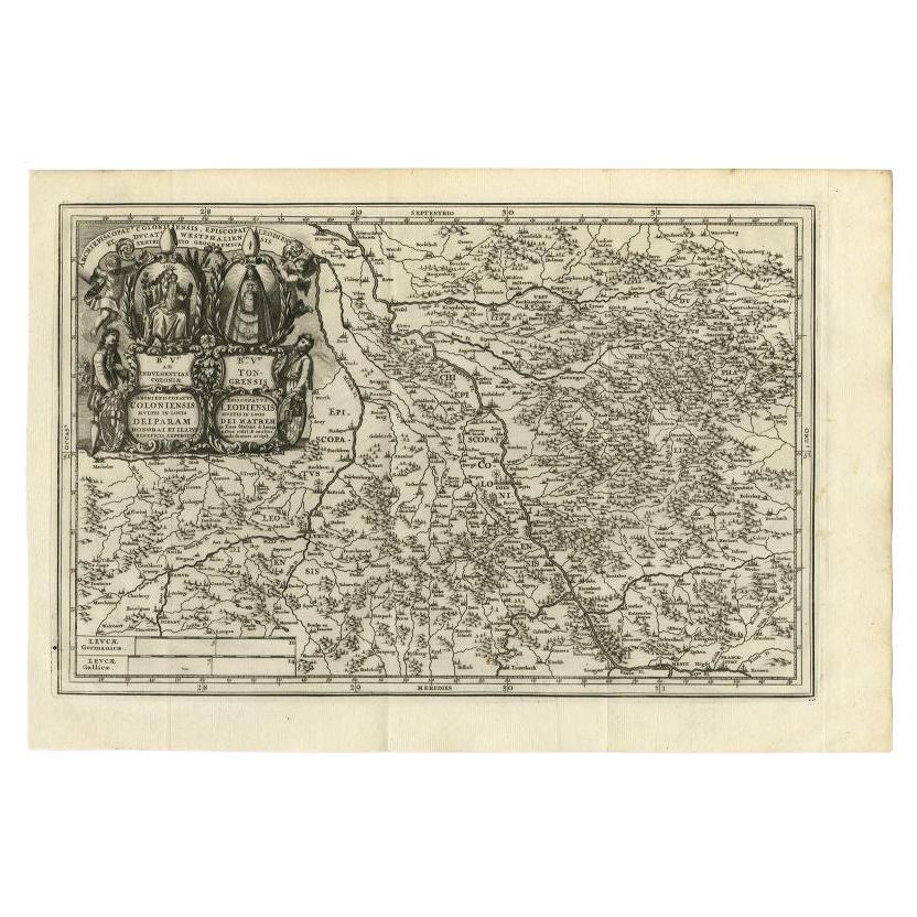
Antique Map of the Region of Cologne and Liege by Scherer, 1699
Located in Langweer, NL
Antique map titled 'Archpiescopatus Coloniensis (..) Episcopatus Leodiensis (..).' Detailed uncommon map of the Archbishopric of Cologne and the Bishopric of Liege/Luik. Source unkno...
Category
Antique 17th Century Maps
Materials
Paper
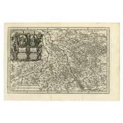
$214 Sale Price
20% Off
Antique Map of the Holy Land Described in the Old and New Testament, ca.1660
Located in Langweer, NL
Antique map titled 'Geographiae Sacrae ex Veteri et Novo Testamento Desumptae Tabula Prima quae Totius Orbis Partes Continet.'
Map of the lands described in the Old and New Testame...
Category
Antique 1660s Maps
Materials
Paper

$808 Sale Price
20% Off
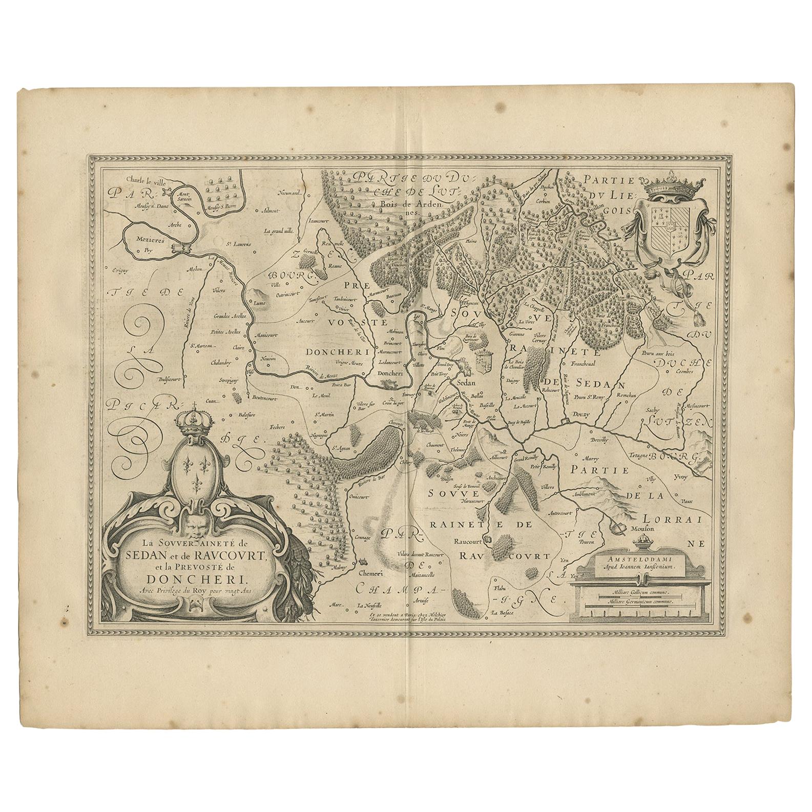
Antique Map of the Region of Sedan and Doncheri by Janssonius, 1657
By Johannes Janssonius
Located in Langweer, NL
Antique map of France titled 'La Souveraineté de Sedan et de Raucourt, et la prevosté de Doncheri'. Lovely map centered on Sedan and Doncheri and the Meuze River from Charleville and...
Category
Antique Mid-17th Century Maps
Materials
Paper
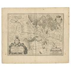
$499 Sale Price
20% Off
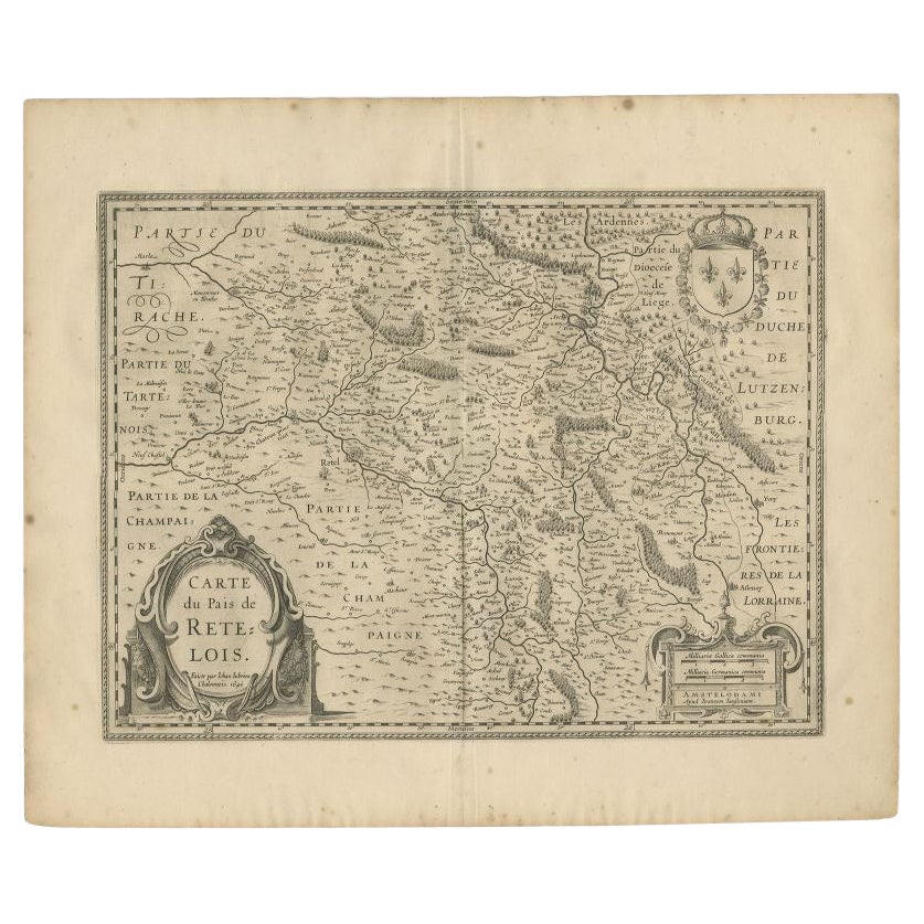
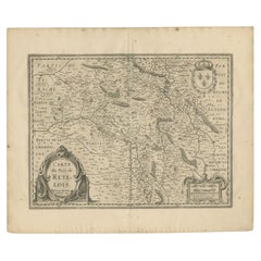
Antique Map of the Region of Rethel by Janssonius, 1657
By Johannes Janssonius
Located in Langweer, NL
Antique map of France titled 'Carte du Pais de Retelois'. Detailed map of the region of Rethel in the north east of France. Showing the city of Rethel, Moncornet en Tirache, Beaumont...
Category
Antique 17th Century Maps
Materials
Paper
$304 Sale Price
20% Off
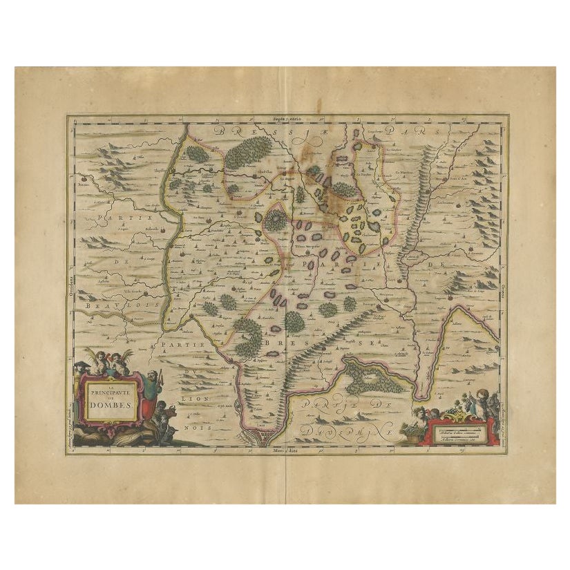
Antique Map of the Region of Lyon by Janssonius, 1657
By Johannes Janssonius
Located in Langweer, NL
Antique map of France titled 'La Principaute de Dombes'. Detailed map of the area above Lyon. This map originates from 'Atlas Novus, Sive Theatrum Orbis Orbis Terrarum: In quo Gallia...
Category
Antique 17th Century Maps
Materials
Paper
$392 Sale Price
20% Off
You May Also Like
17th Century Topographical Map of Cote D'azur, Avignon, Frejus by Iohan Peeters
Located in New York, NY
Fine topographical 17th century map by Iohan Peeters of the towns of Avignon and Frejus in the Cote d'Azur-Provence-Alpes Region of Southeastern France.
Beautifully suited decorativ...
Category
Antique 17th Century Dutch Maps
Materials
Paper

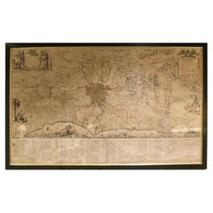
18th Century Map of Rome & Surrounding Vicinity
Located in New Orleans, LA
Intriguing framed map of Rome and the surrounding vicinity featuring detailed cartography, ornamental illustrations, and text index at the bottom. A great, historical conversation pi...
Category
Antique 18th Century Italian Antiquities
Materials
Paper
Original Antique Map of Ancient Greece- Boeotia, Thebes, 1787
Located in St Annes, Lancashire
Great map of Ancient Greece. Showing the region of Boeotia, including Thebes
Drawn by J.D. Barbie Du Bocage
Copper plate engraving by P.F T...
Category
Antique 1780s French Other Maps
Materials
Paper

1718 Ides & Witsen Map "Route D'amsterdam a Moscow Et De La Ispahan Et Gamron
Located in Norton, MA
1718 Ides & Witsen map, entitled
"Route D'Amsterdam A Moscow Et De La Ispahan Et Gamron,"
Ric.b005
Subject: Eastern Europe and Central Asia
Period: 1718 (published)
Publicati...
Category
Antique Early 18th Century Dutch Maps
Materials
Paper

1633 Map "La Souverainete De Sedan Et De Raucourt, Et La Prevoste Ric0011
Located in Norton, MA
1653 map entitled
"La Souverainete de Sedan et de Raucourt, et la Prevoste de Doncheri,"
Ric0011
Description:
Lovely map centered on Sedan and Doncheri and the Meuze River fr...
Category
Antique 17th Century Dutch Maps
Materials
Paper

Map of the Kingdom of Sardinia and Part of the Kingdom of Genoa, Rome
By Giovanni Maria Cassini
Located in Hamilton, Ontario
18th century map by Italian engraver Giovanni Maria Cassini (Italy 1745-1824). Map of Part of the Kingdom of Sardinia and Part of the Kingdom of Genoa: Rome. This is a hand colored a...
Category
Antique 18th Century Italian Maps
Materials
Paper

$795 Sale Price
36% Off
More Ways To Browse
Birds Eye View Map
North Africa Map
West Africa Map
Antique Compass Map
Antique Maps California
Biblical Maps
Hungary Map
Maps Of Mediterranean
Treasure Map
Antique Navigational Tools
Mississippi Furniture
Caribbean Antiques
Antique Maps West Indies
Antique Mozambique
Malaysian Antique Furniture
Relief Map
Sur Tout
Antique Civil War Maps