Early 19th Century Maps
to
209
251
7
261
5
4
1
1
2,963
2,320
481
3
297
34
10
127
10
37
9
2
5
4
3
3
255
11
4
4
3
52
28
27
13
4
261
261
261
4
1
1
1
1
Period: Early 19th Century
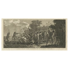
Capt. Cook Aiming His Gun Near Islands of the New Hebrides, Vanuatu, 1803
Located in Langweer, NL
Antique print New Hebrides titled 'Landing op het Eiland Erramanga, een van de Nieuwe Hebriden'.
Antique print depicting the landing at one of the isl...
Category
Antique Early 19th Century Maps
Materials
Paper
$598 Sale Price
40% Off
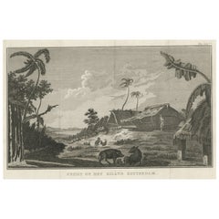
Original Engraving of Rotterdam Island, Nowadays Nomuka, Kingdom of Tonga, c1800
Located in Langweer, NL
Antique print titled 'Gezigt op het eiland Rotterdam'.
View of Rotterdam Island, Pacific. Originates from 'Reizen Rondom de Waereld door James Cook (..)'.
Rotterdam or nowadays Nomuka is a small island in the southern part of the Ha?apai group of islands in the Kingdom of Tonga. It is part of the Nomuka Group of islands, also called the ?Otu Mu?omu?a.
Nomuka, is 7 square kilometres in area and contains a large, brackish lake (Ano Lahi) in the middle, and also three other smaller lakes—Ano Ha'amea, Ano Fungalei, and Molou. There are approximately 400-500 inhabitants who subsist on fishing, farming, and remittances from family members abroad. The island has a secondary school, two primary schools, and a kindergarten. It also has seven churches.
The island is accessible by boat only. Boats leave weekly from Nuku?alofa and Lifuka, Ha?apai. There is one guesthouse on the island, and three or four small fale koloa, or convenience stores. It is also home to the Royal Nomuka Yacht Club
Notable historic visitors include Abel Tasman, Captain Cook, Captain Bligh, and William Mariner. The Dutch Abel Tasman made the first European discovery of the island on 24 January 1643. A party went ashore to get water, and the description of the huge lake they brought back afterwards leaves little doubt about the identification. Tasman called it Rotterdam island, after the city of Rotterdam, a major port in the Netherlands, and noted in his maps the indigenous name of Amamocka, a misspelling of ?a Nomuka, ?a being a subject-indicating article. We also find the name of Amorkakij for Nomuka iki.[1] Captain Bligh in the Bounty spent 3 days wooding and watering at Nomuka in April 1789. The Mutiny on the Bounty occurred the day after they left.
Nomuka is known for raising up the greatest number of church leaders for the major Christian denominations in Tonga such as Rev. Sione Lepa To'a the former president of the Free Wesleyan Church of Tonga, Rev. Seluipepeli Mafi and his son Rev Dr Feke Mafi as both former presidents of the Church of Tonga, and Pastor Tetileti Pahulu, a former president of the Seventh Day Adventist...
Category
Antique Early 19th Century Maps
Materials
Paper
$190 Sale Price
52% Off
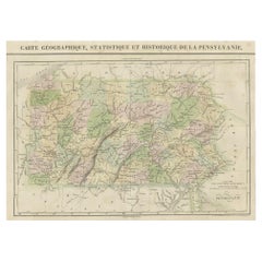
French Geographical, Statistical and Historical Map of Pensylvania, 1825
Located in Langweer, NL
Title: Carte geographique, statistique et historique de la Pensylvanie.
Beautiful Hand-Colored 1825 French Map of Pennsylvania, with a List of Prominent Rivers, Descriptions of Mountains, Climate and Government as well as a list of Colonial and post-American Revolution Governors
Produced by: J. Carez in Paris. (1825)
Hand colored engraved map. Relief shown by hachures. Text and tables at sides and bottom. Prime meridians: Washington and Paris.
A very interesting 1825 French hand-colored map of Pennsylvania from Lucas' 1822 map, which breaks down county populations by Whites and Free Blacks. "Carte Geographique, Statistique et Historique de la Pensylvanie" Originally published in 1822 by Carey and Lea and then revised and republished in 1825 by J. A. C. Buchon (1791-1846 ) in a French edition entitled Atlas Geographique des Deux Ameriques, printed by J. Carez. Fielding Lucas, Jr. (1781-1854), a Baltimore mapmaker and publisher, drew the map. original hand-coloring.
Shown on the map are parts of Maryland, Delaware, New York and New jersey. Printed on the same page as the map is geographical, statistical, and historical information about Pennsylvania, such as descriptions of the state's important rivers, a list of Governors since its founding as well as important French and Indian...
Category
Antique Early 19th Century Maps
Materials
Paper
$456 Sale Price
20% Off
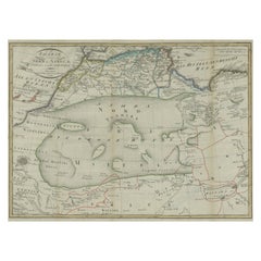
Antique Map of North Africa including the Sahara Desert
Located in Langweer, NL
Antique map titled 'Charte von Nord-Africa'. Scarce map of North Africa. Includes a fantastic depiction of the Sahara Desert. Published in Weimar, 1809.
Category
Antique Early 19th Century Maps
Materials
Paper
$560 Sale Price
20% Off
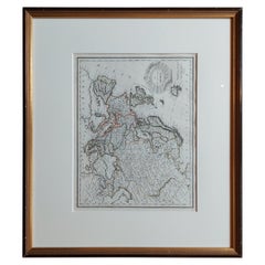
Antique Map of Europe by Lapie, '1809'
Located in Langweer, NL
Antique map titled 'Europe'. Original antique map of Europe by P. Lapie, published 1809. Frame included.
Category
Antique Early 19th Century Maps
Materials
Paper
$285 Sale Price
20% Off
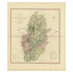
Antique Decorative Map of The County of Nottinghamshire, England, 1804
Located in Langweer, NL
Antique county map of Nottinghamshire first published c.1800. Villages, towns, and cities illustrated include Worksop, Neware, Tuxford, and Maplebe...
Category
Antique Early 19th Century Maps
Materials
Paper
$308 Sale Price
20% Off
Original Antique Map of Oceania, the 5th Continent, 1816
Located in Langweer, NL
Antique map titled ‘Océanie ou cinquième partie du monde‘.
This is an original antique map of Oceania, the 5th continent, by Herisson taken from atlas "Nouv. Abrége de Géographie...
Category
Antique Early 19th Century Maps
Materials
Paper
$266 Sale Price
20% Off
Antique Map of the Atlantic Islands, 1817
Located in Langweer, NL
Antique map titled 'Atlantic Islands'. Large map of the Atlantic Islands include the Cape Verde islands, Canary islands, Azore islands and Madeira islands. Also included a view of th...
Category
Antique Early 19th Century Maps
Materials
Paper
$427 Sale Price
20% Off
Uncommon Miniature Map of the Region around the Caspian Sea, ca.1800
Located in Langweer, NL
Uncommon miniature map of the region around the Caspian Sea.
Including the black sea and several mountains. Source unknown, to be determined.
Artist...
Category
Antique Early 19th Century Maps
Materials
Paper
$180 Sale Price
20% Off
Antique Print of Oedidee, a Native from Bora Bora, 1803
Located in Langweer, NL
Antique print titled 'Oedidee Jongman van Bolabola'.
Antique print of Oedidee, a native from Bora Bora. Originates from 'Reizen Rondom de Waereld door James Cook (..)'.
Artis...
Category
Antique Early 19th Century Maps
Materials
Paper
$171 Sale Price
20% Off
Early Coastal Views of Various Islands of the American West Coast, 1803
Located in Langweer, NL
Antique print America titled 'Gezigten der West-Kust van Amerika'.
Coastal views of various islands of the American coast. Originates from 'Reizen Rondom de Waereld door James Co...
Category
Antique Early 19th Century Maps
Materials
Paper
$598 Sale Price
20% Off
Antique Map of the Extension of the Russian Empire in the XIXth Century, 1806
Located in Langweer, NL
Antique map titled 'L'Empire Russe en Europe et en Asie'.
Map showing the extension of the Russian Empire at the beginning of the XIXth century. Several letterpress notations are...
Category
Antique Early 19th Century Maps
Materials
Paper
$532 Sale Price
20% Off
Old Handcolored Print of an Inhabitant of the Lowlands of Moravia, 1804
Located in Langweer, NL
Old print of an inhabitant of the Lowlands of Moravia.
Moravia, traditional region in central Europe that served as the centre of a major medieval kingdom, known as Great Moravia, before it was incorporated into the kingdom of Bohemia in the 11th century. In the 20th century Moravia became part of the modern state of Czechoslovakia and subsequently of the Czech Republic. The region is bounded by Bohemia on the west and northwest, by Silesia on the northeast, by Slovakia on the east, and by Lower Austria on the south.
This print originates from 'The Costume of the Hereditary States of the House of Austria' by William Miller.
Artists and engravers: Engraved by William Ellis.
Category
Antique Early 19th Century Maps
Materials
Paper
$228 Sale Price
20% Off
Antique Map of the Strait of Le Maire Between Terra Fuego & Staten Island, 1803
Located in Langweer, NL
Antique map titled 'Kaart van de Good Success Baai in de Straat van Le Maire (..)'.
Antique map of the Strait of Le Maire between Terra Fuego and Staten Island. On top, various c...
Category
Antique Early 19th Century Maps
Materials
Paper
$598 Sale Price
20% Off
Antique Map of the Harbour of Tongatabu, One of the Tonga Islands, 1803
Located in Langweer, NL
Antique map Tonga titled 'Kaart van de Haven van Tongataboo'.
Antique map of the harbour of Tongatabu, one of the Tonga Islands. Originates from 'Reizen Rondom de Waereld door Ja...
Category
Antique Early 19th Century Maps
Materials
Paper
$342 Sale Price
20% Off
Map of Winter Harbour on Melville Island, Australia by Parry's Expedition, 1821
Located in Langweer, NL
Antique print titled 'Survey of Winter Harbour Melville Island, June 1820'.
Chart of the bay or harbor on Melville Island where William Parry's expedit...
Category
Antique Early 19th Century Maps
Materials
Paper
$247 Sale Price
20% Off
Antique Map of Seram, Boero and the Banda Islands by Van den Bosch '1818'
Located in Langweer, NL
Antique map titled 'Kaart der Ambonsche Eilanden'. Rare and attractive map of the islands of Seram, Boero and the Banda Islands. Includes a nice view of the Island of Seram. One of 1...
Category
Antique Early 19th Century Maps
Materials
Paper
$1,140 Sale Price
20% Off
Original Antique Map of Pennsylvania Showing Interesting Statistics Etc, 1825
Located in Langweer, NL
Attractive map of Pennsylvania with bordercoloring of the county and showing the various towns, roads, rivers, bridges, and a host of other details...
Category
Antique Early 19th Century Maps
Materials
Paper
$332 Sale Price
20% Off
Antique Print of Saint Isaac's Square, in Saint Petersburg, Russia, ca.1810
Located in Langweer, NL
Description: antique print titled 'The Place of St. Isaac'. View of Saint Isaac's Square, in Saint Petersburg or St Petersbourg, Russia. A city square spra...
Category
Antique Early 19th Century Maps
Materials
Paper
$228 Sale Price
20% Off
Antique Map of Scotland by Cary, '1811'
Located in Langweer, NL
Antique map titled 'A New Map of Scotland from the Latest Authorities':
**Title**: A New Map of Scotland from the Latest Authorities
**Publisher**: J....
Category
Antique Early 19th Century Maps
Materials
Linen, Paper
$760 Sale Price
20% Off
Antique Map of Asia by A. Blondeau, circa 1800
Located in Langweer, NL
This is a fine circa 1800 map of Asia by Alexandre Blondeau. It covers the entire continent from Africa and the Mediterranean east to the Bering Sea and south as far as Java and New ...
Category
Antique Early 19th Century Maps
Materials
Paper
$266 Sale Price
20% Off
Antique Map of Madura and Surabaya by Van den Bosch, '1818'
Located in Langweer, NL
Two maps on one sheet titled 'Kaart van het Eiland Madura en de Oost hoek van het Eiland Java' and 'Kaart van de Haven van Sourabaija'. The left map shows East Java with the Island o...
Category
Antique Early 19th Century Maps
Materials
Paper
$1,140 Sale Price
20% Off
Antique Map of Asia by Mentelle '1819'
Located in Langweer, NL
Antique map titled 'Carte générale et Politique de l'Asie'. Detailed map of Asia. Includes a nice early depiction of Australia (Nouvelle Hollande), including its unknown and conjectu...
Category
Antique Early 19th Century Maps
Materials
Paper
$320 Sale Price
40% Off
Antique Map of the Swabia Region of Germany by Cary, '1811'
By John Cary
Located in Langweer, NL
Antique map titled 'A New Map of the Circle of Swabia'. Antique map of Swabia in Southwestern Germany. Covers from the Upper Rhine region south as far as Switzerland, Lake Constance ...
Category
Antique Early 19th Century Maps
Materials
Paper
$237 Sale Price
20% Off
Antique Map of West Sumatra by P.M.G. Vandermaelen, 1827
Located in Langweer, NL
A chart showing the western part of Sumatra, published in the "Atlas Universel de Géographie".
Category
Antique Early 19th Century Maps
Materials
Paper
$470 Sale Price
20% Off
Antique Map of Bavaria and Salzburg by Cary, 1811
By John Cary
Located in Langweer, NL
Antique map titled 'A New Map of the Circle of Bavaria'. Antique map of Bavaria and Salzburg, Germany. Covers the Duchy of Bavaria and the mountainous A...
Category
Antique Early 19th Century Maps
Materials
Paper
$237 Sale Price
20% Off
Antique Map of the Upper and Lower Rhine by Cary '1811'
By John Cary
Located in Langweer, NL
Antique map titled 'A New Map of the Circles of the Upper and Lower Rhine'. Antique map covering an area from Westphalia and Lower Saxony in the north to France and Swabia in the south.
Category
Antique Early 19th Century Maps
Materials
Paper
$237 Sale Price
20% Off
Antique Map of Indonesia by C.F. Beautemps-Beaupre, circa 1807
Located in Langweer, NL
Antique map titled 'Carte de la partie du grand archipel d'Asie'. Map of Indonesia showing tracks of Recherche and Esperance in 1792-1793. This map is...
Category
Antique Early 19th Century Maps
Materials
Paper
$712 Sale Price
20% Off
Denmark – Large Format Antique Map by Pinkerton, Fine English Engraving c.1814
By Pinkerton
Located in Langweer, NL
Denmark – Large Format Antique Map by Pinkerton, Fine English Engraving c.1814
This impressive antique map of Denmark originates from John Pinkerton’s celebrated Modern Atlas, publi...
Category
English Antique Early 19th Century Maps
Materials
Paper
$411 Sale Price
30% Off
Antique Map of Russia in Europe by J. Thomson, 1819
Located in Langweer, NL
Fine early-19th century map, precisely engraved with an impressive amount of detail. With inset view of equestrian statue of Peter the Great. Issued Edinburgh, 1819 by J. Thomson. Dr...
Category
Antique Early 19th Century Maps
Materials
Paper
Antique Map of North East Borneo and North Sulawesi by P.M.G. Vandermaelen
Located in Langweer, NL
Contemporary colored lithographed map. Relief shown pictorially and by hachures. Covers North Eastern Borneo and part of Northern Sulawesi.
Category
Antique Early 19th Century Maps
Materials
Paper
$470 Sale Price
20% Off
Framed 1820s Hand Colored Map of the United States
Located in Stamford, CT
Framed 1820s hand colored map photos of North America and South America. As found framed in giltwood frame.
Category
American Spanish Colonial Antique Early 19th Century Maps
Materials
Giltwood, Paper, Glass
Early 19th Century Hand Coloured Map of North America by Aaron Arrowsmith
By Aaron Arrowsmith
Located in Hamilton, Ontario
Hand coloured map in French by English cartographer Aaron Arrowsmith (1750–1823) titled "Amerique Septentionale" (North America).
Map size: 9.5" x 8"
Mat size: 20.5" x 14.25".
Category
English Antique Early 19th Century Maps
Materials
Paper
$795 Sale Price
36% Off
Rare Set of 3 Map Samplers by A Charles. Italy, Spain & France
Located in Chelmsford, Essex
Set of 3 Map Samplers by A Charles. All depict countries, cities, seas and landmarks of the respective countries. The first entitled, 'SPAIN and PORTUGAL'. The second, 'MAP OF FRANCE...
Category
English Antique Early 19th Century Maps
Materials
Linen
1817 Large Northern Hindostan Map by J. Thomson – New General Atlas
Located in Langweer, NL
1817 Thomson Map of Northern Hindoostan – Detailed British Cartography of India
This map, titled "A New Map of Hindoostan from the Latest Authorities," was drawn and engraved for Jo...
Category
Antique Early 19th Century Maps
Materials
Paper
$503 Sale Price
20% Off
Map of French Guiana, Suriname and Cayenne: Plan from Petit Atlas National, 1820
Located in Langweer, NL
This map, titled "Guyane" (French Guiana), is part of the Petit Atlas National series, focusing on French colonies. Here are the key elements of the map and its context:
Features:
-...
Category
Antique Early 19th Century Maps
Materials
Paper
$152 Sale Price
20% Off
Map of the United Provinces & Low Countries: Early 19th Century - 1802
Located in Langweer, NL
Antique Map with Title: 'Carte Générale des Provinces Unies et des Pays-Bas'
**Publication Details:**
- **Atlas Title:** Nouvel Atlas Universel de Géographie Ancienne et Moderne
- *...
Category
Antique Early 19th Century Maps
Materials
Paper
Large Antique County Map of Lincolnshire, England
Located in Langweer, NL
Antique map titled 'A Map of Lincolnshire from the best Authorities'. Original old county map of Lincolnshire, England. Engraved by John Cary. Originates from 'New British Atlas' by ...
Category
Antique Early 19th Century Maps
Materials
Paper
$275 Sale Price
20% Off
Large Antique County Map of Somersetshire, England
Located in Langweer, NL
Antique map titled 'A Map of Somersetshire from the best Authorities'. Original old county map of Somersetshire, England. Engraved by John Cary. Originates from 'New British Atlas' b...
Category
Antique Early 19th Century Maps
Materials
Paper
$304 Sale Price
20% Off
Large Antique County Map of Warwickshire, England, with Hand Coloring
Located in Langweer, NL
Antique map titled 'A Map of Warwickshire from the best Authorities'. Original old county map of Warwickshire, England. Engraved by John Cary. Originates from 'New British Atlas' by ...
Category
Antique Early 19th Century Maps
Materials
Paper
$237 Sale Price
20% Off
Large Antique County Map of Worcestershire, England
Located in Langweer, NL
Antique map titled 'A Map of Worcestershire from the best Authorities'. Original old county map of Worcestershire, England. Engraved by John Cary. Originates from 'New British Atlas'...
Category
Antique Early 19th Century Maps
Materials
Paper
$218 Sale Price
20% Off
Large Antique County Map of Northamptonshire, England
Located in Langweer, NL
Antique map titled 'A Map of Northamptonshire from the best Authorities'. Original old county map of Northamptonshire, England. Engraved by John Cary. Originates from 'New British At...
Category
Antique Early 19th Century Maps
Materials
Paper
$266 Sale Price
20% Off
Large Antique County Map of Ruthlandshire, England
Located in Langweer, NL
Antique map titled 'A Map of Ruthlandshire from the best Authorities'. Original old county map of Ruthlandshire, England. Engraved by John Cary. Originates from 'New British Atlas' b...
Category
Antique Early 19th Century Maps
Materials
Paper
$266 Sale Price
20% Off
Large Antique County Map of Westmorland, England
Located in Langweer, NL
Antique map titled 'A Map of Westmoreland from the best Authorities'. Original old county map of Westmorland, England. Engraved by John Cary. Originates from 'New British Atlas' by J...
Category
Antique Early 19th Century Maps
Materials
Paper
$266 Sale Price
20% Off
Large Antique County Map of South Wales, England
Located in Langweer, NL
Antique map titled 'A Map of South Wales from the best Authorities'. Original old county map of South Wales, England. Engraved by John Cary. Originates from 'New British Atlas' by Jo...
Category
Antique Early 19th Century Maps
Materials
Paper
$171 Sale Price
20% Off
1812 United States Map, by Pierre Tardieu, Antique French Map Depicting the U.S.
Located in Colorado Springs, CO
1812 "United States of Nth America -- Carte des Etats-Unis De L'Amerique Septentrionale" Two-Sheet Map by Tardieu
This attractive map, published in Paris in 1812, is one of the most rare large format maps from the period. It features a view of the East Coast of the U.S. from Maryland to just below South Carolina. Additionally, Ellicott’s plan for the City of Washington D.C. is included at the top right and an illustration of Niagara Falls is shown at the bottom right with a description in both French and English. This extremely detailed map not only depicts the mountainous regions of the southeastern U.S., but also includes names of regions, rivers, and towns.
Based on the first state of Arrowsmith’s 4-sheet map of the United States, this map is completely engraved by Tardieu in Paris and showcases high quality engravings. This detailed map of the recently independent United States includes one of the largest and earliest examples of the Ellicott plan of Washington DC.
The artist, Pierre François Tardieu (PF Tardieu) was a very well-known map engraver, geographer, and illustrator. Awarded a bronze medal by King Louis-Phillipe for the accuracy and beauty of his map-making, Tardieu produced many fine works including maps of Louisiana...
Category
French Antique Early 19th Century Maps
Materials
Paper
China with Hainan and Formosa Islands and the Kingdoms Corea and Tonkin, 1802
Located in Langweer, NL
Antique map titled 'China, Contains 15 Subject Provinces Including the 2 Islands of Hainan, Formosa and the Tributary Kingdoms of Korea, Tonkin'.
Old map depicting China, extendi...
Category
Antique Early 19th Century Maps
Materials
Paper
$275 Sale Price
20% Off
Original Hand-Colored Antique Map of the County of Hereford in England, 1804
Located in Langweer, NL
Antique county map of Herefordshire first published c.1800. Villages, towns, and cities illustrated Avenbury, Ashpurton, Kineton, and Bromyard.
...
Category
Antique Early 19th Century Maps
Materials
Paper
$308 Sale Price
20% Off
Academic Costumes; a Pensioner of Trinity Hall, a Doctor of Physics & Law, 1815
Located in Langweer, NL
Antique print titled 'Pensioner of Trinity Hall - Common Dress of the Doctor in Law & The Doctor in Physic'.
Portraits of three men in academic costum...
Category
Antique Early 19th Century Maps
Materials
Paper
View of Dover Castle Atop the Cliffs in the Background, England, 1818
Located in Langweer, NL
Antique print, titled: 'Dover Castle.'
A view of the beach and sea with Dover Castle atop the cliffs in the background. Published by T. McLean in 1818.
Artists and Engravers: ...
Category
Antique Early 19th Century Maps
Materials
Paper
$313 Sale Price
20% Off
Old Antique of the Southern Georgia and the Sandwich Islands by Capt Cook, 1803
Located in Langweer, NL
Antique map Atlantic titled 'Kaart van de Ontdekkingen gedaan in den Zuider Atlantischen Oceaan (..)'.
Antique chart depicting Southern Georgia and the Sandwich Islands. Originat...
Category
Antique Early 19th Century Maps
Materials
Paper
$608 Sale Price
20% Off
Original Antique Print of a Young Woman from Prättigau, Switzerland, ca.1815
Located in Langweer, NL
Antique print titled 'A young woman, Valley of Prettigaw'.
Original antique print of a young woman from Prättigau, Switzerland. This print originates from 'Switzerland, as now di...
Category
Antique Early 19th Century Maps
Materials
Paper
$152 Sale Price
20% Off
Original Copper Engraved Map of the Bering Strait by Captain Cook, 1803
Located in Langweer, NL
Antique map titled 'Kaart van den Mond van Norton, en van de Engte van Bhering, toonende de meest Oostlijke Kaap van Asien, en den meest Westlijken Urthoek van Amerika'.
Map of t...
Category
Antique Early 19th Century Maps
Materials
Paper
$703 Sale Price
25% Off
Original Chart Showing the Region between Cape Grenville and Cape Suckling, 1803
Located in Langweer, NL
Antique map titled 'Kaart van Cook's Rivier in het N.O. gedeelte van Amerika'.
Chart showing the region between Cape Grenville and Cape Suckling, including Whitsuntide Bay, Cape Whitsunday, Smokey Bay, Cape Douglas, Mount St. Augustine, Volcano Mountain, R. Turn-again, Cook's River, Point Possession, Anchor Point, Point Beale Cape Elizabeth...
Category
Antique Early 19th Century Maps
Materials
Paper
$541 Sale Price
20% Off
Two Sheet Map of the Principality of Wales Divided into Counties, 1804
Located in Langweer, NL
A well engraved and detailed large-scale map of Wales, printed on two sheets .
The map is thoroughly detailed and includes good information regarding t...
Category
Antique Early 19th Century Maps
Materials
Paper
$522 Sale Price / set
20% Off
Antique County Map of Derbyshire, England, 1804
Located in Langweer, NL
Antique county map of Derbyshire first published, circa 1800. Villages, towns, and cities illustrated include Chesterfield, Wirksworth, Derby, and ...
Category
Antique Early 19th Century Maps
Materials
Paper
$308 Sale Price
20% Off
Antique County Map of Leicestershire, England, 1804
Located in Langweer, NL
Antique county map of Leicestershire first published c.1800. Villages, towns, and cities illustrated include Lutterworth, Ashby, Hinkley, and Marke...
Category
Antique Early 19th Century Maps
Materials
Paper
$308 Sale Price
20% Off
Antique Decorative and Detailed County Map of Cumberland, England, 1804
Located in Langweer, NL
Antique county map of Cumberland first published c.1800. Villages, towns, and cities illustrated include Carlisle, Penrith, Copeland Forest, and Wigt...
Category
Antique Early 19th Century Maps
Materials
Paper
$308 Sale Price
20% Off
Antique County Map of Monmouthshire, England, circa 1804
Located in Langweer, NL
Antique county map of Monmouthshire first published circa 1800. Villages, towns, and cities illustrated include Newport, Chepstow, Rockfield, and P...
Category
Antique Early 19th Century Maps
Materials
Paper
$308 Sale Price
20% Off
Antique Decorative County Map of Lincolnshire, England, 1804
Located in Langweer, NL
Antique county map of Lincolnshire first published circa 1800 Cities illustrated include Grantham, Spalding, Boston, and Market Raisin.
Charles Smith was a cartographer working in...
Category
Antique Early 19th Century Maps
Materials
Paper
$308 Sale Price
20% Off
