Netherlands
to
286
405
1,134
490
25,933
13,567
12,536
9,546
8,804
6,867
6,172
5,639
4,552
4,277
3,839
3,407
3,255
2,665
2,313
1,813
1,274
1,182
1,130
792
780
665
647
643
541
529
441
436
413
405
391
375
332
309
278
248
218
183
176
169
169
167
163
148
141
139
118
115
90
89
77
76
72
70
68
48
48
36
35
34
25
20
3
3
2
2
2
Period: Late 17th Century
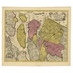
Detailed Map of Southern Holland, Incl the Hague, Rotterdam, Delft, Gouda, c1680
Located in Langweer, NL
Antique map titled 'Delflandia, Schielandia et circumjacentes Insulae ut Voorna, Overflackea, Goerea, Yselmonda et aliae.'
Detailed map of Southern Holland, which includes the ci...
Category
1680s Antique Netherlands
Materials
Paper
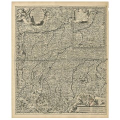
Antique Map of Upper Bavaria, Germany
Located in Langweer, NL
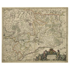
Antique map titled 'Bavariae pars superior cum insertis et adjacentibus regionibus non solum in ejusdem ditiones generales (..). Original antique map of upper Bavaria from Regensburg...
Category
Late 17th Century Antique Netherlands
Materials
Paper
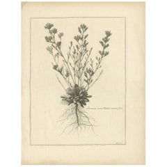
Antique Botany Print of a Limonium Flowering Plant, circa 1680
Located in Langweer, NL
Antique botany print titled 'Limonium minus Bellidis (..)'. Original antique print of a limonium flowering plant. This print originates from 'Me´moires pour servir a' l'histoire des ...
Category
Late 17th Century Antique Netherlands
Materials
Paper
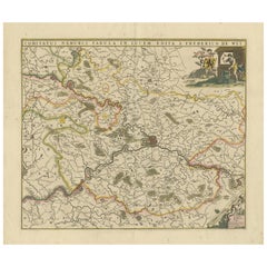
Antique Map of the Namur Region 'France' by F. de Wit, circa 1680
Located in Langweer, NL
Antique map titled 'Comitatus Namurci Tabula in Lucem Edita'. Large map of the Namur region, France. Published by F. de Wit, circa 1680.
Category
Late 17th Century Antique Netherlands
Materials
Paper
Old Print of Vishnu and the Fifth Incarnation, 1672
Located in Langweer, NL
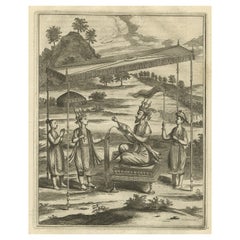
Antique print, untitled. This original antique print shows Vishnu in his fifth incarnation or avatar. Dutch text on verso. From: 'Naauwkeurige Beschryvinge van Malabar en Choromandel...
Category
1670s Antique Netherlands
Materials
Paper
Striking Antique Map of Luxembourg and Northern France 'Lotharingen', c.1680
Located in Langweer, NL
Description: Antique map titled 'Exactissima Lotharingia tam Regis Gallorum quam Ducis.' -
Striking map of Luxembourg and Northern France. Includ...
Category
1680s Antique Netherlands
Materials
Paper
Beautiful Map of Arnhem and the Veluwe Region, Gelderland, The Netherlands, 1690
Located in Langweer, NL
Antique map titled 'Ducatus Geldriae tetrachia Arnhemiensis sive Velavia'.
Beautiful map of the region of Arnhem and the Veluwe region, Gelderland, t...
Category
1690s Antique Netherlands
Materials
Paper
Antique Map of the Siege of Syracuse, Sicilia, Italy, 'ca.1675'
Located in Langweer, NL
Antique map titled 'Syracus beseeged by the Athenians.' This original uncommon antique map shows the siege of Syracuse, Italy, by the Athenians. Key top left.
The siege of Syracus...
Category
1670s Antique Netherlands
Materials
Paper
Original Antique Sea Chart of the Maas 'or Meuse' River with Neptunes, 1684
Located in Langweer, NL
Antique map titled 'Paskaerte van het inkoomen van de Maes (..)'.
Original antique sea chart of the Maas (or Meuse) river and part of the Dutch c...
Category
1680s Antique Netherlands
Materials
Paper
Antique Map of Austria by N. Visscher, circa 1690
Located in Langweer, NL
Antique map titled 'Austriae Archiducatus pars superior in omnes ejusdem'. Spectacular large map of Upper and Lower Austria between Passau and Wien with figurative cartouche and armo...
Category
Late 17th Century Antique Netherlands
Materials
Paper
Original Copperplate Engraved Detailed Map of South Africa, ca.1680
Located in Langweer, NL
Antique map titled 'Pays et Coste des Caffres Empires de Monomotapa (..)'.
Detailed map of South Africa. Engraved by Antoine d'Winter for a Dutch edition of Sanson's pocket atlas...
Category
1680s Antique Netherlands
Materials
Paper
Old Original Miniature View of the Skyline of Miaco 'Kyoto, Japan', 1683
Located in Langweer, NL
Antique print titled 'De l'Asie Figure XXV, Miaco'.
Miniature view of the skyline of Miaco (Kyoto, Japan). This print originates from 'Description de l'Univers', published 1683.
...
Category
1680s Antique Netherlands
Materials
Paper
Rare Engraving of The Opera about The Birth of The Archduchess of Austria, 1678
Located in Langweer, NL
Antique print titled 'Romanus Dictator coram populorem expediens'.
Engraving of a dictator who signs his orders. This engraving shows one of the stage sets for 'Il Fuoco Eterno C...
Category
1670s Antique Netherlands
Materials
Paper
Map of Region Near the Baltic Sea, Present Day Bulgaria, Romania & Turkey, c1670
Located in Langweer, NL
Antique map titled 'Illyricum Orientis: In quo Partes II Moesia et Thracia'.
Engraved map of the area west of the Baltic Sea, present day Bulgaria, Romania, and Turkey. The map i...
Category
1670s Antique Netherlands
Materials
Paper
Old Original Print Showing Arab People with Weapons Receiving Gifts, Ca.1680
Located in Langweer, NL
Antique print, untitled. This original antique print shows Arabian people. Source unknown, to be determined.
Artists and Engravers: Olfert Dapper (c. 1635 - 1689) was a Dutch phys...
Category
1680s Antique Netherlands
Materials
Paper
Coat of Arms of Theodorus Van Bleiswijk, Mayor of Schiedam, Netherlands, Ca.1680
Located in Langweer, NL
Antique print, titled: 'De Heer en Mr. Theodorus van Bleyswijk, Hoogheemraadt, Regerendt Borgermeester der Stad Schiedam.' -
Coat of arms of Theodorus van Bleiswijk, mayor of Sch...
Category
1680s Antique Netherlands
Materials
Paper
Beautiful Map of the Region Naters and Pancrasgors, The Netherlands, ca.1697
Located in Langweer, NL
Antique map titled ‘Caarte der Heerlyckheyt van Naters ende Pancras Gors’.
Beautiful map of the region Naters and Pancrasgors, The Netherlands. This ma...
Category
1690s Antique Netherlands
Materials
Paper
Antique Map of the Coast of Angola Up to Port Elizabeth in South Africa, 1675
Located in Langweer, NL
Antique map titled 'Cimbebas et Caffariae Littora a Catenbela ad Promontorium Bonae Spei'.
This map depicts the coast of Angola, South-West Africa and South Africa up to Port Elizabeth...
Category
1670s Antique Netherlands
Materials
Paper
Antique Map of Switzerland by N. Visscher, circa 1690
Located in Langweer, NL
Antique map titled 'Tabula Geogaphica qua Pars Meridionalis sive Superior Rheni, Mosae, et Mosellae (..)'. Published by N. Visscher, Amsterdam, circa 1690. Contemporary coloring.
Category
Late 17th Century Antique Netherlands
Materials
Paper
Antique Map of Portugal by J. De Ram, circa 1680
Located in Langweer, NL
A detailed map of Portugal. Embellished with beautiful cartouche, sailing vessels and many putti. Very rare edition by J. de Ram, circa 1680.
Category
Late 17th Century Antique Netherlands
Materials
Paper
Antique Decorative Map of the Low Countries, '17 Provinces, Netherlands', c.1680
Located in Langweer, NL
Description: Antique map titled 'Germaniae Inferioris XVII Provinciarum Accuratissima Tabula.'
Map of the low countries (17 provinces, Netherlands). The map is dedicated to Theod...
Category
1680s Antique Netherlands
Materials
Paper
Antique Map of Western Africa and the Cape Verde Islands by Coronelli, 1691
By Vincenzo Coronelli
Located in Langweer, NL
Antique map titled 'Bocche del Fiume Negro et Isole di Capo Verde'. Antique map of Western Africa with the Cape Verde Islands and an inset of Goree Island. Originates from 'Atlante V...
Category
Late 17th Century Italian Antique Netherlands
Materials
Paper
Antique Map of Central Europe "Centered on Germany" by F. de Wit, circa 1680
Located in Langweer, NL
A very detailed map of central Europe, centered on Germany. It extends from Belgium and The Netherlands through Pomerania in the north, and from eastern France to Croatia in the sout...
Category
Late 17th Century Antique Netherlands
Materials
Paper
Antique Map of Germany with Its Bordering Kingdoms and Provinces by N. Visscher
Located in Langweer, NL
Antique map covering the central part of Europe with Germany in the centre and the Netherlands in west. With one cartouche containing cherubs and coat of arms. Published in Amsterdam...
Category
Late 17th Century Antique Netherlands
Materials
Paper
Set of 5 Antique Prints of Various Characters by De La Fage 'C.1698'
Located in Langweer, NL
Set of five antique prints depicting various characters such as nymphs. These prints are part of a series titled 'Recueil des meilleurs desseins de Raimond La Fage...
Category
Late 17th Century Antique Netherlands
Materials
Paper
Antique Portrait of Quoveli by O. Dapper, 1688
Located in Langweer, NL
Antique print titled 'Quoveli', a Turkish Buddhist hermit. This print originates from ''Nauwkeurige Beschrijving van gansch Syrie, en Palenstijn of Heilige Lant'' by O. Dapper, Amste...
Category
Late 17th Century Antique Netherlands
Materials
Paper
Picardy Map - Hand-Colored 17th-Century Engraving by Frederik De Wit c. 1688
Located in Langweer, NL
Title: Picardy Map - Hand-Colored 17th-Century Engraving by Frederik De Wit c. 1688
Description: This beautifully detailed map, "Nova Picardiae Tabula," captures the Picardy region ...
Category
1680s Antique Netherlands
Materials
Paper
Rare Hand-Colored Map of Lyonnais Region in France by Frederik De Wit c. 1688
Located in Langweer, NL
Title: Rare Hand-Colored Map of Lyonnais Region by Frederik De Wit c. 1688
Description: This beautifully detailed map, "Gouvernement General du Lyonnois," showcases the Lyonnais reg...
Category
1680s Antique Netherlands
Materials
Paper
Stunning Hand-Colored Map of Languedoc in France by Frederik De Wit c. 1688
Located in Langweer, NL
Title: Stunning Hand-Colored Map of Languedoc by Frederik De Wit c. 1688
Description: This elegant 17th-century map, "Gouvernement General de Languedoc," beautifully illustrates the...
Category
1680s Antique Netherlands
Materials
Paper
Antique Map of the Region of Bouchain and Cambrai by Visscher 'circa 1680'
By Nicolaes Visscher II
Located in Langweer, NL
Antique map titled 'Carte Nouvelle des Environs de Bouchain & Cambray'. Uncommon map of the region of Bouchain and Cambrai (Cambray, France) showing the camps of two armies.
Category
Late 17th Century Antique Netherlands
Materials
Paper
Antique Map of Denmark by Valk 'circa 1690'
Located in Langweer, NL
The map titled "Regnum Daniae, divisum in Dioeceses Arhusiam, Albergum, Viborgum, et Ripam (..)" is a meticulously detailed representation of the Kingdom of Denmark during a historic...
Category
Late 17th Century Antique Netherlands
Materials
Paper
Antique Print of the Ancient Punishment by Crucifixion 'Constantine the Great'
Located in Langweer, NL
Plate page 714: 'd'Aal-oude Kruis-straffen der Romeinen: hoedanig door Constantyn de Groot ..'. (The ancient punishment by crucifixion which was abolished by Constantine the Great in deference to the cross of Jesus...
Category
Late 17th Century Antique Netherlands
Materials
Paper
Antique Map of Austria by F. de Wit, 1690
Located in Langweer, NL
Antique map titled 'Circuli Austriaci pars Septentrionalis in qua Archiducatus'. Decorative and detailed map of Austria by F. de Wit.
Category
Late 17th Century Antique Netherlands
Materials
Paper
Antique Map of Switzerland by N. Visscher, circa 1690
Located in Langweer, NL
Beautifully detailed map of Switzerland and surrounding regions in present-day France, Germany, and Italy. This map features two decorative cartouches: the larger is flanked by two p...
Category
Late 17th Century Antique Netherlands
Materials
Paper
Antique Map: Friesland and Terschelling with Inset Isles, by Visscher II, 1670
By Nicolaes Visscher II
Located in Langweer, NL
Antique Map: Friesland and Terschelling with Inset Isles, by Nicolaas Visscher II, 1670
This large copper-engraved map provides a detailed and visually stunning depiction of the coastline of Friesland and the island of Terschelling, along with portions of Groningen to the east. Originating from Nicolaas Visscher II’s *Germania Inferiorsive XVII Provinciarum Geographicae Generalis* (Kaert-Boeck van de XVII Nederlandtsche Provincien), this map was published in Amsterdam circa 1670.
The map highlights the main cities of Friesland, beautifully accented in red, and includes a decorative inset in the lower-right corner, illustrating the smaller isles belonging to the province. The finely engraved details make this map a remarkable artifact of 17th-century cartography, with its coastline features rendered with precision and artistic flair.
Adding to its charm, the map is adorned with elaborate decorative cartouches featuring putti (cherubs) and a coat of arms, hallmark elements of Nicolaas Visscher II’s cartographic artistry. Visscher was one of the most prominent Dutch mapmakers of the Golden Age of Cartography, known for his dedication to both geographical accuracy and artistic embellishment. His maps were highly sought after during his lifetime and remain prized by collectors today.
Keywords: antique map Friesland, Terschelling map, Nicolaas Visscher II, 17th-century Dutch cartography, Groningen coastline map, decorative map cartouches, Germania Inferiorsive XVII Provinciarum, Kaert-Boeck Nederlandtsche Provincien, historical Dutch maps, rare collectible maps, Golden Age cartography.
This map is a treasure for collectors of antique cartography...
Category
Late 17th Century Antique Netherlands
Materials
Paper
Chinese Blue and White Porcelain Salt Cellars, Kangxi
Located in Delft, NL
Chinese porcelain salt cellars, Kangxi (1662-1722)
2 Chinese porcelain salt cellars with 3 rims and inside the double blue ring a scene of sever...
Category
Late 17th Century Chinese Antique Netherlands
Materials
Porcelain
1 of the 2 Pairs of Brass & Glass Wall Lights Hillebrand Germany, 1970s
By OTHR
Located in Rijssen, NL
Several beautiful brass and glass wall lights, designed in Germany around the 1970s by Hillebrand. These messing wall lights are handcrafted and of high quality.
Illuminates beautif...
Category
1670s German Mid-Century Modern Antique Netherlands
Materials
Brass
Engraved View of the Dardanelles with Fortifications and Ships, ca. 1680
Located in Langweer, NL
Title: View of the Dardanelles with Fortifications and Ships, ca. 1680
Description: This copperplate engraving offers a detailed view of the Dardanelles Strait, emphasizing its s...
Category
1680s Antique Netherlands
Materials
Paper
View of Fanar in the Aegean Archipelago with Bridge and Ships, ca. 1680
Located in Langweer, NL
Title: View of Fanar in the Aegean Archipelago with Bridge and Ships, ca. 1680
Description: This copperplate engraving showcases a detailed view of Fanar (possibly Fener or anothe...
Category
1680s Antique Netherlands
Materials
Paper
Stormy Scene in the Aegean Archipelago with Coastal Fortifications, circa 1680
Located in Langweer, NL
Title: Stormy Scene in the Aegean Archipelago with Coastal Fortifications, circa 1680
Description: This copperplate engraving illustrates a dramatic stormy maritime scene in the A...
Category
1680s Antique Netherlands
Materials
Paper
Antique bronze Shan Buddha from Burma Original Buddhas
Located in DEVENTER, NL
Material: bronze
57,5 cm high
28 cm wide
Weight: 15.947 kgs
3 parts
Shan (Tai Yai) style
Bhumisparsha mudra
Originating from Burma
17-18th century
Very special !!.
Category
Late 17th Century Burmese Antique Netherlands
Materials
Bronze
Richly adorned riverscape, late 17th century, Dutch golden age
Located in DEVENTER, NL
Gerrit Maes (1649-1706 or later), attributed
Richly adorned riverscape
Signed and dated in the mid-frame, presumably 'Maasius F. 1695'
Oil on canvas
Dimensions excl. frame: 58 x 82 ...
Category
Late 17th Century Dutch School Netherlands
Materials
Canvas, Oil
Hollywood Regency Standing Coat Rack Italian Ornate Brass & Onyx Hall Tree 1960s
Located in Ijzendijke, NL
This high quality free standing Italian ornate hall tree dates to the 1960's.
It is solid and sturdy-capable of handling a full load of coats.
Very lovely square marble, nice foot...
Category
1690s Italian Hollywood Regency Antique Netherlands
Materials
Onyx, Brass
Botanical Illustration of Spanish Kidney Vetch, from Munting’s 1696 Herbal
Located in Langweer, NL
This antique print titled "Anthyllis Vesicaria Hispanica" features the Anthyllis plant, a member of the legume family often found in Mediterranean regions. It comes from Abraham Munt...
Category
1690s Antique Netherlands
Materials
Paper
Fire Grate / Fireplace Grate
Located in Haarlem, Noord-Holland
17th century Dutch wrought iron fireplace basket.
Great looking and very decorative piece, tremendous craftsmanship and detailed decoration.
Great original and usable condition, wo...
Category
Late 17th Century Dutch Antique Netherlands
Materials
Wrought Iron
Tube Shape Desk Lamp by Göran Pehrson for Ateljé Lyktan, 1978
By Ateljé Lyktan, Göran Pehrson
Located in Steenwijk, NL
This very nice and futuristic-looking desk lamp was designed by Göran Pehrson in 1978 for Ateljé Lyktan in Sweden. The lamp shows a tube shaped pipe with one fluorescent bulb. The me...
Category
1670s Swedish Mid-Century Modern Antique Netherlands
Materials
Metal, Aluminum, Chrome
The Southern Courthouse of Stockholm: An Engraving by Willem Swidde, 1691
Located in Langweer, NL
Title: "Cüria in Suburbio Australi Holmiae" - The Southern Courthouse, Now Stockholm City Museum
Description: This historical print, titled "Cüria in Suburbio Australi Holmiae," ill...
Category
Late 17th Century Antique Netherlands
Materials
Paper
Large French 17th-18th Century Louis XIV Trivet
Located in Soest, NL
17th-18th century French Louis XIV period trivet.
It is used for heating up a pan or to keep it warm in front of the fire. In a good working condition.
Category
Late 17th Century French Louis XIV Antique Netherlands
Materials
Wrought Iron
Antique Map of Cologne with the duchies of Jülich and Berg, Germany
Located in Langweer, NL
Antique map title 'Archiepiscopatus Coloniensis ducatibus Iuliacensi et Montensi (..)'. Original map of Cologne with the duchies of Jülich and Berg, Spa...
Category
Late 17th Century Antique Netherlands
Materials
Paper
Antique Map of Westphalia, West Orientation
Located in Langweer, NL
Antique map titled 'Nova totius Westphaliae Descriptio'. Detailed map of Westphalia, Northern Germany. Oriented to the west. The area shown extends from Ha...
Category
Late 17th Century Antique Netherlands
Materials
Paper
Antique Map of the Niederrhein region, Germany
Located in Langweer, NL
Antique map titled 'Circulus Electorum Rheni sive Rhenanus Inferior (..)'. Original antique map of the Niederrhein region, Germany. By F. de Wit, circa 1690.
Frederick de Wit (1629-...
Category
Late 17th Century Antique Netherlands
Materials
Paper
Chinese blue and white “Rotterdam Riots” plate, Kangxi period with silver medal
Located in UTRECHT, UT
A Chinese blue and white “Rotterdam Riots” plate. Kangxi period (1662-1722), ca. 1690-1695, with original Dutch silver medal 1690
Plate:
Painted in underglaze blue, the center wit...
Category
1690s Dutch Chinese Export Antique Netherlands
Materials
Silver
Original Antique Map of the Road from Bristol to Weymouth
Located in Langweer, NL
Antique map titled 'The Road from Bristol to Weymouth (..)'. Original antique map of the road from Bristol to Weymouth. Plate 60 from Ogilby's 'Britannia', the first road atlas of En...
Category
Late 17th Century Antique Netherlands
Materials
Paper
Original Antique Map of the Road from Andover to Crewkerne
Located in Langweer, NL
Antique map titled 'The Continuations of the Road from London to the Lands End'. Original antique map of the road from Andover to Crewkerne. Plate 26 from Ogilby's 'Britannia', the f...
Category
Late 17th Century Antique Netherlands
Materials
Paper
Original Antique Map of Leicestershire, England
Located in Langweer, NL
Antique map titled 'A Mapp of the Country of Leicester'. Original old map of Leicestershire, England. This map originates from 'Britannia: or, a Geographical Description of the Kingd...
Category
Late 17th Century Antique Netherlands
Materials
Paper
Antique Burmese Shan Buddha from Burma
Located in DEVENTER, NL
Material: lacquerware
Measures: 70,6 cm high
43 cm wide and 33,5 cm deep
Weight: 5.8 kgs
Gilded with 24 krt. gold
Shan (Tai Yai) style
Bhumisparsha mudra
Originating from Bur...
Category
Late 17th Century Burmese Antique Netherlands
Materials
Lacquer
Large Copper Engraved Map of the Coastline of Friesland and Terschelling, c.1670
Located in Langweer, NL
Antique print, titled: 'Dominii Frisiae Tabula, inter Flevum et Lavicum (…)'
This large copper engraved map details the coastline of Friesland and Terschelling. At east is a part...
Category
1670s Antique Netherlands
Materials
Paper
Decorative Original Antique Map of the North of Flanders, Belgium, 1697
Located in Langweer, NL
Antique map titled 'Fiandra Parte Occidentale (..)'.
Depicts northern part of Flanders, from North Sea, extends through the northern region of France to the cities of Douai and V...
Category
1690s Antique Netherlands
Materials
Paper
Map of Friesland with Terschelling, Vlieland, Ameland En Schiermonnikoog, C.1670
Located in Langweer, NL
Antique print, titled: 'Tabula Comitatus Frisiae …'
Map of Friesland with the island Terschelling, Vlieland, Ameland en Schiermonnikoog. With a cartouche and a compass rose. Publ...
Category
1670s Antique Netherlands
Materials
Paper
Old Map of the Province of Groningen, the Netherlands & inset of Islands, C.1680
Located in Langweer, NL
Antique map titled 'Tabulae dominii Groeningae quae et complecitur maximam partem Drentiae Emendata'.
Old map of the province of Groningen, the Netherlands. With an inset map of ...
Category
1680s Antique Netherlands
Materials
Paper
