Engraving More Prints

to
43
236
43
62
77
215
162
3
188
105
50
30
7
Overall Height
to
Overall Width
to
34
27
19
10
5
4
2
1
1
1
5
2
2
2
2
2
1
1
1
1
1
1
1
1
1
1
1
1
1
1
195
100
49
36
4
1
3
2
6
7
6
10
142
30
15
13
11
9
5,441
4,533
2,667
1,169
1,025
Medium: Engraving
Academie de l’Espee Tabula XXI by Girard Thibault 17thc fencing engraving
Located in Paonia, CO
Hand colored original engraving from the Academie de l’Espee ( full title can be translated as Academy of the Sword: wherein is demonstrated by mathematical rules on the foundation of a mysterious circle the theory and practice of the true and heretofore unknown secrets of handling arms on foot and horseback ) by Girard Thibault...
Category

17th Century Other Art Style Engraving More Prints

Materials

Engraving

Petunia violacea, antique botanical purple flower engraving
Located in Melbourne, Victoria
Engraving with original hand-colouring. 1834. 230mm by 155mm. From Paxton's 'Magazine of botany and register of flowering plants' by Sir Joseph Paxton.
Category

Mid-19th Century Naturalistic Engraving More Prints

Materials

Engraving

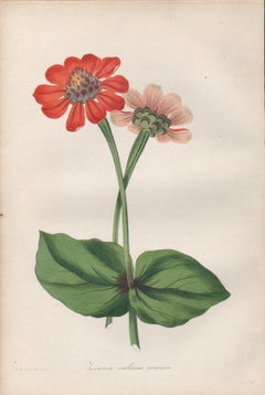
Zinnea violacea coccinea, antique botanical red flower engraving
Located in Melbourne, Victoria
Engraving with original hand-colouring. 1834. 230mm by 155mm. From Paxton's 'Magazine of botany and register of flowering plants' by Sir Joseph Paxton.
Category

Mid-19th Century Naturalistic Engraving More Prints

Materials

Engraving

The Fighting Temeraire: A Framed 19th C. Engraving After J. M. W. Turner
By J.M.W. Turner
Located in Alamo, CA
This beautiful 19th century framed engraving "The Fighting Temeraire" by James Tibbetts Willmore is based on an original painting by the renowned British artist J.M.W. Turner. It was published by James S. Virtue & Co. in London between 1859-1875. It depicts the once mighty British warship the HMS Temeraire being towed away down the river Thames by a much smaller steamboat to a ship-breaking yard to be broken up for scrap. The Temeraire was first launched in 1798 and represented the pinnacle of British ship-building. 180-feet long, constructed of English oak and armed with 98 guns, she was one of the largest warships of the period. The Temeraire became a symbol of British pride and military power that endured throughout the 19th century. The man-of-war served during the French Revolutionary and Napoleonic Wars and was among the last serving ships to have been at the Battle of Trafalgar in 1805. It became one of the many older ships put out of service in the 1830s and 1840s. The once mighty and feared ship symbolizes a once magnificent, but now obsolete, technology. Turner seems to lament her inglorious final journey, being towed by a less magnificent, but modern steam powered tugboat. The Turner painting was created in 1838 and is now held in the National Gallery in London. Willmore's engraving, created in 1859, captures the dramatic scene with great detail and skill. The image has become an iconic representation of the decline of Britain's naval power and the transition from sail to steam in the 19th century. The sunset in the background is symbolic of the sun going down on British naval power and tradition. The painting conveys profound and diverse themes that are central to the human experience: those of mortality and change, technology and progress, heroism and brutality. The painting demonstrates Turner’s skill as an artist. His ability to produce scenes of great beauty that are dramatic, but are also symbolic, stimulating both thoughtful analysis, as well as emotion. Turner's painting was voted by the British public in a 2005 BBC radio sponsored survey to be the British people's favorite painting of all time. In 2020 it was included on a new British banknote...
Category

Mid-19th Century Romantic Engraving More Prints

Materials

Engraving

Ulysses Deriding Polyphemus: A Framed 19th C. Engraving After J. M. W. Turner
By J.M.W. Turner
Located in Alamo, CA
This beautiful 19th century framed hand-colored engraving/etching entitled "Ullyses Deriding Polyphemus" by Edward Goodall is based on an original 1829 painting by the renowned Briti...
Category

Mid-19th Century Romantic Engraving More Prints

Materials

Engraving, Etching

Hibiscus Lindlei, antique botanical pink flower engraving
Located in Melbourne, Victoria
Engraving with original hand-colouring. 1834. 230mm by 155mm. From Paxton's 'Magazine of botany and register of flowering plants' by Sir Joseph Paxton.
Category

Mid-19th Century Naturalistic Engraving More Prints

Materials

Engraving

Azalea indica danielsiana, antique botanical pink flower engraving
Located in Melbourne, Victoria
Engraving with original hand-colouring. 1834. 230mm by 155mm. From Paxton's 'Magazine of botany and register of flowering plants' by Sir Joseph Paxton.
Category

Mid-19th Century Naturalistic Engraving More Prints

Materials

Engraving

St. Michael's Mount, Cornwall: A Framed 19th C. Engraving After Myles Foster
Located in Alamo, CA
This beautiful 19th century framed hand-colored engraving is entitled "St. Michael's Mount, Cornwall" by J. Saddler after an original painting by the British artist Myles Birket Fost...
Category

Mid-19th Century Romantic Engraving More Prints

Materials

Engraving

Yellow Pontic Azalea. Henry Andrews antique botanical flower engraving print
Located in Melbourne, Victoria
'Azalea Pontica - Yellow Pontic Azalea' Native of the coat of the Black Sea. Original copper-line engraving with original hand-colouring from Henry Andrews' 'The Botanist's Reposi...
Category

Early 19th Century Naturalistic Engraving More Prints

Materials

Engraving

Amaryllis formosissima (Sprekelia, Aztec Lily), antique botanical engraving
Located in Melbourne, Victoria
Engraving with original hand-colouring. 1834. 230mm by 155mm. From Paxton's 'Magazine of botany and register of flowering plants' by Sir Joseph Paxton.
Category

Mid-19th Century Naturalistic Engraving More Prints

Materials

Engraving

Malopa grandiflora, antique botanical flower engraving
Located in Melbourne, Victoria
Engraving with original hand-colouring. 1834. 230mm by 155mm. From Paxton's 'Magazine of botany and register of flowering plants' by Sir Joseph Paxton.
Category

Mid-19th Century Naturalistic Engraving More Prints

Materials

Engraving

Figure Rouge avec Portrait de Quevedo
Located in San Francisco, CA
This artwork titled "Figure Rouge avec Portrait de Quevedo" from the suite, Visions De Quevedo, 1975. is an original engraving with pochoir hand coloring on Richard de Bas paper, by ...
Category

1970s Surrealist Engraving More Prints

Materials

Engraving

Foggy Night (the way home or a Stephen King setting)
Located in New Orleans, LA
This impression is #22 Carol Wax originally trained to be a classical musician at the Manhattan School of Music but fell in love with printmaking. Soon after she began engraving mez...
Category

2010s American Modern Engraving More Prints

Materials

Engraving, Mezzotint

Mimulus roseus, antique botanical pink flower engraving
Located in Melbourne, Victoria
Engraving with original hand-colouring. 1834. 230mm by 155mm. From Paxton's 'Magazine of botany and register of flowering plants' by Sir Joseph Paxton.
Category

Mid-19th Century Naturalistic Engraving More Prints

Materials

Engraving

Schizanthus Priestii, antique botanical white flower engraving
Located in Melbourne, Victoria
Engraving with original hand-colouring. 1834. 230mm by 155mm. From Paxton's 'Magazine of botany and register of flowering plants' by Sir Joseph Paxton.
Category

Mid-19th Century Naturalistic Engraving More Prints

Materials

Engraving

Oxyacantha rosea superba, antique botanical pink flower engraving
Located in Melbourne, Victoria
Engraving with original hand-colouring. 1834. 230mm by 155mm. From Paxton's 'Magazine of botany and register of flowering plants' by Sir Joseph Paxton.
Category

Mid-19th Century Naturalistic Engraving More Prints

Materials

Engraving

A View of Scarborough, England: A Framed 19th C. Engraving After J. M. W. Turner
By J.M.W. Turner
Located in Alamo, CA
This beautiful 19th century framed engraving "Scarborough" by W. Chapman is based on an original painting by the renowned British artist J.M.W. Turner. It was published in London by ...
Category

Mid-19th Century Romantic Engraving More Prints

Materials

Engraving

Gesneria Cooperi, antique botanical red flower engraving
Located in Melbourne, Victoria
Engraving with original hand-colouring. 1834. 230mm by 155mm. From Paxton's 'Magazine of botany and register of flowering plants' by Sir Joseph Paxton.
Category

Mid-19th Century Naturalistic Engraving More Prints

Materials

Engraving

Streptanthera cuprea, antique botanical flower engraving
Located in Melbourne, Victoria
Engraving with original hand-colouring. 1834. 230mm by 155mm. From Paxton's 'Magazine of botany and register of flowering plants' by Sir Joseph Paxton.
Category

Mid-19th Century Naturalistic Engraving More Prints

Materials

Engraving

Calceolaria viscosissima, antique botanical yellow flower engraving
Located in Melbourne, Victoria
Engraving with original hand-colouring. 1834. 230mm by 155mm. From Paxton's 'Magazine of botany and register of flowering plants' by Sir Joseph Paxton.
Category

Mid-19th Century Naturalistic Engraving More Prints

Materials

Engraving

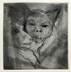
Small Beasts (Dog) Aquatint Etching Jim Dine Pop Art Print
Located in Surfside, FL
Jim Dine (American, b. 1935) Etching depicting a dog or wolf Published by Enitharmon Press for Whitman College, London 1999 Hand signed in pencil lower right. Measures 9" x 7" sheet size This is not numbered. from a limited edition of 30 (plus proofs). Drypoints with aquatint and spit-bite Printed by Julia D'Amario Jim Dine (born June 16, 1935) is an American pop artist. He is sometimes considered to be a part of the Neo-Dada movement.He was born in Cincinnati, Ohio. In 1953, he attended evening classes at The Art Academy of Cincinnati taught by the influential instructor, Paul Chidlaw...
Category

1990s Pop Art Engraving More Prints

Materials

Drypoint, Etching

Calcochortus luteus, antique botanical yellow flower engraving
Located in Melbourne, Victoria
Engraving with original hand-colouring. 1834. 230mm by 155mm. From Paxton's 'Magazine of botany and register of flowering plants' by Sir Joseph Paxton.
Category

Mid-19th Century Naturalistic Engraving More Prints

Materials

Engraving

Passiflora Kermesina, antique botanical pink flower passionflower engraving
Located in Melbourne, Victoria
Engraving with original hand-colouring. 1834. 230mm by 155mm. From Paxton's 'Magazine of botany and register of flowering plants' by Sir Joseph Paxton.
Category

Mid-19th Century Naturalistic Engraving More Prints

Materials

Engraving

Untitled
Located in Barcelona, ES
The painting is being offered with a work and authenticity certificate
Category

1980s Modern Engraving More Prints

Materials

Engraving

Marica caerulea, antique botanical purple flower engraving
Located in Melbourne, Victoria
Engraving with original hand-colouring. 1834. 230mm by 155mm. From Paxton's 'Magazine of botany and register of flowering plants' by Sir Joseph Paxton.
Category

Mid-19th Century Naturalistic Engraving More Prints

Materials

Engraving

A View of Dover, England: A Framed 19th C. Engraving After J. M. W. Turner
By J.M.W. Turner
Located in Alamo, CA
This beautiful 19th century framed engraving "Dover" by Thomas Lupton is based on an original painting by the renowned British artist J.M.W. Turner, which depicts a panoramic view of the harbor of Dover, a town in southeastern England, that has been an important port for centuries. The engraving captures the dramatic sky and sea that Turner was known for, with billowing clouds and waves crashing against the shore. The town and its famous white cliffs are visible in the background, while ships and boats dot the harbor in the foreground. Several wooden rowboats...
Category

Mid-19th Century Romantic Engraving More Prints

Materials

Engraving

Fishing Off Hastings, England: A Framed 19th C. Engraving After J. M. W. Turner
By J.M.W. Turner
Located in Alamo, CA
This beautiful 19th century framed engraving "Line Fishing Off Hastings" by William Miller is based on an original painting by the renowned British artist J.M.W. Turner, which depicts a scene of fishermen at work off the coast of the town of Hastings in East Sussex, England. The Miller engraving faithfully reproduces Turner's painting, capturing the same atmospheric quality and sense of motion. In the foreground of the image, a group of fishermen are shown in a small boat, with one man using a fishing line to catch fish. In the background, there is a larger ship, along with a view of the town of Hastings and the cliffs beyond. Overall, the Miller engraving "Line Fishing Off Hastings" is a beautiful and detailed representation of Turner's original painting, and provides a glimpse into life in a 19th century fishing community. This colorful 19th century engraving is presented in a gold-colored wood frame and a cream-colored French mat highlighted with a light blue band and thinner mustard and gold-colored bands. There is a gold-colored fillet which further embellishes the engraving. The frame measures 18" high, 20.5" wide and 1" deep. The engraving, frame and mat are in excellent condition. Joseph Mallord William (J.M.W.) Turner (1775-1851) was an English painter who is widely considered one of the greatest landscape painters in Western art history. Born in London, he showed a remarkable talent for art from a young age, and studied at the Royal Academy of Arts from the age of 14. He quickly gained recognition for his watercolor landscapes, which were highly innovative and expressive. Turner's style evolved over time, and he became increasingly interested in the effects of light and color. He traveled extensively throughout Europe, and his experiences of the natural world, particularly the sea and the sky, had a profound influence on his art. His paintings are known for their luminosity, atmospheric effects, and dramatic use of color. Despite facing criticism and ridicule from some of his contemporaries, Turner continued to push the boundaries of art, experimenting with new techniques and styles throughout his career. He was a prolific artist, creating thousands of paintings, sketches, and watercolors, and his legacy continues to inspire artists today. William Miller (1796-1882) was an English engraver and publisher, best known for his work in reproducing the paintings of J.M.W. Turner. Miller was born in Bristol and began his career as an engraver at a young age, working for a variety of publications and artists. In the early 1820s, Miller began working with Turner, engraving many of the artist's most famous works, including "The Fighting Temeraire...
Category

Mid-19th Century Romantic Engraving More Prints

Materials

Engraving

Mediterranean and Adriatic Seas: Original 18th Century Hand-colored Map by Bowen
Located in Alamo, CA
This is an original 18th century hand-colored map entitled "An Accurate Chart of The Mediterranean and Adriatic Sea's; with the Archipelago & Part of the Black Sea. Exhibiting all th...
Category

Mid-18th Century Old Masters Engraving More Prints

Materials

Engraving

Chasseur Fortune, Engraving, Van Falenz / Le Bas, Hunter, Decorative Piece
Located in Greven, DE
Le Chasseur Fortune Engraving framed Bez.: C. Van Falenz pinixit // Jac. Ph. Le Bas Sculp. // a Paris chez Le Bas graveur du Cabinet du Roy au bas de la rue de la Harpe...
Category

18th Century Rococo Engraving More Prints

Materials

Engraving

Above the Rush
Located in New York, NY
Fred Mershimer created "Above the Rush" in 2003 using mezzotint and aquatint printmaking techniques. The edition of 120 pieces is printed in color. It is signed, titled, and dated ...
Category

21st Century and Contemporary American Realist Engraving More Prints

Materials

Mezzotint, Aquatint

Map of the World: An Original 18th Century Hand-colored Map by E. Bowen
Located in Alamo, CA
This is an original 18th century hand-colored map entitled "A New & Correct Chart of All The Known World Laid down according to Mercator's Projection" by Emanuel Bowen. It was published in 1744 in London in John Harris's "Navigantium atque Itinerantium Bibliotheca" or "A Complete Collection of Voyages and Travels". This highly detailed and colorful map depicts the world. as it was known in the mid 18th century. A majority of the northern and central portions of Canada and America are left blank due to the purity of knowledge at the time this map was published. The map is embellished with four Compass Roses in the lower left, lower center, lower right and center, along with many rhumb lines. There a is a decorative title cartouche in the upper left. This colorful, attractive, historical and interesting 1744 map presents the entire world on Mercator's projection as it was understood in the middle part of the 18th century, before the landmark explorations of Captain’s Cook, Vancouver, Wilkes and others. It is an example of a nautical chart, a type of map that was designed specifically for use by mariners. The map is centered on the equator and includes both the Eastern and Western Hemispheres. The continents of North America, South America, Europe, Africa, and Asia are depicted, as well as various islands in the Atlantic, Pacific, and Indian Oceans. The map is laid out according to the Mercator projection, a type of cylindrical map projection that was developed in the 16th century by Flemish cartographer Gerardus Mercator. This projection has the advantage of preserving angles and shapes, making it useful for navigation. The map presents a paucity of inland detail, particularly for the Americas, but major cities, geographical landmarks, and regions are included. Ocean currents and Tradewinds are identified, as well as the magnetic declination lines or magnetic variance, which refers to the difference between true north and compass north. The continents are color coded, enhancing the beauty of this map. The three compass roses indicate the directions of the cardinal points. The depiction of the western coast of America, the Pacific and Australia are interesting. There was very little exploration of Australia between the navigations of William Damper in 1699 and Tobias Furneaux in 1773. Most of the maps detail relies on the 17th century Dutch expeditions to Australia's western coast, by Abel Tasman and William Janszoon. Van Diemen's Land (Tasmania) and New Guinea appear connected to the Australian continent. New Zealand appears as a single landmass. North of New Zealand there is a landmass labelled 'Ter d' St. Esprit' which probably represents the New Hebrides Islands. This map precedes the accurate exploration of the South Pacific and east coast of Australia by Captain James Cook later in the 18th century. The map includes ‘Drakes' Port,' the site where Sir Francis Drake supposedly landed in 1579 during his 1579 circumnavigation of the globe. Here he claimed territory for England, restocked, and repaired his vessels. Drake named the region New Albion. The exact location of Drake's Port is a cartographic mystery. Drake's Harbor is believed to be in the region of San Francisco Bay, Bodega Bay, San Pablo Bay...
Category

Mid-18th Century Old Masters Engraving More Prints

Materials

Engraving

View of Emden, Germany: A 16th Century Hand-colored Map by Braun & Hogenberg
Located in Alamo, CA
This is a 16th century original hand-colored copperplate engraved map of a bird's-eye View of Embden, Germany entitled " Emuda, vulgo Embden vrbs Frisia orientalis primaria" by Georg Braun & Franz Hogenberg, in volume II of their famous city atlas "Civitates Orbis Terrarum", published in Cologne, Germany in 1575. This is a beautifully colored and detailed map of Emden, a seaport in northwestern Germany, along the Ems River and perhaps portions of over Dollart Bay, near the border with the Netherland. The map depicts a bird's-eye view of the city from the southwest, as well as a view of the harbor and an extensive system of canals. Numerous ships of various sizes, as well as two rowboats containing numerous occupants are seen in the main waterway in the foreground and additional boats line two canals in the center of the city. Two men and two women are shown on a hill in the foreground on the right, dressed in the 16th century style of nobility. Two ornate crests are included in each corner. A title strap-work cartouche is in the upper center with the title in Latin. The crest on the right including Engelke up de Muer (The Little Angel on the Wall) was granted by Emperor Maximilian I in 1495. This is an English translation of an excerpt of Braun's description of Embden: "In Emden, the capital of East Frisia, rich merchants live in very fine houses. The city has a broad and well-situated harbour, which in my opinion is unique in Holland. Frisia and the whole of the Netherlands, for the ships can anchor here right under the city walls. They have also extended the harbour as far as the New Town, so that up to 400 ships can now find shelter here when the sea is rough." The emphasis on the harbor and waterways within the city highlights the importance of Emden's place as a seaport at this time. Embden developed from a Dutch/Flemish trading settlement in the 7th-8th centuries into a city as late as late 14th century. In 1494 it was granted staple rights, and in 1536 the harbour was extended. In the mid-16th century Emden's port was thought to have the most ships in Europe. Its population then was about 5,000, rising to 15,000 by the end of the 16th century. The Ems River flowed directly under the city walls, but its course was changed in the 17th century by the construction of a canal. Emden has canals within its city limits, a typical feature of Dutch towns, which also enabled the extension of the harbor. In 1744 Emden was annexed by Prussia and is now part of Germany. It was captured by French forces in 1757 during the Seven Years' War, but recaptured by Anglo-German forces in 1758. During the Napoleonic French era, Emden and the surrounding lands of East Frisia were part of the short-lived Kingdom of Holland. References:Van der Krogt 4, 1230, State 2; Taschen, Braun and Hogenberg...
Category

16th Century Old Masters Engraving More Prints

Materials

Engraving

Ireland: A Framed 17th Century Hand-colored Map by Jan Jannson
Located in Alamo, CA
This is a 17th century hand-colored map entitled "Hibernia Regnum Vulgo Ireland" by Johannes Janssonius's (Jan Jansson), published in Amsterdam in 1640. This highly detailed map depicts the Emerald Isle with an extensive display of towns, roads, mountains, rivers, lakes and county borders, etc. It includes two decorative cartouches on the left. The title cartouche includes the Irish harp and the second, in the upper left, includes a lion wearing a crown on the left, a unicorn on the right and a coat-of-arms in the middle, which includes another Irish harp. A distance scale is seen in the lower right, augmented with two putti. The map is embellished with three sailing ships and a sea monster. Western portions of Scotland and England...
Category

Mid-17th Century Old Masters Engraving More Prints

Materials

Engraving

Echium Glaucophyllum, Henry Andrews antique botanical flower engraving print
Located in Melbourne, Victoria
'Echium Glaucophyllum - Sea-green-leaved Viper's Bugloss' Native of Cape of Good Hope, South Africa. Original copper-line engraving with original hand-colouring from Henry Andrews...
Category

Early 19th Century Naturalistic Engraving More Prints

Materials

Engraving

View of Pisaro, Italy: A 16th Century Hand-colored Map by Braun & Hogenberg
Located in Alamo, CA
This is a 16th century original hand-colored copperplate engraved map of View of Pezaro (Pisaro), Italy entitled "Pisaurum vulgo Pezaro" by Georg Braun & Franz Hogenberg, from their famous city atlas "Civitates Orbis Terrarum", published in Augsberg, Germany in 1575. The map depicts a view of Pesaro, Italy from the west looking over the town to the Adriatic Sea. The River Foglia flows into the Adriatic in the foreground. The only identifiable building is the cathedral of San Domenico, which rises above the other roofs with its tall spire. Two women, dressed in styles of the 16th century are in conversation on a hill in the foreground on the left. Pesaro is in the province of Pesaro and Urbino and lies on the Adriatic and east of Florence. The city, which was founded by the Etruscans and named Pisaurum by the Romans, belonged from AD 754 onwards to the Papal States, and after 1285 was controlled by the princely families of Malatesta, Sforza and della Rovere. Today it is the capital of the province of Pesaro and Urbino and has a population of about 92,000. Pesaro's most famous resident, composer Gioacchino Rossini, was born here in 1792. The following is an English translation of an excerpt from Braun's description of the city: "We believe that the astonishingly short life of the inhabitants of Pesaro comes not only from the insalubrious air, but also from the great quantity of delectable and delicious fruits which they consume to excess. For this causes the production in their bodies of evil humours, which then lead to incurably fatal diseases. The area around the city is most charming and well planted with vineyards, fig trees, olive trees and other fruit-bearing trees." 
  References: Van der Krogt 4, 3369, state 1; Taschen, Braun and Hogenberg...
Category

16th Century Old Masters Engraving More Prints

Materials

Engraving

French Neoclassical Design for Candlesticks, engraving after Delafosse
Located in Melbourne, Victoria
Copper-line engraving. C1768. Delafosse was a French decorative designer, engraver and architect. Apprenticed for a time to a sculptor, by 1767 he styled himself an 'architect and professor of design'. He published the first volume of his most important work, 'Nouvelle Iconologie Historique' in 1768, containing 110 plates of his designs for furniture, decorative arts and architectural...
Category

Late 18th Century French School Engraving More Prints

Materials

Engraving

Map of the East Indies: An Original 18th Century Hand-colored Map by E. Bowen
Located in Alamo, CA
This is an original 18th century hand-colored map entitled "An Accurate Map of the East Indies Exhibiting the Course of the European Trade both on the Continent and Islands" by Emanu...
Category

Mid-18th Century Old Masters Engraving More Prints

Materials

Engraving

Europe: An Original 18th Century Hand-colored Map by E. Bowen
Located in Alamo, CA
This is an original 18th century hand-colored map entitled "A New & Accurate Map of Europe Drawn from the Best Authorities Assisted by the Most Improved Modern Charts and Maps." by E...
Category

Mid-18th Century Old Masters Engraving More Prints

Materials

Engraving

Primula Cortusoides - Siberian Primrose. Henry Andrews botanical engraving print
Located in Melbourne, Victoria
'Primula Cortusoides - Siberian Primrose' Native of Siberia. Original copper-line engraving with original hand-colouring from Henry Andrews' 'The Botanist's Repository', 1797-1812...
Category

Early 19th Century Naturalistic Engraving More Prints

Materials

Engraving

China: An Original 18th Century Hand-colored Map by E. Bowen
Located in Alamo, CA
This is an original 18th century hand-colored map entitled "A New & Accurate Map of China, Drawn from Surveys made by the Jesuit Missionaries, by order of the Emperor. The whole bein...
Category

Mid-18th Century Old Masters Engraving More Prints

Materials

Engraving

Map of the Russian Empire: An Original 18th Century Hand-colored Map by E. Bowen
Located in Alamo, CA
This is an original 18th century hand-colored map entitled "A New & Accurate Map of The Whole Russian Empire, As Contain'd Both In Europe and Asia, Drawn from Authentic Journals, Sur...
Category

Mid-18th Century Old Masters Engraving More Prints

Materials

Engraving

French Neoclassical design for a Pulpit, engraving after Delafosse
Located in Melbourne, Victoria
Copper-line engraving. C1768. Delafosse was a French decorative designer, engraver and architect. Apprenticed for a time to a sculptor, by 1767 he styled himself an 'architect and professor of design'. He published the first volume of his most important work, 'Nouvelle Iconologie Historique' in 1768, containing 110 plates of his designs for furniture, decorative arts and architectural...
Category

Late 18th Century French School Engraving More Prints

Materials

Engraving

Small Pinocchio Aquatint Etching Jim Dine Pop Art Print
Located in Surfside, FL
Jim Dine (American, b. 1935) Etching depicting Pinocchio Published by Enitharmon Press for Whitman College, London 1999 Hand signed in pencil lower right. Measures 9" x 7" sheet size This is not numbered. from a limited edition of 30 (plus proofs). Drypoints with aquatint and spit-bite Printed by Julia D'Amario Jim Dine (born June 16, 1935) is an American pop artist. He is sometimes considered to be a part of the Neo-Dada movement.He was born in Cincinnati, Ohio. In 1953, he attended evening classes at The Art Academy of Cincinnati taught by the influential instructor, Paul Chidlaw...
Category

1990s Pop Art Engraving More Prints

Materials

Etching, Drypoint

French Neoclassical Design engraving for Braziers
Located in Melbourne, Victoria
Copper-line engraving. C1768. Delafosse was a French decorative designer, engraver and architect. Apprenticed for a time to a sculptor, by 1767 he styled himself an 'architect and professor of design'. He published the first volume of his most important work, Nouvelle Iconologie Historique in 1768, containing 110 plates of his designs for furniture, decorative arts and architectural...
Category

Late 18th Century French School Engraving More Prints

Materials

Engraving

Loggie di Rafaele nel Vaticano: 18th Century Hand-colored Engraving by Volpato
Located in Alamo, CA
This is an original 18th century hand-colored copper-plate engraving by Giovanni Volpato after a drawing by Camporesi. It was the frontispiece for volume one of the rare and valuable...
Category

Late 18th Century Old Masters Engraving More Prints

Materials

Engraving

Lesser White Throat, bird and nest engraving by John Latham
Located in Melbourne, Victoria
Copper-line engraving. 1781. From John Latham's 'General Synopsis of Birds' 1781-1785, and its Supplements. Plate number top left. Laid paper with water...
Category

Late 18th Century Naturalistic Engraving More Prints

Materials

Engraving

Siberia as Explored by Behring: Original 18th Century Hand-colored Map by Bowen
Located in Alamo, CA
This is an original 18th century hand-colored map entitled "An Exact Chart of all the Countries through which Capt. Behring Travelled from Tobolski, Capital of Siberia to the Country...
Category

Mid-18th Century Old Masters Engraving More Prints

Materials

Engraving

French Neoclassical design for a Pulpit, engraving after Delafosse
Located in Melbourne, Victoria
Copper-line engraving. C1768. Delafosse was a French decorative designer, engraver and architect. Apprenticed for a time to a sculptor, by 1767 he styled himself an 'architect and professor of design'. He published the first volume of his most important work, 'Nouvelle Iconologie Historique' in 1768, containing 110 plates of his designs for furniture, decorative arts and architectural...
Category

Late 18th Century French School Engraving More Prints

Materials

Engraving

French Neoclassical Design Engraving for Braziers
Located in Melbourne, Victoria
Copper-line engraving. C1768. Delafosse was a French decorative designer, engraver and architect. Apprenticed for a time to a sculptor, by 1767 he styled himself an 'architect and professor of design'. He published the first volume of his most important work, 'Nouvelle Iconologie Historique' in 1768, containing 110 plates of his designs for furniture, decorative arts and architectural...
Category

Late 18th Century French School Engraving More Prints

Materials

Engraving

Draught of a Galley /// Old Masters Ship Boat Seascape Construction Diagram Art
By William Henry Toms
Located in Saint Augustine, FL
Artist: William Henry Toms (English, c.1700-1765) Title: "Draught of a Galley" (Plate 13, Vol. III, page 131) Portfolio: La Spectacle de la Nature Year: 1737 Medium: Original Hand-Colored Engraving on laid paper Limited edition: Unknown Printer: Unknown, London, UK Publisher: Humphreys, London, UK Framing: Recently framed in a Regency style gold moulding with rag matting from Holland and museum glass. The frame is an antique frame we've reused, originally built by Knoedler Gallery, New York, NY Framed size: 10.25" x 10.25" Sheet size (irregular margins): 6.63" x 8.25" Image size: 4.75" x 6.75" Condition: In excellent condition with strong colors and good margins Rare Notes: Comes from the 1737 volume edition of Noël-Antoine Pluche's "La Spectacle de la Nature", translated from the original French by Humphreys as "Nature Displayed". With two soft vertical folds within paper as issued. Various dealer reference numbers and an old price pencil inscribed in margins and on verso. Biography: William Henry Toms (c. 1700–1765) was an English engraver. He worked on portraits, book-plates, landscapes and prints of buildings. Among his works were the plates for Robert West's "Perspective Views of All the Ancient Churches in London" (1736–1739). In 1741, he worked with Thomas Badeslade on "Chorographia Britanniae or a New Set of Maps of all the Counties in England and Wales". The maps were republished on 29 September 1742, with additional place names. Among Toms's apprentices was the engraver and publisher John Boydell. W. H. Toms lived in Masham Street, London, and was the father of the painter Peter Toms. Toms died in 1765. Noël-Antoine Pluche (1688-1761) , known as the abbé Pluche, was a French priest...
Category

1730s Baroque Engraving More Prints

Materials

Watercolor, Laid Paper, Engraving, Intaglio

Tournai (Tournay), Belgium: A 16th Century Hand-colored Map by Braun & Hogenberg
Located in Alamo, CA
This is a 16th century original hand-colored copperplate engraved map of Tournai, Belgium, entitled "Tornacum" by Georg Braun & Franz Hogenberg, in volume IV of their famous city atlas "Civitates Orbis Terrarum", published in Cologne or Augsberg, Germany in 1575. The map provides a bird's-eye view of the walled city of Tournai, the second oldest city in Belgium. It lies approximately one hour by car southwest of Brussels or from Ghent. The names of thirty of its streets, prominent buildings, churches and squares are listed in a key within a strap-work cartouche in the lower left. These locations are numbered in the key corresponding to their locations on the map. This colorful map of Tournai (Tornacum or Tournay as it was called in the 16th century) includes the title in Latin in a cartouche in the upper center. Three crests are present across the upper map. A man and two woman are standing on a hill in the foreground in the lower right dressed in the style of 16th century upper class residents of the town. This is an English translation of an excerpt of Braun's description of Tornai: “Tornacum or Turnacum is a city in Gallia Belgica, situated on the Schelde in the territory of the Nervii, called Tournai by its French inhabitants, but Dorneck by the Germans. Tournai has always been a large and powerful city, with an abundance of goods and commercial activities and wonderfully resourceful craftsmen, who invent new articles every day, and although some of these go out of use they constantly conceive of other new things, both useful and delightful, so that they have at all times something that provides work and a means of livelihood for the poor." ReferencesVan der Krogt 4, 4435, State 1; Taschen, Braun and Hogenberg...
Category

16th Century Old Masters Engraving More Prints

Materials

Engraving

Cadiz Island: A Framed 17th Century Hand-colored Map from Blaeu's Atlas Major
Located in Alamo, CA
This is a 17th century hand-colored map entitled "Insula Gaditana Isla de Cadiz" from Johannes (Joan) Blaeu's Atlas Maior, published in Amsterdam in 1662. The map provides an excellent plan of Cadiz Island on the southwest coast of Spain, with its harbor, fortifications, agricultural fields and several surrounding salt processing areas. Numerous sailing ships of various sizes are included in and around the harbor and bay, including five large sailing ships, as well as twenty-four smaller ships. There is a small compass rose overlying the bay. The bridge to the mainland from the island is shown on the right. There is an extremely ornate and colorful title cartouche in the lower left, with its mythological figures reminiscent of Raphael’s Galatea fresco at the Villa Farnesina in Rome. The vibrant colors are vividly preserved. The master colorist tried to emulate a painting by using various tones to create a three-dimensional effect.
 Blaeu's name is present in the plate in the lower right. Blaeu stated in his description of Cadiz: “The main wealth of the islanders consists of salt, which they harvest, and
 the tuna fisheries.” 
 This 17th century hand-colored map is framed in an ornate, partially textured bronze-colored wood frame and glazed with UV protected conservation glass. There is a vertical center fold, as issued. There is a faint crease in the lower right and faint color offset on the left from the right side of the map, resulting from having been in an atlas for hundreds of years. Small foci of paint are present in the upper portion of the left margin and in the left corner margin. The map is otherwise in very good condition. Due in large part to their powerful trade empire, the Dutch became known for cartography in the seventeenth century. This period is considered the Golden Age of Dutch cartography. Their publishing houses produced the highest quality work in Europe, particularly those maps and charts of foreign lands, and Dutch map-making set the bar for cartographic accuracy and artistry into the early-eighteenth century. Some of the most well-known cartographers worked in Amsterdam during this period. Perhaps the most famous of these was the Blaeu family. Willem Janszoon Blaeu, set up shop in Amsterdam. His son, Johannes (Joan), succeeded him upon his death in 1638, continuing in his father’s position as Hydrographer to the Dutch East India Company and selling maps to the public. The Blaeu map presses, located near Amsterdam’s Dam Square...
Category

Mid-17th Century Old Masters Engraving More Prints

Materials

Engraving

Tomb of the Virgin Mary: An Early 19th C. Aquatint after a Luigi Mayer Drawing
Located in Alamo, CA
"Tomb of the Virgin Mary", Pl. 10 in Luigi Mayer's publication 'Views in Egypt, Palestine, and Other Parts of the Ottoman Empire', published by Robert Bowy...
Category

Early 19th Century Engraving More Prints

Materials

Engraving

Roman Hills, Aqueducts and Roads: An Early 18th Century Map by Jan Goeree
Located in Alamo, CA
This richly engraved map of Rome and its environs entitled "Urbis Cum Vicis Seu Pagis Adiacentibus Dissertationi III De Aq et Aqueaed Veteris Promae Praemissa Authore Raph Fabretto G...
Category

Early 18th Century Old Masters Engraving More Prints

Materials

Engraving

View of Seravalle, Italy: A 16th Century Hand-colored Map by Braun & Hogenberg
Located in Alamo, CA
This is an original 16th century copperplate originally hand-colored engraved map of View of Seravalle, Italy entitled "Seravallum Celeberrimum Marchiae Tarvisiniae in Agro Foro Juliensi Opp. - Seravalli, quam vides, Spectator, iconem, operi huic nostro suis sumptib. . . ." by Georg Braun & Franz Hogenberg, from their famous city atlas "Civitates Orbis Terrarum", published in Augsberg, Germany in 1575. The map depicts a view of Seravalle, now Vittorio Veneto, in San Marino, Italy, north of Venice, in a topographically accurate bird's-eye view from the south. A water-filled moat is seen to the south of the city walls and farmland to the east. Two men are depicted standing on a hill in the lower right in conversation next to grain sacks and a grazing horse, while a younger man behind them to the right herds a mule carrying presumably pigs. A very colorful and ornate title cartouche is in the upper center and coat-of-arms are in the right and left upper corners. Serravalle lies in an idyllic setting in the foothills and surrounded by orchards. St Mary's Cathedral with its tall bell tower is prominent in the center of the town. The marketplace and town hall with a bell tower in the square are depicted. Houses and shops are around the main square. Serravalle's importance as an agricultural centre is emphasized by the figures in the foreground. In 1337 Serravalle was conquered by the Republic of Venice. In 1866 the town was united with neighbouring Ceneda to form the town of Vittorio Veneto. The following is an English translation of an excerpt from the French description of the city on the back of the map: "Serravalle, a market town renowned for cloth, wine and grain, is in such a beautiful situation that the number of its inhabitants, attracted by the loveliness of the place, has grown so much at times that the wall encircling it has had to be enlarged for the third time. The city with the surrounding town once belonged to the Church in Ceneda as an imperial fief. It subsequently became the seat of the Da Camino family (a princely house that at that time was one of the five most noble in all Italy). Now the city is under the sway of the Venetians but is prudently governed by them. For they send only one city councillor with instructions to ensure that justice prevails and to collect duties. In all else, power lies in the hands of the noble families." This is a translation of the Latin in the title cartouche on the front: "The picture of the town of Serravalle, which you see, viewer, has been contributed to our work entirely at his own expense by Minutius, son of Hieronymus Minutius, a noble gentleman and one renowned for the far-reaching competence of his jurisdiction. We saw him sojourning in Cologne, where he was on business for Gregory XIII; while our good wishes accompany him, we should also like to accompany him on his way with this remembrance, even though it might be against his will, so that even those who have not seen him may learn of his excellence. However, those who do not yet know him will also see his excellence if God the Almighthy does not summon erring souls too soon back to the eternal seat of the Blessed." References: Van der Krogt 4, 4728, State 1; Taschen, Braun and Hogenberg, p.331; Fauser, #14960 This striking hand-colored city view is printed on laid, chain-linked paper with wide margins. The sheet measures 16" high by 21" wide. There is a central vertical fold as issued and French text on the verso, with Latin on the front. There is some discoloration in the upper and right margins which may represent some watercolor paint from the time of the original hand-coloring of the map. There is a small hole to the right of the upper portion of the vertical fold, which is only visible when held up to light and an area of reinforcement on the verso of the lower vertical fold. The map is otherwise in very good to excellent condition. Braun and Hogenberg's 'The Civitates Orbis Terrarum' was the second atlas of maps ever published and the first atlas of cities and towns of the world. It is one of the most important books published in the 16th century. Most of the maps in the atlas were engraved by Franz Hogenberg and the text, with its descriptions of the history and additional factual information of the cities, was written by a team of writers and edited by Georg Braun. The work contained 546 bird-eye views and map views of cities and towns from all over the world. It gave graphic representation of the main features of the illustrated cities and towns, including the buildings and streets. Although the ordinary buildings are stylized, the principal buildings are reproduced from actual drawings created on location. The principal landmarks and streets can still be recognized today. In addition, the maps often include the heraldic arms of the city, the nature of the surrounding countryside, the important rivers, streams and harbors, even depicting stone bridges, wooden pontoons, flat-bottomed ferries, ships and working boats, wharves and jetties, as well as land-based activities, including horsemen, pedestrians, wagons, coaches, and palanquins. Small vignettes are often included which illustrate the trade, occupations and habits of the local inhabitants, such as agriculture, paper-making and textiles, as well as local forms of punishment, such as gibbets, wheels, floggings etc. Large figures dressed in their local costume are often presented out of proportion in the foreground. The aim of the authors was to give as much information as possible in a pleasing visual form. They succeeded in creating maps that were both informative and decorative works of art. The atlas is a wonderful glimpse of life in medieval Europe. Georg Braun (1541-1622) was German Catholic...
Category

16th Century Old Masters Engraving More Prints

Materials

Engraving

Frankfort, Germany: A 16th Century Hand-colored Map by Braun & Hogenberg
Located in Alamo, CA
This is a 16th century original hand-colored copperplate engraved map of Frankfort, Germany entitled "Francenbergum, vel ut alij Francoburgum Hassiae Opp" by Georg Braun & Franz Hogenberg, from their famous city atlas "Civitates Orbis Terrarum", published in Cologne, Germany in 1595. This is an English translation of an excerpt from the original text in the atlas: "Frankenberg or, according to others, Francoburgum, a town in Hesse. Charlemagne vested the town of Frankenberg with many freedoms and privileges, which it still enjoys to this day, and on account of its valiant and victorious soldiers awarded a signet, upon which there formerly appeared a golden castle with a tower, together with the letter F and a golden crown. Frankenberg, seen here from the northeast, lies on a hill above the River Eder. The hillside is covered with fields neatly separated by bushes and fences. Soaring above the town is the massive Liebfrauenkirche, which was modelled on St Elizabeth's church in Marburg. The New Town was founded in 1335 at the foot of the hill (right) and merged with the Old Town as late as 1556. Frankenberg was founded by Conrad of Thuringia in 1233/34 to prevent the archbishops of Mainz from expanding their sphere of influence...
Category

16th Century Old Masters Engraving More Prints

Materials

Engraving

Purslane-leaved Aizoon. Henry Andrews antique botanical flower engraving print
Located in Melbourne, Victoria
'Aizoon Canariense - Purslane-leaved Aizoon' Original copper-line engraving with original hand-colouring from Henry Andrews' 'The Botanist's Repository', 1797-1812. Accompanied by ...
Category

Early 19th Century Naturalistic Engraving More Prints

Materials

Engraving

Whales, engraving with original hand-colouring, circa 1815
Located in Melbourne, Victoria
Whales, engraving with original hand-colouring, circa 1815. From Bilderbuch Zum Nutzen und Vergnugen Der Jugend by Friedrich Justin Bertuch (1747-1822), an encyclopaedic collection of Interesting Animals, Plants, Flowers, Fruits, Minerals, Costumes, Antiquities and other Interesting Objects...
Category

Early 19th Century Naturalistic Engraving More Prints

Materials

Engraving

Engraving more prints for sale on 1stDibs.

Find a wide variety of authentic Engraving more prints available on 1stDibs. While artists have worked in this medium across a range of time periods, art made with this material during the 19th Century is especially popular. There are many well-known artists whose body of work includes ceramic sculptures. Popular artists on 1stDibs associated with pieces like this include McKenney & Hall, Nicholas Sanson d'Abbeville, Guntars Sietins, and Henry C Andrews. Not every interior allows for large Engraving more prints, so small editions measuring 8.27 inches across are also available Prices for more prints made by famous or emerging artists can differ depending on medium, time period and other attributes. On 1stDibs, the price for these items starts at $85 and tops out at $85, while the average work can sell for $85.

Recently Viewed

View All