Collectibles and Curiosities at Auction

743
4
1
to
741
719
29
748
748
748
121
106
15
5
5
4
3
3
2
1
1
1
1
1
105
244
394
5
117
192
66
13
2
55
20
18
115
25
25
18
22
439
118
102
83
38
451
176
158
108
54
28
8
7
5
5
Ways To Shop: Auction
Original Antique Map of South East Asia by Thomas Clerk, 1817
Located in St Annes, Lancashire
Great map of South East Asia Copper-plate engraving Drawn and engraved by Thomas Clerk, Edinburgh. Published by Mackenzie And Dent, 1817 Unframed.
Category

Antique 1810s English Maps

Materials

Paper

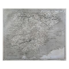
Original Antique Map of Spain and Portugal by Thomas Clerk, 1817
Located in St Annes, Lancashire
Great map of Spain and Portugal Copper-plate engraving Drawn and engraved by Thomas Clerk, Edinburgh. Published by Mackenzie And Dent, 1817 Unframed.
Category

Antique 1810s English Maps

Materials

Paper

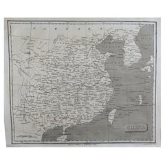
Original Antique Map of China by Thomas Clerk, 1817
Located in St Annes, Lancashire
Great map of China Copper-plate engraving Drawn and engraved by Thomas Clerk, Edinburgh. Published by Mackenzie And Dent, 1817 Unframed.
Category

Antique 1810s English Maps

Materials

Paper

Original Antique Map of The World by Thomas Clerk, 1817
Located in St Annes, Lancashire
Great map of The Eastern and Western Hemispheres On 2 sheets Copper-plate engraving Drawn and engraved by Thomas Clerk, Edinburgh. Published by Mackenzie And Dent, 1817 ...
Category

Antique 1810s English Maps

Materials

Paper

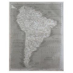
Original Antique Map of South America by Thomas Clerk, 1817
Located in St Annes, Lancashire
Great map of South America Copper-plate engraving Drawn and engraved by Thomas Clerk, Edinburgh. Published by Mackenzie And Dent, 1817 Unframed.
Category

Antique 1810s English Maps

Materials

Paper

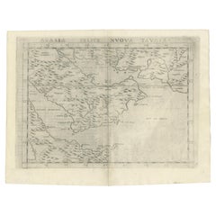
16th Century Map of Saudi Arabia, the Persian Gulf and Red Sea, ca. 1574
Located in Langweer, NL
Ptolemaic map of the Arabian Peninsula based on the 1548 map of Giacomo Gastaldi. It covers nearly all of the peninsula, but does not include the head of the Red Sea. The coastlines ...
Category

Antique 16th Century Maps

Materials

Paper

Vintage Geographic Splendor: 1859 Spain and Portugal
Located in Langweer, NL
The "Vintage Geographic Splendor: 1859 Spain and Portugal" map is an original antique piece from 'The Imperial Atlas of Modern Geography', published ...
Category

Antique Mid-19th Century Maps

Materials

Paper

Original Antique Map of New Brunswick and Nova Scotia, 1889
Located in St Annes, Lancashire
Great map of New Brunswick and Nova Scotia Drawn and Engraved by W. & A.K. Johnston Published By A & C Black, Edinburgh. Original colour Unfr...
Category

Antique 1880s Scottish Victorian Maps

Materials

Paper

Sea Life and Shell Diorama /Shadow Box
Located in Douglas Manor, NY
3-715 Beautiful sea life diorama including sea shells various crustaceans ,seahorse starfish encased in a walnut frame under glass. Brass hanging ring
Category

Vintage 1950s Nautical Objects

Materials

Shell

Togatta Japanese Wooden Traditional Kokeshi Doll
Located in Barcelona, Barcelona
Japanese doll called Kokeshi of the early 20th century. Provenance from the northern Japan. Dolls shapes and patterns are particular to a certain area and are classified under elev...
Category

Early 20th Century Japanese Edo Sculptures and Carvings

Materials

Wood

Antique Japanese Epic Novel Book Edo Period, circa 1820
Located in Barcelona, Barcelona
Antique Japanese epic novel book Edo period, circa 1827 Woodblack print book Book dimensions: 225 mm x 157 mm There are damages because it is antique item as we show on the ph...
Category

Vintage 1920s Japanese Edo Books

Materials

Paper

Antique Map of Canada by Johnston '1909'
Located in Langweer, NL
Antique map titled 'Dominion of Canada'. Original antique map of Canada. This map originates from the ‘Royal Atlas of Modern Geography’. Publishe...
Category

Early 20th Century Maps

Materials

Paper

Original Antique Map of England and Wales from the 1909 Royal Atlas
Located in Langweer, NL
The antique map titled 'England and Wales' is a historical cartographic representation of these two nations. This original antique map of England...
Category

Early 20th Century Maps

Materials

Paper

Refractor Polarimeter Physic Measuring Instrument Made by Steindorff & Co 1920s
Located in Milan, IT
Refractor polarimeter made of painted brass with cast iron tripod base by Steindorff & Co. Berlin D.R.P. Germany, 1920s. It is an antique instrument used to determine the concentrati...
Category

Vintage 1920s German Scientific Instruments

Materials

Brass

Antique Japanese History Book Meiji Era, circa 1878
Located in Barcelona, Barcelona
Antique Japanese History book Meiji era, circa 1878 Woodblock print book Book dimensions: 182 mm x 121 mm There are damages because it is antique i...
Category

Antique 1870s Japanese Meiji Drawings

Materials

Paper

Original Antique Map of Indonesia, 1861
Located in St Annes, Lancashire
Great map of Indonesia Drawn and engraved by Edward Weller Original color Published in The Weekly Dispatch Atlas, 1861 Repairs to minor e...
Category

Antique 1860s English Victorian Maps

Materials

Paper

Original Antique Map of South America, circa 1830
Located in St Annes, Lancashire
Great map of South America Copper plate engraving Published by Butterworth, Livesey & Co., circa 1830 Unframed.   
Category

Antique Early 1800s English Other Maps

Materials

Paper

Large Original Vintage Map of New South Wales, Australia, circa 1920
Located in St Annes, Lancashire
Great map of New South Wales Original color. Good condition Published by Alexander Gross Unframed.  
Category

Vintage 1920s English Edwardian Maps

Materials

Paper

Original Large Antique Map of Paris, France by John Dower, 1861
Located in St Annes, Lancashire
Fabulous monochrome map of Paris. Vignettes of St Germain En Laye, Saint Cloud, Versailles and Fontainbleau. Unframed. Drawn by J.Dower. Lithography by Weller. 4 sheets j...
Category

Antique 1860s English Victorian Maps

Materials

Paper

Large Original Vintage Map of Queensland, Australia, circa 1920
Located in St Annes, Lancashire
Great map of Queensland Original color. Good condition Published by Alexander Gross Unframed.
Category

Vintage 1920s English Edwardian Maps

Materials

Paper

Original Antique Map of South East Asia by Becker, circa 1840
Located in St Annes, Lancashire
Great map of South East Asia Steel engraving with original color outline Engraved by Becker Published by Virtue, circa 1840. Unframed.
Category

Antique 1840s English Other Maps

Materials

Paper

Set of 10 Large Scale Vintage Maps of The United Kingdom, circa 1900
Located in St Annes, Lancashire
Great set of maps of the UK Lithographs. By John Bartholomew & Co. Published by The Edinburgh Geographical Institute Unframed. The measurement ...
Category

Antique Early 1900s English Maps

Materials

Paper

Original Antique Map of Spain and Portugal, circa 1790
Located in St Annes, Lancashire
Super map of Spain and Portugal Copper plate engraving by A. Bell Published, circa 1790. Unframed.  
Category

Antique 1790s English Other Maps

Materials

Paper

Large Original Antique Map of Ohio by Rand McNally, circa 1900
By Rand McNally & Co.
Located in St Annes, Lancashire
Fabulous monochrome map with red outline color Original color By Rand, McNally & Co. Published, circa 1900 Unframed Repairs to minor edge tears.
Category

Antique Early 1900s American Edwardian Maps

Materials

Paper

Original Antique City Plan of Buffalo, New York, USA, circa 1900
By Rand McNally & Co.
Located in St Annes, Lancashire
Fabulous colorful map of Buffalo Original color By Rand, McNally & Co. Published, circa 1900. Unframed Free shipping.
Category

Antique Early 1900s American Maps

Materials

Paper

Original Antique Map of Ancient Greece, Phocis, Gulf of Corinth, 1787
Located in St Annes, Lancashire
Great map of Ancient Greece. Showing the region of Phocis, including the Gulf of Corinth Drawn by J.D. Barbie Du Bocage Copper plate engraving by P.F Tardieu Original hand c...
Category

Antique 1780s French Other Maps

Materials

Paper

Large Original Antique Map of Arkansas by Rand McNally, circa 1900
By Rand McNally & Co.
Located in St Annes, Lancashire
Fabulous monochrome map with red outline color Original color By Rand, McNally & Co. Published, circa 1900 Unframed Minor edge tears.
Category

Antique Early 1900s American Edwardian Maps

Materials

Paper

Large Original Antique City Plan of Minneapolis and St Paul, USA, circa 1900
By Rand McNally & Co.
Located in St Annes, Lancashire
Fabulous colorful map of Minneapolis and St Paul, Minnesota. Original color By Rand, McNally & Co. Published, circa 1900 Unframed Free shipping.
Category

Antique Early 1900s American Maps

Materials

Paper

Large Original Antique City Plan of Cincinnati, USA, circa 1900
By Rand McNally & Co.
Located in St Annes, Lancashire
Fabulous colorful map of Cincinnati, Ohio. Original color By Rand, McNally & Co. Published, circa 1900 Unframed Free shipping.
Category

Antique Early 1900s American Maps

Materials

Paper

Original Antique Map of South Dakota by Rand McNally, circa 1900
By Rand McNally & Co.
Located in St Annes, Lancashire
Fabulous monochrome map with red outline color Original color By Rand, McNally & Co. Published, circa 1900 Unframed Minor edge tears.  
Category

Antique Early 1900s American Edwardian Maps

Materials

Paper

Large Original Antique City Plan of Philadelphia, USA, circa 1900
By Rand McNally & Co.
Located in St Annes, Lancashire
Fabulous colorful map of Philadelphia Original color By Rand, McNally & Co. Published, circa 1900. Unframed Free shipping.
Category

Antique Early 1900s American Maps

Materials

Paper

Original Antique Map of Ancient Greece, Achaia, Corinth, 1786
Located in St Annes, Lancashire
Great map of Ancient Greece. Showing the region of Thessaly, including Mount Olympus Drawn by J.D. Barbie Du Bocage Copper plate engraving by P.F Tardieu Original hand color...
Category

Antique 1780s French Other Maps

Materials

Paper

Large Original Antique City Plan of Montreal, Canada, circa 1900
By Rand McNally & Co.
Located in St Annes, Lancashire
Fabulous colorful map of Montreal Original color By Rand, McNally & Co. Published, circa 1900 Unframed Free shipping.
Category

Antique Early 1900s American Maps

Materials

Paper

Original Antique Map of Ancient Greece- Boeotia, Thebes, 1787
Located in St Annes, Lancashire
Great map of Ancient Greece. Showing the region of Boeotia, including Thebes Drawn by J.D. Barbie Du Bocage Copper plate engraving by P.F T...
Category

Antique 1780s French Other Maps

Materials

Paper

Galvanometer Antique Measuring Instrument Used for Telegraph Cables 1850 circa
Located in Milan, IT
Vertical mirror galvanometer made in 1850 circa, oak and glass, three adjustable screws at the base. Tool constituted by a magnet bar movable inside a coil and connected to a needle. In the absence of current the needle is positioned vertically while when the coil is crossed by the current it creates a magnetic field that moves the needle. This type of galvanometer was used for measurement of insulation of telegraph cables...
Category

Antique 1850s British Scientific Instruments

Materials

Wood

Large Original Vintage Map of South East Asia, circa 1920
Located in St Annes, Lancashire
Great map of South East Asia Original color. Good condition Published by Alexander Gross Unframed.  
Category

Vintage 1920s English Edwardian Maps

Materials

Paper

Nautical Brass Magnetic Compass with Original Box by E. Vion Paris, Early 1900
Located in Milan, IT
Antique and rare magnetic surveying compass, brass with original wooden box, signed E. Vion Paris, early 1900. Very good condition. Height of box cm 32 – inches 12.61. The firm Vion, that still works today, was established in 1830 in Paris and it has always manufactured navigation equipment, in particular compasses and marine instruments...
Category

Early 20th Century French Scientific Instruments

Materials

Brass

Large Original Vintage Map of Japan, circa 1920
Located in St Annes, Lancashire
Great map of Japan Original color. Good condition Published by Alexander Gross Unframed.
Category

Vintage 1920s English Victorian Maps

Materials

Paper

Large Original Antique Map of The Pacific Ocean, Fullarton, C.1870
Located in St Annes, Lancashire
Great map of The Pacific Ocean From the celebrated Royal Illustrated Atlas Lithograph by Swanston. Original color. Published by Fullarton,...
Category

Antique 1870s Scottish Maps

Materials

Paper

Large Original Antique Map of China, Fullarton, C.1870
Located in St Annes, Lancashire
Great map of China From the celebrated Royal Illustrated Atlas Lithograph by Swanston. Original color. Published by Fullarton, Edinburgh. C.1870 Repairs to minor edge te...
Category

Antique 1870s Scottish Maps

Materials

Paper

Large Original Antique Map of Australia, Fullarton, C.1870
Located in St Annes, Lancashire
Great map of Australia From the celebrated Royal Illustrated Atlas Engraved by Swanston after the drawing by Augustus Petermann Lithograph. Original color. Published by ...
Category

Antique 1870s Scottish Maps

Materials

Paper

Original Antique Decorative Map of Iceland & Faroe, Fullarton, C.1870
Located in St Annes, Lancashire
Great map of Iceland and The Faroe Islands Wonderful figural border From the celebrated Royal Illustrated Atlas Lithograph. Original color. Published by Fullarton, Edinb...
Category

Antique 1870s Scottish Maps

Materials

Paper

Original Antique Decorative Map of South America-West Coast, Fullarton, C.1870
Located in St Annes, Lancashire
Great map of Chili, Peru and part of Bolivia Wonderful figural border From the celebrated Royal Illustrated Atlas Lithograph. Original color. Published by Fullarton, Edi...
Category

Antique 1870s Scottish Maps

Materials

Paper

Original Antique Decorative Map of Japan, Fullarton, C.1870
Located in St Annes, Lancashire
Great map of Japan Wonderful figural border From the celebrated Royal Illustrated Atlas Lithograph. Original color. Published by Fullarton, Edinburgh, C.1870 Unframed...
Category

Antique 1870s Scottish Maps

Materials

Paper

Milan 1920/30 Antique Microscope by F.lli Koristka Wooden Box with Accessories
Located in Milan, IT
Optical microscope signed F.lli Koristka Milano n. 42870 produced between 1920/30, of chromed and black painted brass, three-magnification turret, consisting of a stand and a plate w...
Category

Vintage 1920s Italian Scientific Instruments

Materials

Brass

Native American Indian Doll with Traditional Lakota Sioux Cherokee Wedding Dress
Located in Vero Beach, FL
Native American Indian doll with traditional Lakota Sioux Cherokee wedding dress with bead-work, one of a kind This is an authentic Native American, Am...
Category

Vintage 1980s North American Native American Native American Objects

Materials

Leather, Clay

Set of Three Antique Skittles in Wood, circa 1950
Located in Barcelona, Barcelona
Set of three antique skittles, circa 1950. From unknown manufacturer, Spain. In original condition, with minor wear consistent with age and use, p...
Category

Vintage 1950s Spanish Mid-Century Modern Games

Materials

Paper

Vintage Gymnastic Rings in Wood, circa 1950
Located in Barcelona, Barcelona
Gymnastic rings, circa 1950. By unknown manufacturer, from France. In original condition, with minor wear consistent with age and use, preserving a...
Category

20th Century French Mid-Century Modern Sports Equipment and Memorabilia

Materials

Metal

Friso Kramer Hand Signed Miniature Chair Toy Sculpture Ahrend de Cyrkel
By Friso Kramer
Located in Barcelona, Barcelona
Friso Kramer miniature chair toy sculpture Manufactured in the Netherlands by Ahrend de Cyrkel. Scaled miniature plastic Friso Kramer Revolt chair. Comes in pieces to be assemble...
Category

Early 2000s Dutch Mid-Century Modern Mounted Objects

Materials

Plastic

Antique Map of the World, Mercator Projection, by Wyld, '1845'
Located in Langweer, NL
Antique map titled 'The World'. Original antique world map, on Mercator's projection. This map originates from 'An Atlas of the World, Compr...
Category

Antique Mid-19th Century Maps

Materials

Paper

Antique Map of the Eastern Hemisphere by Wyld '1845'
Located in Langweer, NL
Antique map titled 'Eastern Hemisphere'. Original antique map of the eastern hemisphere. This map originates from 'An Atlas of the World, Comprehending Separate Maps of its...
Category

Antique Mid-19th Century Maps

Materials

Paper

Antique Map of South America by Wyld, '1845'
Located in Langweer, NL
Antique map titled 'South America'. Original antique map of South America. This map originates from 'An Atlas of the World, Comprehending ...
Category

Antique Mid-19th Century Maps

Materials

Paper

Antique Map of Europe by Wyld '1845'
Located in Langweer, NL
Antique map titled 'Europe'. Original antique map of Europe. This map originates from 'An Atlas of the World, Comprehending Separate Maps of its ...
Category

Antique Mid-19th Century Maps

Materials

Paper

Antique Map of the West Indies by Wyld '1845'
Located in Langweer, NL
Antique map titled 'Map of the West India Islands'. Original antique map of the West Indies, including Cuba, the Bahamas, the Antilles a...
Category

Antique Mid-19th Century Maps

Materials

Paper

Antique Map of the Kingdom of the Netherlands by Wyld '1845'
Located in Langweer, NL
Antique map titled 'Holland & Belgium formerly Kingdom of the Netherlands'. Original antique map of the Kingdom of the Netherlands. This map originates from 'An Atlas of the World, C...
Category

Antique Mid-19th Century Maps

Materials

Paper

Antique Map of the Philippines by Anson '1749'
Located in Langweer, NL
Antique map titled 'Carte du Canal des Iles Philippines - Kaart van het Kanaal in de Filippynsche Eilanden'. Large detailed chart of the islands of the Philippines. One of the most detailed charts of the Philippines of the era. Shows Islands, bays, reefs, soundings tracks of the Manila Galleon route, etc. Includes a large compass...
Category

Antique Mid-18th Century Maps

Materials

Paper

Antique Map of Juan Fernandez Island and Cumberland Bay, Chile - c. '1749'
Located in Langweer, NL
Antique map titled 'Plan de la Côte du N.E. de l 'Ile de Juan Fernandes - Schets van den Noord-Oost kant van het eiland Juan Fernandes '. This map depicts the northeast coast of the ...
Category

Antique Mid-18th Century Maps

Materials

Paper

Antique Map of Coiba Island by Anson '1749'
Located in Langweer, NL
Antique map titled 'Plan van de Oost-Zyde van het Eiland Quibo'. Original antique map of the eastside of Coiba Island (Quibo), Panama, showing the shoreline around Port de Dames indi...
Category

Antique Mid-18th Century Maps

Materials

Paper

Read More

Pamela Shamshiri Shares the Secrets behind Her First-Ever Book and Its Effortlessly Cool Interiors

The sought-after designer worked with the team at Hoffman Creative to produce a monograph that beautifully showcases some of Studio Shamshiri's most inspiring projects.

Moroccan Artworks and Objects Take Center Stage in an Extraordinary Villa in Tangier

Italian writer and collector Umberto Pasti opens the doors to his remarkable cave of wonders in North Africa.

Montecito Has Drawn Royalty and Celebrities, and These Homes Are Proof of Its Allure

Hollywood A-listers, ex-pat aristocrats and art collectors and style setters of all stripes appreciate the allure of the coastal California hamlet — much on our minds after recent winter floods.

Whaam! Blam! Pow! — a New Book on Pop Art Packs a Punch

Publishing house Assouline and writer Julie Belcove have teamed up to trace the history of the genre, from Roy Lichtenstein, Andy Warhol and Yayoi Kusama to Mickalene Thomas and Jeff Koons.

The Sparkling Legacy of Tiffany & Co. Explained, One Jewel at a Time

A gorgeous new book celebrates — and memorializes — the iconic jeweler’s rich heritage.

What Makes a Gem-Encrusted Chess Set Worth $4 Million?

The world’s most opulent chess set, weighing in at 513 carats, is literally fit for a king and queen.

Tauba Auerbach’s Geometric Pop-Up Book Is Mighty Rare, Thanks to a Hurricane

This sculptural art book has an epic backstory of its own.

Step inside the Storied Mansions of Palm Beach’s Most Effervescent Architect

From Spanish-style courtyards to fanciful fountains, these acclaimed structures abound in surprising and elegant details.

Recently Viewed

View All