Collectibles and Curiosities at Auction

691
3
to
690
675
19
694
694
694
113
101
17
7
5
3
1
1
1
1
1
1
1
1
87
225
379
3
120
170
74
14
1
56
15
18
105
21
28
23
22
430
107
94
76
21
420
165
163
116
54
28
8
7
5
5
Ways To Shop: Auction
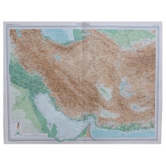
Large Original Vintage Map of Persia / Iran, circa 1920
Located in St Annes, Lancashire
Great maps of Persia. Unframed. Original color. By John Bartholomew and Co. Edinburgh Geographical Institute. Published, circa 1920. Free shipping.  
Category

Vintage 1920s British Maps

Materials

Paper

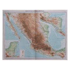
Large Original Vintage Map of Mexico, circa 1920
Located in St Annes, Lancashire
Great maps of Mexico. Unframed. Original color. By John Bartholomew and Co. Edinburgh Geographical Institute. Published, circa 1920. Free shipping.  
Category

Vintage 1920s British Maps

Materials

Paper

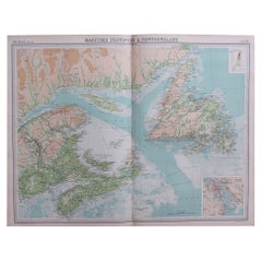
Large Original Vintage Map of the Maritimes, Canada, circa 1920
Located in St Annes, Lancashire
Great map of The Maritime provinces Unframed Original color By John Bartholomew and Co. Edinburgh Geographical Institute Published, circa 1920 Free shipping.  
Category

Vintage 1920s British Maps

Materials

Paper

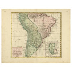
Antique Map of South America by Tirion, c.1765
By Thomas Kitchin
Located in Langweer, NL
Antique map titled 'Kaart van het Onderkoningschap van Peru zig uitstrekkende: over Chile, Paraguay en andere Spaansche Landen als ook van Brazil en verdere Bezittingen van Portugal ...
Category

Antique 18th Century Maps

Materials

Paper

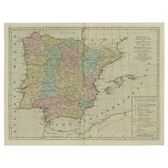
Antique Map of Spain and Portugal by Bowles, c.1780
Located in Langweer, NL
"Antique map titled 'Bowles's New Pocket Map of the Kingdom of Spain and Portugal according to De Lisle'. Large and detailed map of Spain and Portugal. Artists and Engravers: Made by 'Thomas & Carington Bowles' after an anonymous artist. Thomas Bowles, born around 1712, was map publisher and seller in London...
Category

Antique 18th Century Maps

Materials

Paper

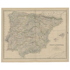
Antique Map of Spain and Portugal, 1882
Located in Langweer, NL
"Antique map titled 'Spain & Portugal'. Old map of Spain and Portugal. This map originates from 'The Royal Atlas of Modern Geography, Exhibiting, in a S...
Category

Antique 19th Century Maps

Materials

Paper

Antique Print of Kedleston Hall by Gandon, c.1770
Located in Langweer, NL
Antique print titled 'Section of the Hall (..)'. Old engraving with a cross section of (most likely) Kedleston Hall. This print originates from 'Vitruvius Britannicus' by Colen Campb...
Category

Antique 18th Century Prints

Materials

Paper

Nice Old Colored Antique Print of Garden Architecture by Van Laar, 1802
Located in Langweer, NL
Untitled print of garden architecture. It shows garden buildings and other garden decor. This print originates from 'Magazijn van tuin-sieraden'. The book is compiled by Gijsbert van...
Category

Antique 19th Century Prints

Materials

Paper

Hand-Colored Antique Print of Garden Gates and Building by Van Laar, 1802
Located in Langweer, NL
Untitled print of garden architecture. It shows garden buildings, gates and garden fences. This print originates from 'Magazijn van tuin-sieraden'. The book is compiled by Gijsbert v...
Category

Antique 19th Century Prints

Materials

Paper

Old Engraving of The Mausoleum of Augustus and its remnants in Rome, Italy
Located in Langweer, NL
Antique print, titled: 'Mausoleum Augusti - Mausoleum Vestigia' - This original old antique print shows the Mausoleum of Augustus and its remnants in Rome, Italy. This original old antique print / plate originates from: 'Beschryving van Oud en Nieuw Rome. Verdeelt in drie Deelen. In 't Fransch beschreven door den Heer Francois Desseine. En in 't Nederduitsch vertaalt.', by Francois Desseine and published by Francois Halma in 1704, first published in French in 1690. Copies of this work are rarely complete as the maps and engravings are of high quality matching the work of Piranesi. Artists and Engravers: Made by 'J. De Later' after 'Jan Goeree'. Made by J .de Later after Jan Goeree. Jan Goeree (1670-1731) was a Dutch engraver and poet. He was the son of the Middelburg bookseller Willem Goeree. Born in Middelburg, but soon they moved to Amsterdam. Initially he focussed on painting, assumably a student of Gerard de Lairesse. But he is best known for his engraving skills, depicting mosttly emblematic and historic scenes. In 1705 he was commisioned by the Mayor of Amsterdam to design the drawings for the ceiling paintings for the grand hall of the old city hall...
Category

Antique 18th Century Prints

Materials

Paper

Old Antique Print showing a Rostral Column in Rome, Italy, 1704
Located in Langweer, NL
Antique print, titled: 'Basis Columnae Rostratae (?)' - This original old antique print shows a rostral column in Rome, Italy. It is a type of victory column, originating in ancient Greece and Rome where they were erected to commemorate a naval military victory. This original old antique print / plate originates from: 'Beschryving van Oud en Nieuw Rome. Verdeelt in drie Deelen. In 't Fransch beschreven door den Heer Francois Desseine. En in 't Nederduitsch vertaalt.', by Francois Desseine and published by Francois Halma in 1704, first published in French in 1690. Copies of this work are rarely complete as the maps and engravings are of high quality matching the work of Piranesi. Artists and Engravers: Made by 'P. Sluiter' after 'Jan Goeree'. Made by P. Sluiter after Jan Goeree. Jan Goeree (1670-1731) was a Dutch engraver and poet. He was the son of the Middelburg bookseller Willem Goeree. Born in Middelburg, but soon they moved to Amsterdam. Initially he focussed on painting, assumably a student of Gerard de Lairesse. But he is best known for his engraving skills, depicting mosttly emblematic and historic scenes. In 1705 he was commisioned by the Mayor of Amsterdam to design the drawings for the ceiling paintings for the grand hall of the old city hall...
Category

Antique 18th Century Prints

Materials

Paper

Antique Map of Spain and Portugal by Migeon, 1880
Located in Langweer, NL
Antique map titled 'Espagne et Portugal'. Old map of Spain and Portugal with a decorative vignette with a view of Alhambra. This map originates from 'Géographie Universelle Atlas-Mig...
Category

Antique 19th Century Maps

Materials

Paper

Antique Print of the Holy Sepulchre at Heckington, England, 1795
Located in Langweer, NL
Antique print titled 'The Holy Sepulchre at Heckington, in the county of Lincoln'. Antique print depicting the Holy Sepulchre at Heckington. Artists and...
Category

Antique 18th Century Prints

Materials

Paper

Traditional Swiss Vintage Metal Stamped Commemorative Jug, circa 1970
Located in Barcelona, Barcelona
Vintage metal commemorative metal jug. By unknown manufacturer, made in Switzerland circa 1970. In original condition, with minor wear consistent with ...
Category

Vintage 1970s Swiss Rustic Historical Memorabilia

Materials

Metal

Large Vintage Maps of the United States, in 3 Sections, 1920
Located in St Annes, Lancashire
Great maps of the USA in 3 sections Unframed Original color By John Bartholomew and Co. Edinburgh Geographical Institute Published, circa 1920 The measurements given is for just...
Category

Vintage 1920s British Maps

Materials

Paper

Large Original Vintage Map of Quebec & Ontario, Canada, circa 1920
Located in St Annes, Lancashire
Great map of Quebec and Ontario. Unframed Original color By John Bartholomew and Co. Edinburgh Geographical Institute Published, circa 1920 ...
Category

Vintage 1920s British Maps

Materials

Paper

Large Original Vintage Map of Manitoba, Canada, circa 1920
Located in St Annes, Lancashire
Great map of Manitoba and part of Ontario Unframed Original color By John Bartholomew and Co. Edinburgh Geographical Institute Published, circa 1920 Free shipping.    
Category

Vintage 1920s British Maps

Materials

Paper

Large Original Vintage Map of the Great Lakes, Canada, circa 1920
Located in St Annes, Lancashire
Great map of The Great Lakes. Unframed. Original color. By John Bartholomew and Co. Edinburgh Geographical Institute Published, circa 1920 ...
Category

Vintage 1920s British Maps

Materials

Paper

Large Original Vintage Map of Alberta & Saskatchewan, Canada, C.1920
Located in St Annes, Lancashire
Great maps of Alberta and Saskatchewan Unframed Original color By John Bartholomew and Co. Edinburgh Geographical Institute Published, circa 1920 Free shipping.  
Category

Vintage 1920s British Maps

Materials

Paper

Large Original Vintage Map of British Columbia, Canada, circa 1920
Located in St Annes, Lancashire
Great map of British Columbia Unframed Original color By John Bartholomew and Co. Edinburgh Geographical Institute Published, circa 1920 ...
Category

Vintage 1920s British Maps

Materials

Paper

Large Original Vintage Map of Western Canada, circa 1920
Located in St Annes, Lancashire
Great map of Western Canada Unframed Original color By John Bartholomew and Co. Edinburgh Geographical Institute Published, circa 1920 Fr...
Category

Vintage 1920s British Maps

Materials

Paper

Original Antique Hand-coloured Fish Print of the Whiting, Merling & Saithe, 1842
Located in Langweer, NL
Antique print, titled: 'Poissons Plate 6 - Le Merlan Commun (Gadus merlangus) - Le Gade Verdatre (Gadus virens).' This rare plate shows the Merlangius merlangus, commonly known a...
Category

Antique 1840s Prints

Materials

Paper

Large Original Antique Map of the Dutchy of Holstein, Germany, ca.1840
Located in Langweer, NL
Antique map titled 'A Map of the Dutchy of Holstein, with the Territories of the Imperial Towns Hamburg & Lubek, Also The Bishoprick of Eutin, Laid down from Fischer's Map (..)'. Sca...
Category

Antique 1840s Maps

Materials

Paper

Map of Choromandel & Malabar, Incl Kerala, Tamil Nadu & Part of Sri Lanka, 1726
Located in Langweer, NL
Antique map titled 'Nieuwe kaart van Choromandel ende Malabar.' Original antique map of Southern India documenting the VOC's areas of influence. Included is Kerala, Tamil Nadu...
Category

Antique 1720s Maps

Materials

Paper

Original Rare Antique Map of the Ancient German Empire in Northern Europe, c1650
Located in Langweer, NL
Antique map titled 'Germaniae Veteris typus.' Map of the ancient German Empire in Northern Europe, based upon an earlier map by Ortelius. Extends fr...
Category

Antique 1650s Maps

Materials

Paper

Original Antique Print of the Port of Calais, France, ca.1860
Located in Langweer, NL
Antique print titled 'Calais Entrée du Port'. Original antique print of the port of Calais, France. This print originates from 'France en miniature'. Published circa 1860. Art...
Category

Antique 1860s Prints

Materials

Paper

Map of the Shire of Westergo in the Province of Friesland, the Netherlands, 1664
Located in Langweer, NL
Antique map titled 'Westergoa Olim Westrachia.' Map of the shire of Westergo in the province of Friesland in the Netherlands, including Stavoren, Bolswar...
Category

Antique 1660s Maps

Materials

Paper

Old Architectural Engraving of a Window of Palazzo Chigi, Rome, ca.1710
Located in Langweer, NL
Antique print titled 'Altra Finestra del secondo piano (..)'. Old print of a second floor window of Palazzo Chigi, Rome. This print originates from 'Studio d'architettura civile ...
Category

Antique 1710s Prints

Materials

Paper

Antique Decorative County Map of Huntingdonshire, England, 1804
Located in Langweer, NL
Antique county map of Huntingdonshire first published c.1800. Cities illustrated include Kimbolton, Chesterton, Folkesworth, and Great Stewkeley. Charles Smith was a cartographer ...
Category

Antique Early 1800s Maps

Materials

Paper

Original Hand-Colored Antique County Map of Durham, England, 1804
Located in Langweer, NL
Antique county map of Durham first published c.1800. Villages, towns, and cities illustrated include Gateshead, South Shields, and Darlington. C...
Category

Antique Early 1800s Maps

Materials

Paper

Antique Print of Althorp, Previous Home of Lady Diana Spencer in England, 1725
Located in Langweer, NL
Antique print titled 'Althrop in Northamptonshire (..)'. Old engraving of Althorp, Northamptonshire. Althorp is a Grade I listed stately home and estate in the civil parish of Althorp, in West Northamptonshire, England of about 13,000 acres (5,300 ha). By road it is about 6 miles (9.7 km) northwest of the county town of Northampton and about 75 miles (121 km) northwest of central London, situated between the villages of Great Brington and Harlestone. It has been held by the prominent aristocratic Spencer family for more than 500 years, and has been owned by Charles Spencer, 9th Earl Spencer since 1992. It was also the home of Lady Diana Spencer...
Category

Antique 18th Century Architectural Models

Materials

Paper

Hand-Colored Print of Folkestone 'United Kingdom' as Seen from the East, 1822
Located in Langweer, NL
Antique print titled 'Folkestone'. This print depicts the town of Folkestone (United Kingdom) as seen from the East, the viewpoint high on the cliffs above the Warren, with cattl...
Category

Antique 1820s Prints

Materials

Paper

Original Detailed Antique Map of Southern India and Most of Ceylon, 1744
Located in Langweer, NL
Antique map titled 'A Map of India on the west Side of the Ganges, comprehending the coasts of Malabar, Coromandel and the Island Ceylon'. Map of Southern India and most of Ceylo...
Category

Antique 1740s Maps

Materials

Paper

China Pair Hand Carved "Long Swords" with Custom Presentation Case
Located in South Burlington, VT
An opportunity to acquire a handsomely cased duo (2) of monumental hand carved stone swords or sabers from China. These are no ordinary swords. These unusual swords were probably int...
Category

20th Century Chinese Sculptures and Carvings

Materials

Limestone

Antique Print of the Royal Palace of Naples in Italy, c.1760
Located in Langweer, NL
Antique print titled 'Amplissimas Aedes quas Pro Regio (..)'. Old engraving of the Royal Palace of Naples, Italy. It was one of the four residences near Naples used by the House of...
Category

Antique 18th Century Prints

Materials

Paper

Rare Hand-Colored Antique Map of Tartary, China and Korea, ca.1741
Located in Langweer, NL
Antique map titled 'A General Map of Eastern and Western Tatary, commonly call'd Tartary; drawn from the Particular Maps of the Jesuit Missionaries'. Rare antique map of Tartary, C...
Category

Antique 1740s Maps

Materials

Paper

Antique Engraving of Dutch and German North Sea Coast of Friesland, ca.1680
Located in Langweer, NL
Antique map titled 'Tabula Nova In qua accuratè demonstratur tota Navigatio ab Amstelodami Statione per Vada vulgo de Watten Hamburgum usq.' - Two maps with the Dutch and German North Sea coast of Friesland, with West Frisian Islands and below East Frisian Islands with inset map of the Elbe around Hamburg. With title and a scale cartouche. Map by Henricus Hondius...
Category

Antique 1680s Maps

Materials

Paper

Beautiful Map of the Region Naters and Pancrasgors, The Netherlands, ca.1697
Located in Langweer, NL
Antique map titled ‘Caarte der Heerlyckheyt van Naters ende Pancras Gors’. Beautiful map of the region Naters and Pancrasgors, The Netherlands. This map originates from ‘Caert-boec...
Category

Antique 1690s Maps

Materials

Paper

Old Map of Indonesian Islands Borneo, Celebes, New Guinea & New Britain, 1792
Located in Langweer, NL
Antique map titled 'Partie de la Nouvelle Grande Carte des Indes Orientales, contenant les Isles de Borneo, Iava, Celebes, Mindanao (..)'. Detailed map of the Indonesian islands Bo...
Category

Antique 1790s Maps

Materials

Paper

Original Antique Sea Chart of the Coastline from England to Gibraltar, ca.1700
Located in Langweer, NL
Antique map titled 'A Chart of the Sea-Coast from England to the Streights.' Original antique map showing the European coastline from the South of England (and North of France) to ...
Category

Antique Early 1700s Maps

Materials

Paper

Map of the Hawaiian Islands with a Large Inset of Karakakooa Bay, 1803
Located in Langweer, NL
Antique map titled 'Kaart van de Sandwich Eilanden'. Map of the Hawaiian Islands with a large inset of Karakakooa Bay, including soundings and anchorages. Originates from 'Reizen R...
Category

Antique Early 1800s Maps

Materials

Paper

Map of East Frisian Islands & Northwestern Tip of Germany, Ostfriesland, c.1595
Located in Langweer, NL
Antique map titled 'Frisia Orientalis'. Beautiful map of east Frisian islands and the northwestern tip of Germany, Ostfriesland. With people in local costumes. Ornamented inset of the Eems estuary. Based on a manuscript map...
Category

Antique 16th Century Maps

Materials

Paper

Beautiful Antique Map of the Province of Noord-Holland, the Netherlands, Ca.1730
Located in Langweer, NL
Antique map titled 'Kennemaria et Westfrisia vulgo et vernaculé Noord-Holland'. Beautiful original antique map of the province of Noord-Holland, the Netherlands. Two large elaborat...
Category

Antique 1730s Maps

Materials

Paper

Old Copper Engraving of the Port City Dabhol in India, 1757
Located in Langweer, NL
Antique print titled 'Dabul'. Old print of the port city Dabhol in India. In the 15th and 16th centuries, Dabul was an opulent Muslim trade center. Around 1660 it was annexed to th...
Category

Antique 1750s Maps

Materials

Paper

Old Map of the Pacific, Incl Australia, Polynesia, Melanesia and Malaysia, 1872
Located in Langweer, NL
Antique map Oceania titled 'Map of Oceanica exhibiting its various divisions, island groups & c'. Map of the Pacific, including Australia, Polynes...
Category

Antique 1870s Maps

Materials

Paper

Old Hand-Colored Print with a View of Marseille, France, ca.1885
Located in Langweer, NL
Antique print titled 'Marseille aus der Vogelschau'. Old print with a view of Marseille, France. This print originates from a German illustrated newsletter, published circa 1885. ...
Category

Antique 1850s Maps

Materials

Paper

Print of Maps of Islands of the South Pacific, Incl. Pitcairn & Dusky Bay, 1788
Located in Langweer, NL
Antique map titled 'Esquisse de la Bay Dusky, Dans La Nouvelle Zeelande / I. Pitcairn / Isles de Wallis / I Turtle / I des Cocos and Traitres / Palmerston I. / I. Suavage / I. D'Hervey/ Havre Pickersgill / I de Pasques.' Detailed set of maps of the islands of the South Pacific...
Category

Antique 1780s Maps

Materials

Paper

Map of the Ottoman Empire in Europe, incl. the Balkans, Greece & Turkey, c.1760
Located in Langweer, NL
Antique map Turkey titled 'An Accurate Map of Turky in Europe drawn from the best Authorities'. Map of the Ottoman Empire in Europe, the Balkans, Greece, and Turkey in Europe. Engr...
Category

Antique 1760s Maps

Materials

Paper

Nice Decorative Hand-Colored Antique Map of Italy, ca.1745
Located in Langweer, NL
Antique map Italy titled 'A New Map of Italy from the lastest observations'. Antique map of Italy originating from 'Geography Anatomiz'd: or, The G...
Category

Antique 1740s Maps

Materials

Paper

Authentic Map of the Coast from Cape Formosa to the Dony River, Africa, 1732
Located in Langweer, NL
Antique map titled 'The New Correct Mapp of Calbar River vulgarly call'd Calabar (..)'. An interesting map of the coast from Cape Formosa to the Dony River stated on the map to be ...
Category

Antique 1730s Maps

Materials

Paper

The New Bridge and Arsenal of Kingston, Hull, Yorkshire, Great Britain, ca.1770
Located in Langweer, NL
Antique print, titled: 'Vue de l'Est du Pont et Nouvel-Arsenal de Kingiston sur l'Hull.' - View of the New Bridge and arsenal of Kingston, Hull, Yorkshire, Great Britain. This is an ...
Category

Antique 1770s Prints

Materials

Paper

Antique Map of the Holy Land Described in the Old and New Testament, ca.1660
Located in Langweer, NL
Antique map titled 'Geographiae Sacrae ex Veteri et Novo Testamento Desumptae Tabula Prima quae Totius Orbis Partes Continet.' Map of the lands described in the Old and New Testame...
Category

Antique 1660s Maps

Materials

Paper

Rare Copper Engraving of Female with Five Breasts Lactating onto Others, 1686
Located in Langweer, NL
Antique print titled 'Painting'. Rare antique print showing painters and various figures including: a female figure holding palette and brushes in centre, with another female figur...
Category

Antique 1680s Religious Items

Materials

Paper

Detailed Antique Map of Southeast England, incl Warwickshire and Hampshire, 1690
Located in Langweer, NL
Antique map titled 'Orientalior districtus Regni Angliae (..)'. Detailed map of southeast England encompassing the country from Lincolnshire and the Wash south and including Warw...
Category

Antique 1690s Maps

Materials

Paper

Original Antique Engraving of a Sea Chart of the Western Mediterranean, ca.1650
Located in Langweer, NL
Antique map titled 'Pascaerte van 't westlyckste deel vande Middelandsche-Zee (..)'. Sea chart of the Western Mediterranean. The map extends from the Straits of Gibralter to Italy ...
Category

Antique 1650s Maps

Materials

Paper

Antique Original Engraving of Chinese Vessels in the 18th Century, 1765
Located in Langweer, NL
Description: Plate no.34: 'Vaisseaux chinois.' (Chinese vessels.) This original auhentic plate originates from: 'Reize rondom de werreld, Gedaan in de jaaren 1740 tot 1744, door den ...
Category

Antique 1760s Prints

Materials

Paper

Antique Map of Groningen, the Netherlands, 1771
Located in Langweer, NL
Antique map titled 'De Synode van Stad en Landen in VII Klassen verdeeld (..)'. Map of the province of Groningen, the Netherlands. This map originates from 'Nieuwe kerkelyke geogra...
Category

Antique 18th Century Maps

Materials

Paper

Antique Map of Hungary Incl Surroundings like Croatia, Bosnia, Servia, 1730
Located in Langweer, NL
Antique map titled 'Nieuwe Kaart van t Koninkryk Hongaryen en Zevenbergen na de laatste ontdekkingen'. This map depicts Hungary including surroundings like Croatia, Bosnia, Servia,...
Category

Antique 18th Century Maps

Materials

Paper

Read More

Pamela Shamshiri Shares the Secrets behind Her First-Ever Book and Its Effortlessly Cool Interiors

The sought-after designer worked with the team at Hoffman Creative to produce a monograph that beautifully showcases some of Studio Shamshiri's most inspiring projects.

Moroccan Artworks and Objects Take Center Stage in an Extraordinary Villa in Tangier

Italian writer and collector Umberto Pasti opens the doors to his remarkable cave of wonders in North Africa.

Montecito Has Drawn Royalty and Celebrities, and These Homes Are Proof of Its Allure

Hollywood A-listers, ex-pat aristocrats and art collectors and style setters of all stripes appreciate the allure of the coastal California hamlet — much on our minds after recent winter floods.

Whaam! Blam! Pow! — a New Book on Pop Art Packs a Punch

Publishing house Assouline and writer Julie Belcove have teamed up to trace the history of the genre, from Roy Lichtenstein, Andy Warhol and Yayoi Kusama to Mickalene Thomas and Jeff Koons.

The Sparkling Legacy of Tiffany & Co. Explained, One Jewel at a Time

A gorgeous new book celebrates — and memorializes — the iconic jeweler’s rich heritage.

What Makes a Gem-Encrusted Chess Set Worth $4 Million?

The world’s most opulent chess set, weighing in at 513 carats, is literally fit for a king and queen.

Tauba Auerbach’s Geometric Pop-Up Book Is Mighty Rare, Thanks to a Hurricane

This sculptural art book has an epic backstory of its own.

Step inside the Storied Mansions of Palm Beach’s Most Effervescent Architect

From Spanish-style courtyards to fanciful fountains, these acclaimed structures abound in surprising and elegant details.
Recently Viewed

View All