Maps
to
4,120
5,612
210
5,827
3
84
36
18
14
9
7
5
4
4
3
1
1
2,975
2,368
484
3
308
34
13
123
12
37
9
2
5
4
3
5
1
5,743
127
63
37
32
1,080
395
268
253
229
5,830
5,830
5,830
104
58
29
21
15
Maps For Sale
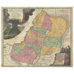
Hand-Colored Map of the Holy Land Divided Among the Twelve Tribes, c.1720
Located in Langweer, NL
Hand-Colored Map of the Holy Land Divided Among the Twelve Tribes, c.1720
This striking antique map, titled "Iudaea seu Palaestina ob Sacratissima Redemtoris Vestigia Hodie Dicta Te...
Category
Early 18th Century European Antique Maps
Materials
Paper
Antique Map of Northern Palestine with The Tribes of Israel. Dutch, 1763
Located in Langweer, NL
Antique Map of Northern Palestine with Tribal Divisions, Bachiene, 1763
The cartouche bears the title: “’t Noordelyke Gedeelte van het Geheel Palestina Benevens het Noordelyk en Zui...
Category
18th Century Dutch Antique Maps
Materials
Paper
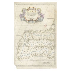
Original Antique Map of the Route of M. Zurabek – Caspian Sea to Isfahan, 1722
Located in Langweer, NL
Original Antique Map of the Route of M. Zurabek – Caspian Sea to Isfahan, 1722
This 18th-century copperplate map, titled Carte de la Route de M. Zurabek, Ambassadeur du Roi de Polog...
Category
Early 18th Century French Antique Maps
Materials
Paper
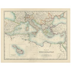
Antique Map of the Mediterranean Basin, 1903, with Detailed Coastal and Inland
Located in Langweer, NL
Title: Antique Map of the Mediterranean Basin, 1903, with Detailed Coastal and Inland Geography
Description: This antique map, titled "Basin of the Mediterranean," was engraved and ...
Category
Early 20th Century Maps
Materials
Paper
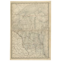
Antique Map of Wisconsin – The Badger State with Railroads & Counties, 1888
Located in Langweer, NL
Antique Map of Wisconsin – The Badger State with Railroads & Counties, 1888
This antique engraved map of Wisconsin, published in 1888 by Rand, McNally & Co. in Chicago for their Imp...
Category
Late 19th Century American Antique Maps
Materials
Paper
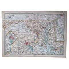
Original Antique Map of the American State of Maryland & Delaware, 1903
Located in St Annes, Lancashire
Antique map of Maryland And Delaware
Published By A & C Black. 1903
Original colour
Good condition
Unframed.
Free shipping
Category
Early 1900s English Antique Maps
Materials
Paper
Antique Map of Alexander the Great's Empire & Campaigns, de Vaugondy, 1753
Located in Langweer, NL
Antique Map of Alexander the Great's Empire & Campaigns, de Vaugondy, 1753
This rare and elegantly engraved map, titled "Antiquor Imperiorum Tabula, in qua Prae Caeteris, Macedonicu...
Category
Mid-18th Century European Antique Maps
Materials
Paper
1709 Map of the Holy Land - Twelve Tribes of Israel, Hand-Colored, Antique Map
Located in Langweer, NL
This is a beautiful 1709 map of the Holy Land, titled "Iudaea seu Terra Sancta quae Hebraeorum sive Israelitarum in suas duodecim Tribus divisa," by Guillaume Sanson and Alexis Huber...
Category
Early 1700s French Antique Maps
Materials
Paper
$1,572 Sale Price
20% Off
Original Antique Map of the American State of North Carolina, 1903
Located in St Annes, Lancashire
Antique map of North Carolina
Published By A & C Black. 1903
Original colour
Good condition
Unframed.
Free shipping
Category
Early 1900s English Antique Maps
Materials
Paper
Constantinople (Istanbul) – City View by Werner and Gläser, Augsburg ca.1730
Located in Langweer, NL
Constantinople (Istanbul) – Panoramic City View by Werner and Gläser, Augsburg c.1730
This striking hand-colored copper engraving offers a grand panoramic view of Constantinople (mo...
Category
Early 18th Century German Antique Maps
Materials
Paper
One of the most influential maps of America ever made, 17th Century Willem Blaeu
By Willem Blaeu
Located in ZWIJNDRECHT, NL
A rare and important 17th Century Italian Engraving of Willem Blaeu's Great Wall Map of America, "America quarta pars orbis quam plerunq, nuvum orbem apellitant primo detecta est ann...
Category
17th Century Dutch Dutch Colonial Antique Maps
Materials
Paper, Linen
Antique Map of Syria, Mount Lebanon and Palestine – circa 1760
Located in Langweer, NL
Map of Syria and Mount Lebanon – “Carte de la Syrie”, c.1760
This finely engraved 18th-century map, titled Carte de la Syrie nouvellement corrigée, presents the region of Syria and ...
Category
Mid-18th Century French Antique Maps
Materials
Paper
1720 Weigel Engraving of Jerusalem: A Biblical View from Josephus' Perspective
Located in Langweer, NL
1720 Weigel Map of Jerusalem Based on Josephus' Writings
This intricate 1720 bird's-eye view map of ancient Jerusalem by I.H. Coccejo, engraved by Christoph Weigel, offers a fasc...
Category
1720s Antique Maps
Materials
Paper
Antique Map of Rhodesia & British Central Africa – Published by Philip, 1895
Located in Langweer, NL
Antique Map of Rhodesia & British Central Africa – Published by George Philip & Son, 1895
This detailed antique map titled "Rhodesia & British Central Africa" was published in 1895 ...
Category
Late 17th Century English Antique Maps
Materials
Paper
Rare Antique Wall-Map of North America: French and Indian War Boundaries, 1793
Located in Langweer, NL
Rare 1793 Map of North America: French and Indian War Boundaries and Historical Notes
This remarkable engraved map of North America, printed in 1793 by Emanuel Bowen and John Gibs...
Category
1790s Antique Maps
Materials
Paper
$5,843 Sale Price
25% Off
Antique Map of the Northeastern United States and Canada by Tardieu, 1802
Located in Langweer, NL
This antique map titled "Carte de la Partie Septentrionale des Etats Unis," created by Pierre Antoine Tardieu, depicts the northeastern part of the United States and parts of Canada....
Category
Early 1800s Antique Maps
Materials
Paper
$539 Sale Price
20% Off
Original Antique Map of the American State of Michigan ( Northern Part ), 1903
Located in St Annes, Lancashire
Antique map of Michigan ( Northern part )
Published By A & C Black. 1903
Original colour
Good condition
Unframed.
Free shipping
Category
Early 1900s English Antique Maps
Materials
Paper
Konstantinopel – Panoramic View of Istanbul by François Halma, 1705
Located in Langweer, NL
Konstantinopel – Panoramic View of Istanbul by François Halma, 1705
This engaging hand-colored engraving of “Konstantinopel” offers a sweeping panoramic view of 18th-century Istanbu...
Category
Early 18th Century Dutch Antique Maps
Materials
Paper
Original Antique Map of the American State of Texas ( Eastern Part ), 1903
Located in St Annes, Lancashire
Antique map of Texas ( Eastern part )
Published By A & C Black. 1903
Original colour
Good condition
Unframed.
Free shipping
Category
Early 1900s English Antique Maps
Materials
Paper
Very Attractive Antique Map of the World as Planisphere, Shows Cook's Voyages
Located in Langweer, NL
Antique map titled 'Chart of the World, according to Mercators Projection'. This world map shows the various discoveries of Captain James Cook during his 3 voyages between 1768 and 1780, and the English and French Explorers who followed immediately thereafter, including Vancouver and La Perouse. This edition of the map is significantly revised from the editions issued immediately after the official report of Cook's Voyages were integrated into the map, showing better detail in New Zealand, Australia, the Northwest Coast of America and North East coast of Asia, along with Greenland. A new large lake also appears for the first time in the Western part of North America, shortly before the commencement of the Lewis...
Category
Late 18th Century Antique Maps
Materials
Paper
$1,348 Sale Price
25% Off
Ancient World Map of Europe, Asia & Northern Africa with Ancient Names, 1725
Located in Langweer, NL
Antique map titled 'Geografische Kaarte van de Oude Weereld (..).'
Original antique map of the ancient world depicting Europe, Asia, and northern Africa with ancient place names....
Category
1720s French Antique Maps
Materials
Paper
$1,198 Sale Price
20% Off
Dresden Germany, Old Town Plan by Baldwin & Cradock 1833
Located in Langweer, NL
Dresden, depicted in this antique map by Baldwin & Cradock from 1833, was a historically significant city in Saxony, Germany. This map, published under the supervision of the Society...
Category
1830s Antique Maps
Materials
Paper
Unusual Benedictine Map of Italy, Showing Various States of the Church, C.1745
Located in Langweer, NL
Antique map titled 'Italia Benedictina Delineata A.P.R.C.P.W.' Unusual Benedictine map of Italy, showing the various states of the church, with an elaborate cartouche. Part of a seri...
Category
18th Century Antique Maps
Materials
Paper
$1,444 Sale Price
20% Off
1573 Ortelius Map: First to Name California, Spanning Tartary to North America
Located in Langweer, NL
"1573 Abraham Ortelius Map of Tartary, Japan, and Western North America"
Description of the Map:
This is an outstanding example of Abraham Ortelius' map titled "Tartariae Sive Magn...
Category
16th Century Antique Maps
Materials
Paper
$2,310 Sale Price
20% Off
Antique Map of California, Utah, Nevada, Colorado, New Mexico & Arizona '1872'
Located in Langweer, NL
Antique map titled 'Johnson's California (..)'. Original map of California, Utah, Nevada, Colorado, New Mexico and Arizona. This map originates from ...
Category
Late 19th Century Antique Maps
Materials
Paper
$239 Sale Price
20% Off
Rare 1572 Map of Ancient Rome with Monuments by Ligorio, Braun & Hogenberg
Located in Langweer, NL
Rare 1572 Map of Ancient Rome with Monuments by Ligorio, Braun & Hogenberg
This remarkable 16th-century map, *Urbis Romae Situs cum ils quae adhuc Conspiciuntur Veter. Monumet Rel...
Category
16th Century German Antique Maps
Materials
Paper
Original Antique Map of Ancient Greece, Achaia, Corinth, 1786
Located in St Annes, Lancashire
Great map of Ancient Greece. Showing the region of Thessaly, including Mount Olympus
Drawn by J.D. Barbie Du Bocage
Copper plate engraving by P.F Tardieu
Original hand color...
Category
1780s French Other Antique Maps
Materials
Paper
New York State Antique Map c.1888 – The Empire State, Railroads & Counties
Located in Langweer, NL
Antique Map of New York State – Rand McNally, circa 1888
This antique map of New York State was published by Rand, McNally & Co. around 1888. Unlike the sectional plates, this gener...
Category
Late 19th Century American Antique Maps
Materials
Paper
Large Original Antique Map of North Carolina, USA, 1894
Located in St Annes, Lancashire
Fabulous map of North Carolina
Original color
By Rand, McNally & Co.
Published, 1894
Unframed
Free shipping.
Category
1890s American Antique Maps
Materials
Paper
Finely Engraved Historical Map of Middle East and Asia, c.1745
Located in Langweer, NL
Description: Antique map titled'Theatrum Historicum pars Orientalis.'
Finely engraved historical map with a profusion of details. It shows the Middle East and Asia. Decorative ti...
Category
1740s Antique Maps
Materials
Paper
$1,390 Sale Price
20% Off
An Ornate and Historical Tallis Map of Jamaica with Decorative Vignettes, 1851
Located in Langweer, NL
This original antique map of Jamaica is part of the renowned series created by the Tallis Company, known for their detailed and decorative maps ...
Category
1850s English Antique Maps
Materials
Paper
Antique Map of Epirus 'Albania, Greece' by J. Janssonius, circa 1650
Located in Langweer, NL
This map covers the northwestern coast of Greece and part of present-day Albania. The map was drawn by Johannes Wilhelm Laurenberg, a mathematician and historian who produced several...
Category
Mid-17th Century Antique Maps
Materials
Paper
Original Map of the East Indies Including Sumatra, Java, Borneo & Malaysia, 1755
Located in Langweer, NL
TitlEast Indies map – Java, Sumatra, Borneo & Malay Peninsula, c.1755
Attractive 18th-century map of the East Indies centered on Borneo and the Malay world, showing Sumatra, Java, t...
Category
1750s Dutch Antique Maps
Materials
Paper
Large Original Antique Map of the World, Fullarton, circa 1870
Located in St Annes, Lancashire
Great map of the World.
From the celebrated Royal Illustrated Atlas
Lithograph. Original color.
Published by Fullarton, Edinburgh, circa 1870.
Unframed.
Category
1870s Scottish Antique Maps
Materials
Paper
Antique Map of Italy, Showing Corsica, Sardinia, Croatia, Malta and More, C.1740
Located in Langweer, NL
Antique map titled 'Nieuwe Kaart van Italie na de Nieuwste waarnemingen van de l'Isle en andere.'
Attractive detailed map showing Italy as well as Corsica, Sardinia, Minorca, Croat...
Category
18th Century Antique Maps
Materials
Paper
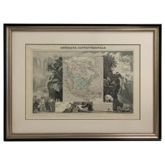
Small Map of the United States, circa 1870
Located in Langweer, NL
Antique map titled 'Amérique septe. Physique'. Small map of the United States. lithographed by C. Callewaert brothers in Brussels circa 1870.
Category
Mid-19th Century Belgian Antique Maps
Materials
Paper
Antique Map of Southern Sweden by Covens & Mortier, 'circa 1720'
Located in Langweer, NL
Antique map titled 'Regni Gothiae (..)'. Detailed map of South Sweden. Embellished with beautiful title cartouche with scale and coats of arms. Published in Amsterdam by Covens & Mor...
Category
Early 18th Century Dutch Antique Maps
Materials
Paper
Antique Map of the United States by Titus '1871'
Located in Langweer, NL
Antique map titled 'The United States of America'. Original antique map of the United States. This map originates from 'Atlas of Prebl...
Category
Late 19th Century Antique Maps
Materials
Paper
$767 Sale Price
20% Off
Large Original Antique Map of Massachusetts, USA, circa 1900
Located in St Annes, Lancashire
Fabulous map of Massachusetts
In 2 sheets. They can be joined but I have not done it
Original color
Engraved and printed by the George F. Cram ...
Category
1890s American Antique Maps
Materials
Paper
Greece and Ottoman Balkans Map – Homann Engraving ca. 1720
Located in Langweer, NL
Greece and the Danube Basin Map c.1720 – Antique Engraving of the Balkans
This remarkable early 18th-century map presents a sweeping view of southeastern Europe, centering on the co...
Category
18th Century German Antique Maps
Materials
Paper
Antique Celestial Charts of the Northern and Southern Hemispheres, 1884
Located in Langweer, NL
Antique Celestial Charts of the Northern and Southern Hemispheres, 1884
This finely engraved double celestial chart comes from the New and Revised Edition of Black’s General Atlas o...
Category
1880s Scottish Antique Maps
Materials
Paper
Antique 1743 Map – Travels of Jesus Christ & Apostles by Seutter
Located in Langweer, NL
Antique 1743 Map – Travels of Jesus Christ & Apostles by Seutter
This is an original antique map titled “Carte des Voyages de Notre Seigneur Jesus-Christ et des Actes des Apotres St...
Category
Mid-18th Century German Antique Maps
Materials
Paper
$1,620 Sale Price
20% Off
Rare Antique Map of the Americas with Island California by Danckerts, c.1680
Located in Langweer, NL
Rare Antique Map of the Americas with Island California by Justus Danckerts, ca. 1696
This exceptional antique map titled Novissima et Accuratissima Totius Americae Descriptio per I...
Category
Late 17th Century Dutch Antique Maps
Materials
Paper
$3,369 Sale Price
20% Off
Antique 19th Century Map of Ancient Syria & Assyria - Historical Regions, c.1802
Located in Langweer, NL
19th Century Map of Ancient Syria and Assyria: 'Tabula Regiones inter Syriam et Assyriam continens'"*
This beautifully detailed 18th-century map, titled...
Category
Early 1800s Antique Maps
Materials
Paper
$298 Sale Price
20% Off
Antique Dinosaur Chromolithographs – Jurassic & Cretaceous Landscapes, c.1880
Located in Langweer, NL
Antique Dinosaur Chromolithographs – Jurassic & Cretaceous Landscapes, c.1880
These two large-format chromolithographs present spectacular reconstructions of prehistoric life in Eur...
Category
Late 19th Century German Antique Maps
Materials
Paper
Antique Map of the Northern Hemisphere and North Pole by Tirion, circa 1754
Located in Langweer, NL
Antique map titled 'Nieuwe Kaart van de Noord Pool na de alderlaatste ondekking int licht gebracht'. Map of the Northern Hemisphere and North Pole, which shows the NE Passage, but no...
Category
Mid-18th Century Antique Maps
Materials
Paper
$674 Sale Price
24% Off
Antique Map of France by Janssonius, c.1650
Located in Langweer, NL
Antique map titled 'Gallia Vetus'. Beautiful map of France based on Caesar's De Bello Gallico. In the columns to the left and right important tribes and people are described.
Art...
Category
17th Century Antique Maps
Materials
Paper
$503 Sale Price
20% Off
1711 Star Chart of Southern Sky with Mythical Constellations and Exotic Animals
Located in Langweer, NL
1711 Star Chart of the Southern Sky - "Mappa Stellarum Australium quae in Altitudine Poli Borei Graduum"
This beautiful star chart, engraved by Arnold van Westerhout in 1711, shows ...
Category
1710s Belgian Antique Maps
Materials
Paper
$1,626 Sale Price
20% Off
Antique Map of Germany, Netherlands, Belgium & Switzerland – Stülpnagel, 1857
Located in Langweer, NL
Antique Map of Germany, Netherlands, Belgium & Switzerland – Stülpnagel, 1857
Fine mid-19th century map of Central Europe titled "Deutschland, Niederlande, Belgien, Schweiz", drawn ...
Category
Mid-19th Century German Antique Maps
Materials
Paper
1888 California Map – The Golden State’s Railroads, Cities & Counties
Located in Langweer, NL
Antique Map of California – Railroads, Cities & Counties, 1888
This antique engraved map shows California in 1888, at a time of enormous growth and transformation. Published by Rand...
Category
Late 19th Century American Antique Maps
Materials
Paper
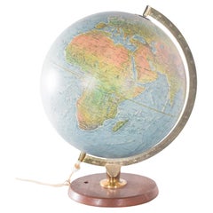
Floor Model Light Up Globe by Replogle Ca. 1950/1960's
Located in New York, NY
Exceptional light up floor model globe, by Replogle Globes Inc. The globe is 16 in. in diameter, it features an interior light, and restrain a solid mahogany frame. This example is i...
Category
Mid-20th Century American Mid-Century Modern Maps
Materials
Glass, Mahogany, Paper
Large Antique Set Ottoman Empire Maps – Europe & Asia in Striking Detail, 1868
Located in Langweer, NL
Antique Maps of the Ottoman Empire – Europe and Asia by Andriveau-Goujon, circa 1865
This finely engraved and hand-colored two-sheet map of the Ottoman Empire was published in Paris...
Category
Mid-19th Century French Antique Maps
Materials
Paper
Zevenwolden, Friesland – von Reilly antique map, 1791
Located in Langweer, NL
Title: Zevenwolden, Friesland – von Reilly antique map, 1791
Fine late-18th-century engraved map of the region of Zevenwolden in Friesland, the Netherlands. Published in 1791 for Fr...
Category
18th Century Austrian Antique Maps
Materials
Paper
Antique Map of Eastern Hemisphere from the collection of Thierry Despont
Located in New York, NY
Designed by Enrico Bonetti (E. Bonatti) and published by Francesco Vallardi Editore. Based on an earlier map by Evangelista Azzi (Ev. Azzi). Labeled as such at bottom edge of map.
T...
Category
Late 19th Century Italian Antique Maps
Materials
Canvas, Wood
Antique Map of North and South America by Pierre Antoine Tardieu (1784-1869)
Located in Langweer, NL
This is an original antique map titled "Carte Générale et Politique de l'Amérique," depicting the political and geographical features of North and South America. This map, created by Pierre Antoine Tardieu, illustrates the continent's boundaries, major regions, and significant features as understood in the early 19th century.
Map Details:
- **Title**: Carte Générale et Politique de l'Amérique
- **Creator**: Pierre Antoine Tardieu (1784-1869)
- **Publication Date**: Early 19th century
- **Dimensions**: Approximately 34.5 x 43.5 cm (13.5 x 17.25 inches)
- **Features**: The map includes detailed representations of North and South America, highlighting political boundaries, major cities, rivers, and mountain ranges. The title cartouche is located in the lower right corner, and the outlines are hand-colored to distinguish different regions and countries.
Condition Overview:
1. Paper Quality: The paper shows typical signs of aging, such as slight yellowing, but remains in good condition without major tears or damage.
2. Edges and Corners: The edges are slightly worn, with minor fraying and small tears, particularly near the center fold. These imperfections do not significantly impact the overall readability or aesthetic value.
3. Center Fold: A center fold is present, which is common for maps of this period that were often folded for storage or publication. The fold appears intact without significant separation or damage, except for a small split at the lower end.
4. Color and Print Quality: The hand-colored outlines remain vibrant and clear, highlighting the borders of different regions. The print quality is excellent, with sharp, legible text and detailed illustrations.
5. Staining and Spots: There are a few spots and stains, particularly near the edges and along the fold. These do not obscure any critical details of the map.
Historical Context
Around the year 1800, the Americas were a region of significant political change and exploration. Here’s an overview of the region during that period:
Political Landscape
1. North America:
- United States: The United States was a young nation, having gained independence from Great Britain in 1776. The early 19th century was a period of westward expansion and the establishment of new states.
- Canada: Canada was divided into British colonies, including Upper Canada (Ontario) and Lower Canada (Quebec). The British maintained control over these territories following the American Revolution.
- Mexico: Mexico was part of the Spanish Empire, known as New Spain. It would gain independence from Spain in 1821.
2. Central and South America:
- Spanish Colonies: Much of Central and South America was under Spanish colonial rule. Significant regions included New Granada (Colombia), Peru, and the Viceroyalty of the Rio de la Plata (Argentina).
- Portuguese Brazil: Brazil was a Portuguese colony and the largest territory in South America. It would gain independence from Portugal in 1822.
- Independence Movements: The early 19th century was marked by independence movements across Latin America, led by figures such as Simón Bolívar and José de San Martín, which resulted in the creation of new nations.
3. Caribbean:
- The Caribbean islands were controlled by various European powers, including Spain, France, Great Britain, and the Netherlands. These islands were significant for their sugar plantations and as hubs of the Atlantic slave trade.
Socio-Economic Conditions
1. Trade and Commerce:
- The Americas were integral to global trade, exporting commodities such as sugar, tobacco, cotton, and coffee. The port cities of Havana, Veracruz, and Buenos Aires were crucial trade...
Category
Early 1800s Antique Maps
Materials
Paper
$498 Sale Price
20% Off
Antique County Map, Shropshire, English, Atlas Engraving, Richard Blome, C.1673
Located in Hele, Devon, GB
This is an antique county map of Shropshire. An English, framed atlas engraving by Richard Blome, dating to the 17th century and later.
A treat for the collector or county native, ...
Category
17th Century British Restauration Antique Maps
Materials
Glass, Wood, Paper
Large Decorative Colonial-Era Map of South India – Peninsula of India, 1800
Located in Langweer, NL
Antique Map of South India – “A Map of the Peninsula of India,” London 1800
This large and detailed antique map titled *A Map of the Peninsula of India* was published in London in 1...
Category
Early 19th Century English Antique Maps
Materials
Linen, Paper
Antique World Map by P. Schenk '1706'
By Peter Schenk
Located in Langweer, NL
Antique map titled 'Diversa Orbis Terrae. Visu Incedente per Coluros Tropicorum, Ambos Ejus Polos, et Parciularis Sphaerae Zenith, in Planum Orthographica Projectio (..) Plat Ontwerp van verscheyde Aert-klooten (..)'. One of the earliest Dutch World Maps to focus on a more modern cartographic style, based on Carel Allard's map of 1696. This map represented a noteworthy shift from the traditional decorative Dutch 17th century maps where the margins would be full of classical mythological...
Category
Early 18th Century Antique Maps
Materials
Paper
$5,198 Sale Price
20% Off
Mediterranean, Black Sea & Ottoman Empire Map 1853
Located in Langweer, NL
Mediterranean, Black Sea & Ottoman Empire Map 1853
This impressive antique print shows the Mediterranean and Black Sea regions with a focus on the Ottoman Empire, titled “Das Mittel...
Category
Mid-19th Century German Antique Maps
Materials
Paper
Old Map of Anatolia, part of modern-day Turkey, Armenia and Syria, 1745
Located in Langweer, NL
Title: "Kaartje van Natolie en Syrie opgesteld door de Hr. Lucas en de Hr. Guil de L'Isle en andere auteuren"
The title "Kaartje van Natolie en Syrie opgesteld door de Hr. Lucas en...
Category
1740s Antique Maps
Materials
Paper
$421 Sale Price
20% Off
Recently Viewed
View AllMore Ways To Browse
Table Vigneron
Tall Wooden Cabinets
Tea Caddy Japan
Tea Clipper
Teak Desk By Kai Kristiansen
Teak Fish
Theodore Alexander Chest
Tigers Eye Sculptures
Tip Top Table
Tole Cabinets
Torring Denmark
Toso Bird
Trapezoid Cabinet
Tree Trunk Sculptures
Tulip Vase Silver
Unusual Dresser
Used 2 Drawer Wood File Cabinet
Used Communion Set
