Maps Of Australia
to
79
142
49
95
85
48
36
33
19
16
16
14
12
9
8
8
7
5
4
4
4
4
4
4
3
3
3
3
3
2
2
2
2
2
2
1
1
1
1
1
1
1
1
39
3
2
2
2
Sort By
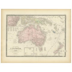
Antique Map of Australia by Levasseur, '1875'
Located in Langweer, NL
Antique map titled 'Carte générale de l'Australie'. Large map of Australia. This map originates
Category
Antique Late 19th Century Maps
Materials
Paper
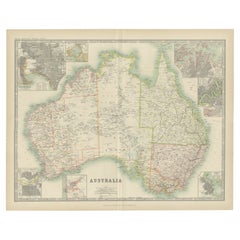
Antique Map of Australia by Johnston '1909'
Located in Langweer, NL
Antique map titled 'Australia'. Original antique map of Australia. With inset maps of Melbourne
Category
Early 20th Century Maps
Materials
Paper
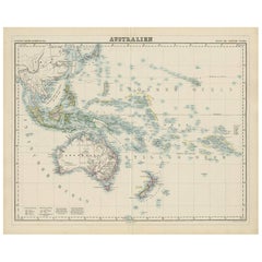
Antique Map of Australia by H. Kiepert, 1875
Located in Langweer, NL
Antique map titled 'Australien'. Large and detailed map of Australia and New Zealand. With color
Category
Antique Late 19th Century Maps
Materials
Paper
Original Antique Map of Australia by Dower, circa 1835
Located in St Annes, Lancashire
Nice map of Australia
Drawn and engraved by J.Dower
Published by Orr & Smith. C.1835
Unframed
Category
Antique 1830s English Maps
Materials
Paper
Large Original Antique Map of Australia by Sidney Hall, 1847
Located in St Annes, Lancashire
Great map of Australia
Drawn and engraved by Sidney Hall
Steel engraving
Original colour
Category
Antique 1840s Scottish Maps
Materials
Paper
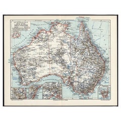
German Antique Map of Australia, Meyers, 1885
Located in Langweer, NL
Australien.' (Map of Australia. With inset maps of the large cities and Tasmania.) This attractive
Category
Antique 19th Century Maps
Materials
Paper
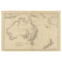
Antique Map of Australia and New Zealand by W. G. Blackie, 1859
Located in Langweer, NL
Antique map titled 'Australia and New Zealand'. Original antique map of Australia and New Zealand
Category
Antique Mid-19th Century Maps
Materials
Paper
$237 Sale Price
20% Off
H 14.57 in W 21.26 in D 0.02 in
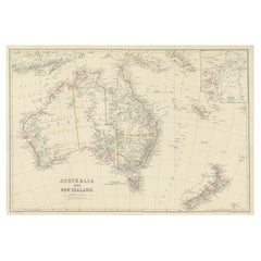
Antique Map of Australia and New Zealand, c.1860
Located in Langweer, NL
Antique map titled 'Australia and New Zealand'. Unusual edition of this map of Australia and New
Category
Antique 19th Century Maps
Materials
Paper
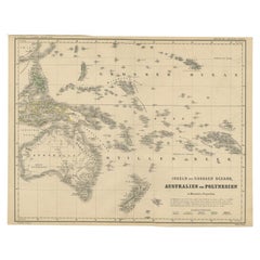
German Antique Map of Australia and Polynesia, c.1870
Located in Langweer, NL
Antique map titled 'Inseln des Grossen Oceans, Australien und Polynesien'. Old map of Australia and
Category
Antique 19th Century Maps
Materials
Paper
$142 Sale Price
20% Off
H 13.82 in W 17.92 in D 0 in
German Antique Map of Australia and New Zealand, 1857
Located in Langweer, NL
Antique map Australia titled 'Festland von Australien und benachbarte Inseln'. Detailed map of
Category
Antique 19th Century Maps
Materials
Paper
$237 Sale Price
20% Off
H 14.38 in W 17.52 in D 0 in
Large Detailed Map of Australia Wint Inset of Tasmania, 1937
Located in Langweer, NL
Antique map titled 'Australia'. Large folding map of Australia. With inset map of Tasmania. Printed
Category
20th Century Maps
Materials
Paper
$332 Sale Price
20% Off
H 29.73 in W 39.57 in D 0 in
Antique Map of Australia, New Zealand and Oceania by F. von Stülpnagel, 1850
Located in Langweer, NL
Antique map titled 'Australien und Polynesien in Mercators Projection'. A map of Australia, New
Category
Antique Mid-19th Century Maps
Materials
Paper
$182 Sale Price
30% Off
H 15.16 in W 18.31 in D 0.02 in
Antique Map of Australia and Oceania – Physical Relief Map by Hachette, c.1883
Located in Langweer, NL
Antique Map of Australia and Oceania – Physical Relief Map by Hachette, c.1883
Description:
This
Category
Antique Late 19th Century French Maps
Materials
Paper
$462
H 10.12 in W 12.84 in D 0.01 in
Antique Map of Australia, New Zealand & Polynesia – Stülpnagel, 1857
Located in Langweer, NL
Antique Map of Australia, New Zealand & Polynesia – Stülpnagel, 1857
Description:
This finely
Category
Antique Mid-19th Century German Maps
Materials
Paper
$498
H 14.77 in W 17.88 in D 0.01 in
Antique Exploration Map of Australia from Beltana to Perth, 1876
Located in Langweer, NL
im Western ausgefuhrt durch E. Giles (..)'. Old map of Australia from Bunbury to Adelaide in the
Category
Antique 19th Century German Maps
Materials
Paper
Antique Map of Australia and Polynesia, inset of Tasmania c.1860
Located in Langweer, NL
German antique map titled 'Australien und Polynesien'. Old map of Australia (New Holland) and
Category
Antique 19th Century Maps
Materials
Paper
$113 Sale Price
20% Off
H 8.67 in W 10.83 in D 0 in
Antique Map of New South Wales with Inset Maps of Australia and Swan River, 1854
Located in Langweer, NL
Antique map titled 'Colony of New South Wales'. Map of New South Wales with inset maps of Australia
Category
Antique 19th Century Maps
Materials
Paper
$303 Sale Price
20% Off
H 18.31 in W 14.57 in D 0 in
Antique Map of Australia by Lowry, 1852
Located in Langweer, NL
Antique map titled 'Australia'. Two individual sheets of Australia. This map originates from
Category
Antique Mid-19th Century Maps
Materials
Paper
Antique Map of Australia, 1903, with Colonial Divisions and Detailed Topography
Located in Langweer, NL
Title: Antique Map of Australia, 1903, with Colonial Divisions and Detailed Topography
Description
Category
Early 20th Century Maps
Materials
Paper
$355
H 14.49 in W 18.51 in D 0.01 in
Antique Exploration Map of Australia from Sharks Bay to Alice Springs, 1876
Located in Langweer, NL
, Forrest (..)'. Old map of Australia from Sharks Bay to 90 Mile Beach over to Alice Springs. It shows much
Category
Antique 19th Century Maps
Materials
Paper
$237 Sale Price
20% Off
H 10.83 in W 27.17 in D 0 in
1882 Map of Australia and New Zealand with Regional and Geographical Features
Located in Langweer, NL
This 1882 map of Australia and New Zealand, published by Blackie and Son as part of the
Category
Antique 1880s Maps
Materials
Paper
$296
H 14.97 in W 22.45 in D 0 in
Map of Australia, New Zealand, Part of China, Japan and Southeast Asia, 1857
Located in Langweer, NL
German Antique map titled 'Australien'. Map of Australia, New Zealand, part of China, Japan and
Category
Antique 19th Century Maps
Materials
Paper
$664 Sale Price
20% Off
H 23.23 in W 27.96 in D 0 in
Jacques Liozu's 1951 illustrated map of Australia and Oceania
By Jacques Liozu
Located in PARIS, FR
Jacques Liozu's 1951 illustrated map of Australia and Oceania is a remarkable cartographic work
Category
1950s Prints and Multiples
Materials
Lithograph, Paper
$889
H 16.15 in W 22.05 in
Impressive Geological Map of Australia – Rare Oversized Wall Display, 1931–32
Located in Langweer, NL
Geological Map of the Commonwealth of Australia by Sir Edgeworth David, 1931–32
Large and highly
Category
Early 20th Century Australian Maps
Materials
Linen, Paper
$5,624 / set
H 65.16 in W 79.53 in D 0.08 in
Detailed German Map of Australia Including Statistics of 1841, Published in 1854
Located in Langweer, NL
geography of the time.
The map also honors the history of exploration and discovery in Australia, with
Category
Antique 1850s Maps
Materials
Paper
$189 Sale Price
20% Off
H 14.06 in W 17.52 in D 0 in
Antique Map of Australia and surrounding Islands by F. von Stülpnagel, 1850
Located in Langweer, NL
Antique map titled 'Festland von Asutralien und benachbarte Inseln'. Map showing Australia, New
Category
Antique Mid-19th Century Maps
Materials
Paper
$182 Sale Price
30% Off
H 15.16 in W 18.31 in D 0.02 in
Old Map of Australia Showing The Routes of the Main Explorers, ca.1900
Located in Langweer, NL
Antique print, untitled. This map shows Australia with the routes of explorers in the continent and
Category
Antique Early 1900s Maps
Materials
Paper
$113 Sale Price
20% Off
H 8.19 in W 6.66 in D 0 in
Antique Map of Oceania and the Pacific Ocean, Australia and New Zealand, 1826
Located in Langweer, NL
Antique map of Australia titled 'Karte von Australien'. Old map of Australia and New Zealand
Category
Antique 19th Century Maps
Materials
Paper
$151 Sale Price
20% Off
H 8.47 in W 9.85 in D 0 in
Antique Map of New South Wales with an Inset of Sydney, Australia, 1833
Located in Langweer, NL
Antique map of Australia titled 'New South Wales'. Old map of New South Wales, Australia. With an
Category
Antique 19th Century Maps
Materials
Paper
$521 Sale Price
20% Off
H 13.78 in W 16.15 in D 0 in
Antique Map of New Zealand by A & C. Black, 1870
Located in Langweer, NL
Antique map titled 'New Zealand'. Original antique map of New Zealand with inset Maps of Australia
Category
Antique Late 19th Century Maps
Materials
Paper
Vintage Australia Map, Framed, Historic 19th Century Cartography Interest, 1988
Located in Hele, Devon, GB
This is a vintage Australia map. A late 20th century reproduction of John Tallis’ original 1850
Category
1990s Australian Victorian Maps
Materials
Glass, Paper
$1,286
H 15.16 in W 17.92 in D 0.6 in
Antique Map of South East Asia, Australia and the Indian Ocean, 1726
By F. Valentijn
Located in Langweer, NL
Antique map titled 'Tabula Indiae Orientalis'.
Beautiful detailed map of Australia, Southeast
Category
Antique Mid-18th Century Dutch Maps
Materials
Paper
$6,830 Sale Price
20% Off
H 20.67 in W 27.17 in D 0.02 in
Antique Map of Western Australia and Van Diemen's Land or Tasmania, 1833
Located in Langweer, NL
Antique map of Australia titled 'Western Australia - Van-Diemen Island'. Two maps on one sheet
Category
Antique 19th Century Maps
Materials
Paper
$260
H 13.78 in W 16.15 in D 0 in
Johnson’s Australia Map, USA Published c.1864 – Decorative Hand-Colored Map
Located in Langweer, NL
Johnson’s Australia Map, USA Published c.1864 – Decorative Hand-Colored Map
This is a finely
Category
Antique Mid-19th Century American Maps
Materials
Paper
$391
H 14.06 in W 18 in D 0.01 in
Australia, New Zealand, and Neighbouring Islands Map 1858
Located in Langweer, NL
Australia and Neighbouring Islands Map 1858
This attractive antique print shows “Festland von
Category
Antique Mid-19th Century German Maps
Materials
Paper
German Antique Map of Southeastern Australia, 1904
Located in Langweer, NL
This large antique map is taken from; 'Andrees Allgemeiner Handatlas in 126 Haupt-Und 139
Category
20th Century Maps
Materials
Paper
$71 Sale Price
20% Off
H 10.8 in W 17.3 in D 0.001 in
Gold Rush Era Masterpiece: The Tallis & Rapkin Rare Map of Pre-Queensland, 1851
Located in Langweer, NL
The image is an original historical map of Australia from the year 1851, created by John Rapkin
Category
Antique 1850s Maps
Materials
Paper
$550 Sale Price
20% Off
H 104.34 in W 14.26 in D 0 in
Antique Map of South Australia by Tallis, 1851
By Thomas Kitchin
Located in Langweer, NL
Antique map Australia titled 'Part of South Australia'. Decorative map of part of South Australia
Category
Antique 19th Century Maps
Materials
Paper
Antique Map of South Australia by Johnston, 1882
By Thomas Kitchin
Located in Langweer, NL
Antique map titled 'South Australia, New South Wales, Victoria & Queensland'. Old map of Southern
Category
Antique 19th Century Maps
Materials
Paper
Old Map of Southern Australia, with an Inset Map of Cape York Peninsula, 1882
Located in Langweer, NL
Antique map titled 'South Australia, New South Wales, Victoria & Queensland'.
Old map of
Category
Antique 1880s Maps
Materials
Paper
$275 Sale Price
20% Off
H 24.22 in W 19.53 in D 0 in
Antique Map of Southeastern Australia by F. von Stülpnagel, 1850
Located in Langweer, NL
Antique map titled 'Süd-Östlichen Australien'. Map of southeastern Australia with inset maps of
Category
Antique Mid-19th Century Maps
Materials
Paper
$169 Sale Price
35% Off
H 15.16 in W 18.31 in D 0.02 in
Antique Map of New South Wales 'Australia' by Wyld '1845'
Located in Langweer, NL
Wales, Australia. This map originates from 'An Atlas of the World, Comprehending Separate Maps of its
Category
Antique Mid-19th Century Maps
Materials
Paper
$237 Sale Price
20% Off
H 14.18 in W 10.24 in D 0.02 in
Antique Map of South East Australia by Stieler, c.1848
By Thomas Kitchin
Located in Langweer, NL
Antique map Australia titled 'Süd-Ost Australien'. Detailed map of South East Australia. Orginates
Category
Antique 19th Century Maps
Materials
Paper
$56 Sale Price
20% Off
H 17.13 in W 14.38 in D 0 in
Antique Map of South Australia by A.K. Johnston, 1865
Located in Langweer, NL
Antique map titled 'South Australia, New South Wales, Victoria & Queensland'. This map originates
Category
Antique Mid-19th Century Maps
Materials
Paper
$284 Sale Price
20% Off
H 24.41 in W 19.1 in D 0.02 in
Antique Map of New South Wales in Australia, ca. 1850
Located in Langweer, NL
Antique map of Victoria, or Port Phillip (12.7 x 10.0") in Australia. Superb map of Victoria
Category
Antique Mid-19th Century European Maps
Materials
Paper
$690 Sale Price
40% Off
H 13.4 in W 9.8 in D 0.002 in
Antique Map of Asia Depicting Asia and Australia, c.1814
Located in Langweer, NL
Antique map titled 'Asia'. This map depicts Asia and Australia. Engraved by J. and G. Menzies and
Category
Antique 19th Century Maps
Materials
Paper
$332 Sale Price
20% Off
H 21.26 in W 27.96 in D 0 in
Antique Map of Victoria ‘Australia’ by J. Tallis, circa 1855
Located in Langweer, NL
A highly decorative and finely engraved mid-19th century map of Victoria, Australia which appeared
Category
Antique Mid-19th Century British Maps
Materials
Paper
$284 Sale Price
20% Off
H 10.56 in W 14.73 in D 0.02 in
Map of Western Australia & Swan River, insets of Perth, Aboriginals, Sheep, 1851
Located in Langweer, NL
Antique map titled 'Western Australia, Swan River'. Map of Western Australia and Swan River
Category
Antique 1850s Maps
Materials
Paper
$303 Sale Price
20% Off
H 14.57 in W 10.63 in D 0 in
Detailed Map of New South Wales, Australia from 1833 by SDUK
Located in Langweer, NL
Detailed Map of New South Wales, Australia from 1833 by SDUK
This historical map of New South
Category
Antique 1830s Maps
Materials
Paper
$531 Sale Price
20% Off
H 15.4 in W 13.7 in D 0.02 in
Antique Map of Asia with Northern Portion of Australia “Hollandia Nova", 1727
Located in Langweer, NL
antique map of the continent of Asia with a northern portion of Australia “Hollandia Nova”. The map is
Category
Antique 18th Century Maps
Materials
Paper
$1,565 Sale Price
20% Off
H 21.07 in W 25.01 in D 0 in
Antique Detailed Map of New South Wales, Queensland & Victoria, Australia, 1865
Located in Langweer, NL
Antique map Australia titled 'South Australia, New South Wales, Victoria & Queensland'. Old map
Category
Antique 19th Century Maps
Materials
Paper
$332 Sale Price
20% Off
H 24.41 in W 19.49 in D 0 in
Antique Map of Asia and Australia with a Speculative Coastline, 1777
Located in Langweer, NL
Antique map titled 'A New & Accurate Map of Asia'. Detailed map of Asia and Australia, shows a
Category
Antique 18th Century Maps
Materials
Paper
$398 Sale Price
20% Off
H 13.19 in W 17.72 in D 0 in
Old Antique Map of the Banda Islands (Southeast), Indonesia & Northern Australia
By F. Valentijn
Located in Langweer, NL
Original antique map titled 'Kaart van de Zuyd-Ooster Eylanden van Banda'. Important map of the
Category
Antique Early 18th Century Maps
Materials
Paper
$730 Sale Price
20% Off
H 20.28 in W 24.02 in D 0.02 in
Large Antique Map of Bass Strait, Tasmania, Australia by Cook, 1803
Located in Langweer, NL
Antique map Australia titled 'Kaart van Basses Straat tusschen Nieuw Zuid Wales en van Diemensland
Category
Antique 19th Century Maps
Materials
Paper
$4,268 Sale Price
20% Off
H 29.14 in W 20.87 in D 0 in
Antique Map of Victoria, or Port Phillip in Australia, ca. 1850
Located in Langweer, NL
centered around Melbourne, Australia. Crafted by John Tallis around 1850, this map is part of the
Category
Antique Mid-19th Century European Maps
Materials
Paper
$680 Sale Price
20% Off
H 10 in W 12.7 in D 0.002 in
Antique Map of South Australia, New South Wales, Victoria and Queensland, 1903
Located in Langweer, NL
Title: Antique Map of South Australia, New South Wales, Victoria, and Queensland, 1903
Description
Category
Early 20th Century Maps
Materials
Paper
$355
H 18.51 in W 14.49 in D 0.01 in
French Antique Map of Oceania with Details of the Australian Colonies, c.1840
Located in Langweer, NL
Antique map Oceania titled 'Océanie par C.V. Monin'. Old map of Oceania with an inset of New South
Category
Antique 19th Century French Maps
Materials
Paper
$260
H 13 in W 17.52 in D 0.01 in
- 1
Get Updated with New Arrivals
Save "Maps Of Australia", and we’ll notify you when there are new listings in this category.
Maps Of Australia For Sale on 1stDibs
At 1stDibs, there are many versions of the ideal maps of australia for your home. A maps of australia — often made from paper — can elevate any home. Your living room may not be complete without a maps of australia — find older editions for sale from the 18th Century and newer versions made as recently as the 20th Century. When you’re browsing for the right maps of australia, those designed in Victorian styles are of considerable interest. A well-made maps of australia has long been a part of the offerings for many furniture designers and manufacturers, but those produced by F. Valentijn are consistently popular.
How Much is a Maps Of Australia?
The average selling price for a maps of australia at 1stDibs is $250, while they’re typically $71 on the low end and $7,048 for the highest priced.
Questions About Maps Of Australia
- 1stDibs ExpertApril 5, 2024In Australia, you spell jewelry as "jewellery." This is also the preferred spelling in the United Kingdom, while in the U.S., jewelry is the proper spelling. In Canada, you will see both jewelry and jewellery in use. On 1stDibs, find a wide variety of antique, vintage and contemporary jewelry from some of the world's top sellers.
- 1stDibs ExpertNovember 13, 2024In Australia, a couch is often simply called a couch. However, some people also refer to these long upholstered furnishings as sofas or lounges. In some cases, the term couch may be reserved for a more casual piece. Shop a wide range of sofas from some of the world's top sellers on 1stDibs.
- 1stDibs ExpertJanuary 27, 2025There are actually multiple famous wildlife artists in Australia. The incredible biodiversity of the country has inspired numerous artists, such as James Hough, who produces realistic depictions of animals and birds. Another is Natalie Jane Parker, known for her acrylic works on clay boards. Other notable Australian wildlife artists include Chris McClelland and Maree Davidson. On 1stDibs, shop a collection of Australian art.
More Ways To Browse
Yves Saint Laurent 1979 Jacket
Black And White Striped Heels
Aboriginal Spear
William Parry
Heavy Glass Candle
Vintage Burlap Sack
Vintage Cast Iron Figures
Vintage Ceramic Match Holder
Vintage Ceramic Quail
Vintage Ceramic Squirrels
Vintage Chemex
Vintage Cheshire Cat
Vintage China Place Settings
Vintage Chinese Shell Art
Vintage Chrome Bed
Vintage Clock West Germany
Vintage Clothes Pin
Vintage Coastal Henry Link
