European Travel Maps
3
to
9
186
105
184
153
67
51
40
37
28
28
27
16
15
15
11
9
9
9
9
6
6
4
3
3
3
2
2
2
2
2
2
2
1
1
1
1
1
1
1
1
1
42
42
19
16
12
Sort By
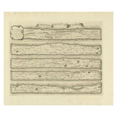
Antique Map Made After a Roman Papyrus Travel Map, Known as Peutinger Map, 1773
Located in Langweer, NL
map is a 13th-century parchment copy of a possible Roman original. It covers Europe (without the
Category
Antique 18th Century Maps
Materials
Paper
H 15.56 in W 18.51 in D 0 in
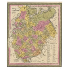
Antique Map of Old European Russia, 1846
Located in Langweer, NL
Antique map titled 'Russia in Europe'. Old map of European Russia. This map originates from 'A New
Category
Antique 19th Century Maps
Materials
Paper
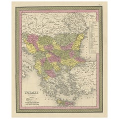
Old Colourful Decorative Map of Turkey in Europe, 1846
Located in Langweer, NL
Antique map titled 'Turkey in Europe'. Old map of Turkey in Europe.
This map originates from 'A
Category
Antique 1840s Maps
Materials
Paper
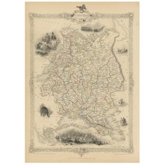
Antique Map of Russia in Europe by Tallis, '1851'
Located in Langweer, NL
Antique map titled 'Russia in Europe'. Map of European Russia. Showing vignettes of the Neoskoi
Category
Antique Mid-19th Century Maps
Materials
Paper
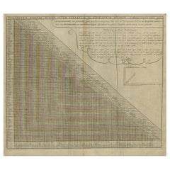
Antique Chart of Travelling Distances between European Cities, Ca.1792
Located in Langweer, NL
'. This unusual chart depicts the traveling distances between various European cities.
Artists and
Category
Antique 18th Century Maps
Materials
Paper
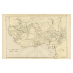
Original Antique Coloured Map of Western Africa, Published in 1882
Located in Langweer, NL
Detail**: The map shows the region just before the "Scramble for Africa" where European countries
Category
Antique 1880s Maps
Materials
Paper
No Reserve
H 14.97 in W 22.45 in D 0 in
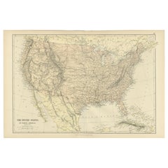
Antique Map of The United States of North America, 1882
Located in Langweer, NL
This is a historical map titled "The United States of North America, Central Part" from the 1882
Category
Antique 1880s Maps
Materials
Paper
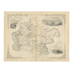
Map of Independent Tartary with Vignettes of the Region's Culture, 1851
Located in Langweer, NL
both charm and educational value to the map, reflecting the 19th-century European interest in exotic
Category
Antique 1850s Maps
Materials
Paper
No Reserve
H 10.71 in W 14.26 in D 0 in
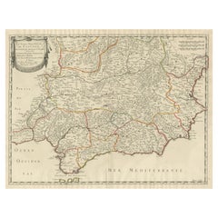
Large Map of Castile's Southern Realms - Granada, Andalusia, and Murcia, 1652
Located in Langweer, NL
This antique map, titled 'Les Etats de la Couronne de Castille', represents the southern regions of
Category
Antique Mid-17th Century Maps
Materials
Paper
H 17.64 in W 23.75 in D 0.02 in
1899 Poole Brothers Antique Railroad Map of the Illinois Central Railroad
Located in Colorado Springs, CO
travel maps.
In 1868, George Amos Poole along with his uncle William H. Rand and Andrew McNally formed
Category
Antique 1890s American Maps
Materials
Paper
California, Alaska and Mexico: 18th Century Hand-Colored Map by de Vaugondy
By Didier Robert de Vaugondy
Located in Alamo, CA
This an 18th century hand-colored map of the western portions of North America entitled "Carte de
Category
Antique 1770s French Maps
Materials
Paper
H 13.75 in W 16.63 in D 0.13 in
Captain Cook's Exploration of Tahiti 18th C. Hand-Colored Map by Bellin
By Jacques-Nicolas Bellin
Located in Alamo, CA
This beautiful 18th century hand-colored copper plate engraved map is entitled "Carte de l'Isle de
Category
Antique Mid-18th Century French Maps
Materials
Paper
H 11.38 in W 17.5 in D 0.13 in
Map of Russia with Vignettes of the Neoskoi Prospect, St. Petersburg, ca.1851
Located in Langweer, NL
Antique map titled 'Russia in Europe'.
Map of European Russia. Showing vignettes of the Neoskoi
Category
Antique 1850s Maps
Materials
Paper
H 14.38 in W 10.63 in D 0 in
Antique 1844 J Calvin Smith JH Colton Midwest United States Survey Map 27"
By J.H. Colton
Located in Dayton, OH
Antique framed black and white map of seven Midwestern American states. Guide Through Ohio
Category
Antique 1840s Maps
Materials
Paper
H 21 in W 26.5 in D 0.5 in
Antique Map of the Journey from Zhe-Hol in Tartary to Beijing and Hang-Tchoo Foo
Located in Langweer, NL
Europeans valuable new information on China's geography and social customs.
This map originates from 'An
Category
Antique Late 18th Century Maps
Materials
Paper
No Reserve
H 26.78 in W 20.08 in D 0.02 in
Antique Print of the City of Ten-Tchoo-Foo, China, 1796
Located in Langweer, NL
Thomas Hickey.
From another source: Macartney was dispatched to Beijing in 1792, traveling via Madeira
Category
Antique 1790s Maps
Materials
Paper
Original Vintage Poster Sabena Belgian Airlines To Europe Asia Africa Travel Map
Located in London, GB
Original vintage pictorial travel map poster advertising Sabena Belgian Airlines flights to Europe
Category
Vintage 1950s Belgian Posters
Materials
Paper
H 39.38 in W 25.6 in D 0.04 in
Original Antique Poster Norvege Norway Midnight Sun Stavkirke Church Travel Map
Located in London, GB
and the building reflected in the calm water next to a route map marking travel over the Atlantic
Category
Antique 1610s Norwegian Posters
Materials
Paper
H 38.98 in W 25.6 in D 0.04 in
Original Vintage Poster BEA British European Airways International Air Route Map
Located in London, GB
Original vintage travel advertising poster for BEA British European Airways International Air
Category
Vintage 1950s British Posters
Materials
Paper
H 35.04 in W 43.71 in D 0.04 in
Original Vintage Travel Poster Air France World Map Postal Network Reseau Aerian
Located in London, GB
Original vintage Air France map poster - Air France Reseau Aerian Postal / Air France Postal
Category
Vintage 1940s French Posters
Materials
Paper
H 25.6 in W 39.77 in D 0.04 in
Original Vintage Air Maroc Travel Poster Route Map France Morocco Spain Services
By E. Esperance
Located in London, GB
Original vintage travel poster advertising Air Maroc. Great design featuring a stylised image of a
Category
Vintage 1950s French Posters
Materials
Paper
H 39.97 in W 25.6 in D 0.04 in
Original Vintage Poster British Airways BOAC BSAA BEA World Route Map Air Travel
Located in London, GB
European Overseas S American Airways - featuring a colourful graphic design showing three yellow and orange
Category
Vintage 1940s British Posters
Materials
Paper
H 40.16 in W 25.2 in D 0.04 in
Original Vintage Travel Poster Fly Aer Lingus Travel The Easy Way Midcentury Art
By John Bainbridge
Located in London, GB
Original vintage travel poster featuring a great mid-century design - Travel the easy way Fly Aer
Category
Vintage 1950s Irish Posters
Materials
Paper
H 39.77 in W 24.81 in D 0.04 in
Mid-Century Modern Architecture Travel Guide East Coast USA
Located in New York City, NY
regional map. The book includes all the additional information needed to find and visit each building. Its
Category
21st Century and Contemporary European Books
Materials
Paper
Vintage Illustrated Book, Yorkshire By George Home, English, County Travel Guide
Located in Hele, Devon, GB
county travel guide, this 3rd edition published in 1925.
Born in London, Gordon Home (1878 - 1969) was
Category
Early 20th Century European Edwardian Books
Materials
Paper
H 8.08 in W 5.91 in D 1.58 in
1937 Original planisphere by Lucien boucher - World map
By Lucien Boucher
Located in PARIS, FR
Original poster
Airline Company - Map - Tourism
West - Northern - Orient - Midi
In 1937, Lucien
Category
1930s Prints and Multiples
Materials
Linen, Lithograph, Paper
California: 18th Century Hand-colored Map by de Vaugondy
By Didier Robert de Vaugondy
Located in Alamo, CA
This is an 18th century hand-colored map of the western portions of North America entitled "Carte
Category
1770s Landscape Prints
Materials
Engraving
1938 original map titled "Carte du réseau aérien français" Air France
Located in PARIS, FR
that encapsulated the excitement and possibilities of air travel in the pre-war era.
Map - Airline
Category
1930s Prints and Multiples
Materials
Linen, Paper, Lithograph
Original California Wine Country vintage wine and travel poster
Located in Spokane, WA
-growing regions of California to regions in Europe. (Vineyards near the towns of Napa, Santa Cruz, and
Category
1970s Abstract Expressionist Landscape Prints
Materials
Offset
H 36 in W 24 in D 0.05 in
Original Vintage Travel Advertising Poster Fly Imperial Airways India Australia
By David Lee Theyre Elliott
Located in London, GB
Original vintage travel advertising poster - Fly by Imperial Airways India in three days Australia
Category
Vintage 1930s British Posters
Materials
Paper
H 40.16 in W 24.81 in D 0.04 in
New France and Labrador - Graphite Drawing, Landscape, On Antiqued Map
By Don Pollack
Located in Chicago, IL
Postcards From the Edge of the West
My work originates from journey and travel. The process often
Category
21st Century and Contemporary Contemporary Landscape Paintings
Materials
Canvas, Oil
Ireland: A Framed 17th Century Hand-colored Map by Jan Jannson
By Johannes Janssonius
Located in Alamo, CA
. He produced maps of Europe, Asia, Africa, and the Americas, as well as detailed maps of individual
Category
Mid-17th Century Old Masters Landscape Prints
Materials
Engraving
H 17.88 in W 22 in D 0.75 in
Original Vintage Travel Advertising Poster BEA Great Britain Via London Lewis
By David Lewis
Located in London, GB
Original vintage mid-century design travel advertising poster for British European Airways - BEA
Category
Vintage 1950s British Posters
Materials
Paper
H 40.16 in W 25.2 in D 0.04 in
Original Vintage Travel Poster Imperial Airways Routes Ensign Empire Flying Boat
Located in London, GB
Original vintage travel poster for Imperial Airways showing a world map with the routes operated by
Category
Vintage 1930s British Posters
Materials
Paper
H 25.2 in W 39.77 in D 0.04 in
Original Vintage Travel Poster Air France Stockholm Paris Art Deco Scandinavia
Located in London, GB
design showing the cities marked on a map of the northern part of Europe with an illustration of
Category
Vintage 1930s French Art Deco Posters
Materials
Paper
H 19.69 in W 12.21 in D 0.04 in
Original Vintage Travel Poster Amerique Du Sud Par Les Chargeurs Reunis Cruise
Located in London, GB
les Chargeurs Reunis featuring a ship sailing on the Atlantic Ocean between map shapes of Europe and
Category
Vintage 1930s French Posters
Materials
Paper
H 23.63 in W 15.75 in D 0.04 in
Original Vintage Travel Poster Nord Air Express Air France Sabena Art Deco
Located in London, GB
Deco design showing a tri-engine propeller plane flying at speed over a map of Europe marking the route
Category
Vintage 1930s Belgian Art Deco Posters
Materials
Paper
H 39.38 in W 24.81 in D 0.04 in
Captain Cook's Exploration of Tahiti: 18th C. Hand-colored Map by Bellin
By Jacques-Nicolas Bellin
Located in Alamo, CA
This beautiful 18th century hand-colored copper plate engraved map is entitled "Carte de l'Isle de
Category
Late 18th Century Landscape Prints
Materials
Engraving
Original Vintage Imperial Airways Travel Brochure Poster Flying Boat Land Planes
Located in London, GB
Original vintage double sided travel advertising chromolithograph brochure poster published by
Category
Vintage 1930s British Posters
Materials
Paper
H 29.53 in W 19.49 in D 0.04 in
Seminal guide to the East and West Indies, with 42 coloured maps and plates
By Jan Huygen van Linschoten
Located in ZWIJNDRECHT, NL
Seminal guide to the East and West Indies, with 42 double-page and folding plates, including 6 maps
Category
Antique Early 17th Century Dutch Dutch Colonial Books
Materials
Paper
Free Shipping
H 12.6 in W 8.27 in D 1.58 in
Signature Dishes That Matter
Located in New York City, NY
over the past 300 years
Today's food-lovers often travel the globe to enjoy the food of acclaimed
Category
21st Century and Contemporary European Books
Materials
Paper
Vintage Baedeker's Guide, Tyrol & Dolomites, English Language, Published 1927
Located in Hele, Devon, GB
become synonymous with promoting travel and exploration within Europe and beyond since the mid 19th
Category
Vintage 1920s German Victorian Books
Materials
Paper
H 6.3 in W 4.34 in D 1.19 in
Antique Print of the City Hu Kew Hyen or Kyew on the River Kyang, China
Located in Langweer, NL
work is an anthology of travel narratives. It contains maps and plates of the Americas, Africa, Asia
Category
Antique 18th Century Prints
Materials
Paper
Antique Print of a City Near Canton, China circa 1745
Located in Langweer, NL
four volume work is an anthology of travel narratives. It contains maps and plates of the Americas
Category
Antique 18th Century Prints
Materials
Paper
Sand and Sea
By Shawna Moore
Located in San Luis Obispo, CA
continuation painting traditions from including American, European and beyond. The use of encaustic (or wax
Category
2010s Abstract Mixed Media
Materials
Wax, Encaustic
Russian Silver, Gold And Niello Topographical Snuff Box
Located in New Orleans, LA
of trade, travel and silver craftsmanship along Russia’s historic Volga River.
More than an object
Category
Antique 19th Century Russian Other Snuff Boxes and Tobacco Boxes
Materials
Gold, Silver
Les Betes de la Cote D'Azur, Original Painting
By Libby Ramage
Located in San Francisco, CA
recycled souvenirs. She even includes travel brochures from her great-grandmother's trip to Europe in 1957
Category
21st Century and Contemporary Outsider Art Mixed Media
Materials
Mixed Media
Louis Vuitton Diamond Enamel 18k White Gold Globe Charm Pendant
By Louis Vuitton
Located in Bellmore, NY
is adorned with intricately applied enamel, creating a vivid representation of the world map that is
Category
21st Century and Contemporary Contemporary Charm Bracelets
Materials
White Diamond, Gold, 18k Gold, White Gold, Enamel
Modernist British Israeli Lithograph Expressionist Figures
By Michael Druks
Located in Surfside, FL
late 1960s, Druks was established as a leading young Israeli artist and decided to travel abroad. He
Category
20th Century Neo-Expressionist Figurative Prints
Materials
Lithograph
Original Vintage Art Deco Style Poster Aerotransport Swedish Airlines VI Flyver
By Ernst Mentze
Located in London, GB
umbrella in one hand and three planes on leashes in the other, each plane flying over a map of Europe
Category
Vintage 1920s Swedish Art Deco Posters
Materials
Paper
H 33.67 in W 20.48 in D 0.01 in
Occasional table model U 601 designed by Josef Frank for Svenskt Tenn, Sweden
By Svenskt Tenn, Josef Frank
Located in Stockholm, SE
.
Mahogany, glass and brass.
The map is a replica of the world map drawn by the Venetian monk and
Category
Mid-20th Century Swedish Mid-Century Modern Coffee and Cocktail Tables
Materials
Brass
Section 30 - Landscape Painting, Original Oil on Canvas
By Don Pollack
Located in Chicago, IL
via bicycle following Lewis and Clark. His work has utilized maps, documents, photography, painting
Category
21st Century and Contemporary Contemporary Landscape Paintings
Materials
Canvas, Oil
North American Indians by George Catlin, Two Volumes, First Grant Edition, 1926
By George Catlin
Located in Colorado Springs, CO
Conditions, Written During Eight Years' Travel Amongst the Wildest Tribes of Indians in North America, 1832
Category
Vintage 1920s Scottish Books
Materials
Paper
H 10.63 in W 7 in D 4.75 in
MIxed Media Conceptual Art Sculpture Drawing Human Rights Welded Iron
By Francoise Schein
Located in Surfside, FL
in New York where she begins a work on cartography territories. Subway map Floating on NY Sidewalk is
Category
Late 20th Century Conceptual Abstract Sculptures
Materials
Iron
'Maple River' original color lithograph by John Mix Stanley
By John Mix Stanley
Located in Milwaukee, WI
: to produce topographical maps, to document flora and fauna, and to document natural resources to
Category
1850s Romantic Landscape Prints
Materials
Lithograph
Rare Engraving of Mount Sinai with St. Catherine's Monastery and Bedouins, 1680
Located in Langweer, NL
Europe, he was dependent on the assistance of others. So he bought travelogues and information from
Category
Antique 1680s Religious Items
Materials
Paper
H 12.72 in W 14.57 in D 0 in
'Camp Red River Hunters' original lithograph by John Mix Stanley
By John Mix Stanley
Located in Milwaukee, WI
: to produce topographical maps, to document flora and fauna, and to document natural resources to
Category
1850s Romantic Landscape Prints
Materials
Lithograph
'Lieutenant Crovers Despatch – Return of Governor Stevens to Fort Benton'
By John Mix Stanley
Located in Milwaukee, WI
: to produce topographical maps, to document flora and fauna, and to document natural resources to
Category
1850s Romantic Landscape Prints
Materials
Lithograph
'Victor's Camp - Hell Gate Ronde' original John Mix Stanley lithograph
By John Mix Stanley
Located in Milwaukee, WI
: to produce topographical maps, to document flora and fauna, and to document natural resources to
Category
1850s Romantic Landscape Prints
Materials
Lithograph
'Kettle Falls, Columbia River' original color lithograph by John Mix Stanley
By John Mix Stanley
Located in Milwaukee, WI
: to produce topographical maps, to document flora and fauna, and to document natural resources to
Category
1850s Romantic Landscape Prints
Materials
Lithograph
- 1
Get Updated with New Arrivals
Save "European Travel Maps", and we’ll notify you when there are new listings in this category.
European Travel Maps For Sale on 1stDibs
Find a variety of european travel maps available on 1stDibs. Browse a selection of modern, contemporary or street art versions of these works for sale today — there are 87 modern, 42 contemporary, 20 abstract, 4 Art Deco and 4 street art examples available. These items have been made for many years, with versions that date back to the 18th Century alongside those produced as recently as the 21st Century. European travel maps available on 1stDibs span a range of colors that includes gray, blue, beige, brown and more. There have been many well-done artworks of this subject over the years, but those made by (after) Henri Matisse, Henri Matisse, Don Pollack, Patrick Beaulieu and Michael Hoffman are often thought to be among the most beautiful. Frequently made by artists working in lithograph, paint and oil paint, all of these available pieces are unique and have attracted attention over the years.
How Much are European Travel Maps?
Prices for art of this kind can differ depending upon size, time period and other attributes — european travel maps in our inventory begin at $35 and can go as high as $45,494, while the average can fetch as much as $1,642.
More Ways To Browse
Pure Silk Carpet
Gradient Rug
Monk Dining
Foo Chinese Antique
Champagne Cellar
Chinese Restaurant
Mission Copper
Anglo Chinese Furniture
Aluminum Midcentury Vase
Silk Viscose Rug
Vintage Wine Barrel Furniture
Door Table India
Antique Emerald Cross
Rand Mcnally Antique Maps
Antique Map Of Austria
Map Monde
Map Of Persia
Persia Map
