Framed Art Maps
8
to
98
1,459
482
1,249
811
528
312
176
133
129
80
77
73
73
57
55
51
46
41
36
33
27
26
24
22
18
16
16
16
15
14
13
11
10
10
8
7
6
6
5
5
4
4
4
4
3
3
2
2
2
1
1
1
1
1
1
1
1
1
100
52
44
42
42
Sort By
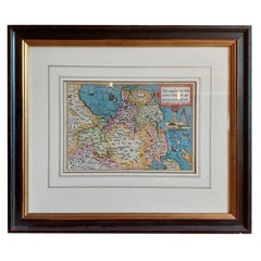
Antique Map of Friesland by Bussemacher in Frame, c.1592
Located in Langweer, NL
Original antique map titled 'Frisiae Antiquissimae (..)'. Original antique map of Friesland
Category
Antique 18th Century Maps
Materials
Paper
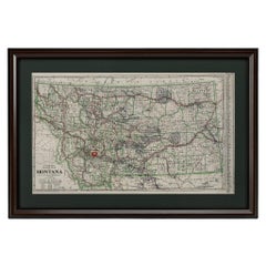
"Clason's Guide Map of Montana" by The Clason Map Company, Circa 1920s
Located in Colorado Springs, CO
red ink or wax crayon.
Map is archivally framed in a new, custom wooden frame with acid-free mats and
Category
Vintage 1920s American Art Deco Maps
Materials
Paper
H 23.13 in W 33.88 in D 1.5 in
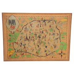
Art Deco Cartoon Style Map of Paris possibly by Arthur Zaindenberg circa 1930's
By Arthur Zaidenberg
Located in New York, NY
Art Deco cartoon style map of Paris possibly by Arthur Zaidenberg. The map depicts witty references
Category
Vintage 1930s American Art Deco Maps
Materials
Paper
H 21.5 in W 30 in D 0.75 in
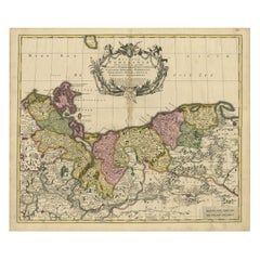
Antique Map of Pomerania by Schenk, circa 1750
Located in Langweer, NL
emblem or frame typically bearing the map's title and other details.
Published by P. Schenk jr., this
Category
Antique Mid-18th Century Maps
Materials
Paper
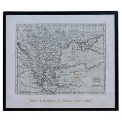
Map Turkey in Europe & Hungary Thomas Kitchin, 1783
Located in BUNGAY, SUFFOLK
Thomas Kitchen (1718 - 1784) : Map of Turkey in Europe & Hungary 1783
Visible sheet within the
Category
Antique 18th Century English Georgian Maps
Materials
Paper
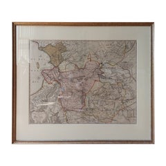
Antique Map of Overijssel by Visscher, c.1660
Located in Langweer, NL
Engravers: The Visscher family were art and map dealers in Amsterdam during the 17th century. Founded by C
Category
Antique 17th Century Maps
Materials
Paper
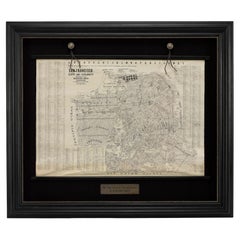
1915 "San Francisco City and County" Hanging Map by W. Bashford Smith
Located in Colorado Springs, CO
outer margins.
Map has been artfully mounted, hanging, inside a custom wooden frame, with linen mats
Category
Vintage 1910s American Art Deco Maps
Materials
Wood, Paper
Antique Map of Southern Zeeland by Von Reilly, 1790
Located in Langweer, NL
"Antique map titled 'Seelands südlicher Theil oder die Inseln Süd Beverland, Tholen, Wolfersdyk und
Category
Antique 18th Century Maps
Materials
Paper
Antique Map of the Netherlands and Belgium by Hérisson, 1829
Located in Langweer, NL
art but also a reliable historical document.
This map is a valuable historical artifact, offering
Category
Antique Mid-19th Century Maps
Materials
Paper
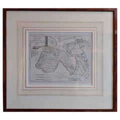
Antique Map of the Middle East by Von Sandrart, 1708
Located in Langweer, NL
Antique map titled 'Die Gegend des Irdlisches Paradieses und des Landes Kanaan.' Map of the Middle
Category
Antique 18th Century Maps
Materials
Paper
Striking Antique Map of Luxembourg and Northern France 'Lotharingen', c.1680
Located in Langweer, NL
Description: Antique map titled 'Exactissima Lotharingia tam Regis Gallorum quam Ducis
Category
Antique 1680s Maps
Materials
Paper
H 18.71 in W 22.25 in D 0 in
Original Antique Hand-Colored Map of Friesland by C. Merian, 1659
Located in Langweer, NL
such maps typically involves careful handling, framing, and placement away from direct sunlight to
Category
Antique Mid-17th Century Maps
Materials
Paper
Free Shipping
H 11.74 in W 14.3 in D 0.02 in
An Old Illustrated Tallis Map of Central America with Volcanic Vignettes, 1851
Located in Langweer, NL
This map of Central America, part of John Tallis & Company's series from "The British Colonies" by
Category
Antique 1850s Maps
Materials
Paper
H 10.71 in W 14.26 in D 0 in
Martinique Island in the Caribbean by Bellin Original Original Antique Map, 1780
Located in Langweer, NL
This mid-18th century map, "Carte de l'Isle de la Martinique pour servir a l'historie generale des
Category
Antique Late 18th Century Maps
Materials
Paper
H 9.85 in W 13.39 in D 0 in
Antique Map of the Provinces of Gelderland and Overijssel by Kaerius, 1617
Located in Langweer, NL
staining from handling. Original sheet from atlas, not shortened or cut. Map will look nice when framed
Category
Antique 17th Century Maps
Materials
Paper
H 15.75 in W 20.67 in D 0 in
1817 John Thomson's Handcolored Antique Map of St. Kitts, Nevis, and St. Lucia
Located in Langweer, NL
, including its mountains and natural harbors. Each island's map is framed within its own neat line border
Category
Antique Early 19th Century Maps
Materials
Paper
No Reserve
H 21.07 in W 29.34 in D 0 in
1948 "A Hysterical Map of Yellowstone National Park" by Jolly Lindgren, 2nd Ed.
Located in Colorado Springs, CO
; light spotting in margin. Linen backed. B+/B. Map measures 16 x 16”. Map has been expertly framed, to
Category
Vintage 1940s American Maps
Materials
Paper
H 20 in W 20 in D 0.75 in
Mapping History: The Decorative Cartography of Indre-et-Loire by Levasseur, 1856
Located in Langweer, NL
captured, making this map not only a navigational tool but also a work of art.
The addition of outline
Category
Antique 1850s Maps
Materials
Paper
H 20.67 in W 14.34 in D 0 in
Detailed Antique Cartography of Asian Russia, 1882
Located in Langweer, NL
reference works, ensured that this map was not only a tool for scholars and explorers but also a work of art
Category
Antique 1880s Maps
Materials
Paper
Levasseur's 1852 Cartographic Portrait of Gironde: Celebrating the Bordeaux Wine
Located in Langweer, NL
products.
Maps from this era, especially those by Levasseur, are notable for their combination of art and
Category
Antique 1850s Maps
Materials
Paper
H 20.67 in W 14.06 in D 0 in
Framed Map of China
Located in Greenwich, CT
Map of China, 19th century. European print map of China
Conservation frame with walnut frame
Category
Antique 19th Century European Qing Prints
Materials
Paper
Rhinoceros, cutouts, maps, mapart, animal art,
Located in Brooklyn, NY
Rhinoceros image embedded in layered glass. Created with cutouts, maps
rhinoceros, cutouts, maps
Category
2010s Contemporary Mixed Media
Materials
Mixed Media, Glass
Double Hemisphere Old World Map Print, Matted & Framed
Located in Plainview, NY
framing the double round maps. The old world map print Will elevate the style of a library, office or
Category
20th Century Landscape Prints
Materials
Paper
Flamenco, cutouts, maps, mapart, dancers, dancing art
Located in Brooklyn, NY
Dancer image embedded in layered glass. Created with cutouts, maps
Category
2010s Contemporary Mixed Media
Materials
Glass, Mixed Media
Early Folk Art American Two Sided Framed Military Drawing with Map
Located in Savannah, GA
This unusual set of drawings in a double sided frame came out of an old New England Estate in a
Category
Antique Late 18th Century American Folk Art Political and Patriotic Memo...
Materials
Glass, Wood, Paper
Celestial Map
By Laura Ball
Located in Denver, CO
represent access points and maps to the primeval places we all have in common, a familiarity outside of
Category
2010s Contemporary Paintings
Materials
Ink, Acrylic, Watercolor, Gouache, Graphite
Weather Map
By William L'Engle
Located in Provincetown, MA
of Gerrit Beneker, Karl Knaths, Blanche Lazzell, and Agnes Weinrich.
This abstract weather map
Category
Mid-19th Century Abstract Abstract Paintings
Materials
Watercolor
Gorilla, cutouts, maps, mapart, animal art, gorilla mixed media
Located in Brooklyn, NY
Gorilla image embedded in layered glass. Created with cutouts, maps
Title : Gorilla
Size :12x16
Category
2010s Contemporary Mixed Media
Materials
Glass, Mixed Media
Louisiana: A Framed 19th Century Map by O.W. Gray
Located in Alamo, CA
This framed 19th century map of the Louisiana territory was published in "Gray's Atlas of the
Category
1870s Landscape Prints
Materials
Engraving
H 20 in W 22.63 in D 0.88 in
A Variety of Eight Wonderful Old Maps, Framed
Located in San Francisco, CA
A Variety of Eight Wonderful Old Maps, Framed
Category
20th Century Decorative Art
Materials
Paper
Railway Map of India.
Located in London, GB
THUILLIER, Colonel Henry Ravenshaw.
Railway Map of India. Railways Brought up to October 1895
Category
1890s Other Art Style More Art
Materials
Lithograph
Seeking Alignment - Original Surrealist Art Map Figurative
Located in Los Angeles, CA
. Imbued with layers of headlines, articles, and ads, his street art becomes a powerful platform for
Category
21st Century and Contemporary Surrealist Figurative Paintings
Materials
Charcoal, Paper, Ink, Mixed Media
A Hand Colored 18th Century Framed Map of South America by Thomas Jefferys
Located in Alamo, CA
This detailed hand colored map of South America by Thomas Jefferys was published in London in 1750
Category
Mid-18th Century Other Art Style Landscape Prints
Materials
Engraving
H 12.25 in W 14.25 in D 1 in
Ireland: A Framed 17th Century Hand-colored Map by Jan Jannson
By Johannes Janssonius
Located in Alamo, CA
This is a 17th century hand-colored map entitled "Hibernia Regnum Vulgo Ireland" by Johannes
Category
Mid-17th Century Old Masters Landscape Prints
Materials
Engraving
H 17.88 in W 22 in D 0.75 in
Meissen, Germany : A Large Framed 18th Century Map by Petrus Schenk
Located in Alamo, CA
corner and an explanation of symbols in the lower left.
This large framed copperplate 18th century map
Category
Mid-18th Century Old Masters Landscape Prints
Materials
Engraving
H 26.13 in W 42.13 in D 0.75 in
History Maps
Located in Deddington, GB
History Maps by Maria Pierides [2020]
original
Oil, oil stick collage, pastel and wax on cradled
Category
21st Century and Contemporary Abstract Expressionist Abstract Paintings
Materials
Mixed Media, Canvas
Map of Days
By Grayson Perry
Located in London, GB
Silk scarf framed with museum-grade UV-resistant glass.
90 x 90 cm
35 7/16 x 35 7/16 inches
103 x
Category
2010s Contemporary Prints and Multiples
Materials
Silk, Screen
Road Map
Located in Los Angeles, CA
This is an abstract painting by Bianca Wellwood. The colors are vibrant but subtle.
Frame
Category
2010s Abstract Expressionist Abstract Paintings
Materials
Canvas, Acrylic
Persia & Afghanistan: A Framed Hand-colored 17th Century Map by John Cary
By John Cary
Located in Alamo, CA
are included.
This hand-colored map is presented in a brown wood frame with a gold inner trim and a
Category
Early 19th Century Old Masters More Prints
Materials
Engraving
H 23.5 in W 25.75 in D 1 in
Canterbury: An Original 16th C. Framed Hand-colored Map by Braun & Hogenberg
By Franz Hogenberg
Located in Alamo, CA
This is a framed 16th century map and city view of Canterbury, England entitled "Cantuarbury" by
Category
16th Century Old Masters Landscape Prints
Materials
Engraving
H 18.75 in W 22.25 in D 0.88 in
Stanford's Portable Map of India
Located in London, GB
STANFORD, Edward
Stanford's Portable Map of India.
Shewing its Present Divisions and the Adjacent
Category
1870s Other Art Style Prints and Multiples
Materials
Watercolor, Engraving
Theories of Planetary Motion: An 18th C. Framed Celestial Map by Doppelmayr
By Johann Gabriel Doppelmayr 1
Located in Alamo, CA
Mercator.
This framed 18th century double page hand-colored engraved celestial map is printed on chain
Category
Early 18th Century Landscape Prints
Materials
Engraving
H 31.25 in W 34.88 in D 1 in
Theories of Planetary Orbits: A Framed 18th C. Celestial Map by Doppelmayr
By Johann Gabriel Doppelmayr 1
Located in Alamo, CA
This 18th century hand-colored copperplate celestial map by Johann Doppelmayr entitled "Astronomia
Category
Early 18th Century Landscape Prints
Materials
Engraving
H 31.5 in W 34.94 in D 1 in
"Rhode Island Map, 1933"
Located in Bristol, CT
Classic c1933 colour (12 fold) red framed map of Rhode Island designed by H.W. Hetherington from
Category
1930s Prints and Multiples
Materials
Lithograph
Untitled (Road Maps)
By Tom Friedman
Located in Saint Louis, MO
Tom Friedman
Untitled (Road Maps), 2005
Lambda print
Image Dimensions: 40 1/4 x 31 1/4 inches
Category
Early 2000s Contemporary Abstract Prints
Materials
Lambda
A Map of the World
By Max Ferguson
Located in Greenwich, CT
Map Room at the Public Library, Bryant Park, NYC
Born in New York City in 1959, Max Ferguson
Category
2010s Photorealist Figurative Paintings
Materials
Oil, Panel
North America: A Framed Hand-colored 19th Century German Map by Adolph Stieler
By Adolf Stieler
Located in Alamo, CA
This framed early 19th century map of North America entitled "Nord-Amerika" is plate No. LIV (No
Category
1830s Landscape Prints
Materials
Engraving
H 19.5 in W 22 in D 0.88 in
Crazy - street art colorful abstract mixed media painting framed
By David Fredrik Moussallem
Located in New York, NY
lines that appear like city maps. His works are layers of hidden stories evoking the pace of frenetic
Category
2010s Street Art Abstract Paintings
Materials
Acrylic, Archival Paper, Canvas
Represent - street art colorful abstract mixed media painting framed
By David Fredrik Moussallem
Located in New York, NY
lines that appear like city maps. His works are layers of hidden stories evoking the pace of frenetic
Category
2010s Street Art Abstract Paintings
Materials
Canvas, Acrylic, Archival Paper
New France and Labrador - Detailed Graphite Landscape on Antiqued Map, Framed
By Don Pollack
Located in Chicago, IL
, landscape, and history in the North American Midwest. Here, Pollack antiques a map of the area and enhances
Category
21st Century and Contemporary Contemporary Landscape Drawings and Waterc...
Materials
Graphite, Archival Paper
Cadiz Island: A Framed 17th Century Hand-colored Map from Blaeu's Atlas Major
By Joan (Johannes) Blaeu
Located in Alamo, CA
fisheries.”
This 17th century hand-colored map is framed in an ornate, partially textured bronze-colored
Category
Mid-17th Century Old Masters Landscape Prints
Materials
Engraving
H 20 in W 24.88 in D 1.13 in
Florida Map, Painting, Acrylic on Canvas
By Brian Nash
Located in Yardley, PA
This painting is acrylic on deep-profile canvas, wired and ready to hang. :: Painting :: Pop-Art
Category
2010s Pop Art Paintings
Materials
Acrylic
Maria Pierides, History Maps, Original Abstract Painting, Mixed Media Art
Located in Deddington, GB
History Maps by Maria Pierides [2020]
Original
Oil, oil stick collage, pastel and wax on cradled
Category
21st Century and Contemporary Abstract Abstract Paintings
Materials
Pastel, Mixed Media, Wax, Oil, Panel
Free Shipping
H 9.45 in W 9.45 in D 1.97 in
Jones 11, cutouts, maps, sports basketball
Located in Brooklyn, NY
image embedded in layered glass. Created with cutouts, maps
maps, cuutout, cutout art, football
Category
2010s Contemporary Mixed Media
Materials
Glass, Mixed Media
VF6, Contemporary Abstract Landscape Painting, Contemporary Map Art, Green Blue
By Jonathan Moss
Located in Deddington, GB
from the wall.
Discover artworks by Jonathan Moss available to buy online and in our art gallery. "My
Category
21st Century and Contemporary Contemporary Landscape Paintings
Materials
Metal
H 19.3 in W 19.3 in D 0.79 in
The Orbits of Venus and Mercury: An 18th C. Framed Celestial Map by Doppelmayr
By Johann Gabriel Doppelmayr 1
Located in Alamo, CA
depicted above the vignette.
This framed 18th century double page hand-colored engraved celestial map is
Category
Early 18th Century Landscape Prints
Materials
Engraving
H 31.13 in W 34.88 in D 1 in
Map Of The Island Of Antigua
Located in Bristol, CT
Classic colour plate depicting a 'Map of the Island of Antigua' by Eman Bowen
Print Sz: 13 1/2"H x
Category
19th Century Prints and Multiples
Materials
Lithograph
Broke - Mixed Media Credit Card Map Original Artwork
By Fabio Coruzzi
Located in Los Angeles, CA
one-of-a-kind original artwork on panel. This colorful 9-inch high by 11-inch wide artwork is framed
Category
21st Century and Contemporary Pop Art Mixed Media
Materials
Mixed Media, Spray Paint, Panel
Map of the North of Scotland 17th century hand-coloured map by Gerardus Mercator
Located in London, GB
Gerardus Mercator (1512 - 1594)
Map of the North of Scotland (1683)
Engraving with later hand
Category
1680s Prints and Multiples
Materials
Engraving
Love Bird cutouts, maps, sports bird animal
Located in Brooklyn, NY
image embedded in layered glass. Created with cutouts, maps
Map art, maps, cutouts, cutout art
Category
2010s Contemporary Mixed Media
Materials
Glass, Mixed Media
- 1
- ...
Get Updated with New Arrivals
Save "Framed Art Maps", and we’ll notify you when there are new listings in this category.
Framed Art Maps For Sale on 1stDibs
On 1stDibs, there are several options of framed art maps available for sale. Finding the perfect contemporary, abstract or street art examples of these works for your space is difficult — today, we have a vast range of variations and more on offer. There are many variations of these items available, from those made as long ago as the 18th Century to those made as recently as the 21st Century. Adding a colorful piece of art to a room that is mostly decorated in warm neutral tones can yield a welcome change — see the framed art maps on 1stDibs that include elements of gray, brown, beige, blue and more. These artworks have been a part of the life’s work for many artists, but the versions made by Nemo Jantzen, David Burdeny, Nicholas Evans-Cato, Heny Steinberg and (after) Henri Matisse are consistently popular. Each of these unique pieces was handmade with extraordinary care, with artists most often working in paint, paper and fabric.
How Much are Framed Art Maps?
Prices for pieces in our collection of framed art maps start at $59 and top out at $275,000 with the average selling for $1,850.
More Ways To Browse
Map Of Cape Cod
Ewan David Eason
Hermes Heir
Cape Cod Map
Wisconsin Map
Green Mountainside
Grayson Perry Plate
Nova Totius
Mercurius Hermes
Laila Jalallar
Vintage West Indies Map
Mappemonde Antique
Sailboat Minimalist
Hermes Berlin Germany
Tycho Brahe
Antique Maps And Prints Uk
Hermes Double Moon
Antique Model Sailboats
