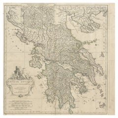
Large Map France
9
to
62
436
205
255
236
164
131
104
96
75
58
54
49
38
36
36
26
25
24
24
23
22
20
20
18
18
13
13
11
11
9
9
8
8
8
7
7
6
5
5
5
5
5
5
4
4
4
3
3
3
3
3
2
2
2
2
2
1
1
1
54
42
42
16
13
Sort By
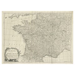
Large Antique Map of the Kingdom of France
Located in Langweer, NL
Antique map titled 'The Kingdom of France (..)'. Large antique map of the Kingdom of France
Category
Antique Late 18th Century Maps
Materials
Paper
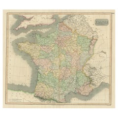
Large Antique Map of France with Original Hand Coloring
Located in Langweer, NL
Antique map titled 'France in Provinces'. Beautiful antique map of France. Drawn and engraved for
Category
Antique Early 19th Century Maps
Materials
Paper
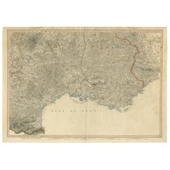
Striking Large Format Antique Map of Southeastern France, 1799
Located in Langweer, NL
large format map of Southeastern France, showing the region from the Mediterranean Coast and Gulf of
Category
Antique 1790s Maps
Materials
Paper
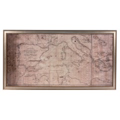
Large Framed Map of the Mediterranean
Located in New York, NY
Large map/chart chart of The Mediterranean and the Grecian Archipelago showing Italy, Sardinia
Category
20th Century French Mid-Century Modern Maps
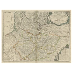
Large Antique Map of the Picardy Region of France, 1694
Located in Langweer, NL
Antique map titled 'La Province de Picardie (..)'.
Large map of the Picardy region of France
Category
Antique 1690s Maps
Materials
Paper
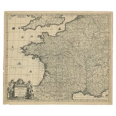
Large Antique Map of France by De Wit, c.1680
By Frederick de Wit
Located in Langweer, NL
Antique map titled 'Accuratissima Galliae Tabula vulgo Royaume de France'. Detailed map of France
Category
Antique 17th Century Maps
Materials
Paper
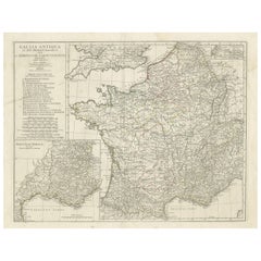
Large Antique Map of Gaul, or France in Ancient Roman Times
Located in Langweer, NL
Original antique map titled 'Gallia Antiqua ex Aevi Romani Monumentis (..)'. Large map of Gaul, or
Category
Antique Mid-18th Century Maps
Materials
Paper
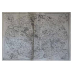
Original Large Antique Map of Paris, France by John Dower, 1861
Located in St Annes, Lancashire
Fabulous monochrome map of Paris.
Vignettes of St Germain En Laye, Saint Cloud, Versailles and
Category
Antique 1860s English Victorian Maps
Materials
Paper
No Reserve
H 25.5 in W 36 in D 0.07 in
Large Scale Map of Greece with Inset Map of Macedonia, c.1786
Located in Langweer, NL
Antique map titled 'Graeciae Antiquae'. Large scale map of Greece, extends south to the island of
Category
Antique 18th Century Maps
Materials
Paper
Large Antique Map of the Region of Berry, Nivernois & Bourbonnais, France, 1753
Located in Langweer, NL
Antique map titled 'Gouvernements généraux du Berry, du Nivernois et du Bourbonois'.
Large
Category
Antique 1750s Maps
Materials
Paper
H 22.05 in W 28.75 in D 0 in
1812 United States Map, by Pierre Tardieu, Antique French Map Depicting the U.S.
By Pierre François Tardieu
Located in Colorado Springs, CO
Map by Tardieu
This attractive map, published in Paris in 1812, is one of the most rare large
Category
Antique 1810s French Maps
Materials
Paper
H 43.5 in W 48 in D 2.25 in
Large Folding Map of Paris, France, on Linen, 36 Segments, Published in 1836
Located in Langweer, NL
d'apres les travaux de la Nouvelle Carte De France'.
Folding map of Paris on linen, 36 segments
Category
Antique 1830s Maps
Materials
Paper
H 27.96 in W 39.77 in D 0 in
Antique Map of France by Faden '1792'
Located in Langweer, NL
Antique map titled 'France divided into Metropolitan Circles (..)'. Large, original antique map of
Category
Antique Late 18th Century Maps
Materials
Paper
Antique Map of France by Faden, 1792
Located in Langweer, NL
Antique map titled 'France divided into Metropolitan Circles (..)'. Large, original antique map of
Category
Antique 18th Century Maps
Materials
Paper
Large Antique Map of France, with a Small Inset of the Island of Corsica, 1792
Located in Langweer, NL
Antique map titled 'France divided into Metropolitan Circles (..)'.
Large, original antique map
Category
Antique 1790s Maps
Materials
Paper
H 21.66 in W 30.71 in D 0 in
Antique Map of the Coast of France, 1710
By Jacobus Harrewijn
Located in Langweer, NL
France showing the estuaries of the Somme and the Bresle. This map is part of a serie of maps that
Category
Antique Early 18th Century Maps
Materials
Paper
Antique Decorative French Map of Java, Indonesia, 1718
Located in Langweer, NL
tout Nouvellement (..)'.
Decorative large format map map of Java, with an inset of the bay of Batavia
Category
Antique 18th Century Maps
Materials
Paper
Antique Map of Algeria and the French Colonies, 1875
Located in Langweer, NL
Antique map titled 'Algérie et Colonies Francaises'. Large map of Algeria and the French Colonies
Category
Antique Late 19th Century Maps
Materials
Paper
Stunning Large Scale Antique Map of Martinique, Rare, Published 1758
Located in Langweer, NL
accurate and finely engraved separately issued maps.
Artist: Jacques Nicolas Bellin (1703-1772): French
Category
Antique 18th Century Maps
Materials
Paper
Antique Map of France by Covens & Son, c.1790
Located in Langweer, NL
divisée en 83 Departements (..)'
**Date**: Circa 1790
**Description**: This large map of France, notable
Category
Antique 18th Century Maps
Materials
Paper
Portugal: A Large 17th Century Hand-colored Map by Sanson and Jaillot
By Nicolas Sanson
Located in Alamo, CA
This large hand-colored map entitled "Le Royaume de Portugal et des Algarves Divisee en see
Category
Antique 1690s French Maps
Materials
Paper
Antique Map of Hérault ‘France’ by V. Levasseur, 1854
Located in Langweer, NL
Antique map titled 'Dépt. de l'Hérault'. Map of the French department of Herault, France. This area
Category
Antique Mid-19th Century Maps
Materials
Paper
Africa: A Large 17th Century Hand-Colored Map by Sanson and Jaillot
By Nicolas Sanson
Located in Alamo, CA
This large original hand-colored copperplate engraved map of Africa entitled "L'Afrique divisee
Category
Antique 1690s French Maps
Materials
Paper
Antique Map of France by Covens & Mortier, c.1730
Located in Langweer, NL
Antique map titled 'Nova regni Galliae (..) La France'. Old map of France with large decorative
Category
Antique 18th Century Maps
Materials
Paper
Decorative Map of the French Regions of Picardy, Artois & French Flanders, c1780
Located in Langweer, NL
Boulenois.'
An attractive example of Rigobert Bonne's 1771 decorative map of the French regions of
Category
Antique 1780s Maps
Materials
Paper
H 14.57 in W 19.49 in D 0 in
Antique French Map of Java, Indonesia by Chatelain, '1719'
Located in Langweer, NL
in a large insert in the lower left portion of the map. Above the map are two drapery style title
Category
Antique Early 18th Century Maps
Materials
Paper
Superb, Large Map of British India, Chinese Empire, Indochina, Malaysia, 1860
Located in Langweer, NL
Antique map titled 'Indes, colonies Anglaises.'
Large map of the East Indies, British Colonies
Category
Antique 1860s Maps
Materials
Paper
H 22.8 in W 31.07 in D 0 in
Large Map of Castile's Southern Realms - Granada, Andalusia, and Murcia, 1652
Located in Langweer, NL
This antique map, titled 'Les Etats de la Couronne de Castille', represents the southern regions of
Category
Antique Mid-17th Century Maps
Materials
Paper
H 17.64 in W 23.75 in D 0.02 in
Antique Map of France with Inset showing the Northern Departments
Located in Langweer, NL
map of France. Includes a large cartouche and an inset, showing the northern Departments. Engraved by
Category
Antique Late 18th Century Maps
Materials
Paper
Antique Map of the French Coast at Boulogne and Picardy
Located in Langweer, NL
Antique map titled 'Les Costes du Boulenois et de la Picardie'. Map of the French coast at Boulogne
Category
Antique Early 18th Century Maps
Materials
Paper
Southern & Eastern Europe: A Large 17th C. Hand-colored Map by Sanson & Jaillot
By Nicolas Sanson
Located in Alamo, CA
This large hand-colored map entitled "Estats de L'Empire des Turqs en Europe, ou sont les
Category
Antique 1690s French Maps
Materials
Paper
H 24.88 in W 38 in D 0.13 in
Vienna, Austria: A Large 17th Century Hand-Colored Map by Sanson and Jaillot
By Nicolas Sanson
Located in Alamo, CA
This large 17th century hand-colored map of Vienna, Austria and the surrounding countryside and
Category
Antique 1690s French Maps
Materials
Paper
H 20 in W 24.88 in D 0.13 in
Antique Map of the Limoges Region in France, c.1690
Located in Langweer, NL
Antique map titled 'Le Diocèse de Limoges'. Large map of the Limoges region, France.
The map is
Category
Antique 17th Century Maps
Materials
Paper
Southern Greece: A Large 17th C. Hand-colored Map by Sanson and Jaillot
By Nicolas Sanson
Located in Alamo, CA
This large original hand-colored copperplate engraved map of southern Greece and the Pelopponese
Category
Antique 1690s French Maps
Materials
Paper
Plan of Paris, France, by A. Vuillemin, Antique Map, 1845
Located in Colorado Springs, CO
This large and detailed plan of Paris was published by Alexandre Vuillemin in 1845. The map conveys
Category
Antique 1840s American Maps
Materials
Paper
Antique Engraved Map with Original Hand Colour of French Guiana, 1876
Located in Langweer, NL
The 1876 map of French Guiana from the "Grand Atlas Départemental de la France de L'Algérie et des
Category
Antique Late 19th Century Maps
Materials
Paper
Antique Map Normandy 'France' by Homann Heirs, Published in c.1740
By Homann Heirs
Located in Langweer, NL
(..)'.
Decorative regional map of Normandy, France, circa 1740. Large, decorative title cartouche.
Category
Antique Mid-18th Century German Maps
Materials
Paper
Original Antique Map of the Picardy Region in Northern France, 1694
Located in Langweer, NL
Antique map titled 'La Province de Picardie (..)'. Large map of the Picardy region of France. Shows
Category
Antique 17th Century Maps
Materials
Paper
Original Antique Map of the Region of Picardy, France, ca.1602
Located in Langweer, NL
maps by different map makers in a uniform format. Three Latin editions as well as a Dutch, French and
Category
Antique Early 1600s Maps
Materials
Paper
Large Antique Map of the Lower Nile Valley Including Egypt and Nubia, 1842
Located in Langweer, NL
Antique map titled 'Carte de l'Égypte, de la Nubie, de l'Abissinie'. Map of Egypt, covering the
Category
Antique 19th Century Maps
Materials
Paper
H 26.78 in W 19.89 in D 0 in
1752 Vaugoundy Map of Flanders : Belgium, France, and the Netherlands, Ric.a002
Located in Norton, MA
Large Vaugoundy Map of Flanders:
Belgium, France, and the Netherlands
Colored -1752
Ric.a002
Category
Antique 17th Century Unknown Maps
Materials
Paper
H 51.5 in W 66 in D 1 in
18th Century French Map and City View of Joppe/Jaffa 'Tel Aviv' by Sanson
By Nicolas Sanson
Located in Alamo, CA
historical treatises. His maps came to the attention of Cardinal Richelieu and then King Louis XIII of France
Category
Antique Early 18th Century French Maps
Materials
Paper
H 18.88 in W 23 in D 1.13 in
Large Antique Map of the British Isles, with inset of the Orkneys and Shetlands
Located in Langweer, NL
Antique map titled 'A Map of Great Britain and Ireland (..)'. Large antique map of the British
Category
Antique Late 18th Century Maps
Materials
Paper
H 18.43 in W 24.93 in D 0.02 in
Large Scale Map of Greece, Extending to Cythera with Inset of Macedonia, ca.1786
Located in Langweer, NL
Antique map titled 'Graeciae Antiquae'.
Large scale map of Greece, extends south to the island
Category
Antique 1780s Maps
Materials
Paper
H 21.26 in W 21.26 in D 0 in
Striking Antique Map of Cayenne in French Guyana, South America, ca.1760
Located in Langweer, NL
Kust van Zuid-Amerika'.
Striking map of the island and settlement of Cayenne in French Guyana, with
Category
Antique 1760s Maps
Materials
Paper
Antique Map of Picardy, Aroits and French Flanders by Bonne, c.1780
Located in Langweer, NL
Boulenois.' An attractive example of Rigobert Bonne's 1771 decorative map of the French regions of Picardy
Category
Antique 18th Century Maps
Materials
Paper
Antique Map of Asia, 1846
Located in Langweer, NL
Antique map titled 'Asie'. Original antique map of Asia. Source unknown, to be determined
Category
Antique 19th Century Maps
Materials
Paper
The Normandy Region of France: A 17th C. Hand-colored Map by Sanson and Jaillot
By Nicolas Sanson
Located in Alamo, CA
This large hand-colored map entitled "Le Duché et Gouvernement de Normandie divisée en Haute et
Category
Antique 1690s French Maps
Materials
Paper
H 24.88 in W 38 in D 0.13 in
Antique Map of the Artois Region 'France' by F. de Wit, circa 1680
Located in Langweer, NL
Antique map titled 'Tabula Comitatus Artesiae emendata'. Large map of the Artois region, France
Category
Antique Late 17th Century Maps
Materials
Paper
Antique Map of the Hainaut Region 'France' by F. de Wit, circa 1680
Located in Langweer, NL
Antique map titled 'Comitatus Hannoniae et Episcopatus Cambresis Descriptio'. Large map of the
Category
Antique Late 17th Century Maps
Materials
Paper
Antique Map of the Namur Region 'France' by F. de Wit, circa 1680
Located in Langweer, NL
Antique map titled 'Comitatus Namurci Tabula in Lucem Edita'. Large map of the Namur region, France
Category
Antique Late 17th Century Maps
Materials
Paper
Antique Map of Belgium and Northern France by F. de Wit, circa 1680
Located in Langweer, NL
Antique map titled 'Belgii Regii Accuratissima Tabula Pluribus Locis Recens Emen'. Large map of
Category
Antique Late 17th Century Maps
Materials
Paper
Authentique Map by Pilon of The French Colonies in The West Indies, 1876
Located in Langweer, NL
This map is a significant representation of the French colonies in the West Indies during the late 19th
Category
Antique Late 19th Century Maps
Materials
Paper
H 14.38 in W 16.54 in D 0 in
Antique Map of France in Ancient Roman Times by d'Anville 'c.1795'
Located in Langweer, NL
Antique map titled 'Gallia Antiqua ex Aevi Romani Monumentis (..)'. Original, large, map of France
Category
Antique Late 18th Century Maps
Materials
Paper
Antique Map of the Region of Vermandois and Cappelle, France by Janssonius, 1657
By Johannes Janssonius
Located in Langweer, NL
Antique map of France titled 'Descriptio Veromanduorum - Gouvernement de la Cappelle'. Two detailed
Category
Antique 17th Century Maps
Materials
Paper
H 19.69 in W 23.63 in D 0 in
Old Map of Region Champagne-Ardenne with Reims, Troyes & Épernay in France, 1759
Located in Langweer, NL
France by J. B. Homann, covering the region Champagne-Ardenne with Reims, Troyes and Épernay. The map
Category
Antique 1750s Maps
Materials
Paper
H 24.93 in W 21.07 in D 0 in
Map of Languedoc-Roussillon and Provence in France and Piedmont in Italy, c1680
Located in Langweer, NL
Principaute de Piemont.'
Very large and highly detailed map of the Languedoc-Roussillon and Provence
Category
Antique 1680s Maps
Materials
Paper
H 21.19 in W 35.83 in D 0 in
Antique Map of France according to the Treaty of Paris '1815', Published in 1854
Located in Langweer, NL
Paris. (1815)'. Large map of France. From James Wyld's 'A New General Atlas of Modern Geography
Category
Antique 19th Century Maps
Materials
Paper
H 23.04 in W 28.35 in D 0 in
Antique Map of South West Germany with an Inset of Brisac or Brisach, France
Located in Langweer, NL
of modern day France and Luxemburg. With a large inset of New and Old Brisach. Originates from 'A
Category
Antique 18th Century Maps
Materials
Paper
H 15.36 in W 10.24 in D 0 in
Antique Map of Artois in the North of France by Famous Mapmaker Blaeu, c.1640
Located in Langweer, NL
Antique map titled 'Artesia Comitatus Artois'. Map of Artois or Artesia, France. Artois is former
Category
Antique 17th Century Maps
Materials
Paper
No Reserve
H 19.69 in W 23.43 in D 0 in
- 1
- ...
Get Updated with New Arrivals
Save "Large Map France", and we’ll notify you when there are new listings in this category.
More Ways To Browse
Victorian Celestial Decor
Southwestern Furniture And Decor
Ashley Antique Furniture
Epernay France
Antique Folding Sink
Czar And Czarina
Antique Portuguese Chain
Antique Micrometer
Antique Micrometers
Antique French Provincial Secretaries
Holy Water Sink
Map Of Quebec
Antique Slovenia
Map Of French Alps
Montenegro Antique Map
Carte Egypte Antique
Antique Map Of New Hampshire
Heinrich Kiepert On Sale
