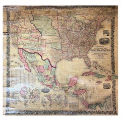
Map Americas
79
to
214
1,879
820
934
924
600
554
476
337
238
238
213
209
149
115
113
105
90
85
76
73
72
65
62
56
51
42
39
37
31
31
29
26
26
23
22
19
18
18
16
14
14
11
11
11
10
10
10
9
8
7
6
6
5
4
3
3
3
3
2
1
1
1
1
103
52
46
42
42
Sort By
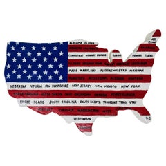
Vintage US Map American Flag Wall Art
Located in San Diego, CA
Beautiful and original wall art in the shape of the US depicting the American Flag along with all
Category
1990s American Folk Art Picture Frames
Materials
Canvas
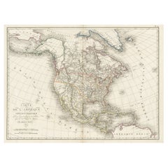
Antique Map of North America, 1821
Located in Langweer, NL
Antique map of America titled 'Carte de l'Amerique septentrionale'. Scarce map of North America
Category
Antique 19th Century Maps
Materials
Paper
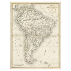
Scarce Antique Map of South America
Located in Langweer, NL
Antique map titled 'Carte de l'Amérique Méridionale'. Scarce map of South America, published in
Category
Antique Early 19th Century Maps
Materials
Paper
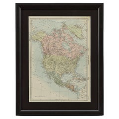
1875 "North America" Map by J. Bartholomew
Located in Colorado Springs, CO
Presented is an original 1875 map of “North America.” The map was issued in Volume 1 of the Ninth
Category
Antique 1870s Scottish Maps
Materials
Paper
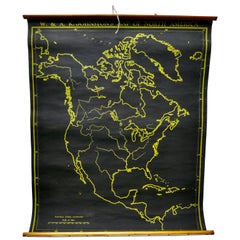
University Chart “Black Map of North America
Located in Chillerton, Isle of Wight
University Chart “Black Map of North America
W&A K Johnston’s Charts of Physical Maps By G W
Category
Early 20th Century Industrial Maps
Materials
Linen
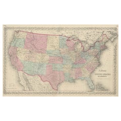
Antique Map Colton's United States of America
Located in Langweer, NL
Antique map titled 'Colton's United States of America'. Show railroads, canals, state capitals
Category
Antique Mid-19th Century Maps
Materials
Paper
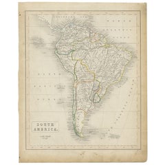
Antique Map of South America, c.1840
Located in Langweer, NL
Antique map titled 'South America'. Original, antique map depicting South America. With outline
Category
Antique 19th Century Maps
Materials
Paper
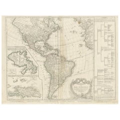
Antique Map of America by Vaugondy, 1778
Located in Langweer, NL
Antique map titled 'Amerique ou Indes Occidentales (..)'. Vaugondy's map of America, pre-dating
Category
Antique Late 18th Century Maps
Materials
Paper
Large Antique 1859 Map of North America
Located in Sag Harbor, NY
This Map was made by Augustus Mitchell in 1859 It is in amazing condition for being 163 years old
Category
Antique Mid-19th Century American Maps
Materials
Canvas, Paper
Vintage Reproduction 17th Century Map of Europe, American, Cartography, Blaeuw
Located in Hele, Devon, GB
This is a vintage reproduction map of Europe. An American, paper stock cartography print in frame
Category
Late 20th Century Central American Mid-Century Modern Maps
Materials
Glass, Wood, Paper
H 30.32 in W 38.39 in D 1.38 in
Antique Decorative Coloured Map of North America, 1882
Located in Langweer, NL
This original antique map of North America is from the Blackie & Son Atlas published in 1882. Here
Category
Antique 1880s Maps
Materials
Paper
Original Antique Map of South America. C.1780
Located in St Annes, Lancashire
Great map of South America
Copper-plate engraving
Published C.1780
Two small worm holes to left
Category
Antique Early 1800s English Georgian Maps
Materials
Paper
1864 Map of North America, Antique Hand-Colored Map, by Adolphe Hippolyte Dufour
Located in Colorado Springs, CO
Offered is a map of North America entitled Amerique du Nord from 1864. This rare, separately
Category
Antique 1860s French Maps
Materials
Paper
H 44.5 in W 33 in D 1.5 in
Antique Map of North America by Wyld '1845'
Located in Langweer, NL
Antique map titled 'North America'. Original antique map of North America. This map originates from
Category
Antique Mid-19th Century Maps
Materials
Paper
Antique Map of South America by Wyld, '1845'
Located in Langweer, NL
Antique map titled 'South America'. Original antique map of South America. This map originates from
Category
Antique Mid-19th Century Maps
Materials
Paper
Antique Map of North America by Johnson, '1872'
Located in Langweer, NL
Antique map titled 'Johnson's North America'. Original map of North America, with an inset map of
Category
Antique Late 19th Century Maps
Materials
Paper
Antique Map of South America by Lowry, 1852
Located in Langweer, NL
Antique map titled 'South America'. Original map of South America. This map originates from
Category
Antique Mid-19th Century Maps
Materials
Paper
Antique Map of North America by Lowry '1852'
Located in Langweer, NL
Antique map titled 'North America'. Original map of North America. This map originates from
Category
Antique Mid-19th Century Maps
Materials
Paper
Antique Map of South America by Balbi '1847'
Located in Langweer, NL
Antique map titled 'Amérique du sud'. Original antique map of South America. This map originates
Category
Antique Mid-19th Century Maps
Materials
Paper
Antique Map of North America by Levasseur '1875'
Located in Langweer, NL
Antique map titled 'Carte générale de l'Amérique Septentrionale'. Large map of North America. This
Category
Antique Late 19th Century Maps
Materials
Paper
Antique Map of South America by Migeon '1880'
By J. Migeon
Located in Langweer, NL
Antique map titled 'Amérique Méridionale'. Old map of South America. With an inset map of the
Category
Antique Late 19th Century French Maps
Materials
Paper
Antique Map of South America by Johnston '1909'
Located in Langweer, NL
Antique map titled 'South America, Southern Sheet'. Depicting Chile, Argentina, Brazil, Patagonia
Category
Early 20th Century Maps
Materials
Paper
Antique Map of North America by Lapie '1842'
Located in Langweer, NL
Antique map titled 'Carte de l'Amérique septentrionale'. Map of North America, with an inset map of
Category
Antique Mid-19th Century Maps
Materials
Paper
Antique Map of North America by Johnston, 1882
By Alexander Keith Johnston
Located in Langweer, NL
Antique map titled 'North America'.
Old map of North America. This map originates from 'The Royal
Category
Antique 19th Century Maps
Materials
Paper
Interesting Original Antique Map of South America, 1822
Located in Langweer, NL
Antique map titled 'South America'.
Map of South America with attractive topography, surrounded
Category
Antique 19th Century Maps
Materials
Paper
Antique Map of South America by Walker, 1816
By Thomas Kitchin
Located in Langweer, NL
Antique map titled 'South America'. Old map of South America. This map originates from 'Walker's
Category
Antique 19th Century Maps
Materials
Paper
Antique Map of South America by Lapie '1842'
Located in Langweer, NL
Antique map titled 'Carte Générale de l'Amérique Meridionale'. Map of South America. This map
Category
Antique Mid-19th Century Maps
Materials
Paper
Antique Map of South America by Finlayson, 1822
Located in Langweer, NL
America'. This map depicts part of South America (including part of Brazil and Chili) and provides a lot
Category
Antique 19th Century Maps
Materials
Paper
Original Antique Map of South America, circa 1830
Located in St Annes, Lancashire
Great map of South America
Copper plate engraving
Published by Butterworth, Livesey & Co
Category
Antique Early 1800s English Other Maps
Materials
Paper
Antique Map of South America by Reichard, 1820
By Thomas Kitchin
Located in Langweer, NL
Antique map titled 'Süd America'. Decorative antique map of South America with an inset map of
Category
Antique 19th Century Maps
Materials
Paper
Antique Map of South America by Tyrer, 1821
By Thomas Kitchin
Located in Langweer, NL
Antique map titled 'South America'. Beautiful antique map of South America engraved by Tyrer
Category
Antique 19th Century Maps
Materials
Paper
Antique Map of South America by Johnston, 1844
Located in Langweer, NL
Antitique map titled 'South America'. Beautiful original antique map of South America. This map
Category
Antique 19th Century Maps
Materials
Paper
Antique Map of South America by Kelly, 1835
Located in Langweer, NL
Antique map titled 'South America'. Old map of South America engraved by A. Findley. With
Category
Antique 19th Century Maps
Materials
Paper
Antique Map of South America by Johnston, 1861
Located in Langweer, NL
Antique map titled 'South America'.
Old map of South America, with an inset map of the Galapagos
Category
Antique 19th Century Maps
Materials
Paper
Antique Map of South America by Johnston, 1882
Located in Langweer, NL
Antique map titled 'South America'. Old map of South America, with an inset map of the Galapagos
Category
Antique 19th Century Maps
Materials
Paper
Antique Map of South America by Petri, 1852
By Thomas Kitchin
Located in Langweer, NL
Antique map titled 'Zuid-Amerika'. Map of South America. This map originates from 'School-Atlas van
Category
Antique 19th Century Maps
Materials
Paper
Antique Map of South America, Southern Part, 1882
Located in Langweer, NL
Antique map titled 'South America'. Old map of South America. This map originates from 'The Royal
Category
Antique 19th Century Maps
Materials
Paper
Antique Map of South America by Buchon, 1825
Located in Langweer, NL
Antique map titled 'Carte de l'Amérique méridionale'. Map of South America with attractive
Category
Antique 19th Century Maps
Materials
Paper
Antique Lithography Map, South America, English, Framed, Cartography, Victorian
Located in Hele, Devon, GB
This is an antique lithography map of South America. An English, framed atlas engraving of
Category
Antique Mid-19th Century British Early Victorian Maps
Materials
Wood
H 21.86 in W 17.13 in D 0.79 in
Antique Map of British North America by Lowry, '1852'
Located in Langweer, NL
Antique map titled 'British North America'. Original map of British North America. This map
Category
Antique Mid-19th Century Maps
Materials
Paper
Antique Map of British America by Tallis 'c.1850'
Located in Langweer, NL
Antique map titled 'British America'. Decorative map of British America, with vignettes showing
Category
Antique Mid-19th Century Maps
Materials
Paper
Antique Map of South America by Dower, ‘circa 1845’
Located in Langweer, NL
Antique map titled 'South America'. Old map of South America. Published by Orr & Company, Amen
Category
Antique Mid-19th Century Maps
Materials
Paper
Antique Map of South America by Philip & Son, 1875
Located in Langweer, NL
Antique map titled 'South America'. Old map of South America. Source unknown, to be determined
Category
Antique 19th Century Maps
Materials
Paper
Large Original Vintage Map of North America, circa 1920
Located in St Annes, Lancashire
Great map of North America
Original color. Good condition
Published by Alexander Gross
Category
Vintage 1920s English Edwardian Maps
Materials
Paper
Original Antique Map of Central America / Florida, Arrowsmith, 1820
Located in St Annes, Lancashire
Great map of Central America.
Drawn under the direction of Arrowsmith.
Copper-plate engraving
Category
Antique 1820s English Maps
Materials
Paper
No Reserve
H 10.5 in W 16 in D 0.07 in
Antique Map of North America by Dufour 'circa 1834'
Located in Langweer, NL
Antique map titled 'Amérique Septentrionale'. Uncommon map of North America. Published by or after
Category
Antique Mid-19th Century Maps
Materials
Paper
Antique Map of North America Including the West Indies
Located in Langweer, NL
Original antique map titled 'Nord-America'. Old map of North America and the West Indies. Also
Category
Antique Mid-19th Century Maps
Materials
Paper
Excellent Antique Map of America with Unusual Northwest Coast of America, c.1754
Located in Langweer, NL
aanwyzing an de Scheepstogten der Nederlanderne Naar West Indie.' Excellent map of America, featuring an
Category
Antique 1750s Maps
Materials
Paper
No Reserve
H 13.98 in W 15.75 in D 0 in
Antique Map of South America by Conder, c.1775
Located in Langweer, NL
Antique map titled 'South America agreeable to the most approved maps and charts'. Rare map of
Category
Antique 18th Century Maps
Materials
Paper
Antique Map of South America by J. Cook, 1775
Located in Langweer, NL
America, focusing on Cook's tracks around the Cape Horn and Tierra del Fuego in 1775. This map originates
Category
Antique Mid-18th Century Maps
Materials
Paper
Antique Map of South America by V. Levasseur, 1854
By Victor Levasseur
Located in Langweer, NL
Antique map titled 'Amérique Méridionale'. Map shows South America, beautiful surrounded by typical
Category
Antique Mid-19th Century Maps
Materials
Paper
Antique Map of South America by Wyld, circa 1850
By J. Wyld
Located in Langweer, NL
Beautiful folding map of South America titled 'Colombia Prima or South America Drawn from the Large
Category
Antique Mid-19th Century British Maps
Materials
Paper
Antique Map of North America by Laarman, c.1860
Located in Langweer, NL
Antique map titled 'Noord Amerika'. Original antique map of North America. Published circa 1860
Category
Antique 19th Century Maps
Materials
Paper
Antique Map of South America by J. Cook (1775)
Located in Langweer, NL
America, focusing on Cook's tracks around the Cape Horn and Tierra del Fuego in 1775. This map originates
Category
Antique Late 18th Century Maps
Materials
Paper
Set of Two Antique Maps of South America with Inset Maps of Rio de Janeiro
Located in Langweer, NL
Set of two antique maps titled 'Süd-America in zwei Blättern'. Two individual sheets of South
Category
Antique Mid-19th Century Maps
Materials
Paper
Free Shipping
H 14.57 in W 17.88 in D 0.02 in
Antique Map of South America Depicting Guayana, c.1780
Located in Langweer, NL
Operations et les Cartes recentes des Ingenieurs-Geographes Francois'. Antique map of South America depicting
Category
Antique 18th Century Maps
Materials
Paper
Antique Map of South America by Cadell & Davies, 1803
Located in Langweer, NL
Antique map South America titled 'South America'. Antique map of South America published by Cadell
Category
Antique 19th Century Maps
Materials
Paper
Antique Map of South America by Tirion 'circa 1765'
Located in Langweer, NL
'. Attractive and quite detailed map of most of South America, lacking the northern parts of Venezuela and
Category
Antique Mid-18th Century Maps
Materials
Paper
Antique Map of South America by Petri, c.1873
By Thomas Kitchin
Located in Langweer, NL
Antique map titled 'Zuid-Amerika'. Old map depicting South America, with an inset map of the
Category
Antique 19th Century Maps
Materials
Paper
Antique Map of South America by Gordon, c.1745
Located in Langweer, NL
Antique map titled 'South America according to the latest observations'. Antique map of South
Category
Antique 18th Century Maps
Materials
Paper
- 1
- ...
Get Updated with New Arrivals
Save "Map Americas", and we’ll notify you when there are new listings in this category.
Map Americas For Sale on 1stDibs
An assortment of map americas is available at 1stDibs. The range of distinct map americas — often made from paper, wood and fabric — can elevate any home. Map americas have been produced for many years, with earlier versions available from the 18th Century and newer variations made as recently as the 21st Century. Map americas bearing Neoclassical or Mid-Century Modern hallmarks are very popular at 1stDibs. Many map americas are appealing in their simplicity, but Abraham Ortelius, Aaron Arrowsmith and Bowen produced popular map americas that are worth a look.
How Much are Map Americas?
Prices for map americas can differ depending upon size, time period and other attributes — at 1stDibs, map americas begin at $1 and can go as high as $26,500, while the average can fetch as much as $803.
More Ways To Browse
Antique Maps Of Philadelphia
Oregon Trail
Old Map California
Old Map Of California
Antique Map Of Philadelphia
Louisiana Antiques
Farming Tools
Mississippi Map
Migeon Migeon
French Horloge
Migeon And Migeon
Antique Niagara
Map Bavaria
Brazil Map
Map Of Bavaria
Cape Dutch Furniture
Quito School
Stanford Antique Furniture
