Mississippi Map

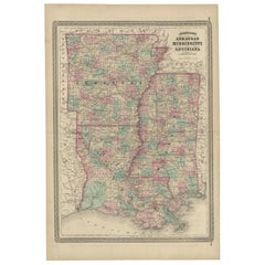
Antique Map of Arkansas, Mississippi and Louisiana by Johnson, 1872
Located in Langweer, NL
Antique map titled 'Johnson's Arkansas (..)'. Original map of Arkansas, Mississippi and Louisiana
Category

Antique Late 19th Century Maps

Materials

Paper

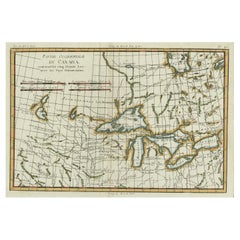
Old Map of the Great Lakes and Upper Mississippi Valley, Northern America, c1780
Located in Langweer, NL
Guilleme Raynal's 1780 map of the Great Lakes and upper Mississippi Valley. A map of considerable
Category

Antique 1780s Maps

Materials

Paper

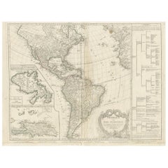
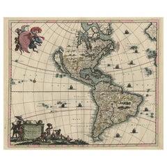
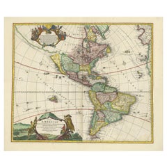
Antique Map of America by Vaugondy, 1778
Located in Langweer, NL
Antique map titled 'Amerique ou Indes Occidentales (..)'. Vaugondy's map of America, pre-dating
Category

Antique Late 18th Century Maps

Materials

Paper

Antique Map of America by Vaugondy, 1778
H 20.87 in W 27.56 in D 0.02 in
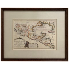
1705 Golfe de Mexico and Florida Framed Map
Located in Stamford, CT
Framed map of Mexico & Florida circa 1705, Paris. Small map with Mexico and the Gulf Coast. Inset
Category

Antique Early 1700s French Spanish Colonial Maps

Materials

Glass, Wood, Paper

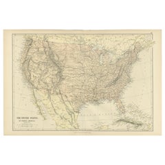
Antique Map of The United States of North America, 1882
Located in Langweer, NL
This is a historical map titled "The United States of North America, Central Part" from the 1882
Category

Antique 1880s Maps

Materials

Paper

Antique Map of The United States of North America, 1882
Free Shipping
H 14.97 in W 22.45 in D 0 in
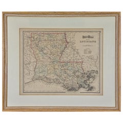
Louisiana: A Framed 19th Century Map by O. W. Gray
By Gray and Co
Located in Alamo, CA
. It is a highly detailed map of Louisiana and adjacent portions of Mississippi to the east and Texas
Category

Antique Mid-19th Century American Other Maps

Materials

Paper

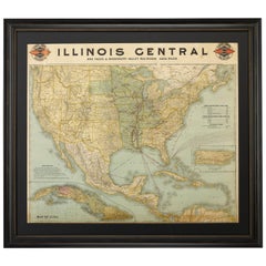
1899 Poole Brothers Antique Railroad Map of the Illinois Central Railroad
Located in Colorado Springs, CO
This is an 1899 railroad map of the Illinois Central and Yazoo and Mississippi Valley Railroads
Category

Antique 1890s American Maps

Materials

Paper

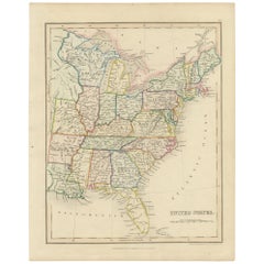
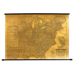
Original Antique Hand-colored Map of the United States, circa 1845
Located in Langweer, NL
Antique map titled 'United States'. Old map of the United States, includes the last part of the
Category

Antique Mid-19th Century Maps

Materials

Paper

Original Hand-Colored Antique Map of America by Danckerts, circa 1680
Located in Langweer, NL
Antique map titled 'Novissima et Accuratissima Totius Americae Descriptio per I. Danckerts
Category

Antique Late 17th Century Maps

Materials

Paper

Antique Map of America with California as an Island by Homann '1710'
Located in Langweer, NL
Lakes and Mississippi River**: The map provides detailed information about the Great Lakes and the
Category

Antique Early 18th Century Maps

Materials

Paper

1863 "Lloyd's New Map of the United States, the Canadas, and New Brunswick"
Located in Colorado Springs, CO
copies of Lloyd’s Mississippi River map for Rear Admiral Chas. E. Davis, “for use of his squadron." J.T
Category

Antique 1860s American Maps

Materials

Linen, Wood, Paper

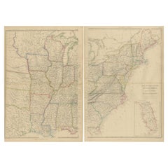
Set of 2 Antique Maps of the United States by W. G. Blackie, 1859
Located in Langweer, NL
Mississippi'. Original antique map of the United States of North America, Atlantic States and Valley of the
Category

Antique Mid-19th Century Maps

Materials

Paper

Antique 1844 J Calvin Smith JH Colton Midwest United States Survey Map 27"
By J.H. Colton
Located in Dayton, OH
shows Maiden’s Rock on the tranquil Mississippi. The map provides a fascinating glimpse at how the U.S
Category

Antique 1840s Maps

Materials

Paper

1879 "United States of America, Western Part" by O. J. Stuart
Located in Colorado Springs, CO
of the Mississippi River. CONDITION: Good condition. Colored map, with state borders in red
Category

Antique 1870s American Maps

Materials

Paper

Mississippi. USA Century Atlas state antique vintage map
Located in Melbourne, Victoria
'The Century Atlas. Mississippi' Original antique map, 1903. Central fold as issued. Map name and
Category

Early 20th Century Victorian More Prints

Materials

Lithograph

Mississippi Lamp by Elyse Graham
Located in Geneve, CH
Mississippi lamp by Elyse Graham Dimensions: D26 x H51 cm Materials: Plaster, Resin, Cotton rag
Category

2010s American Post-Modern Table Lamps

Materials

Brass, Nickel

Mississippi Lamp by Elyse Graham
H 20.08 in Dm 10.24 in
Contemporary Oblong Marbled Mississippi Vase in Blue by Elyse Graham
By Elyse Graham
Located in Springfield, OR
reference topographical maps. We take queues for our palette from the rivers for which the pieces are named
Category

2010s American Vases

Materials

Plaster, Resin

Louisiana: A Framed 19th Century Map by O.W. Gray
Located in Alamo, CA
. It is a highly detailed map of Louisiana and adjacent portions of Mississippi to the east and Texas
Category

1870s Landscape Prints

Materials

Engraving

one of the earliest large-scale English maps of North America
By John Senex
Located in London, GB
one of the earliest large-scale English maps of North America SENEX, John. North America Corrected
Category

1710s Naturalistic More Art

Materials

Watercolor, Engraving

The Decorative Arts of The Mariner by Gervis Frere-Cook, Stated 1st American Ed
Located in valatie, NY
, Mississippi river craft, charts and maps, navigational instruments, figureheads, decorative rope, ship models
Category

Vintage 1960s American Books

Materials

Paper

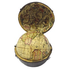
English Pocket Globe, London, Circa 1775-1798
By Herman Moll
Located in Milano, IT
region in his 1727 map. (Encyclopaedia Britannica, ed. 1902, under "States of Central Africa"); Tartary
Category

Antique Late 18th Century English George III Globes

Materials

Shagreen, Paper

'Lieutenant Crovers Despatch – Return of Governor Stevens to Fort Benton'
By John Mix Stanley
Located in Milwaukee, WI
newly acquired lands and territories west of the Mississippi. The goals of these surveys were manifold
Category

1850s Romantic Landscape Prints

Materials

Lithograph

'Victor's Camp - Hell Gate Ronde' original John Mix Stanley lithograph
By John Mix Stanley
Located in Milwaukee, WI
newly acquired lands and territories west of the Mississippi. The goals of these surveys were manifold
Category

1850s Romantic Landscape Prints

Materials

Lithograph

'Maple River' original color lithograph by John Mix Stanley
By John Mix Stanley
Located in Milwaukee, WI
newly acquired lands and territories west of the Mississippi. The goals of these surveys were manifold
Category

1850s Romantic Landscape Prints

Materials

Lithograph

'Kettle Falls, Columbia River' original color lithograph by John Mix Stanley
By John Mix Stanley
Located in Milwaukee, WI
newly acquired lands and territories west of the Mississippi. The goals of these surveys were manifold
Category

1850s Romantic Landscape Prints

Materials

Lithograph

'Camp Red River Hunters' original lithograph by John Mix Stanley
By John Mix Stanley
Located in Milwaukee, WI
newly acquired lands and territories west of the Mississippi. The goals of these surveys were manifold
Category

1850s Romantic Landscape Prints

Materials

Lithograph

A truly delightful miniature terrestrial pocket globe
By Nathaniel Mills
Located in ZWIJNDRECHT, NL
turning overhead. In line with its counterpart, the terrestrial globe, celestial globes are mapped by a
Category

Antique Mid-18th Century British Dutch Colonial Globes

Materials

Other

'Distribution of Goods to the Assiniboines' original John Mix Stanley lithograph
By John Mix Stanley
Located in Milwaukee, WI
newly acquired lands and territories west of the Mississippi. The goals of these surveys were manifold
Category

1850s Romantic Landscape Prints

Materials

Lithograph

'Distribution of Goods to the Gros Ventres' lithograph by John Mix Stanley
By John Mix Stanley
Located in Milwaukee, WI
newly acquired lands and territories west of the Mississippi. The goals of these surveys were manifold
Category

1850s Romantic Landscape Prints

Materials

Lithograph

"Portrait of an Italian Fencer, " John Frederick Kensett, Hudson River School
By John Frederick Kensett
Located in New York, NY
engraver of labels, banknotes and maps and was employed part of that time by the American Bank Note Company
Category

1840s Hudson River School Figurative Paintings

Materials

Watercolor, Paper

People Also Browsed

Wonderful and extremely rare Dutch pocketglobe
By Dementz Family DEUR Art Company
Located in ZWIJNDRECHT, NL
Only three copies worldwide. Miniature terrestrial pocket globe in a celestial case made by Johannes Deur. Amsterdam, 1720. Diameter of 2,5 inches / 6 cm. 2 legends are inscribed a...
Category

Antique Early 18th Century Dutch Dutch Colonial Globes

Materials

Hardwood, Paper

Wonderful and extremely rare Dutch pocketglobe
Free Shipping
H 2.5 in Dm 2.5 in
Keith Haring Fun Gallery exhibition poster 1983 (vintage Keith Haring)
By Keith Haring
Located in NEW YORK, NY
Keith Haring Fun Gallery 1983: Original 1983 Keith Haring illustrated exhibition poster published on the occasion of Haring's historic 1983 show at the Fun Gallery in the East Villag...
Category

1980s Pop Art Abstract Prints

Materials

Lithograph, Offset

Rare Pierre D´Avesn French Art Deco Acid Etched Table Lamp
By Pierre D'Avesn
Located in Oakland, CA
French Art Deco table lamp created by Pierre D’Avesn, circa 1930. Unique combination of French iron “fer forge” with a combination of a horizontally banded frosted shade and a glass ...
Category

Vintage 1930s French Art Deco Table Lamps

Materials

Iron

Antique 18th Century Spanish Colonial Carved Cedar Coffer Chest Mexico 1750
Located in Portland, OR
Antique 18th century Spanish Colonial carved cedar coffer/chest, Mexico, circa 1750. The chest having a lift up lid with hand cut iron strap hinges, the chest is profusely chip-carve...
Category

Antique Mid-18th Century Mexican Spanish Colonial Blanket Chests

Materials

Cedar

Jim Rose Legacy Collection - One-Drawer Plank Top Side Table, Steel Furniture
By Jim Rose
Located in Chicago, IL
Jim Rose - Legacy Collection One-drawer plank top table found steel with natural rust patina Measures: 27.50 H x 31.50 W x 27.50 D in 69.85 H x 80.01 W x 69.85 D cm JR0229 Jim Rose ...
Category

2010s American Mid-Century Modern End Tables

Materials

Steel

19th Century English Victorian Campaign Style Travel Desk Writing Box
Located in Forney, TX
A antique Victorian era English campaign style brass bound mahogany portable lap desk / writing slope with nicely aged patina. circa 1850 Commonly used by military officers in the f...
Category

Antique Mid-19th Century English Campaign Decorative Boxes

Materials

Brass

Pair of 19th Century French Mantel Urns, circa 1890
Located in Dallas, TX
Wonderfully well preserved, this pair of 19th century French mantel urns were designed to adorn the mantel or buffet, or perhaps console in the foyer of a luxuriously appointed home ...
Category

Antique 1890s French Neoclassical Urns

Materials

Marble, Spelter

19th Century Original Mexican Retablo "Exvoto" Oil on Tin
Located in Mexico City, CDMX
Dated 1870, we offer this 19th century original Mexican retablo "Exvoto" oil on tin, due to the effects of time, the writing has been erased but we can read the nex: “Le aconteció...
Category

Antique 1870s Mexican Folk Art Religious Items

Materials

Metal

Worn-In Distressed Antique Persian Karaja Heriz Rug with Rustic Style
Located in Dallas, TX
72988 Worn-In Distressed Antique Persian Karaja Heriz Rug with Rustic Style. This hand-knotted wool distressed antique Persian Karaja Heriz rug with Mid-Century Modern style features...
Category

Early 20th Century Persian Rustic Persian Rugs

Materials

Wool

19th Century Bronze Coin with Silver Bezel Earrings by Jewels
Located in Point Richmond, CA
19th Century Bronze Coin with Silver Bezel Earrings by Jewels of Santa Fe/Marrakesh A pair of earrings made by Jewels with bronze coins from Morocco and Egypt set in silver bezels a...
Category

Antique 19th Century Moroccan Tribal Tribal Art

Materials

Silver, Bronze

Vintage Victor Valery Signed Notre Dame Reims Signed Etching France Framed 15"
Located in Dayton, OH
Lochelongue, Victor Valery (1870-1930) Lochelongue, Victor Valery (1870-1930) was a French etcher of copper plate etchings (drypoint), primarily of scenes of Paris. He was born i...
Category

Early 20th Century Prints

Materials

Paper

Early 19th Century Flame Birch Chest of Drawers
Located in Nantucket, MA
Early 19th century Flame Birch chest of drawers. With original stain and lovely grain, four graduated drawers with beaded drawer fronts and turned knob pulls, on ogee bracket feet. ...
Category

Antique Early 19th Century Canadian Commodes and Chests of Drawers

Materials

Birch

Harmonious Mischief: A Triptych of Baroque Putti, circa 1620
Located in Langweer, NL
These images are rare but fine examples of original 17th-century European engravings, displaying characteristics that might point to an Italian origin based on stylistic analysis. Th...
Category

Antique 1620s Prints

Materials

Paper

Whimsical Archers: Duo of Baroque Putti, circa 1620
Free Shipping
H 7.88 in W 5.79 in D 0 in
19th Century French Renaissance-Style Buffet a Deux Corps in Walnut
Located in Miami, FL
A Belle Époque French buffet a deux corps in a medium, brown-colored walnut. This very beautiful Renaissance-style buffet features exceptional carvings of urns, flowers & foliage tha...
Category

Antique Late 19th Century French Renaissance Revival Buffets

Materials

Brass

Antique World Map by P. Schenk '1706'
By Peter Schenk
Located in Langweer, NL
Antique map titled 'Diversa Orbis Terrae. Visu Incedente per Coluros Tropicorum, Ambos Ejus Polos, et Parciularis Sphaerae Zenith, in Planum Orthographica Projectio (..) Plat Ontwerp...
Category

Antique Early 18th Century Maps

Materials

Paper

Antique World Map by P. Schenk '1706'
H 20.87 in W 23.82 in D 0.02 in

Recent Sales

1762 Map of North America
By Thomas Kitchin
Located in New York, NY
showing the Delta to the Mississippi River. This 254-year-old original, engraved map documents the
Category

1760s Realist Landscape Prints

Materials

Engraving

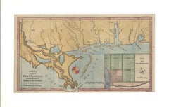
1772 Map of Part of "West Florida"
Located in New York, NY
Mississipi". A fascinating map showing the Mississippi delta and coastal regions of the now states of
Category

1770s Realist Landscape Prints

Materials

Engraving

1730 Hand-Colored Antique Map of the Americas
Located in La Jolla, CA
the map. The Mississippi flows into the Gulf of Mexico on the Texas coast. The Great Lakes are well
Category

Antique 1730s Dutch Baroque Prints

Materials

Paper

Highly Decorative Italian Wall Map of the World
By Paolo Petrini
Located in La Jolla, CA
Exceedingly rare separately-issued wall map of the World, by the Neapolitan mapmaker Paolo Petrini
Category

Antique Early 1700s Italian Baroque Prints

Materials

Paper

1719 Chatelain Map of Mexico, Southeast North America and the Caribbean
By Henri-Abraham Chatelain
Located in New York, NY
Original first edition 1719 engraved map, full title in French "Carte contenant royaume mexique et
Category

1710s Realist Landscape Prints

Materials

Engraving

Large 1804 Hand-Colored Map of America After the Louisiana Purchase
By Aaron Arrowsmith
Located in La Jolla, CA
Fine example of Arrowsmith's map of America, in four sheets. An excellent map of America on the
Category

Antique Early 1800s English Federal Prints

Materials

Paper

L' Amerique Septentrionale (North America with California as an Island)
Located in New York, NY
Original and rare 1702 map of North America showing California as a island stretching as far north
Category

Early 1700s Realist Landscape Prints

Materials

Engraving

Plate 69: 'Floraes Gecks-Kap of Afbeeldinge van 't wonderlijcke jaer van 1637.
By Dancker Danckerts
Located in Zeeland, Noord-Brabant
MDCCXX", Amsterdam, 1720. (The Great Mirror of Folly, which is actually a collection of all prints, maps
Category

1720s Figurative Prints

Materials

Engraving, Etching

Painting of a Cotton Picker by William Aiken Walker
By William Aiken Walker
Located in Alexandria, VA
mainly of drawing maps and sketches of Charleston's defenses, until he was mustered out at the end of
Category

Antique 1870s American Paintings

Materials

Composition

Mitchell's New National Wall Map Exhibiting the United States, circa 1856
Located in Colorado Springs, CO
of the region. A seminal map and a must for any serious United States, Southwest or Trans-Mississippi
Category

Antique 1850s American Maps

1854 Map of Partial North America, Antique Wall Map by Jacob Monk
Located in Colorado Springs, CO
"New Map of that Portion of North America, exhibiting the United States and Territories, The
Category

Antique 1850s American Maps

Materials

Paper

1860 Map of South Central United States by Swanston, Antique Hand-Colored Map
Located in Colorado Springs, CO
"United States. North America. The South Central Section. Comprising Texas, Louisiana, Mississippi
Category

Antique 1860s British Maps

Materials

Paper

1828 "Map of the United States" by T. Ensign
Located in Colorado Springs, CO
Mississippi River and the Pacific, the map is a mirror of American expansionist ambitions of the time
Category

Antique 1820s American Maps

Materials

Paper

Atwood's Pictorial Map of the United States, circa 1854
Located in Colorado Springs, CO
This is the 1854 J. M. Atwood ornamental engraved map of the United States published by Ensign
Category

Antique 1850s American Maps

1842 Map of Lewis and Clark's Expedition of North America
Located in Colorado Springs, CO
"Map of Lewis and Clark's Track across the Western Portion of North America, from the Mississippi
Category

Antique 1840s American Maps

Materials

Paper

New Map of North America, with the West India Islands
Located in Downingtown, PA
"A New Map of North America, with the West India Islands...according to the latest surveys, and
Category

Antique 1780s Georgian Maps

Materials

Paper

1848 "Pictorial Map of the United States" by Ensign & Thayer
Located in Colorado Springs, CO
the Mississippi river at this time. The map also predates the Gold Rush, thus Sacramento is not yet
Category

Antique 1840s Maps

Materials

Paper

Grant's Siege of Vicksburg, Civil War Era Military Map, circa 1863
Located in Colorado Springs, CO
"1863 Map of the Siege of Vicksburg, Mississippi by the Union Forces under the Command of Major
Category

Antique 1860s American Maps

Materials

Paper

1857 Wall Map of the United States by Fanning, Bridgman & Ensign
By Thayer, Bridgman and Fanning
Located in Colorado Springs, CO
Presented is a scarce American wall map of the United States and Mexico issued by Ensign, Bridgman
Category

Antique 1850s American Maps

Materials

Paper

1856 Hanging "Map of the United States from the Latest Authorities"
Located in Colorado Springs, CO
Presented is a scarce American wall map of the United States by Ensign, Bridgman, and Fanning in
Category

Antique 1850s American Maps

Materials

Linen, Wood, Paper

1847 "Pictorial Map of the United States" by Ensign and Thayer
Located in Colorado Springs, CO
Offered is a scarce map of the United States and Mexico by Ensign and Thayer. This pictorial map
Category

Antique 1840s American Maps

Materials

Paper

1846 Antique Map of Texas, Oregon, California, and Regions Adjoining by Mitchell
By Samuel Augustus Mitchell 1
Located in Colorado Springs, CO
between the Mississippi and the Missouri, and Wilkes map of Oregon. This map features the "Stovepipe
Category

Antique 1840s American Maps

Materials

Paper

Antique Map of North America, Depicting the New World's Lakes and Rivers, 1790
Located in Colorado Springs, CO
A particular map of the American Lakes and Rivers Published in London for John Harrison This is a
Category

Antique 1790s British Maps

Materials

Paper

1854 "New Map of That Portion of North America" Published by Jacob Monk
Located in Colorado Springs, CO
“New Map of that Portion of North America, exhibiting the United States and Territories, The
Category

Antique 1850s American Maps

Materials

Paper

Giltwood Framed and Matted Map
Located in Tarry Town, NY
Giltwood framed and matted library / study room map of Arkansas, Mississippi, Louisiana. Each map
Category

Early 20th Century Posters

Materials

Giltwood, Paper

Giltwood Framed and Matted Map
H 32 in W 25 in D 32 in
Crayon or Pastel on Muslin Naive Map of America
Located in York County, PA
NAÏVE MAP OF AMERICA, CRAYON OR PASTEL ON MUSLIN, CA 1920-30, WITH A MYRIAD OF INTERESTING
Category

Early 20th Century Paintings

Materials

Cotton

Exceptional Naive Antique Map of America, Crayon or Pastel on Muslin, 1920-30
Located in York County, PA
LARGE, NAIVE MAP OF AMERICA, CRAYON OR PASTEL ON MUSLIN, CA 1920-30, WITH A MYRIAD OF INTERESTING
Category

20th Century Paintings

Caarte Van West Indien, Soo Vaste landen als Eylanden, ...
By Joan Vingboons
Located in New York, NY
This late 17th-century copperplate engraved map was published in Amsterdam by Gerard Valk and Peter
Category

Late 17th Century Other Art Style More Prints

Materials

Engraving

Personal Memoirs of U.S. Grant, Special 2-Volume First Edition, 1885-1886
Located in Colorado Springs, CO
Grant, and 43 maps. Grant’s memoirs recount his own childhood and personal history, his military career
Category

Antique 1880s Books

Personal Memoirs of U.S. Grant, First Edition, Two-Volume Set, circa 1885-1886
By Ulysses S. Grant
Located in Colorado Springs, CO
engraved black and white illustrations, fold-out facsimile letters written by Grant, and 43 maps
Category

Antique 1880s American Books

Materials

Paper

Personal Memoirs of U.S. Grant, Second Edition, Two-Volume Set, 1892
By Ulysses S. Grant
Located in Colorado Springs, CO
engraved black and white illustrations, fold-out facsimile letters written by Grant, and forty-three maps
Category

Antique 1890s American Books

Materials

Paper

"Italy, Do You Know The Land" - Oil Painting on Unstretched Canvas - Pink, Blue
By Anne-Louise Ewen
Located in Joshua Tree, CA
/educational poster featuring a map of Italy, a cluster of lemons with blossoms, and an ancient Roman ruin
Category

2010s Contemporary Figurative Paintings

Materials

Canvas, Oil

"Southern Gentleman" Unusal White Subject. Known for his African American
By William Aiken Walker
Located in San Antonio, TX
the Mississippi" and "The Levee, New Orleans," and his recognition soon grew. Throughout the Civil War
Category

1870s Realist Portrait Paintings

Materials

Oil

Original Antique Map of Mississippi, 1889
Located in St Annes, Lancashire
Great map of Mississippi Drawn and Engraved by W. & A.K. Johnston Published By A & C Black
Category

Antique 1880s Scottish Victorian Maps

Materials

Paper

Original Antique Map of Mississippi, 1889
1 bid
No Reserve
H 11 in W 8 in D 0.07 in
Original Antique Map of Mississippi, circa 1890
Located in St Annes, Lancashire
Great map of Mississippi Original color. Published, circa 1890 A few minor edge tears
Category

Antique 1890s English Other Maps

Materials

Paper

Original Antique Map of Mississippi, circa 1890
Free Shipping
H 16.5 in W 11.75 in D 0.07 in
Large Original Antique Map of Mississippi, USA, C.1900
Located in St Annes, Lancashire
Fabulous map of Mississippi Original color Engraved and printed by the George F. Cram Company
Category

Antique 1890s American Maps

Materials

Paper

Large Original Antique Map of Mississippi, USA, C.1900
1 bid
No Reserve
H 22 in W 15 in D 0.07 in
Original Antique Map of The American State of Mississippi, 1889
Located in St Annes, Lancashire
Great map of Mississippi Drawn and engraved by W. & A.K. Johnston Published By A & C Black
Category

Antique 1880s Scottish Victorian Maps

Materials

Paper

Large Original Antique Map of Mississippi by Rand McNally, circa 1900
By Rand McNally & Co.
Located in St Annes, Lancashire
Fabulous monochrome map with red outline color Original color By Rand, McNally & Co
Category

Antique Early 1900s American Edwardian Maps

Materials

Paper

1844 Map of the United States, Antique Map, Featuring the Republic of Texas
Located in Colorado Springs, CO
This is Phelps and Ensign's 1844 travellers guide map of the United States, containing the roads
Category

Antique 19th Century American Maps

Materials

Paper

Framed 19th Century Colton Map of Mexico, Texas, California and US Territories
By J.H. Colton
Located in Alamo, CA
This framed 19th century map of the southern portions of North America by J. H. Colton, published
Category

Antique Mid-19th Century American Other Maps

Materials

Paper

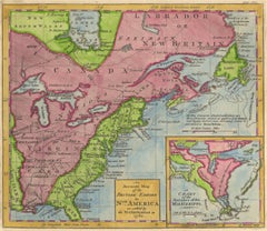
Antique Map of the British Colonies in North America by Homann Heirs, 1756
Located in Langweer, NL
Scarce first edition of this fine early map of the British Colonies in North America at the outset
Category

Antique Mid-18th Century Maps

Materials

Paper

Antique Map of the United States of North America ‘East’ by A.K. Johnston, 1865
Located in Langweer, NL
Antique map titled 'United States of North America (Eastern States) '. Depicting Mississippi
Category

Antique Mid-19th Century Maps

Materials

Paper

Old Print Showing New Zealand, Cuba, Iceland etc. Lakes, Mountains, Rivers, 1851
Located in Langweer, NL
Antique map titled 'A comparative view of the principal Waterfalls, Islands, Lakes, Rivers and
Category

Antique 1850s Maps

Materials

Paper

Contemporary Oblong Marbled Mississippi Vase in Blue by Elyse Graham
By Elyse Graham
Located in Springfield, OR
reference topographical maps. We take queues for our palette from the rivers for which the pieces are named
Category

2010s American Vases

Materials

Resin, Plaster

1805 Map of the United States
Located in Missouri, MO
. This is a finely detailed and engraved map credited in the inscription to Aaron Arrowsmith and printed
Category

Early 1800s More Prints

Materials

Etching

Very Rare Marine Map of Florida, France, 1864
Located in Kensington, MD
Rare marine map engraving of Florida and the Gulf of Mexico dated 1864. The inscription reads
Category

Antique 1860s French Beaux Arts Drawings

Materials

Giltwood, Paper

Antique Map of Americas - California as an Island
By Nicolas de Fer
Located in Houston, TX
Splendid hand colored vintage map of the Americas with California depicted as an island by
Category

18th Century and Earlier Other Art Style More Art

Materials

Ink, Paper, Watercolor

American Commonwealths, Missouri
Located in valatie, NY
the Mississippi, the admission of Missouri into the Union, abolition of slavery, The Convention of
Category

Antique Late 19th Century American Books

Materials

Paper, Leather

American Commonwealths, Missouri
H 7.25 in W 5 in D 1 in
Roosevelt's "The Winning of the West, " "American Ideals" and "Wilderness Hunter"
Located in Colorado Springs, CO
became president. The Winning of the West. Volume one; From the Alleghanies to the Mississippi 1769
Category

Antique Early 1900s Books

"Personal Memoirs of U.S. Grant" First Edition, Two-Volume Set, circa 1885-1886
By Ulysses S. Grant
Located in Colorado Springs, CO
stamps celebratory of both U.S. Grant and the Mississippi River. Internally, all maps and fold-outs are
Category

Antique 1880s American Books

Materials

Paper

Pensacola - Original Etching 1769
By Dominic Serres
Located in Roma, IT
, east of the outlet of the Mississippi River, after a drawing made on the same spot in the year 1743
Category

1790s Old Masters Figurative Prints

Materials

Etching

Personal Memoirs of U.S. Grant, Two-Volume Set, circa 1885-1886
Located in Colorado Springs, CO
and white illustrations, fold-out facsimile letters written by Grant, and forty-three maps. Grant’s
Category

Antique Late 19th Century Books

Materials

Paper

U.S. Grant Memoirs, First Edition, Original Boot Strap Binding, 1885-1886
By Ulysses S. Grant
Located in Colorado Springs, CO
engraved black and white illustrations, fold-out facsimile letters written by Grant, and 43 maps. Grant’s
Category

Antique 1880s American Books

Materials

Paper

Personal Memoirs of U.S. Grant, Two-Volume Set, circa 1885-1886, Period Binding
By Ulysses S. Grant
Located in Colorado Springs, CO
engraved black and white illustrations, fold-out facsimile letters written by Grant, and 43 maps
Category

Antique 1880s American Books

Materials

Paper

Antique Map of the Southern United States with Inset Map of New Orleans
Located in Langweer, NL
Antique map titled 'Die Staaten von Arkansas Mississippi, Louisiana & Alabama'. Detailed map of the
Category

Antique Mid-19th Century Maps

Materials

Paper

Eastern Hemisphere map
Located in Los Angeles, CA
This is a map of the Eastern Hemisphere, and was printed in Paris by the Quai De L'Horlogue
Category

Antique 18th Century and Earlier French Prints

Eastern Hemisphere map
H 28.5 in W 34 in
1825 Engraved H/C Map CARTE DE L'AMERIQUE SEPTENTRIONALE Adrien-Hubert Brué
Located in Gallatin, TN
Description Antique Early 19th Century Hand-colored Engraved Map of North America by Andre Hubert
Category

19th Century More Prints

Materials

Engraving

Monumental Pair of Cary's Library Globes
Located in New York, NY
, ending in spade feet on brass casters. The terrestrial globe is mapped with detailed
Category

Antique 19th Century English Globes

Materials

Mahogany

Large Pictorial Map of North America by Palmer & Associates, Los Angeles
Located in Los Angeles, CA
Large pictorial map of North America, circa 1935 by Palmer and Associates, Los Angeles, circa 1935
Category

Vintage 1930s American Mid-Century Modern Maps

Materials

Canvas, Paper, Wood

1762 Map of North America
By Thomas Kitchin
Located in New York, NY
showing the Delta to the Mississippi River. This 254-year-old original, engraved map documents the
Category

1760s Realist Landscape Prints

Materials

Engraving

Get Updated with New Arrivals
Save "Mississippi Map", and we’ll notify you when there are new listings in this category.

Mississippi Map For Sale on 1stDibs

With a vast inventory of beautiful furniture at 1stDibs, we’ve got just the mississippi map you’re looking for. A mississippi map — often made from paper, wood and fabric — can elevate any home. Find 55 options for an antique or vintage mississippi map now, or shop our selection of 3 modern versions for a more contemporary example of this long-cherished piece. You’ve searched high and low for the perfect mississippi map — we have versions that date back to the 18th Century alongside those produced as recently as the 21st Century are available. A mississippi map is a generally popular piece of furniture, but those created in Baroque, Georgian and mid-century modern styles are sought with frequency. Ulysses S. Grant, Elyse Graham and Aaron Arrowsmith each produced at least one beautiful mississippi map that is worth considering.

How Much is a Mississippi Map?

A mississippi map can differ in price owing to various characteristics — the average selling price 1stDibs is $1,642, while the lowest priced sells for $1 and the highest can go for as much as $65,000.