Map Of Cologne
to
25
214
34
142
118
73
42
34
28
27
27
13
9
4
4
4
4
4
3
3
3
1
1
1
1
97
79
7
3
3
Sort By
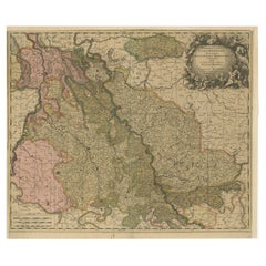
Antique Map of Cologne with the duchies of Jülich and Berg, Germany
Located in Langweer, NL
map of Cologne with the duchies of Jülich and Berg, Spanish Geldern and the county of Moers, Germany
Category
Antique Late 17th Century Maps
Materials
Paper
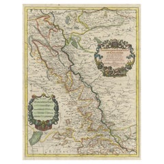
Antique Map of the Archdiocese of Cologne, Germany
Located in Langweer, NL
Antique map titled 'Archevesche et Eslectorat de Cologne avec ses Enclaves'. Original old map of
Category
Antique Late 17th Century Maps
Materials
Paper
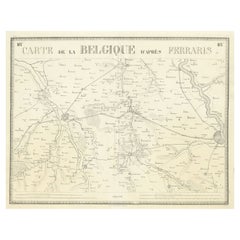
Antique Map of the Region near Cologne, Germany
Located in Langweer, NL
Antique map titled 'Carte de la Belgique d'après Ferraris'. Original antique map of the region near
Category
Antique Mid-19th Century Maps
Materials
Paper
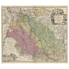
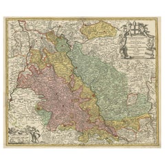
Antique Map of the Rhine centered on Cologne, Germany
Located in Langweer, NL
Rhine river, centered on Cologne, Germany. The Rhine River cuts across this map from south of Bonn
Category
Antique Early 18th Century Maps
Materials
Paper
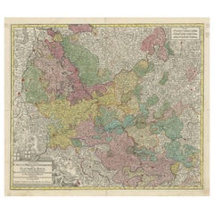
Antique Map of the region of Trier, Mainz and Cologne, Germany
Located in Langweer, NL
antique map of the region of Trier, Mainz and Cologne, Germany. Published by T.C. Lotter, circa 1765
Category
Antique Late 18th Century Maps
Materials
Paper
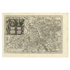
Antique Map of the Region of Cologne and Liege by Scherer, 1699
Located in Langweer, NL
uncommon map of the Archbishopric of Cologne and the Bishopric of Liege/Luik. Source unknown, to be
Category
Antique 17th Century Maps
Materials
Paper
Antique Map of the Rhine centered on Cologne, Germany, with outline coloring
Located in Langweer, NL
Rhine river, centered on Cologne, Germany. The Rhine River cuts across this map from south of Bonn
Category
Antique Early 18th Century Maps
Materials
Paper
H 21.58 in W 26.15 in D 0.02 in
Antique Map of the Rhine centered on Cologne, Germany, with original coloring
Located in Langweer, NL
Rhine river, centered on Cologne, Germany. The Rhine River cuts across this map from south of Bonn
Category
Antique Early 18th Century Maps
Materials
Paper
H 20.16 in W 24.14 in D 0.02 in
Antique Map of Part of Germany by Moll, c.1740
Located in Langweer, NL
Antique map Germany titled 'The North West Part of Germany; Containing ye Dominions of ye Arch: and
Category
Antique 18th Century Maps
Materials
Paper
Antique Map of both sides of the Central Rhine River, Germany
Located in Langweer, NL
(..)'. Decorative map of region on either side of the Central Rhine River, showing Dusseldorf, Cologne, Bonn, etc
Category
Antique Mid-18th Century Maps
Materials
Paper
Antique Map of present-day North-Rhine Westphalia, Germany
Located in Langweer, NL
the East. The map is centered on the Rhine region from Cologne to Arnheim, and showing Cleef, Nidwesel
Category
Antique Mid-18th Century Maps
Materials
Paper
Antique Original Map of the City of Deventer, the Netherlands, 1588
Located in Langweer, NL
Antique map titled 'Liberae et Hanseaticae urbis Daventriensis delineatio'.
Original bird's eye
Category
Antique 16th Century Maps
Materials
Paper
Antique Map of Friesland by Bussemacher in Frame, c.1592
Located in Langweer, NL
Original antique map titled 'Frisiae Antiquissimae (..)'. Original antique map of Friesland
Category
Antique 18th Century Maps
Materials
Paper
Antique Map of the City of Hindeloopen by Braun & Hogenberg, c.1598
Located in Langweer, NL
Antique map titled 'Hindelopia'. Original antique map of the city of Hindeloopen, Friesland, the
Category
Antique 16th Century Maps
Materials
Paper
Antique Map of the City of Bolsward, Friesland in The Netherlands, c.1598
Located in Langweer, NL
Cologne/Germany. He was a prolific copper engraver and etching artist of maps and town views. In
Category
Antique 16th Century Maps
Materials
Paper
H 9.45 in W 10.63 in D 0 in
Antique Map of the City of Leeuwarden and Franeker by Braun & Hogenberg, 1580
Located in Langweer, NL
Antique map titled 'Lewardum Occidentlis Frisiae Opp: 1580, Franicher Nobiliu hominum, in Frisia
Category
Antique 16th Century Maps
Materials
Paper
H 15.56 in W 20.95 in D 0 in
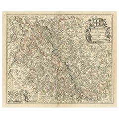
Rhine Splendor: Antique Map of the Lower Rhine Region, circa 1680
Located in Langweer, NL
The antique map titled 'Novissima et Accuratissima Archiepiscopatus et Electoratus Coloniensis
Category
Antique 1680s Maps
Materials
Paper
Free Shipping
H 21.03 in W 24.22 in D 0 in
Very Old Original Antique Map of The City of Douai in France, ca.1575
Located in Langweer, NL
Cologne/Germany. He was a prolific copper engraver and etching artist of maps and town views. In
Category
Antique 16th Century Maps
Materials
Paper
Antique Map of Dokkum a City in the North of Friesland, the Netherlands, 1868
Located in Langweer, NL
Antique map titled 'Provincie Friesland - Gemeente Dokkum'. Map of the township of Dokkum
Category
Antique 19th Century Maps
Materials
Paper
H 7.49 in W 9.85 in D 0 in
1859 Detailed Map of North West Germany with Bavaria Inset - Blackie's Atlas
Located in Langweer, NL
The "Antique Map of North West Germany" with an inset map of Bavaria is a distinguished piece from
Category
Antique Mid-19th Century Maps
Materials
Paper
H 21.26 in W 14.57 in D 0.02 in
Antique Map of The Frisian Cities Leeuwarden and Franeker in Friesland, 1580
Located in Langweer, NL
Antique map titled 'Lewardum Occidentlis Frisiae Opp: 1580, Franicher Nobiliu hominum, in Frisia
Category
Antique 16th Century Maps
Materials
Paper
H 19.69 in W 15.36 in D 0 in
17th Century Hand Colored Map of the Liege Region in Belgium by Visscher
By Nicolaes Visscher II
Located in Alamo, CA
. The map is centered on Liege, Belgium, includes the area between Antwerp, Turnhout, Roermond, Cologne
Category
Antique Late 17th Century Dutch Maps
Materials
Paper
Antique Town Plan of Emden ‘Germany’ by Braun & Hogenberg, 1597
Located in Langweer, NL
Antique map titled 'Embdena (..)'. Old, antique bird's-eye view plan of Emden, Germany. This bird's
Category
Antique 16th Century Maps
Materials
Paper
Frisian Cities Bolsward, Stavoren, Harlingen & Hindelopen, The Netherlands, 1598
Located in Langweer, NL
Cologne/Germany. He was a prolific copper engraver and etching artist of maps and town views. In
Category
Antique 16th Century Maps
Materials
Paper
H 15.91 in W 20.04 in D 0 in
Map of Aldenburgum Holsatie - From "Civitates Orbium Terrarum" - 1575
By Franz Hogenberg
Located in Roma, IT
volume of this collection was published in Cologne in 1572; the following in 1575, 1581, 1588, and 1598
Category
16th Century Figurative Prints
Materials
Etching, Aquatint, Watercolor
H 5.91 in W 10.4 in D 0.04 in
Map of Canonor - Etching by G. Braun/F. Hogenberg - 1575
Located in Roma, IT
Terrarum".
The first volume of the Civitates Orbis Terrarum was published in Cologne in 1572. The sixth and
Category
16th Century Modern Figurative Prints
Materials
Etching
H 5.52 in W 6.3 in D 0.04 in
Map of Groningen - Etching by George Braun - Late 16th Century
Located in Roma, IT
This map of Groninga is an original etching realized by George Braun and Franz Hogenberg, and part
Category
16th Century Figurative Prints
Materials
Etching
H 13.19 in W 19.49 in D 0.04 in
Map of Nemavsus - Etching by George Braun - Late 16th Century
Located in Roma, IT
This Map of Nemavsus is an original etching realized by George Braun (1541 – 1622)
The state of
Category
16th Century More Prints
Materials
Etching
H 8.08 in W 10.24 in D 0.04 in
Map of Arras - Etching by George Braun - Late 16th Century
Located in Roma, IT
This Map of Arras is an original etching realized by George Braun (1541 – 1622)
The state of
Category
16th Century More Prints
Materials
Etching
H 8.67 in W 20.48 in D 0.04 in
Map of Broversavia - Etching by George Braun - Late 16th Century
Located in Roma, IT
This Map of Broversavia is an original etching realized by George Braun (1541 – 1622)
The state
Category
16th Century More Prints
Materials
Etching
H 8.08 in W 10.24 in D 0.04 in
Map of Methoni - Etching by George Braun - Late 16th Century
Located in Roma, IT
This Map of Methoni is an etching realized by George Braun (1541 – 1622)
The state of
Category
17th Century More Prints
Materials
Etching
H 6.89 in W 19.1 in D 0.04 in
Map of San Georgi - Etching by G. Braun/F. Hogenberg - 1575
Located in Roma, IT
Orbis Terrarum".
The first volume of the Civitates Orbis Terrarum was published in Cologne in 1572. The
Category
16th Century Modern Figurative Prints
Materials
Etching
H 5.52 in W 6.3 in D 0.04 in
Map of Burdegalen - Original Etching by George Braun - 1575 ca.
Located in Roma, IT
published in Cologne in 1572; the following in 1575, 1581, 1588, and 1598. The sixth and final volume
Category
16th Century More Prints
Materials
Etching
H 6.3 in W 8.67 in D 0.04 in
Map of Ingolstadt - Etching by George Braun- Late 16th Century
Located in Roma, IT
Cologne in 1572; the following in 1575, 1581, 1588, and 1598. The sixth and final volume appeared in 1617
Category
16th Century More Prints
Materials
Etching
H 3.94 in W 9.06 in D 0.04 in
Ancient Map of Calaris - Etching by George Braun - Late 16th Century
Located in Roma, IT
Ancient Map of Calaris is an original etching belonging to the collection "Civitates Orbis
Category
16th Century More Prints
Materials
Etching
H 10.63 in W 8.27 in D 0.04 in
Map of Calcaria - From "Civitates Orbium Terrarum" by F. Hogenberg - 1575
By Franz Hogenberg
Located in Roma, IT
"Machelen", from the collection "Civitates Orbis Terrarum", Cologne, T. Graminaeus, 1575.
The
Category
16th Century Figurative Prints
Materials
Etching, Aquatint
H 13 in W 18.9 in D 0.04 in
Map of Safi - Original Etching by George Braun - Late 16th Century
Located in Roma, IT
. The first volume of this collection was published in Cologne in 1572; the following in 1575, 1581
Category
16th Century More Prints
Materials
Etching
H 8.08 in W 10.24 in D 0.04 in
Map of Goricum - Original Etching by George Braun - Late 16th Century
Located in Roma, IT
dedicated to topographical views. The first volume of this collection was published in Cologne in 1572; the
Category
16th Century More Prints
Materials
Etching
George BraunMap of Goricum - Original Etching by George Braun - Late 16th Century, Late 16th Century
H 8.08 in W 10.24 in D 0.04 in
Map of Casablanca - Etching by G. Braun and F. Hogenberg - 16th Century
By Franz Hogenberg
Located in Roma, IT
This Map of Casablanca is an original etching realized by George Braun and Franz Hogenberg as part
Category
16th Century Modern Figurative Prints
Materials
Etching
Franz HogenbergMap of Casablanca - Etching by G. Braun and F. Hogenberg - 16th Century, 16th Century
H 4.14 in W 9.65 in D 0.04 in
Nordlingen, Antique Map from"Civitates Orbis Terrarum"
By Franz Hogenberg
Located in Roma, IT
Braun G. and Hogenberg F., Nordlingen from the collection "Civitates Orbis Terrarum", Cologne, T
Category
16th Century Landscape Prints
Materials
Etching
H 4.14 in W 10.36 in
[Civitates Orbis Terrarum]Map of Cefal - Etching by G. Braun/F. Hogenberg - 1575
Located in Roma, IT
condition.
The first volume of the Civitates Orbis Terrarum was published in Cologne in 1572. The sixth and
Category
16th Century Contemporary Figurative Prints
Materials
Etching
Map of Wittemberg and Frankfurt- by G. Braun and F. Hogenberg - 16th Century
By Franz Hogenberg
Located in Roma, IT
This Map of Wittemberg and Frankfurt (ancient names: Wittenburga - Francfordiensis) is an original
Category
16th Century Modern Figurative Prints
Materials
Etching
H 7.88 in W 20.87 in D 0.04 in
View of Meissen, Germany: A 16th Century Hand-colored Map by Braun & Hogenberg
By Franz Hogenberg
Located in Alamo, CA
atlas "Civitates Orbis Terrarum", published in Cologne, Germany in 1575.
The map depicts a side view
Category
16th Century Old Masters Landscape Prints
Materials
Engraving
View of Emden, Germany: A 16th Century Hand-colored Map by Braun & Hogenberg
By Franz Hogenberg
Located in Alamo, CA
This is a 16th century original hand-colored copperplate engraved map of a bird's-eye View of
Category
16th Century Old Masters Landscape Prints
Materials
Engraving
Map of Kampen, Netherlands - by G. Braun and F. Hogenberg - Late 16th Century
By Franz Hogenberg
Located in Roma, IT
This map of Kampen (the ancient Campensis) is an original etching realized by George Braun and
Category
16th Century Figurative Prints
Materials
Etching
H 15.95 in W 21.26 in D 0.04 in
View of Seravalle, Italy: A 16th Century Hand-colored Map by Braun & Hogenberg
By Franz Hogenberg
Located in Alamo, CA
This is an original 16th century copperplate originally hand-colored engraved map of View of
Category
16th Century Old Masters Landscape Prints
Materials
Engraving
View of Pisaro, Italy: A 16th Century Hand-colored Map by Braun & Hogenberg
By Franz Hogenberg
Located in Alamo, CA
This is a 16th century original hand-colored copperplate engraved map of View of Pezaro (Pisaro
Category
16th Century Old Masters Landscape Prints
Materials
Engraving
Map of Ypres - Etching by G. Braun and F. Hogenberg - Late 16th Century
By Franz Hogenberg
Located in Roma, IT
This map of Hypra is an original etching realized by George Braun and Franz Hogenberg as part of
Category
16th Century Figurative Prints
Materials
Etching
H 13.19 in W 12.6 in D 0.04 in
Map of Nijmegen - Etching by G. Braun and F. Hogenberg - Late 16th Century
By Franz Hogenberg
Located in Roma, IT
This map of Noviomagvs is an original etching realized by Georg Braun and Franz Hogenberg as part
Category
16th Century Figurative Prints
Materials
Etching
H 11.42 in W 18.9 in D 0.04 in
Map of Magdeburg - Etching by G. Braun e F. Hogenberg - Late 16th Century
By Franz Hogenberg
Located in Roma, IT
This map of Magdebvrgvm is an original etching realized by George Braun and Frans Hogenberg, as
Category
16th Century Figurative Prints
Materials
Etching
H 15.95 in W 21.26 in D 0.04 in
Map of Augsburg - Etching by G. Braun e F. Hogenberg - Late 16th Century
By Franz Hogenberg
Located in Roma, IT
This map of Avgvsta is an original etching realized by George Braun and Franz Hogenberg, as part
Category
16th Century Figurative Prints
Materials
Etching
H 15.95 in W 21.26 in D 0.04 in
Map of Kalkar - Etching by G. Braun and F. Hogenberg - Late 16th Century
By Franz Hogenberg
Located in Roma, IT
This map of Calcaria is an original etching realized by George Braun and Franz Hogenberg, as part
Category
16th Century Figurative Prints
Materials
Etching
H 15.95 in W 21.26 in D 0.04 in
Map of Alhama - Etching by G. Braun and F. Hogenberg - Late 16th Century
By Franz Hogenberg
Located in Roma, IT
This map of Alhama de Granada is an original etching realized by G. Braun and F. Hogenberg, as
Category
16th Century Figurative Prints
Materials
Etching
H 15.95 in W 21.26 in D 0.04 in
Windsor, Antique Map from "Civitates Orbis Terrarum"
By Franz Hogenberg
Located in Roma, IT
", Cologne, T. Graminaeus, 1572-1617. Image Dim: cm 18 x 48 , Dim: cm 20.5 x 54.
Very Fine B/W Aquatint
Category
16th Century Landscape Prints
Materials
Etching
H 8.08 in W 21.26 in D 0.04 in
Utrecht, Antique Map from "Civitates Orbis Terrarum"
By Franz Hogenberg
Located in Roma, IT
Braun G., Hogenberg F., Traiectum or Utrecht, from the collection Civitates Orbis Terrarum, Cologne
Category
16th Century Landscape Prints
Materials
Etching
H 15.75 in W 20.67 in D 0.04 in
Map of Rouen - Original Etching by G.Braun and F. Hogenberg - Late 16th Century
By Franz Hogenberg
Located in Roma, IT
This Map of Roan is an original etching realized by G. Braun and F. Hogenberg within the famous
Category
16th Century Figurative Prints
Materials
Etching
H 6.11 in W 18.51 in D 0.04 in
Map of the Netherlands - Etching by G. Braun and F. Hogenberg -Late 16th Century
By Franz Hogenberg
Located in Roma, IT
Map of the Netherlands is an original etching realized by George Braun and Franz Hogenberg, as
Category
16th Century Figurative Prints
Materials
Etching
H 15.95 in W 21.26 in D 0.04 in
Map of Embden - Original Etching by G. Braun e F. Hogenberg - Late 16th Century
By Franz Hogenberg
Located in Roma, IT
This map of Embdena is an original etching realized by George Braun and Franz Hogenberg in the
Category
16th Century Figurative Prints
Materials
Etching
H 15.95 in W 21.26 in D 0.04 in
Stade, Antique Map from "Civitates Orbis Terrarum" - 1572-1617
By Franz Hogenberg
Located in Roma, IT
Terrarum, Cologne, T. Graminaeus, 1572-1617.
Precious hand-colored aquatint showing a view of Stade
Category
16th Century Landscape Prints
Materials
Etching
H 5.91 in W 10.24 in D 0.04 in
Buda, Antique Map from "Civitates Orbis Terrarum" - 1572-1617
By Franz Hogenberg
Located in Roma, IT
Braun G., Hogenberg F., Buda, from the collection Civitates Orbis Terrarum, Cologne, T. Graminaeus
Category
16th Century Landscape Prints
Materials
Etching
H 8.08 in W 20.87 in D 0.04 in
- 1
Get Updated with New Arrivals
Save "Map Of Cologne", and we’ll notify you when there are new listings in this category.
Map Of Cologne For Sale on 1stDibs
Surely you’ll find the exact map of cologne you’re seeking on 1stDibs — we’ve got a vast assortment for sale. You can easily find an example made in the modern style, while we also have 37 modern versions to choose from as well. Finding the perfect map of cologne may mean sifting through those created during different time periods — you can find an early version that dates to the 18th Century and a newer variation that were made as recently as the 21st Century. If you’re looking to add a map of cologne to create new energy in an otherwise neutral space in your home, you can find a work on 1stDibs that features elements of beige, gray, black, blue and more. A map of cologne from Frans Hogenberg, Uwe Ommer, Petra Rös-Nickel, Chris Anderson and Christo — each of whom created distinctive versions of this kind of work — is worth considering. Artworks like these of any era or style can make for thoughtful decor in any space, but a selection from our variety of those made in etching, archival pigment print and pigment print can add an especially memorable touch.
How Much is a Map Of Cologne?
The price for a map of cologne in our collection starts at $126 and tops out at $338,128 with the average selling for $1,019.
