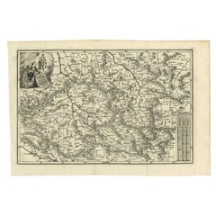
Munich Map
to
19
146
92
104
93
76
51
26
25
20
15
14
11
8
8
7
7
6
6
6
5
4
4
1
1
51
42
42
12
4
Sort By
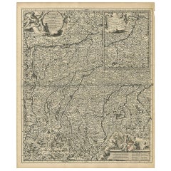
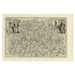
Antique Map of Upper Bavaria, Germany
Located in Langweer, NL
towards Schwaz in the neighbouring Tirol in the south of the map. Close to the centre of the map ,Munich
Category
Antique Late 17th Century Maps
Materials
Paper
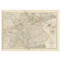
Antique Map of Germany by Johnston '1909'
Located in Langweer, NL
Frankfurt and Munich. This map originates from the ‘Royal Atlas of Modern Geography’. Published by W. & A.K
Category
Early 20th Century Maps
Materials
Paper
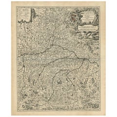
Antique Map of Bavaria with many details, Germany
Located in Langweer, NL
-significant part of Germany. The map stretches south to Innsbruck and north to Amberg. Also shown are Munich
Category
Antique Late 17th Century Maps
Materials
Paper
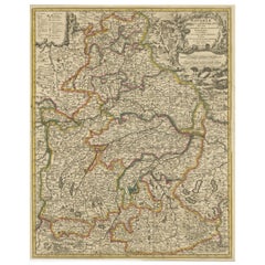
Antique Map of Bavaria, Bayern, with original Hand Coloring
Located in Langweer, NL
Antique map titled 'Bavariae Circulus atq Electoratus tam cum Adiacentibus quam insertis Regionibus
Category
Antique Late 17th Century Maps
Materials
Paper
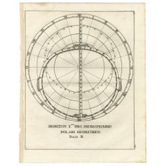
Antique Map Depiciting a Horizon or Hemisphere c.1703
Located in Langweer, NL
Antique map depiciting a horizon/hemisphere. Printed for Scherer's 'Atlas Novus' (1702-1710
Category
Antique 18th Century Maps
Materials
Paper
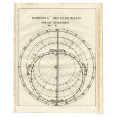
Antique Map of a Hemisphere by Scherer, c.1703
Located in Langweer, NL
Antique map depiciting a horizon/hemisphere. Printed for Scherer's 'Atlas Novus' (1702-1710
Category
Antique 18th Century Maps
Materials
Paper
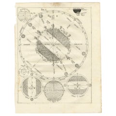
Antique Map Illustrating Solar Eclipses by Scherer, C.1703
Located in Langweer, NL
Antique map of an hemisphere and several figures illustrating the position of the earth, moon and
Category
Antique 18th Century Maps
Materials
Paper
Antique Map of the Franconia Region by Scherer, 1699
Located in Langweer, NL
Antique map titled 'Franconia multa numerat loca deiparae sacra in quibus magna recipit à dei matre
Category
Antique 17th Century Maps
Materials
Paper
Antique Uncommon Map of Bohemia, Moravia and Silesia, 1699
Located in Langweer, NL
Antique map titled 'B. V. Boleslaviensis in Bohemia, Moravia et Silesia (..).' Detailed uncommon
Category
Antique 17th Century Maps
Materials
Paper
Antique Map of Saxony and Westphalia by Scherer, 1699
Located in Langweer, NL
Antique map titled 'Saxonia et Westphalia varijs in locis sacris erga dei matre est officiosa
Category
Antique 17th Century Maps
Materials
Paper
Antique Map of South America by Scherer, c.1700
By Thomas Kitchin
Located in Langweer, NL
Antique map of part of South America. Two maps on a single sheet, each depicting nearly the same
Category
Antique 18th Century Maps
Materials
Paper
Antique Map of the Berchtesgaden Region by Scherer, 1699
Located in Langweer, NL
Antique map titled 'Principat et praepositura Berchtesgadensis (..).' Detailed uncommon map of the
Category
Antique 17th Century Maps
Materials
Paper
Remarkable Antique Map of West Europe by Scherer, circa 1703
Located in Langweer, NL
Antique map of Western Europe. Depicting Bergen, Stockholm, Dublin, Paris, Wien, Madrid, Rome
Category
Antique 18th Century Maps
Materials
Paper
Remarkable Antique Map of Central Africa by Scherer, c.1703
Located in Langweer, NL
Untitled map of Central Africa depicting Tarodant, Lempta, Guber, Borno, Chaxumo, Tombut, Melegvete
Category
Antique 18th Century Maps
Materials
Paper
Antique Map of part of Europe by Scherer, c.1703
Located in Langweer, NL
Untitled map of Europe depicting Calais, Münster, Paris, Lion, Prag, Wien, Berlin, Clermont and
Category
Antique 18th Century Maps
Materials
Paper
Antique Map of Western Europe and Spain by Scherer, circa 1703
Located in Langweer, NL
Untitled map of Western Europe and Spain. Depicting Rome, Edinburgh, Paris, Madrid, Stockholm and
Category
Antique 18th Century Maps
Materials
Paper
Massive Vintage Wall Map of the Soviet Union 'Sowjetunion' by Karl Wenschow
By Denoyer-Geppert
Located in San Diego, CA
A massive vintage wall map of the Soviet Union (Sowjetunion) published by Karl Wenschow in Munich
Category
Mid-20th Century American Maps
Materials
Wood, Paper
Antique Original Map of the City of Deventer, the Netherlands, 1588
Located in Langweer, NL
Antique map titled 'Liberae et Hanseaticae urbis Daventriensis delineatio'.
Original bird's eye
Category
Antique 16th Century Maps
Materials
Paper
Antique Map of Gallia and Germania on one Sheet, c.1703
Located in Langweer, NL
Antique map depicting France (Gallia) and Germany (Germania). Printed for Scherer's 'Atlas Novus
Category
Antique 18th Century Maps
Materials
Paper
Antique Map of Southern Germany by F. de Wit, circa 1680
Located in Langweer, NL
This antique map depicts a portion of southern Germany that included the historic regions of
Category
Antique Late 17th Century Maps
Materials
Paper
Very Decorative Rare Antique Map of the Northern Part of Africa, 1702
Located in Langweer, NL
Antique map titled 'Africae Pars Borealis.'
Very decorative antique map of the northern part of
Category
Antique Early 1700s Maps
Materials
Paper
Antique Map of the Region of Cologne and Liege by Scherer, 1699
Located in Langweer, NL
Antique map titled 'Archpiescopatus Coloniensis (..) Episcopatus Leodiensis (..).' Detailed
Category
Antique 17th Century Maps
Materials
Paper
Intriguing Antique Map of Europe, Asia and Africa by Scherer, c.1703
Located in Langweer, NL
Two maps on a single sheet showing Europe, Asia and Africa, each depicting nearly the same area. On
Category
Antique 18th Century Maps
Materials
Paper
Antique Map of the City of Hindeloopen by Braun & Hogenberg, c.1598
Located in Langweer, NL
Antique map titled 'Hindelopia'. Original antique map of the city of Hindeloopen, Friesland, the
Category
Antique 16th Century Maps
Materials
Paper
Remarkable Map of the Alsace Region and Nova Zembla, Russia, ca.1700
Located in Langweer, NL
Antique map titled 'Chorographia Alsatiae.'
Map of the Alsace region and Nova Zembla, printed
Category
Antique Early 1700s Maps
Materials
Paper
Very Detailed Antique Map of the Jesuit Province of Bavaria, Germany, c.1700
Located in Langweer, NL
Antique map titled 'Provinciae Superior Germaniae Societatis.' Very detailed map of the Jesuit
Category
Antique 18th Century Maps
Materials
Paper
H 10.71 in W 15.95 in D 0 in
Antique Map of Central Asia Wiht Nova Zembla as an Island, C.1700
Located in Langweer, NL
Antique map titled 'Asiae Pars Potissima.' Attractive map focusing on the central part of Asia but
Category
Antique 18th Century Maps
Materials
Paper
Antique Map of Continental Asia, with Japan, Arabia, India, Russia, etc c.1702
Located in Langweer, NL
Antique map titled 'Totius Asiae Continens (..).' On this map of continental Asia and the adjacent
Category
Antique 18th Century Maps
Materials
Paper
H 10.75 in W 15.95 in D 0 in
Antique Map of the City of Bolsward, Friesland in The Netherlands, c.1598
Located in Langweer, NL
Antique map titled ‘Bolzvardia vetus in Frisia Foederis (..)’. Old map of the city of Bolsward
Category
Antique 16th Century Maps
Materials
Paper
H 9.45 in W 10.63 in D 0 in
Curious Map of the Laptev Sea 'Arctic Ocean' and the Mediterranean, ca.1700
Located in Langweer, NL
Antique map, untitled.
Map of the Laptev Sea (Arctic Ocean) and the Mediterranean, printed for
Category
Antique Early 1700s Maps
Materials
Paper
H 10.63 in W 8.31 in D 0 in
Antique Map of the Alsace region and Nova Zembla by Scherer, c.1700
Located in Langweer, NL
Antique map titled 'Chorographia Alsatiae.' Map of the Alsace region and Nova Zembla, printed for
Category
Antique 18th Century Maps
Materials
Paper
Rare Antique Map of Part of Europe and Africa by Scherer, C.1703
Located in Langweer, NL
Antique map with two figures. The upper figures showing part of Europe and Africa. Below a chart
Category
Antique 18th Century Maps
Materials
Paper
Map of the Electorate of Bavaria, Incl Lake Constance, by Jesuit Scherer, c.1700
Located in Langweer, NL
Antique map titled 'Electorat Bavariae.' Map of the Electorate of Bavaria by the Jesuit Heinrich
Category
Antique Early 1700s Maps
Materials
Paper
H 10.63 in W 8.47 in D 0 in
Intriguing Antique Map of Europe, the Middle East and Africa by Scherer, c.1703
Located in Langweer, NL
Antique map depicting part of Africa, Europe and the Middle East. Also showing various cities in
Category
Antique 18th Century Maps
Materials
Paper
H 10.63 in W 8.27 in D 0 in
Very Old Original Antique Map of The City of Douai in France, ca.1575
Located in Langweer, NL
Antique Map of Douai (France) titled 'Duacum, Catuacorum Urbs, tam situ, quam incolis, et
Category
Antique 16th Century Maps
Materials
Paper
Original Antique Engraving of the Eastern Hemisphere, c.1700
Located in Langweer, NL
Antique map titled 'Proiectio Optica Aequinoctia lis Hemishaerii Orientalis' - Map of the Eastern
Category
Antique 17th Century Maps
Materials
Paper
Frisian Cities Bolsward, Stavoren, Harlingen & Hindelopen, The Netherlands, 1598
Located in Langweer, NL
Antique map titled ‘Bolzvardia, Stavria, Harlinga, Hindelopia’. Four maps on one sheet. This map
Category
Antique 16th Century Maps
Materials
Paper
H 15.91 in W 20.04 in D 0 in
Two Charts of The English Channel, Each Adorned with Nice Compass Roses, ca.1700
Located in Langweer, NL
Antique map titled 'Hydrographia Canalis Marini Inter Angliam et Galiiam de Fluentis.'
Sheet
Category
Antique Early 1700s Maps
Materials
Paper
H 10.63 in W 8.08 in D 0 in
Unique Antique Projection of the World with Twice California as an Island, c1703
Located in Langweer, NL
Description: Antique map of the world. Printed for Scherer's 'Atlas Novus' (1702-1710).
On this
Category
Antique Early 1700s Maps
Materials
Paper
H 10.79 in W 15.83 in D 0 in
Vintage Mid-Century World Map Globe Lamp Light by JRO Verlag Munich circa 1970s
By JRO-Verlag 1
Located in Landau an der Isar, Bayern
Wonderful vintage Mid-Century fun world map globe table lamp or desk light by JRO-Verlag München
Category
Late 20th Century German Mid-Century Modern Table Lamps
Materials
Metal
H 14.57 in Dm 9.85 in
Women and Hokusai's Maps
By Bastienne Schmidt
Located in Fairfield, CT
, and reassigning value to them.
Schmidt was born in Munich, Germany and moved at the age of 9 with her
Category
21st Century and Contemporary Mixed Media
Materials
Paper, Mixed Media
Maps - Héliogravure by Käthe Kollwitz - 1910 ca
By Käthe Kollwitz
Located in Roma, IT
Maps is a work realized by Kate Kollwitz, 1910 ca.
Portfolio, two-page cover sheet with text and
Category
1910s Modern Figurative Prints
Materials
Paper
H 16.93 in W 12.21 in D 1.19 in
Map of Canonor - Etching by G. Braun/F. Hogenberg - 1575
Located in Roma, IT
by Franz Hogenberg, eventually contained 546 prospects, bird-eye views and map views of cities from
Category
16th Century Modern Figurative Prints
Materials
Etching
H 5.52 in W 6.3 in D 0.04 in
Map of San Georgi - Etching by G. Braun/F. Hogenberg - 1575
Located in Roma, IT
engraved by Franz Hogenberg, eventually contained 546 prospects, bird-eye views and map views of cities
Category
16th Century Modern Figurative Prints
Materials
Etching
H 5.52 in W 6.3 in D 0.04 in
Walking in Circles - Geometric Abstract Neutral Colored Landscape Map Painting
By Heny Steinberg
Located in Los Angeles, CA
Mexican artist Heny Steinberg’s abstracted landscapes invite us to travel from the map to the
Category
21st Century and Contemporary Abstract Abstract Paintings
Materials
Canvas, Mixed Media, Acrylic
Paris Street View #9 – Michael Wolf, Google Maps, Color Photography, Pixel
By Michael Wolf
Located in Zurich, CH
in Munich, Germany. He worked and lived in Paris and Hong Kong where he died in April 2019. The focus
Category
Early 2000s Contemporary Color Photography
Materials
C Print
Free Shipping
H 70.01 in W 90.01 in
Map 5-Limited Edition of 10, iPad Drawing on Aluminum-12x12
By Sebastian Spreng
Located in West Palm Beach, FL
group exhibitions from Boston to Seattle to Munich, Essen to Tokyo. His work is inspired on observations
Category
2010s Abstract Abstract Prints
Materials
Metal
Natural Order - Abstract Landscape Light Green and Grey Map Line Painting
By Heny Steinberg
Located in Los Angeles, CA
Mexican artist Heny Steinberg’s abstract artworks invite us to travel from the map to the localized
Category
21st Century and Contemporary Abstract Abstract Paintings
Materials
Acrylic, Canvas, Mixed Media
[Civitates Orbis Terrarum]Map of Cefal - Etching by G. Braun/F. Hogenberg - 1575
Located in Roma, IT
by Franz Hogenberg, eventually contained 546 prospects, bird-eye views and map views of cities from
Category
16th Century Contemporary Figurative Prints
Materials
Etching
Map 6-Limited Edition of 10, iPad Drawing on Aluminum 12 X 12
By Sebastian Spreng
Located in West Palm Beach, FL
participated in solo and group exhibitions from Boston to Seattle to Munich, Essen to Tokyo. His work is
Category
2010s Abstract Abstract Prints
Materials
Metal
Map 2- Limited Edition of 10, iPad Drawing on Aluminum 10 X 10
By Sebastian Spreng
Located in West Palm Beach, FL
participated in solo and group exhibitions from Boston to Seattle to Munich, Essen to Tokyo. His work is
Category
21st Century and Contemporary Abstract Abstract Prints
Materials
Metal
Antique Print of Büdingenin Germany by Braun & Hogenberg, 1617
Located in Langweer, NL
Antique map titled 'Bingen'. Bird's eye-view of Büdingen, Germany. The view shows a city surrounded
Category
Antique 17th Century Prints
Materials
Paper
19th-century Carved, Painted and Gilt tortoise shell, 'the Cosmic Turtle'
Located in Amsterdam, NL
:
Private collection, Munich
Following the natural forms of the carapace, the artist carved medals all
Category
Antique Late 19th Century Natural Specimens
Materials
Multi-gemstone, Gold Leaf
Free Shipping
H 7.88 in W 10.24 in D 12.6 in
November 2021 - geometric abstraction, accompanied by numbered artist signed COA
By Sarah Morris
Located in New York, NY
from multinational corporations, to transportation networks and maps, GPS technology and even lunar
Category
2010s Contemporary Abstract Prints
Materials
Lithograph, Paper, Ink, Offset
Antique Print of Liège / Luik in Belgium by Braun & Hogenberg, 1575
Located in Langweer, NL
, follow by German and French translations. Franz Hogenberg (1533-1588) was the son of a Munich engraver
Category
Antique 16th Century Prints
Materials
Paper
Laughing Rocket
By Demba Camara
Located in New York, NY
Affordable Art Fair in Rome by Kyo black Representation on map a series of objects by Camara deep by Frédéric
Category
21st Century and Contemporary Folk Art Abstract Sculptures
Materials
Mixed Media
Horseman with Chain Saw
By Demba Camara
Located in New York, NY
Kyo black Representation on map a series of objects by Camara deep by Frédéric Bruly Bouabré
2013
Category
21st Century and Contemporary Figurative Sculptures
Materials
Mixed Media
Robot With Mask
By Demba Camara
Located in New York, NY
Fair in Rome by Kyo black Representation on map a series of objects by Camara deep by Frédéric Bruly
Category
21st Century and Contemporary Contemporary Figurative Sculptures
Materials
Mixed Media
Untitled, Grids and Threads
By Bastienne Schmidt
Located in Fairfield, CT
, and reassigning value to them. Schmidt was born in Munich, Germany and moved at the age of 9 with her
Category
2010s Mixed Media
Materials
Paper, Mixed Media
Vessel
By Bastienne Schmidt
Located in Fairfield, CT
, and reassigning value to them. Schmidt was born in Munich, Germany and moved at the age of 9 with her
Category
2010s Figurative Drawings and Watercolors
Materials
Paper, Mixed Media
- 1
Get Updated with New Arrivals
Save "Munich Map", and we’ll notify you when there are new listings in this category.
Munich Map For Sale on 1stDibs
Choose from an assortment of styles, material and more with respect to the munich map you’re looking for at 1stDibs. A munich map — often made from paper, metal and wood — can elevate any home. There are many kinds of the munich map you’re looking for, from those produced as long ago as the 18th Century to those made as recently as the 20th Century. A munich map, designed in the mid-century modern style, is generally a popular piece of furniture. Many designers have produced at least one well-made munich map over the years, but those crafted by JRO-Verlag and Thomas Kitchin are often thought to be among the most beautiful.
How Much is a Munich Map?
Prices for a munich map can differ depending upon size, time period and other attributes — at 1stDibs, they begin at $137 and can go as high as $68,451, while the average can fetch as much as $1,648.
