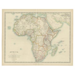
Africa Map
19
to
116
669
260
319
311
205
201
191
139
131
95
71
67
55
51
48
48
43
39
36
32
31
23
21
17
16
16
15
13
11
10
9
9
9
9
9
8
8
7
7
6
6
5
5
5
5
4
4
4
4
4
2
2
2
2
2
2
1
1
1
1
1
1
42
42
40
8
7
Sort By
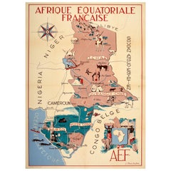
Original Vintage Poster French Equatorial Africa Map Afrique Chad Congo Francais
Located in London, GB
Original vintage pictorial map poster of French Equatorial Africa / Afrique Equatoriale Francaise
Category
Vintage 1950s French Posters
Materials
Paper
H 46.86 in W 31.5 in D 0.04 in
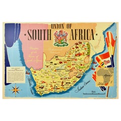
Original Vintage Poster Union Of South Africa Map Natural & Industrial Resources
Located in London, GB
Original vintage illustrated map poster for the Union of South Africa Her Natural and Industrial
Category
Vintage 1940s British Posters
Materials
Paper
H 19.69 in W 29.53 in D 0.04 in
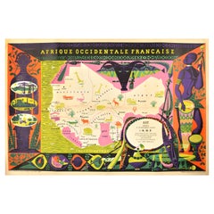
Original Vintage Poster French West Africa Map Afrique Occidentale Francaise Art
By alain cornic
Located in London, GB
Original vintage poster featuring an illustrated map of French West Africa / Afrique Occidentale
Category
Vintage 1950s French Posters
Materials
Paper
H 31.5 in W 47.25 in D 0.04 in
Mapa frente al espejo (Africa) / Map in front of the Mirror (Africa)
By Alexandre Arrechea
Located in Mexico City, MX
Alexandre Arrechea´s work remains caught in an endless uphill climb towards a new representational framework. The pieces he produces serve as a warning of our own limits and how pret...
Category
2010s Abstract Abstract Prints
Materials
Drypoint, Aquatint
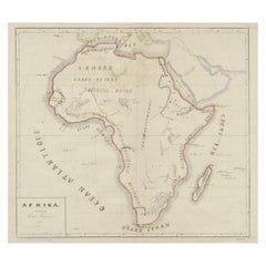
Original Antique Map of Africa
Located in Langweer, NL
Antique map titled 'Afrika'. Original antique map of Africa, drawn by Van Beusekom. Published by
Category
Antique Late 19th Century Maps
Materials
Paper
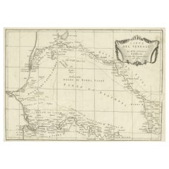
Antique Map of Senegal, West Africa
Located in Langweer, NL
Original antique map titled 'Carta del Senegal'. Antique map of Senegal, West Africa. This map
Category
Antique Mid-18th Century Maps
Materials
Paper
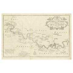
Antique Map of Gambia, West Africa
Located in Langweer, NL
Antique map titled 'Carte du Cours de la Riviere de Gambra ou Gambie (..)'. Detailed map of Gambia
Category
Antique Mid-18th Century Maps
Materials
Paper
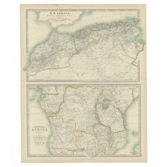
Antique Map of N.W. Africa & Central Africa by Johnston (1909)
Located in Langweer, NL
Antique map titled 'N.W. Africa & Central Africa'. Original antique map of N.W. Africa & Central
Category
Early 20th Century Maps
Materials
Paper
Antique Map of Africa by Johnston (1909)
Located in Langweer, NL
Antique map titled 'Africa'. Original antique map of Africa. This map originates from the ‘Royal
Category
Early 20th Century Maps
Materials
Paper
Antique Map of North Africa and South Africa by Black, 1854
Located in Langweer, NL
Antique map titled 'Africa north part - Africa south part'. Old map of Africa showing the region of
Category
Antique 19th Century Maps
Materials
Paper
Antique Map of Africa by Lapie, 1842
Located in Langweer, NL
Antique map titled 'Carte d'Afrique'. Map of Africa. This map originates from 'Atlas universel de
Category
Antique Mid-19th Century Maps
Materials
Paper
Antique Map of Africa by Delamarche, 1806
Located in Langweer, NL
Antique map titled 'L'Afrique'.
Decorative map of Africa by Robert de Vaugondy, revised and
Category
Antique 19th Century Maps
Materials
Paper
Antique Map of North Africa showing Egypt, Mauritania and Africa Minor, 1672
Located in Langweer, NL
Antique map titled 'Africa Minor, Mauritania , Aegyptus.' Charming miniature map of North Africa
Category
Antique 17th Century Maps
Materials
Paper
H 5.63 in W 5.12 in D 0 in
Antique Map of Africa by Homann Heirs, '1804'
Located in Langweer, NL
Antique map titled 'Charte von Africa'. Large, original antique map of Africa by Franz Ludwig
Category
Antique Early 19th Century Maps
Materials
Paper
Antique Map of South Africa by Wyld '1845'
Located in Langweer, NL
Antique map titled 'South Africa'. Original antique map of South Africa.
This decorative original
Category
Antique Mid-19th Century Maps
Materials
Paper
Uncoulored Original Antique Map of Western Africa, 1749
Located in Langweer, NL
Africa (..)'. Original antique map of Western Africa. This map originates from 'Neue Sammlung der
Category
Antique Mid-18th Century Maps
Materials
Paper
Old Original Map of Africa and Arabia, 1848
Located in Langweer, NL
Antique map titled 'Africa et Arabia'.
Old map of Africa and Arabia originating from 'Orbis
Category
Antique 1840s Maps
Materials
Paper
Antique Map of Africa with Original Hand Coloring
Located in Langweer, NL
Antique map titled 'Kaart van Afrika door den Heer d'Anville'. Detailed original old map of Africa
Category
Antique Mid-18th Century Maps
Materials
Paper
Antique Map of West Africa by Lowry, 1852
Located in Langweer, NL
Antique map titled 'West Africa'. Three individual sheets of West Africa. This map originates from
Category
Antique Mid-19th Century Maps
Materials
Paper
Antique Map of South Africa by Lowry, 1852
Located in Langweer, NL
Antique map titled 'South Africa'. Two individual sheets of South Africa. This map originates from
Category
Antique Mid-19th Century Maps
Materials
Paper
Antique Map of North Africa by Lowry '1852'
Located in Langweer, NL
Antique map titled 'North Africa Marocco Algiers & Tunis'. Two individual sheets of North Africa
Category
Antique Mid-19th Century Maps
Materials
Paper
Antique Map of Southern Africa by Levasseur, 1875
Located in Langweer, NL
Antique map titled 'Afrique Méridionale'. Large map of Southern Africa. This map originates from
Category
Antique Late 19th Century Maps
Materials
Paper
Antique Map of Africa by Levasseur 'c.1840'
Located in Langweer, NL
Antique map titled 'Afrique'. Original antique map of Africa. Decorative map of the continent
Category
Antique Mid-19th Century Maps
Materials
Paper
Antique Map of Northern Africa by Levasseur, '1875'
Located in Langweer, NL
Antique map titled 'Carte de l'Afrique Septentrionale'. Large map of Northern Africa. This map
Category
Antique Late 19th Century Maps
Materials
Paper
Antique Map of Western Africa by Levasseur '1875'
Located in Langweer, NL
Antique map titled 'Carte de la Senegambie Soudan et Guinée'. Large map of Western Africa. This map
Category
Antique Late 19th Century Maps
Materials
Paper
Original Antique Map of South Africa, Arrowsmith, 1820
Located in St Annes, Lancashire
Great map of South Africa.
Drawn under the direction of Arrowsmith.
Copper-plate engraving
Category
Antique 1820s English Maps
Materials
Paper
Antique Map of Africa by Dufour, circa 1834
Located in Langweer, NL
Antique map titled 'Afrique'. Uncommon map of Africa. Published by or after A.H. Dufour, circa 1834
Category
Antique Mid-19th Century Maps
Materials
Paper
Antique Map of Northern Africa by Perthes, 1848
Located in Langweer, NL
Antique map titled 'Africa Propria (..)'. Old map of North Africa and the region of Babylon
Category
Antique 19th Century Maps
Materials
Paper
Antique Map of Northwest Africa by Bartholomew, 1922
Located in Langweer, NL
Antique map of Africa titled 'North-West Africa'. Old map of north-west Africa depicting Morocco
Category
20th Century Maps
Materials
Paper
Antique Lithography Map, West Africa, English, Framed, Cartography, Victorian
Located in Hele, Devon, GB
This is an antique lithography map of Western Africa. An English, framed atlas engraving of
Category
Antique Mid-19th Century British Early Victorian Maps
Materials
Wood
H 17.52 in W 19.89 in D 0.79 in
Antique Map of North Africa including the Sahara Desert
Located in Langweer, NL
Antique map titled 'Charte von Nord-Africa'. Scarce map of North Africa. Includes a fantastic
Category
Antique Early 19th Century Maps
Materials
Paper
Antique Map of Africa by A & C, Black, 1870
Located in Langweer, NL
Antique map titled 'Africa'. Original antique map of Africa. This map originates from ‘Black's
Category
Antique Late 19th Century Maps
Materials
Paper
Antique Map of Africa Made after Hondius, circa 1655
Located in Langweer, NL
Antique map titled 'Africa Nova Tabula Auct Jud. Hondio'. Beautiful and rare paneled map of Africa
Category
Antique Mid-17th Century Maps
Materials
Paper
Antique Map of Africa by Keizer & de Lat, 1788
Located in Langweer, NL
Antique map titled 'Kaartje van Africa (..)'. Uncommon original antique map of Africa. This map
Category
Antique Late 18th Century Maps
Materials
Paper
Original Antique Map of Africa with large decorative cartouche
Located in Langweer, NL
Original antique map titled 'L'Afrique divisée en ses principaux États'. Attractive and precise map
Category
Antique Late 18th Century Maps
Materials
Paper
Antique Map of Africa by Bordiga Fratelli 'circa 1818'
Located in Langweer, NL
Antique map titled 'Carta dell Africa'. Large and quite scarce Italian map of Africa, reflecting
Category
Antique Early 19th Century Maps
Materials
Paper
Antique Map of the West Coast of Africa, 1771
By Rigobert Bonne
Located in Langweer, NL
qu'ils sont connus'. Map of the West Coast of Africa. Covers from the Cape Verde Islands eastward to the
Category
Antique 18th Century Maps
Materials
Paper
Antique Map of the Coast of Guinea, Africa, 1820
Located in Langweer, NL
Antique map Africa titled 'Carte de la Haute et de la Basse Guinée'. Map of the Coast of Guinea
Category
Antique 19th Century Maps
Materials
Paper
Antique Map of Africa and Arabia with Inset Map of Ethiopia and Eritrea, 1845
Located in Langweer, NL
Antique map titled 'Mittel- und Nord-Africa (östl. Theil) und Arabien'. This map depicts North and
Category
Antique 19th Century Maps
Materials
Paper
H 14.18 in W 17.33 in D 0 in
Original Antique Hand- Map of Africa by Allard '1697'
Located in Langweer, NL
Antique map titled 'Novissima et Perfectissima Africae (..)'. Beautiful large map of Africa. This
Category
Antique Late 17th Century Maps
Materials
Paper
Western Africa Antique Map by W. G. Blackie, 1859
Located in Langweer, NL
The antique map titled 'Western Africa' presents an original depiction of the region. Originating
Category
Antique Mid-19th Century Maps
Materials
Paper
Large Original Vintage Map of South Africa, circa 1920
Located in St Annes, Lancashire
Great map of South Africa
Original color.
Good condition / repair to a minor edge tear middle
Category
Vintage 1920s English Edwardian Maps
Materials
Paper
Antique Map of Africa with European Language Borders, 1852
Located in Langweer, NL
Antique map titled 'Afrika'. Map of Africa. This map originates from 'School-Atlas van alle deelen
Category
Antique 19th Century Maps
Materials
Paper
Antique Map of the Kingdom of Tunisia, Africa, 1773
Located in Langweer, NL
Antique map titled 'Kaart van het Koningryk van Tunis'. Old map of the Kingdom of Tunisia
Category
Antique 18th Century Maps
Materials
Paper
Antique Map of North Africa by Ortelius, c.1600
Located in Langweer, NL
Antique map titled 'Barbariae et Biledulgerid nova descriptio'.
Old map of coastal North Africa
Category
Antique 17th Century Maps
Materials
Paper
Antique Map of Mauritania 'Africa' by G. Ruscelli, 1574
Located in Langweer, NL
A very rare mid-16th century black and white map of North and West Africa called Mauritania by the
Category
Antique 16th Century Maps
Materials
Paper
Antique Map of North Africa by Ortelius, c.1580
Located in Langweer, NL
Africa. The map covers the regions of Barbaria and Biledulgerid, essentially the territories north and
Category
Antique 16th Century Maps
Materials
Paper
Rare Antique Map of 'Barbarie' or Northern Africa, 1655
Located in Langweer, NL
Tripoli et Pays Circomvoisins'. This map depicts North Africa with Malta and originates from 'Cartes
Category
Antique 17th Century Maps
Materials
Paper
Antique Map of West Africa by R. Bonne, 1780
Located in Langweer, NL
Antique map titled 'Partie Occidentale De L'Ancien Continent Depuis Lisbonne Jusqua La Riviere De
Category
Antique Late 18th Century Maps
Materials
Paper
Antique Decorative Coloured Map of South Africa and Madagascar, 1882
Located in Langweer, NL
The map of South Africa is from the Blackie & Son Atlas, published in 1882. This historical map is
Category
Antique 1880s Maps
Materials
Paper
Free Shipping
H 14.97 in W 22.45 in D 0 in
Original Antique Coloured Map of Western Africa, Published in 1882
Located in Langweer, NL
This is a map of Western Africa from the 1882 Blackie & Son atlas. The map details the West African
Category
Antique 1880s Maps
Materials
Paper
No Reserve
H 14.97 in W 22.45 in D 0 in
Antique Map of Africa with Mountain Ranges and other details
Located in Langweer, NL
Antique map titled 'Carte générale et Politique de l'Afrique'. Original antique map of Africa
Category
Antique Late 18th Century Maps
Materials
Paper
Free Shipping
H 19.06 in W 25.44 in D 0.02 in
Antique Map of the Coast of Guinea, Africa, c.1780
Located in Langweer, NL
Antique map Africa titled 'Carte de la Haute et de la Basse Guinée'. Map of the Coast of Guinea
Category
Antique 18th Century Maps
Materials
Paper
Antique Map of Africa by Claude Buy de Mornas '1761'
Located in Langweer, NL
Antique map titled 'Afrique'. Original antique map of Africa flanked with descriptions containing
Category
Antique Mid-18th Century Maps
Materials
Paper
Original Antique Map of Northern Africa by Van Dùren (1749)
Located in Langweer, NL
This is a German antique map titled 'Neue Geographische Vorstellung der Mitternaechtlichen Küste
Category
Antique Mid-18th Century Maps
Materials
Paper
Antique Map of the Cape Verde Islands, Africa, ca.1670
Located in Langweer, NL
Antique map titled 'Pascaert van de Soute Eylanden ofte Ilhas de Cabo Verde'.
This map depicts
Category
Antique 1670s Maps
Materials
Paper
"Africa Vetus": a 17th Century Hand-Colored Map by Sanson
By Nicolas Sanson
Located in Alamo, CA
This original hand-colored copperplate engraved map of Africa entitled "Africa Vetus, Nicolai
Category
Antique Late 17th Century French Maps
Materials
Paper
Decorative Antique Map of the Southern Part of Africa, 1806
Located in Langweer, NL
Antique map titled 'Congo, Cafrerie.'
Decorative map of the southern part of Africa by Robert
Category
Antique Early 1800s Maps
Materials
Paper
Original Hand-Colored Antique Map of Africa by Elwe '1792'
Located in Langweer, NL
Antique map titled 'l'Afrique Divisée en ses Empires, Royaumes, et Etats'. Decorative large map of
Category
Antique Late 18th Century Maps
Materials
Paper
Original Copperplate Engraved Detailed Map of South Africa, ca.1680
Located in Langweer, NL
Antique map titled 'Pays et Coste des Caffres Empires de Monomotapa (..)'.
Detailed map of
Category
Antique 1680s Maps
Materials
Paper
- 1
- ...
Get Updated with New Arrivals
Save "Africa Map", and we’ll notify you when there are new listings in this category.
Africa Map For Sale on 1stDibs
Choose from an assortment of styles, material and more with respect to the Africa map you’re looking for at 1stDibs. Frequently made of paper, wood and fabric, every Africa map was constructed with great care. You’ve searched high and low for the perfect Africa map — we have versions that date back to the 18th Century alongside those produced as recently as the 21st Century are available. Each Africa map bearing Industrial, Folk Art or Neoclassical hallmarks is very popular. You’ll likely find more than one Africa map that is appealing in its simplicity, but Vincenzo Coronelli, Samuel Boulton and Covens & Mortier produced versions that are worth a look.
How Much is a Africa Map?
Prices for a Africa map start at $67 and top out at $55,191 with the average selling for $575.
More Ways To Browse
Hand Colored Italy Map
Antique Map Orient
Vintage Embroidered Bag
Animal Drum
Cattle Poster
Vintage Fishing Posters
Paris Dakar
Antique Map Mediterranean
Prevost Paris
Antique Riviere
African Framed Textiles
Pair Of Atlas
Ship Engraving Dutch
South Africa Vintage Map
Vintage Fishing Boat
Vintage Drum Posters
Vintage Map Of South Africa
Antique Wind Rose
