Maps
to
1,667
2,084
56
2,142
26
3
3
2
1
1
1
2,926
2,181
476
3
289
34
10
127
7
35
9
2
5
3
4
2
2,119
28
15
11
10
176
110
80
23
20
2,142
2,142
2,142
24
16
13
12
12
Maps For Sale
Period: Early 20th Century
Period: 18th Century
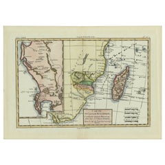
Antique Map of Mozambique and Cape of Good Hope with Kingdom Monomotapa, 1780
Located in Langweer, NL
Antique map titled 'Carte Du Canal De Mozambique.' The main map, on the right, covers from the Cape of Good Hope north as far as Zanzibar and modern day Kenya, focusing on the gold r...
Category
18th Century Antique Maps
Materials
Paper
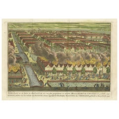
Antique Print of the Batavia Massacre 'Present-Day Jakarta', Indonesia
Located in Langweer, NL
Antique print titled 'Tableau de la Partie de Batavia, ou s'est fait proprement le terrible Massacre des Chinois (..)'. Original antique print of the Batavia massacre. The 1740 Batav...
Category
Mid-18th Century Antique Maps
Materials
Paper
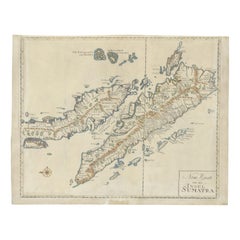
Antique Map of Sumatra, Indonesia 'c.1780'
Located in Langweer, NL
Antique map titled 'Neue Karte von der Insel Sumatra'. Extremely rare map of Sumatra, Indonesia. Published circa 1780.
Category
Late 18th Century Antique Maps
Materials
Paper
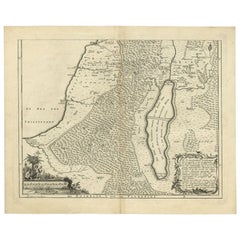
Antique Map of Southern Palestine by Bachiene, 1763
Located in Langweer, NL
"Antique map of the south part of Palestine. This simplified map shows the most important cities of the Jewish Land. Source unknown, to be determined. Artists and Engravers: Made by ...
Category
18th Century Antique Maps
Materials
Paper
Antique Map of South America by Tirion 'circa 1765'
Located in Langweer, NL
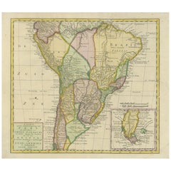
Antique map titled 'Kaart van het Onderkoningschap van Peru, zig uitstrekkende over Chili, Paraguay en andere Spaansche Landen: als ook van Brazil en verdere Bezittingen van Portugal...
Category
Mid-18th Century Antique Maps
Materials
Paper
1773 John Blair Map of the Ancient Holy Land: Tribes, Journeys, and Empires
Located in Langweer, NL
Title: 1773 John Blair Map of the Ancient Holy Land: Tribes, Journeys, and Empires
This exceptional map by John Blair, published in London in 1773, offers a richly detailed view o...
Category
1770s Antique Maps
Materials
Paper
Original Antique Map of England, Ireland, Scotland and Wales
Located in Langweer, NL
Antique map titled 'Les Isles Britanniques, ou sont les Royaumes d Angleterre (..)'. Detailed map of England, Ireland, Scotland and Wales, with French coast and part of the Netherlan...
Category
Early 18th Century Antique Maps
Materials
Paper
Original Hand-Colored Antique Map of Africa by Elwe '1792'
Located in Langweer, NL
Antique map titled 'l'Afrique Divisée en ses Empires, Royaumes, et Etats'. Decorative large map of Africa. The cartography is typical for the 17th century with the Nile originating i...
Category
Late 18th Century Antique Maps
Materials
Paper
1748 Homann Heirs Double Map of the East Indies and Southeast Asia
Located in Langweer, NL
Title: 1774 Homann Heirs Double Map of the East Indies and Southeast Asia
Description:
This stunning 1774 double map by the Homann Heirs showcases the East Indies and Southeast ...
Category
1740s Antique Maps
Materials
Paper
Antique Map of the Northern Coast of Africa and Southern Europe, circa 1745
Located in Langweer, NL
Antique map titled 'In Notitiam Ecclesiasticam Africae Tabula Geographica'. Very decorative hand-colored map of the northern coast of Africa, Spain, Italy and the Mediterranean with the islands of Sardinia, Corsica, Majorca, Minorca etc. Sicily features a smoking Mount Aetna. Embellished with three architectural cartouches...
Category
Mid-18th Century Antique Maps
Materials
Paper
Topographical and Infrastructure Map of the Province of Valencia, 1901
Located in Langweer, NL
A historical map of the province of Valencia, dated 1901. The map includes intricate details such as topographical features, with mountain ranges and river systems prominently marked...
Category
Early 1900s Antique Maps
Materials
Paper
Girona 1902: Geographic and Infrastructural Map of Catalonia’s Northern Province
Located in Langweer, NL
The map provided is of the province of Girona (in Catalan, Girona), located in the northeast of Spain, within the autonomous community of Catalonia, as of the year 1902. Here are the...
Category
Early 1900s Antique Maps
Materials
Paper
Geographical Antique Map of Principality of Monaco
Located in Alessandria, Piemonte
ST/609 - Interesting antique color map of Monaco Principality in French language : "Carte qui contient le Principauté de Piémont, le Monferrat et la comté de...
Category
Late 18th Century Italian Other Antique Maps
Materials
Paper
Original Engraved Map of Saint Lucia in the West Indies by Bellin, 1758
Located in Langweer, NL
The "Carte de L’Isle de Sainte Lucie" by Jacques Nicolas Bellin, a prominent figure as the Royal Hydrographer and engineer of the French Navy, is a remarkable antique map showcasing ...
Category
1750s Antique Maps
Materials
Paper
Antique Map of Guadeloupe, Island in the Caribbean, c.1757
Located in Langweer, NL
Antique map titled 'Carte de L'Isle de la Guadeloupe'.
A very decorative map of Guadeloupe in the Caribbean, adorned with rhumb lines, fleur-de-lys, and two decorative rococo-style...
Category
18th Century Antique Maps
Materials
Paper
Antique Map of the Northern Portion of the Philippines by J.N. Bellin, 1764
Located in Langweer, NL
Detailed map of the Northern portion of the Philippines, extending from Batanes and Babuyanes to Mindonoro and Masbate, and centered on Luzon. One of the most detailed maps of the pe...
Category
Mid-18th Century Antique Maps
Materials
Paper
18th Century Antique Engraving of the Southern Hemisphere by G. de L'Isle
Located in Langweer, NL
Antique map titled 'Hemisphere Meridional pour voir plus distinctement Les Terres Australes'. Hemispherical map of the southern hemisphere centered on ...
Category
Late 18th Century Antique Maps
Materials
Paper
Antique Map of South American, The West Indies & Most of Africa, Ca.1775
Located in Langweer, NL
Antique map titled 'Carte pour Servir a l' Histoire Philosophique et Politique des Etablissemens et du Commerce des Europeens dans les deux Indes'.
This map is roughly centered o...
Category
1770s Antique Maps
Materials
Paper
Antique Map of Southern England and Wales by Zatta, 1784
Located in Langweer, NL
"Antique map titled 'Parte Meridionale dell' Inghilterra e del Pricipato di Galles'. Engraved map of the southern part of England and Wales, with title cartouche. Shows political and...
Category
18th Century Antique Maps
Materials
Paper
Very Decorative Original Antique Map of the World, Published in France in c.1780
Located in Langweer, NL
Antique map titled 'L'Ancien Monde Et Le Nouveau en Deux Hemispheres' - Double hemisphere map of the World, showing the contemporary geographical...
Category
18th Century Antique Maps
Materials
Paper
Antique Map of the Banda Islands in Indonesia by Valentijn, 1726
Located in Langweer, NL
Antique map Indonesia titled 'Kaart der Zuyd-Wester Eylanden van Banda'. Map of the islands in the southwestern part of the Banda Sea including ...
Category
Mid-18th Century Antique Maps
Materials
Paper
Old Antique Print of Fort Noordwijk, Batavia in the Dutch East Indies, 1739
Located in Langweer, NL
Antique print titled 'Ein Prospect des Forts Nortweijck, wie sich dasselbe wan man von Jacatra komt, mit seiner Gegend präsentiret'.
Old print of Fort Noordwijk, Batavia (Jakarta). This print originates from from 'Allerneuester Geographische- und Topographischer Schau-platz, von Africa und Ost-Indien'.
Artists and Engravers: Johann Wolfgang Heydt, a German artist who worked for the Dutch East India...
Category
1730s Antique Maps
Materials
Paper
Original Antique Map of the Cape Verde Islands, 1746
Located in Langweer, NL
Antique map titled 'Carte Des Isles Du Cap Verd.' Original antique map of the Cape Verde Islands. Decorative cartouche and compass rose. Extends from Isle d...
Category
18th Century Antique Maps
Materials
Paper
Antique Map of the Caspian Sea, Uzbekistan, Northern Persia Etc, C.1735
Located in Langweer, NL
Antique map titled 'Nova Maris Caspii et Regions Usbeck (..).' Detailed map of Central Asia centered on the Caspian Sea, showing Uzbekistan to the east of ...
Category
18th Century Antique Maps
Materials
Paper
Antique Map of Flanders, France Incl the Cities Lille, Tournai, Douai, c.1730
Located in Langweer, NL
Antique map titled 'Flandriae comitatus pars Australis'. Decorative antique map of the southern portion of Flanders, France. It shows the cities of Lille (Rijsel), Douai, Tournai (Do...
Category
18th Century Antique Maps
Materials
Paper
Cuenca 1901: A Historical Cartographic Detailing of High Plains and Mountains
Located in Langweer, NL
The original antique map displays the province of Cuenca, located in the autonomous community of Castilla-La Mancha in central Spain, as of 1901. Here are some of its features:
It i...
Category
Early 1900s Antique Maps
Materials
Paper
Antique Map of Guyenne, Gascony and Béarn, France
Located in Langweer, NL
Antique map titled 'Guyenne et Gascogne et Bearn'. Original old map of Guyenne (or Guienne), Gascony and Béarn, France. This map originates from 'Le Petit Atlas Maritime Recueil De C...
Category
Mid-18th Century Antique Maps
Materials
Paper
Genuine Antique Engraved Map of Helvetia or Switzerland, 1729
Located in Langweer, NL
Decorative early 18th century engraved map of Switzerland.
Title: Helvetia Conterminarumq terra rum antiqua.
Translated from Latin: Switzerland is an ancient land
Description: Switzerland, antique copperplate engraved map with hand coloring and a decorative title cartouche. Two figures greatly enhances visual appeal.
Author: Phillip Cluver, or Philip Cluverius, Philipp Clüver, Latinized as Philippus Cluverius studied law in Leiden and settled over there in 1615.
We only sell Guaranteed Absolutely Original authentic Maps and Prints.
A Certificate of Authenticity ( COA ) will be supplied on request.
We ship our antique maps and prints...
Category
1720s Antique Maps
Materials
Paper
Map of the West African coast from the North of Mauretania to Guinee, 1788
Located in Langweer, NL
Antique map titled 'Particular Map of the Western Coast of Africa, from Cape Blanco to Cape de Verga, and of the Course of the Rivers Senega and Gambia.'
Map of the African coast...
Category
1780s Antique Maps
Materials
Paper
Antique Map of Menorca / Minorca by Homann Heirs '1757'
Located in Langweer, NL
Antique map titled 'Carte Topographique de l'Isle Minorque'. Scarce decorative map of Menorca (or Minorca), with two gorgeous views of Mahon and Fort St. Phillipe at the bottom. Publ...
Category
Mid-18th Century Antique Maps
Materials
Paper
Antique Map of the Port of Zihuatanejo in Mexico, c.1740
Located in Langweer, NL
Antique map titled 'Plan du Port de Chequetan ou Seguataneo'. Map of the Mexican port of Zihuatanejo. This area was originally named Cihuatlán in Aztec, which means 'Place of Women,'...
Category
18th Century Antique Maps
Materials
Paper
Antique Map of the Region of Brie and Champagne by Zatta, 1779
Located in Langweer, NL
Antique map titled 'Li Governi di Sciampagna e Brie'. Old map of France showing the provinces of Brie and Champagne. This map originates from 'Atlante Novissimo, illustrato ed accres...
Category
18th Century Antique Maps
Materials
Paper
Antique Map of the Coast of Guinea and the Cape Verde Islands
Located in Langweer, NL
Antique map titled 'Carte de la Guinée (..)'. This map was originally part of a 2 sheet larger map of Eastern Africa, showing the Cape Verde Islands and Senegal. This map originates ...
Category
Late 18th Century Antique Maps
Materials
Paper
Rare Old English Sea Chart of Part of Indonesia with Java, Madura and Bali, 1711
Located in Langweer, NL
Antique map titled 'A Large Draught of the East End of Java and Madura shewing the Streights of Bally.'
Rare early example of this working English Sea Chart of part of Indonesia ...
Category
1710s Antique Maps
Materials
Paper
Huelva 1901: A Cartographic Presentation of Andalusia's Atlantic Frontier
Located in Langweer, NL
The map displays the province of Huelva, located in the southwestern part of the autonomous community of Andalusia in Spain, as of the year 1901. It outlines various geographic and m...
Category
Early 1900s Antique Maps
Materials
Paper
Antique Map of South East Asia, Australia and the Indian Ocean, 1726
By F. Valentijn
Located in Langweer, NL
Antique map titled 'Tabula Indiae Orientalis'.
Beautiful detailed map of Australia, Southeast Asia and the Indian Ocean. The map features a fine depiction of the outlines of the western two-thirds of Australia, based on the discoveries of explorers working for the Dutch East India Company (the VOC). These include Willem Jansz's discoveries in the Gulf of Carpentaria in 1606; the encounters of Dirk...
Category
Mid-18th Century Dutch Antique Maps
Materials
Paper
Fabulous Original Antique two-sheet Map of the Caspian Sea, ca.1723
Located in Langweer, NL
Carte Marine de la Mer Caspiene... [and] Coste de Perse sur la Mer Caspiene et Partie de Celles de Tartarie", Delisle, Guillaume (2 maps)
Subject: Caspian Sea
...
Category
1720s Antique Maps
Materials
Paper
Echoes of Empire: Spanish Territories in West Africa, 1903
Located in Langweer, NL
This is a historical map showing Spanish possessions in West Africa from the year 1903. The map includes the islands of Fernando Póo (now known as Bioko), part of the modern-day country of Equatorial Guinea, Annobón Island, and the Elobey Islands, along with the Spanish-controlled areas on the continental region near Rio Muni.
These territories were part of Spain's colonial empire and are situated in the Gulf of Guinea, off the coast of Central Africa. Fernando Póo (Bioko) is particularly notable for its volcanic origins and as a center of cocoa production during the colonial period. Annobón, lying further southwest of Bioko, is a small volcanic island. The Elobey Islands are very small and located near the coast of Gabon.
Here's a brief overview of their significance:
1. **Bioko Island (Fernando Póo)**: The island has a rich biodiversity and is known for its unique flora and fauna, including several endemic species. Malabo, the capital city of Equatorial Guinea, is located here.
2. **Annobón Island**: This remote island has a small population and is known for its isolation and distinctive Creole culture, which has developed independently from the mainland.
3. **Elobey Islands**: These consist of Elobey Grande and Elobey Chico and are situated near the mouths of the Muni and Campo rivers. They were historically important as transit points in river trade...
Category
Early 1900s Antique Maps
Materials
Paper
Antique Map of the Mongol Empire, 1767
Located in Langweer, NL
Antique map titled 'The Moguls Empire divided into its principal governments'. Old map of India, Bangladesh, and parts of eastern China.
Artists and Engravers: Published in the G...
Category
18th Century Antique Maps
Materials
Paper
Antique Map of Turkey in Europe by Russell, circa 1795
Located in Langweer, NL
Antique map titled 'Turkey in Europe and Hungary'. Original map of Turkey in Europe. Covers present day Northern Turkey, Greece, Albania, Romania, Hungary, Croatia, Bosnia Herzogovin...
Category
Late 18th Century Antique Maps
Materials
Paper
Antique Engravings of Mauritius and Indonesia, incl de Banda Islands, c.1730
Located in Langweer, NL
Title on page: "Ins. de Cerno a. Nostatibus Mauritius Nominata [on sheet with] Gunnanappi Labetacq [and] Civitas Gammelamme [and] Rex Tubatus", Le Clerc, Jean
This sheet includes fo...
Category
1730s Antique Maps
Materials
Paper
Antique Decorative French Map of Java, Indonesia, 1718
Located in Langweer, NL
Antique map of Java titled 'Carte de l'Ile de Java: Partie Occidentale, Partie Orientale, Dressee tout Nouvellement (..)'.
Decorative large format map...
Category
18th Century Antique Maps
Materials
Paper
Antique Map of the City of Groningen Made After Harrewijn, C.1750
Located in Langweer, NL
Antique map titled 'Groeningue'. Old map of the city of Groningen, the Netherlands. Source unknown, to be determined.
Artists and Engravers: Most likely made after J. Harrewijn.
...
Category
18th Century Antique Maps
Materials
Paper
Original Antique Map of Northern India
Located in Langweer, NL
Antique map titled 'Carte de l'Indoustan (..) - Kaart van Hindoestan (..)'. Original antique map of northern India. This map originates from 'His...
Category
Mid-18th Century Antique Maps
Materials
Paper
Antique Map of South America by Gordon, c.1745
Located in Langweer, NL
Antique map titled 'South America according to the latest observations'. Antique map of South America originating from 'Geography Anatomiz'd: or, The Geographical Grammar'. Artists a...
Category
18th Century Antique Maps
Materials
Paper
Old Antique Map of Borneo 'Kalimantan Indonesia, Sabah Malaysia & Brunei'
Located in Langweer, NL
Antique map titled 'Kaart van het Eyland Borneo'. Original antique map of the island of Borneo. Published 1724-1726 by Joannes van Braam and Gerard Onder de ...
Category
Early 18th Century Antique Maps
Materials
Paper
Antique Map of France at the End of the Reign of Jean II by Zannoni, 1765
Located in Langweer, NL
Antique map France titled 'La France sous la fin du Regne de Jean II (..)'. Beautiful old map of France. This map originates from 'Atlas Historique de la France Ancienne et Moderne' ...
Category
18th Century Antique Maps
Materials
Paper
Rare Antique English SeaChart of Bali, Lombok, Floris, Borneo, Celebes etc, 1711
Located in Langweer, NL
Antique map titled 'A Large Draught from Benjar on the Island of Borneo To Macasser on the Island of Celebes Shewing the Streight of Bally with the Islands to the Eastward thereof.' ...
Category
1710s Antique Maps
Materials
Paper
Antique Map of the Congo, Gabon and Angola by N. Sanson, circa 1700
Located in Langweer, NL
Attractive map of Gabon, the Congo and Angola from Cape Lopez and Sao Tomé to approximately the border with present-day Namibia. The map is fully engraved with mountains, rivers, for...
Category
Early 18th Century Antique Maps
Materials
Paper
Large Original Vintage Map of Israel, circa 1920
Located in St Annes, Lancashire
Great map of Israel
Original color.
Good condition
Published by Alexander Gross
Unframed.
Category
1920s English Edwardian Vintage Maps
Materials
Paper
Highly Decorative Map of The Eastern Mediterranean and The Middle East, ca.1700
Located in Langweer, NL
Antique map titled 'Byzondere Kaart van de Landen Daar de Apostelen Het Evangelium Gepredikt Hebben (..).'
Highly decorative map of the eastern Mediterranean...
Category
Early 1700s Antique Maps
Materials
Paper
Antique Bible World Map by R. & J. Wetstein, 1743
Located in Langweer, NL
Antique world map titled 'De Werelt Caart'.
A scarce and richly detailed double hemisphere world map that was probably based on an earlier work by Cornelis Dankerts. This map has t...
Category
Mid-18th Century Antique Maps
Materials
Paper
Huesca 1901: A Geographic Overview of Aragon's Northern Frontier in Spain
Located in Langweer, NL
The map provided is of the province of Huesca, located in the northeastern part of Spain, within the autonomous community of Aragon, as of the year 1901. Here are some of the key fea...
Category
Early 1900s Antique Maps
Materials
Paper
Antique Map of Westergo, Friesland in the the Netherlands, by Tirion, 1744
By Isaak Tirion
Located in Langweer, NL
Antique map titled 'Westergo'. Original antique map of Westergo, part of the province of Friesland, the Netherlands. Published 1744.
Artists and Engravers: Isaak Tirion (1705 in U...
Category
18th Century Antique Maps
Materials
Paper
Large Wall Map of Europe by George Philip & Son, circa 1920
Located in Langweer, NL
Antique map titled 'Philips' New Commercial Map of Europe'. Very large wall map of Europe including the North African coast and Turkey. Decorative bord...
Category
Early 20th Century Maps
Materials
Linen, Paper
Antique Map of Martinique, Showing Roads, Houses, Sugar Plantations, etc. c.1750
Located in Langweer, NL
Antique map titled 'Carte de l'Isle de la Martinique'.
Detailed map of Martinique. Shows hilly terrain, forests, roads, houses, and even the sugar plantations. The island was to ...
Category
18th Century Antique Maps
Materials
Paper
Original Antique Engraving of Algiers in Algeria, 1773
Located in Langweer, NL
Antique print titled 'Algiers'. Old print with a view of Algiers, Algeria. With Dutch legend. Originates from the first Dutch editon of an interesting travel account of Northern Afri...
Category
18th Century Antique Maps
Materials
Paper
Large Scale Antique Scroll Map of Lincolnshire, England, Dated 1778
Located in St Annes, Lancashire
Wonderful scroll map of Lincolnshire
By Captain Armstrong, 1778
Copper plate engraving on paper laid on canvas
Original ebonized wood frame with lovely t...
Category
1770s English Georgian Antique Maps
Materials
Wood, Paper
