Maps
to
2,446
2,934
116
3,053
26
12
1
1
2,926
2,181
476
3
289
34
10
127
7
35
9
2
5
3
4
2
3,039
30
20
4
3
245
109
80
72
31
3,053
3,053
3,053
63
24
16
13
13
Maps For Sale
Period: 18th Century and Earlier
Period: Early 1900s
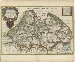
Rare 1670 Map of Tartary by Richard Blome after Sanson, Hand-colored Engraving
Located in Langweer, NL
Rare 1670 Map of Tartary by Richard Blome after Sanson, hand-colored engraving
This striking and highly decorative map, titled *A Generall Mapp of the Kingdome of Tartaria*, was pub...
Category
1670s Antique Maps
Materials
Paper
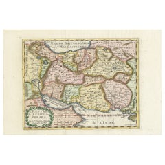
Map of the Persian Empire by Nicolas Sanson, Hand-colored, circa 1683
Located in Langweer, NL
Map of the Persian Empire by Nicolas Sanson, hand-colored, circa 1683
This finely detailed and delicately hand-colored map titled *L'Empire du Sophy des Perses* presents a late 17th...
Category
1680s Antique Maps
Materials
Paper
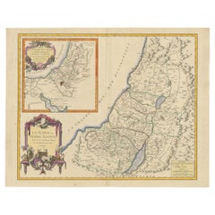
1750 Map of the Holy Land: The Land of Canaan and the Twelve Tribes
Located in Langweer, NL
Carte de la Terre de Canaan ou Terre Promise
Cartographer: Le St. Robert
Date of Publication: 1750
This exquisite 18th-century map, 'Carte de la Terre de Canaan ou Terre Promise', w...
Category
1750s Antique Maps
Materials
Paper
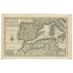
Antique Map of the Mediterranean Sea and Surroundings by Keizer & de Lat, 1788
Located in Langweer, NL
Antique map titled 't Wester Deel van de Middelandse Zee (..)'. Uncommon original antique map of the Mediterranean Sea and surroundings. This map originates from 'Nieuwe Natuur- Gesc...
Category
Late 18th Century Antique Maps
Materials
Paper
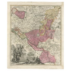
Historical Map of the Duchy of Lauenburg by Johann Baptist Homann - Circa 1720
Located in Langweer, NL
Historical Map of the Duchy of Lauenburg by Johann Baptist Homann - Circa 1720
This splendid historical map titled Ducatus Lauemburgicus is a highly detailed and beautifully engra...
Category
1720s Antique Maps
Materials
Paper
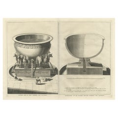
The 'Brazen Sea' in Solomon's Temple and a Cross Section of the Brazen Sea, 1725
Located in Langweer, NL
Two religious images on one sheet titled 'Kopere Zee in den Tempel van Salomon' and 'Doorsnede van de Kopere Zee des Tempels van Salomon'.
The 'Brazen Sea' in Solomon's Temple an...
Category
1720s Antique Maps
Materials
Paper
1573 Ortelius Map: First to Name California, Spanning Tartary to North America
Located in Langweer, NL
"1573 Abraham Ortelius Map of Tartary, Japan, and Western North America"
Description of the Map:
This is an outstanding example of Abraham Ortelius' map titled "Tartariae Sive Magn...
Category
16th Century Antique Maps
Materials
Paper
Antique Map of Paraguay by A. Montanus, circa 1671
Located in Langweer, NL
Antique map titled 'Paraquaria Vulgo Paraguay Cum adjacentibus'. Antique map extending from Rio de Janiero to the Rio de la Plata basin. The map include...
Category
Mid-17th Century Antique Maps
Materials
Paper
Original Antique Map of the American State of Colorado, 1903
Located in St Annes, Lancashire
Antique map of Colorado
Published By A & C Black. 1903
Original colour
Good condition
Unframed.
Free shipping
Category
Early 1900s English Antique Maps
Materials
Paper
Detailed Antique Map of Italy and surrounding Islands
Located in Langweer, NL
Antique map titled 'Italie volgens de allernieuwste Uitgave van den Heere d'Anville'. Very detailed antique map, based on D'Anville's important map of It...
Category
Mid-18th Century Antique Maps
Materials
Paper
Palermo – 1620 Braun & Hogenberg Bird’s-Eye Map of Palermo, Sicily
Located in Langweer, NL
Palermo – 1620 Braun & Hogenberg Bird’s-Eye Map of Palermo, Sicily
This beautifully detailed bird’s-eye view of Palermo, Sicily, was created by Georg Braun and Frans Hogenberg aro...
Category
1620s Antique Maps
Materials
Paper
Antique Bird's-Eye View of Hangzhou (China) by Matthäus Merian, 1638
Located in Langweer, NL
This is an exquisite antique bird's-eye view map of Hangzhou, historically referred to as "Xuntien or Quinzay," from the first edition of Matthäus Merian's publication in 1638. This ...
Category
1630s Antique Maps
Materials
Paper
Antique Map of the City of Brielle 'The Netherlands' by L. Guicciardini, 1625
Located in Langweer, NL
Plan of Brielle, Briel, Den Briel in the Province of Zuid-Holland, The Netherlands, Holland. This map originates from the 1625 edition of 'Discrittione di tutti i Paesi Bassi', by L....
Category
Early 17th Century Antique Maps
Materials
Paper
Historical Map of Greece and the Eastern Mediterranean by Delisle - 1780
Located in Langweer, NL
Historical Map of Greece and the Eastern Mediterranean by Guillaume Delisle - 1780 Reissue
This captivating map titled "Carte de la Grèce" was originally crafted by the eminent Fr...
Category
1780s Antique Maps
Materials
Paper
Gorgeous Antique World Map by the Dutch Mapmaker Visscher, published circa 1679
Located in Langweer, NL
Antique map titled 'Novissima Totius Terrarum Orbis Tabula, Auctore Nicolao Visscher'. Gorgeous example of Nicholas Visscher's World map, which appeared...
Category
Late 17th Century Antique Maps
Materials
Paper
Natives from Pegu, the Moluccan Islands, Penequais Indians and St Thomas, c.1605
Located in Langweer, NL
Antique print titled 'Provincie Pegu incola (..) - Incola ex Insulis Moluco (..) - Penequais familiae (..)'.
Old print showing various figures including a man from Pegu, a man fr...
Category
Early 1600s Antique Maps
Materials
Paper
Hand-Colored Map of Delfland by Hendrik de Leth, 1740 – Delft & The Hague
Located in Langweer, NL
Hand-Colored Map of Delfland by Hendrik de Leth, 1740 – Delft & The Hague
This beautifully preserved antique map titled "Nieuwe Gemeete Kaert van Delfland" was engraved by Hendrik d...
Category
1740s Antique Maps
Materials
Paper
Large Antique Map of Ceylon, Sri Lanka
Located in Langweer, NL
Antique map titled 'Nieuwe Kaart van het Eyland Ceylon opgestelt door Francois Valentyn'. Beautiful map of Sri Lanka. Originates from 'Oud en Nieuw Oost ...
Category
Mid-18th Century Antique Maps
Materials
Paper
Large 17th-Century Coronelli Map of Europe with Mythical Islands and Rich Detail
Located in Langweer, NL
Large 17th-Century Coronelli Map of Europe with Mythical Islands and Rich Detail
This exceptional two-sheet map of Europe by Vincenzo Maria Coronelli, published in Venice in 1692,...
Category
1690s Antique Maps
Materials
Paper
Original Map of the East Indies Including Sumatra, Java, Borneo & Malaysia, 1747
Located in Langweer, NL
Antique map titled 'Carte des Isles Java, Sumatra, Borneo (..) - Kaart van de Eilanden van Iava, Sumatra, Borneo (..)'.
Map of the East Indies including Sumatra, Java, Borneo and...
Category
1740s Antique Maps
Materials
Paper
Antique Map of the Sunda Islands Including Sumatra, Java, and Borneo, 1705
Located in Langweer, NL
Title: “Antique Map of the Sunda Islands Including Sumatra, Java, and Borneo”
This print is a beautifully detailed and relatively rare map of Western Indonesia, encompassing the reg...
Category
Early 1700s Antique Maps
Materials
Paper
1732 Henri Chatelain Map of the Holy Land Divided Among the Tribes of Israel
Located in Langweer, NL
Title: 1732 Henri Chatelain Map of the Holy Land Divided Among the Tribes of Israel
This exquisite 18th-century map by Henri Chatelain, published in 1732, offers a detailed depict...
Category
1710s Antique Maps
Materials
Paper
Antique Map of the County of Burgundy by Johann Baptist Homann circa 1710
Located in Langweer, NL
Antique Map of the County of Burgundy by Johann Baptist Homann circa 1710 Hand-Colored
This finely detailed antique map titled Comitatus Burgundia depicts the historic region of t...
Category
1720s Antique Maps
Materials
Paper
Detailed Antique Map of the Southern Part of European Russia and Ukraine, 1752
Located in Langweer, NL
Antique map titled 'Partie meridionale de la Russie Européenne'.
Detailed map of the southern part of European Russia by Robert de Vaugondy. It covers from Moscow south to Georgia and from Poland east to the Volga River, including Crimea and Ukraine.
Artists and engravers: Gilles Robert de Vaugondy (1688-1766) was the head of a leading family of geographers in eighteenth century France. Gilles got his start when he jointly inherited the shop of Pierre-Moullart Sanson, grandson of the famous geographer Nicholas Sanson. The inheritance included the business, its stock of plates, and a roller press...
Category
1750s Antique Maps
Materials
Paper
Antique Map of the Gaspar Strait by Huddart, '1788'
Located in Langweer, NL
Antique map titled 'Sketch of the Straits of Gaspar'. Detailed sea chart of the Gaspar Strait, showing part of the Island of Banca on the east coast of Sumatra just to the south of S...
Category
Late 18th Century Antique Maps
Materials
Paper
Rare Antique Map of the Dutch East Indies 'Indonesia', 1774
Located in Langweer, NL
Rare decorative engraved map of the Dutch East Indies, or nowadays Indonesia.
Title (in old Dutch): NIEUWE EN NAUKEURIGE KAART DER OOST-INDISCHE ...
Category
1770s Antique Maps
Materials
Paper
1616 Petrus Bertius Miniature Map of Cambay (Gujarat, India)
Located in Langweer, NL
Title: 1616 Petrus Bertius Map of Cambay and Gujarat, India
Description: This early seventeenth-century map, titled Descriptio Cambaiæ, was published in 1616 by Petrus Bertius, a ...
Category
1610s Antique Maps
Materials
Paper
Original Old Map of Present-Day Mongolia, Northeast China and Korea
Located in Langweer, NL
Antique map titled 'Carte de la Tartarie Chinoise. Projettee et assujettie aux observations astronomiques par M. Bonne, Hydrographe du Roi. A Paris, Chez Lattre Graveur, ordinaire de...
Category
Late 18th Century Antique Maps
Materials
Paper
1788 Map of Europe - France, Italy, Spain, Germany, Great Britain & Ireland
Located in Langweer, NL
Title: "1788 Map of Europe - France, Italy, Spain, Germany, Great Britain & Ireland by D'Anville"
Description:
This detailed map of Europe, titled "First Part of the Map of Europe...
Category
1780s Antique Maps
Materials
Paper
Antique Map of the Empire of Morocco by Kitchin, c.1760
Located in Langweer, NL
Antique map titled 'A Map of the Empire of Morocco Comprehending the Kingdoms of Fez, Morocco'. Original antique map of the kingdoms of Fez, Algiers, Segelmese, Tafilet and Morocco. ...
Category
18th Century Antique Maps
Materials
Paper
Original Antique View of the City of Damietta, Egypt, 1774
Located in Langweer, NL
Antique print, titled: 'Prospect der Stadt Damiat.' - Tab VIII.
View of the city of Damietta, Egypt. From 'Reisebeschreibung von Arabien und anderen umliegenden Landern (1774-1778)...
Category
1770s Antique Maps
Materials
Paper
Antique Map of the Ancient Greek Colonization
Located in Langweer, NL
Antique map titled 'Map I containing the Western Division of the Grecian Colonies & Conquests'. Original antique map of the ancient Greek colonization. Frontispiece map of 'The Histo...
Category
Late 18th Century Antique Maps
Materials
Paper
Venetian Trade Routes in the Levant – Antique Map by Pieter van der Aa, ca.1720
Located in Langweer, NL
Venetian Trade Routes in the Levant – Antique Map by Pieter van der Aa, Early 18th Century
This finely engraved map, published by Pieter van der Aa in Leiden, provides a detailed d...
Category
1720s Antique Maps
Materials
Paper
Original Antique Bird's Eye View of Banten or Bantam in Java, Indonesia, 1725
Located in Langweer, NL
Antique print titled 'La Ville de Bantam capitale du Roiaume de meme nom'.
A bird's eye view of the city Banten or Bantam near the western end of Java in Indonesia. Several tall ...
Category
1720s Antique Maps
Materials
Paper
Pl. 8 Antique Print of Garden Pavilions by Le Rouge, c.1785
Located in Langweer, NL
Antique print titled 'Pavillon pour les jardins (..)'. Copper engraving showing the pavilions of knight Worsley of Hovingham and knight Willoughby. This print originates from 'Jardin...
Category
18th Century Antique Maps
Materials
Paper
Map of Avenches Region Switzerland by Mercator, Original 1585 Engraving
Located in Langweer, NL
Map of Wiflispurgergov by Gerardus Mercator, Avenches Region, 1585
This rare and finely engraved map, titled *Das Wiflispurgergov*, was produced by Gerardus Mercator and published i...
Category
16th Century Dutch Antique Maps
Materials
Paper
Map of Lake Geneva and Surroundings by Hondius, Geneva Region, circa 1612
Located in Langweer, NL
Map of Lake Geneva and Surroundings by Hondius, Geneva Region, 1606
This rare and intricately engraved map, titled *Chorographica Tabula Lacus Lemanni Locorumque Circumiacentium*, w...
Category
Early 17th Century Dutch Antique Maps
Materials
Paper
Map of Zurich and Basel Region by Mercator, Uncolored Engraving c.1600
Located in Langweer, NL
Map of Zurich and Basel Region by Mercator, Uncolored Engraving c.1600
This original uncolored copperplate engraving, titled *Zurichgow et Basiliensis Provincia*, was created by the...
Category
Early 17th Century Antique Maps
Materials
Paper
Rare 1572 Map of Ancient Rome with Monuments by Ligorio, Braun & Hogenberg
Located in Langweer, NL
Rare 1572 Map of Ancient Rome with Monuments by Ligorio, Braun & Hogenberg
This remarkable 16th-century map, *Urbis Romae Situs cum ils quae adhuc Conspiciuntur Veter. Monumet Rel...
Category
16th Century Antique Maps
Materials
Paper
Antique Hand-Colored Map of France by J.B. Elwe, 1792
Located in Langweer, NL
Antique map titled 'Carte Nouvelle du Royaume de France'. Beautiful antique map of France, including the Southern part of England. Decorated with cartouche and 12 coats of arms.
Category
Late 18th Century Antique Maps
Materials
Paper
Teruel 1901: A Cartographic Depiction of Heritage and Natural Splendor in Spain
Located in Langweer, NL
Original antique map of Teruel in Spain, with highlighted gold. The province of Teruel, located in the region of Aragon in eastern Spain, is known for several unique features:
1. **Mudejar Architecture**: Teruel is famous for its well-preserved Mudejar architecture, which is a style that is a fusion of Christian and Islamic design. This includes notable examples like the Tower of El Salvador and the Teruel Cathedral, both of which are UNESCO World Heritage sites.
2. **Dinopolis**: It hosts Dinópolis, a paleontological park that is one of the largest of its kind in Europe, featuring dinosaur fossils and interactive...
Category
Early 1900s Antique Maps
Materials
Paper
Antique plan of Ayutthaya, the capital of Siam, Thailand
Located in Langweer, NL
Antique map titled 'Judia, De Hoofd-Stad van Siam'. Antique plan of Ayutthaya, the capital of Siam (Thailand). This print originates from 'Oud en Nieuw Oost-...
Category
Mid-18th Century Antique Maps
Materials
Paper
Map of the Kingdom of Sardinia and Part of the Kingdom of Genoa, Rome
Located in Hamilton, Ontario
18th century map by Italian engraver Giovanni Maria Cassini (Italy 1745-1824). Map of Part of the Kingdom of Sardinia and Part of the Kingdom of Genoa: Rome. This is a hand colored a...
Category
18th Century Italian Antique Maps
Materials
Paper
1773 Map of Persia, Gujarat & Malabar Coasts – Arabia to India, Hand-Colored
Located in Langweer, NL
1773 Bellin map of Persia, Gujarat and Malabar coasts with Arabia and Maldives
Description:
This finely engraved and delicately hand-colored 18th-century map titled Kaart van de Kusten van Persië, Guzaratte en Malabar was produced by the eminent French cartographer Jacques-Nicolas Bellin and engraved by Jakob van der Schley. It was published in 1773 in Amsterdam by E. van Harrevelt and D. Changuion, as part of a Dutch edition of Bellin’s maritime atlas focused on the East Indies and the Indian Ocean.
The map presents the coastline bordering the Arabian Sea, extending from the Persian Gulf and parts of the Arabian Peninsula to the shores of Gujarat and the Malabar Coast in southwestern India. It provides a detailed representation of the coastlines of Persia (modern-day Iran), the western coast of India, and a portion of southern Arabia including the Oman Peninsula. Coastal towns, rivers, ports, and geographical landmarks are clearly labeled, including prominent trading centers like Surat, Goa, Calicut, Cochin, and Cape Comorin (now Kanyakumari).
Additionally, the map shows the Laccadive Islands (Laka Dives) and the Maldives (Maldivische Eilanden), with attention to navigational details such as shoals, sandbanks, and anchor points. A large compass rose and clear latitude and longitude markings enhance its utility as a navigational aid.
A highly decorative title cartouche at lower left features maritime iconography such as sea creatures, a fountain, and shells. An inset legend beneath the map provides explanations in Dutch for the symbols used to indicate bays, capes, ports, forts, islands, and towns.
This is a copperplate engraving printed on laid paper with full original hand coloring. It retains its original fold lines as issued. The condition is generally good, with minor age toning and a few light spots in the margins. No repairs or restoration are visible. The paper is strong, and the impression remains crisp and clear.
This historical map is a significant and attractive example of 18th-century European cartography, especially valued for its depiction of maritime trade regions and coastal geography during the age of exploration and colonial expansion.
To frame this 1773 Bellin map attractively and safely:
- Use acid-free matting in a neutral tone like cream or antique white
- Consider double matting with a subtle inner color that complements the map
- Choose a simple wooden frame in walnut, cherry, or aged oak for a classic look
- Use UV-protective glass or acrylic to prevent fading
- For a full display, consider float mounting to show the edges and fold lines
- Allow 2 to 3 inch mat margins to balance the composition and enhance presentation
Keywords:
Bellin map 1773, van der Schley, Persia coast map, Gujarat map, Malabar map...
Category
1780s Antique Maps
Materials
Paper
Original Antique 17th-Century Map of Shaangxi (Xensi) Province, China – by Blaeu
Located in Langweer, NL
Antique 17th-Century Map of Shaangxi Province, China – "Xensi" by Blaeu, Featuring Decorative Cartouches
Description: This exquisite 17th-century map of Shaangxi Province, historically known as Xensi Province, is an exceptional work by Johannes Blaeu, one of the most celebrated mapmakers of the Dutch Golden Age. Originally published in Blaeu's groundbreaking 'Novus Atlas Sinensis', this map is a masterful blend of geography and artistry. Blaeu's atlas was created in collaboration with Martino Martini, a Jesuit missionary whose insights into China provided European audiences with unprecedented geographical accuracy.
The map meticulously charts Shaangxi's mountains, rivers, mines, cities, and towns, with names rendered in Latin. It also features a detailed section of the Great Wall of China, a symbol of the region's historical significance. The artistry of this map is further enhanced by its elaborate cartouches. At the top, a Chinese warrior is beautifully illustrated, while the lower-left corner displays a deer, possibly a reference to the elusive Pere David deer...
Category
1650s Antique Maps
Materials
Paper
Gascogne and Guyenne Map - Hand-Colored 17th-Century Engraving by De Wit, c.1688
Located in Langweer, NL
Title: Gascogne and Guyenne Map - Hand-Colored 17th-Century Engraving by Frederik De Wit c. 1688
Description: This remarkable map, "Gouvernement de la Guyenne & Gascogne," captures ...
Category
1680s Antique Maps
Materials
Paper
Old Map Depicting Turkey, Persia, Arab and Black Sea Etc, 1778
Located in Langweer, NL
Antique map titled 'Turquie d'Asie, Arabie, Perse, Tartarie Independante'.
Old map of Turkey in Asia. The map shows all of Turkey and the Black Sea, and extends east to include t...
Category
1770s Antique Maps
Materials
Paper
1601 Miniature Map of Southeast Asia & Nova Guinea by Ortelius, Vrients Edition
Located in Langweer, NL
This miniature map of the East Indies and Nova Guinea was created by Abraham Ortelius and published in 1601 as part of the "Epitome" by Giovanni Battista Vrients. It is a finely hand...
Category
Early 1600s Antique Maps
Materials
Paper
Original Antique Map of the American State of Massachusetts, 1903
Located in St Annes, Lancashire
Antique map of Vermont and New Hampshire
Published By A & C Black. 1903
Original colour
Good condition
Unframed.
Free shipping
Category
Early 1900s English Antique Maps
Materials
Paper
Original Antique Map of Arabia and the Red Sea
Located in Langweer, NL
Antique map titled 'Carte de la Coste d'Arabie (..) - Kaart van de Kust van Arabië (..)'. This is a Dutch version, engraved by J. van Schley, of Bellin's map of Arabia and the Red Sea...
Category
Mid-18th Century Antique Maps
Materials
Paper
1718 Holy Land Map - Twelve Tribes, Six Provinces, Hand-Colored, Antique Map
Located in Langweer, NL
Title: Terra Sancta in XII olim Tribus nunc VI Provincias Dispertita
Cartographer: Christoph Weigel the Elder (1654–1725)
Publisher: Johann Ernst Adelbulner
Publication Locatio...
Category
1710s Antique Maps
Materials
Paper
Antique Print of the Melville House in Fife, Scotland, 1725
Located in Langweer, NL
Antique print titled 'The Elevation of Melvin House in the Shire of Fyfe (..)'.
Old engraving of Melville House in Fife, Scotland. This print originates from 'Vitruvius Britannic...
Category
18th Century Antique Maps
Materials
Paper
Original Antique Hand-colored World Map with or without Frame, '1696'
Located in Langweer, NL
Antique world map titled 'Mappe-Monde dressee sur les Observations de Mrs. de l'Academie Royale des Sciences (..)'. Beautiful original antique world map...
Category
Late 17th Century Antique Maps
Materials
Paper
Europe Divided into Principal States by Jean Denis Janvier, Paris, 1782
Located in Langweer, NL
This is a historical map of Europe titled "L'Europe divisee en ses Principaux Etats," created by Jean Denis Janvier in 1782.
This beautiful map depicts the political boundaries and...
Category
1780s Antique Maps
Materials
Paper
Very Attractive Map of North and South America and Western Part of Africa, 1744
Located in Langweer, NL
Antique map titled 'Nieuwe Kaart van America.' Very attractive map of North and South America, the western part of Africa and south west Europe. With full contemporary hand colouring...
Category
18th Century Antique Maps
Materials
Paper
Original Antique Map of Ancient Greece- Boeotia, Thebes, 1787
Located in St Annes, Lancashire
Great map of Ancient Greece. Showing the region of Boeotia, including Thebes
Drawn by J.D. Barbie Du Bocage
Copper plate engraving by P.F T...
Category
1780s French Other Antique Maps
Materials
Paper
17th Century Cartographic Marvel: A Detailed Engraving of Guangzhou (Kanton)
Located in Langweer, NL
This engraving of Guangzhou ("Kanton") is from a French edition of Olfert Dapper's work. The French edition titled "Description de l’Empire de la Chine" was published in 1674. It is ...
Category
1670s Antique Maps
Materials
Paper
Old Eastern Balkans Map, with Dalmatia, Croatia, Slavonia, Bosnia, Serbia, 1633
Located in Langweer, NL
Antique map titled 'Sclavonia, Croatia, Bosnia cum Dalmatiae Parte'. Old map of the Eastern Balkans with the geographical & political divisions of Dalmatia, Croatia, Slavonia, Bosnia, Serbia, etc. The map details the course of the Danube, Sauus, and Drauus Rivers. Originates from the 1633 German edition of the Mercator-Hondius Atlas Major, published by Henricus Hondius and Jan Jansson under the title: 'Atlas: das ist Abbildung der gantzen Welt, mit allen darin begriffenen Laendern und Provintzen: sonderlich von Teutschland, Franckreich, Niderland, Ost und West Indien: mit Beschreibung der selben.'
Artists and Engravers: Gerard Mercator (1512 - 1594) originally a student of philosophy was one of the most renowned cosmographers and geographers of the 16th century, as well as an accomplished scientific instrument maker. He is most famous for introducing Mercators Projection, a system which allowed navigators to plot the same constant compass bearing on a flat map...
Category
1630s Antique Maps
Materials
Paper
