Maps
to
354
518
22
540
10
1
2,923
2,186
476
3
289
34
10
127
7
35
9
2
5
3
4
2
536
6
4
4
3
83
71
68
60
55
540
540
540
29
6
1
1
1
Maps For Sale
Period: Late 19th Century
Period: Early 1900s
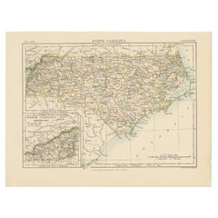
Antique Map of North Carolina, with inset map of the western part
Located in Langweer, NL
Antique map titled 'North Carolina'. Original antique map of North Carolina, United States. With inset map of the western part of North Carolina....
Category
Late 19th Century Antique Maps
Materials
Paper
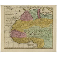
Antique Map of North and West Africa by J.B. Elwe, 1792
Located in Langweer, NL
Beautiful richly engraved map of North and West Africa, based upon the earlier maps of De L'Isle. Richly annotated throughout and with excellent regional detail. Too much detail to d...
Category
Late 19th Century Antique Maps
Materials
Paper
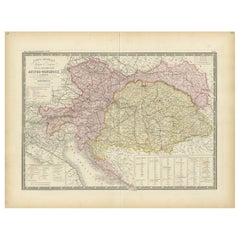
Antique Map of Austria-Hungary by Levasseur, '1875'
Located in Langweer, NL
Antique map titled 'Carte générale de la Monarchie Austro-Hongroise (..)'. Large map of Austria-Hungary. This map originates from 'Atlas de Géographie M...
Category
Late 19th Century Antique Maps
Materials
Paper
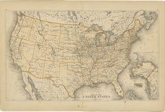
1874 Map of the United States with Territorial Boundaries
Located in Langweer, NL
Title: 1874 Map of the United States with Territorial Boundaries
Description: This is an 1874 map titled "Map of the United States," showcasing the country during a period of rapid ...
Category
1870s Antique Maps
Materials
Paper
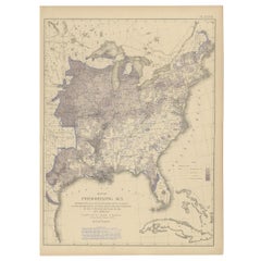
Antique Chart of the US Predominating Sex, 1874
Located in Langweer, NL
Antique chart titled 'Map of predominating sex showing the local excess of males or of females in the distribution of population over the territory of th...
Category
Late 19th Century Antique Maps
Materials
Paper
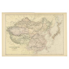
Old Map of the Chinese Empire and Japan, 1882
Located in Langweer, NL
An original antique map titled "The Chinese Empire and Japan," dating from an 1882 atlas by Blackie & Son. It is a color map with geographical features such as mountain ranges, river...
Category
1880s Antique Maps
Materials
Paper
The World in the Assyrian Empire's Era: A Historical Map, Published in 1880
Located in Langweer, NL
This map from the "Spruner-Menke Atlas Antiquus" is titled "ORBIS TERRARVM regni Assyrii tempore," which translates to "The World at the Time of the Assyrian Kingdom." It depicts the...
Category
1880s Antique Maps
Materials
Paper
Mediterranean Encounters: From the Punic Wars to the Hannibalic War, 1880
Located in Langweer, NL
The map, with the title "MARE INTERNUM cum populis adiacentibus a bello Hannibalico usque ad Vespasiani M. princip," depicts the Mediterranean Sea and its surrounding territories, ex...
Category
1880s Antique Maps
Materials
Paper
Oriental Realms: A Detailed Map of Persia, Afghanistan, and Beloochistan, 1882
Located in Langweer, NL
This historical map from the 1882 atlas published by Blackie & Son is a comprehensive depiction of Persia (modern-day Iran), Afghanistan, and Baluchistan (the region that includes pa...
Category
1880s Antique Maps
Materials
Paper
Gipuzkoa 1902: A Cartographic Snapshot of the Basque Coastline and Highlands
Located in Langweer, NL
The map showcases the province of Gipuzkoa (also known as Guipúzcoa in Spanish), which is part of the autonomous community of the Basque Country in northern Spain, as of the year 190...
Category
Early 1900s Antique Maps
Materials
Paper
Asia Minor and Provinces: A Roman Empire Map from Spruner-Menke Atlas, 1880
Located in Langweer, NL
This authentic map of the 19th century, titled "PONTUS ET BITHYNIA, ASIA, LYCIA ET PAMPHYLIA, GALATIA, CAPPADOCIA, SYRIA, CRET, CYPRVS," details the regions of Asia Minor and surrounding territories during the Roman Empire.
The map is interesting for a number of reasons:
1. **Comprehensive Detail**: It covers a wide range of regions that played significant roles in ancient history, from the cultural crossroads of Asia Minor to the strategic island of Cyprus.
2. **Geographical Information**: It includes detailed topographical features such as mountain ranges, river systems, and coastlines, illustrating the complex geography that influenced ancient political and military strategies.
3. **Historical Context**: The map reflects the Roman administrative organization of these provinces, which were critical for trade, military campaigns, and cultural exchange within the empire.
4. **Inset Maps**: The presence of inset maps for Lycia, Ionia, and Asia Minor provides focused details on regions that had substantial historical significance due to their cultural heritage and geopolitical importance.
5. **Latin Labels**: The use of Latin in the map’s labels and descriptions adds to the historical authenticity and would have served as a scholarly reference for 19th-century academics.
6. **Ancient Civilizations**: This area was the cradle of numerous ancient civilizations and the map likely includes cities of ancient Greek...
Category
1880s Antique Maps
Materials
Paper
1882 Detailed Map of South America showing Political and Geographical Features
Located in Langweer, NL
This 1882 map of South America, published by Blackie and Son as part of the 'Comprehensive Atlas and Geography of the World,' showcases the continent in remarkable detail. It provide...
Category
1880s Antique Maps
Materials
Paper
Antique Map of the Region of Georgia with Inset Maps of Florida and Texas
Located in Langweer, NL
Antique map of part of the United States showing Alabama, Georgia, North Carolina, South Carolina, Tennessee, Kentucky, Virginia and part of Florida. With inset maps of the southern ...
Category
Late 19th Century Antique Maps
Materials
Paper
Southwestern U.S. Immigration Map for Texas, Arkansas, and Louisiana, 1881
Located in Langweer, NL
Southwestern U.S. Immigration Map - Published by The Southwestern Immigration Company, Austin, Texas. Detailed Railroad Routes and Regional Statistics for Texas, Arkansas, and Louisi...
Category
1880s Antique Maps
Materials
Paper
Roman Frontiers Engraved: Germania, Raetia, and Noricum, Published in 1880
Located in Langweer, NL
The map, titled "GERMANIA, RAETIA, NORICUM," depicts the regions of Germania, Raetia, and Noricum, which correspond to parts of modern-day Central and Eastern Europe, including areas of Germany, Austria, Switzerland, and the Balkans.
Features of the map include:
1. **Regional Divisions**: The map is divided into the regions of Germania, Raetia, and Noricum, each likely differentiated by color or shading.
2. **Topography**: It details the mountain ranges, rivers, and other geographical features of the region. The Alps, which are central to Raetia, are prominently displayed.
3. **Roman Settlements and Roads**: The map likely marks Roman...
Category
1880s Antique Maps
Materials
Paper
Original Antique Map of Greece and Epirus after the Persian Wars, Published 1880
Located in Langweer, NL
The map titled "GRAECIA, EPIRUS post bella Persica," translates to "Greece and Epirus after the Persian Wars." It covers the regions of ancient Greece and Epirus following the Greco-Persian Wars, a series of conflicts between the Greek city-states and the Persian Empire during the 5th century BC.
What makes this map interesting:
1. **Historical Context**: The period after the Persian Wars was pivotal for ancient Greece, leading to the rise of Athens as a major power and the Golden Age of Athens.
2. **Inset Maps**: Detailed insets, such as the one showing the Acropolis of Athens, provide close-up views of historically significant locations.
3. **Topography**: It features the diverse terrain of Greece, from the rugged mountain ranges to the intricate coastlines and islands, influencing the development of Greek city-states.
4. **City-States**: The map likely details the various polis or city-states, such as Athens, Sparta, Thebes, and others, which played critical roles in the Persian Wars.
5. **Battle Sites**: It might mark important battle sites from the wars, like Marathon, Thermopylae, Salamis, and Plataea.
6. **Latin Labels**: The use of Latin for place names and descriptions adds to the map's scholarly quality.
7. **Cultural Landmarks**: The map may include locations of significant cultural and historical landmarks from the era, such as temples, theatres, and agoras.
This map is from the "Spruner-Menke Atlas Antiquus," compiled by Karl Spruner von Merz and edited by Theodorus Menke. The atlas, known for its detailed maps of historical and ancient geographies, was a significant educational tool in the 19th century.
The Greco-Persian Wars, which included famous battles such as Marathon and Salamis, were crucial for the preservation of Greek independence...
Category
1880s Antique Maps
Materials
Paper
Old Print of a Mosque in a Kampung Java or Village of Javanese, Indonesia, 1874
Located in Langweer, NL
Antique print titled 'Missigit in Kampong Djawa'.
Antique print depicting a scene in Indonesia. Originates from 'De Oorlog tusschen Nederland en Atchin' by G.L. Klepper.
Artis...
Category
1870s Antique Maps
Materials
Paper
Antique Map of the United States of North America, c.1882
Located in Langweer, NL
Antique map titled 'United States of North America'. Old map of the United States of North America. This map originates from 'The Royal Atlas of Modern Geography, Exhibiting, in a Se...
Category
1880s Antique Maps
Materials
Paper
Authentic Antique Map of India and Ceylon, '1875'
Located in Langweer, NL
Antique map titled 'Carte générale des Indes'. Large map of India and Ceylon. This map originates from 'Atlas de Géographie Moderne Physique et Politique' by A. Levasseur. Published ...
Category
Late 19th Century Antique Maps
Materials
Paper
Original Antique Map of the American State of Missouri ( Northern part ), 1903
Located in St Annes, Lancashire
Antique map of Missouri ( Northern Part )
Published By A & C Black. 1903
Original colour
Good condition
Unframed.
Free shipping
Category
Early 1900s English Antique Maps
Materials
Paper
Maritime and Terrestrial Survey of Spanish Santander in 1901, An Original Map
Located in Langweer, NL
This antique map is a historical map of the province of Santander (currently known as Cantabria) from the year 1901. Santander is located along the northern coast of Spain, bordering...
Category
Early 1900s Antique Maps
Materials
Paper
Original Antique Map of the American State of Washington, 1889
Located in St Annes, Lancashire
Great map of Washington
Drawn and Engraved by W. & A.K. Johnston
Published By A & C Black, Edinburgh.
Original colour
Unframed.
Category
1880s Scottish Victorian Antique Maps
Materials
Paper
End XIX century Small Terrestrial Globe Signed C.M.C Paris Papier Maché Sphere
Located in Milan, IT
Small terrestrial globe signed C.M.C. Paris, end of XIX century. Papier maché sphere and turned and ebonized wooden base. Height cm 13 - inches 5.1, diameter of sphere cm 6,5 - inche...
Category
1890s French Antique Maps
Materials
Paper
Antique Map of Virginia, with Inset Map of the South Western Continuation
Located in Langweer, NL
Antique map titled 'Virginia'. Original antique map of Virginia, United States. With inset map of the south western continuation of Virginia. T...
Category
Late 19th Century Antique Maps
Materials
Paper
Old Map of Mediterranean Powers: Pompey to Actium (66-31 BC), Published in 1880
Located in Langweer, NL
This is a historical map that depicts the Mediterranean region during a specific timeframe in Roman history, from the return of Pompey the Great after...
Category
1880s Antique Maps
Materials
Paper
Levant in Antiquity: Lands of Phoenicia, Judea, and Neighboring Kingdoms, 1880
Located in Langweer, NL
The map is titled "PHOENICE, COELESYRIA, IDUMAEA, JUDAEA MACCABAEORUM TEMPORE," which translates to "Phoenicia, Coele-Syria, Idumea, Judea at the Time of the Maccabees."
This origi...
Category
1880s Antique Maps
Materials
Paper
1882 Original Antique Map of New Zealand with Inset of Auckland's Environs
Located in Langweer, NL
This 1882 map of New Zealand, published by Blackie and Son as part of the 'Comprehensive Atlas and Geography of the World,' provides a detailed representation of the North Island and...
Category
1880s Antique Maps
Materials
Paper
1904 "Nell's Topographical Map of the State of Colorado"
Located in Colorado Springs, CO
This highly detailed pocket map is a topographical map of the state of Colorado by Louis Nell from 1904. The map "has been compiled from all available...
Category
Early 1900s American Antique Maps
Materials
Leather, Paper
Antique Map of New Hampshire
Located in Langweer, NL
Antique map titled 'New Hampshire'. Original antique map of New Hampshire, United States. This print originates from 'Encyclopaedia Britan...
Category
Late 19th Century Antique Maps
Materials
Paper
1901 Chart of Port Jefferson, New York
Located in Norwell, MA
Original chart by George Eldridge of Port Jefferson on Long Island, New York. The identified waters include Setauket Harbor, Mount Misery Point, and Match Rock. Two channels are mark...
Category
Early 1900s North American Antique Maps
Materials
Paper
Antique Map of The World in Hemispheres on Various Projections, 1882
Located in Langweer, NL
This stunning 1882 'Antique Map of The World in Hemispheres' showcases an exquisite blend of cartographic precision and artistic elegance. Crafted under the watchful eye of W.G. Blac...
Category
1880s Antique Maps
Materials
Paper
Large Original Antique City Plan of Philadelphia, USA, circa 1900
Located in St Annes, Lancashire
Fabulous colorful map of Philadelphia
Original color
By Rand, McNally & Co.
Published, circa 1900.
Unframed
Free shipping.
Category
Early 1900s American Antique Maps
Materials
Paper
Antique Map of Ohio, with Inset Maps of Cleveland, Columbus and Cincinnati
Located in Langweer, NL
Antique map titled 'Ohio'. Original antique map of Ohio, United States. With inset maps of Cleveland, Columbus and Cincinnati. This print originates from 'Encyclopaedia Britannica', ...
Category
Late 19th Century Antique Maps
Materials
Paper
Antique Map of Spain, Mauritia and Africa by H. Kiepert, circa 1870
Located in Langweer, NL
Antique map titled 'Hispania, Mauretania et Africa'. This map originates from 'Atlas Antiquus. Zwölf Karten zur Alten Geschichte' by H. Kiepert. Published in Berlin, circa 1870.
Category
Late 19th Century Antique Maps
Materials
Paper
Antique Map of Mexico and Central America by Johnson '1872'
Located in Langweer, NL
Antique map titled 'Johnson's Mexico (..)'. Two maps one one sheet showing Mexico and Central America, with inset maps of Tehuantepec and Panama. This map originates from 'Johnson's ...
Category
Late 19th Century Antique Maps
Materials
Paper
Antique Map of the Region of Verona 'Italy' by Ortelius, circa 1584
Located in Langweer, NL
Antique map titled 'Veronae Urbis Terratorium'. Original antique map of the Verona region, Italy. Centered on Verona, and including Mantua, and Lago de Garda. Published by A. Orteliu...
Category
Late 19th Century Antique Maps
Materials
Paper
Large Original Antique Map of North Dakota, USA, circa 1900
Located in St Annes, Lancashire
Fabulous map of North Dakota
Original color
Engraved and printed by the George F. Cram Company, Indianapolis.
Published, circa 1900
Unframed
Free shi...
Category
1890s American Antique Maps
Materials
Paper
Antique Map of the East Indies by Levasseur, '1875'
Located in Langweer, NL
Antique map titled 'Carte de la Malaisie'. Large map of the East Indies. This map originates from 'Atlas de Géographie Moderne Physique et Politique' by A. Levasseur. Published 1875.
Category
Late 19th Century Antique Maps
Materials
Paper
Antique Map of Kentucky
Located in Langweer, NL
Antique map titled 'Kentucky'. Original antique map of Kentucky, United States. This print originates from 'Encyclopaedia Britannica', Ninth E...
Category
Late 19th Century Antique Maps
Materials
Paper
Antique Map of Western States, Michigan, Wisconsin, Iowa by A & C. Black, 1870
Located in Langweer, NL
Antique map titled 'Western States, Michigan, Wisconsin, Minnesota, Iowa with portions of Illinois & Indiana'. Original antique map of Western States, Michigan, Wisconsin, Minnesota,...
Category
Late 19th Century Antique Maps
Materials
Paper
Antique Map of Northern Africa by Levasseur, '1875'
Located in Langweer, NL
Antique map titled 'Carte de l'Afrique Septentrionale'. Large map of Northern Africa. This map originates from 'Atlas de Géographie Moderne Physique et...
Category
Late 19th Century Antique Maps
Materials
Paper
Old Map of the Oceans Around Australia, Indonesia and New Zealand, 1880
Located in Langweer, NL
Antique map titled 'Océanie'.
Old map of the oceans around Australia, Indonesia and New Zealand. With vignettes of people from Polynesia and the old monument Laparouse. This map ...
Category
1880s Antique Maps
Materials
Paper
Antique Map of Moldova to Thessaly and from the Adriatic to the Black Sea, 1880
Located in Langweer, NL
Antique map titled 'Turquie d'Europe'.
Map of the european parts of Turkey. The map covers from Moldova to Thessaly and from the Adriatic to the Black Sea. Greece and the island ...
Category
1880s Antique Maps
Materials
Paper
Antique Map of Oceania by Levasseur, '1875'
Located in Langweer, NL
Antique map titled 'Carte générale de l'Océanie'. Large map of Oceania. This map originates from 'Atlas de Géographie Moderne Physique et Politique' by A. Levasseur. Published 1875.
Category
Late 19th Century Antique Maps
Materials
Paper
Antique Map of the German Empire by Levasseur, '1875'
Located in Langweer, NL
Antique map titled 'Carte générale de l'Europe Centrale (..)'. Large map of the German Empire. This map originates from 'Atlas de Géographie Moderne Phys...
Category
Late 19th Century Antique Maps
Materials
Paper
Antique Map of Pennsylvania and New Jersey by Johnson, 1872
Located in Langweer, NL
Antique map titled 'Johnson's Pennsylvania and New Jersey'. Original map showing Pennsylvania and New Jersey. This map originates from 'Johnson's New Illustrated Family Atlas of the ...
Category
Late 19th Century Antique Maps
Materials
Paper
Large U.S. Coast and Geodetic Survey Chart A of the Atlantic Coast, 1877
Located in Nantucket, MA
Large U.S. Coast and Geodetic Survey Chart A of the Atlantic Coast, 1877, re-issued in February 1881, a printed paper laid down on linen navigational chart of the U.S. Atlantic coast...
Category
1880s American Other Antique Maps
Materials
Linen
Antique Map of the Prussian Monarchy by Levasseur, '1875'
Located in Langweer, NL
Antique map titled 'Carte générale de la Monarchie Prussienne (..)'. Large map of the Prussian Monarchy. This map originates from 'Atlas de Géographie Moderne Physique et Politique' ...
Category
Late 19th Century Antique Maps
Materials
Paper
1873 "Map of the States of California and Nevada" by Chas. Drayton Gibbes
Located in Colorado Springs, CO
Presented is Warren Holt and Charles Drayton Gibbes' 1873 “Map of California and Nevada.” This map is considered to be one of the finest large-scale ...
Category
1870s American Antique Maps
Materials
Paper
1889 Map of Italy in 3D Relief
Located in Weesp, NL
Introducing a true gem for collectors and history enthusiasts alike: this rare 1889 *"Italia in Rilievo"* map by L. Roux & Co. from Torino, a masterpiece of craftsmanship and cartogr...
Category
1880s European Antique Maps
Materials
Paper
"Atlas to Accompany Monograph XXXII on the Geology of Yellowstone National Park"
By United States Geological Survey
Located in Colorado Springs, CO
This is an original 1904 "Atlas to Accompany Monograph XXXII on the Geology of the Yellowstone National Park" by Arnold Hague. Published by the Department of the Interior, the Atlas ...
Category
Early 1900s American Antique Maps
Materials
Leather, Fabric, Paper
Original Antique Map of the South Part of Italy with an Inset of Malta, 1882
Located in Langweer, NL
Embark on a captivating journey through the southern part of Italy with an original Antique Map from the esteemed 'Comprehensive Atlas and Geography of the World,' meticulously craft...
Category
1880s Antique Maps
Materials
Paper
1901 Nautical Chart Showing Woods Hole, Mass
Located in Norwell, MA
Rare 1901 chart of Woods Hole, Mass., showing Buzzards Bay, Penzance Point, Nonamesset Island, Downtown Woods Hole, Parker Neck, Nobska Head, Vineyard Sound, Woods Hole Golf Club, Ra...
Category
Early 1900s North American Antique Maps
Materials
Paper
Antique Map of Australia by Levasseur, '1875'
Located in Langweer, NL
Antique map titled 'Carte générale de l'Australie'. Large map of Australia. This map originates from 'Atlas de Géographie Moderne Physique et Politiq...
Category
Late 19th Century Antique Maps
Materials
Paper
Antique Map of Siberia by Levasseur '1875'
Located in Langweer, NL
Antique map titled 'Carte de la Russie d'Asie Sibérie'. Large map of Siberia. This map originates from 'Atlas de Géographie Moderne Physique et Politique' by A. Levasseur. Published ...
Category
Late 19th Century Antique Maps
Materials
Paper
Oil Lamp with an Illuminating Globe Shade, circa 1885
Located in London, GB
A rare late 19th century oil lamp with a globe shade and base decorated with a castle set in a rural scene, circa 1885.
Northern Europe...
Category
Late 19th Century European Antique Maps
Materials
Glass
1882 Cartographic Views of Ireland's North and South Regions
Located in Langweer, NL
Title: 1882 Maps of Ireland: Northern and Southern Regions
These two maps provide a detailed representation of Ireland as it was in 1882, divided into the northern and southern regi...
Category
1880s Antique Maps
Materials
Paper
1876 Map of the United States: Detailing the Railroads and Unsettled Territories
Located in Langweer, NL
Stanford’s Smaller Railway Map of the United States, 1876
This original 1876 map, titled "Stanford's Smaller Railway Map of the United States Distinguishing the Unsettled Territorie...
Category
1870s Antique Maps
Materials
Paper
