Maps
to
891
1,174
83
1,258
10
3
3
2
1
1
2,926
2,181
476
3
289
34
10
127
7
35
9
2
5
3
4
2
1,247
19
12
9
9
170
105
80
43
23
1,258
1,258
1,258
63
12
11
10
6
Maps For Sale
Period: Early 20th Century
Period: 17th Century
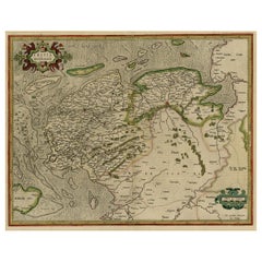
Early Antique Map of the Dutch Provinces of Friesland and Groningen, 1604
Located in Langweer, NL
Antique map titled 'Frisiae Occidentalis.'
This attractive map shows the Dutch Provinces of Friesland and Groningen. Embellished with strapwork tit...
Category
Early 1600s Antique Maps
Materials
Paper
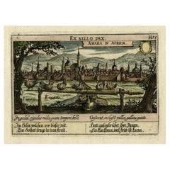
Old Print Titled from War Comes Peace, City Amara in Africa in Background, C1630
Located in Langweer, NL
Antique print, titled: 'Amara in Africa.'
Caption above the image reads: 'Ex bello Pax' (From War comes Peace). A lance is used as a roost for chickens. In the background the cit...
Category
1630s Antique Maps
Materials
Paper
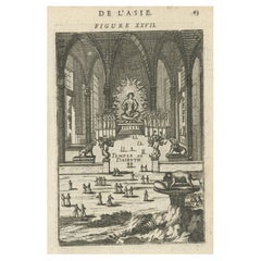
Antique Print with a View of the Temple of Daibuth, Japan, 1683
Located in Langweer, NL
Antique print titled 'Temple de Daibuth'.
View of the temple of Daibuth, Japan. Originates from 'Description de l'Univers'.
Artists and Engravers: Alain Manesson Mallet, a Fr...
Category
1680s Antique Maps
Materials
Paper
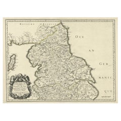
Engraved Map of Northern England, Focusing on Northumberland, 1658
Located in Langweer, NL
Antique map titled 'Ancien Royaume de Northumberland, aujourdhuy Provinces de Nort (..)'.
Engraved map of northern England, focusing on Northumber...
Category
1650s Antique Maps
Materials
Paper
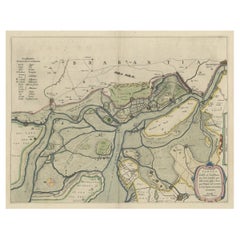
Original Map of the Military Situation After the Dutch Blockade of Antwerp, 1648
Located in Langweer, NL
Antique map titled 'Tabula Castelli ad Sandflitam (..)'.
This map depicts the complex military situation that had developed after the Dutch blockade of Antwerp. All entrenchment'...
Category
1640s Antique Maps
Materials
Paper
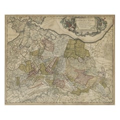
Original Colored Antique Map of Utrecht & Surroundings, The Netherlands, c1690
Located in Langweer, NL
Antique map titled 'Tabula nova Provinciae Ultrajectinae quam jussu Nob: hujus Dominij Ordinum Emensus est Bernardus du Roy'.
Map of the region of Utrecht, The Netherlands. This ...
Category
1690s Antique Maps
Materials
Paper
Governor of Miaco (Kyoto, Japan), Leaving the City in a Carriage, 1669
Located in Langweer, NL
Antique print, titled: 'Sortie pompeuse du Gouverneur de Miaco. 't Uytreyden des Gouverneurs van Miaco.'
The governor of Miaco (Kyoto), in a carriage as part of a long procession...
Category
1660s Antique Maps
Materials
Paper
Map of Southeast Asia, Extending from India to Tibet & Japan to New Guinea, 1640
Located in Langweer, NL
Antique map titled 'India quae Orientalis dicitur et Insulae adiacentes'.
Map of Southeast Asia, extending from India to Tibet to Japan to New Guinea. This map is one of the firs...
Category
1640s Antique Maps
Materials
Paper
Original Antique Detailed Map of the Rhine and Moselle River Regions, ca.1680
Located in Langweer, NL
Antique map titled 'Tabula Geographica qui Pars Meridionalis sive Superior Rheni, Mosae et Mosellae (..).'
Detailed map of the Rhine and Moselle River regions and contigous parts...
Category
1680s Antique Maps
Materials
Paper
Charming Decorative Miniature Map of Russia, from an Old Pocket Atlas, 1685
Located in Langweer, NL
Antique map titled 'Russia cum Consinijs'.'
Charming miniature map of Russia, from the pocket atlas 'Introductionis in Universam Geographiam tam Veterem quam novam .. Acessit P. ...
Category
1680s Antique Maps
Materials
Paper
Antique Map of Austria, Centered Around the Danube from Passau to Vienna, C.1690
Located in Langweer, NL
Antique map of Austria titled 'Circuli Austriaci pars septentrionalis in quia archiducatus Austriae et Ducatus Stiriae accuratissime divisi ostenduntur per F. de Wit'.
Detailed m...
Category
1690s Antique Maps
Materials
Paper
Decorative and Detailed Original Antique Map of Switzerland, 1657
Located in Langweer, NL
Antique map of Switzerland titled 'Helvetiae Rhetiae & Valesiae'.
Decorative and detailed map of Switzerland. This map originates from 'Atlas Novus, Sive Theatrum Orbis Orbis Ter...
Category
1650s Antique Maps
Materials
Paper
Antique Handcolored Map of the Dutch Province Groningen, Incl. Emden, Ca.1680
Located in Langweer, NL
Antique print, titled: 'Groningae et Omlandiae Dominium vulgo de Pronvicie van Stadt en Lande …'
A map of the Dutch province Groningen. A small part of Germany is also shown (Emd...
Category
1680s Antique Maps
Materials
Paper
Detailed Antique Map of Southeast England, incl Warwickshire and Hampshire, 1690
Located in Langweer, NL
Antique map titled 'Orientalior districtus Regni Angliae (..)'.
Detailed map of southeast England encompassing the country from Lincolnshire and the Wash south and including Warw...
Category
1690s Antique Maps
Materials
Paper
Two Original Antique Engravings with the Dutch and German North Sea Coast, c1650
Located in Langweer, NL
Antique map titled 'Nieuwe Caerte waerinne vertoont wordt de gantsche Vaert van Amsterdam over de Watten tot de stadt Hamborch toe'.
Two maps with the Dutch and German North Sea ...
Category
1650s Antique Maps
Materials
Paper
Antique Engraving of a Print Showing the Indian City of Suratte 'Surat', 1672
Located in Langweer, NL
Antique print, titled: 'Suratte' -
View of the Indian city of Suratte (Surat) showing a panoramic view of the city with figures, animals and a river ...
Category
1670s Antique Maps
Materials
Paper
Antique Map of Friesland and Groningen, Provinces of the Netherlands, 1628
Located in Langweer, NL
Antique map Friesland titled 'Frisia Occidentalis'. Small, decorative map of the province of Friesland, the Netherlands. Second state, out of three, originating from 'Atlas Minor' by...
Category
17th Century Antique Maps
Materials
Paper
Antique Map of Friesland by De Wit, c.1690
Located in Langweer, NL
Antique map titled 'Tabula Comitatus Frisiae'.
Old map of the province of Friesland, the Netherlands. With a small inset map of the Wadden area. Third state of the map by Schotan...
Category
17th Century Antique Maps
Materials
Paper
Antique Map of Friesland, The Netherlands, 1638
Located in Langweer, NL
Antique map titled 'Frisia Occidentalis'.
Original antique map of Friesland, the Netherlands. First state, originating from 'Atlantis novi pars secunda' published 1638.
Artis...
Category
17th Century Antique Maps
Materials
Paper
Antique Map of Friesland, Groningen and German East Friesland by Ortelius, 1603
Located in Langweer, NL
Antique map titled 'Oost end West Vrieslandts beschrijvinghe. Utriusque Frisiorum Regionis Noviss: Descriptio. 1568.' Detailed map of Friesland, the Netherlands. Includes a larger co...
Category
17th Century Antique Maps
Materials
Paper
Antique Map of the Banda Islands or Spice Islands, Moluccas, Indonesia, 1697
Located in Langweer, NL
Antique map titled 'Isole di Banda Nelle Molucche'.
Engraved map of Isola di Banda, Nelle, Molucche. On verso: 'Isola di Solor'.
Artists and Engravers: Vincenzo Maria (Padre)...
Category
17th Century Antique Maps
Materials
Paper
Antique Map of the Province of Groningen in the Netherlands, 1634
Located in Langweer, NL
Antique map titled 'Groninga Dominium'.
Old map of the province of Groningen, the Netherlands. In the upper right hand corner a general view of Groningen (taken from Guicciardini...
Category
17th Century Antique Maps
Materials
Paper
Antique Map of Friesland and Groningen in The Netherlands, 1616
Located in Langweer, NL
Antique map titled 'Frisia'. Small map of the province of Friesland, the Netherlands.
This map originates from 'Omnium Belgii, sive Inferioris Germaniae, regionum descriptio' by ...
Category
17th Century Antique Maps
Materials
Paper
Antique Map of Guinea in West Africa by Blaeu, c.1638
Located in Langweer, NL
Antique map titled 'Guinea'.
Decorative map of West Africa, including numerous animals in the interior, sailing ships and several elegant cartouches. Both the map and the sea are s...
Category
17th Century Antique Maps
Materials
Paper
Antique Map of Drenthe, a Province in The Netherlands, 1658
Located in Langweer, NL
Antique map titled 'Drentia comitatus (..)'. Copper engraved contemp. hand coloured map of Drenthe, a province in the Netherlands. Large cartouche with coats of arms. This map is mad...
Category
17th Century Antique Maps
Materials
Paper
Antique City View and Map of IJlst, City in Friesland, Holland, Framed, 1664
Located in Langweer, NL
Antique map titled 'Ylst'. Old map and city view of the city of IJlst, Friesland. This map originates from 'Beschrijvinge van de Heerlyckheydt van Frieslandt' by B. Schotanus à Sterr...
Category
17th Century Antique Maps
Materials
Paper
Antique Map of Nisari, Le Simie, Carchi Elimoia and Piscopia, Greece, 1687
Located in Langweer, NL
Antique map titled 'Carchi Elimoia, Nisari, Le Simie, Piscopia.' Sheet with four maps on one page showing Nisyros, Simi and other islands, Greece. Source unknown, to be determined. A...
Category
17th Century Antique Maps
Materials
Paper
Antique Map of Java and Part of Borneo, Indonesia, c.1657
Located in Langweer, NL
Antique map titled 'Insulae Iavae cum parte insularum Boreno Sumatrae (..)'.
Beautiful map of the island of Java and part of Borneo, Bali, Madura and Sumatra. With decorative carto...
Category
17th Century Antique Maps
Materials
Paper
Rare Antique Map of Germany with English Text, c.1690
Located in Langweer, NL
Antique map Germany titled 'Germani by Robt. Morden'. Rare antique map of Germany. Originates from 'Atlas Terestris'. Artists and Engravers: Robert M...
Category
17th Century Antique Maps
Materials
Paper
Original Antique Map of Friesland by Guicciardini, 1612
Located in Langweer, NL
Antique map titled 'Frisiae Occidentalis Typus'. Original antique map of the province of Friesland, the Netherlands. This map originates from 'Beschryvinghe van alle de Neder-Landen'...
Category
17th Century Antique Maps
Materials
Paper
Early Antique Map of Gelderland and Overijssel in the Netherlands, c.1625
Located in Langweer, NL
Antique map titled 'Geldria et Transysulana'.
One of the earliest maps of Gelderland and Overijssel in the Netherlands, prepared by Gerard Mercator.
Artists and Engravers: Gerard...
Category
17th Century Antique Maps
Materials
Paper
Original Antique Map of Friesland in Frame, The Netherlands, 1612
Located in Langweer, NL
Antique map titled 'Frisiae Occidentalis Typus'. Original antique map of the province of Friesland, the Netherlands. Second state, published 1612. Artists and Engravers: Published by...
Category
17th Century Antique Maps
Materials
Paper
Beautiful First State Map of Friesland, the Netherlands, c.1665
Located in Langweer, NL
Antique map titled 'Dominii Frisiae Tabula, inter Flevum et Lavicam'. Beautiful first state map of Friesland, the Netherlands. With small inset map of the Frisian Wadden islands Vlie...
Category
17th Century Antique Maps
Materials
Paper
Antique Map of Delfland and Schieland by Hondius, c.1630
Located in Langweer, NL
Antique map titled ‘Novissima Delflandiae, Schielandiae et circumiacentium insularum ut Voornae, Overflackeae, Goereae, Iselmondae (..)’. Engraving of Delfland and Schieland. Designe...
Category
17th Century Antique Maps
Materials
Paper
Antique Map of the 1591 Siege and Occupation of Deventer City, Holland, c1610
Located in Langweer, NL
Antique map titled 'Daventria'. Old map of the city of Deventer, the Netherlands. The print illustrates the siege and occupation of Deventer by the State army under command of prince...
Category
17th Century Antique Maps
Materials
Paper
Detailed Antique Miniature Map of France by Mallet, c.1683
Located in Langweer, NL
Antique map titled 'France en General'. BG-11796-55. Originates from Mallet's 'Description de l'Univers'.
Artists and Engravers: Alain Manneson Mallet (1630-1706) spent the first ...
Category
17th Century Antique Maps
Materials
Paper
Antique Map of Denmark with Details of Fortresses, Cities, Towns Etc, c.1680
Located in Langweer, NL
Antique map of Denmark titled 'Insularum Danicarum ut Zee-Landiae, Fioniae, Langelandiae, Lalandiae Falstriae, Fembriae, Monae (..)'. This map depicts the main Danish Islands and a s...
Category
17th Century Antique Maps
Materials
Paper
Rare Map of Six Coast Views and Anchorages of Sierra Leone and Indonesia, 1660
Located in Langweer, NL
This rare antique map includes six coastal elevation views of anchorages and bays favored by Dutch and French vessels on their way to Asia. Two views of the coast of Sierra Leone, Africa "Tagrin" opposite Freetown. A view of the coast of Aceh on the northern coast of Sumatra and a further unidentified anchorage "Baye de l'Encau". A view of the African coast including the Bay of Saldagne and Table Bay...
Category
17th Century Antique Maps
Materials
Paper
Antique Map of Belgium and the Netherlands by Johnston '1909'
Located in Langweer, NL
Antique map titled 'Belgium and The Netherlands'. Original antique map of Belgium and the Netherlands. With inset maps of Amsterdam and Brussels. This m...
Category
Early 20th Century Maps
Materials
Paper
Antique Map of India ( Southern ) by Johnston (1909)
Located in Langweer, NL
Antique map titled 'India'. Original antique map of India Southern sheet. With inset maps of south eastern provinces of India. This map originates from the ‘Royal Atlas of Modern Geo...
Category
Early 20th Century Maps
Materials
Paper
Antique Map of Spain and Portugal by Johnston, '1909'
Located in Langweer, NL
Antique map titled 'Spain and Portugal'. Original antique map of Spain and Portugal. With inset maps of the Canary Islands, Madeira, Lisbon and Ma...
Category
Early 20th Century Maps
Materials
Paper
Antique Map of Sweden and Norway by Johnston (1909)
Located in Langweer, NL
Antique map titled 'Sweden and Norway'. Original antique map of Sweden and Norway. With inset maps of Christiania and Stockholm. This map originates from...
Category
Early 20th Century Maps
Materials
Paper
Antique Map of the United States 'North West' by Johnston, '1909'
Located in Langweer, NL
Antique map titled 'United States of North America'. Original antique map of the United States of North America ( North West ). This map originates from the ‘Royal Atlas of Modern Ge...
Category
Early 20th Century Maps
Materials
Paper
Antique Map of South-West Russia by Johnston (1909)
Located in Langweer, NL
Antique map titled 'South-West Russia'. Original antique map of South-West Russia. With inset map of Odessa. This map originates from the ‘Royal Atlas of Modern Geography’. Published...
Category
Early 20th Century Maps
Materials
Paper
Antique Map of India 'Northern' by Johnston '1909'
Located in Langweer, NL
Antique map titled 'India'. Original antique map of India, Northern sheet. This map originates from the ‘Royal Atlas of Modern Geography’. Published by W. & A.K. Johnston, 1909.
Category
Early 20th Century Maps
Materials
Paper
Antique Map of Scotland 'Northern' by Johnston, '1909'
Located in Langweer, NL
Antique map titled 'Scotland'. Original antique map of Scotland. With inset map of the Shetland Islands. This map originates from the ‘Royal Atlas of M...
Category
Early 20th Century Maps
Materials
Paper
Antique Map of South America by Johnston '1909'
Located in Langweer, NL
Antique map titled 'South America, Southern Sheet'. Depicting Chile, Argentina, Brazil, Patagonia, the Falkland Island and more. With inset maps of Valparaiso, Rio de Janeiro and Bue...
Category
Early 20th Century Maps
Materials
Paper
Antique County Map of Cheshire, Dutch, Framed, Cartography, Janssonius, C.1660
Located in Hele, Devon, GB
This is an antique county map of Cheshire. A Dutch, framed atlas engraving by Johannes Janssonius, dating to the 17th century and later.
A treat for the collector or county native,...
Category
Mid-17th Century Dutch Charles II Antique Maps
Materials
Glass, Wood, Paper
Antique Map of the East Indies by Brouwer, 1917
Located in Langweer, NL
Antique map titled 'Geotektonische Schetskaart van het Oostelijk Gedeelte van den Oost-Indischen Archipel':
**Title**: Geotektonische Schetskaart van het Oostelijk Gedeelte van den ...
Category
Early 20th Century Maps
Materials
Canvas, Paper
Antique Plan of Paramaribo 'Suriname' Published 1920
Located in Langweer, NL
Large lithographed plan of Paramaribo, capital city of Suriname, showing the situation, circa 1916-1917. With small inset plan. Published in 1920.
Category
Early 20th Century Maps
Materials
Paper
Antique Map of Vänersborg by Merian 'circa 1680'
Located in Langweer, NL
Antique map titled 'Grundtriss und Situation von der Statt und Vöstung Wennersburg'. Copper engraved plan of Vänersborg, Sweden. This map orginates from 'Theatrum Europaeum' by Meria...
Category
Late 17th Century Antique Maps
Materials
Paper
Antique Map of Northern Natal by Stanford, 1900
Located in Langweer, NL
Antique map titled 'Northern Natal'. Lithograph of Northern Natal. The Colony of Natal was a British colony in south-eastern Africa. It was proclaimed a British colony on 4 May 1843 ...
Category
Early 20th Century Maps
Materials
Paper
Antique Map of the Cambrai Region by Pitt, circa 1680
Located in Langweer, NL
Antique map titled 'Archiepiscopatus Cameracensis - Archevesche de Cambray'. Decorative map of the Cambrai region of France. This map originates from 'The English Atlas' by Moses Pit...
Category
Late 17th Century Antique Maps
Materials
Paper
Antique Map of the Region of 'Île de France' by Janssonius, circa 1650
Located in Langweer, NL
Antique map of France titled 'Le Gouvernement de L'Isle de France'. Paris is represented by a miniature plan of the city, making it distinct from the other towns of the region which ...
Category
Mid-17th Century Antique Maps
Materials
Paper
Antique Map of the Moluccas by Porcacchi, 'circa 1620'
Located in Langweer, NL
Antique map titled 'Isole Molucche'. The map depicts the East Indies and Indochina, including modern-day Indonesia and the Philippines. The area covered stretches from the Bay of Bengal...
Category
Early 17th Century Antique Maps
Materials
Paper
Antique Map of Loudun and Mirebeau by Janssonius '1657'
Located in Langweer, NL
Antique map 'Loudunois Laudunum - Mirebalais'. Decorative map of the region of Loudun and Mirebeau. This map originates from 'Atlas Novus, Sive Theatrum Orbis Orbis Terrarum: In quo ...
Category
Mid-17th Century Antique Maps
Materials
Paper
Antique Map of the North-Western Part of France by Janssonius (c.1657)
Located in Langweer, NL
Antique map of France titled 'Le Gouvernement de Calais'. Attractive map of the north-western part of France including the towns of Calais, Gravelines. This map originates from 'Atla...
Category
Mid-17th Century Antique Maps
Materials
Paper
Antique Map of the Region of Rethelois by Janssonius, 1657
Located in Langweer, NL
Antique map of France titled 'Dioecese de Rheims et le Païs de Rethel'. Detailed map, centered on the River Ayne and the River Velle and sowing Reims, Chalons, Sedan, Charleville, as...
Category
Mid-17th Century Antique Maps
Materials
Paper
