Maps
to
776
921
80
1,003
10
9
2
1
1
1
2,926
2,181
476
3
289
34
10
127
7
35
9
2
5
3
4
2
991
16
13
11
4
106
44
31
19
17
1,003
1,003
1,003
63
12
11
10
6
Maps For Sale
Period: Mid-20th Century
Period: 17th Century
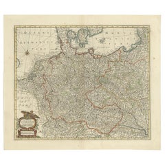
Antique Map of the German Empire, Johannes Janssonius van Waesbergen, circa 1670
Located in Langweer, NL
Antique map titled 'Nova Totius Germaniae Descriptio'. Uncommon map of the German Empire including the Netherlands, Germany, Switzerland, Austria, Bohemia,...
Category
Late 17th Century Antique Maps
Materials
Paper
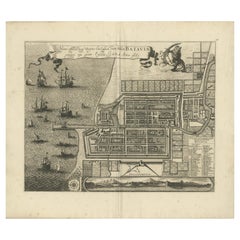
Rare 1681 Map of Batavia: Detailed Dutch Colonial Era Cartography, 1681
Located in Langweer, NL
The map of Batavia (modern-day Jakarta) from 1681, attributed to Frederick de Wit holds significant historical importance for several reasons:
Historical Context
1. Colonial Era: This map dates back to the Dutch colonial era when Batavia served as the administrative and commercial hub of the Dutch East India Company (VOC). The VOC was a powerful trading entity that played a crucial role in the global spice trade and colonization in Southeast Asia.
2. Strategic Importance: Batavia was strategically located on the northwestern coast of Java, providing the Dutch with a critical base for their maritime operations. The city became the center of Dutch political and military control in the region.
Cartographic Significance
1. Detailed Urban Layout: The map meticulously details the layout of Batavia, including its fortifications, canals, streets, and significant buildings. This level of detail provides insights into the urban planning and architectural styles of the period.
2. Military Engineering: The fortifications shown on the map illustrate the advanced military engineering techniques used by the Dutch to protect their valuable colony. The walls, bastions, and moats indicate the strategic considerations taken to defend against potential invasions.
3. Maritime Activity: The depiction of ships in the harbor highlights Batavia's role as a major maritime center. The VOC's fleets were essential for trade routes connecting Europe, Africa, and Asia, making Batavia a crucial node in global commerce.
Artistic and Cultural Value
1. Artistic Elements: The decorative elements, such as the lion holding a shield and the intricate cartouches, reflect the artistic trends of Dutch Golden Age cartography. These embellishments were not only informative but also served to display the cartographer's skill and the map's prestige.
2. Cultural Exchange: Maps like this one provide evidence of cultural exchange between the Dutch and the indigenous populations of Java. The blending of Dutch and local influences can be seen in various aspects of the map and the architecture of the city.
Rarity and Preservation
1. Rarity: Maps from the 17th century, especially those in good condition, are relatively rare and highly valued by collectors and historians. Each map provides a unique snapshot of historical geography and urban development.
2. Preservation of History: This map serves as a historical document, preserving knowledge about Batavia's cityscape, infrastructure, and colonial governance. It helps historians and scholars understand the socio-economic and political dynamics of the period.
Conclusion
The map of Batavia from 1681 is special due to its detailed depiction of one of the most important colonial cities in Southeast Asia during the Dutch Golden Age. It reflects the strategic, economic, and cultural significance of Batavia, serving as a valuable resource for understanding the history of Dutch colonialism and its global impact. The map's artistry and precision make it an important artifact in the history of cartography.
---------------
The map is an original and historical map of Batavia (present-day Jakarta) on the island of Java, dated 1681. There are several details to consider when evaluating its origins and possible authorship:
1. **Style and Detail**: The intricate details and style are reminiscent of maps created by Frederick de Wit, a prominent Dutch cartographer and engraver of the 17th century. He was known for his detailed city maps and sea charts.
2. **Lack of Signature**: The absence of "F. de Wit, Excudit" could indicate either an omission or a different engraver. However, it is essential to note that some maps from that period were reproduced or copied by other engravers and cartographers. This was not uncommon, as map-making was a collaborative effort, and copies of popular maps were frequently made.
3. **Map Characteristics**:
- The depiction of ships and the detailed fortifications are typical of Dutch cartography in the late 17th century.
- The decorative elements, such as the lion holding a shield, are also characteristic of Dutch map engravers.
4. **Other Possible Engravers**: While Frederick de Wit is a strong candidate, other notable Dutch engravers from that period include Joan Blaeu and Willem Janszoon Blaeu. They also produced highly detailed maps and could potentially be the creators or inspirers of this map.
To determine the precise authorship, you might consider:
- **Comparing** this map with other confirmed works of Frederick de Wit and his contemporaries to identify stylistic similarities and differences.
- **Historical Records**: Consulting historical records or publications related to Dutch cartography in the 17th century might provide more context or even direct references to this particular map.
If you have access to additional details or higher-resolution images of specific sections, it might help further pinpoint the map's origin and authorship.
-------------
Frederick de Wit (1629–1706) was a prominent Dutch cartographer, engraver, and publisher known for his detailed and decorative maps, atlases, and globes. He played a significant role in the Dutch Golden Age of cartography, contributing to the wealth of geographic knowledge and artistic achievement during this period. Here are key aspects of his life and work:
### Biography
- **Early Life**: Frederick de Wit was born in Gouda, Netherlands, in 1629. Little is known about his early years, but he moved to Amsterdam, the epicenter of Dutch cartography, in the mid-17th century.
- **Career Beginnings**: De Wit began his career as an engraver and publisher, initially producing maps that were reissues of earlier works by other cartographers, such as Joan Blaeu and Willem Janszoon Blaeu.
### Contributions to Cartography
- **Mapmaking**: De Wit was known for his meticulous attention to detail and artistic flair. He produced a wide range of maps, including world maps, regional maps, city plans, and maritime charts...
Category
1680s Antique Maps
Materials
Paper
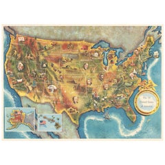
American Election Map and 1960 Presidential Fact Sheet, Published 1960
Located in Langweer, NL
Title: “The 50 United States of America”
Subject: United States, Presidential Elections
Date: 1960 (dated)
Color: Printed Color
Size: 24.9 x 17.9 inches (63.2 x 45.5 cm)
This colorful map of the United States was drawn by Lorin Thompson and published by the General Foods Corporation. The map has an unusual coloring style with symbols of American history including past presidents, Native Americans, important buildings (White House, Statue of Liberty, Alamo), agriculture, industry, and more. Includes inset maps of Hawaii and Alaska with small American flags...
Category
1960s Vintage Maps
Materials
Paper
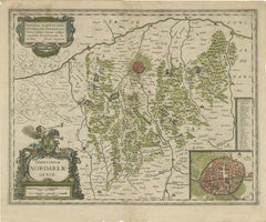
Territorium Norimbergense - Antique Map of Nürnberg by Janssonius (1645-58)
Located in Langweer, NL
This is an antique map of Nürnberg, titled "Territorium Norimbergense," created by Johannes Janssonius and published between 1645 and 1658. It is a copperplate engraving printed on p...
Category
1650s Antique Maps
Materials
Paper
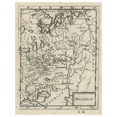
Antique Map of Modern Day Ukraine and Russia Titled Moscovie 'Moscow', Ca.1683
Located in Langweer, NL
Antique map of modern day Ukraine and Russia titled ‚Moscovie‘. Miniature map of the Moscovia region by A.M. Mallet.
Artists and Engravers: Alain Manneson Mallet (1630-1706) spent...
Category
1680s Antique Maps
Materials
Paper
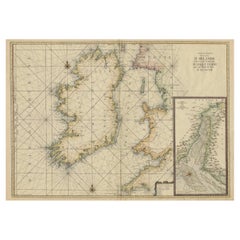
Large 1693 Maritime Map of Irish Sea, West Coasts of Ireland, England, Scotland
Located in Langweer, NL
This is a historical sea chart titled "Carte Generale des Costes d'Irlande, et des Costes Occidentales d'Angleterre avec une Partie de celles d'Ecosse," which translates to "General Map of the Coasts of Ireland and the Western Coasts of England with a Part of Scotland."
The map was first published in 1693 in the atlas "La Neptune Francois," created by Jaillot and published by Pieter Mortier in Amsterdam. This initiative was started by the French minister Colbert to improve maritime navigation.
Details of the Map:
1. **Geographical Coverage:**
- The map primarily focuses on the Irish coast.
- It also includes the west coast of England and Wales.
- Parts of the west coast of Scotland are also depicted.
2. **Inset Map:**
- There is a detailed inset map showing the area around Chester and the course of the River Dee.
3. **Features:**
- **Depth Soundings:** The Irish Sea is detailed with depth soundings to assist in navigation.
- **Coastal Towns and Islands:** Numerous coastal towns, islands, and geographical features are indicated.
- **Rhumb Lines:** The map includes extensive rhumb lines, which are lines used by navigators to plot a straight-line course.
- **Key:** There is a key describing the quality of the terrain along the coast, important for navigators to understand the nature of the coastal landscape.
4. **Labels and Annotations:**
- **Coastal Settlements:** Ports, forts, and villages along the coast are labeled.
- **Geographical Features:** Islands and other significant features are marked.
5. **Artistic and Practical Elements:**
- The map is printed on thick paper and is hand-colored, reflecting contemporary coloring techniques.
- Detailed lines and soundings are included to help ships navigate around the numerous small islands and narrow inlets safely.
6. **Historical Context:**
- The map was part of a significant French maritime project aimed at improving navigation and charting European waters more accurately.
- It reflects the high level of cartographic skill and knowledge of the late 17th century.
This map would have been a valuable tool for mariners of the time, providing them with crucial information about the coastal features, depth soundings, and safe passage routes around the complex coastlines of Ireland, England, and Scotland.
About the Makers and the Atlas
**1. Alexis-Hubert Jaillot (1632-1712):**
- **Background:** Jaillot was a prominent French cartographer and publisher in the 17th century. He was known for his detailed and accurate maps and atlases.
- **Work:** He collaborated with other notable cartographers of his time and played a key role in improving and publishing detailed maps. Jaillot's work was characterized by its precision and artistic quality.
- **Contribution:** He was instrumental in the creation of "La Neptune Francois," a maritime atlas aimed at improving French naval navigation.
**2. Pieter Mortier (1661-1711):**
- **Background:** Mortier was a Dutch engraver, publisher, and mapmaker based in Amsterdam. He was well-known for his high-quality prints and maps.
- **Work:** Mortier published several important atlases and maps, often collaborating with other cartographers and engravers. His work was recognized for its detailed craftsmanship and accuracy.
- **Contribution:** Mortier published "La Neptune Francois" in Amsterdam, making significant contributions to maritime navigation by providing highly detailed sea charts.
About the Atlas "La Neptune Francois":
**1. Purpose:**
- The atlas was created as part of an initiative led by Jean-Baptiste Colbert, the French minister of finance under King Louis XIV. The goal was to enhance the accuracy and availability of maritime charts for French naval and commercial vessels.
- "La Neptune Francois" was designed to be a comprehensive and detailed reference for navigators, covering various European waters with a focus on the French coast and adjacent regions.
**2. Content:**
- The atlas includes a series of sea charts, each providing detailed information on coastal regions, depth soundings, rhumb lines, and other navigational aids.
- The maps were printed on high-quality paper and hand-colored, reflecting the artistic standards of the time.
**3. Historical Significance:**
- "La Neptune Francois" was a landmark in the history of cartography, representing a significant advancement in the accuracy and detail of maritime maps...
Category
1690s Antique Maps
Materials
Paper
Antique Map of Southern Germany by F. de Wit, circa 1680
Located in Langweer, NL
This antique map depicts a portion of southern Germany that included the historic regions of Bavaria, the Palatinate, Prussia-Brandenburg, the Rhineland and Saxony. Regensberg, Freis...
Category
Late 17th Century Antique Maps
Materials
Paper
Map of Styria by William Blaeu, 1645: A Masterpiece of 17th-Century Cartography
Located in Langweer, NL
This 1645 map, created by Willem Janszoon Blaeu, represents Styria (Steyrmark), a historical region in present-day Austria, located in the Alpine regions. Blaeu, one of the most sign...
Category
1640s Antique Maps
Materials
Paper
Antique Map of the Course of the Rhine River by Blaeu, circa 1640
Located in Langweer, NL
Antique map titled 'Rhenus Fluviorum Europae celeberrimus, cum Mosa, Mosella, et reliquis, in illum se exonerantibus, fluminibus'. Beautiful map of the course of the Rhine River...
Category
Mid-17th Century Antique Maps
Materials
Paper
Antique Map: Carte du Détroit du Sond with Copenhagen Inset, 1693
Located in Langweer, NL
Antique Map: Carte du Détroit du Sond with Copenhagen Inset, Jaillot/Mortier, 1693
This rare and striking antique map, titled *Carte du détroit du Sond contenant les costes de l’Is...
Category
Late 17th Century Antique Maps
Materials
Paper
1930s AM Radio Map of US, Canada, Cuba, Mexico – Stations & Frequencies
Located in Langweer, NL
Title: 1930s Lewis Bros. Limited Detailed Radio Station Map of the United States and Canada – AM Stations, Call Signs, Frequencies, Vintage Advertising
Detailed Description: This v...
Category
1930s Vintage Maps
Materials
Paper
Early Woodcut Map of the Rhine River Region in Germany and Holland, circa 1628
Located in Langweer, NL
Early Woodcut Map of the Rhine River Region, "Die Dritte Tafel des Rheinstroms," ca. 16th Century
This early woodcut map, titled "Die Dritte Tafel des Rheinstroms Innhaltend das Nid...
Category
1620s Antique Maps
Materials
Paper
Old Map of Prussia, Embellished with a Large Cartouche and Compass Rose, ca.1680
Located in Langweer, NL
Antique map titled 'Prussiae nova Tabula'.
Later edition of Blaeu's map of Prussia, embellished with a large cartouche and compass rose. Prussia was a historically prominent Germ...
Category
1680s Antique Maps
Materials
Paper
Early Woodcut Map of Swabia and Bavaria in Germany, 1628
Located in Langweer, NL
Title: Early Woodcut Map of Swabia and Bavaria, 16th Century
This early woodcut map titled "Schwaben und Bayernlande / Darbey auch begreiffen der Oenwaldt / Nordgaw / etc." provides...
Category
1620s Antique Maps
Materials
Paper
Woodcut Map of the Rhine River Region Covering the Palatinate, Austria and Elsa
Located in Langweer, NL
Early Woodcut Map of the Rhine River Region Covering the Palatinate, Austria, and Elsass, ca. 1628
This early woodcut map, titled "Die ander Tafel des Rheinstromes/begriffen die Pfa...
Category
1620s Antique Maps
Materials
Paper
America Septentrionalis by Carroli Allard (1648-1709) Copper Plate Engraving
Located in San Francisco, CA
"Recentissuma Novi Orbis Sive Americae Septentrionale et Meriodionalis"
A hand-colored copper plate engraving of North and South America by Carel Allard depicting recent discoveries...
Category
Late 17th Century Dutch Antique Maps
Materials
Paper
Original Antique Map showing Southern India, Northern Sri Lanka & Malabar, 1652
Located in Langweer, NL
Antique map titled 'Presqu'Isle de l'Inde deca le Gange (..)'.
Old map showing the southern part of India, including the northern part of Sri Lanka. With inset map of Southern India (Malabar). This map covers the subcontinent from the Bay of Bengal and the Gulf of Cambay to Ceylon. The Mogul Empire can be found in the north. Further south...
Category
1650s Antique Maps
Materials
Paper
Early Original Antique Map of South East Asia with Large Parts Still Unknown
Located in Langweer, NL
Antique map titled 'Insulae Indiae Orientalis'. Original antique map of Southeast Asia. Shows towns, villages, landmarks, mountains, and rivers. Relief shown pictorially. This map or...
Category
Late 17th Century Antique Maps
Materials
Paper
Old Map of Ancient Times covering Egypt Towards Arabia and India to Java, c.1660
Located in Langweer, NL
Description: Antique map titled 'Erythraei Sive Rubri Maris Periplus olim ab arriano descriptus nunc vero ab abrah ortelio ex eodem delineatus'. Map of the Indian Ocean, or Erythraea...
Category
1660s Antique Maps
Materials
Paper
Rare Small Antique Map of the Persian Empire, 1692
Located in Langweer, NL
Antique map titled 'Perse'. Small engraved map of the Persian Empire, decorated with a simple cartouche and armorial shield. This map originates from 'L'Atlas en Abrege, ou Nouvelle ...
Category
17th Century Antique Maps
Materials
Paper
Antique Map of North Africa showing Egypt, Mauritania and Africa Minor, 1672
Located in Langweer, NL
Antique map titled 'Africa Minor, Mauritania , Aegyptus.' Charming miniature map of North Africa, showing Egypt, Mauritania and Africa Minor. This map originates from the pocket atla...
Category
17th Century Antique Maps
Materials
Paper
Antique Map of the City of Goch by Blaeu, 1649
Located in Langweer, NL
Antique map titled 'Gochum vernacule Goch'. Old map of the city of Goch, Germany. This map originates from 'Novum Ac Magnum Theatrum Urbium Belgicæ Liberæ ac Foederatæ' by J. Blaeu. ...
Category
17th Century Antique Maps
Materials
Paper
Rare Original Handcolored Miniature Map of Malaysia and Singapore, 1600
Located in Langweer, NL
Very handsome original old coloured copper engraving of Malaysia and Singapore, with parts of Sumatra, inc the island of Bangka and Bintam. Title of the map 'Description Malacca'. On...
Category
Early 1600s Antique Maps
Materials
Paper
Antique Map of North Africa by Ortelius, c.1600
Located in Langweer, NL
Antique map titled 'Barbariae et Biledulgerid nova descriptio'.
Old map of coastal North Africa and the Mediterranean. The map extends from Morocco and the Sahara to Libya and sh...
Category
17th Century Antique Maps
Materials
Paper
The 17th Century Map of Northern Dithmarschen and Its Towns in Germany
Located in Langweer, NL
This is a detailed colored copperplate engraving depicting northern Dithmarschen, accompanied by town plans of Weßlingburen (now Wesselburen), Lunden, and Heyde (now Heide) at the to...
Category
1640s Antique Maps
Materials
Paper
Orignal Hand-Colored Antique Map of Chili by W. Blaeu, 1658
By Willem Blaeu
Located in Langweer, NL
Very decorative antique map of Chili published by W. Blaeu, 1658. This map depicts Chile from Copiapo southward to the island of Chiloé with ships and sea monsters adorning the sea. ...
Category
Mid-17th Century Antique Maps
Materials
Paper
Bishopric of Hildesheim Map in Northern Germany by Willem & Joan Blaeu, 1645
Located in Langweer, NL
This beautifully hand-colored map, titled "Episcopatus Hildesiensis Descriptio Novissima," depicts the Bishopric of Hildesheim, a historical ecclesiastical territory in present-day L...
Category
1640s Antique Maps
Materials
Paper
Antique Map of Catalonia by Blaeu, circa 1650
Located in Langweer, NL
Antique map titled 'Catalonia'. Antique map of Catalonia, extending from C. De Romani on the Northern Coast to Alfachs and Panicola in Valencia on the southern end of the coast and s...
Category
Mid-17th Century Antique Maps
Materials
Paper
Antique Map of Cheshire, North West England
Located in Langweer, NL
Antique map titled 'Cestria comitatus Palatinus'. Original old map of Cheshire, Northwest England. Published circa 1665 by J. Blaeu. Willem Jansz. Blaeu and his son Joan Blaeu are th...
Category
Mid-17th Century Antique Maps
Materials
Paper
Map of Philadelphia with a Historical Tribute to its Volunteer Fire Companies
Located in Langweer, NL
This elaborate map of Philadelphia in Pennsylvania served as a historical tribute to the city's first volunteer fire departments. It was drawn by J...
Category
1930s Vintage Maps
Materials
Paper
Decorative Hand-Colored Map of Germany by Nicolas Sanson, 1648
Located in Langweer, NL
Title: Hand-Colored Map of Germany by Nicolas Sanson, 1648
This hand-colored map, titled "Allemagne," was created by Nicolas Sanson, a prominent 17th-century French cartographer and...
Category
1640s Antique Maps
Materials
Paper
Antique Map of Greece by Allard (c.1698)
Located in Langweer, NL
Antique map titled 'Hellas seu Graecia Universa' Detailed map of Greece, with Crete, the Aegean Islands, and part of Turkey. With two cartouches, compass rose and scale. Carolus Alla...
Category
Late 17th Century Antique Maps
Materials
Paper
Antique Map of Madagascar by N. Sanson, circa 1680
Located in Langweer, NL
Antique map titled 'Isle de Madagascar ou de St. Laurens. Tiree de Sanutu &c'. Antique map of Madagascar, first published by Sanson in 1657. Sanson n...
Category
Late 17th Century Antique Maps
Materials
Paper
Rare 16th Century Original Handcolored Miniature Map of Java, Indonesia, 1616
Located in Langweer, NL
Very handsome original old coloured copper engraving by Bertius of the island of Java in the early days of the Dutch colonisation - at that time named The Dutch East Indies or nowada...
Category
1610s Antique Maps
Materials
Paper
Rare Antique Miniature Map of Pakistan, India and Cambaia, ca.1616
Located in Langweer, NL
Old 17th century miniature antique map of 'Cambaia' , from the 1616 edition of Jadocus Hondius Atlas by Petrus Bertius.
Original copperplate engraving with hand coloring.
Carto...
Category
17th Century Antique Maps
Materials
Paper
Antique Map of the Burgundy Region by Mallet, c.1683
Located in Langweer, NL
Antique map titled 'Cercle de Bourgogne'. Detailed miniature map of the Burgundy region, France. Also shows the Netherlands and Belgium. Originates from Mallet's 'Description de l'Un...
Category
17th Century Antique Maps
Materials
Paper
Historic Map of the Bishopric of Paderborn by Blaeu, a Masterpiece of 1645
Located in Langweer, NL
This hand-colored map, titled "Paderbornensis Episcopatus Descriptio Nova," depicts the Bishopric of Paderborn, a historical ecclesiastical territory within the Holy Roman Empire, lo...
Category
1640s Antique Maps
Materials
Paper
Old Print of Ascension Island with Ships, a Whale and Flying Fish, 1601
Located in Langweer, NL
Antique print, titled: 'Vera effigies et delineato Insulae Ascenstio …' - Bird's eye view of Ascension Island. Five large sailing ships in the background and flying fish and waterfowl in the foreground. On the rear an image of four ships sailing towards a whale, accompanied by fowl, flying fish and dolphins. From 'Indiae Orientalis', 1598-1604.
Artists and Engravers: Made by an anonymous engraver after 'Jean Theodore de Bry...
Category
Early 1600s Antique Maps
Materials
Paper
Original Antique Map of the Road from Marlborough to Huntspil
Located in Langweer, NL
Antique map titled 'The Continuation of the Road from London to Bristol (..)'. A strip map of the continuation of the road from London to Bristol, this particular sheet showing the r...
Category
Late 17th Century Antique Maps
Materials
Paper
Antique Map of Denmark by F. de Wit, 1680
Located in Langweer, NL
Antique map titled 'Dania Regnum'. Large, attractive map of Denmark, Sleschwig-Holstein and southern Sweden. Good detail throughout. Embellished with a title cartouche with the Danis...
Category
Late 17th Century Antique Maps
Materials
Paper
Battle of Wimpfen, 1622: Engraving by Matthäus Merian (ca. 1645)
Located in Langweer, NL
Title: Battle of Wimpfen, 1622: Engraving by Matthäus Merian (ca. 1645)
Description: This antique copper engraving, created by the renowned Swiss-German engraver Matthäus Merian aro...
Category
1640s Antique Maps
Materials
Paper
Antique Map of Madagascar by Mariette 'c.1670'
Located in Langweer, NL
Antique map titled 'Isle Dauphine communement nommée par les Europeens Madagascar, et St. Laurens (..)'. Original large-scale antique map of Madagascar...
Category
Mid-17th Century Antique Maps
Materials
Paper
Antique Map of Piedmonte and Savoie 'Italy' by N. Visscher, circa 1683
Located in Langweer, NL
Antique map titled 'Regiae Celsitudinis Sabaudicae Status consistens in Sabaudiae ac Montisferrati Ducatus, Pedemontii Principatum (..). This map originates from 'Atlas Minor Sive Ge...
Category
Late 17th Century Antique Maps
Materials
Paper
Original Antique Map of the Area of Bremen and Lower Saxony
Located in Langweer, NL
Antique map titled 'Ducatus olim Episcopatus Bremensis et ostiorum Albis et Visurgis Fluviorum novissima Descriptio'. Original old map of the area of ??Bremen and Lower Saxony. Uncom...
Category
Mid-17th Century Antique Maps
Materials
Paper
Old Map Focusing on the Wine Region of Metz, the Moselle Region of France, 1657
Located in Langweer, NL
Antique map of France titled 'Territorium Metense'.
Old map focusing on the wine region surrounding Metz, in the Moselle region of France. This map originates from 'Atlas Novus, ...
Category
1650s Antique Maps
Materials
Paper
Antique Map of the Islands Near Ceylon by Baldaeus, 1672
Located in Langweer, NL
Antique print, untitled. This original antique print shows the islands Leyden, Middelburg, Hammenhiel, Bramines, Dona Clara and Deserta near Ceylon / Sri Lanka, with their Dutch name...
Category
17th Century Antique Maps
Materials
Paper
Antique Print of Büdingenin Germany by Braun & Hogenberg, 1617
Located in Langweer, NL
Antique map titled 'Bingen'. Bird's eye-view of Büdingen, Germany. The view shows a city surrounded by vineyards and well fortified with walls and moats. On the right is the castle w...
Category
17th Century Antique Maps
Materials
Paper
Grand Map of Europe by Frederick de Wit, Circa 1690: A Baroque Era Masterpiece.
Located in Langweer, NL
This is an attractive historical map of Europe created by Frederick de Wit, published around 1690. Here's a detailed description of the map and additional context about its creation:...
Category
Late 17th Century Antique Maps
Materials
Paper
Antique Print of the City of Hukoen in China, 1668
Located in Langweer, NL
Antique print China titled 'Hukoen of ou Hukeu'. Old print depicting a view on the Chinese city of Hukoen with its ramparts. This print originates ...
Category
17th Century Antique Maps
Materials
Paper
Antique Map of the Region of Touraine by Janssonius 'circa 1650'
Located in Langweer, NL
Antique map of France titled 'Touraine - Turonensis Ducatus'. Decorative map of the Touraine region, France. It shows the cities of Tours, Amboise and others. Published by J. Jansson...
Category
Mid-17th Century Antique Maps
Materials
Paper
The 1649 Haderschleben Map of Western Jutland and North Sea Islands
Located in Langweer, NL
This is a beautiful example of an antique map, titled "Westertheil des Amptes Haderschleben Zusambt Rieben und dem Loehmcloster Anno 1649." It's a hand-colored copper etching by Matt...
Category
1640s Antique Maps
Materials
Paper
1645 Blaeu Map of Westmorland, Northern England – Hand Colored, Decorative
Located in Langweer, NL
This map, "Westmoria Comitatus; Anglice Westmorland", was created by the esteemed Dutch cartographer Willem Blaeu and was published around 1645 in 'Le Theatre du Monde ou Nouvel Atlas'. It provides a detailed look at Westmorland, a historic county in northern England, based on John Speed’s earlier map. The map features numerous place names, parks, and estates, including Brigster Park, Colnhead Park, Crosbye, and Midleton, along with a detailed depiction of Windermere (spelled Wynandermere) and the surrounding regions.
Additional Features:
- Hand-colored map, with vibrant and detailed colors that bring out the topographical and decorative features.
- Includes intricate cartouches, such as the royal coat of arms, a decorative title cartouche topped with putti (cherubic figures), and six coats of arms (two left blank).
- Depicts the region’s rich landscape, including the rolling hills and mountainous terrain of northern England.
- French text on the verso, indicative of the publication period from 1645-1648, part of Blaeu’s highly sought-after atlases.
- Map shows precise details of small towns, estates, and parks, such as Brigster Park, Colnhead Park, Crosbye, and Wynandermere (now Windermere Lake).
This map would be of particular interest to collectors of English county maps, antique maps of northern England, 17th-century cartography, and the decorative works of Willem Blaeu. Blaeu's maps are renowned for their accuracy, artistic beauty, and historical significance.
Keywords: Willem Blaeu, Westmorland map, northern England, 17th-century map, antique map, English county map, John Speed, Windermere, decorative cartography, hand-colored map, rare map, antique cartography...
Category
1640s Antique Maps
Materials
Paper
Antique Hand-Colored Map of Western Russia and Ukraine, c.1680
Located in Langweer, NL
Description: Antique map titled 'Novissima et Accuratissima Totius Russiae vulgo Muscoviae Tabula'.
Antique map of Western Russia and Ukraine, published by Justus Danckerts. The ma...
Category
1680s Antique Maps
Materials
Paper
Antique Detailed World Map Drawn on Mercator's Projection, 1700
Located in Langweer, NL
Antique world map titled 'Carte generale du monde, ou description du monde terrestre & Aquatique - Generale Waereld kaart, of beschryving van de land en water waereld'. This is Pierr...
Category
17th Century Antique Maps
Materials
Paper
Antique Map of Germany from a 17th Century Pocket Atlas, 1685
Located in Langweer, NL
Antique map titled 'Nova Totius Germaniae descriptio.' Miniature map of Germany, from the pocket atlas 'Introductionis in Universam Geographiam tam Veterem...
Category
17th Century Antique Maps
Materials
Paper
Antique Map of the Island of Psara by Dapper, 1688
Located in Langweer, NL
Antique map titled 'Sara.' Map of Psara ( Psyra or Ipsera) Island (North East Aegean Islands), Greece. This map originates from 'Nauwkeurige Beschrijving der eilanden in de Archipel ...
Category
17th Century Antique Maps
Materials
Paper
Large 1695 Hand-Colored Engraved Map of Gascony (Gascogna), France
Located in Langweer, NL
This map, created by Giacomo Cantelli da Vignola in 1695, represents the "General Government of Guyenne and Gascony" in southwest France. Cantelli da Vignola was a renowned Italian c...
Category
1690s Antique Maps
Materials
Paper
Very Rare Antique Print of the Kings Celebrations in Pegu, Myanmar, 1682
Located in Langweer, NL
Plate: 'Konings feesten tot Pegu.' (Kings celebrations in Pegu.)
On this plate: 1. The King. 2. And the Queen, sprinkling water on each other. 3. Their children. 4. Officers. 5. ...
Category
1680s Antique Maps
Materials
Paper
