Maps
324
5,408
3
2
to
1,009
5,170
236
5,413
5,413
5,413
47
34
14
9
7
5
5
5
4
2
1
1
1
2,888
2,107
413
5
230
30
11
85
7
59
6
3
3
4
5
2
5,329
84
31
31
24
475
261
171
116
109
104
63
29
26
16
Maps For Sale
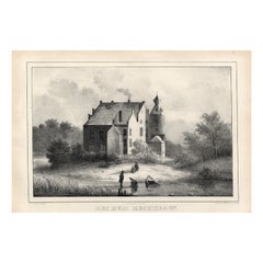
Liaukama-State, Van der Aa, 1846
Located in Langweer, NL
Liaukama-State.' (Liauckama Castle.) This Castle was situated in the province of Friesland in Sexbierum. The castle was demolished in 1824. Today there is a hotel and restaurant on t...
Category
19th Century Antique Maps
Materials
Paper
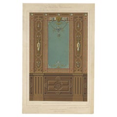
Antique Print of the Design of a Dining Room by Gruz, c.1860
Located in Langweer, NL
Antique print titled 'Lambris - Salle a Manger'. Antique print depicting the boarding of the dining room, Renaissance style. This print originates from 'Motifs de Peinture Decorative...
Category
19th Century Antique Maps
Materials
Paper
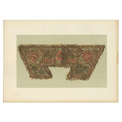
Antique Print of the Cuff of Lord Darnley's Glove by Gibb, 1890
Located in Langweer, NL
Antique print titled 'Cuff of one of Lord Darnley's Gloves'. Chromolithographic plate originating from 'The Royal House of Stuart. Illustrated by a Series of Forty Plates in Colours ...
Category
19th Century Antique Maps
Materials
Paper
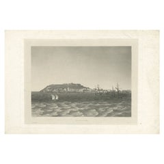
Antique Print of the Island of Gorée, close to Dakar, Senegal in Africa, c.1835
Located in Langweer, NL
Antique print title d'Ile-de-Gorée'. Etched and aquatint view on chine collé depicting the island of Gorée. The island of Gorée lies off the coast of Senegal, opposite Dakar. Origina...
Category
19th Century Antique Maps
Materials
Paper
Antique Map of Edom, an Ancient Kingdom in Transjordan, 1773
Located in Langweer, NL
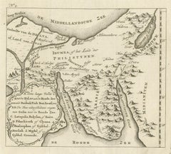
Antique print titled 'Idumea, of thet Land der Philistynen'. Old map of Edom, an ancient kingdom in Transjordan located between Moab to the northeast, the Arabah to the west and the ...
Category
18th Century Antique Maps
Materials
Paper
Foremarke Hall, a Georgian-Palladian House in South Derbyshire, England, Ca.1770
Located in Langweer, NL
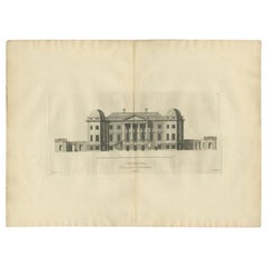
Antique print titled 'North Front of Foremark (..)'.
Old engraving of Foremarke Hall, a Georgian-Palladian country house and manor house. This print originates from 'Vitruvius Britannicus...
Category
18th Century Antique Maps
Materials
Paper
Remarkable Decorative Rare Antique Print of Figures and Vases, c.1780
Located in Langweer, NL
Antique print with two small views of a figure reaching for a vase. Source unknown, to be determined. Artists and Engravers: Anonymous.
Artist: Anonymous.
Condition: Good, general ...
Category
18th Century Antique Maps
Materials
Paper
Antique Map of the Region of Zevenwouden in Friesland, The Netherlands, 1635
Located in Langweer, NL
Antique map titled 'De Zeeven Wolden'. Map of the region of Zevenwouden (or Zevenwolden) in Friesland, the Netherlands. This region include the villages of Langweer, Echtenerbrug, Le...
Category
17th Century Antique Maps
Materials
Paper
Antique Map of Iberia or the Iberian Peninsula with Portugal and Spain, 1842
Located in Langweer, NL
Antique map titled 'Carte de l'Ibérie ou Espagne Ancienne'. Map of Iberia, or the Iberian Peninsula. This map originates from 'Atlas universel de géographie ancienne et moderne (..)'...
Category
19th Century Antique Maps
Materials
Paper
Antique Map of the City of Tiel by Blaeu, 1649
Located in Langweer, NL
Antique map titled 'Tyel'. Beautiful map of the city of Tiel, The Netherlands. With a coat of arms and key of various locations. Originates from 'Toneel der Steeden' published by Joa...
Category
17th Century Antique Maps
Materials
Paper
Map of the Vietnamese Coast, Centered on Turon Harbor 'Da Nang Area', 1796
Located in Langweer, NL
Antique map titled 'A chart of part of the coast of Cochin-China including Turon Harbour and the Island Callao'.
Detailed map of the Vietnamese Coast, centered on Turon Harbor (D...
Category
1790s Antique Maps
Materials
Paper
Pl. 33 Antique Chart of the US Wealth Distribution in 1870 '1874'
Located in Langweer, NL
Antique chart titled 'Map showing the distribution of wealth. Compiled from the tables of "true valuation," ninth census of the United States, 1870'. Chart of the US wealth distribut...
Category
Late 19th Century Antique Maps
Materials
Paper
Pl. 14 Antique Print of a Triumphal Arch by Le Rouge, c.1785
Located in Langweer, NL
Antique print titled 'Arc de Triomphe dans les Jardins (..)'. Copper engraving showing part of a triumphal arch. This print originates from 'Jardins Anglo-Chinois à la Mode' by Georg...
Category
18th Century Antique Maps
Materials
Paper
Pl. 22 Antique Print of Various Rock Formations by Le Rouge, c.1785
Located in Langweer, NL
Antique print titled 'Idées pour la construction des Rochers dans les Jardins Anglais'. Copper engraving showing various rock formations for English gar...
Category
18th Century Antique Maps
Materials
Paper
View of the Island Onrust Near Batavia 'Jakarta', Indonesia, 1739
Located in Langweer, NL
Antique print titled 'Ein Prospect der Insul Onrust oder Unruhe 2 Meilen von Batavia gelegen.' (View of the island ' Onrust' near Batavia.)
Onrust Island also known as Pulau Onrust or Pulau Kapal (ship island) is an Indonesian island off the coast of Jakarta. It measures about 3.5 km2 (1.4 sq mi) and is part of the Thousand Islands. The town on the island had houses and warehouses, but it also had a gunpowder magazine, a storage for water transported from Batavia, general warehouses, and a lot of warehouses specifically meant to store pepper. Specific to the shipyard were the reservoirs for trees. Sawing windmills processed these trees to make planks for the shipyards. There was also a smithy that served the shipyard. Near the waterfront there were special installations to easily pull ships on their side. Sometimes ships for local use were built at the island. The VOC employees were only allowed to leave the island two times a year.
In 1911 Onrust Island was turned into a quarantine station for pilgrims returning from the Hajj. The island had the advantage of being completely isolated. Furthermore, it was so small that it was possible to make it malaria free by the only method known at the time. This was done by filling up all the small ponds and other fresh water instances on the island and by removing most vegetation. Later a sanatorium for lung diseases was established on the island, because of the very much improved health situation. From 1933 it was used to lock up the mutineers of the 1933 mutiny on the HNLMS De Zeven Provinciën (1909).
In 1940 German nationals were interned on Onrust. In May 1940 the Netherlands were attacked by Germany. In the Dutch East Indies thousands of Germans, Hungarians, Czechs, Italians, Dutchmen with a German family name, and members of the National Socialist Movement in the Netherlands were arrested and locked up at Onrust and in Ngawai. After war with Japan broke out on 8 December 1941 a small part of these prisoners was evacuated to Suriname. The Japanese also used Onrust as a prison.
On 23 January 1950 Raymond Westerling attempted the APRA coup d'état. It failed, and most of the APRA military were seized by the Dutch troops that were still on Java. The Dutch military...
Category
1730s Antique Maps
Materials
Paper
Original Antique Engraved Map of the Russian Empire, 1778
Located in Langweer, NL
Description: Antique map titled 'A New and Correct Map of the Russian Empire'.
Original antique map of the Russian Empire. This map originates from Moore's 'New and Complete Coll...
Category
1770s Antique Maps
Materials
Paper
Original Detailed Antique Map of Southern India and Most of Ceylon, 1744
Located in Langweer, NL
Antique map titled 'A Map of India on the west Side of the Ganges, comprehending the coasts of Malabar, Coromandel and the Island Ceylon'.
Map of Southern India and most of Ceylo...
Category
1740s Antique Maps
Materials
Paper
Antique Map of the Region of Wonseradeel by Schotanus, 1664
By B. Schotanus
Located in Langweer, NL
Antique map titled 'De Grietenije van Wonsera-deel (..).' Map of the Grietenij of Wonseradeel, Friesland, The Netherlands. Multiple cartouches, key and coat of arms. "Beschrijvinge e...
Category
17th Century Antique Maps
Materials
Paper
Antique Map of Asia by Lapie, 1842
Located in Langweer, NL
Antique map titled 'Carte de l'Asie'. Map of Asia. This map originates from 'Atlas universel de géographie ancienne et moderne (..)' by Pierre M. Lapie and...
Category
Mid-19th Century Antique Maps
Materials
Paper
Antique Map of German Colonies by Meyer, 1895
Located in Langweer, NL
Antique map titled 'Deutsche Kolonien.' Lithographed map of the German Colonies. German East-Africa, German Southeast-Africa, Cameroon, Marshall-Islands, German Colonies in the Pacif...
Category
19th Century Antique Maps
Materials
Paper
Antique Map of the Region of Zeitz in Germany, 1749
By Schreiber
Located in Langweer, NL
Antique map titled 'Das Stifft Zeitz (..)'. Map of the region of Zeitz, Germany. Zeitz is a town in the Burgenlandkreis district, in Saxony-Anhalt, Germany. It is situated on the riv...
Category
18th Century Antique Maps
Materials
Paper
The Holy Sepulchre '..', Basire, 1795
Located in Langweer, NL
Antique print titled 'The Holy Sepulchre at Northwold in the County of Norfolk'. Antique print depicting the Holy Sepulchre, Northwold. Artists and Engr...
Category
18th Century Antique Maps
Materials
Paper
Antique Map of the Extension of the Russian Empire in the XIXth Century, 1806
Located in Langweer, NL
Antique map titled 'L'Empire Russe en Europe et en Asie'.
Map showing the extension of the Russian Empire at the beginning of the XIXth century. Several letterpress notations are...
Category
Early 1800s Antique Maps
Materials
Paper
Antique Map of the Banda Islands by Commelin, 1646
Located in Langweer, NL
Plate 15: 'Afteeckeninge van 't Eyland Banda.' Depiction of the Banda Islands, Indonesia. Rare. This attrative plate originates from: 'Title: Waerachtigh verhael van de Schipvaerd op Oost-Indien Ghedaen by de acht Schepen in den jare 1598. van Amsterdam uyt-gezeylt, onder 't beleyd van den Admirael Jacob Cornelissoon van Neck...
Category
17th Century Antique Maps
Materials
Paper
Original Antique Map of the Ancient Netherlands and Belgium, c.1750
Located in Langweer, NL
Description: Antique map titled 'Naauwkeurige Kaart van het Oude Nederland (..)'.
Original antique map of the Netherlands and Belgium. This map originates from 'Vaderlandsche his...
Category
1750s Antique Maps
Materials
Paper
Antique Map of the Region of Artois by Covens & Mortier, c.1730
Located in Langweer, NL
Antique map titled 'Carte d'Artois et des environs'. Large map of the region of Artois, France. Artois is former province located in the northwestern part of France, boarding Belgium...
Category
18th Century Antique Maps
Materials
Paper
Antique Map of Sangir Island and the Talaud Islands by Valentijn, 1726
Located in Langweer, NL
Antique map titled 'Het Eyland Sangir & De Talautse Eylanden'. Two maps on one sheet. To the left, a map of Sangir Island, Indonesia. To the right, a map of the Talaud Islands, Indon...
Category
18th Century Antique Maps
Materials
Paper
Antique Map of the Main Comoro Islands by Van Schley, 1749
Located in Langweer, NL
Antique map titled ‘Carte des Isles de Comore (..) - Kaart van de Eilanden Komoro (..)’. Original antique map of the main Comoro Islands or Comoros including Comore, Mohéli, Anjouan ...
Category
18th Century Antique Maps
Materials
Paper
Antique Map of Java in The Dutch East Indies, Now Indonesia, c.1690
Located in Langweer, NL
Antique map titled 'Insulae Iavae cum parte insularum Boreno Sumatrae (..)'.
Beautiful map of the Island of Java and part of Borneo, Bali, Madura and Sumatra. Artists and Engrave...
Category
17th Century Antique Maps
Materials
Paper
Antique Map of Harvey Island and Surroundings by Cook, 1803
Located in Langweer, NL
Antique map Oceania titled 'Harvey's Eiland...''.
This map originates from 'Reizen Rondom de Waereld door James Cook''.
Old engraving by James Cook 1778.
Engraved by Robert Bern...
Category
19th Century Antique Maps
Materials
Paper
Pl. 2 Antique Print of a Waterfall and Garden Swing by Le Rouge, c.1785
Located in Langweer, NL
Antique print titled 'Balancoire a Rambouillet - Cascade a Dampiere'. Copper engraving showing a swing at Rambouillet and the waterfall of Dampiere. This print originates from 'Jardi...
Category
18th Century Antique Maps
Materials
Paper
Antique Colourful Map of the Dutch East Indies 'Indonesia', ca.1806
Located in Langweer, NL
Antique map titled 'Les Isles de la Sonde Moluques Philippines, Carolines et Marianes'. Old map of the East Indies, also showing a part of Australia.
Artists and Engravers: Publi...
Category
19th Century Antique Maps
Materials
Paper
Antique Print of the Landing at Tanna Island by Cook, 1803
Located in Langweer, NL
Antique print New Hebrides titled 'Landing op het Eiland Tanna, een van de Nieuwe Hebriden'. Antique print depicting the landing at one of the islands of the New Hebrides, Vanuatu. O...
Category
19th Century Antique Maps
Materials
Paper
Antique Map of the Provinces of Madrid, Toledo and La Mancha by Homann, 1781
Located in Langweer, NL
Antique map titled 'Castilliae Novae pars Occidentalis provincias Madrit, Toledo et Mancha (..)'. Antique map of the central Spanish provinces of Madrid, Toledo and La Mancha with pi...
Category
18th Century Antique Maps
Materials
Paper
Antique Map of Nova Zembla by Janssonius, c.1650
Located in Langweer, NL
Antique map titled 'Nova Zemla, waygats fretum Nassovi cum et terra Samoiedum singula omnium emendatissime descripta'. This map depicts Nova Zembla and the northern continental coast...
Category
17th Century Antique Maps
Materials
Paper
Antique Map of South Australia by Tallis, 1851
Located in Langweer, NL
Antique map Australia titled 'Part of South Australia'. Decorative map of part of South Australia, surrounded by illustrations of Adelaide, natives on a catamaran, an Australian dog and a nymphicus bird illustrated. Originates from 'The Illustrated Atlas, And Modern History Of The World Geographical, Political, Commercial & Statistical, Edited By R. Montgomery Martin'. Published; John Tallis London, New York, Edinburgh & Dublin. 1851. Drawn and Engraved by J. Rapkin. Artists and Engravers: John Tallis (1817-1876) was a British map...
Category
19th Century Antique Maps
Materials
Paper
Architectural Print of Pharmacie Gymnase in France, Chabat, c.1900
Located in Langweer, NL
Antique print titled 'Pharmacie Gymnase, École Nationale Professionnelle d'Armentières, Mr. Charles Chipiez Architecte'. This print depicts the design of a building in France. Origin...
Category
20th Century Maps
Materials
Paper
Antique Map of Sumatra by Bellin, 1764
Located in Langweer, NL
Antique map Sumatra titled 'Carte de l'Isle de Sumatra'. Old map of Sumatra, Malaysia and the Straits of Malacca, including Singapore. This map originates ...
Category
18th Century Antique Maps
Materials
Paper
Detailed Antique Map of Santa Domingo, Puerto Rico, Eastern Bahamas, ca. 1780
Located in Langweer, NL
Description: Antique map titled 'L'Isle De St. Domingue, et celle De Porto-Rico.'
Detailed map of Santa Domingo, Puerto Rico, etc. Includes substanti...
Category
1780s Antique Maps
Materials
Paper
Large Detailed Map of Australia Wint Inset of Tasmania, 1937
Located in Langweer, NL
Antique map titled 'Australia'. Large folding map of Australia. With inset map of Tasmania. Printed by L.F. Johnston, Canberra.
Artists and Engravers: Compiled and drawn by Propert...
Category
20th Century Maps
Materials
Paper
Rare Original Double Hemisphere World Map with Allegorical Figures, 1785
Located in Langweer, NL
Antique map titled 'Nieuwe en Naukeurige Kaart der Gantsche bekende Werreld.'
A double hemisphere world map. Four allegorical figures in the c...
Category
1780s Antique Maps
Materials
Paper
Nice Antique Asian Village View in Aceh, Sumatra, Indonesia, 1874
Located in Langweer, NL
Antique print Indonesia titled 'Fort en Dorp Pedir, ten oosten van de hoofdstad Atchin gelegen'. Antique print depicting a scene in Indonesia. Originates from 'De Oorlog tusschen Ned...
Category
1870s Antique Maps
Materials
Paper
Antique Map of Illinois by Johnson, 1872
Located in Langweer, NL
Antique map titled 'Johnson's Illinois'. Original map of Illinois. This map originates from 'Johnson's New Illustrated Family Atlas of the World' by A....
Category
Late 19th Century Antique Maps
Materials
Paper
Antique Map of Asia Minor, Route of the Retreat of Ten Thousand Greeks, c.1720
Located in Langweer, NL
Antique map Asia Minor titled 'The Retreat of the Ten Thousand Greeks according to Xenophon'. Historical depiction of the ancient Greek army in Asia M...
Category
18th Century Antique Maps
Materials
Paper
Antique Map of the Island of Java by Van Der Aa, 1725
Located in Langweer, NL
Antique map titled 'Map: 'L'Ile de Java'. (The island of Java.) This map shows the Indonesian island of Java. With compass rose and scale. This plate originates from the very scarse:...
Category
18th Century Antique Maps
Materials
Paper
Antique Map of the Indre Region in France, ca. 1852
Located in Langweer, NL
Antique map titled 'Dépt. de l'Indre'.
Map of the French department of Indre, France. Part of the Loire Valley wine region, this area is known for its production of Chinon wines, typically red, and production of Pouligny-Saint-Pierre, goats'-milk cheese. It is also the birthplace of the great philosopher Rene Descartes...
Category
Mid-19th Century Antique Maps
Materials
Paper
Antique Map of Georgia and Alabama by Johnson, 1872
Located in Langweer, NL
Antique map titled 'Johnson's Georgia and Alabama'. Original map of Georgia and Alabama. This map originates from 'Johnson's New Illustrated Family Atl...
Category
Late 19th Century Antique Maps
Materials
Paper
Antique Map of Nottinghamshire by Speed, 1676
Located in Langweer, NL
Antique map titled 'The Countie of Nottingham (..)'. Map of Nottinghamshire, England. Includes an inset town plan of Nottingham. This map originates from 'Theatre of Great Britaine' ...
Category
17th Century Antique Maps
Materials
Paper
Antique Map of the Baltic States by Rücker, 1846
Located in Langweer, NL
Antique map titled 'General Karte Russischen Ost See-Provinzen Liv-Ehst und Kurland'. Large folding map of the Baltic States, on linen. Artists and Engravers: Published by Franz Klug...
Category
19th Century Antique Maps
Materials
Paper
Pl. 20 Antique Print of a Garden Planted by Louis XV by Le Rouge, c.1785
Located in Langweer, NL
Antique print titled 'Nouveau Trianon planté par Louis XV'. Copper engraving showing a garden planted by Louis XV. This print originates from 'Jardins Anglo-Chinois à la Mode' by Geo...
Category
18th Century Antique Maps
Materials
Paper
Pl. 20 Antique Print of the Bridge of Nogent Chapel and a Chinese Bridge by Le R
Located in Langweer, NL
Antique print titled 'Pont Ruiné à la Chapelle-Nogent (..)'. Copper engraving of the bridge of Nogent Chapel and a Chinese bridge. This print originates...
Category
18th Century Antique Maps
Materials
Paper
Pl. 4 Antique Print of Sanssouci Palace by Le Rouge, c.1785
Located in Langweer, NL
Antique print titled 'Vue du Palais de sa Majesté Prussienne (..)'. Copper engraving showing the facade of Sanssouci Palace, Potsdam. This print originates from 'Jardins Anglo-Chinoi...
Category
18th Century Antique Maps
Materials
Paper
Pl. 15 Antique Print of the Garden of Maupertuis and Chaville by Le Rouge
Located in Langweer, NL
Antique print titled 'Tour dans les Jardins de Maupertuis (..)'. Copper engraving with a view of the garden of Maupertuis and Chaville. This print originates from 'Jardins Anglo-Chin...
Category
18th Century Antique Maps
Materials
Paper
Antique Map of the City of Franeker by Blaeu, 1652
Located in Langweer, NL
Antique map titled 'Franekera'. Old map of the city of Franeker, Friesland. Also shows two cartouches, coats of arms and legend. This map originates from a Latin edition of the town ...
Category
17th Century Antique Maps
Materials
Paper
Antique Print of Duncombe Park by Campbell, 1725
Located in Langweer, NL
Antique print titled 'Duncomb Park in Yorkshire (..)'. Old engraving of Duncombe Park, Yorkshire. Duncombe Park is the seat of the Duncombe family whose senior members assumed the ti...
Category
18th Century Antique Maps
Materials
Paper
Antique Map of the Roadstead of Batavia by Van der Aa, 1725
Located in Langweer, NL
Antique map titled 'La rade de Batavia'. (The roadstead of Batavia.) This map shows the roadstead before the Indonesian city of Batavia, nowadays Jakarta. This plate originates from ...
Category
18th Century Antique Maps
Materials
Paper
Antique Map of the Roadstead of Bantam by Van der Aa, 1725
Located in Langweer, NL
Antique map titled 'La rade de Bantam'. (The roadstead of Bantam.) This map shows the Indonesian city of Banten / Bantam on Java, Indonesia and its roadstead. With compass rose and s...
Category
18th Century Antique Maps
Materials
Paper
Antique Map of the Netherlands and Belgium by Bowen, 1747
Located in Langweer, NL
Antique map Belgium titled 'A New and Accurate Map of the Netherlands or Low Countries'. Detailed map of South of the Netherlands and Belgium. With large inset of the city of Mons, B...
Category
18th Century Antique Maps
Materials
Paper
Recently Viewed
View AllMore Ways To Browse
Antique Sailing Map
Antique Sailing Maps
Bay Area Antique Furniture
West Coat Of Arms
Greek Asia Minor
Hemisphere World Map
Speed Map
Antique Maps Canada
Antique Map Canada
Canada Antique Map
Malaysian Antique
West Indies Map
Blaeu World Map
Charing Cross
Antique Maps Of Canada
Bali Map
Antique Portuguese Plates
Map Of Brazil
